Signs Tagged With Intersection
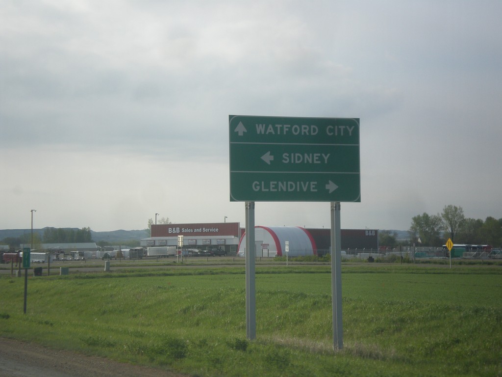
MT-200 East at MT-16 and MT-23
MT-200 East at MT-16 and MT-23. Turn right for MT-16 south to Glendive. Continue straight for MT-23 east to Watford City (ND); left for MT-16 North/MT-200 East to Sidney.
Taken 05-09-2015


 Sidney
Richland County
Montana
United States
Sidney
Richland County
Montana
United States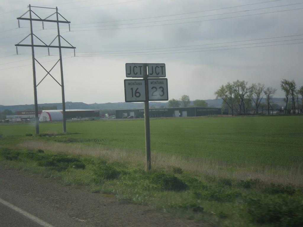
MT-200 East Approaching MT-16/MT-23 Junction
MT-200 East Approaching MT-16/MT-23 Junction in Richland County.
Taken 05-09-2015
Sidney
Richland County
Montana
United States
MT-200 East at MTS-254
MT-200 east at MTS-254 south to Glendive. Continue east on MT-200 for Sidney.
Taken 05-09-2015
 Richey
Dawson County
Montana
United States
Richey
Dawson County
Montana
United States
MT-200 West at MT-200S
MT-200 West at MT-200S. Turn right to continue west on MT-200; left for MT-200S east.
Taken 05-09-2015
 Circle
McCone County
Montana
United States
Circle
McCone County
Montana
United States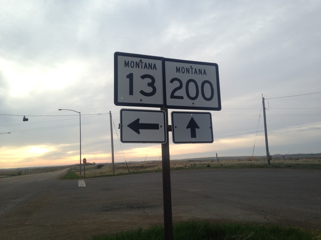
MT-200 East at MT-13
MT-200 East at MT-13 in Circle.
Taken 05-09-2015
 Circle
McCone County
Montana
United States
Circle
McCone County
Montana
United States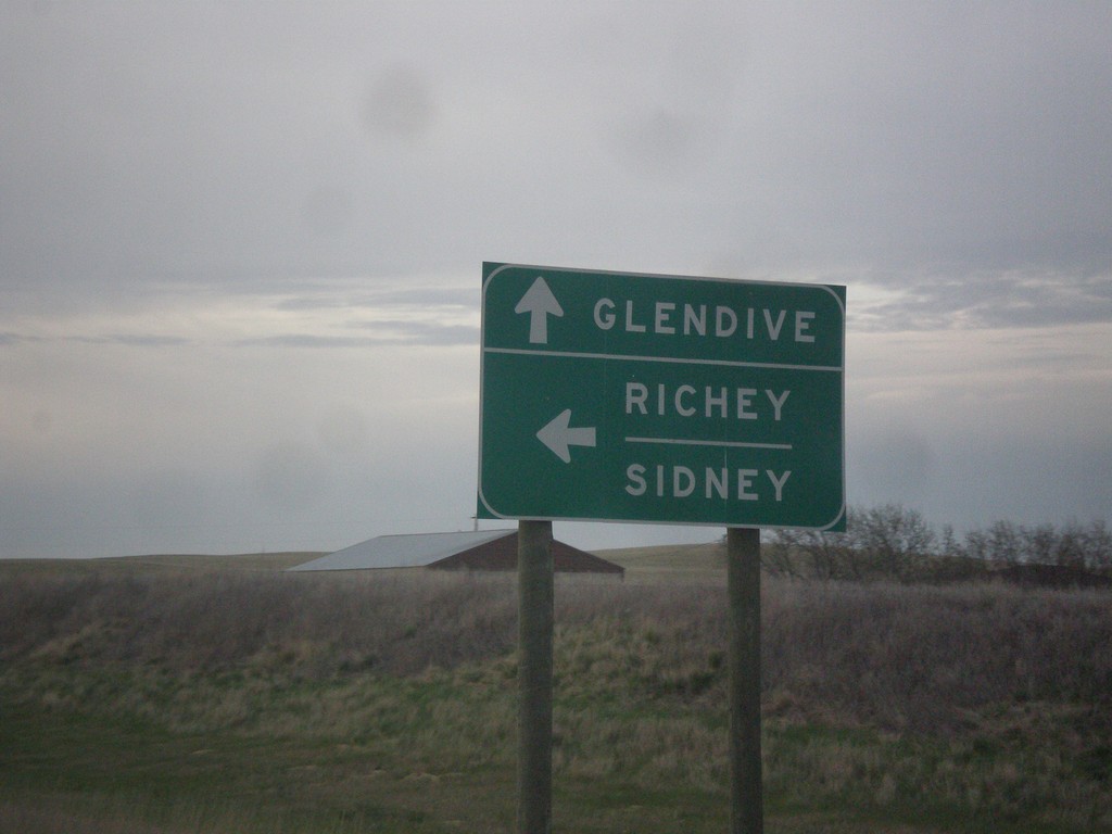
MT-200 East at MT-200S East
MT-200 East at MT-200S East. Turn left on MT-200 for Richey and Sidney. Continue straight for MT-200S to Glendive.
Taken 05-09-2015
Circle
McCone County
Montana
United States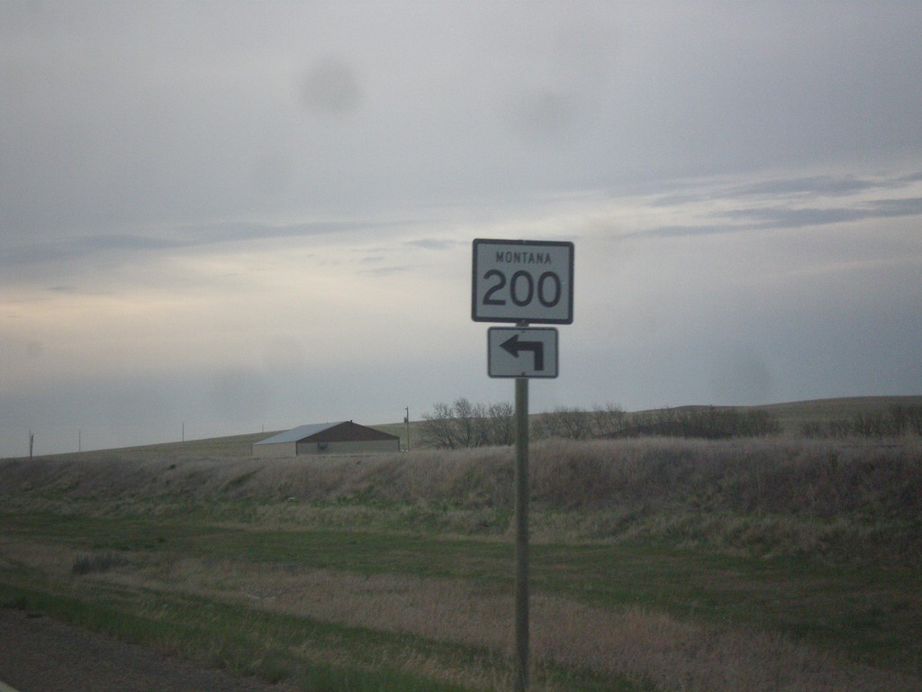
MT-200 East at MT-200S
MT-200 east at MT-200S. Turn left to continue east on MT-200.
Taken 05-09-2015
Circle
McCone County
Montana
United States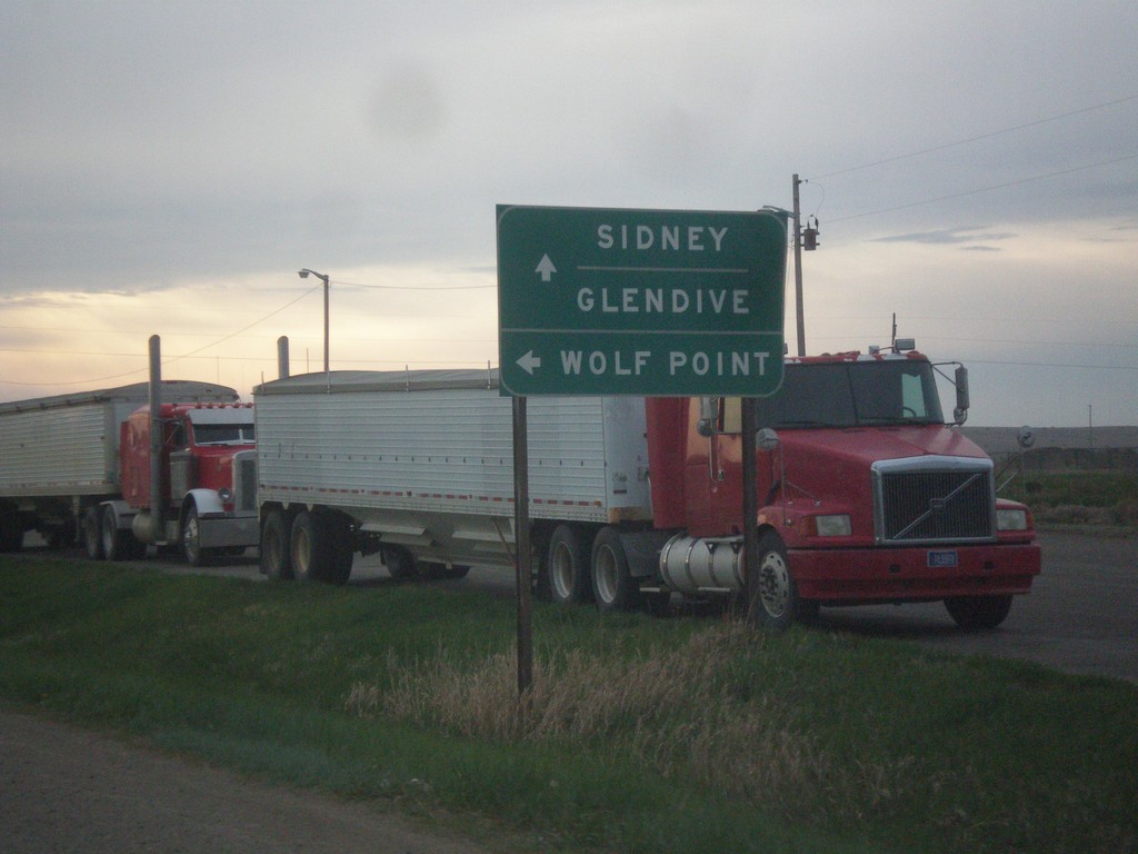
MT-200 East at MT-13 North
MT-200 East at MT-13 North. Use MT-13 for Wolf Point. Continue east on MT-200 for Sidney and Glendive (via MT-200S).
Taken 05-09-2015
Circle
McCone County
Montana
United States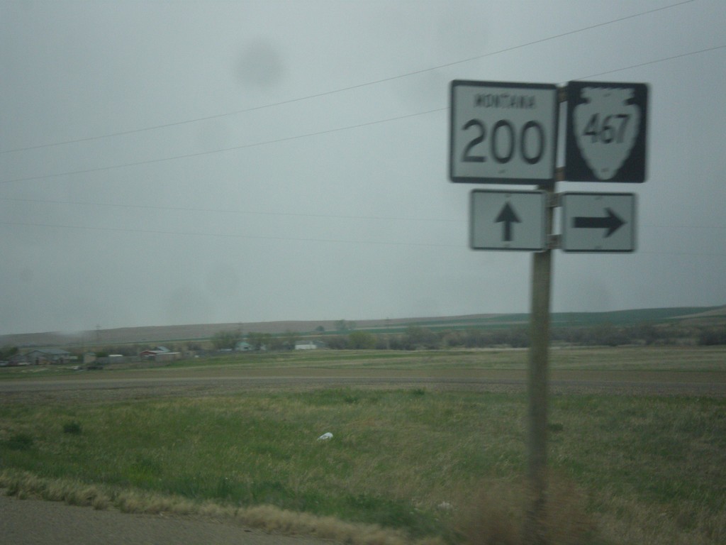
MT-200 East at MTS-467
MT-200 East at MTS-467 south in McCone County.
Taken 05-08-2015
 Circle
McCone County
Montana
United States
Circle
McCone County
Montana
United States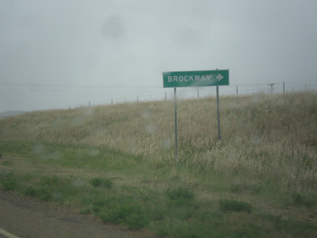
MT-200 East at MTS-253
MT-200 East at MTS-253 south to Brockway.
Taken 05-08-2015
 Brockway
McCone County
Montana
United States
Brockway
McCone County
Montana
United States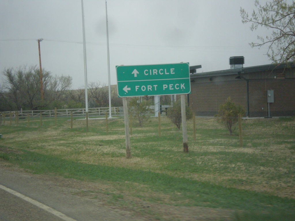
MT-200 East at MT-24
MT-200 East at MT-24 north to Fort Peck. Continue east on MT-200 for Circle.
Taken 05-08-2015
 Brockway
Garfield County
Montana
United States
Brockway
Garfield County
Montana
United States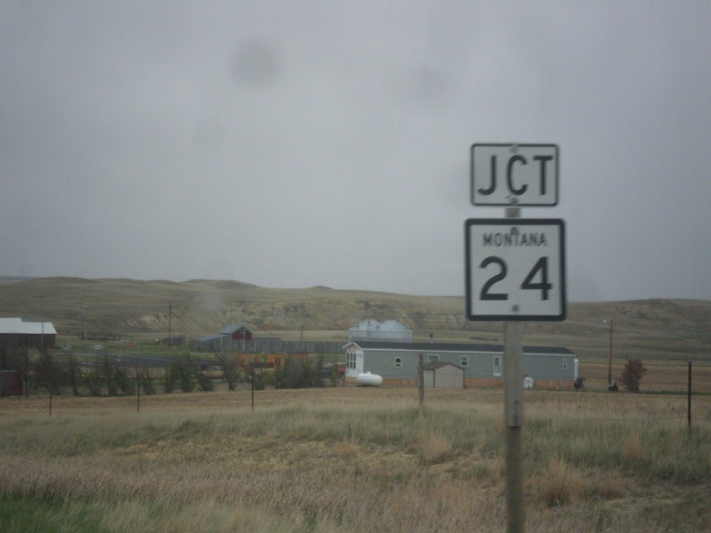
MT-200 East Approaching MT-24
MT-200 East approaching MT-24 in Garfield County.
Taken 05-08-2015
Brockway
Garfield County
Montana
United States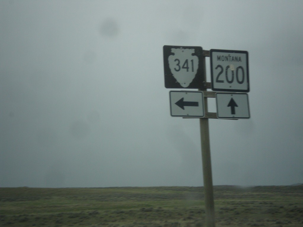
MT-200 East at MTS-341
MT-200 east MTS-341 junction in Garfield County.
Taken 05-08-2015
 Jordan
Garfield County
Montana
United States
Jordan
Garfield County
Montana
United States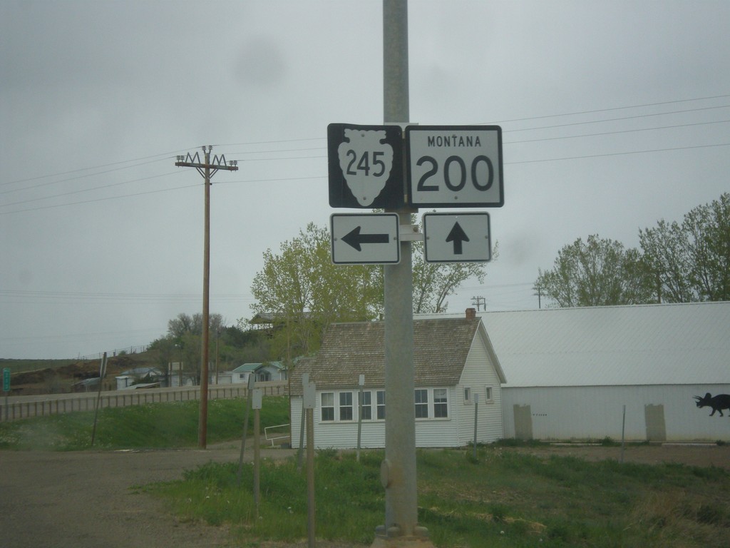
MT-200 East at MTS-245
MT-200 East at MTS-245 junction. Use MTS-245 north for Hell Creek State Park on Fort Peck Reservoir.
Taken 05-08-2015
 Jordan
Garfield County
Montana
United States
Jordan
Garfield County
Montana
United States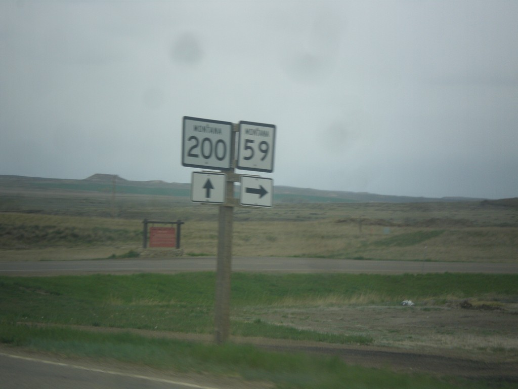
MT-200 East at MT-59
MT-200 East at MT-59 South. Taken just outside of Jordan.
Taken 05-08-2015
 Jordan
Garfield County
Montana
United States
Jordan
Garfield County
Montana
United States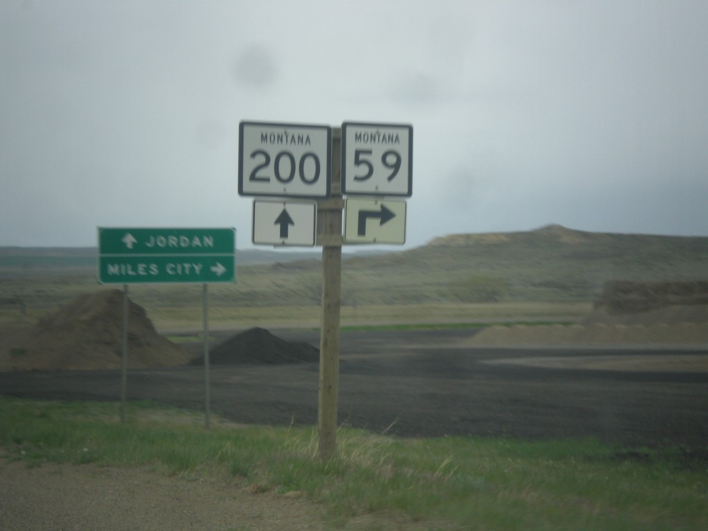
MT-200 East Approaching MT-59
MT-200 East approaching MT-59 south to Miles City. Continue east on MT-200 for Jordan.
Taken 05-08-2015
Jordan
Garfield County
Montana
United States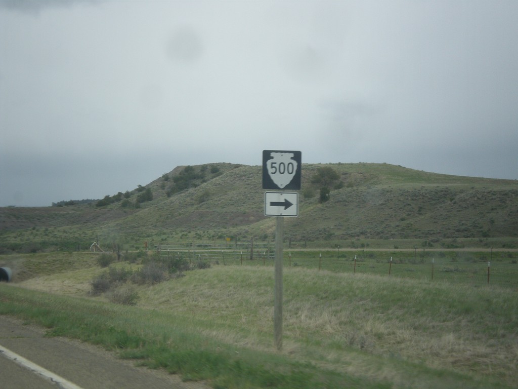
MT-200 East at MTS-500
MT-200 East at MTS-500 in Petroleum County.
Taken 05-08-2015
 Winnett
Petroleum County
Montana
United States
Winnett
Petroleum County
Montana
United States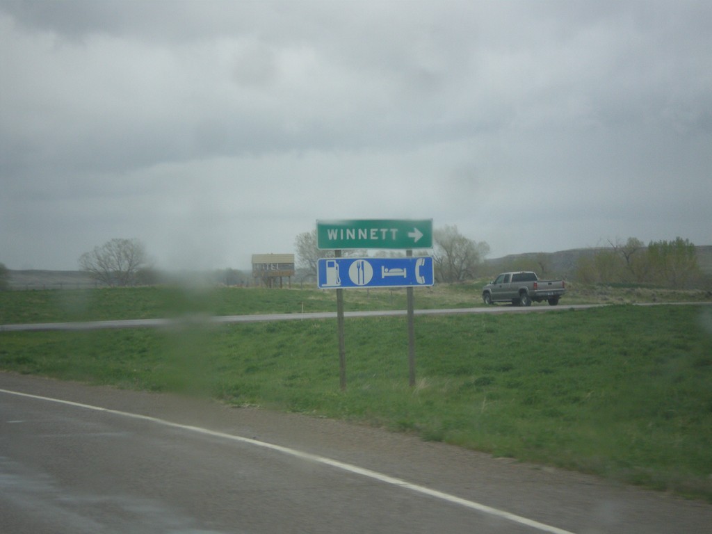
MT-200 East at MTS-244
MT-200 East at MTS-244 South to Winnett. Winnett is the county seat of Petroleum County, Montana. Petroleum County is the smallest county by population in Montana, with 494 residents as of the 2010 Census.
Taken 05-08-2015
Winnett
Petroleum County
Montana
United States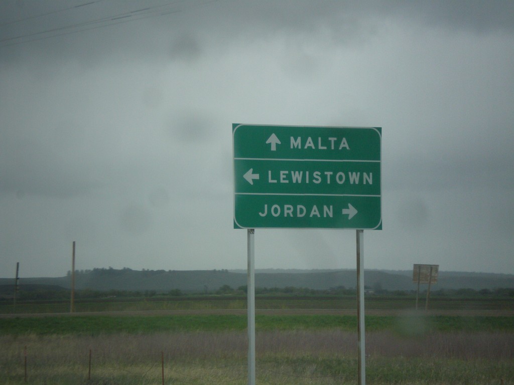
US-87 North at MT-19/MT-200
US-87 north at MT-19 and MT-200. Turn left to continue north on US-87 and MT-200 West to Lewistown; straight for MT-19 to Malta; right for MT-200 East to Jordan.
Taken 05-08-2015

 Grass Range
Fergus County
Montana
United States
Grass Range
Fergus County
Montana
United States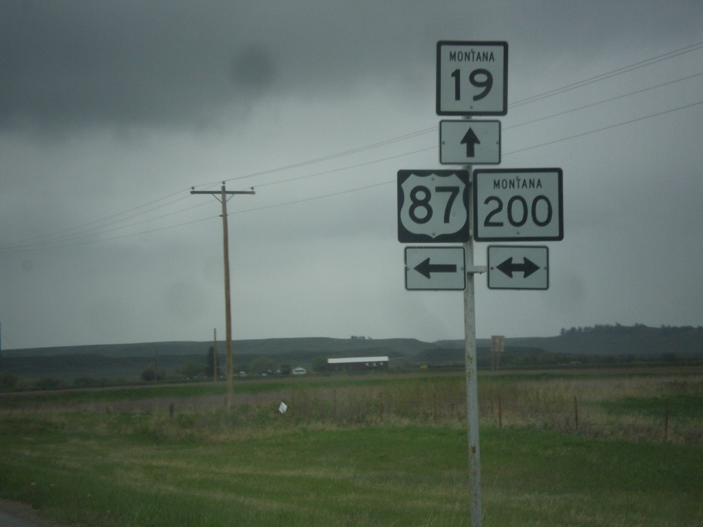
US-87 North at MT-19/MT-200
US-87 north at MT-19 and MT-200. Turn left to continue north on US-87 and MT-200 West; straight for MT-19; right for MT-200 East.
Taken 05-08-2015
Grass Range
Fergus County
Montana
United States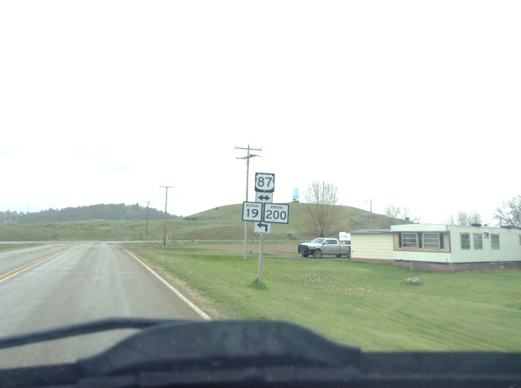
4th St. In Grass Range at US-87
4th St. In Grass Range at US-87 junction. Turn left for MT-19 and MT-200 junction.
Taken 05-08-2015
Grass Range
Fergus County
Montana
United States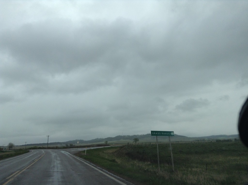
US-87 South/MT-200 East at Grass Range Junction
US-87 South/MT-200 East at Grass Range junction.
Taken 05-08-2015
Grass Range
Fergus County
Montana
United States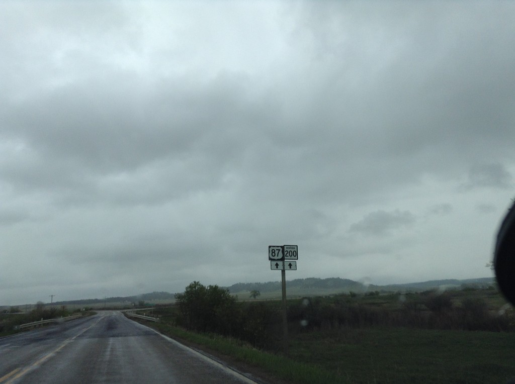
US-87 South/MT-200 East Approaching Grass Range
US-87 South/MT-200 East approaching Grass Range. Continue straight to continue on US-87/MT-200.
Taken 05-08-2015
Grass Range
Fergus County
Montana
United States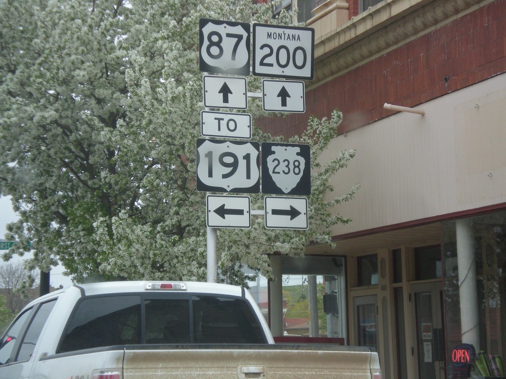
US-87 South/MT-200 East at MTS-238/To US-191
US-87 South/MT-200 East at MTS-238/To US-191. Turn left for US-191;left for MTS-238; straight for US-87 South/MT-200 East.
Taken 05-08-2015

 Lewistown
Fergus County
Montana
United States
Lewistown
Fergus County
Montana
United States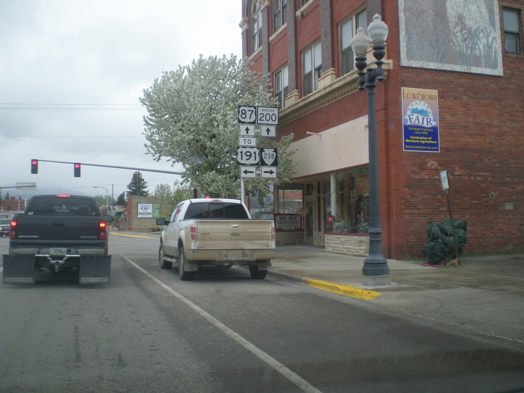
US-87 South/MT-200 East at MTS-238/To US-191
US-87 South/MT-200 East at MTS-238/To US-191. Turn left for US-191;left for MTS-238; straight for US-87 South/MT-200 East.
Taken 05-08-2015
Lewistown
Fergus County
Montana
United States