Signs Tagged With Intersection
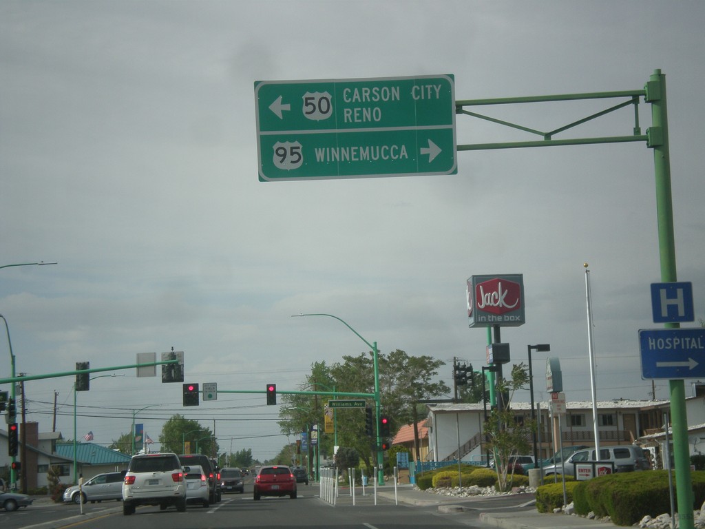
US-95 North at US-50
US-95 north at US-50 in Fallon. Turn left for US-50 west to Carson City and Reno. Turn right for US-50 East (not signed) and US-95 north to Winnemucca. US-95 joins US-50 for a few blocks through Fallon.
Taken 05-05-2014

 Fallon
Churchill County
Nevada
United States
Fallon
Churchill County
Nevada
United States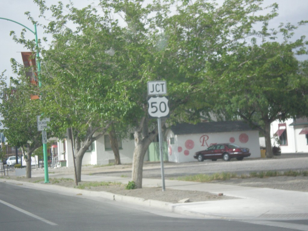
US-95 North Approaching US-50
US-95 North approaching US-50 in Fallon.
Taken 05-05-2014
Fallon
Churchill County
Nevada
United States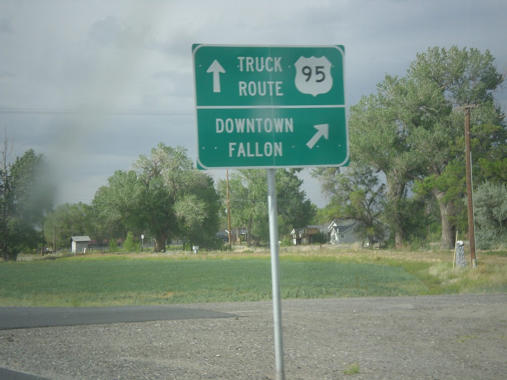
US-95 North - Fallon Truck Route
US-95 north at Maine St. junction. Turn right for Downtown Fallon; continue straight for US-95 North along the Truck Route.
Taken 05-05-2014
Fallon
Churchill County
Nevada
United States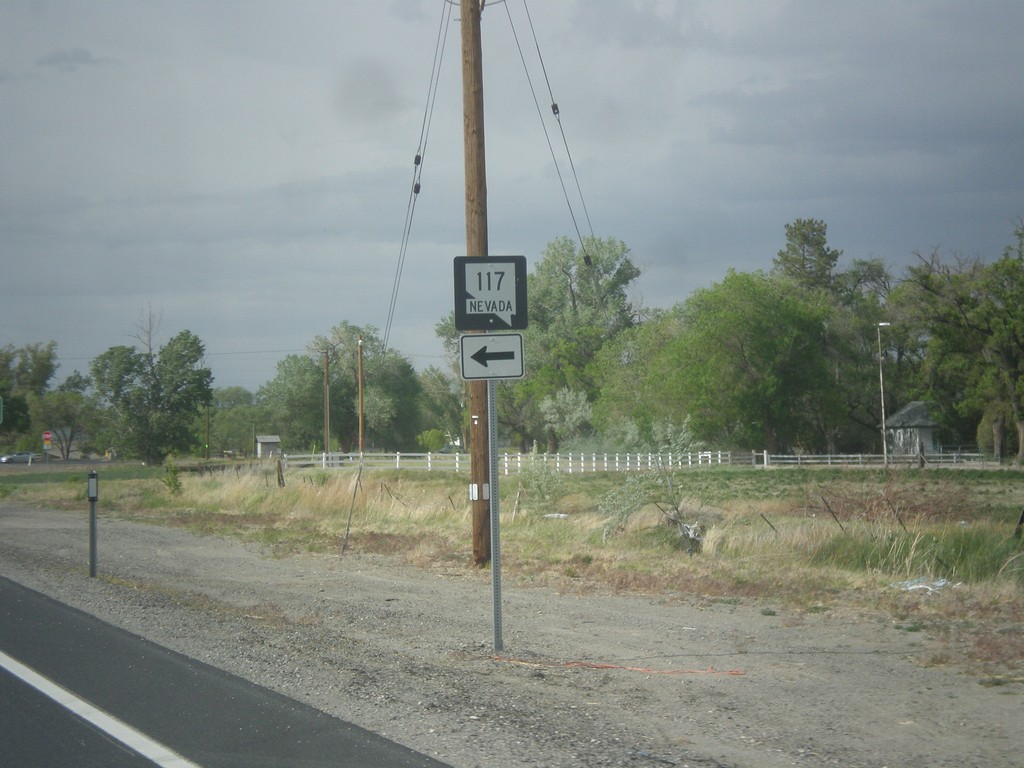
US-95 North at NV-117
US-95 north at NV-117 in Fallon.
Taken 05-05-2014
 Fallon
Churchill County
Nevada
United States
Fallon
Churchill County
Nevada
United States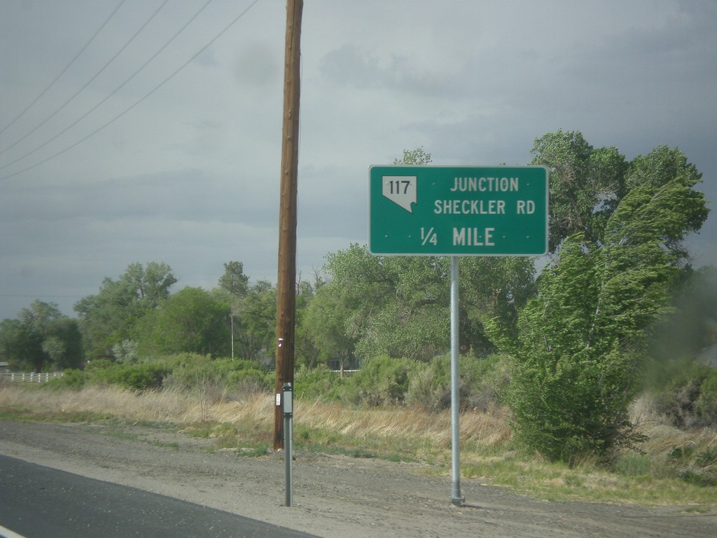
US-95 North Approaching NV-117
US-95 North approaching NV-117 - Sheckler Road.
Taken 05-05-2014
Fallon
Churchill County
Nevada
United States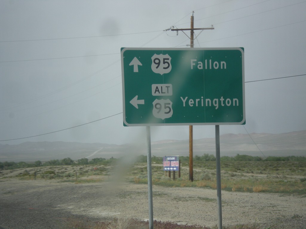
US-95 North at Alt. US-95 North
US-95 North at Alt. US-95 North to Yerington. Continue north on US-95 for Fallon. Alt. US-95 rejoins US-95 north of Fallon at I-80.
Taken 05-05-2014
 Schurz
Mineral County
Nevada
United States
Schurz
Mineral County
Nevada
United States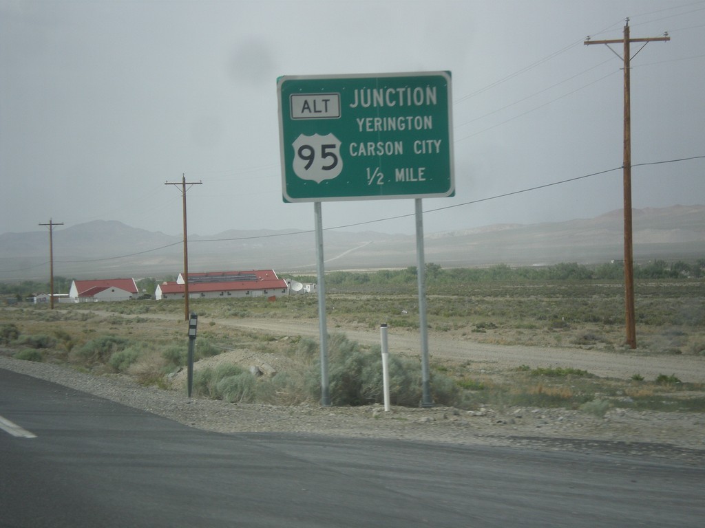
US-95 North Approaching Alt. US-95
US-95 north Approaching Alt. US-95 to Carson City and Yerington.
Taken 05-05-2014
Schurz
Mineral County
Nevada
United States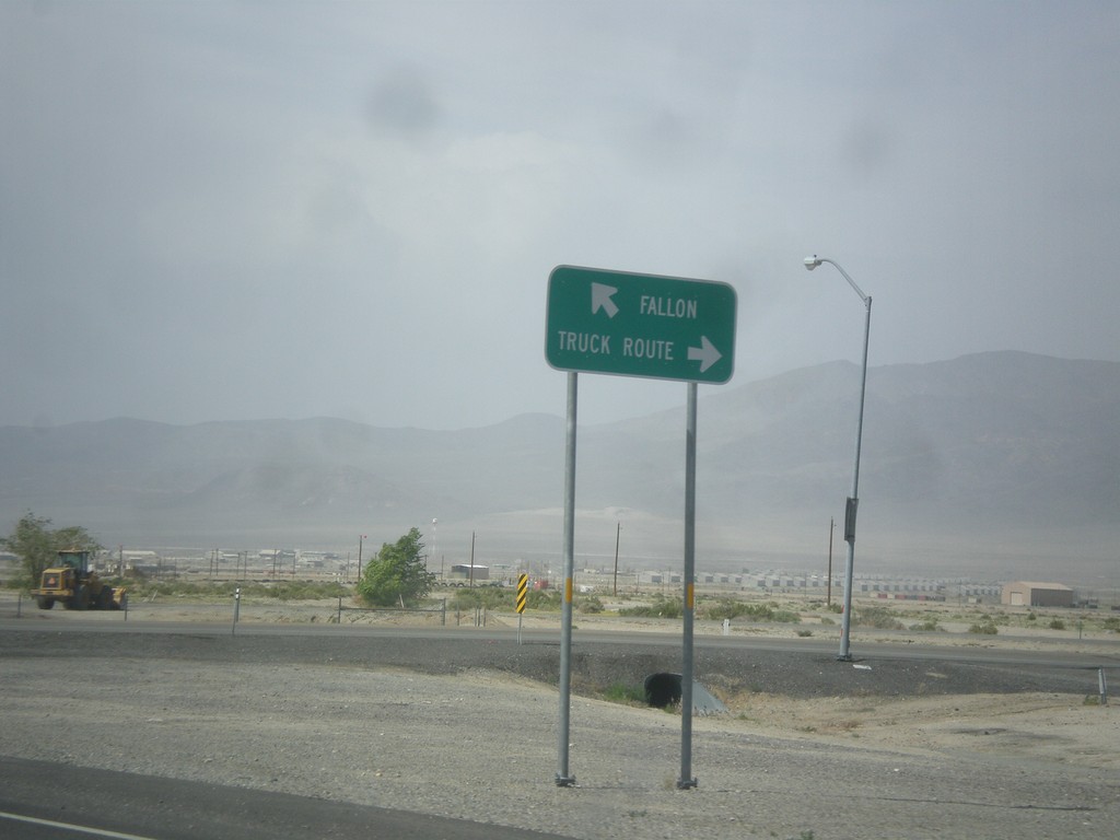
US-95 North at Hawthorne Truck Route
US-95 north at Hawthorne Truck Route. Merge right for the Truck Route, merge left for US-95 north towards Fallon.
Taken 05-05-2014
 Hawthorne
Mineral County
Nevada
United States
Hawthorne
Mineral County
Nevada
United States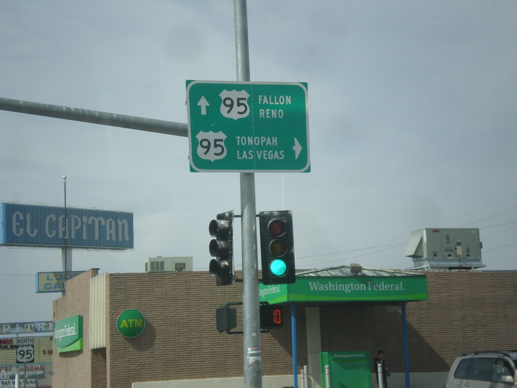
End NV-359 at US-95
End NV-359 at US-95. Turn right for US-95 south to Tonopah and Las Vegas. Continue straight for US-95 north to Fallon and Reno.
Taken 05-05-2014
 Hawthorne
Mineral County
Nevada
United States
Hawthorne
Mineral County
Nevada
United States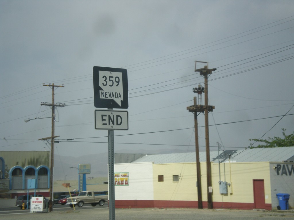
End NV-359 North at US-95
End NV-359 north at US-95 in Hawthorne.
Taken 05-05-2014
Hawthorne
Mineral County
Nevada
United States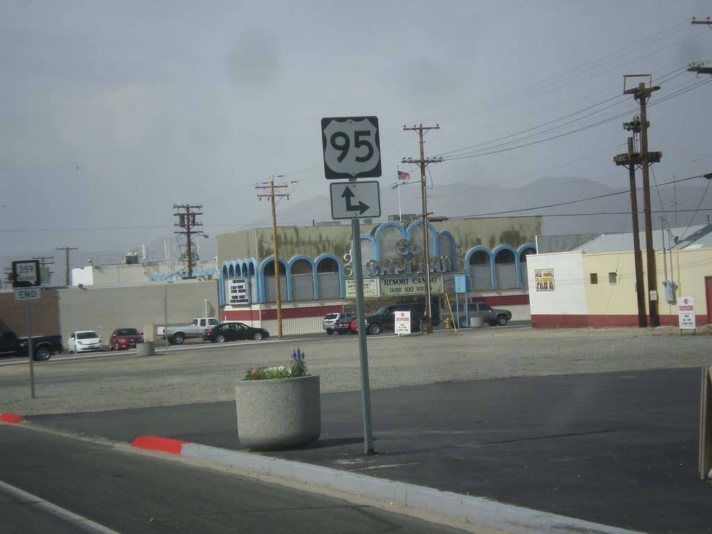
NV-359 North Approaching US-95
NV-359 North approaching US-95 in Hawthorne.
Taken 05-05-2014
Hawthorne
Mineral County
Nevada
United States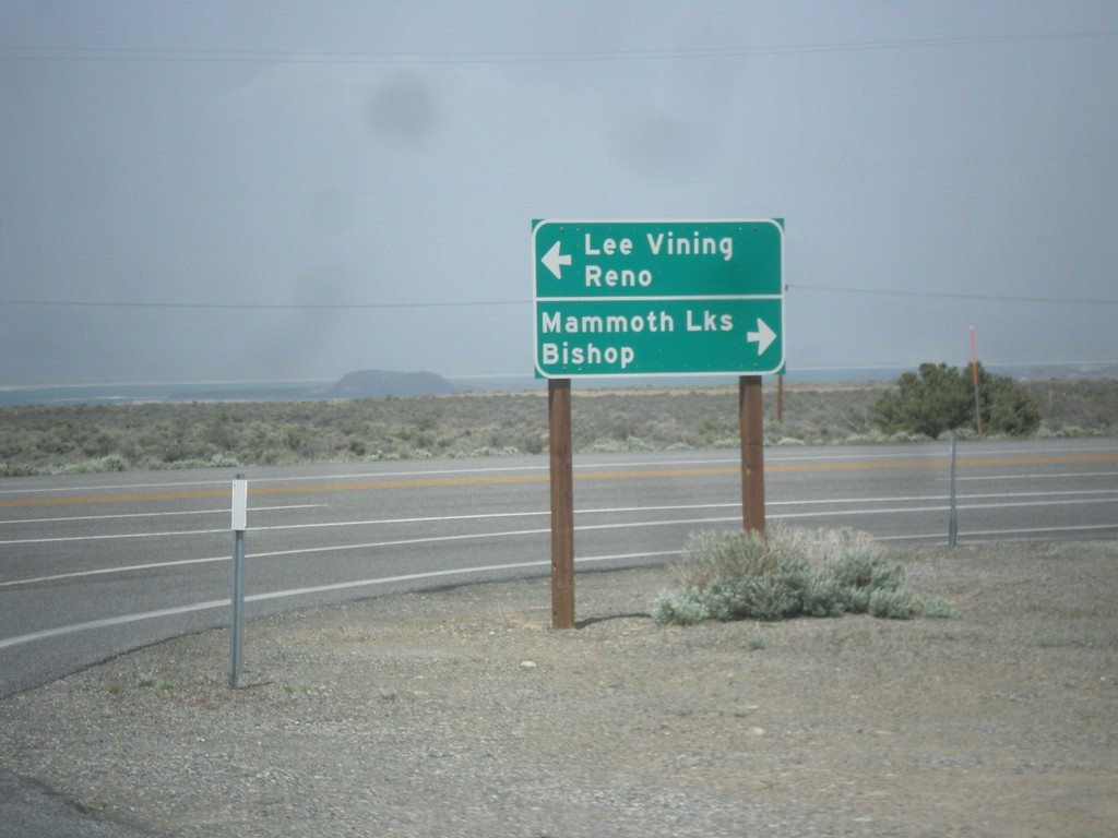
CA-120 East at US-395
CA-120 east at US-395. Turn right for US-395 south to Bishop and Mammoth Lakes. Turn left for US-395 north to Lee Vining and Reno. Turn right to continue east on CA-120.
Taken 05-05-2014

 Lee Vining
Mono County
California
United States
Lee Vining
Mono County
California
United States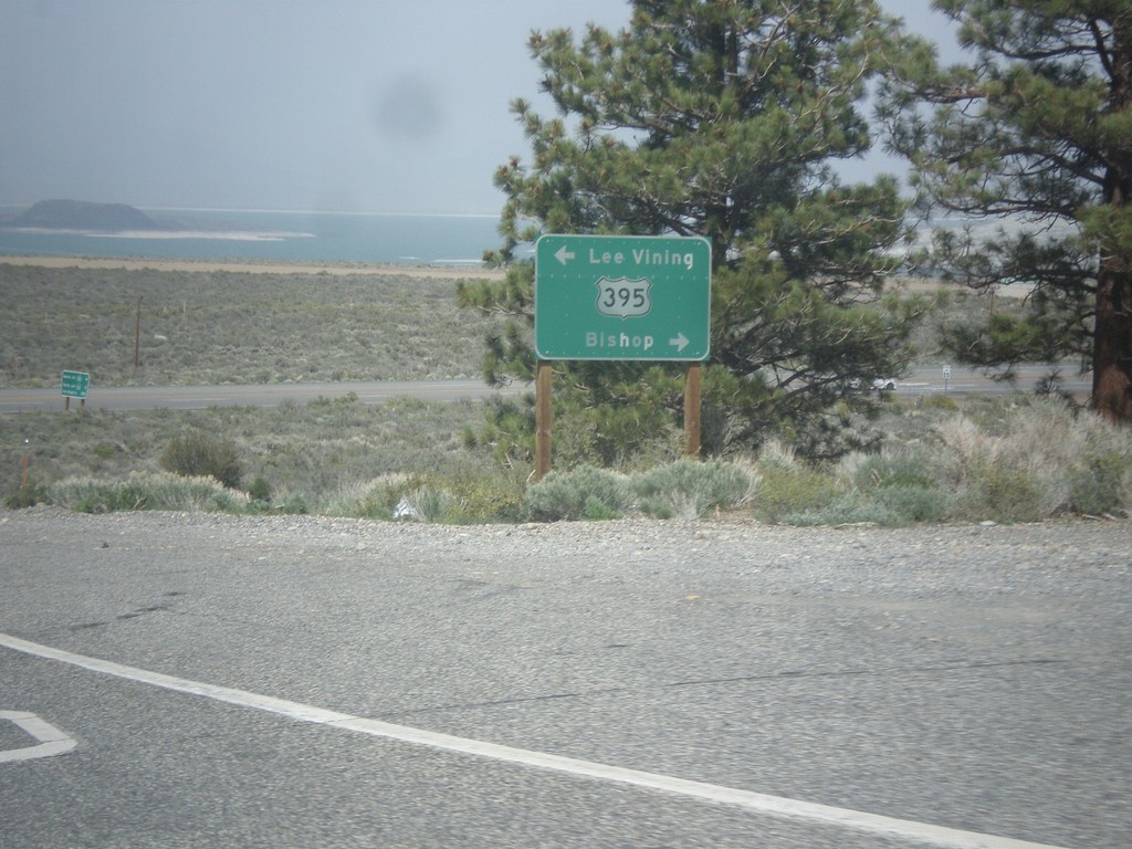
CA-120 East at US-395
CA-120 east at US-395. Turn right for US-395 north to Lee Vining; left for US-395 south to Bishop. Turn right on US-395 to continue east on CA-120.
Taken 05-05-2014
Lee Vining
Mono County
California
United States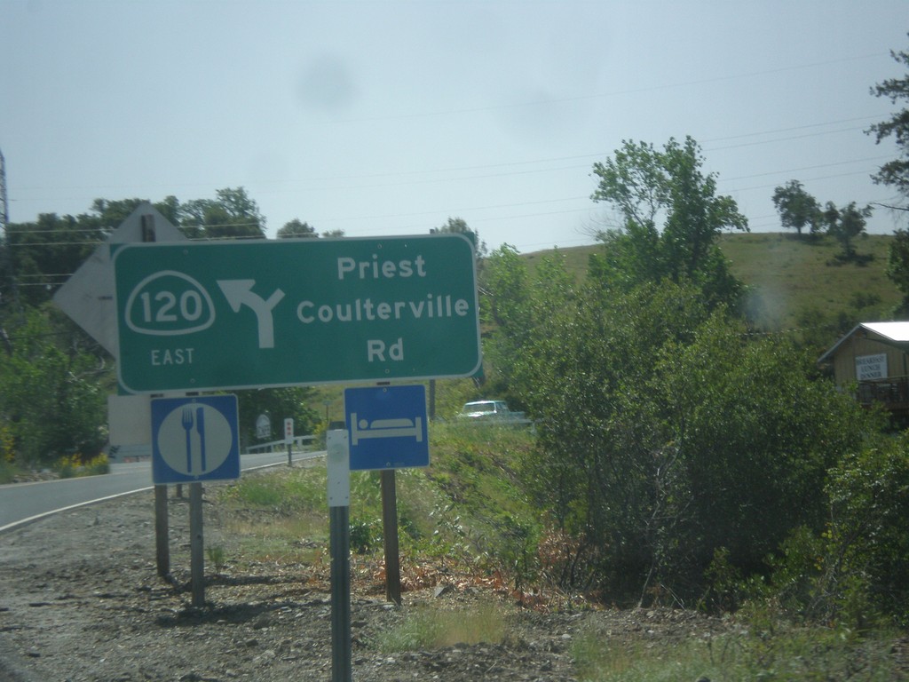
CA-120 East - Priest Coulterville Road
CA-120 East at Priest Coulterville Road in Tuolumne County.
Taken 05-05-2014
Jamestown
Tuolumne County
California
United States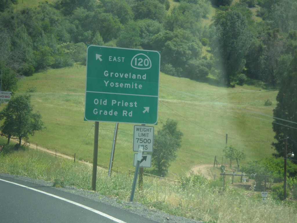
CA-120 East - Old Priest Grade Road
CA-120 East at Old Priest Grade Road. Continue east on CA-120 for Groveland and Yosemite.
Taken 05-05-2014
Moccasin
Tuolumne County
California
United States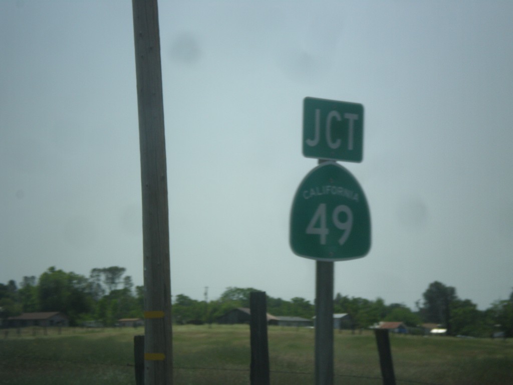
CA-120 East Approaching CA-49
CA-120 East approaching CA-49 in Chinese Camp.
Taken 05-05-2014
 Jamestown
Tuolumne County
California
United States
Jamestown
Tuolumne County
California
United States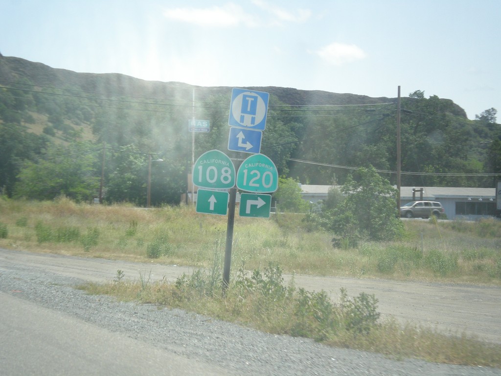
CA-108/CA-120 East at CA-120
CA-108/CA-120 East at CA-120 junction in Tuolumne County.
Taken 05-05-2014
 Jamestown
Tuolumne County
California
United States
Jamestown
Tuolumne County
California
United States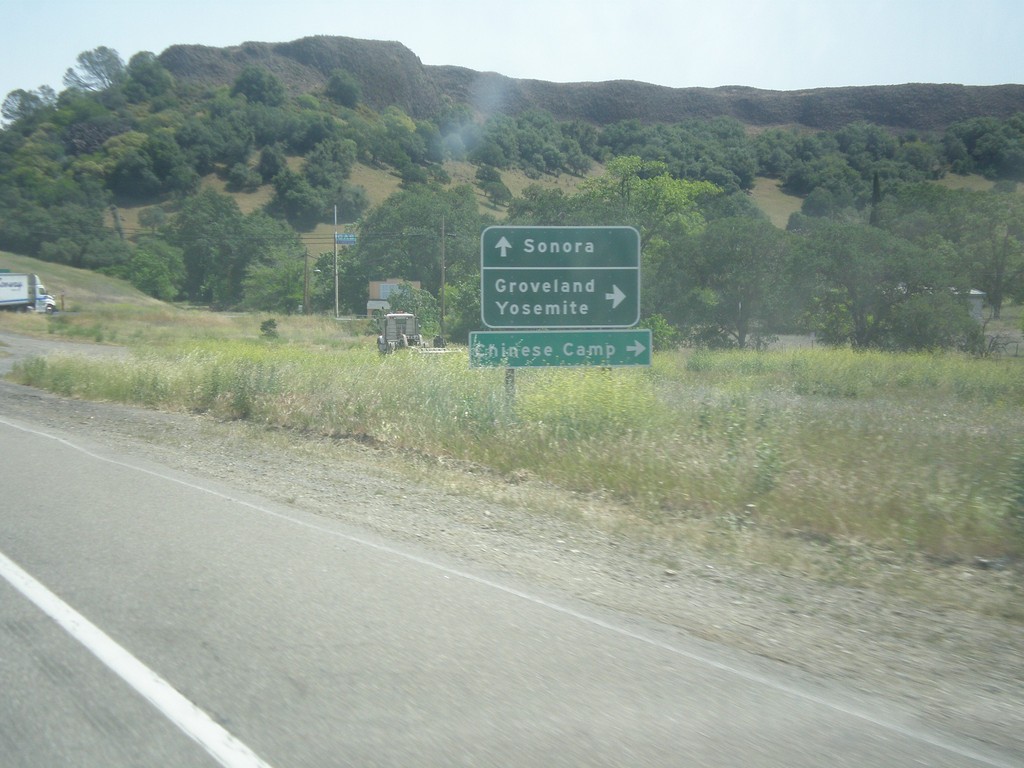
CA-108/CA-120 East at CA-120
CA-108/CA-120 East at CA-120 east to Groveland, Yosemite, and Chinese Camp. Continue east on CA-108 for Sonora.
Taken 05-05-2014
Jamestown
Tuolumne County
California
United States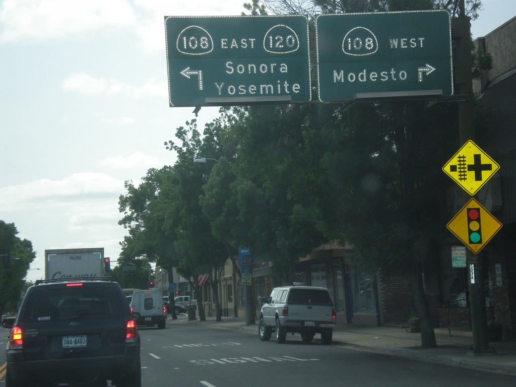
CA-120 East at CA-108
CA-120 east at CA-108 in Oakdale. Turn right for CA-108 west to Modesto. Turn left for CA-108/CA-120 east to Sonora and Yosemite. CA-120 joins CA-108 eastbound to the Chinese Camp area.
Taken 05-05-2014
Oakdale
Stanislaus County
California
United States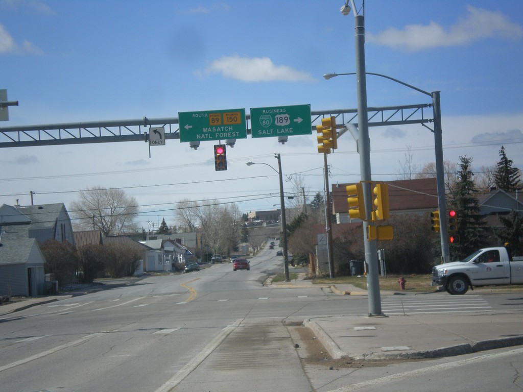
BL-80/Bus US-189 at WY-89/To WY-150
BL-80/Bus US-189 at WY-89/To WY-150. Turn left for WY-89 South/(To)WY-150 to Wasatch National Forest. Turn right for BL-80 East/Bus. US-189 South to Salt Lake.
Taken 03-31-2014


 Evanston
Uinta County
Wyoming
United States
Evanston
Uinta County
Wyoming
United States
BL-80/Bus. US-189 West Approaching WY-89
BL-80/Bus. US-189 West approaching WY-89 in Evanston.
Taken 03-31-2014
Evanston
Uinta County
Wyoming
United States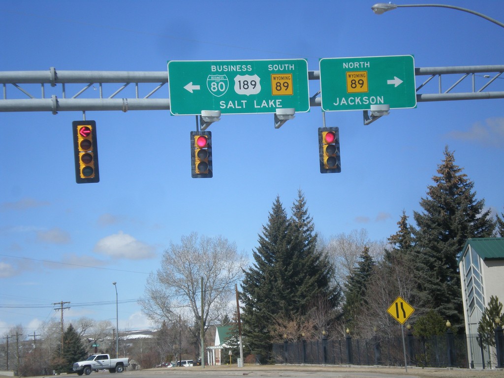
BL-80/Bus. US-189 West At WY-89
BL-80/Bus. US-189 West at WY-89. Turn right for WY-89 North to Jackson; left for WY-89 South/BL-80/Bus. US-189 to Salt Lake.
Taken 03-31-2014
Evanston
Uinta County
Wyoming
United States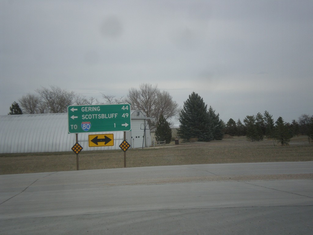
End NE-53E Link at NE-71
End NE-53E Link at NE-71. Use NE-71 north for Gering and Scottsbluff. Use NE-71 south for I-80.
Taken 03-30-2014

 Kimball
 County
Nebraska
United States
Kimball
Kimball County
Nebraska
United States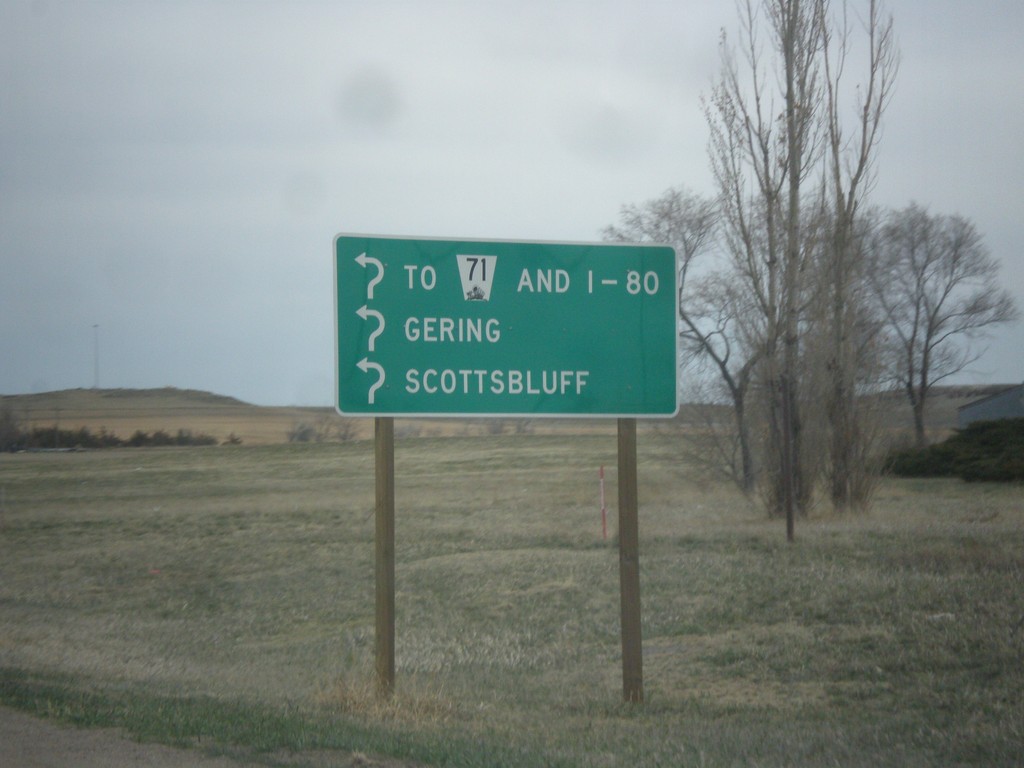
NE-53E Link - Roundabout
Roundabout on NE-53E Link. Enter roundabout for To NE-71 and I-80, Gering, and Scottsbluff. The roundabout only connects two segments of NE-53E Link. Notice the usage of the word I-80 instead of a shield.
Taken 03-30-2014
Kimball
Kimball County
Nebraska
United States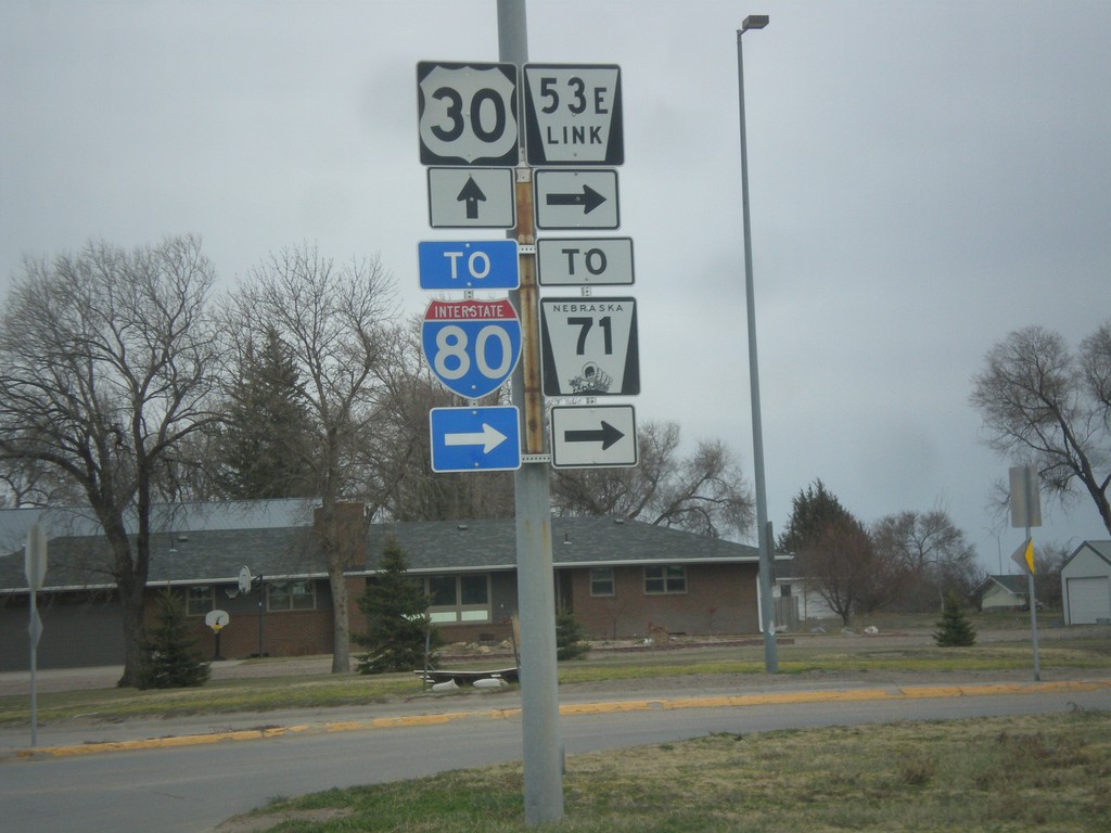
US-30 East at NE-53E Link
US-30 east at NE-53E Link. Use NE-53E Link for NE-71 and I-80 (via NE-71).
Taken 03-30-2014

 Kimball
 County
Nebraska
United States
Kimball
Kimball County
Nebraska
United States