Signs Tagged With Intersection
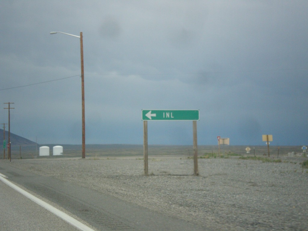
US-20 East - Idaho National Laboratory
US-20 east at junction to Idaho National Laboratory (INL).
Taken 05-07-2015
 Blackfoot
Butte County
Idaho
United States
Blackfoot
Butte County
Idaho
United States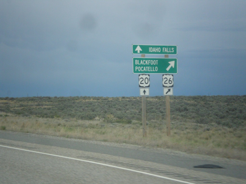
US-20/US-26 East Split
US-20/US-26 east at US-20/US-26 split. US-26 continues east to Pocatello and Blackfoot, US-20 east goes to Idaho Falls.
Taken 05-07-2015
 Cerro Grande
Bingham County
Idaho
United States
Cerro Grande
Bingham County
Idaho
United States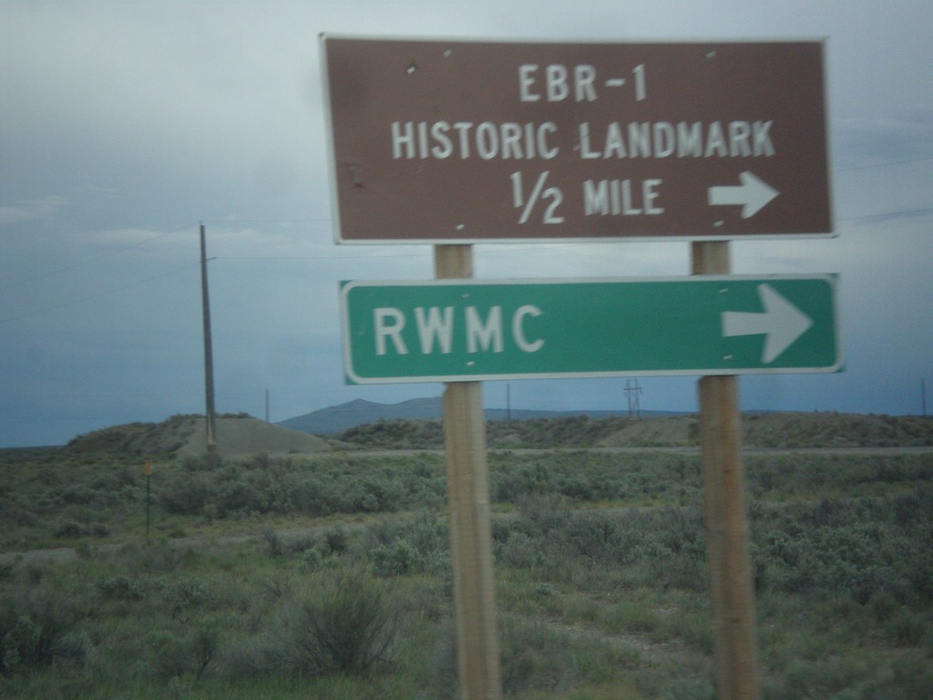
US-20/US-26 East - EBR-1 Junction
US-20/US-26 East at junction to EBR-1 (Experimental Breeder Reactor - 1), which was the worlds first electricity generating nuclear power plant. EBR-1 is part of the Idaho National Laboratory (INL), and as scheduled tours for the general public. Also turn right for the RWMC (Radioactive Waste Management Complex) at the INL.
Taken 05-07-2015
Scoville
Butte County
Idaho
United States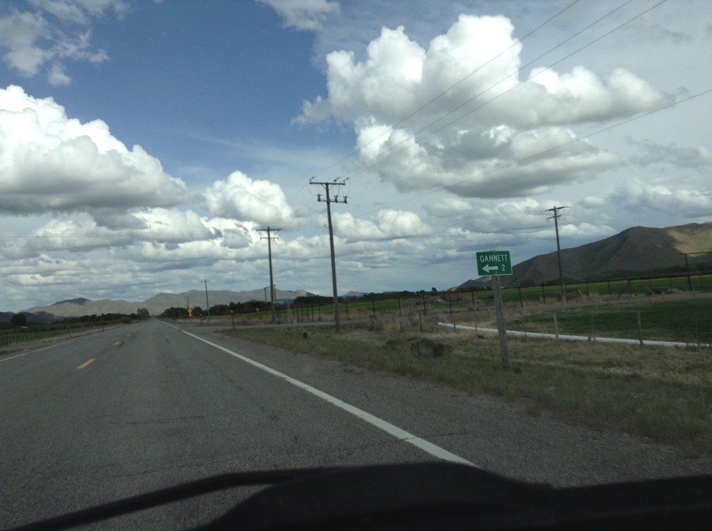
US-20 East - Gannett Junction
US-20 East at Gannett junction.
Taken 05-07-2015
Bellevue
Blaine County
Idaho
United States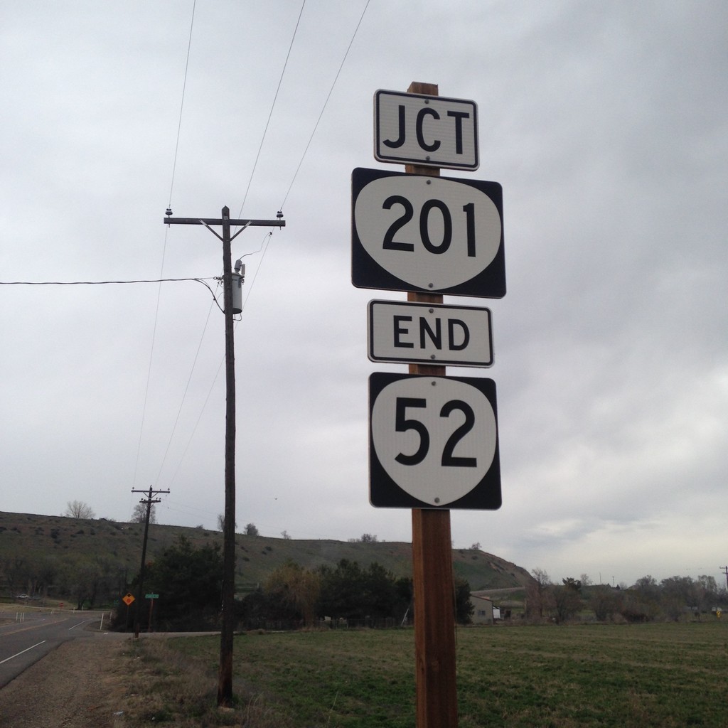
End OR-52 East at OR-201
End OR-52 east at OR-201 in Malheur County. OR-52 is a short continuation of ID-52 from Idaho.
Taken 03-21-2015

 Ontario
Malheur County
Oregon
United States
Ontario
Malheur County
Oregon
United States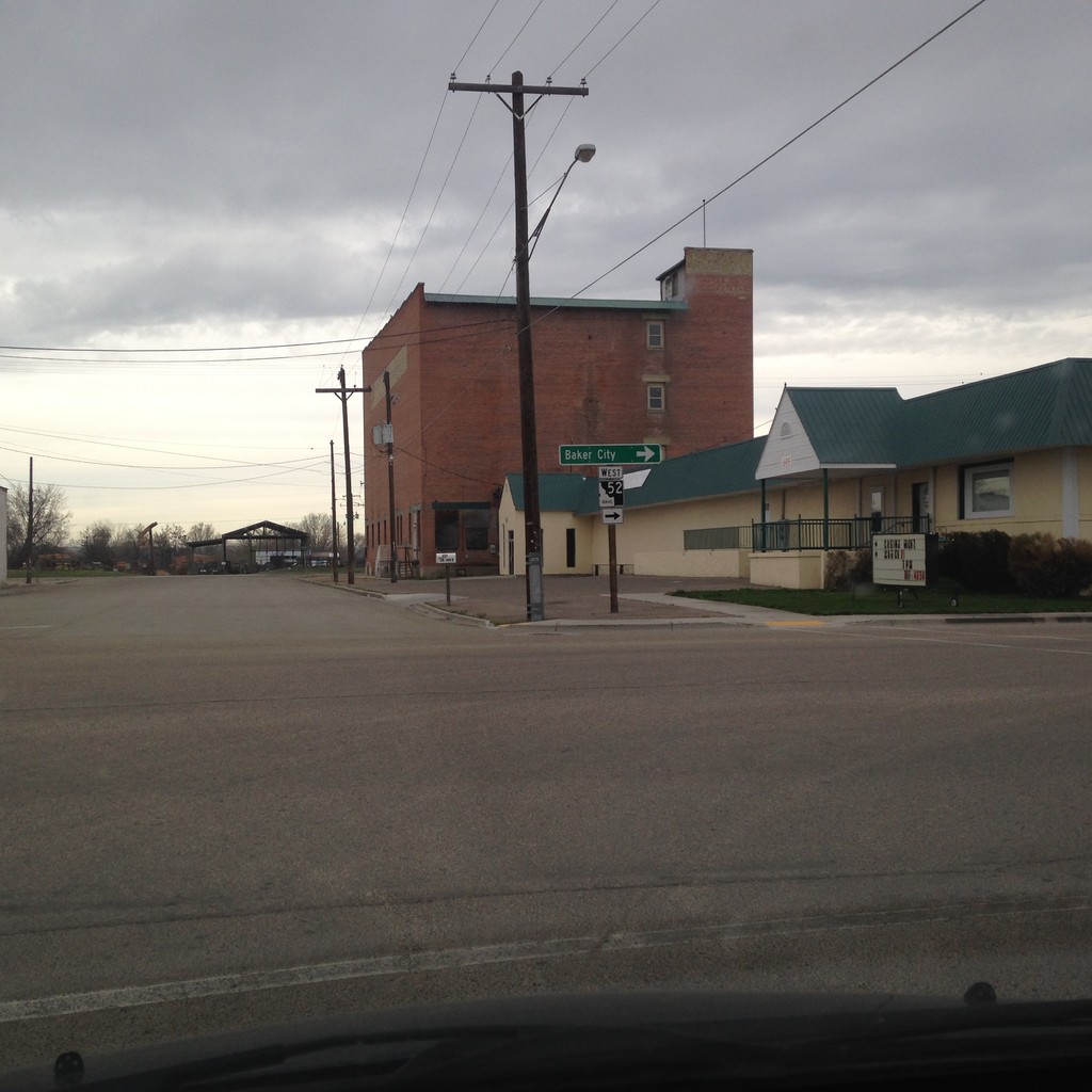
ID-52 West - Payette
ID-52 west in Payette. Turn right on 7th St. to continue west on ID-52 for Baker City (Oregon).
Taken 03-21-2015
 Payette
 County
Idaho
United States
Payette
Payette County
Idaho
United States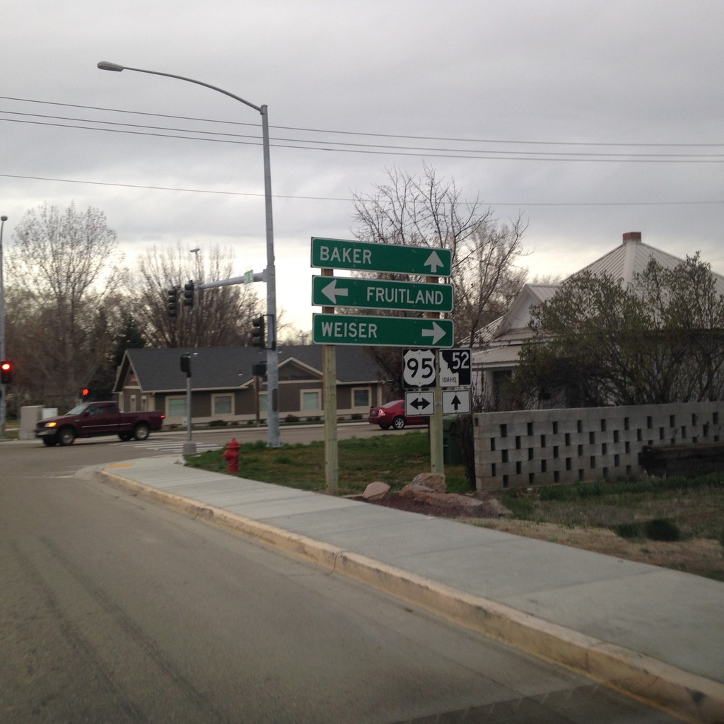
ID-52 West at US-95
ID-52 west at US-95 in Payette. Turn right for US-95 north to Weiser; left for US-95 south to Fruitland. Continue west on ID-52 for Baker (City, Oregon).
Taken 03-21-2015
 Payette
 County
Idaho
United States
Payette
Payette County
Idaho
United States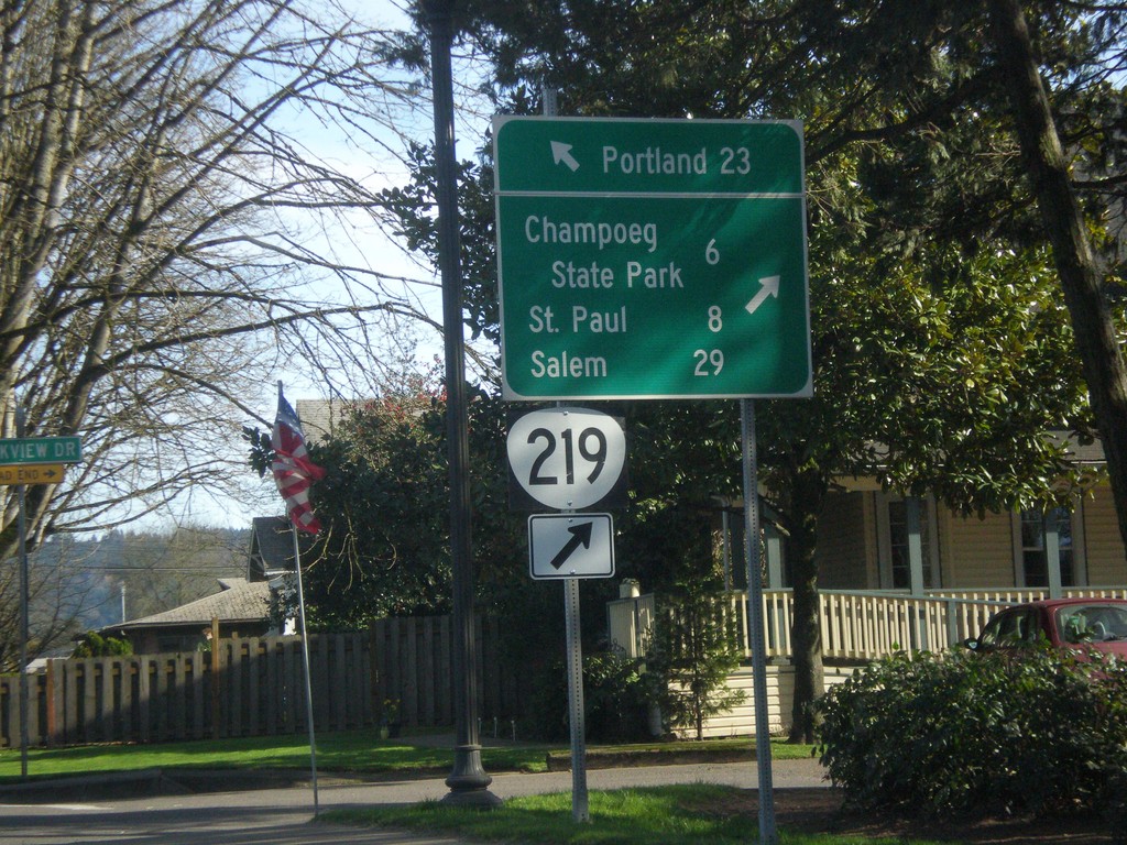
OR-99W North/OR-219 South Split in Newberg
OR-99W North/OR-219 South split in Newberg. Use OR-219 south for Champoeg State Park, St. Paul, and Salem. Continue north on OR-99W for Portland.
Taken 02-16-2015

 Newberg
Yamhill County
Oregon
United States
Newberg
Yamhill County
Oregon
United States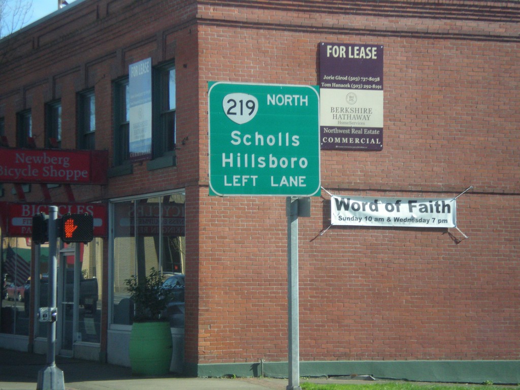
OR-99W North Approaching OR-219
OR-99W North Approaching OR-219 North to Scholls and Hillsboro. OR-219 joins OR-99W through Newberg.
Taken 02-16-2015
Newberg
Yamhill County
Oregon
United States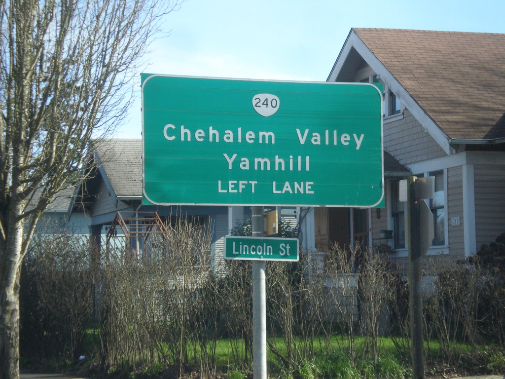
OR-99W North Approaching OR-240
OR-99W north approaching OR-240 north to Chehalem Valley and Yamhill. Use left lanes for OR-240 North.
Taken 02-16-2015
 Newberg
Yamhill County
Oregon
United States
Newberg
Yamhill County
Oregon
United States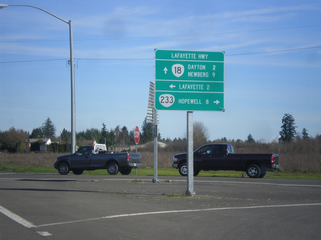
OR-18 East at OR-233 (Lafayette Highway)
OR-18 east at OR-233 (Lafayette Highway). Use OR-233 south for Hopewell. Turn north on Lafayette Highway for Lafayette. Continue east on OR-18 for Dayton and Newberg. OR-233 follows OR-18 north to OR-99W junction.
Taken 02-16-2015

 Dayton
Yamhill County
Oregon
United States
Dayton
Yamhill County
Oregon
United States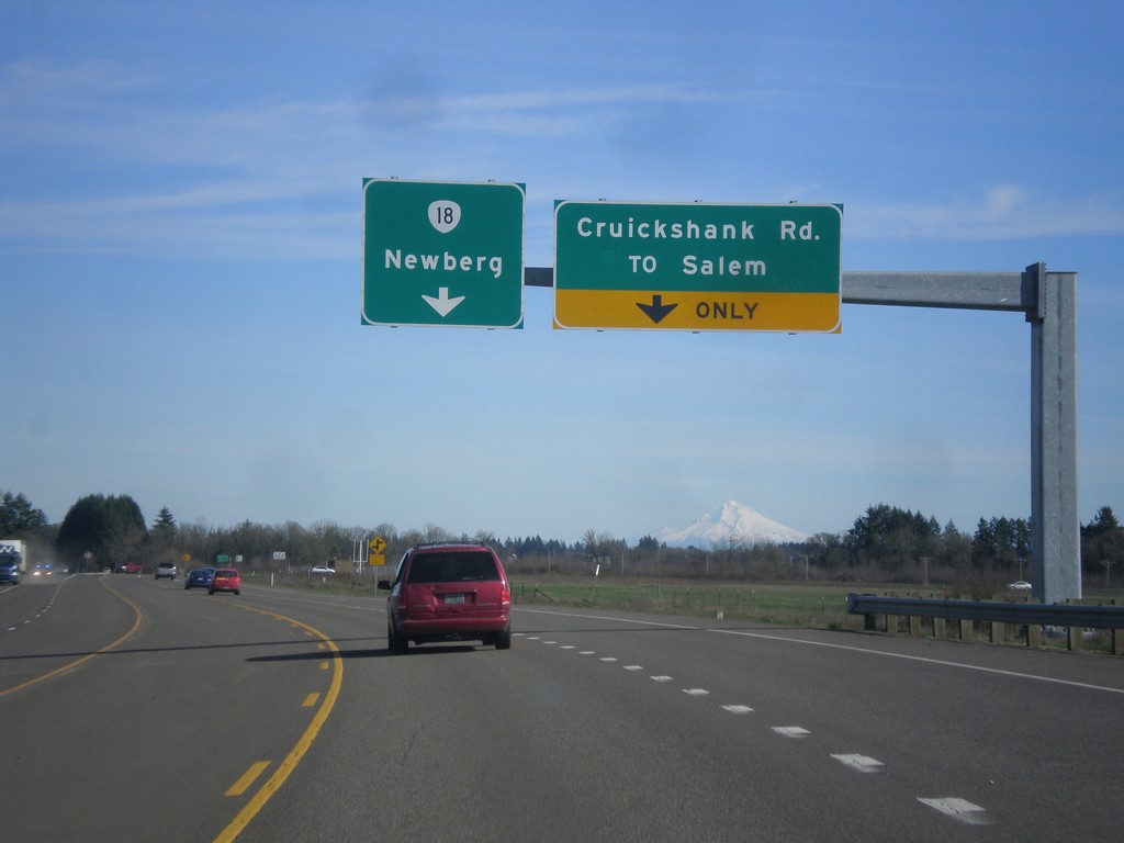
OR-18 East - Cruickshank Road Jct.
OR-18 east at Cruickshank Road/To Salem Jct. Continue east on OR-18 for Newberg.
Taken 02-16-2015
McMinnville
Yamhill County
Oregon
United States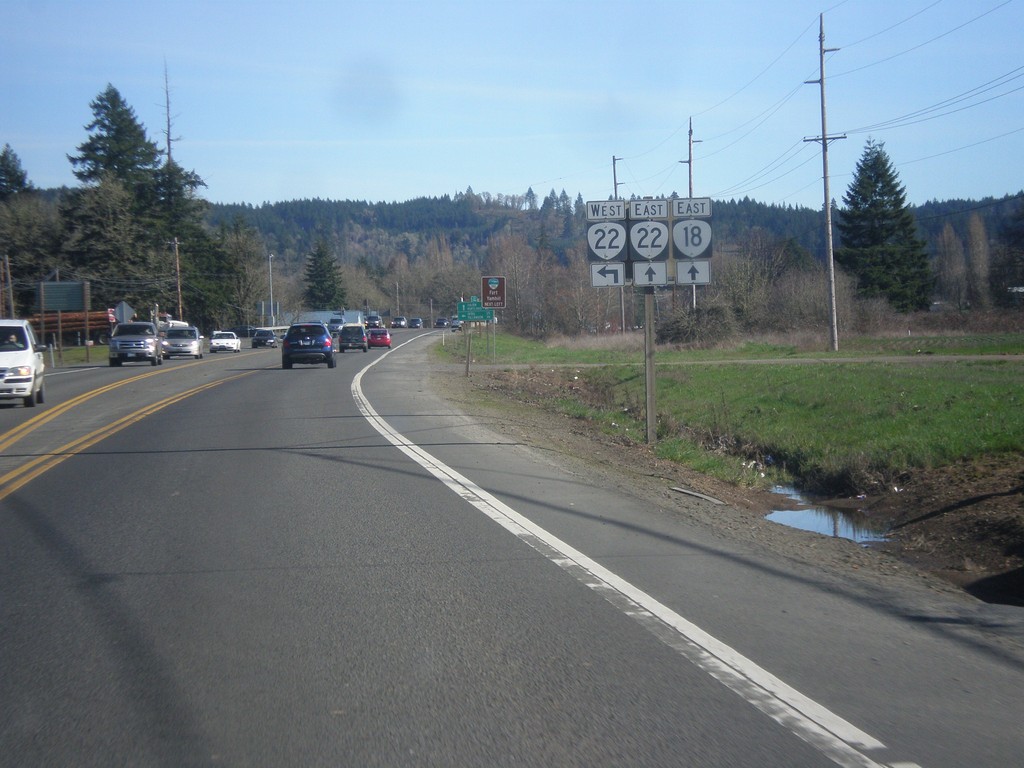
OR-18 East at OR-22
OR-18 east approaching OR-22. OR-22 follows OR-18 east to Willamina.
Taken 02-16-2015
 Grand Ronde
Polk County
Oregon
United States
Grand Ronde
Polk County
Oregon
United States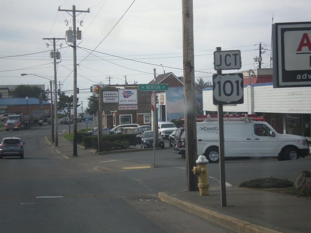
US-20 West Approaching US-101
US-20 west approaching US-101, its western terminus. US-20 starts in Boston, Massachusetts, and at 3365 miles is the longest route in the United States.
Taken 02-13-2015
 Newport
Lincoln County
Oregon
United States
Newport
Lincoln County
Oregon
United States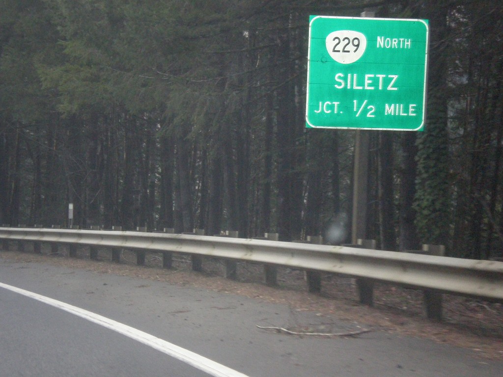
US-20 West Approaching OR-229 North
US-20 west approaching OR-229 north to Siletz.
Taken 02-13-2015
 Toledo
Lincoln County
Oregon
United States
Toledo
Lincoln County
Oregon
United States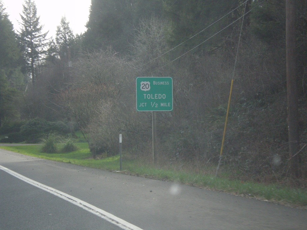
US-20 West Approaching Bus. US-20/Toledo
US-20 West approaching the eastern end of the Toldeo business loop.
Taken 02-13-2015
 Toledo
Lincoln County
Oregon
United States
Toledo
Lincoln County
Oregon
United States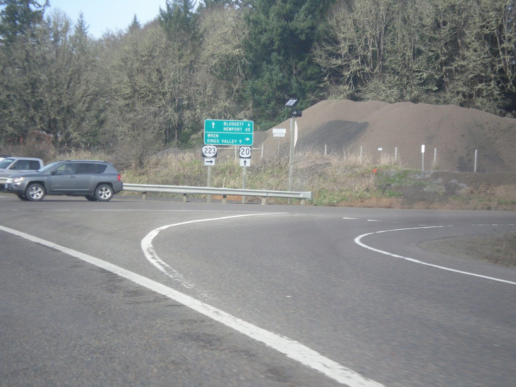
US-20 West at OR-223 North
US-20 west at OR-223 north to Wren and Kings Valley. Continue on US-20 west for Blodgett and Newport.
Taken 02-13-2015
 Philomath
Benton County
Oregon
United States
Philomath
Benton County
Oregon
United States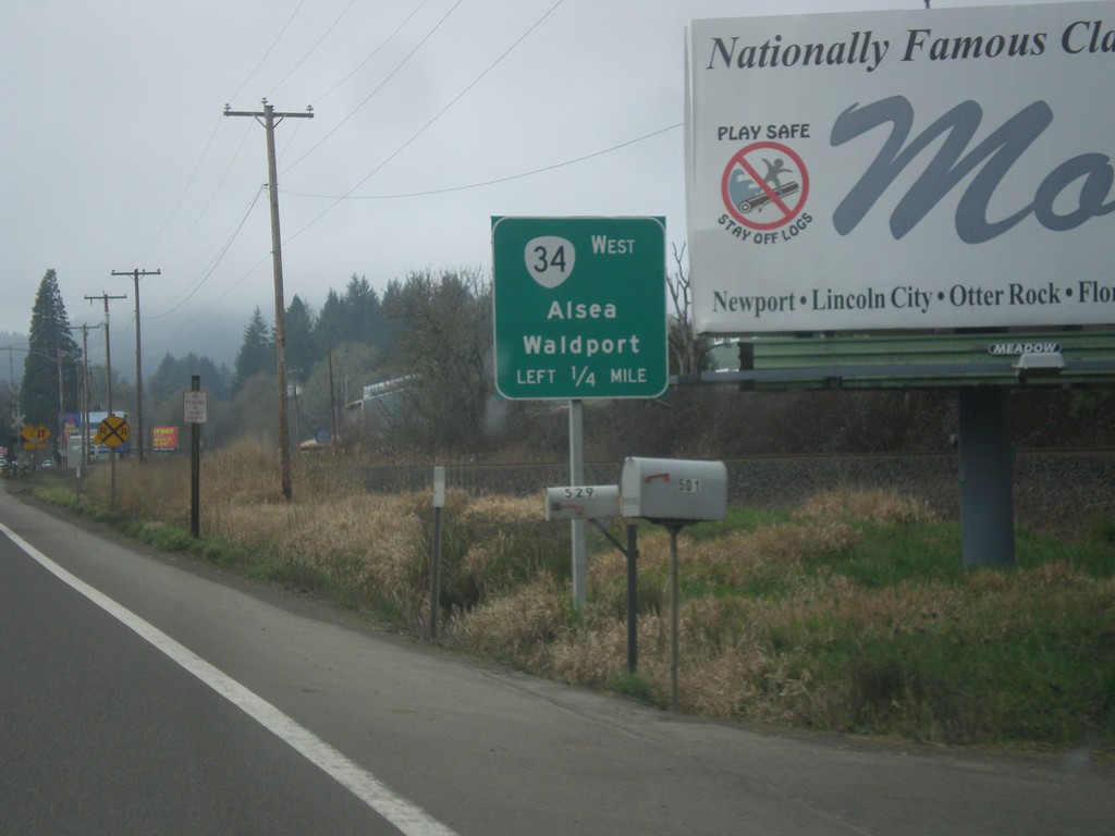
US-20/OR-34 West Approaching US-20/OR-34 Split in Philomath
US-20/OR-34 West Approaching US-20/OR-34 split in Philomath. Turn left for OR-34 west to Alsea and Waldport.
Taken 02-13-2015
 Philomath
Benton County
Oregon
United States
Philomath
Benton County
Oregon
United States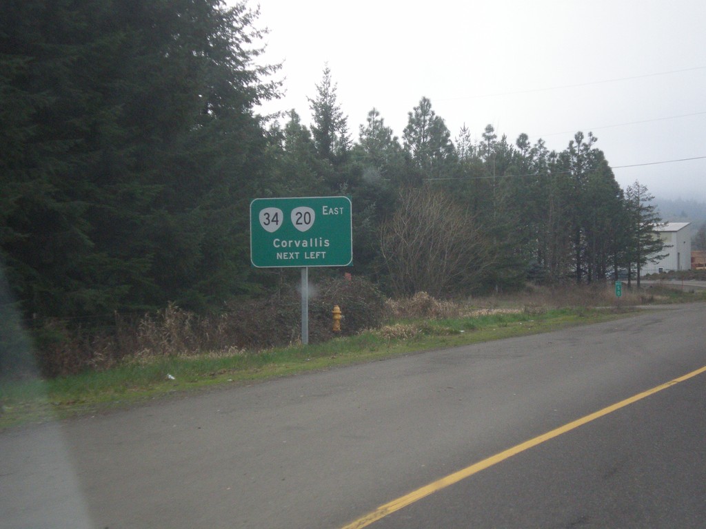
US-20/OR-34 West at Turnaround To US-20/OR-34 East
US-20/OR-34 west at turnaround To US-20/OR-34 East in Philomath and western end of one-way couplet. Use US-20/OR-34 East to Corvallis. Notice the US-20 shield is incorrectly displayed using the Oregon state highway shield.
Taken 02-13-2015
Philomath
Benton County
Oregon
United States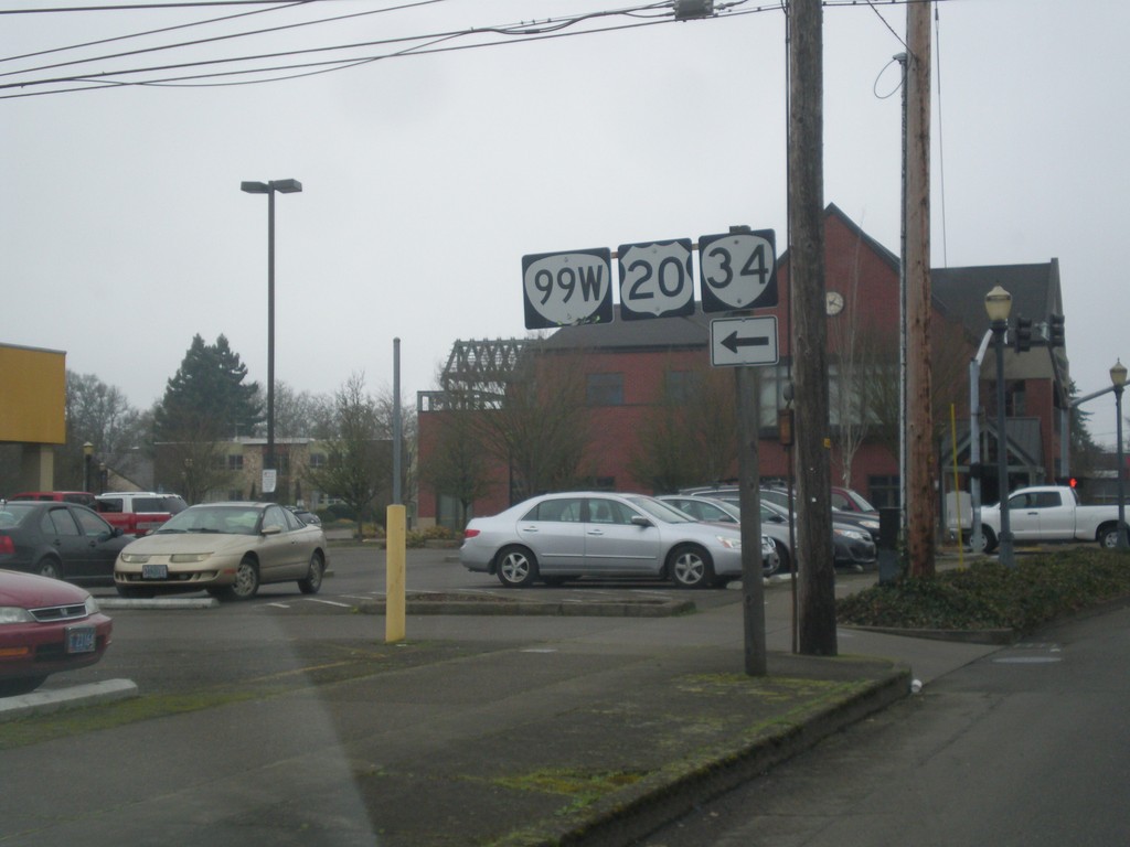
US-20/OR-34 West at OR-99W
US-20/OR-34 West (NW Harrison Blvd.) at OR-99W South (NW 4th St.). Turn left to continue west on US-20/OR-34 West which joins OR-99W through Corvallis.
Taken 02-13-2015
Corvallis
Benton County
Oregon
United States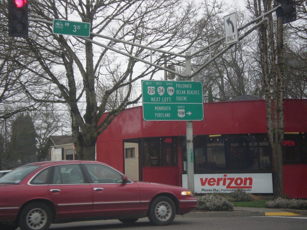
US-20 East (NE Harrison Blvd.) at OR-99W at (NW 3rd St.)
US-20 East (NE Harrison Blvd.) at OR-99W at (NW 3rd St.) in Corvallis. Turn right for OR-99W North to Monmouth and Portland. Continue straight for US-20/OR-34 West/OR-99W South to Philomath, Ocean Beaches, and Eugene. Notice the OR-99W North shield is incorrectly displayed as a US highway shield.
Taken 02-13-2015
Corvallis
Benton County
Oregon
United States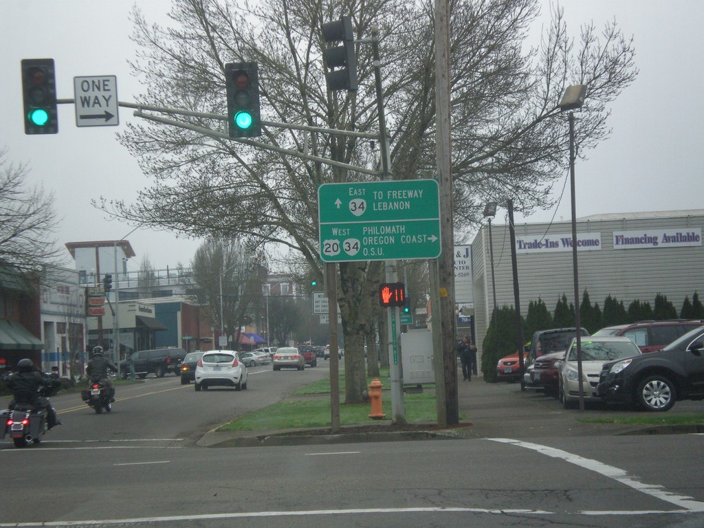
US-20 West at OR-34 - Corvallis
US-20 West (NW 2nd St.) at OR-34 (NW Harrison Blvd). Use US-20/OR-34 West for Philomath/Oregon Coast/O.S.U. (Oregon State University). Continue straight for OR-34 east to Freeway (I-5) and Lebanon.
Taken 02-13-2015
Corvallis
Benton County
Oregon
United States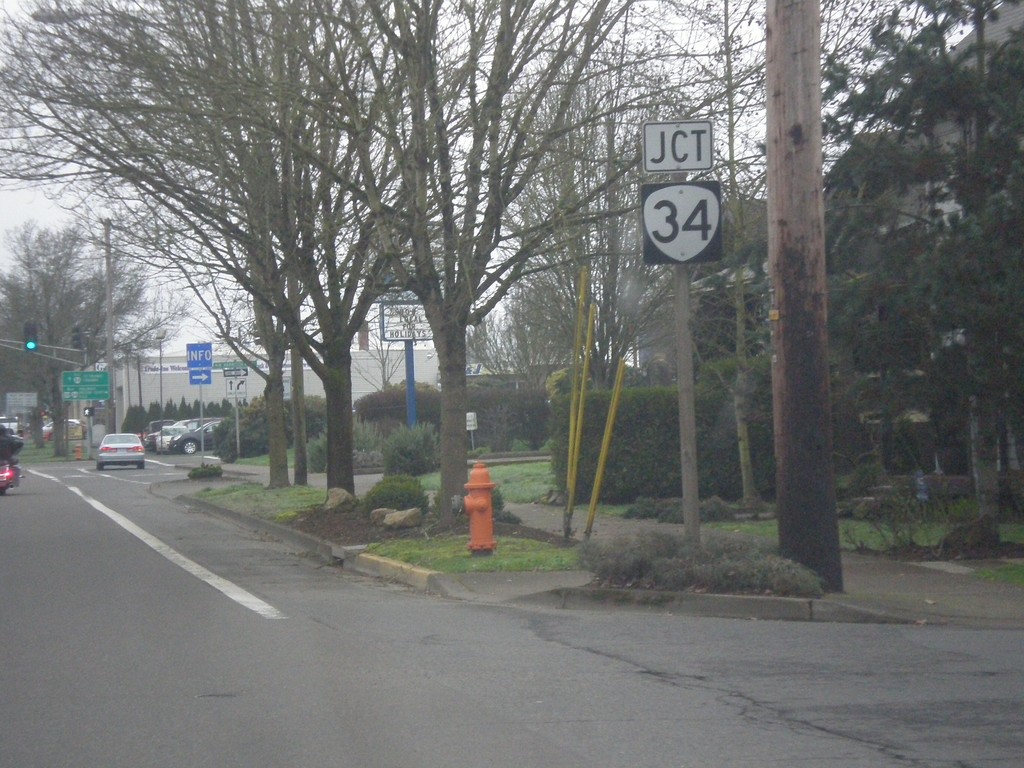
US-20 West Approaching OR-34
US-20 West (NW 2nd St.) approaching OR-34 (NW Harrison Blvd.) in Corvallis.
Taken 02-13-2015
Corvallis
Benton County
Oregon
United States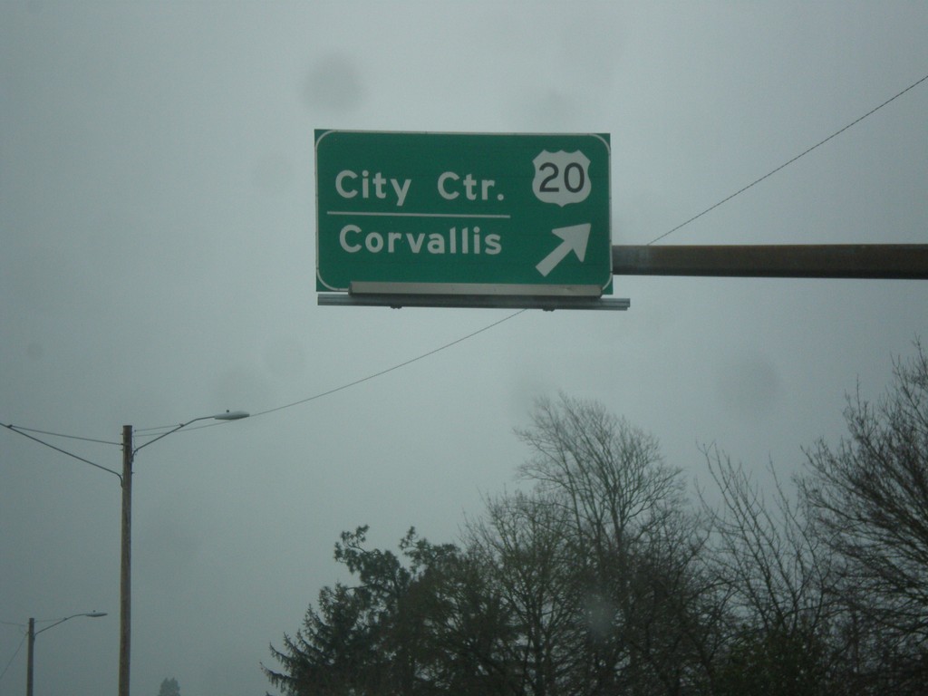
US-20 West/OR-99E (Pacific Blvd. SE) at US-20/OR-99E Split
US-20 West/OR-99E (Pacific Blvd. SE) at US-20/OR-99E split. Merge right for US-20 West/City Center (Albany)/Corvallis.
Taken 02-13-2015
 Albany
Linn County
Oregon
United States
Albany
Linn County
Oregon
United States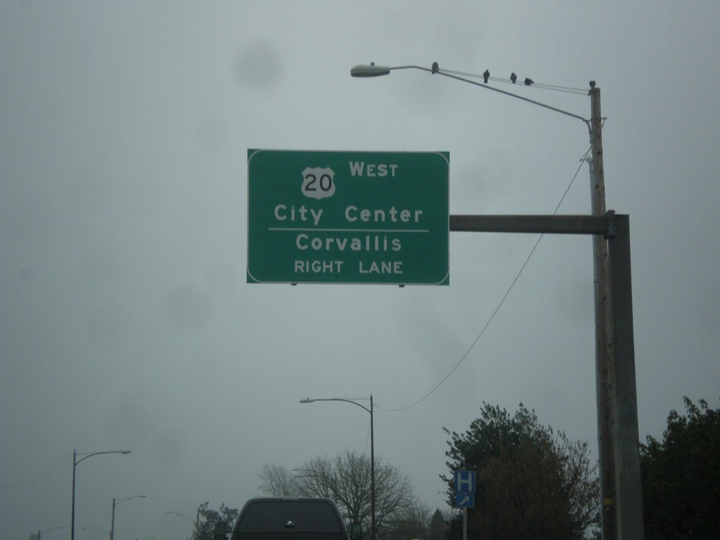
US-20 West/OR-99E South (Pacific Blvd. SE) Approaching Split
US-20 West/OR-99E South (Pacific Blvd. SE) approaching US-20/OR-99E split. Use right lane for US-20 West/City Center (Albany)/Corvallis.
Taken 02-13-2015
Albany
Linn County
Oregon
United States