Signs Tagged With Intersection
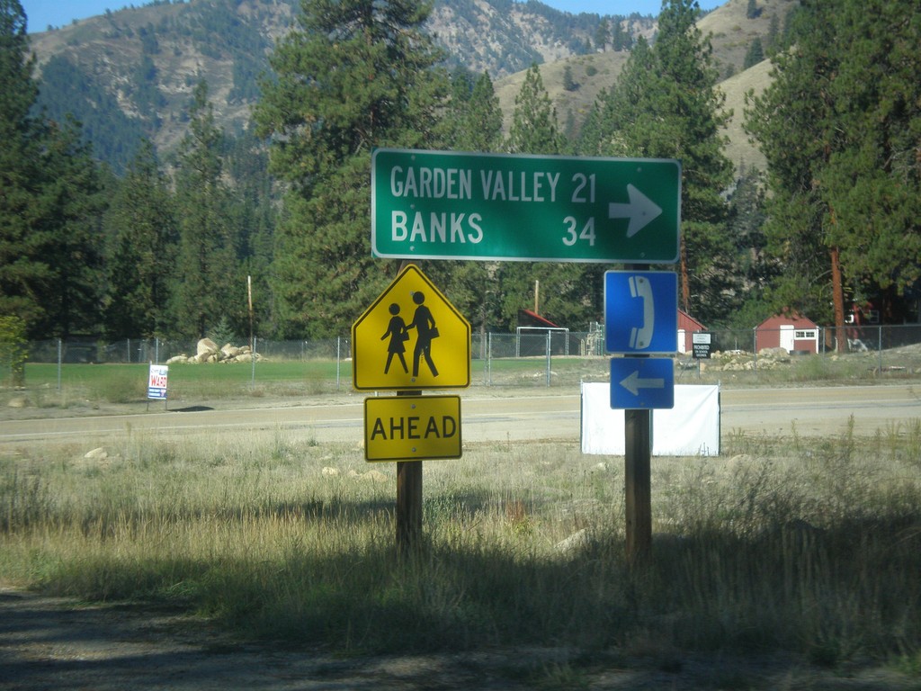
ID-21 South - Banks-Lowman Highway Jct.
ID-21 South at Banks-Lowman Highway Jct. Use the Banks-Lowman Highway for Garden Valley and Banks.
Taken 10-05-2014
 Lowman
Boise County
Idaho
United States
Lowman
Boise County
Idaho
United States
ID-21 South - Grandjean Jct.
ID-21 south at Grandjean Jct.
Taken 10-05-2014
Lowman
Boise County
Idaho
United States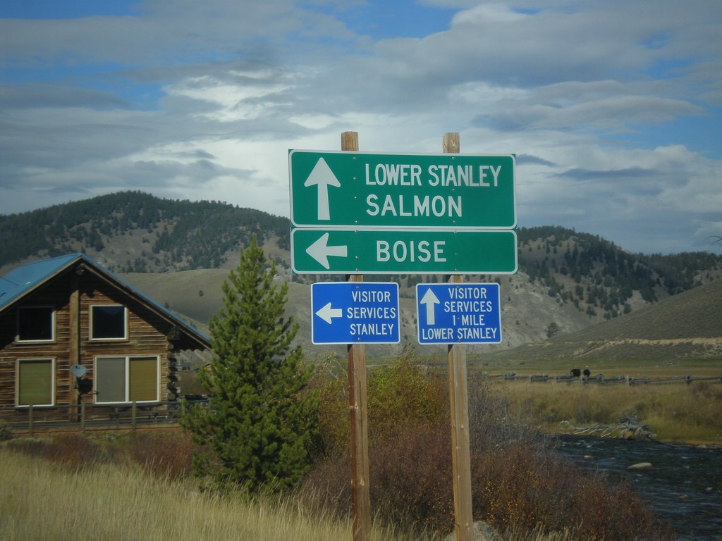
ID-75 North at ID-21 South
ID-75 North at ID-21 South. Use ID-75 north for Lower Stanley and Salmon. Use ID-21 south for Boise. The Salmon River can be seen in the background of the picture.
Taken 10-04-2014
 Stanley
Custer County
Idaho
United States
Stanley
Custer County
Idaho
United States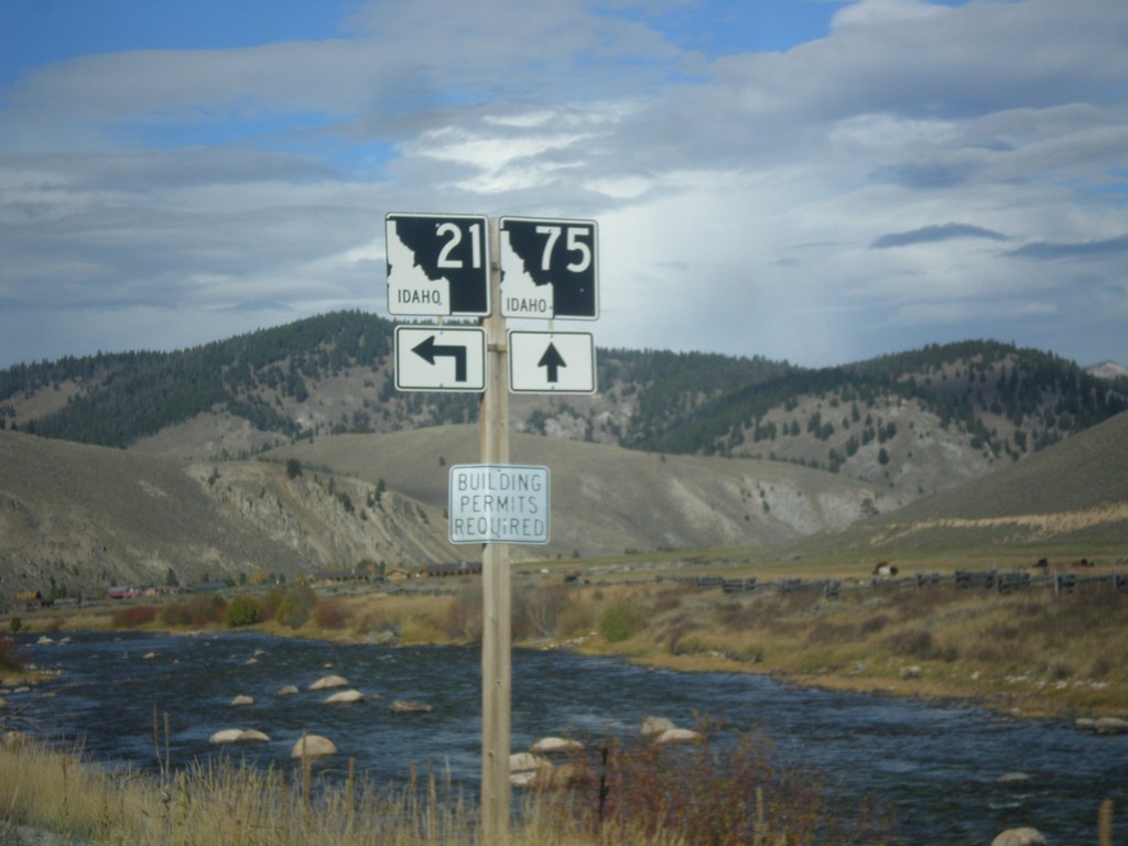
ID-75 North at ID-21 South
ID-21 Junction on ID-75 North in Stanley.
Taken 10-04-2014
Stanley
Custer County
Idaho
United States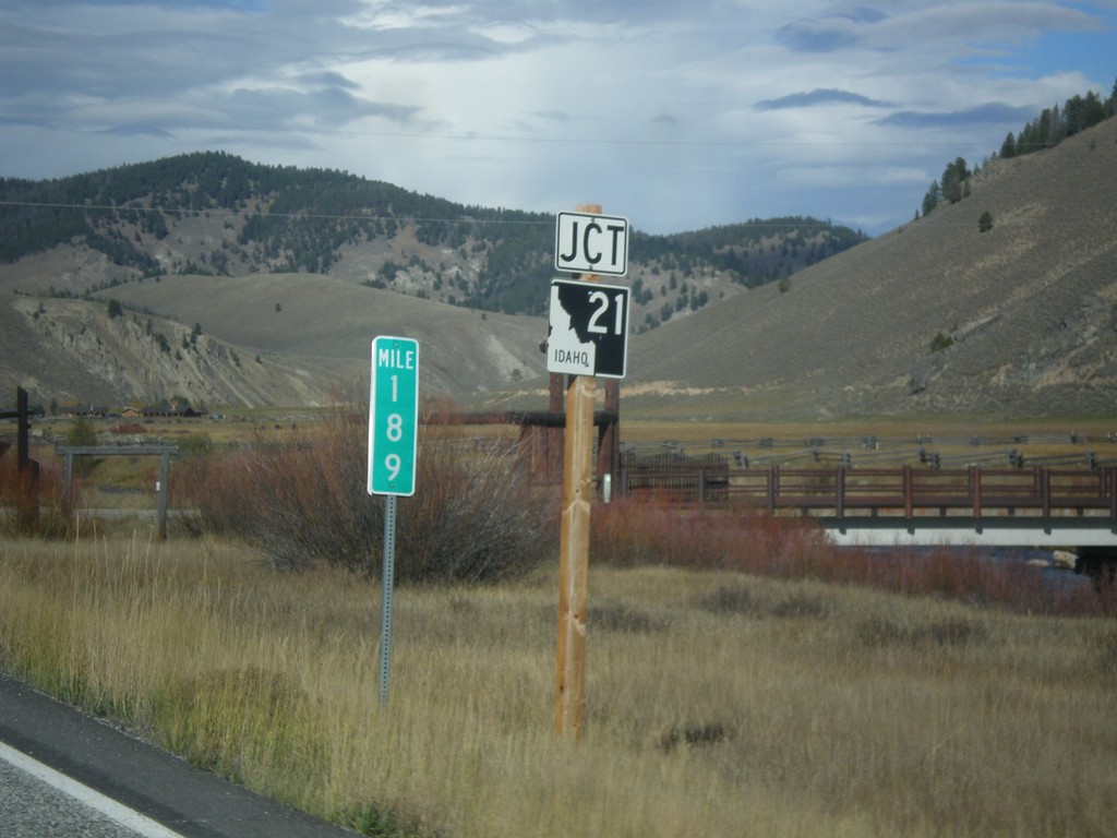
ID-75 North Approaching ID-21
Approaching ID-21 Junction on ID-75 North in Stanley. Milemarker 189.
Taken 10-04-2014
Stanley
Custer County
Idaho
United States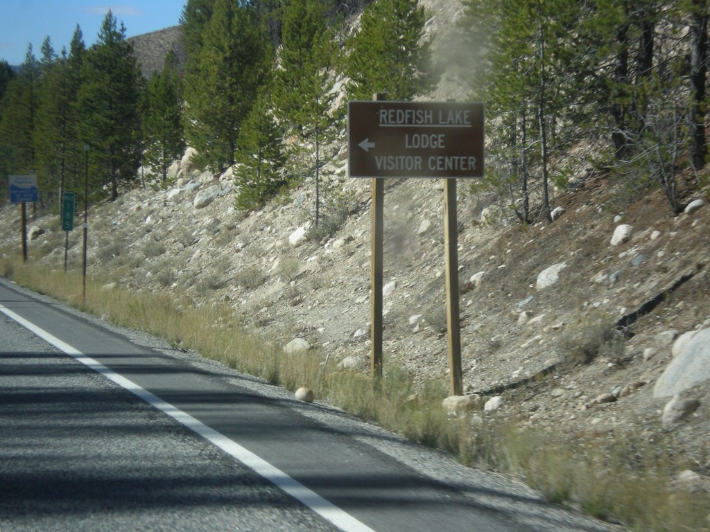
ID-75 North - Redfish Lake Jct.
ID-75 North at Redfish Lake Lodge/Visitor Center junction.
Taken 10-04-2014
Stanley
Custer County
Idaho
United States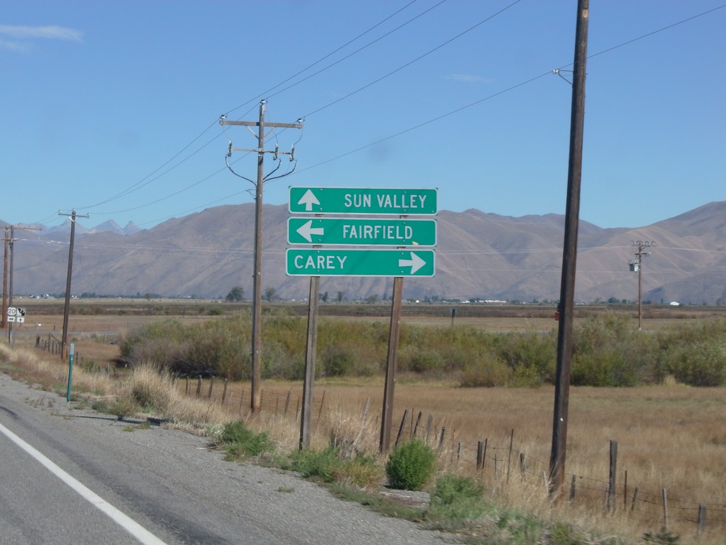
ID-75 North at US-20
ID-75 north at US-20. Use US-20 east for Carey; US-20 west for Fairfield. Continue north to Sun Valley.
Taken 10-04-2014
 Bellevue
Blaine County
Idaho
United States
Bellevue
Blaine County
Idaho
United States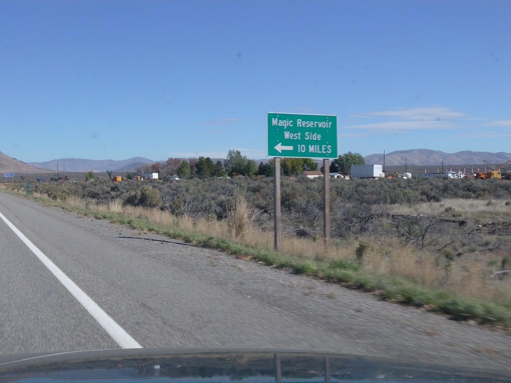
ID-75 North - Magic Reservoir West Side
ID-75 North at junction to Magic Reservoir - West Side. Magic Reservoir lies on the Big Wood River south of Sun Valley.
Taken 10-04-2014
Shoshone
Lincoln County
Idaho
United States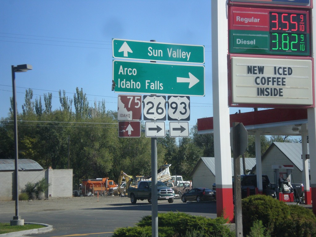
Begin ID-75 North at US-26/US-93
US-26/US-93 at ID-75 in Shoshone. Turn right for US-26 East/US-93 North to Arco and Idaho Falls. Continue straight for ID-75 to Sun Valley.
Taken 10-04-2014

 Shoshone
Lincoln County
Idaho
United States
Shoshone
Lincoln County
Idaho
United States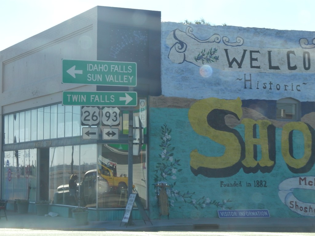
US-26 East at US-93
US-26 east at US-93 in downtown Shoshone. Turn right for US-93 south to Twin Falls; turn left for US-26 East/US-93 North to Idaho Falls (via US-20) and Sun Valley (via ID-75). US-26 joins US-93 northbound to Arco.
Taken 10-04-2014
Shoshone
Lincoln County
Idaho
United States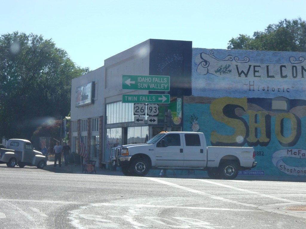
US-26 East at US-93
US-26 east at US-93 in downtown Shoshone. US-26 joins US-93 northbound to Arco.
Taken 10-04-2014
Shoshone
Lincoln County
Idaho
United States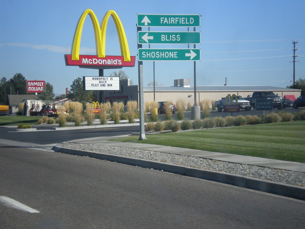
ID-46 North at US-26
ID-46 north at US-26. Turn right on US-26 east for Shoshone; left on US-26 west for Bliss. Continue north on ID-46 for Fairfield.
Taken 10-04-2014
 Gooding
 County
Idaho
United States
Gooding
Gooding County
Idaho
United States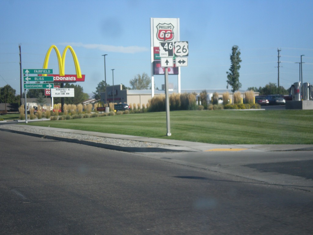
ID-46 North Approaching US-26
ID-46 North approaching US-26 in Gooding.
Taken 10-04-2014
Gooding
Gooding County
Idaho
United States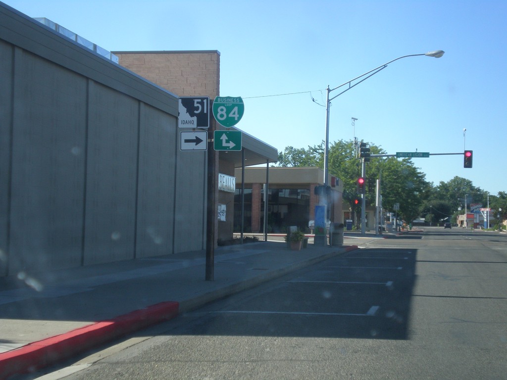
ID-51 North at BL-84
ID-51 North (Old US-30) at BL-84. Turn right on American Legion Blvd. for BL-84 east; continue straight for BL-84 west.
Taken 08-31-2014

 Mountain Home
Elmore County
Idaho
United States
Mountain Home
Elmore County
Idaho
United States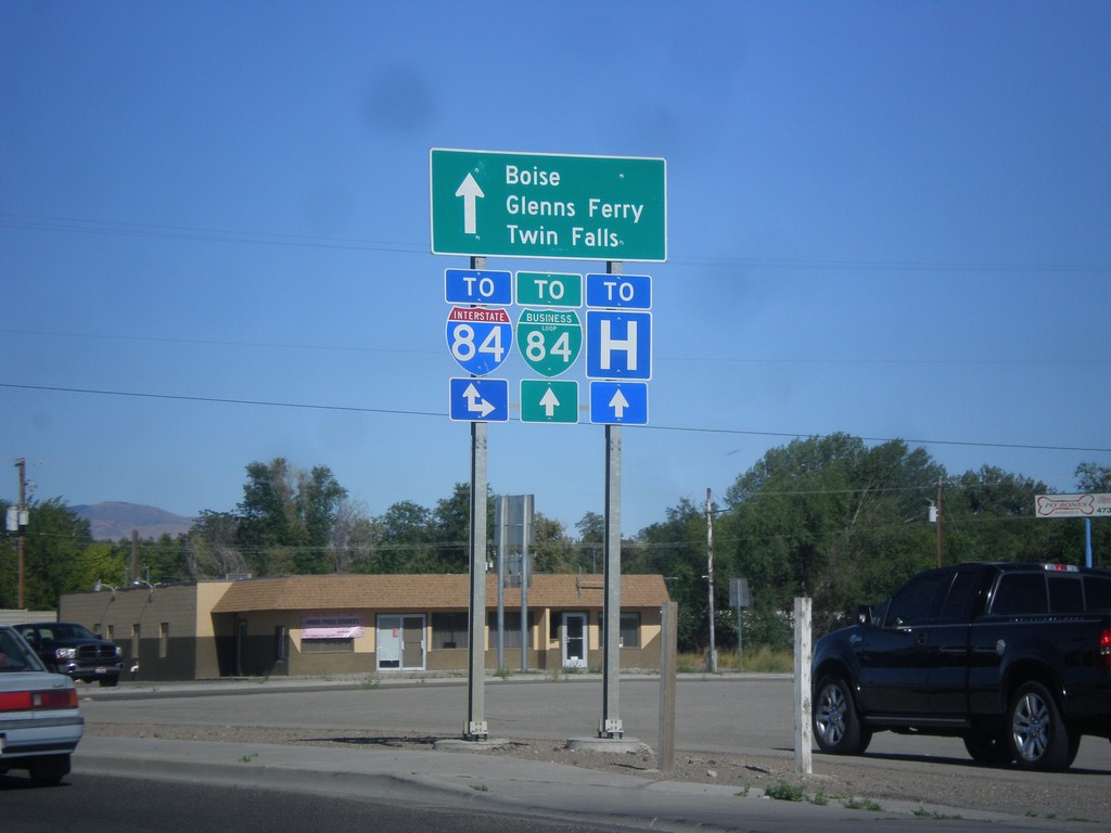
ID-51 North At Old US-30
ID-51 north at Old US-30. Use Old US-30 for I-84 eastbound access. Continue north on ID-51 for I-84, BL-84, Boise, Glenns Ferry, and Twin Falls. This intersection used to route Twin Falls traffic along Old US-30, but has recently been changed to route traffic along the business loop.
Taken 08-31-2014
 Mountain Home
Elmore County
Idaho
United States
Mountain Home
Elmore County
Idaho
United States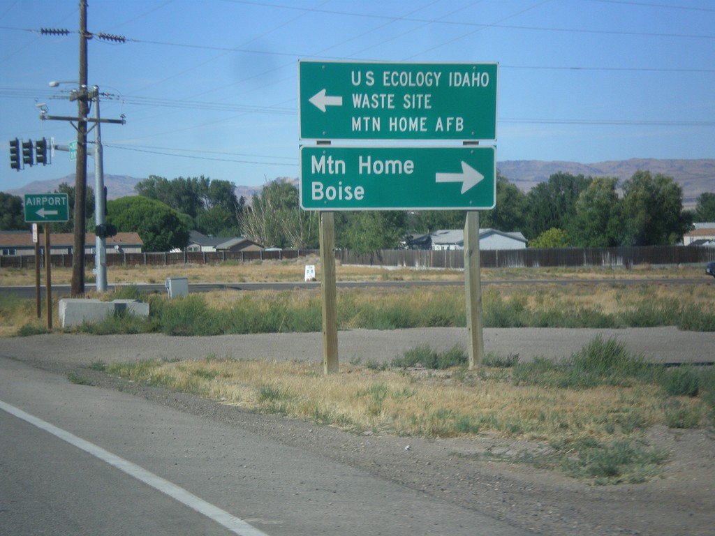
ID-51 North at ID-67
ID-51 north at ID-67. Turn left for ID-67 east to US Ecology Idaho Waste Site and Mountain Home AFB. Turn right on ID-51 north for Mountain Home and Boise.
Taken 08-31-2014
 Mountain Home
Elmore County
Idaho
United States
Mountain Home
Elmore County
Idaho
United States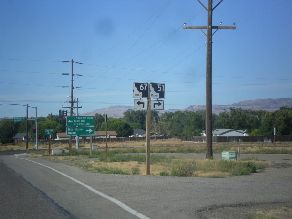
ID-51 North Approaching ID-67
ID-51 north approaching ID-67. Turn right to continue north on ID-51; left for ID-67.
Taken 08-31-2014
Mountain Home
Elmore County
Idaho
United States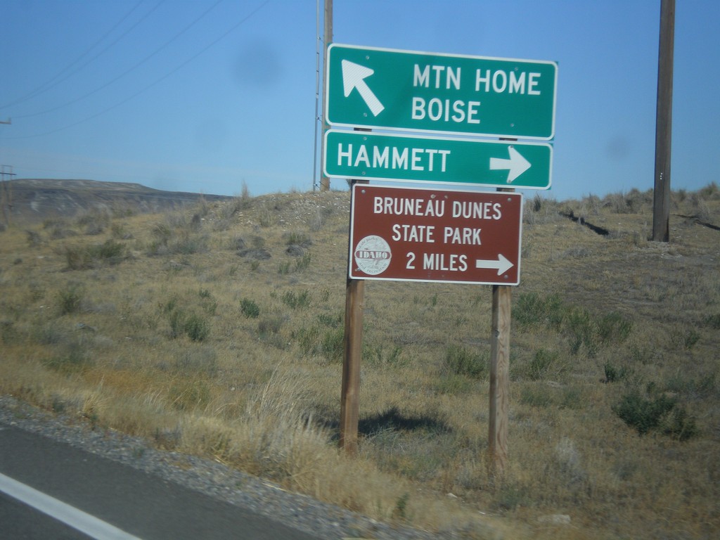
ID-51 North/ID-78 East Jct.
ID-51 North/ID-78 East at ID-51/ID-78 junction. Turn right for ID-78 east to Hammett and Bruneau Dunes State Park. Continue north on ID-51 for Mountain Home and Boise.
Taken 08-31-2014
 Mountain Home
Owyhee County
Idaho
United States
Mountain Home
Owyhee County
Idaho
United States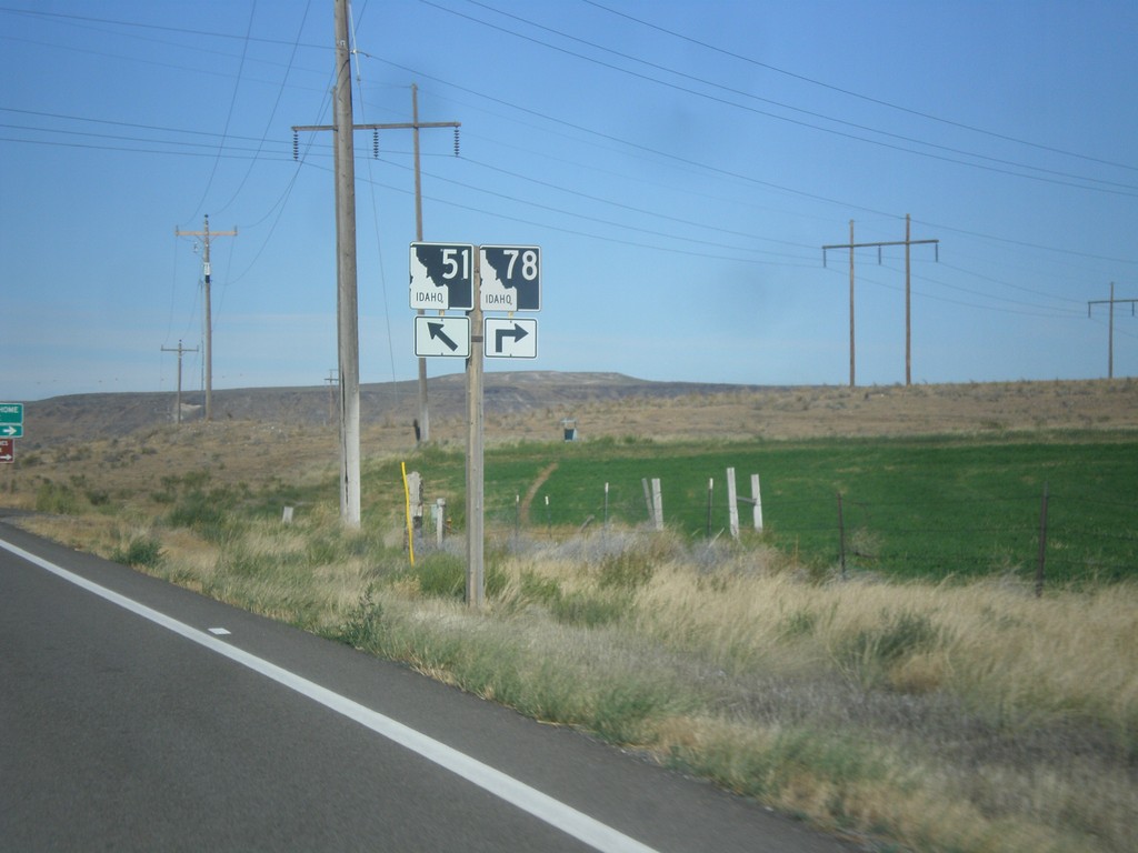
ID-51 North/ID-78 East at Split
ID-51 North/ID-78 East at split. Merge right to continue east on ID-78.
Taken 08-31-2014
Mountain Home
Owyhee County
Idaho
United States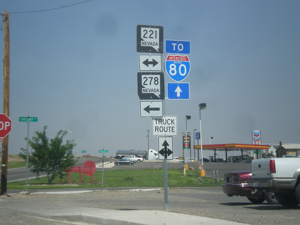
10th St. North at Chestnut St.
10th St. northbound at Chestnut St. (BL-80/NV-221) in Carlin. Use westbound Chestnut St. for NV-278. Continue north on 10th St. (NV-766) for I-80.
Taken 08-31-2014


 Carlin
Elko County
Nevada
United States
Carlin
Elko County
Nevada
United States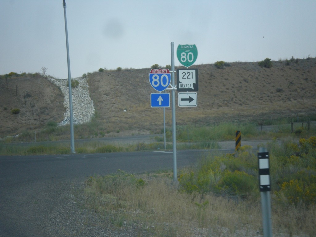
NV-278 North at BL-80/NV-221
NV-278 north at BL-80/NV-221. Continue north on NV-278 for I-80 junction.
Taken 08-31-2014
Carlin
Elko County
Nevada
United States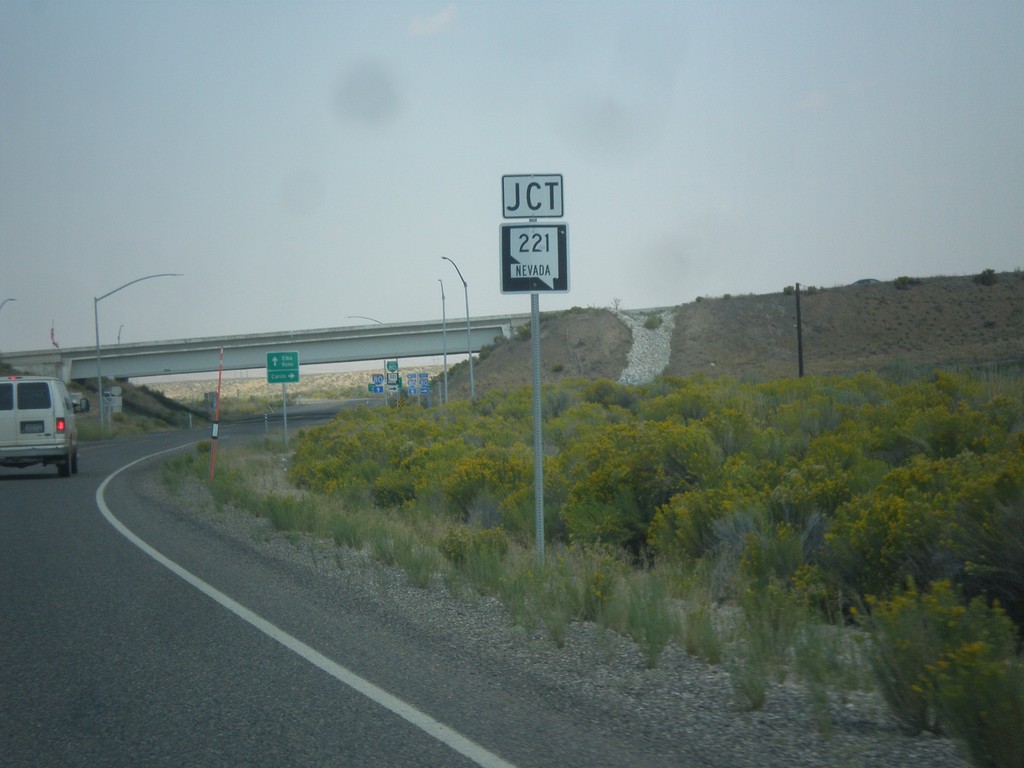
NV-278 North Approaching NV-221 (BL-80)
NV-278 North approaching NV-221 (BL-80) in Carlin.
Taken 08-31-2014
Carlin
Elko County
Nevada
United States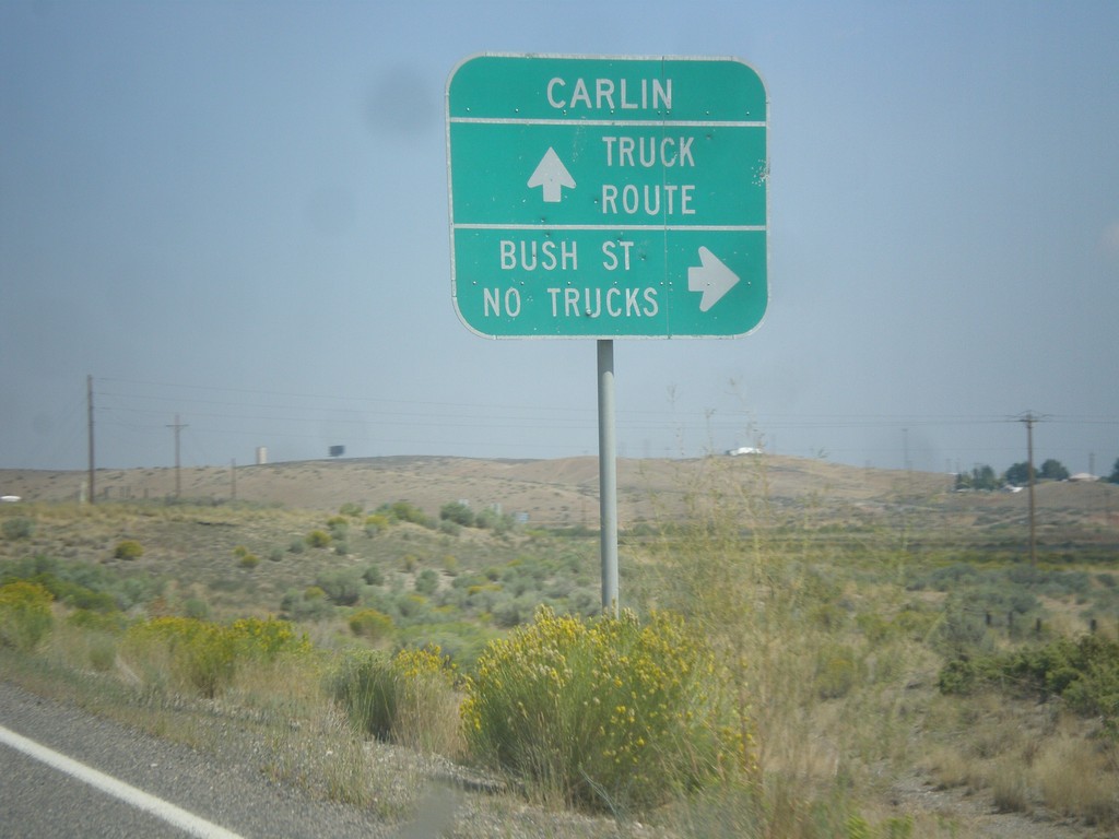
NV-278 North - Bush St. Jct.
NV-278 north at Bush St. Non truck traffic can enter Carlin on Bush Street. Truck traffic needs to continue north on NV-278 to the business loop.
Taken 08-31-2014
Carlin
Elko County
Nevada
United States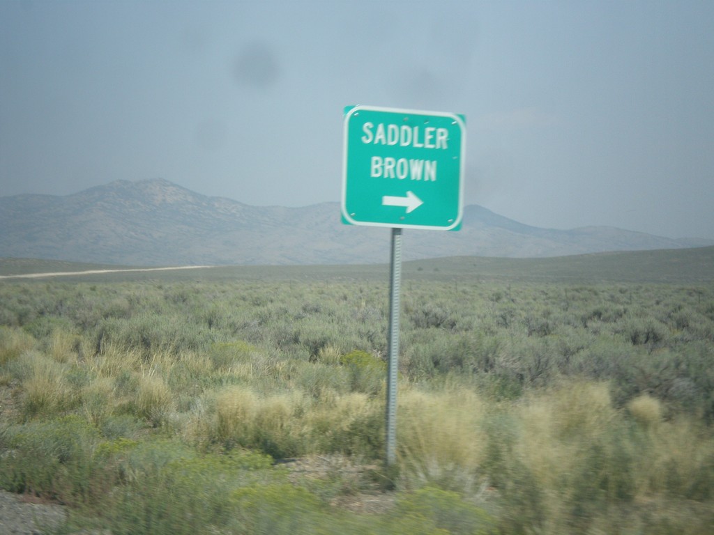
NV-278 North at Saddler Brown Road
NV-278 North at Saddler Brown Road.
Taken 08-31-2014
Eureka
Eureka County
Nevada
United States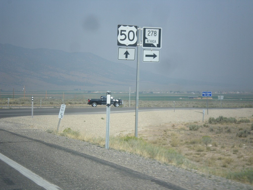
US-50 West at NV-278 North
US-50 west at NV-278 north. NV-278 connects US-50 north to I-80.
Taken 08-31-2014
 Eureka
 County
Nevada
United States
Eureka
Eureka County
Nevada
United States