Signs Tagged With Intersection
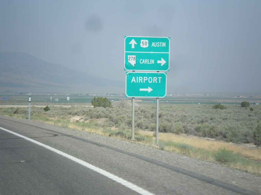
US-50 West at NV-278
US-50 west at NV-278 north to Carlin and (Eureka County) Airport. Continue west on US-50 for Austin.
Taken 08-31-2014

 Eureka
 County
Nevada
United States
Eureka
Eureka County
Nevada
United States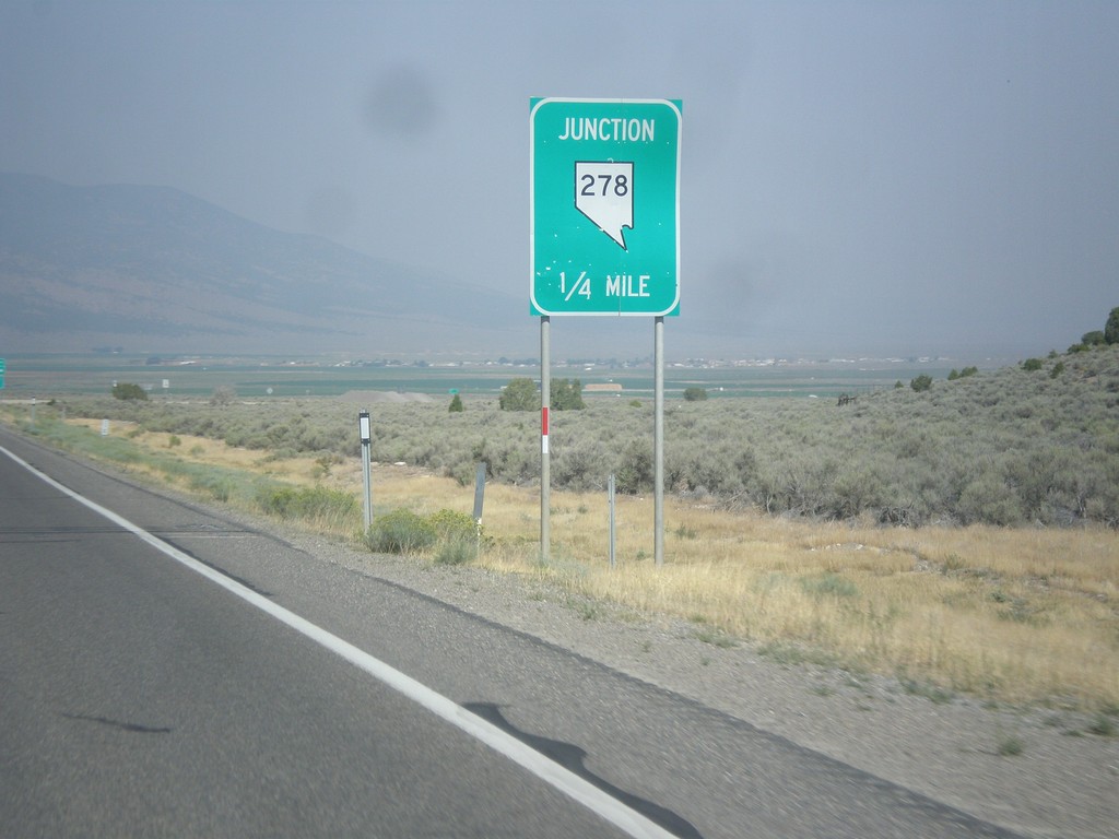
US-50 West Approaching NV-278
US-50 west approaching NV-278 junction.
Taken 08-31-2014
Eureka
Eureka County
Nevada
United States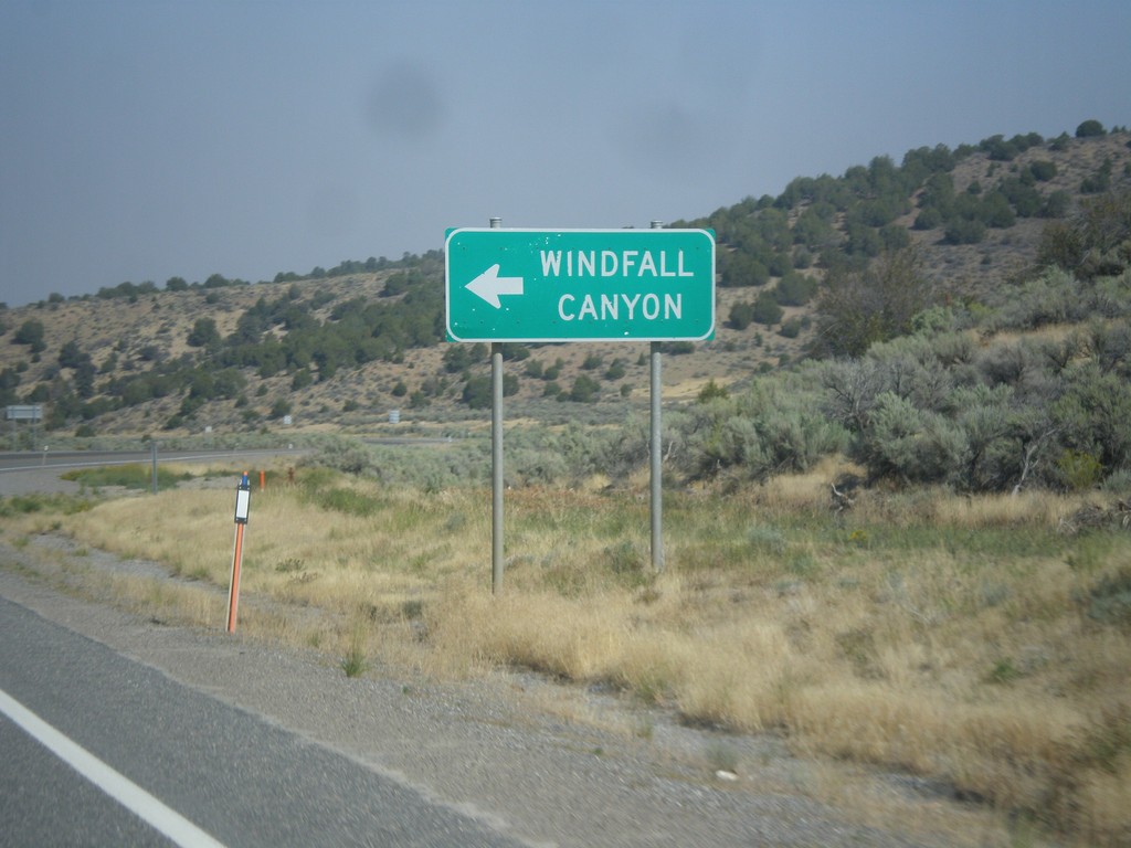
US-50 West - Windfall Canyon Jct.
US-50 west at junction to Windfall Canyon.
Taken 08-31-2014
Eureka
Eureka County
Nevada
United States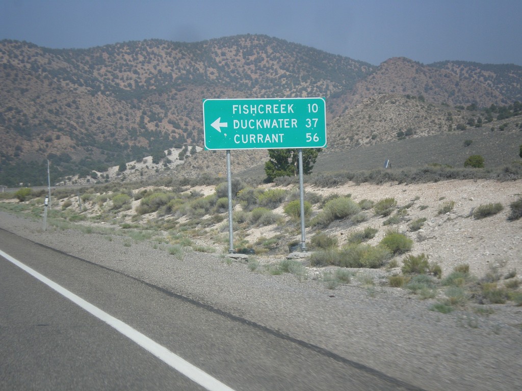
US-50 West - Duckwater Jct.
US-50 west at junction to Fishcreek, Duckwater, and Currant.
Taken 08-31-2014
Eureka
Eureka County
Nevada
United States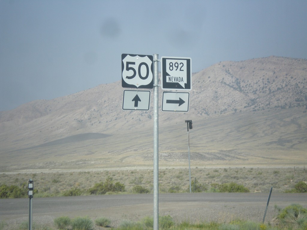
US-50 West at NV-892 North
US-50 West at NV-892 North to Strawberry.
Taken 08-31-2014
 Eureka
White Pine County
Nevada
United States
Eureka
White Pine County
Nevada
United States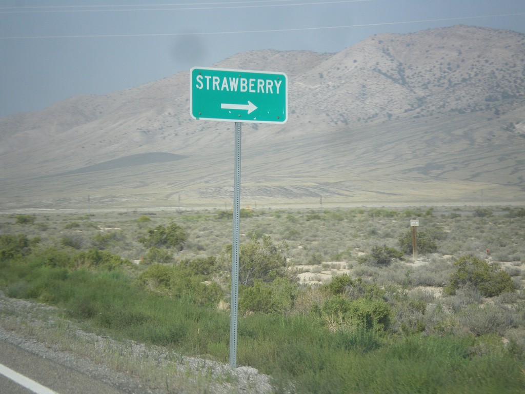
US-50 West Approaching NV-892
US-50 west approaching NV-892 north to Strawberry.
Taken 08-31-2014
Eureka
White Pine County
Nevada
United States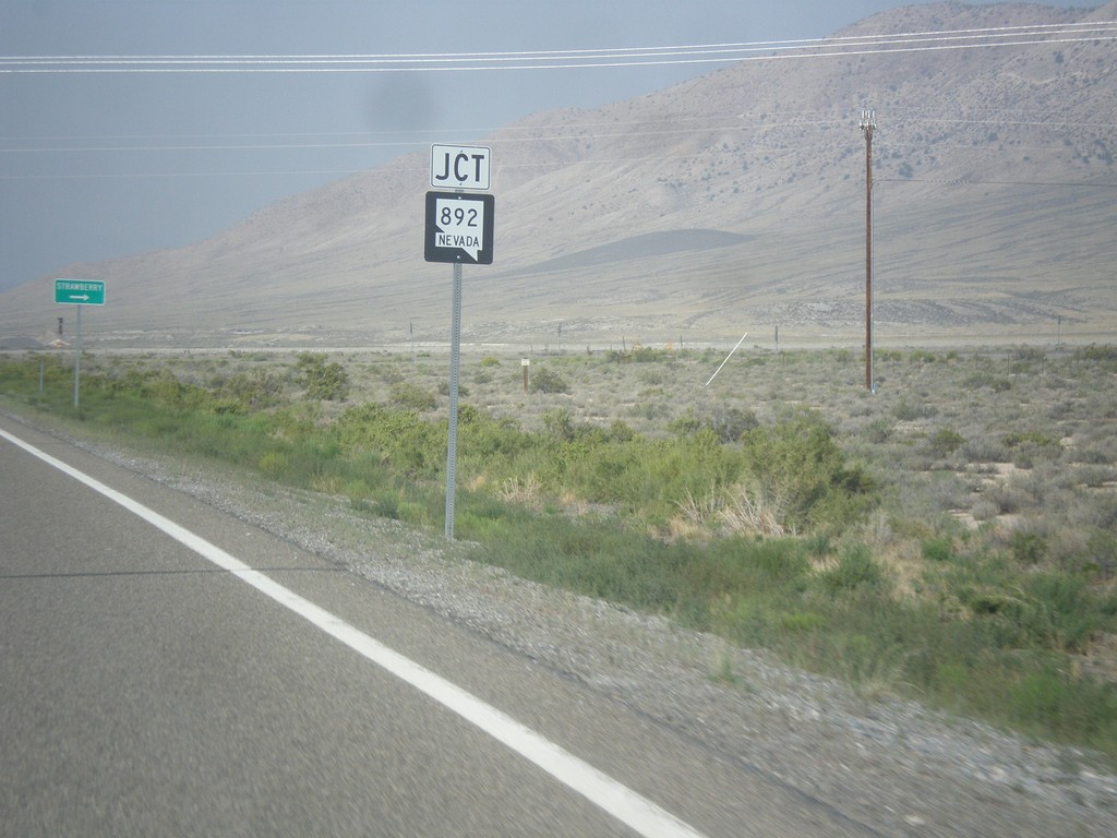
US-50 West Approaching NV-892
US-50 West approaching NV-892 junction in White Pine County.
Taken 08-31-2014
Eureka
White Pine County
Nevada
United States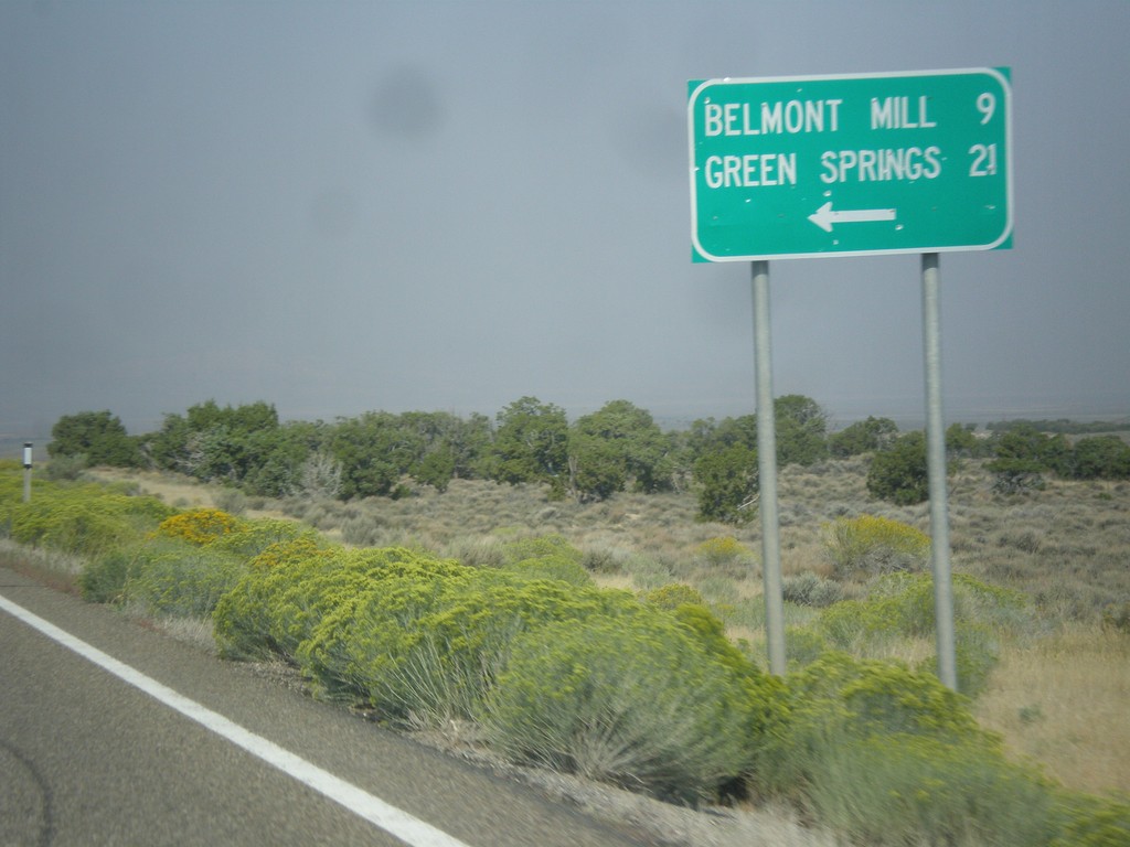
US-50 West - Belmont Mill Jct.
US-50 west at junction to Belmont Mill and Green Springs.
Taken 08-31-2014
White Pine County
Nevada
United States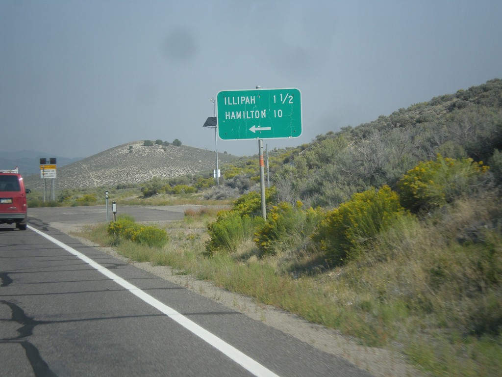
US-50 West - Illipah and Hamilton Jct.
US-50 West at Illipah and Hamilton Jct.
Taken 08-31-2014
Ely
White Pine County
Nevada
United States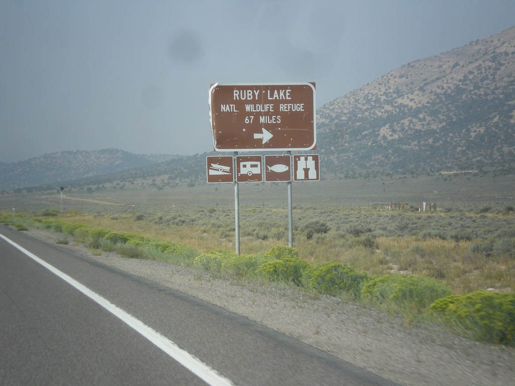
US-50 West - Ruby Lake NWR Jct.
US-50 west at junction to Ruby Lake National Wildlife Refuge in White Pine County.
Taken 08-31-2014
Ely
White Pine County
Nevada
United States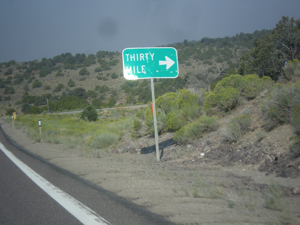
US-50 West - Thirty Mile Jct.
Thirty Mile Jct. on US-50 west in White Pine County.
Taken 08-31-2014
Ely
White Pine County
Nevada
United States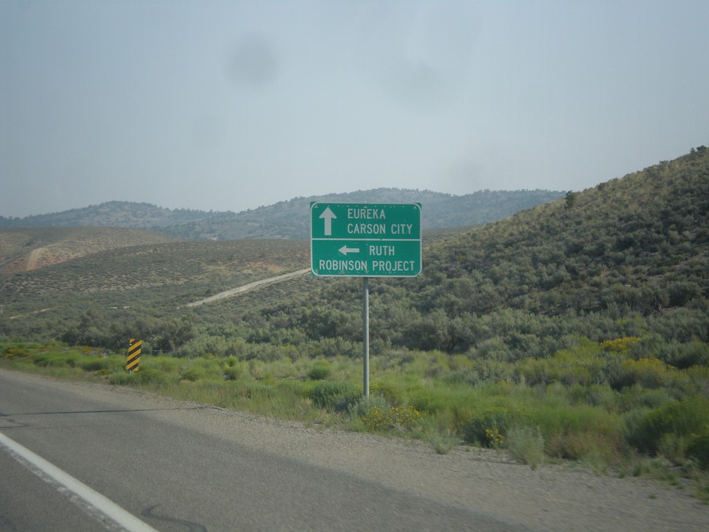
US-50 West - Ruth Jct.
US-50 west at junction to Ruth and Robinson Project. The Robinson Project is a large copper mine.
Taken 08-31-2014
Ruth
White Pine County
Nevada
United States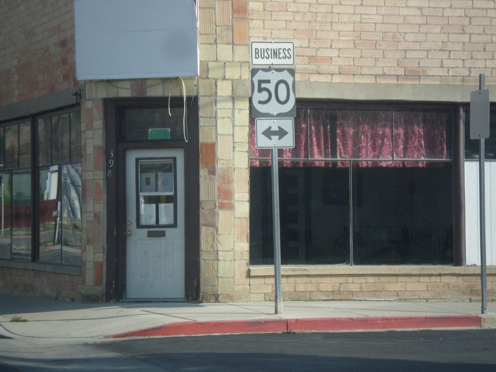
Mill St. at Clark St. (Bus. US-50)
Mill St. south at Clark St. in downtown Ely. Clark St. is one block south of the main route of US-50 and is signed as Bus. US-50. In this picture Bus. US-50 is shown as going in both directions, but Clark St. is one way eastbound.
Taken 08-31-2014
 Ely
White Pine County
Nevada
United States
Ely
White Pine County
Nevada
United States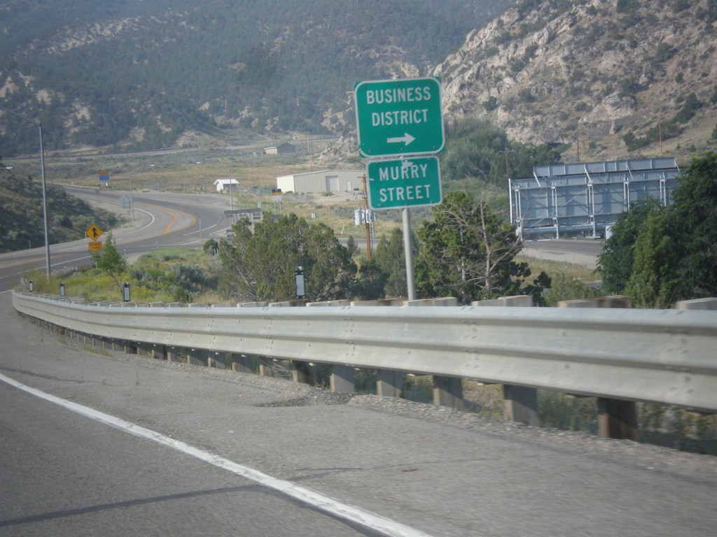
US-6 West - Murry St.
US-6 west approaching Murry St. into the Ely Business District. Murry St. used to be the former route of US-6 into Ely.
Taken 08-31-2014
 Ely
White Pine County
Nevada
United States
Ely
White Pine County
Nevada
United States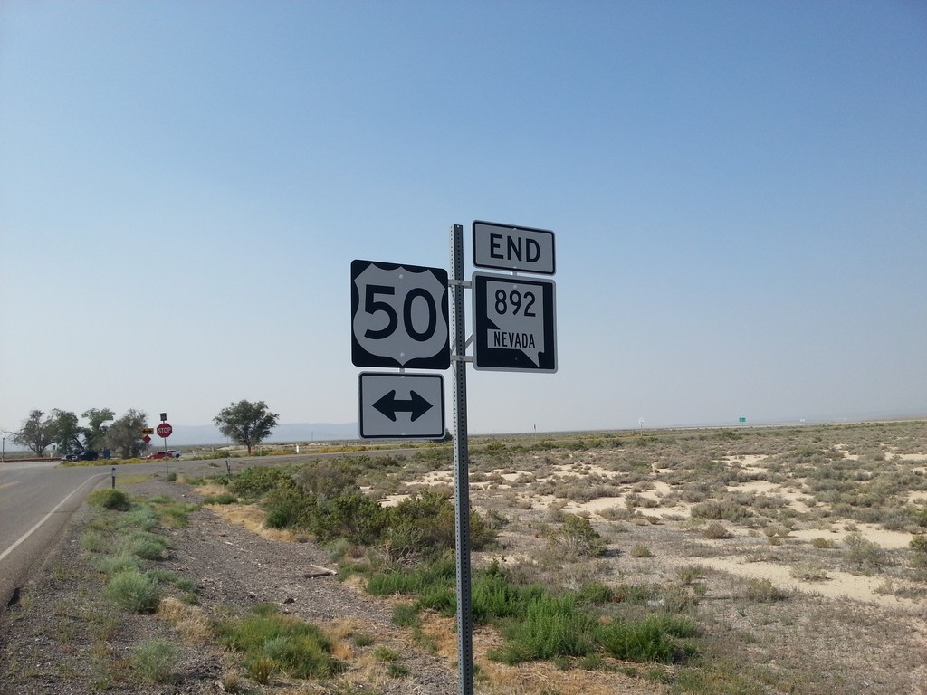
End NV-892 South at US-50
End NV-892 south at US-50 in White Pine County.
Taken 08-31-2014
Eureka
White Pine County
Nevada
United States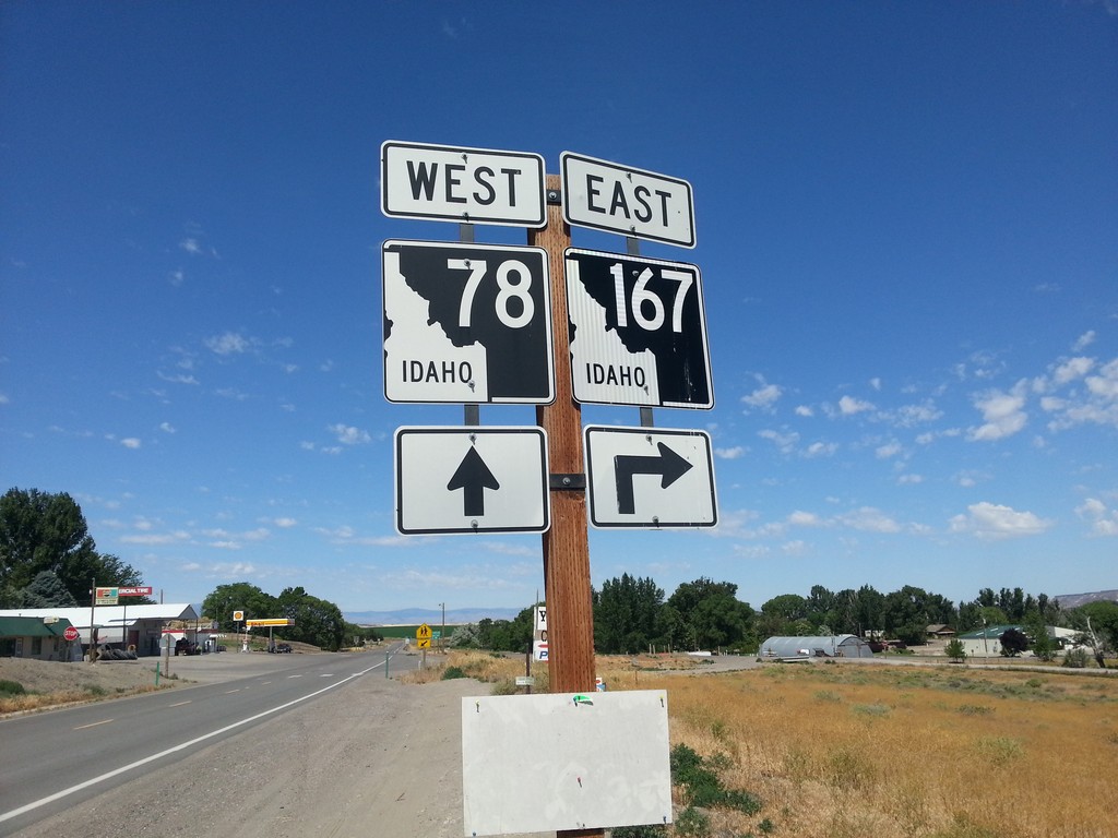
ID-78 West at ID-167 East
ID-78 west at ID-167 east in Grand View.
Taken 06-22-2014

 Grand View
Owyhee County
Idaho
United States
Grand View
Owyhee County
Idaho
United States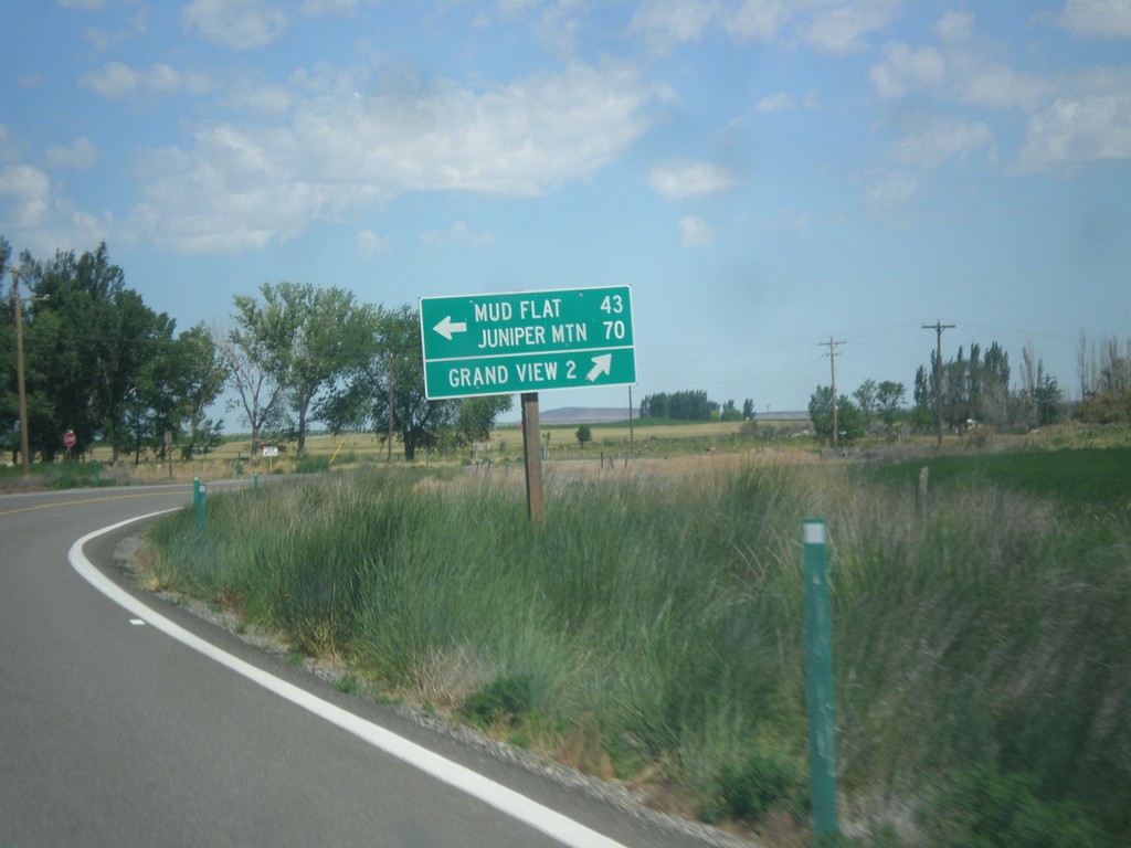
ID-78 West at Mud Flat Road
ID-78 west at Mud Flat Road to Mud Flat and Juniper Mountain. Continue west on ID-78 for Grand View. This is the beginning of the Owyhee Uplands Backcountry Byway, which follows Mud Flat Road along the south side of the Owyhee Mountains and ending in Jordan Valley, Oregon.
Taken 06-21-2014
Grand View
Owyhee County
Idaho
United States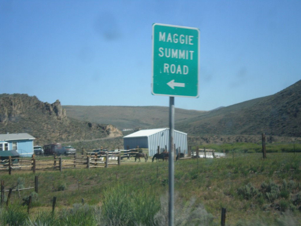
NV-225 North - Maggie Summit Road
NV-225 north at Maggie Summit Road.
Taken 06-21-2014
 Mountain City
Elko County
Nevada
United States
Mountain City
Elko County
Nevada
United States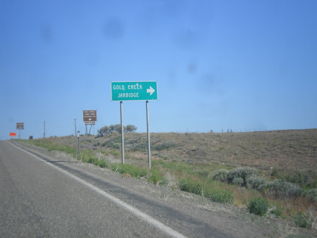
NV-225 North - Gold Creek Road
NV-225 north at Gold Creek Road to Gold Creek and Jarbidge.
Taken 06-21-2014
Elko
Elko County
Nevada
United States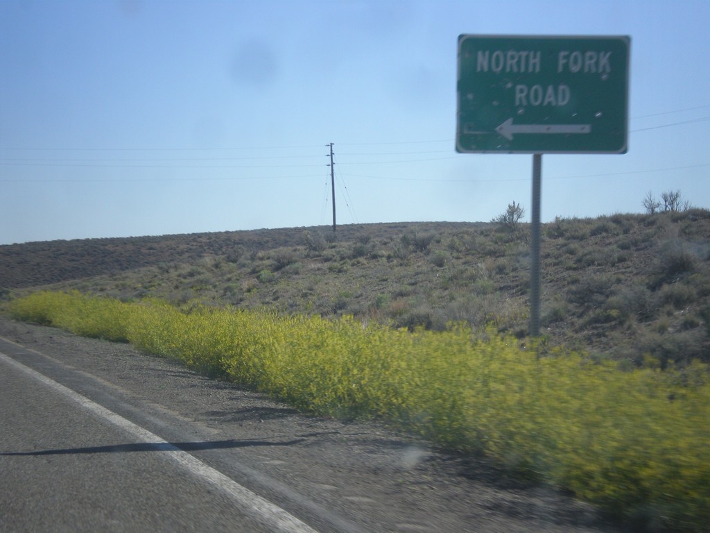
NV-225 North - North Fork Road
NV-225 north at North Fork Road junction. North Fork refers to the North Fork of the Humboldt River.
Taken 06-21-2014
Elko
Elko County
Nevada
United States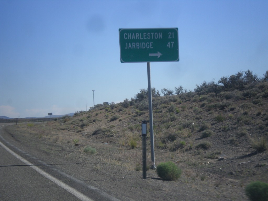
NV-225 North - Charleston/Jarbidge Jct.
NV-225 North at junction with road to Charleston and Jarbidge.
Taken 06-21-2014
Elko
Elko County
Nevada
United States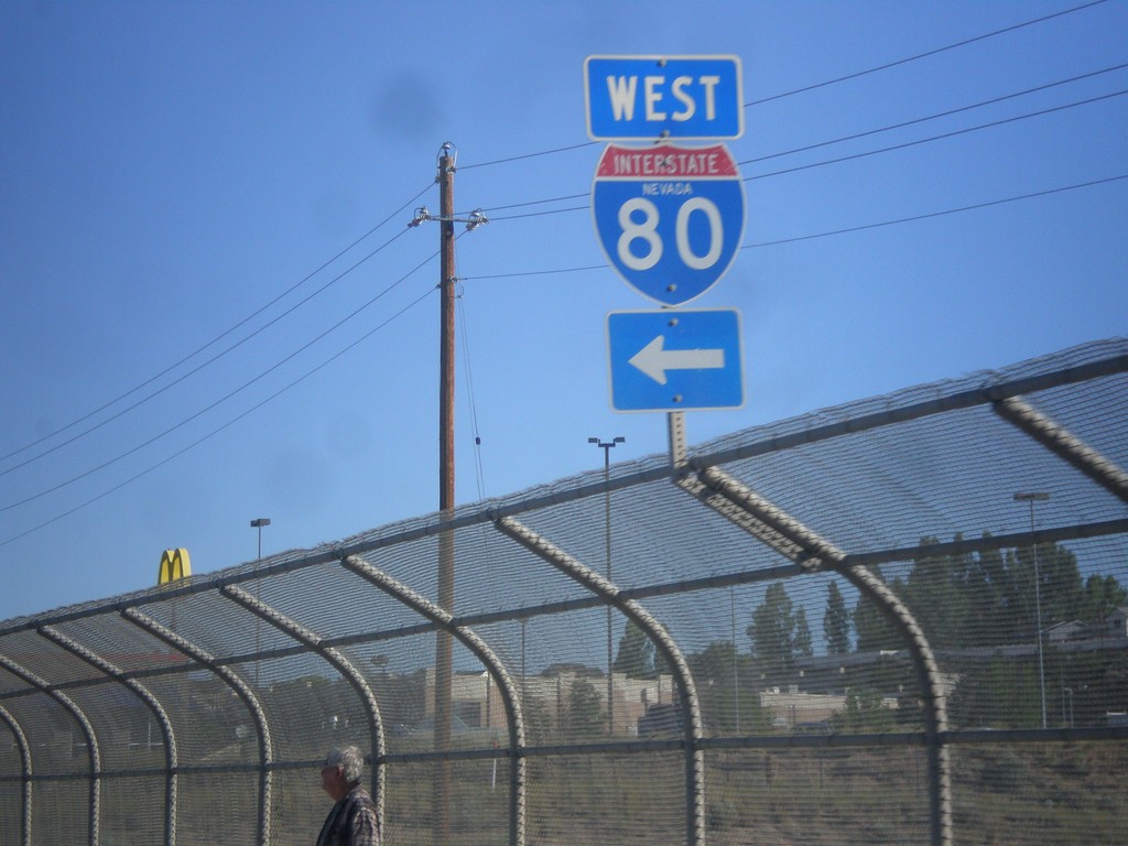
NV-225 North at I-80 West
NV-225 north at I-80 West (Exit 301).
Taken 06-21-2014
 Elko
Elko County
Nevada
United States
Elko
Elko County
Nevada
United States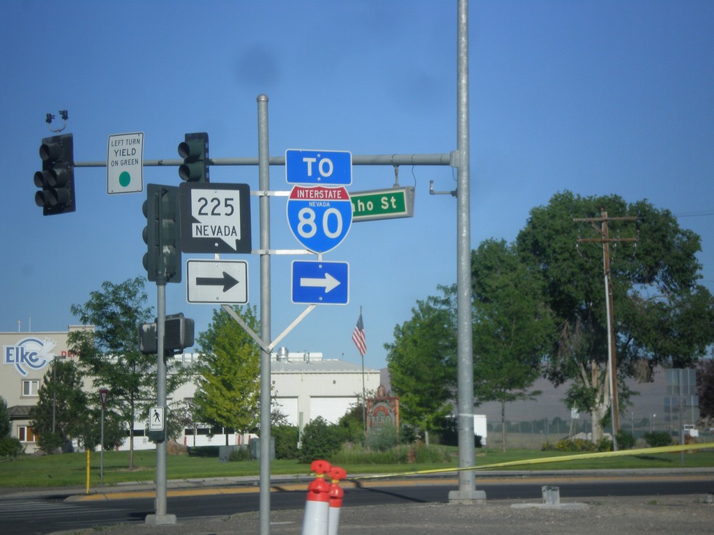
BL-80 West at NV-225 (To I-80)
BL-80 West at NV-225 North. Continue west on BL-80 (Idaho St.) for I-80.
Taken 06-21-2014
 Elko
Elko County
Nevada
United States
Elko
Elko County
Nevada
United States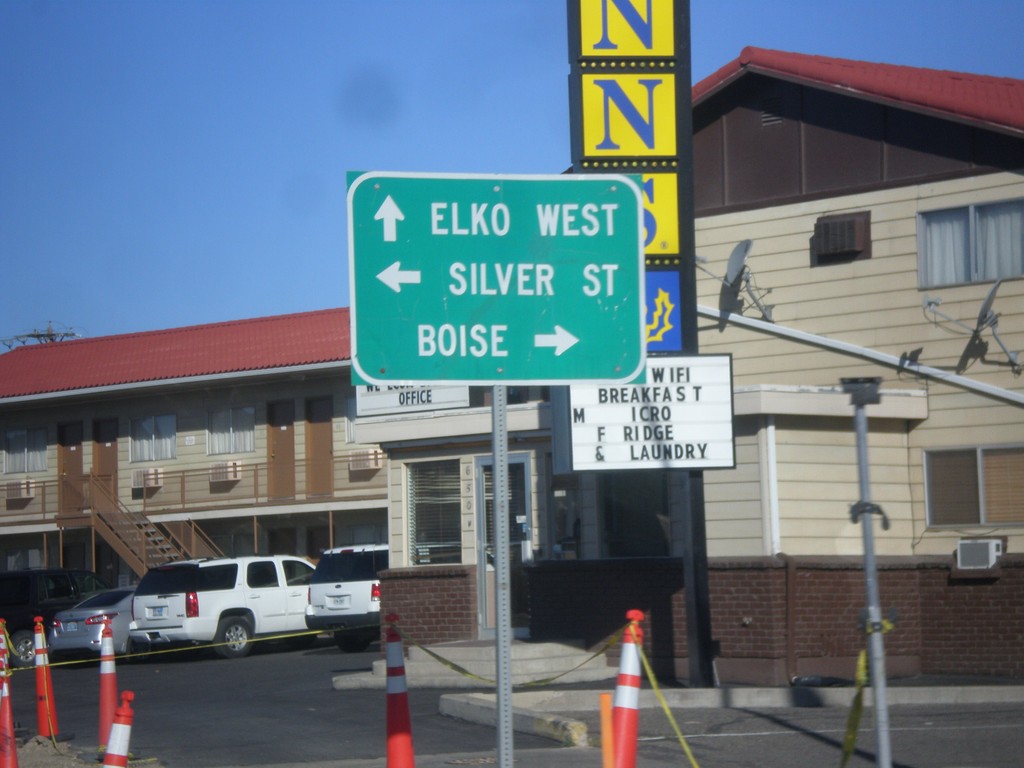
BL-80 West at NV-225
BL-80 West (Idaho Street) at NV-225 North. Use NV-225 north to Boise. Continue west on BL-80 to Elko West. Turn left for Silver St.
Taken 06-21-2014
Elko
Elko County
Nevada
United States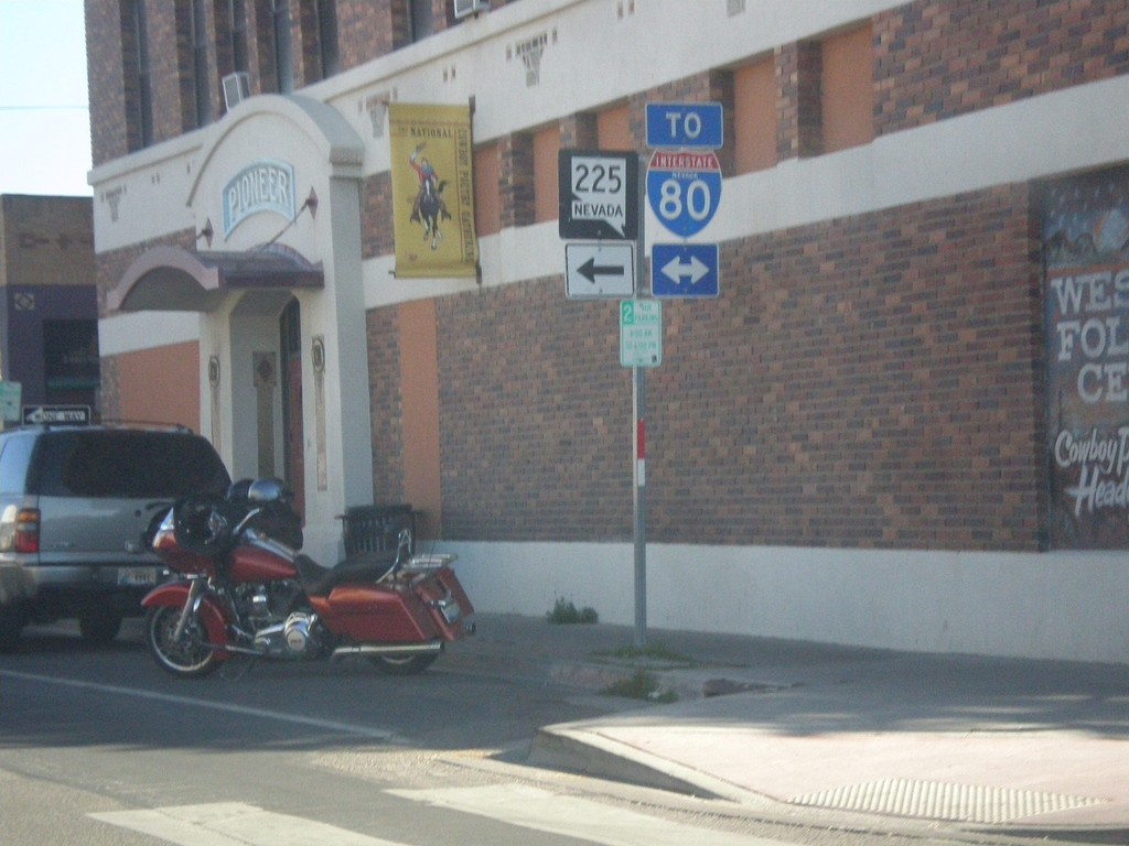
End NV-227 at BL-80 (Idaho St.)
End NV-227 west at BL-80 (Idaho St.) in downtown Elko. Use Idaho St. for access to I-80. Use Idaho St. west for access to NV-225.
Taken 06-21-2014
 Elko
Elko County
Nevada
United States
Elko
Elko County
Nevada
United States