Signs Tagged With Intersection
NV-227 West at NV-228 South
NV-227 West at NV-228 South in Spring Creek.
Taken 06-21-2014

 Spring Creek
Elko County
Nevada
United States
Spring Creek
Elko County
Nevada
United States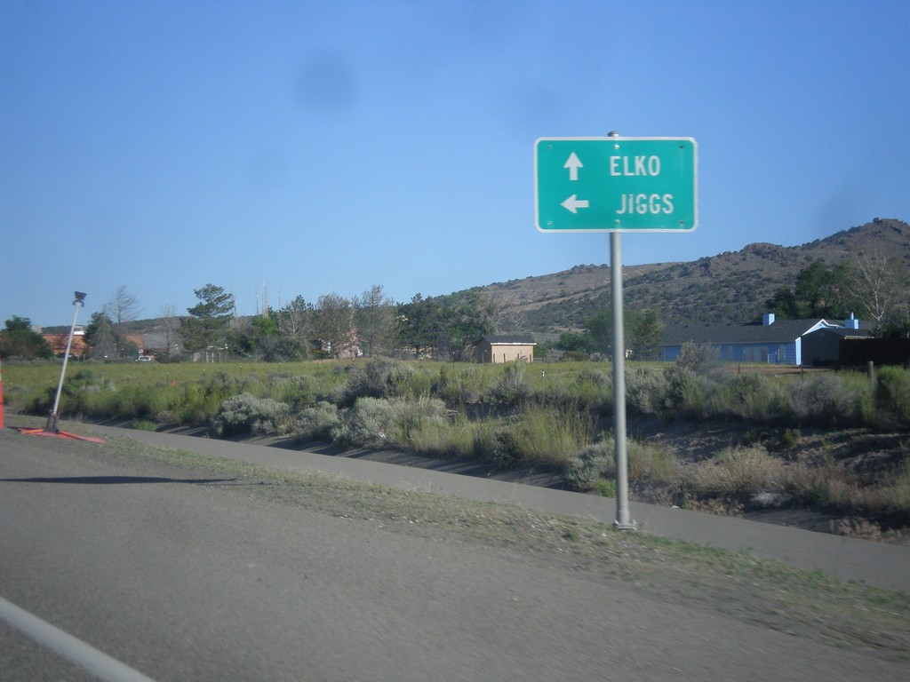
NV-227 West at NV-228
NV-227 West at NV-228 South. Use NV-228 south to Jiggs; continue west for NV-227 to Elko.
Taken 06-21-2014
Spring Creek
Elko County
Nevada
United States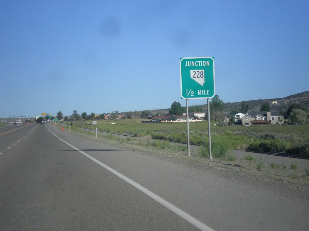
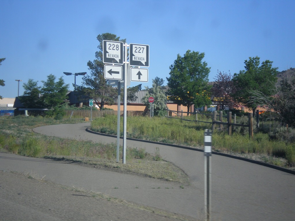
NV-227 West Approaching NV-228
NV-227 West approaching NV-228 south in Spring Creek.
Taken 06-21-2014
Spring Creek
Elko County
Nevada
United States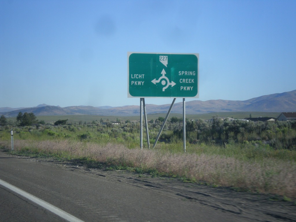
NV-227 West - Spring Creek Parkway and Licht Parkway
NV-227 west approaching roundabout at Spring Creek Parkway and Licht Parkway.
Taken 06-21-2014
Spring Creek
Elko County
Nevada
United States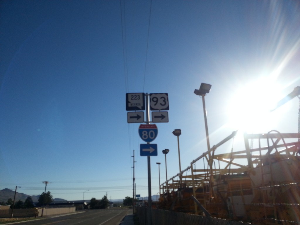
BL-80/NV-223 East At 6th St.
BL-80/NV-223 east (Humboldt Ave.) at 6th St in Wells. Turn right to continue east on BL-80/NV-223 and for I-80.
Taken 06-21-2014


 Wells
Elko County
Nevada
United States
Wells
Elko County
Nevada
United States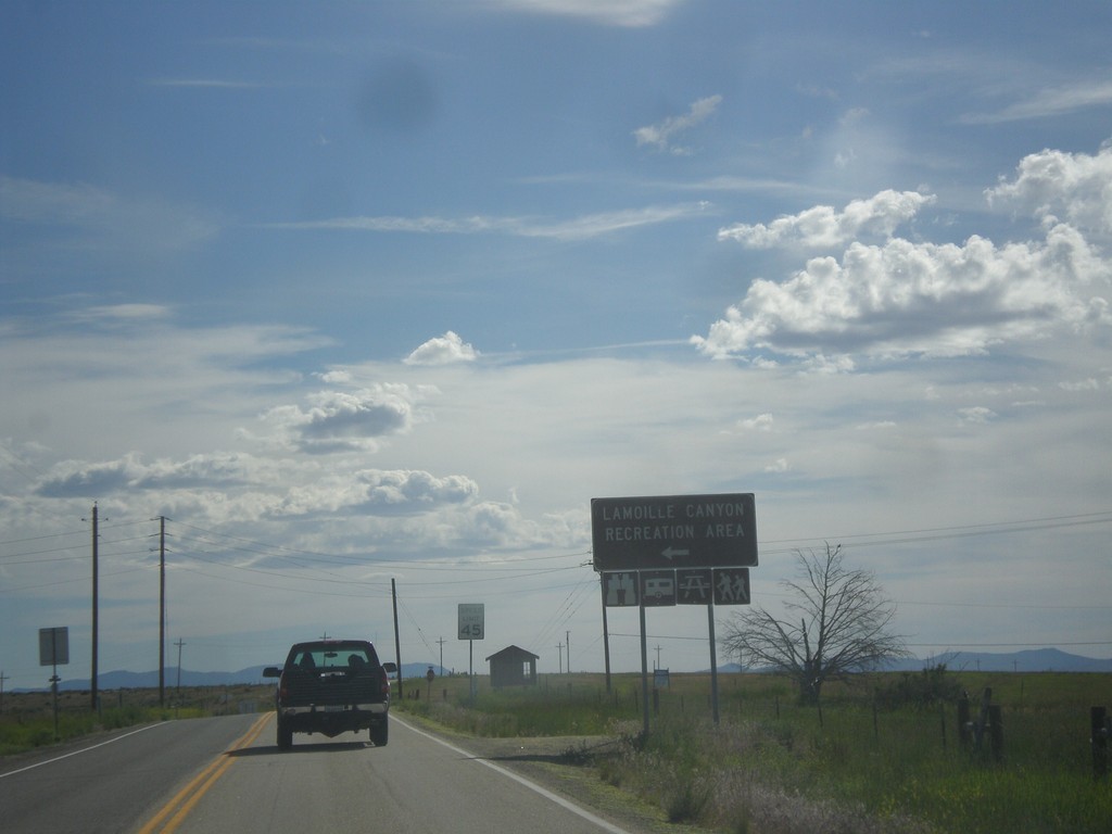
NV-227 West - Lamoille Canyon Jct.
NV-227 west at Lamoille Canyon Recreation Area junction.
Taken 06-21-2014
Lamoille
Elko County
Nevada
United States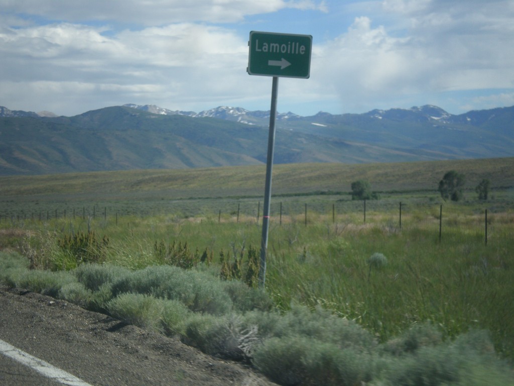
NV-229 South at Lamoille Jct.
NV-229 South at Lamoille junction.
Taken 06-21-2014
 Elko County
Nevada
United States
Elko County
Nevada
United States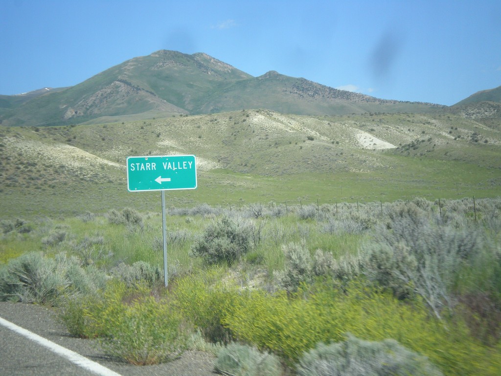
NV-229 South - Starr Valley Junction
NV-229 South at Starr Valley junction.
Taken 06-21-2014
Halleck
Elko County
Nevada
United States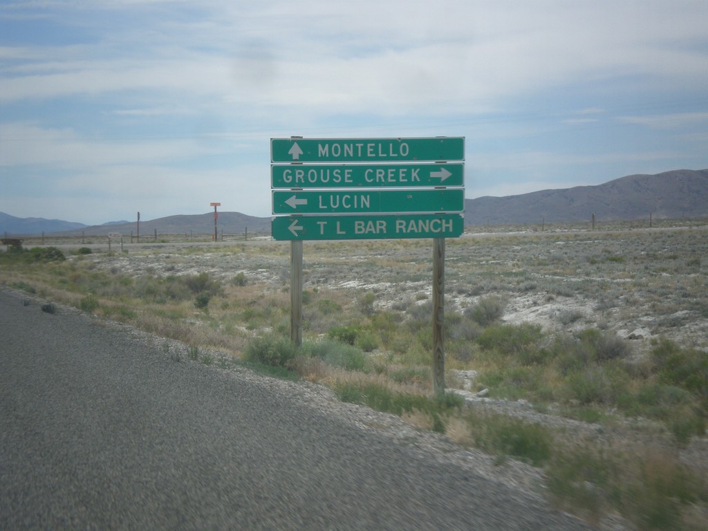
UT-30 West - Lucin and Grouse Creek Jct.
UT-30 west at Grouse Creek Road. Turn right for Grouse Creek, left for Lucin and T Bar Ranch. Continue west on UT-30 for Montello (Nevada).
Taken 06-21-2014
 Wendover
Box Elder County
Utah
United States
Wendover
Box Elder County
Utah
United States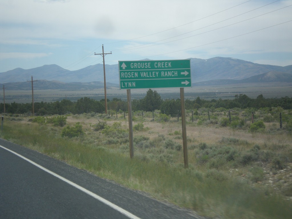
UT-30 West - Lynn Jct.
UT-30 west at junction to Lynn and Roden Valley Ranch. Continue west on UT-30 for Grouse Creek.
Taken 06-21-2014
Park Valley
Box Elder County
Utah
United States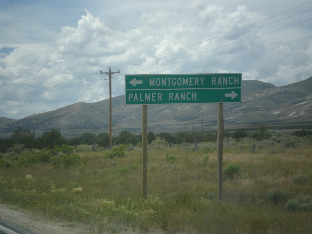
UT-30 West - Ranch Jct.
UT-30 west at junction to Montgomery Ranch and Palmer Ranch.
Taken 06-21-2014
Park Valley
Box Elder County
Utah
United States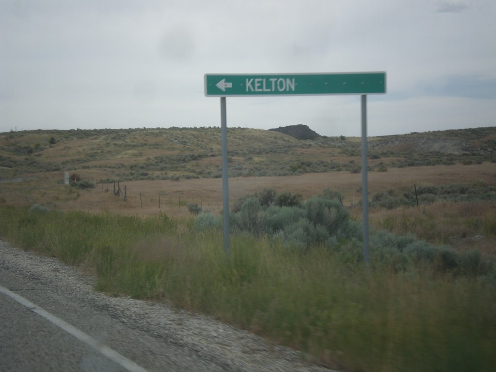
UT-30 West - Kelton Jct.
UT-30 west at turnoff to Kelton. Kelton is a ghost town that at one time was the rail head for all Idaho bound stage coaches.
Taken 06-21-2014
Park Valley
Box Elder County
Utah
United States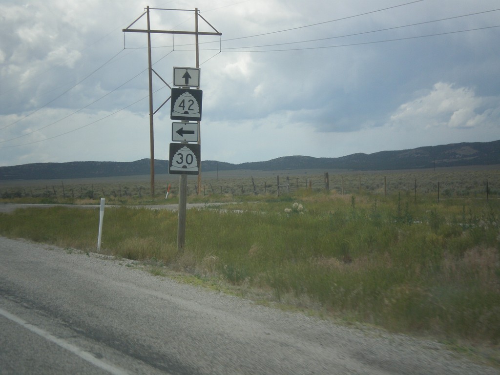
UT-30 West at UT-42
UT-30 West at UT-42 in rural Box Elder County.
Taken 06-21-2014
 Snowville
Box Elder County
Utah
United States
Snowville
Box Elder County
Utah
United States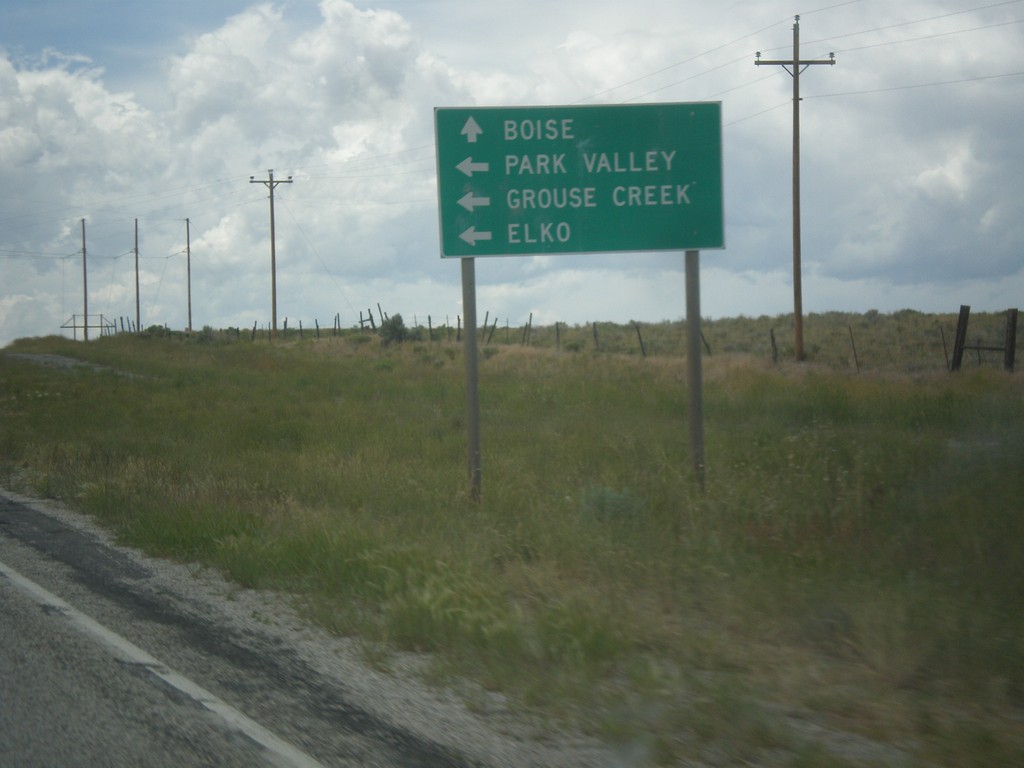
UT-30 West Approaching UT-42
UT-30 west approaching UT-42. Use UT-42 for Boise (Idaho). Continue west (turn left) on UT-30 for Park Valley, Grouse Creek, and Elko (Nevada). Boise is an interesting destination city to put on this sign since Boise is on the entire other side of the state from where UT-42 crosses into Idaho. Malta, or even Burley would be more appropriate.
Taken 06-21-2014
Snowville
Box Elder County
Utah
United States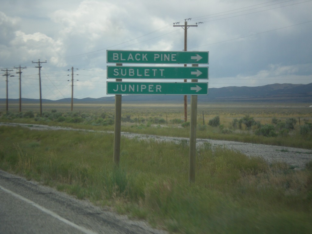
UT-30 West - Black Pine Road
UT-30 west at Black Pine Road jct. to Black Pine, Sublett, and Juniper. All three of those destinations are tiny communities within Idaho.
Taken 06-21-2014
Snowville
Box Elder County
Utah
United States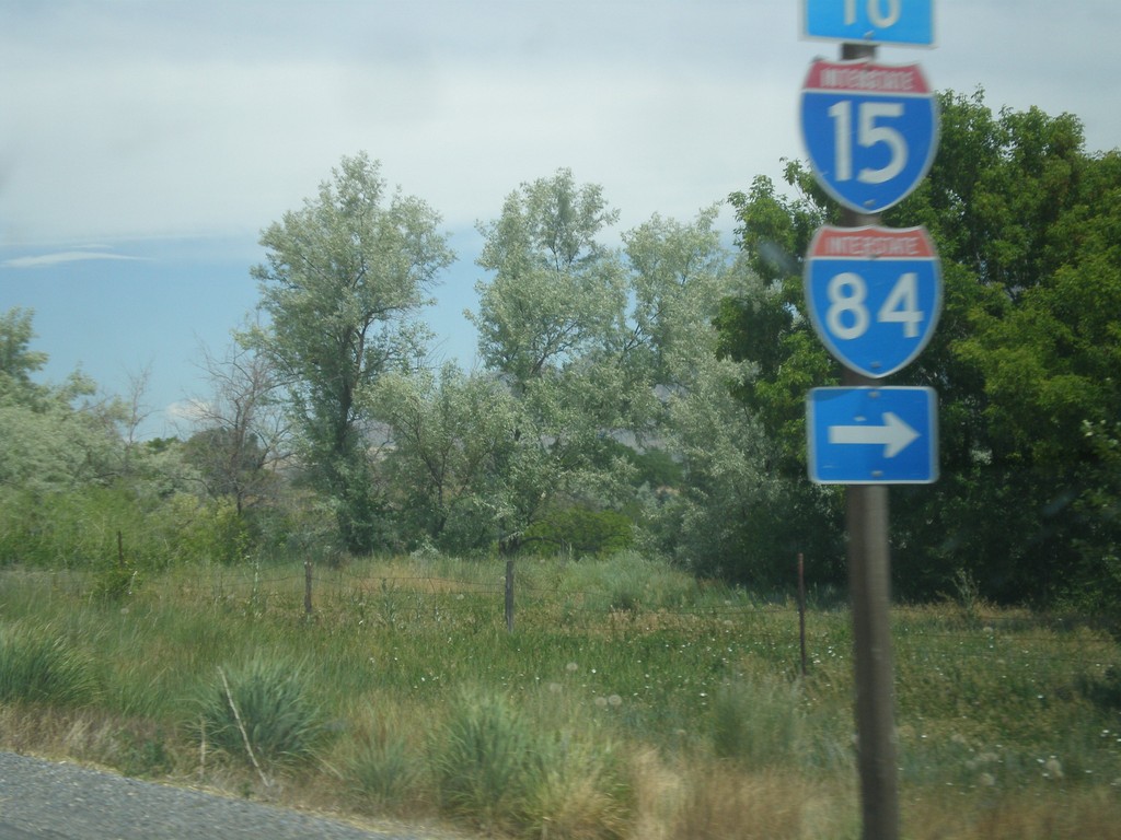
UT-13 North at 4600 West
UT-13 north at 4600 West. Turn right on 4600 West to I-15 and I-84.
Taken 06-21-2014


 Honeyville
Box Elder County
Utah
United States
Honeyville
Box Elder County
Utah
United States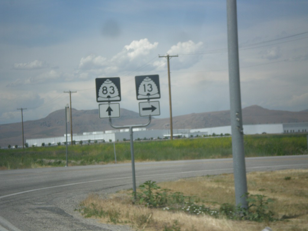
UT-13 North at UT-83
UT-13 north at UT-83 in Corrine. Continue straight for UT-83; turn right for UT-13 north.
Taken 06-21-2014
 Corinne
Box Elder County
Utah
United States
Corinne
Box Elder County
Utah
United States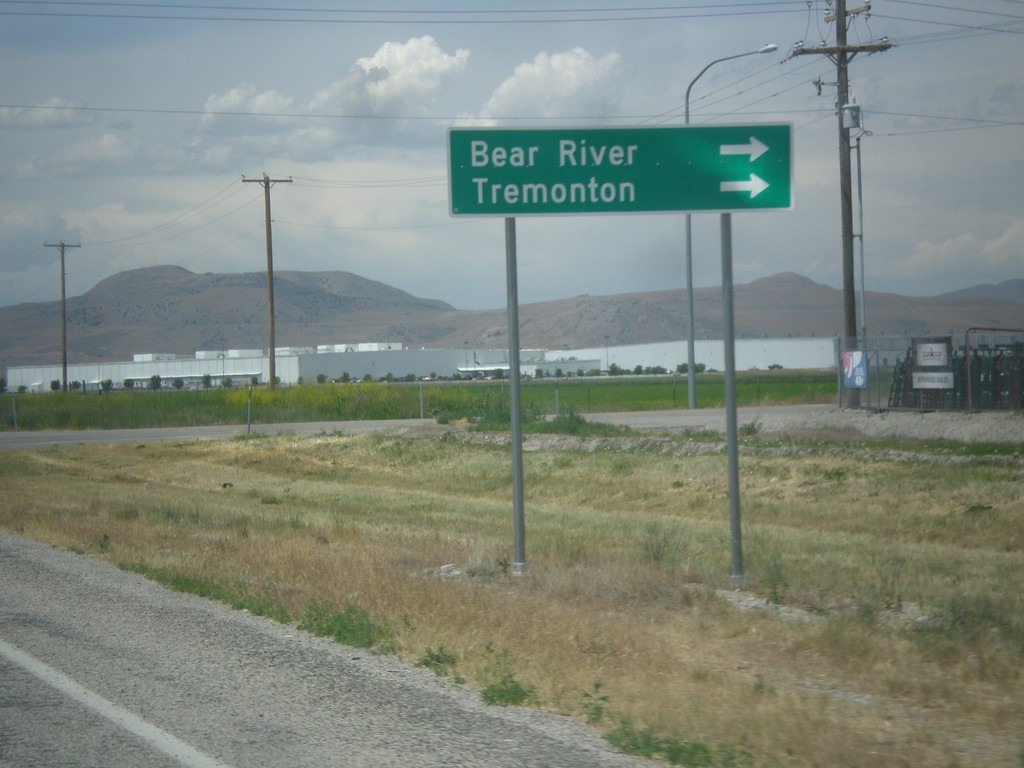
UT-13 North at UT-83
UT-13 north at UT-83. Turn right to continue north on UT-13 to Bear River and Tremonton.
Taken 06-21-2014
Corinne
Box Elder County
Utah
United States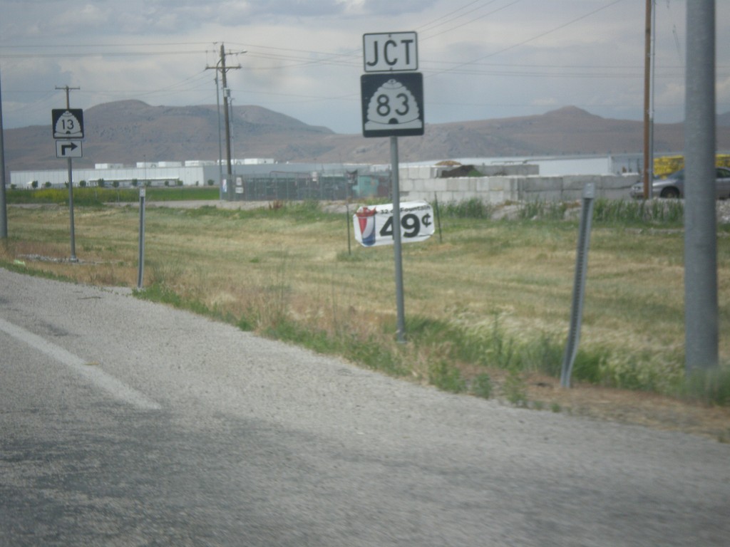
UT-13 North Approaching UT-83
UT-13 North approaching UT-83 in Corrine.
Taken 06-21-2014
Corinne
Box Elder County
Utah
United States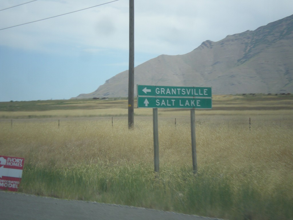
UT-38 North at UT-112 West
UT-38 North at UT-112 West to Grantsville. Continue north on UT-36 to Salt Lake.
Taken 06-20-2014

 Stansbury Park
Tooele County
Utah
United States
Stansbury Park
Tooele County
Utah
United States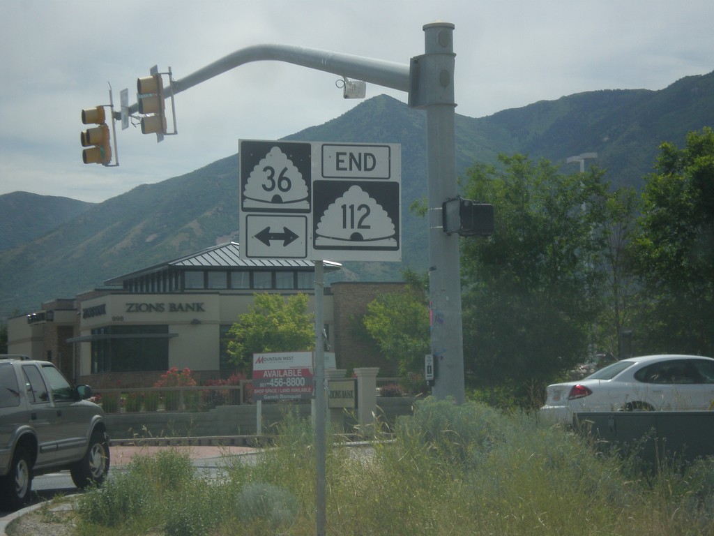
End UT-112 East at UT-36
End UT-112 east at UT-36 in Tooele.
Taken 06-20-2014
Tooele
Tooele County
Utah
United States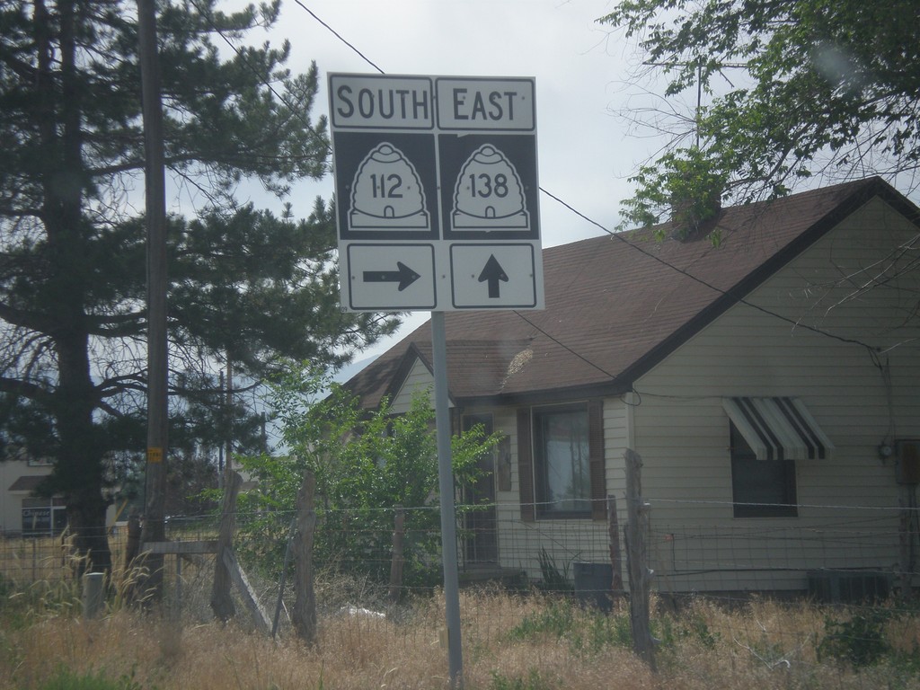
UT-138 East at UT-112
UT-138 east at UT-112 in Grantsville.
Taken 06-20-2014
 Grantsville
Tooele County
Utah
United States
Grantsville
Tooele County
Utah
United States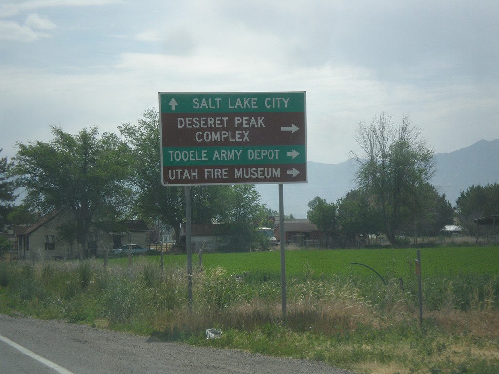
UT-138 East at UT-112
UT-138 east at UT-112 east to Deseret Peak Complex, Utah Fire Museum, and Tooele Army Depot.
Taken 06-20-2014
Grantsville
Tooele County
Utah
United States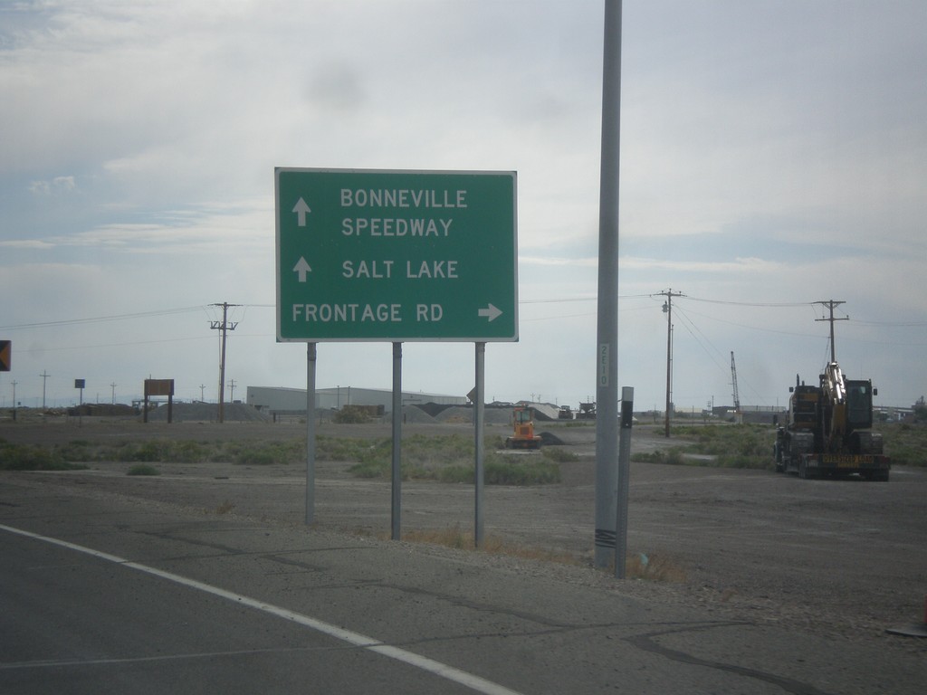
BL-80/UT-58 East at Frontage Road
BL-80/UT-58 East at Frontage Road. Continue on BL-80/UT-58 for I-80 east to Bonneville Speedway and Salt Lake.
Taken 06-20-2014
Wendover
Tooele County
Utah
United States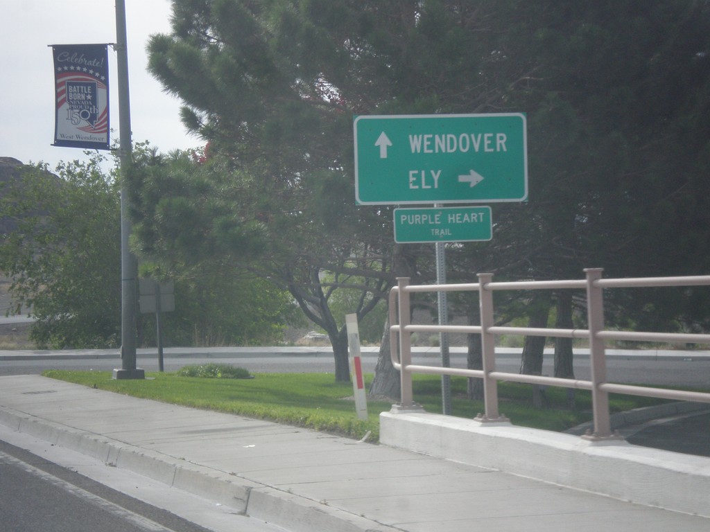
BL-80 East at Alt. US-93 South
BL-80 East/Alt. US-93 South (Wendover Blvd.) at Alt. US-93 south to Ely. Continue straight for BL-80 east to Wendover (Utah).
Taken 06-20-2014
 West Wendover
Elko County
Nevada
United States
West Wendover
Elko County
Nevada
United States