Signs Tagged With Intersection
US-287 North at CO-96
US-287 north at CO-96. CO-96 joins US-287 north into Eads.
Taken 03-30-2014

 Eads
Kiowa County
Colorado
United States
Eads
Kiowa County
Colorado
United States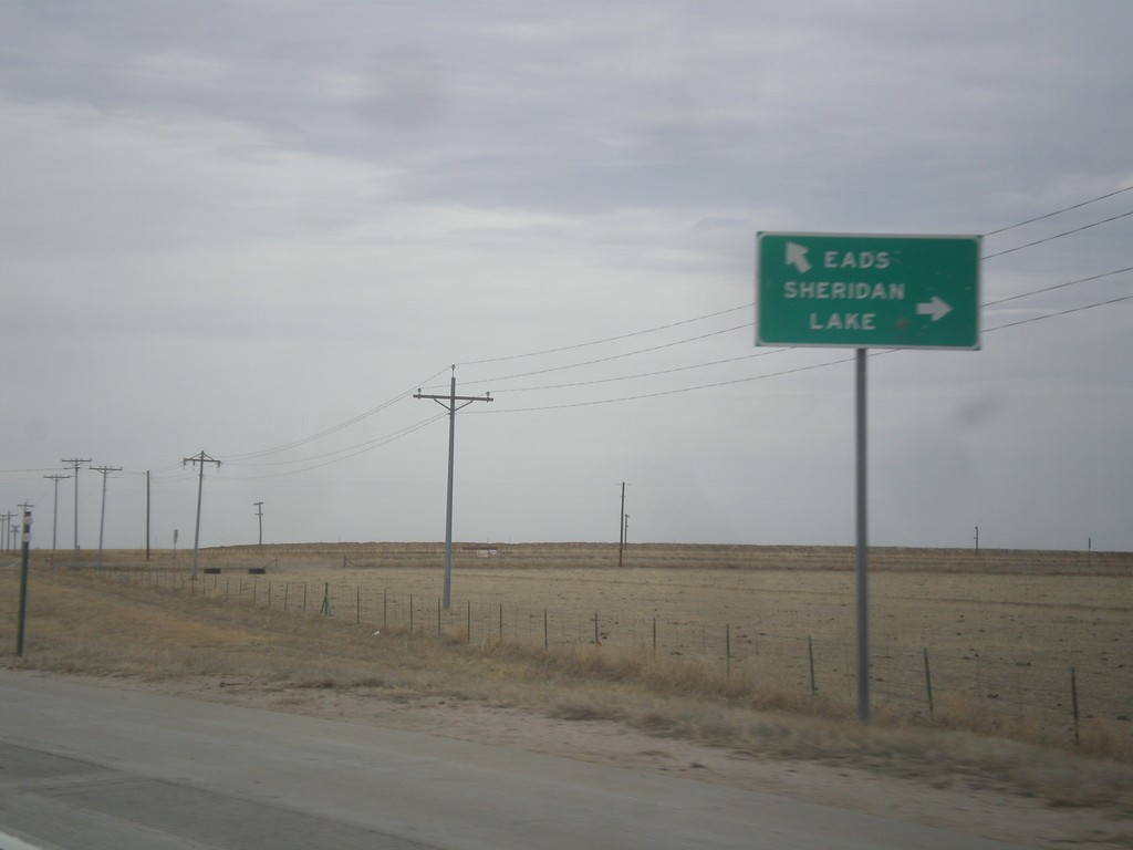
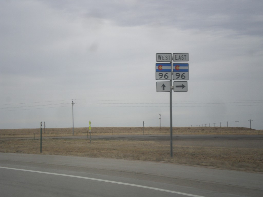
US-287 North at CO-96
US-287 north at CO-96. Use CO-96 east to Sheridan Lake. Use US-287 North/CO-96 West to Eads. CO-96 joins US-287 into Eads.
Taken 03-30-2014
Eads
Kiowa County
Colorado
United States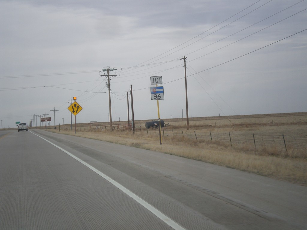
US-287 North Approaching CO-96
US-287 North approaching CO-96 in Kiowa County.
Taken 03-30-2014
Eads
Kiowa County
Colorado
United States
CO-196 East at US-287
CO-196 east at US-287 in Prowers County.
Taken 03-30-2014
 Wiley
Prowers County
Colorado
United States
Wiley
Prowers County
Colorado
United States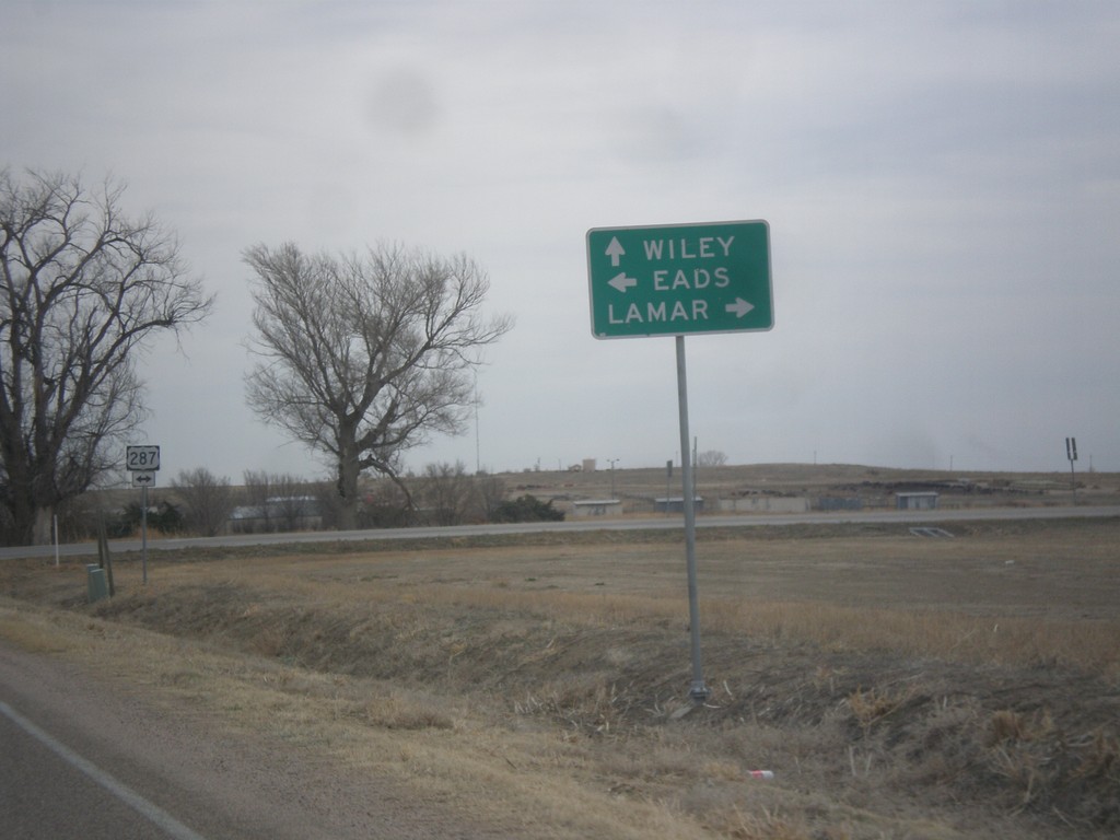
CO-196 East at US-287
CO-196 east at US-287. Turn right for US-287 south to Lamar; left for US-287 north to Eads. Continue on CO-196 east to Wiley.
Taken 03-30-2014
Wiley
Prowers County
Colorado
United States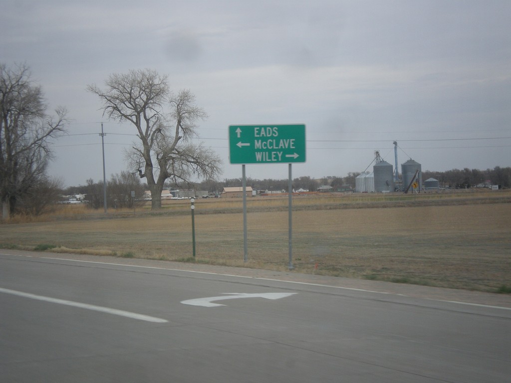
US-287 North at CO-196
US-287 north at CO-196. Turn right on Wiley; turn left for McClave. Continue on US-287 North to Eads.
Taken 03-30-2014
Wiley
Prowers County
Colorado
United States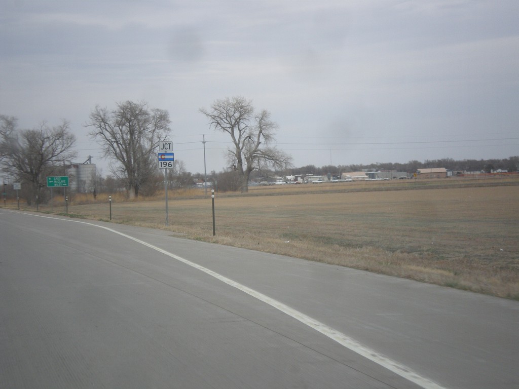
US-287 North Approaching CO-196
US-287 North approaching CO-196 in Prowers County.
Taken 03-30-2014
Wiley
Prowers County
Colorado
United States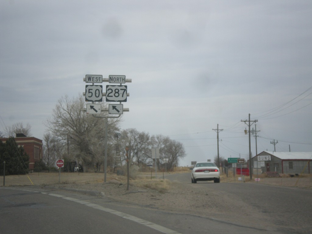
US-50 West/US-287 North at CO-196
US-50 West/US-287 North at CO-196. Merge left to continue on US-50/US-287.
Taken 03-30-2014
 Lamar
Prowers County
Colorado
United States
Lamar
Prowers County
Colorado
United States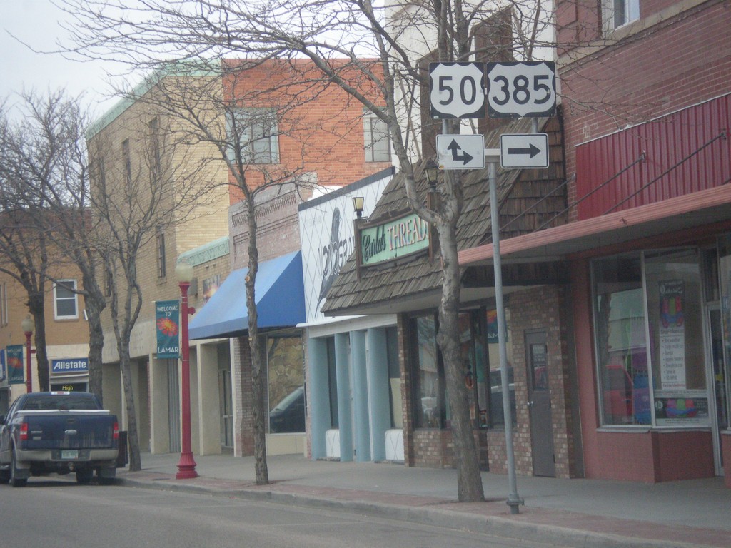
US-287/US-385 North at US-50
US-287/US-385 North at US-50 in Lamar. US-385 north joins US-50 east; US-287 north joins US-50 west.
Taken 03-30-2014
 Lamar
Prowers County
Colorado
United States
Lamar
Prowers County
Colorado
United States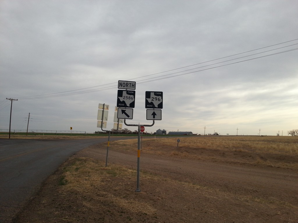
FM-296 East at FM-2586
FM-296 east at FM-2586 in Dallam County.
Taken 03-30-2014

 Texline
Dallam County
Texas
United States
Texline
Dallam County
Texas
United States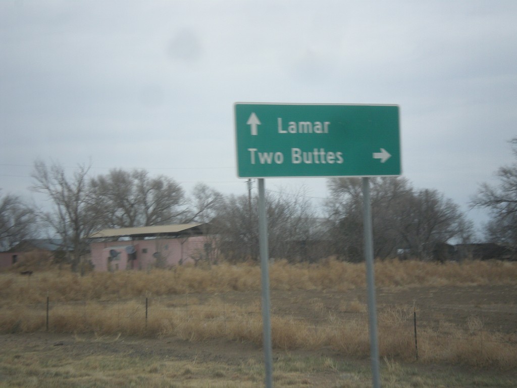
US-287/US-385 North at CO-116
US-287/US-385 North at CO-116 east to Two Buttes. Continue north on US-287/US-385 to Lamar.
Taken 03-30-2014
 Springfield
Baca County
Colorado
United States
Springfield
Baca County
Colorado
United States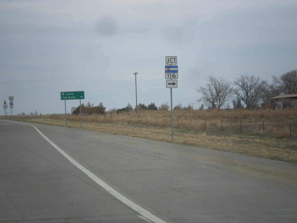
US-287/US-385 North Approaching CO-116
US-287/US-385 North approaching CO-116 in Baca County.
Taken 03-30-2014
Two Buttes
Baca County
Colorado
United States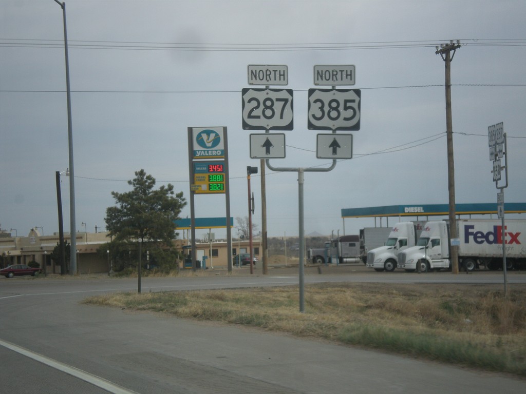
US-287/US-385 North at US-160
US-287/US-385 North at US-160 near Springfield.
Taken 03-30-2014
 Springfield
Baca County
Colorado
United States
Springfield
Baca County
Colorado
United States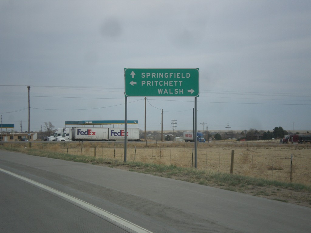
US-287/US-385 North at US-160
US-287/US-285 north at US-160. Use US-160 west to Pritchett; use US-160 east to Walsh. Continue north on US-287/US-385 for Springfield.
Taken 03-30-2014
Springfield
Baca County
Colorado
United States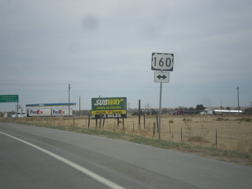
US-287/US-385 North Approaching US-160
US-287/US-385 North approaching US-160 near Springfield.
Taken 03-30-2014
Springfield
Baca County
Colorado
United States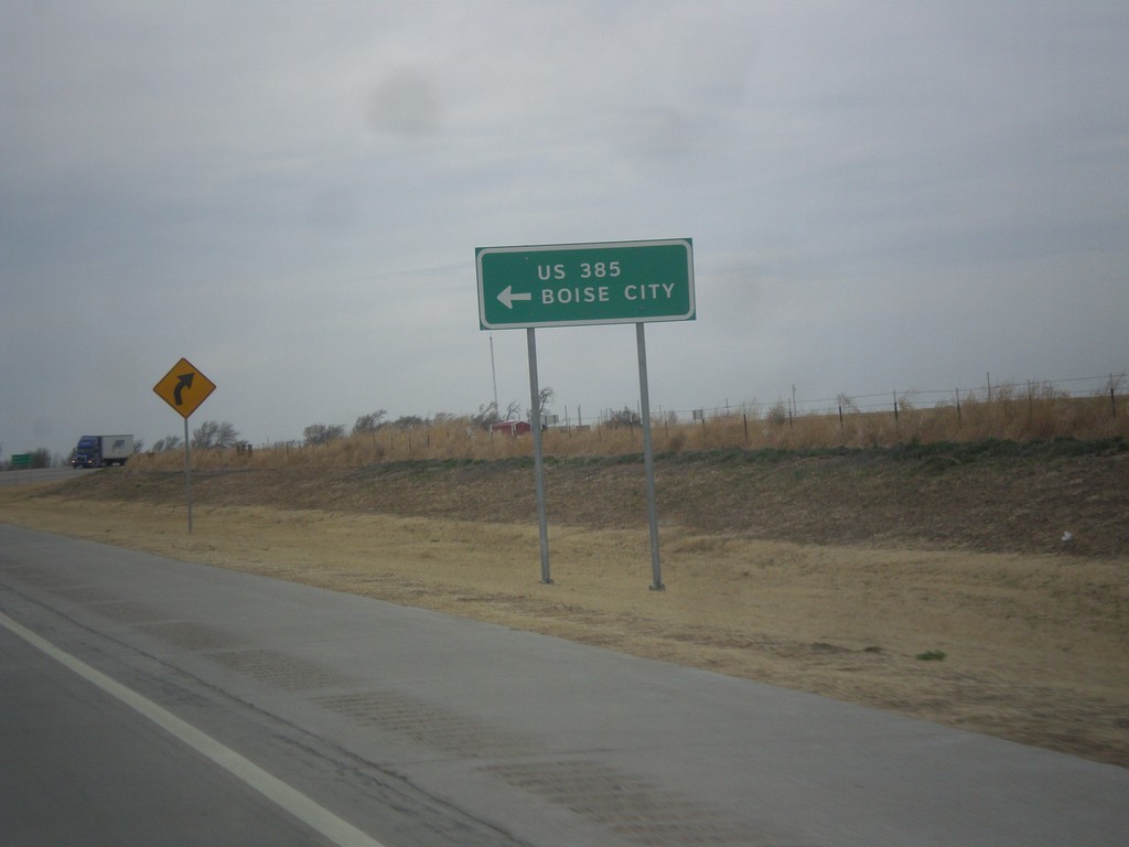
US-287 North at US-385/OK-3
US-287 north at US-385/OK-3 junction. OK-3 joins US-287 north to the Oklahoma - Colorado line. US-385 joins US-287 north to Lamar, Colorado. Notice the route US-385 is spelled out instead of displayed in a typical shield.
Taken 03-30-2014
 Boise City
Cimarron County
Oklahoma
United States
Boise City
Cimarron County
Oklahoma
United States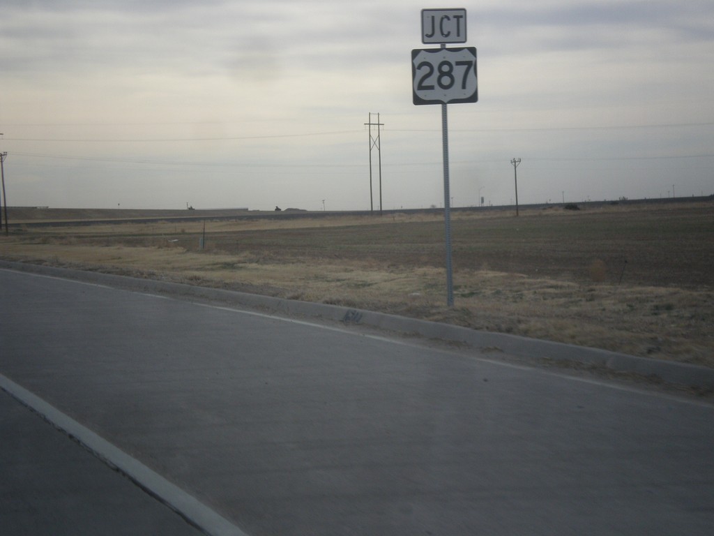
US-56/US-64/US-412/OK-3 East Approaching US-287
US-56/US-64/US-412/OK-3 East approaching US-287 in Boise City.
Taken 03-30-2014


 Boise City
Cimarron County
Oklahoma
United States
Boise City
Cimarron County
Oklahoma
United States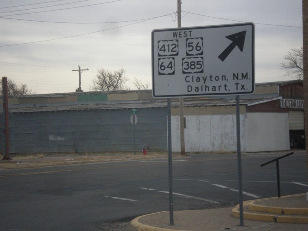
US-56/US-64/US-412/OK-3/US-385 - South Exit of Boise City Roundabout
US-56/US-64/US-412/OK-3/US-385 - south exit of the Boise City roundabout. Turn right for US-56/US-64/US-412 West/US-385 South to Clayton, NM and Dalhart, TX. This sign is white as opposed to the usual green sign.
Taken 03-30-2014
Boise City
Cimarron County
Oklahoma
United States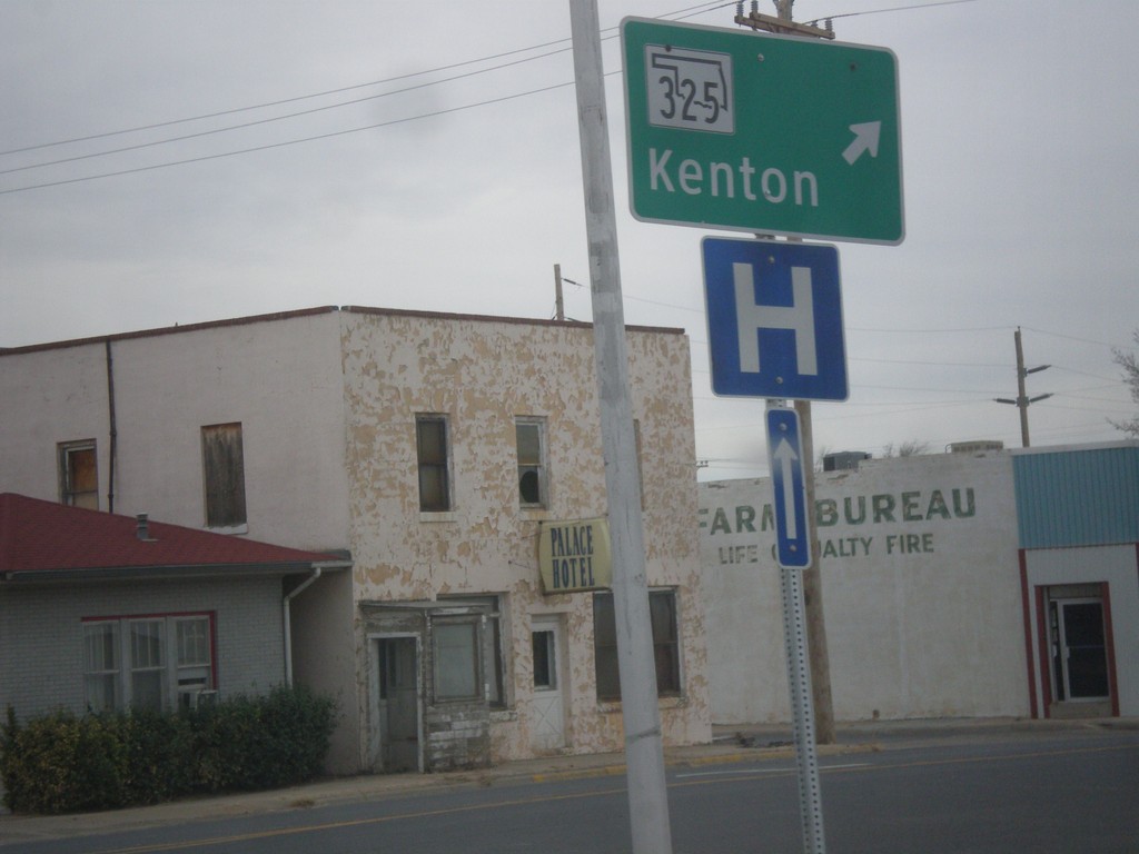
US-56/US-64/US-412/OK-3/US-385 at OK-325 - West Exit of Boise City Roundabout
US-56/US-64/US-412/OK-3/US-385 at OK-325 the west exit of the Boise City Roundabout. Turn right for OK-325 West to Kenton.
Taken 03-30-2014
 Boise City
Cimarron County
Oklahoma
United States
Boise City
Cimarron County
Oklahoma
United States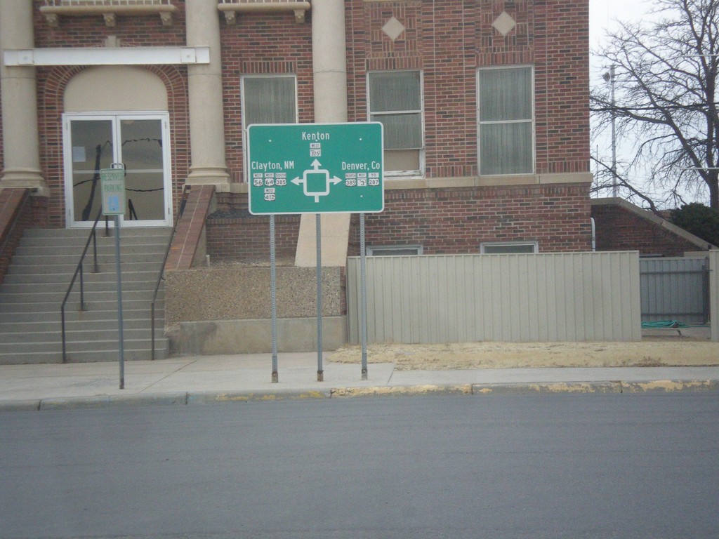
US-56/US-64/US-412/OK-3 East at US-385/OK-325
Roundabout diagram in front of the Cimarron County Courthouse in Boise City.
Taken 03-30-2014
Boise City
Cimarron County
Oklahoma
United States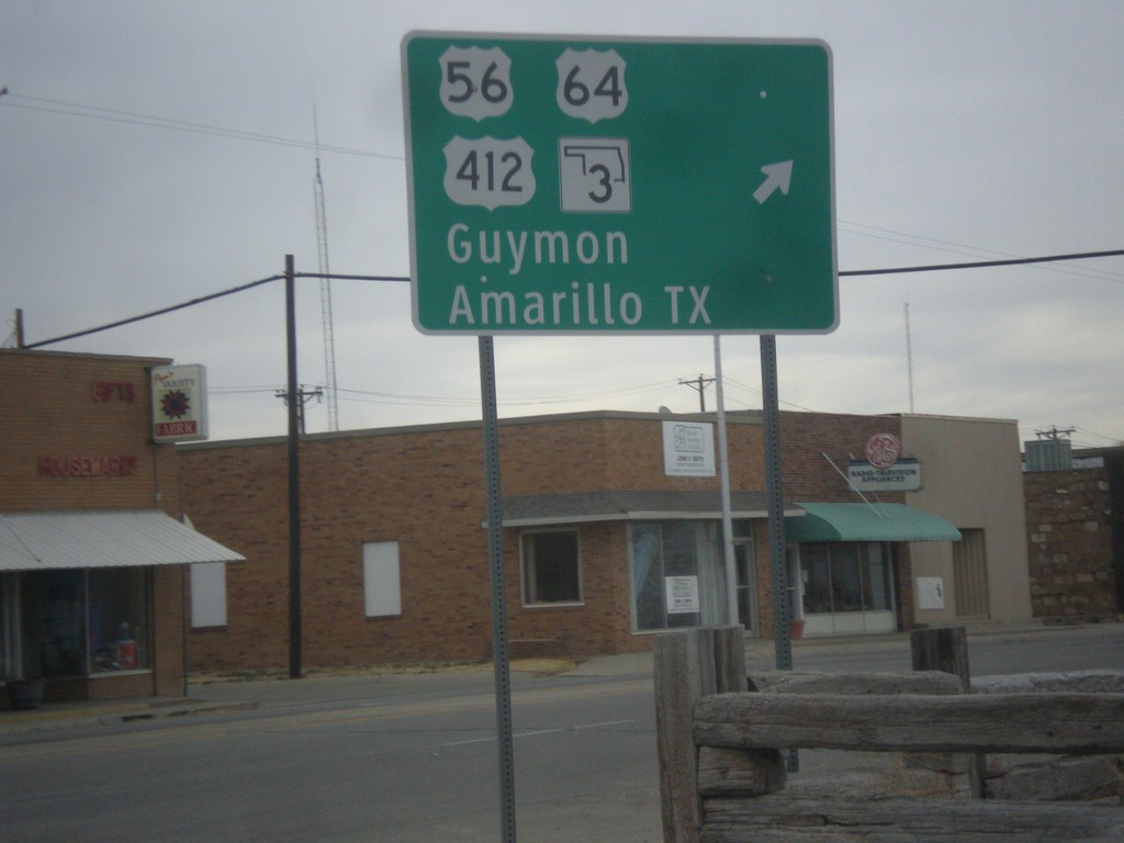
US-56/US-64/US-412/OK-3/US-385 - East Exit of Boise City Roundabout
US-56/US-64/US-412/OK-3/US-385 at east exit of Boise City roundabout. Turn right for US-56/US-64/US-412/OK-3 East to Guymon and Amarillo, Texas.
Taken 03-30-2014
Boise City
Cimarron County
Oklahoma
United States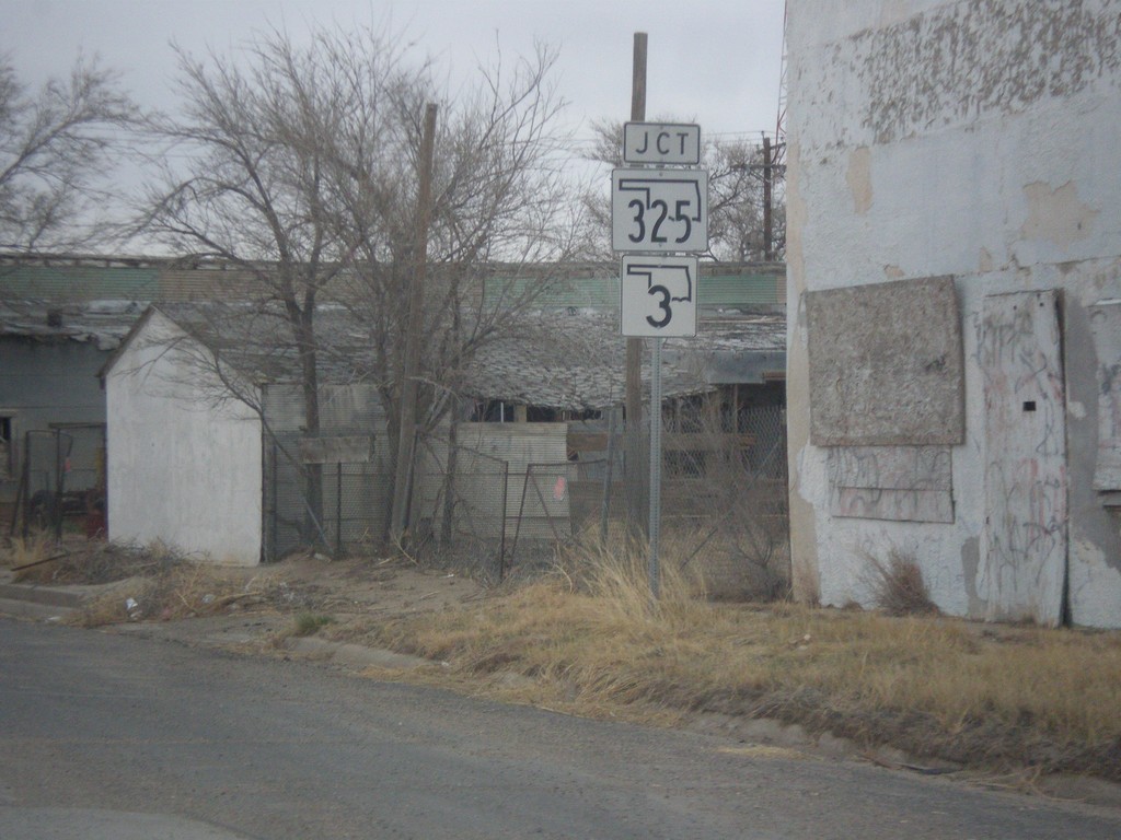
US-56/US-64/US-385/US-412 at OK-3/OK-325
US-56/US-64/US-385/US-412 approaching OK-3/OK-325 in Boise City.
Taken 03-30-2014
Boise City
Cimarron County
Oklahoma
United States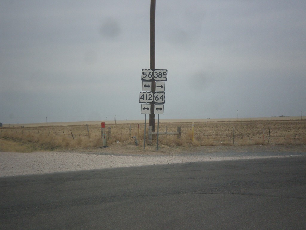
US-385 North at US-56/US-64/US-412
US-385 North at US-56/US-64/US-412. Turn left for US-56/US-64/US-412 west; right to continue north on US-385 with US-56/US-64/US-412 east.
Taken 03-30-2014
Boise City
Cimarron County
Oklahoma
United States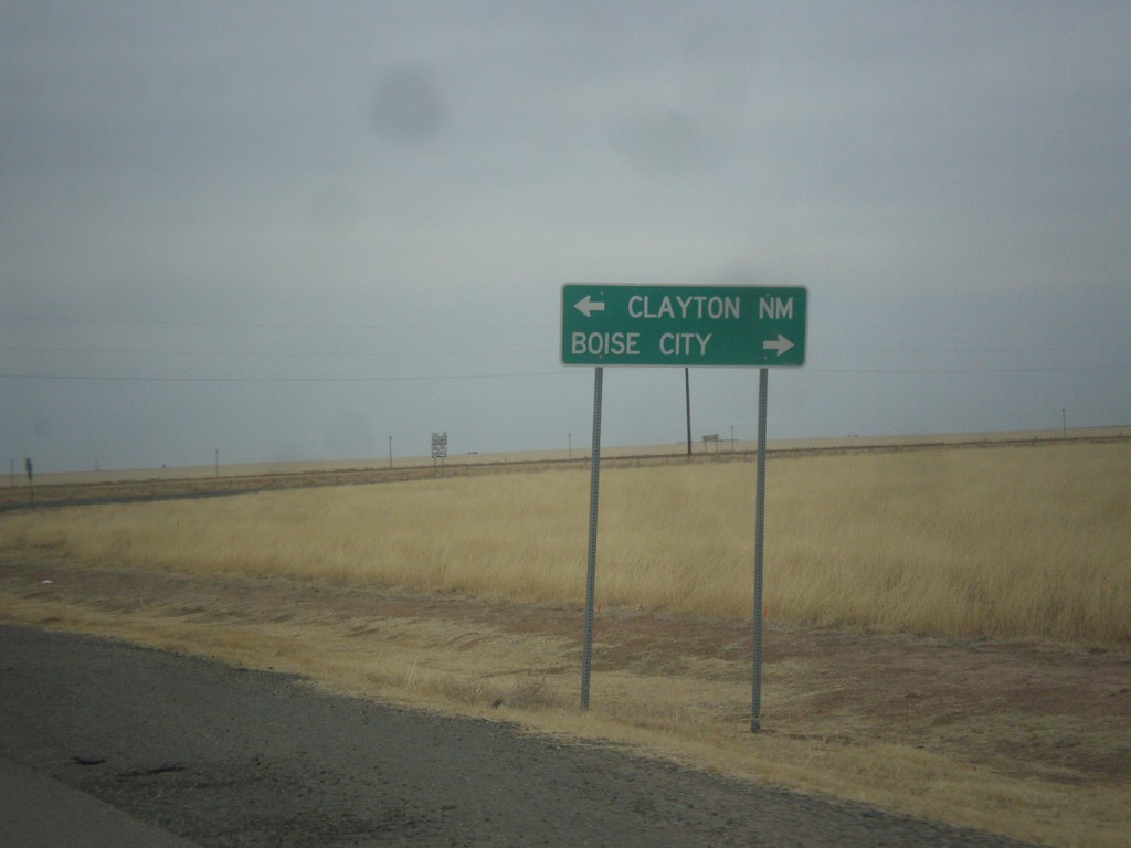
US-385 North At US-56/US-64/US-412
US-385 North At US-56/US-64/US-412. Turn left for US-56/US-64/US-412 west to Clayton, NM. Turn right for US-56/US-64/US-412 East/US-385 North to Boise City.
Taken 03-30-2014
Boise City
Cimarron County
Oklahoma
United States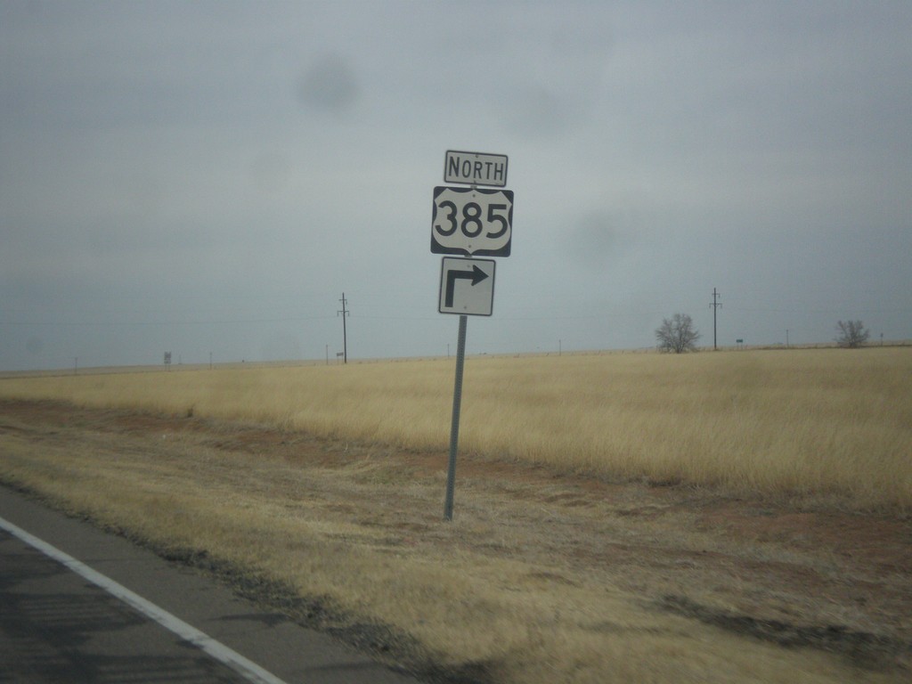
US-385 North at US-56/US-64/US-385/US-412
US-385 North at US-56/US-64/US-385/US-412 in Cimarron County.
Taken 03-30-2014
Boise City
Cimarron County
Oklahoma
United States