Signs Tagged With Intersection
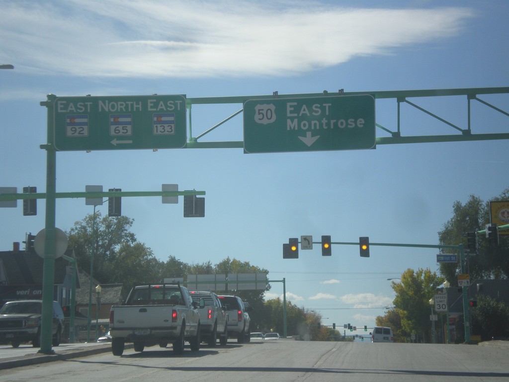
US-50 East at CO-92/CO-65/CO-133
US-50 east at CO-92/CO-65/CO-133 in Delta. Continue east on US-50 for Montrose.
Taken 10-08-2013


 Delta
Delta County
Colorado
United States
Delta
Delta County
Colorado
United States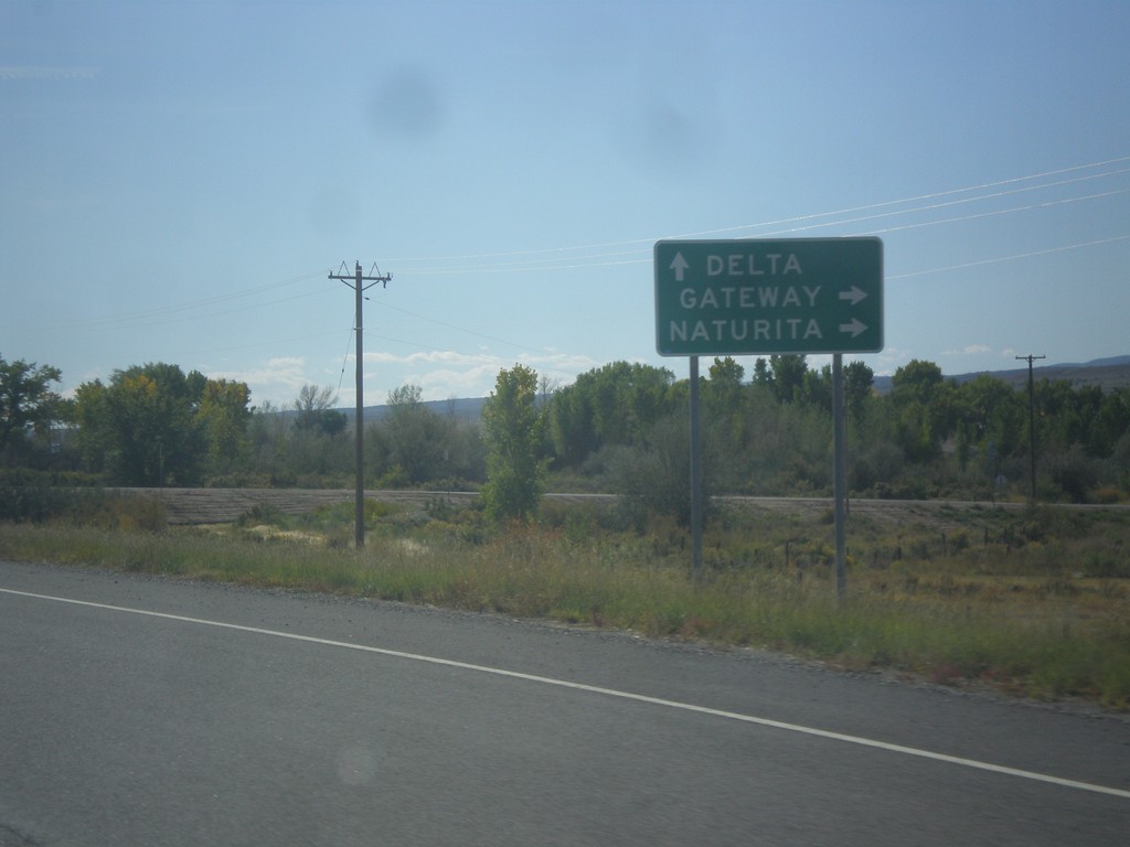
US-50 East at CO-141 South
US-50 East at CO-141 South to Gateway and Naturita. Continue east on US-50 for Delta.
Taken 10-08-2013
 Grand Junction
Mesa County
Colorado
United States
Grand Junction
Mesa County
Colorado
United States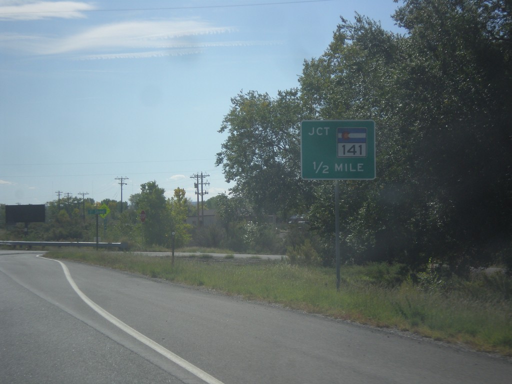
US-50 East Approaching CO-141
US-50 east approaching CO-141 in Mesa County.
Taken 10-08-2013
Mesa County
Colorado
United States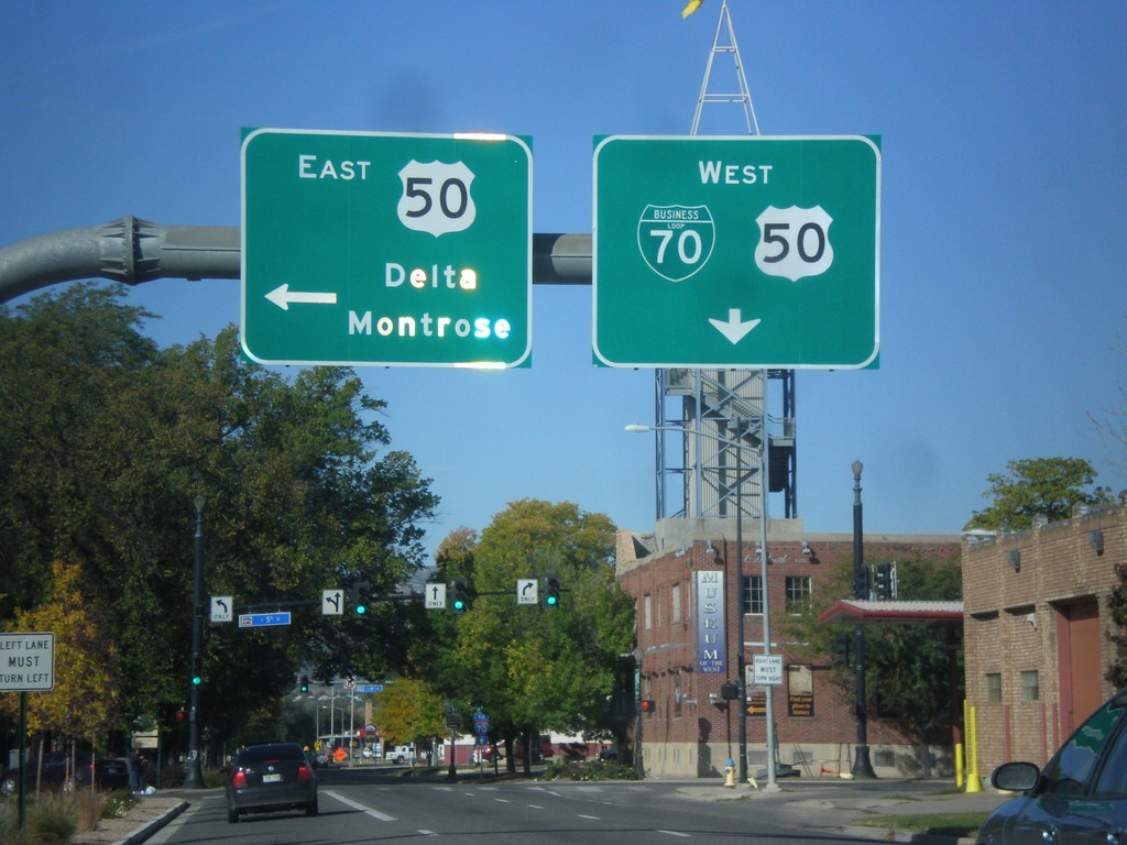
BL-70 West at US-50
BL-70 west (Ute St.) at US-50 (5th St.) in Downtown Grand Junction. Turn left on US-50 for Delta and Montrose. Continue straight on Ute St. for BL-70/US-50 west.
Taken 10-08-2013
 Grand Junction
Mesa County
Colorado
United States
Grand Junction
Mesa County
Colorado
United States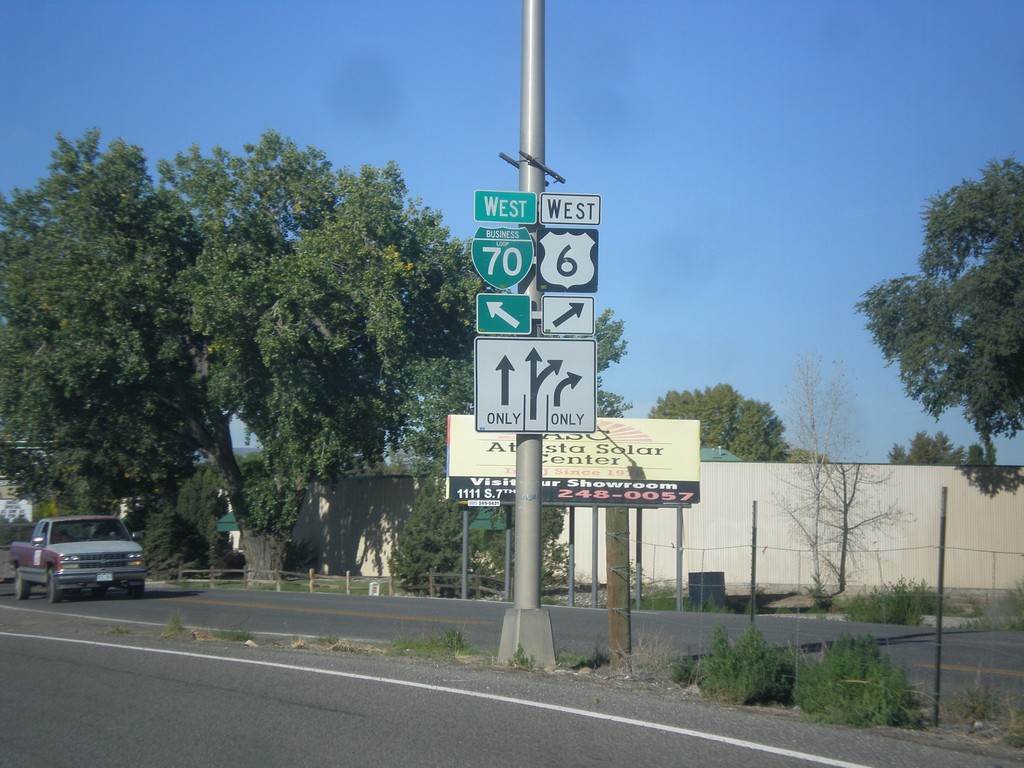
US-6 West/BL-70 West Split
US-6 West/BL-70 West Split in Grand Junction. Merge right for US-6 West (North Ave.); merge left for BL-70 West.
Taken 10-08-2013
 Grand Junction
Mesa County
Colorado
United States
Grand Junction
Mesa County
Colorado
United States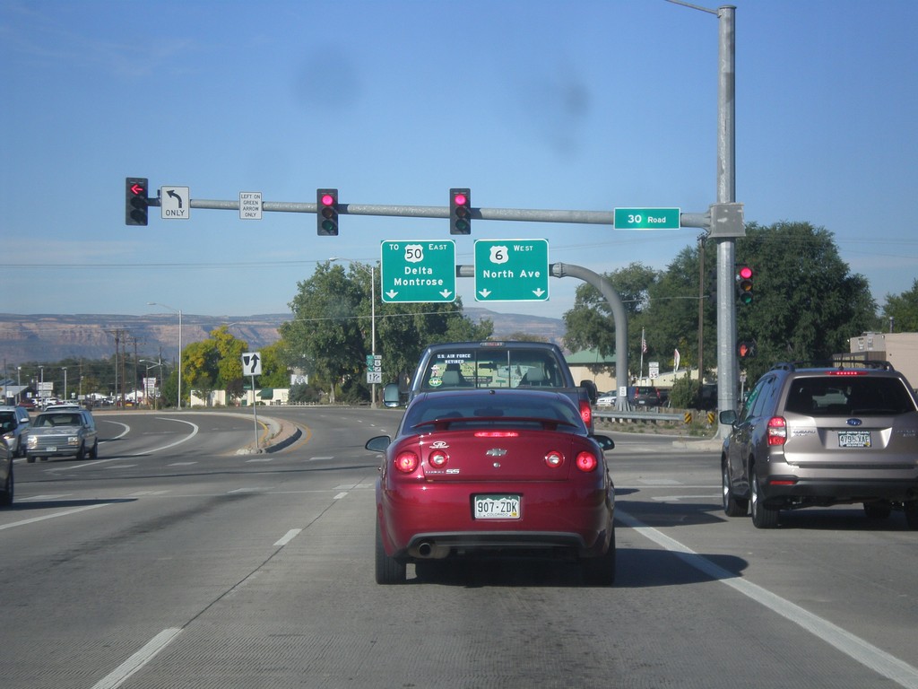
US-6/BL-70 West at US-6/BL-70 Split
US-6/BL-70 West at US-6/BL-70 Split in Grand Junction. Merge right for US-6 West/North Ave. Merge right for BL-70 West/To US-50/Delta/Montrose.
Taken 10-08-2013
Grand Junction
Mesa County
Colorado
United States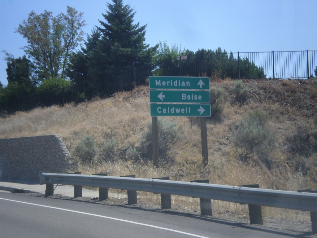
ID-55 South at US-20/US-26
ID-55 South (Eagle Road) at US-20/US-26. Turn right for US-20/US-26 west to Caldwell; left for US-20/US-26 east to Boise; straight for ID-55 south to Meridian.
Taken 07-15-2013


 Boise
Ada County
Idaho
United States
Boise
Ada County
Idaho
United States
ID-44 West at ID-55
ID-44 west at ID-55. Turn right for ID-55 south; continue straight for ID-55 north/ID-44 east. ID-55 joins ID-44 through Eagle.
Taken 07-15-2013
 Eagle
Ada County
Idaho
United States
Eagle
Ada County
Idaho
United States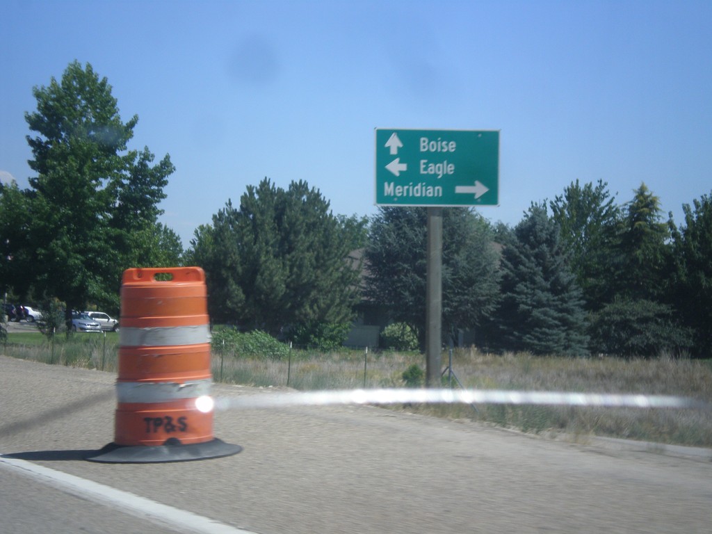
ID-44 East at ID-55
ID-44 east (State St.) at ID-55. Turn right on ID-55 (Eagle Road) for Meridian. Turn left on Eagle Road for Eagle (downtown). Continue straight on ID-44/ID-55 for Boise. ID-55 follows ID-44 through Eagle.
Taken 07-15-2013
Eagle
Ada County
Idaho
United States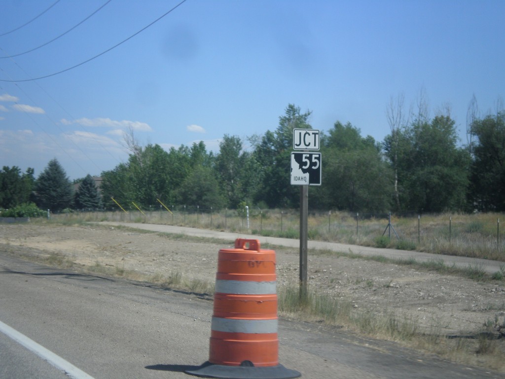
ID-44 East Approaching ID-55
ID-44 east approaching ID-55 in Eagle.
Taken 07-15-2013
Eagle
Ada County
Idaho
United States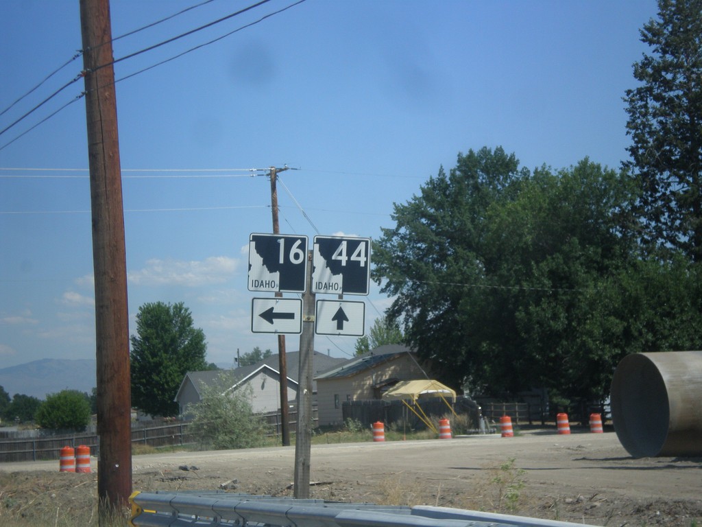
ID-44 East at ID-16
ID-44 east at ID-16 in Star.
Taken 07-15-2013
 Eagle
Ada County
Idaho
United States
Eagle
Ada County
Idaho
United States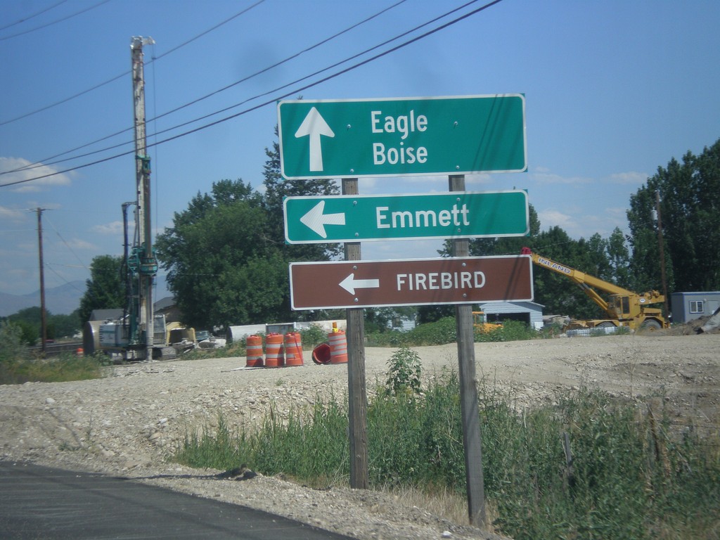
ID-44 East Approaching ID-16
ID-44 east approaching ID-16. Turn left on ID-16 north of Emmett and Firebird Raceway. Continue east on ID-44 for Eagle and Boise.
Taken 07-15-2013
Eagle
Ada County
Idaho
United States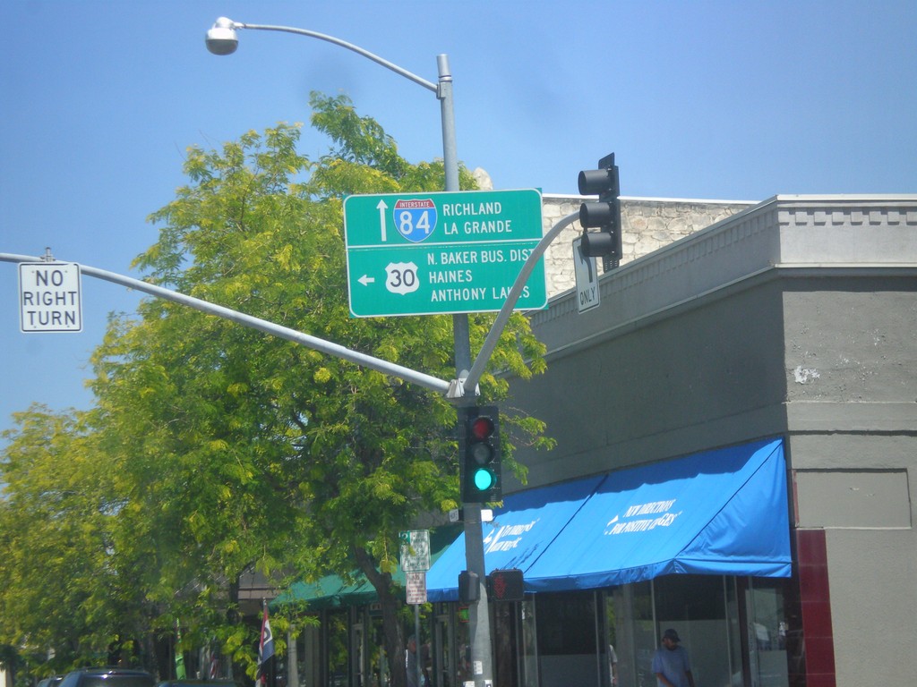
US-30 West/OR-7 East Split
US-30 West/OR-7 east in Baker City. Turn left for US-30 west to North Baker Business District, Haines, and Anthony Lakes. Continue straight for OR-7 east, to I-84, Richland, and La Grande.
Taken 07-15-2013


 Baker City
Baker County
Oregon
United States
Baker City
Baker County
Oregon
United States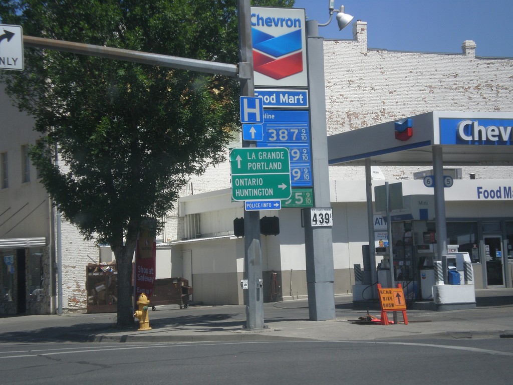
OR-7 East at US-30
OR-7 east at US-30 in Baker City. Turn right on US-30 east for Ontario and Huntington. Continue straight on US-30 West/OR-7 East for La Grande and Portland.
Taken 07-15-2013
Baker City
Baker County
Oregon
United States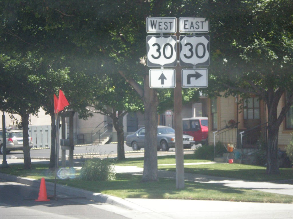
OR-7 East Approaching US-30
OR-7 east approaching US-30 in Baker City.
Taken 07-15-2013
Baker City
Baker County
Oregon
United States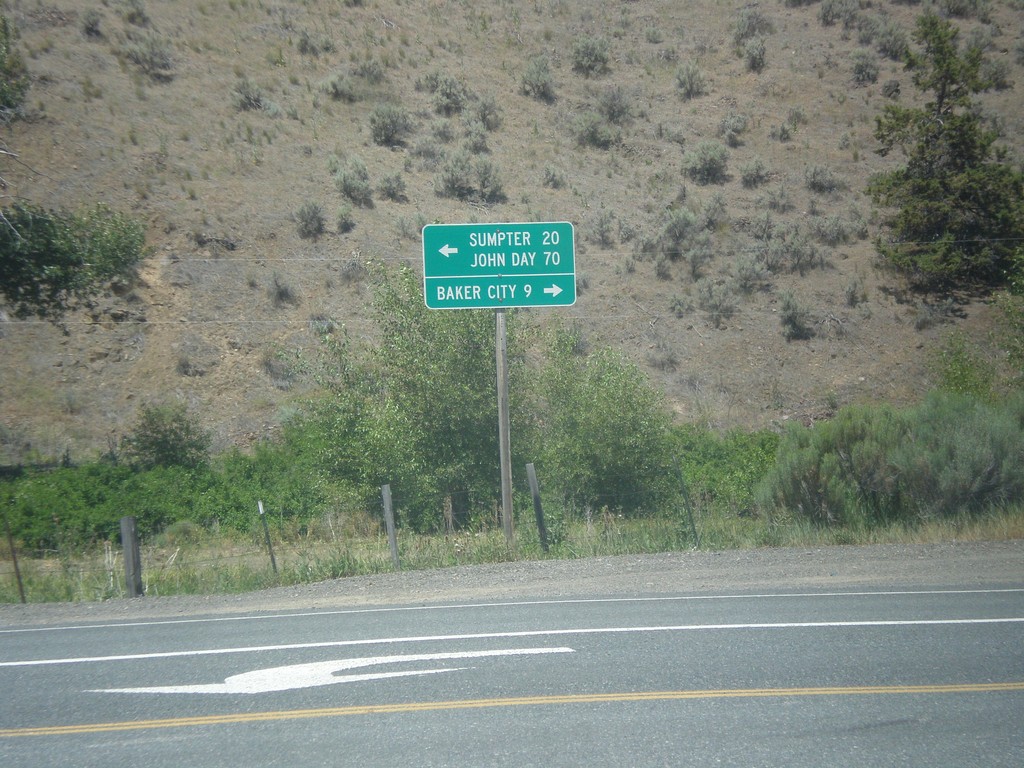
End OR-245 East at OR-7
End OR-245 east at OR-7. Turn right on OR-7 east for Baker City; turn left on OR-7 west for Sumpter and John Day.
Taken 07-15-2013
 Baker City
Baker County
Oregon
United States
Baker City
Baker County
Oregon
United States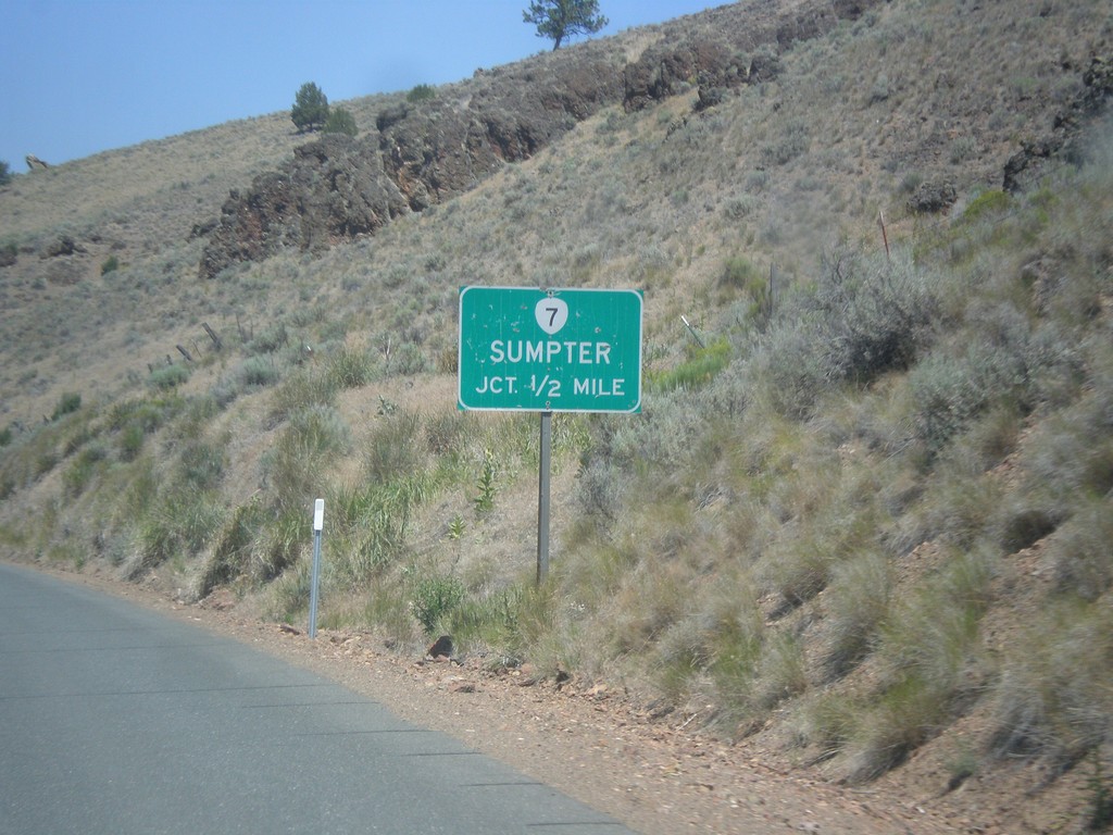
OR-245 East Approaching OR-7
OR-245 east approaching OR-7. Use OR-7 west for Sumpter.
Taken 07-15-2013
Baker City
Baker County
Oregon
United States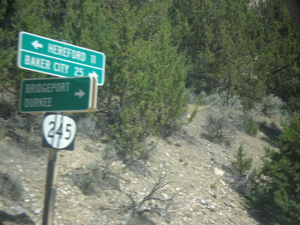
OR-245 East at Bridgeport/Durkee Jct.
OR-245 east at Bridgeport/Durkee Junction.
Taken 07-15-2013
Bridgeport
Baker County
Oregon
United States
FM-1905 East at TX-6 Spur
FM-1905 east at TX-6 Spur. Turn right for TX-6 Spur, continue ahead on FM-1905 for I-10.
Taken 04-15-2013


 Anthony
El Paso County
Texas
United States
Anthony
El Paso County
Texas
United States
NM-460/NM-478 Roundabout
Roundabout at NM-460/NM-478 junction. Merge right to continue south on NM-460; continue through roundabout for NM-460 north.
Taken 04-15-2013

 Anthony
Doña Ana County
New Mexico
United States
Anthony
Doña Ana County
New Mexico
United States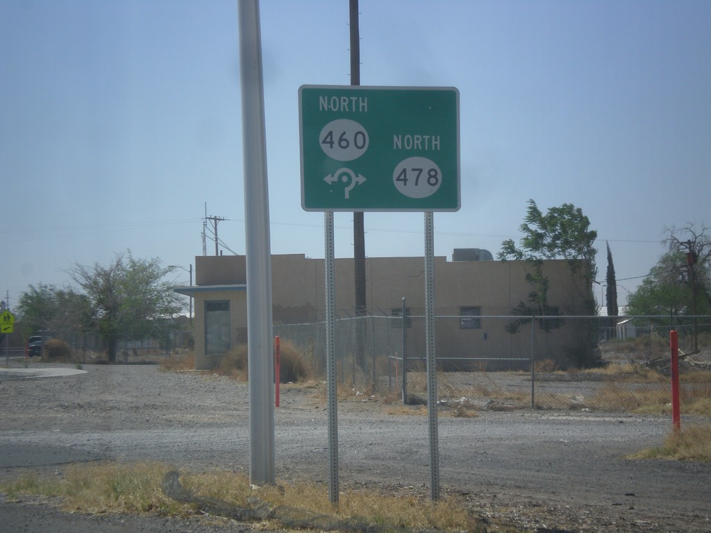
NM-478 South at NM-478/NM-460 Roundabout
NM-478/NM-478 roundabout on NM-478 south.
Taken 04-15-2013
Anthony
Doña Ana County
New Mexico
United States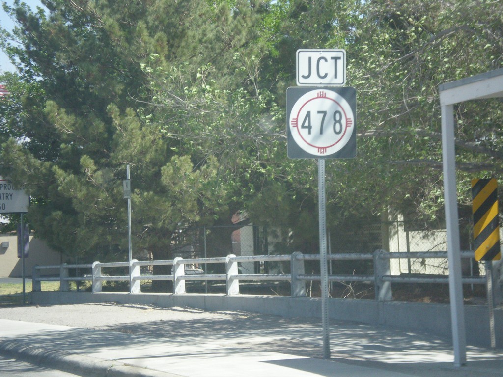
NM-460 North Approaching NM-478
NM-460 north approaching NM-478 in Anthony.
Taken 04-15-2013
Anthony
Doña Ana County
New Mexico
United States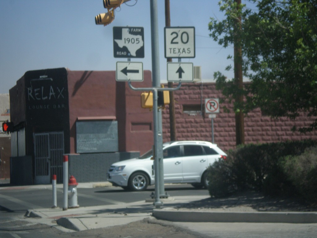
TX-20 West at FM-1905
TX-20 west at FM-1905 junction in Anthony, TX.
Taken 04-15-2013
 Anthony
El Paso County
Texas
United States
Anthony
El Paso County
Texas
United States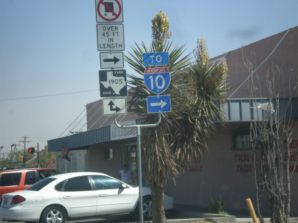
TX-20 West at FM-1905
TX-20 west at FM-1905 junction. FM-1905 joins TX-20 west for a few blocks through Anthony. Use FM-1905 east for I-10.
Taken 04-15-2013
Anthony
El Paso County
Texas
United States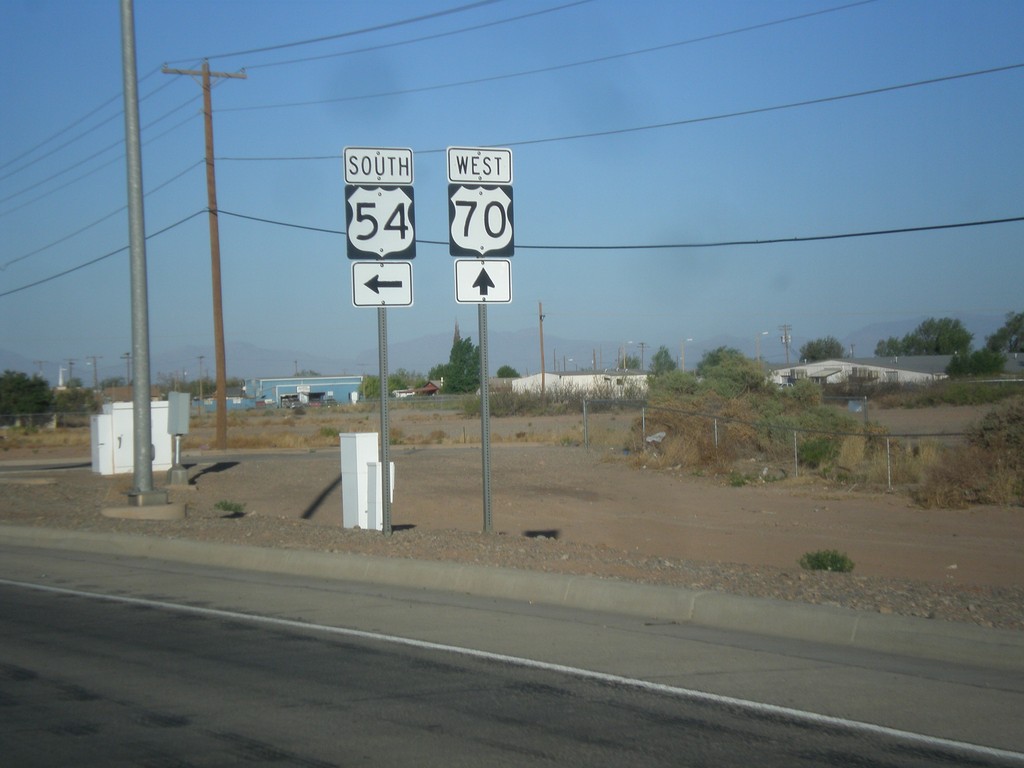
US-70 West/US-54 South at Split
US-70 West/US-54 South at US-70/US-54 split.
Taken 04-15-2013

 Alamogordo
Otero County
New Mexico
United States
Alamogordo
Otero County
New Mexico
United States