Signs Tagged With Intersection
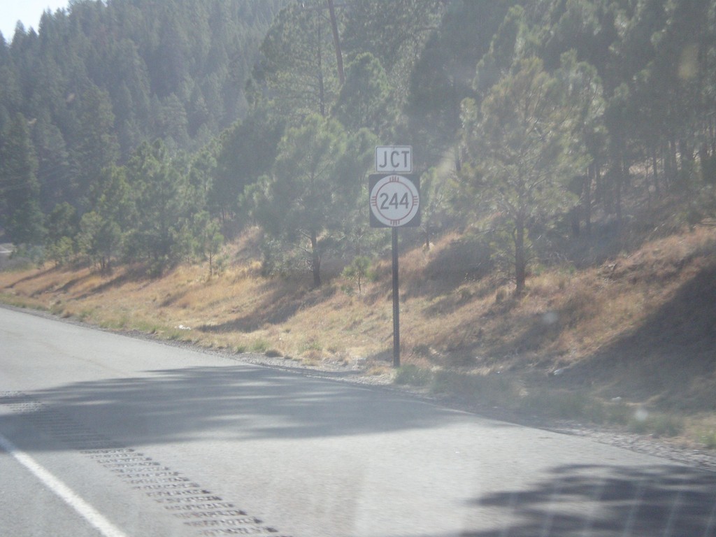
US-70 West Approaching NM-244
US-70 west approaching NM-244 junction.
Taken 04-15-2013

 Mescalero
Otero County
New Mexico
United States
Mescalero
Otero County
New Mexico
United States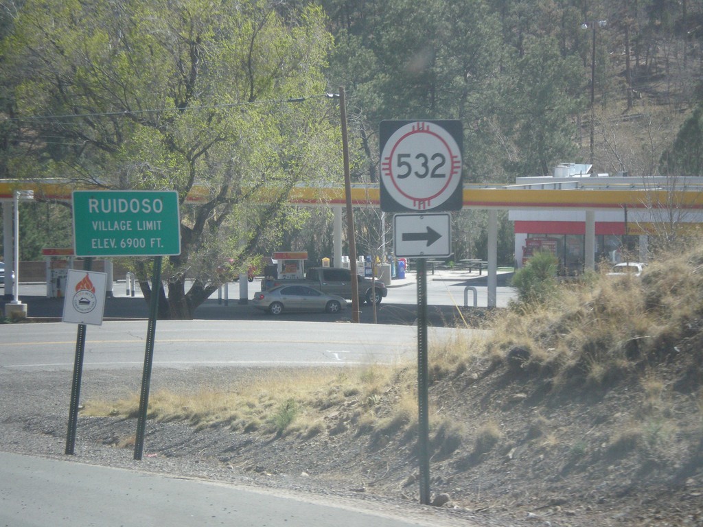
NM-48 South at NM-532
NM-48 south at NM-532. Entering the village of Ruidoso - Elevation 6,900 Feet.
Taken 04-15-2013

 Alto
Lincoln County
New Mexico
United States
Alto
Lincoln County
New Mexico
United States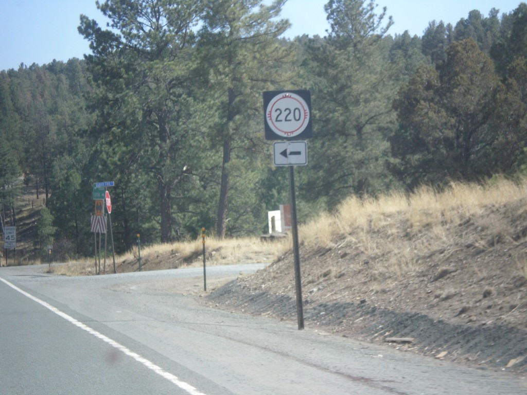
NM-48 South at NM-220
NM-48 south at NM-220 junction in Lincoln County.
Taken 04-15-2013
 Alto
Lincoln County
New Mexico
United States
Alto
Lincoln County
New Mexico
United States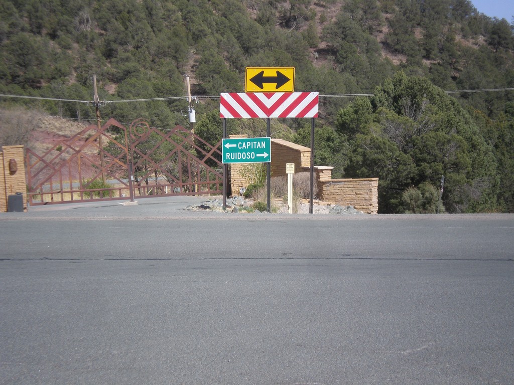
End NM-37 At NM-48
End NM-37 at NM-48. Turn right for NM-48 south to Ruidoso; turn left for NM-48 north to Capitan.
Taken 04-15-2013
 Alto
Lincoln County
New Mexico
United States
Alto
Lincoln County
New Mexico
United States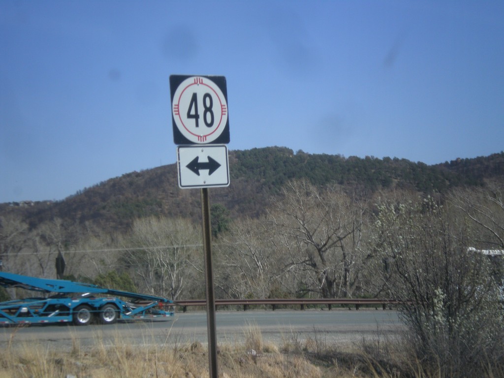
End NM-37 South at NM-48
End NM-37 south at NM-38 in rural Lincoln County.
Taken 04-15-2013
Capitan
Lincoln County
New Mexico
United States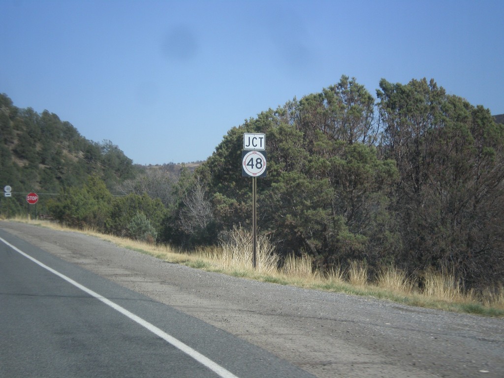
NM-37 South Approaching NM-48
End NM-37 south approaching NM-48 junction.
Taken 04-15-2013
Capitan
Lincoln County
New Mexico
United States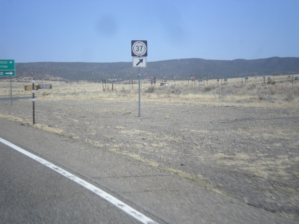
US-380 East at NM-37
US-380 east at NM-37 south, in Lincoln County.
Taken 04-15-2013
 Carrizozo
Lincoln County
New Mexico
United States
Carrizozo
Lincoln County
New Mexico
United States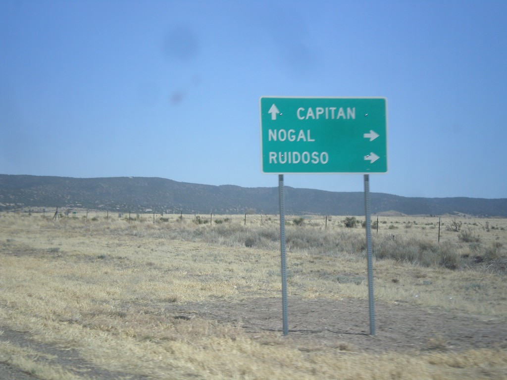
US-380 East at NM-37
US-380 east at NM-37. Use NM-37 south for Nogal and Ruidoso. Continue east on US-380 for Capitan.
Taken 04-15-2013
Carrizozo
Lincoln County
New Mexico
United States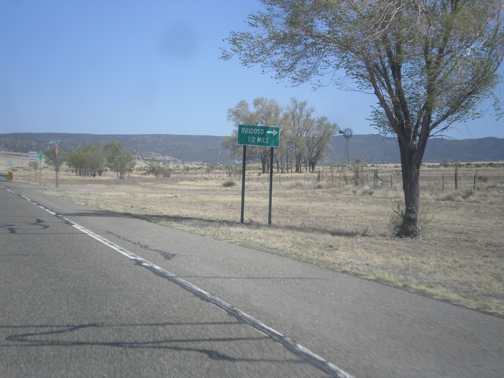
US-380 East Approaching NM-37
US-380 east approaching NM-37 south to Ruidoso.
Taken 04-15-2013
Carrizozo
Lincoln County
New Mexico
United States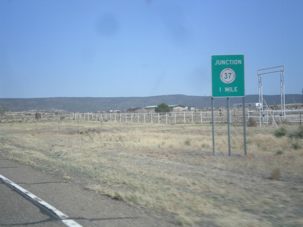
US-380 East Approaching NM-37
US-380 east approaching NM-37.
Taken 04-15-2013
Carrizozo
Lincoln County
New Mexico
United States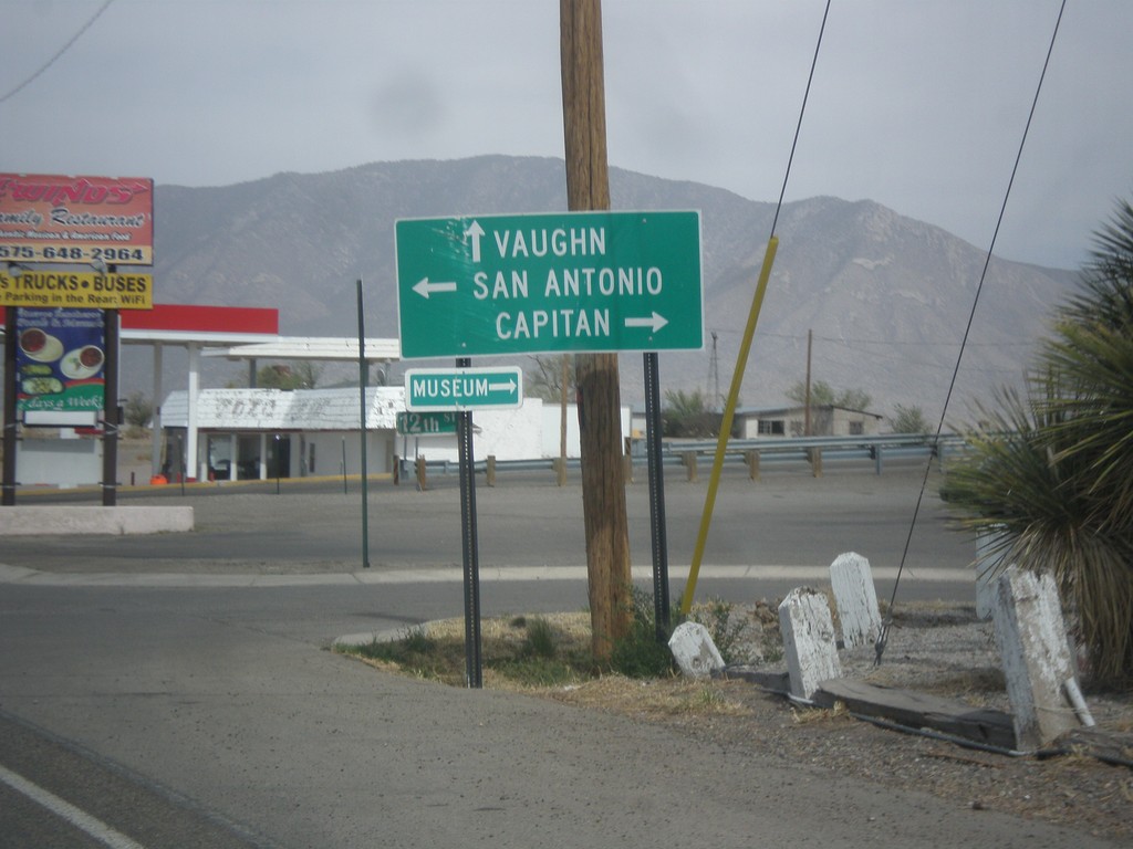
US-54 North at US-380
US-54 north at US-380. Turn right for US-380 east to Capitan; left for US-380 west to San Antonio. Continue north for US-54 to Vaughn.
Taken 04-15-2013
 Carrizozo
Lincoln County
New Mexico
United States
Carrizozo
Lincoln County
New Mexico
United States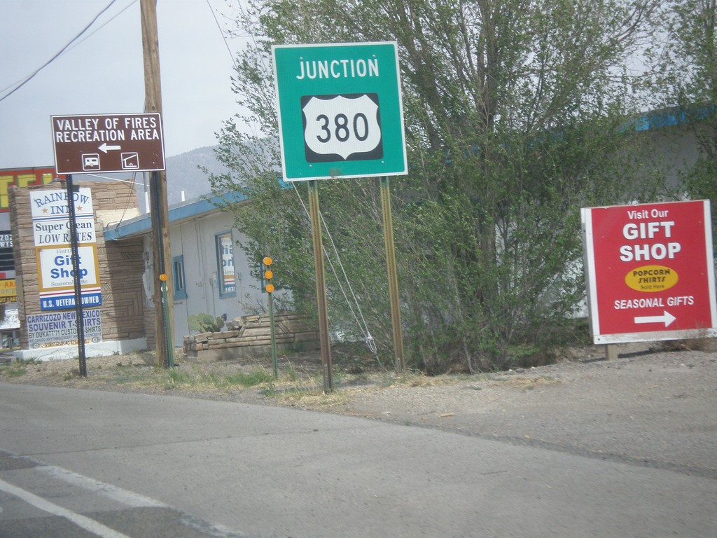
US-54 North Approaching US-380
US-54 north approaching US-380 in Carrizozo. Turn left for Valley of Fires State Recreation Area.
Taken 04-15-2013
Carrizozo
Lincoln County
New Mexico
United States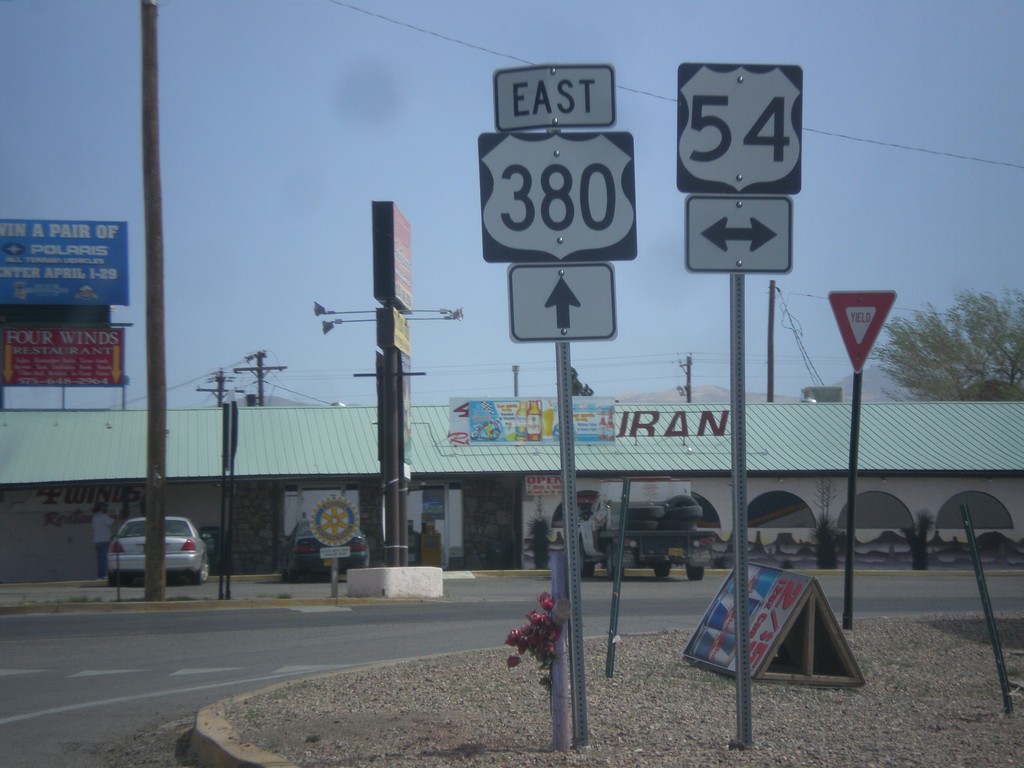
US-380 East at US-54
US-380 east at US-54 junction in Carrizozo.
Taken 04-15-2013
Carrizozo
Lincoln County
New Mexico
United States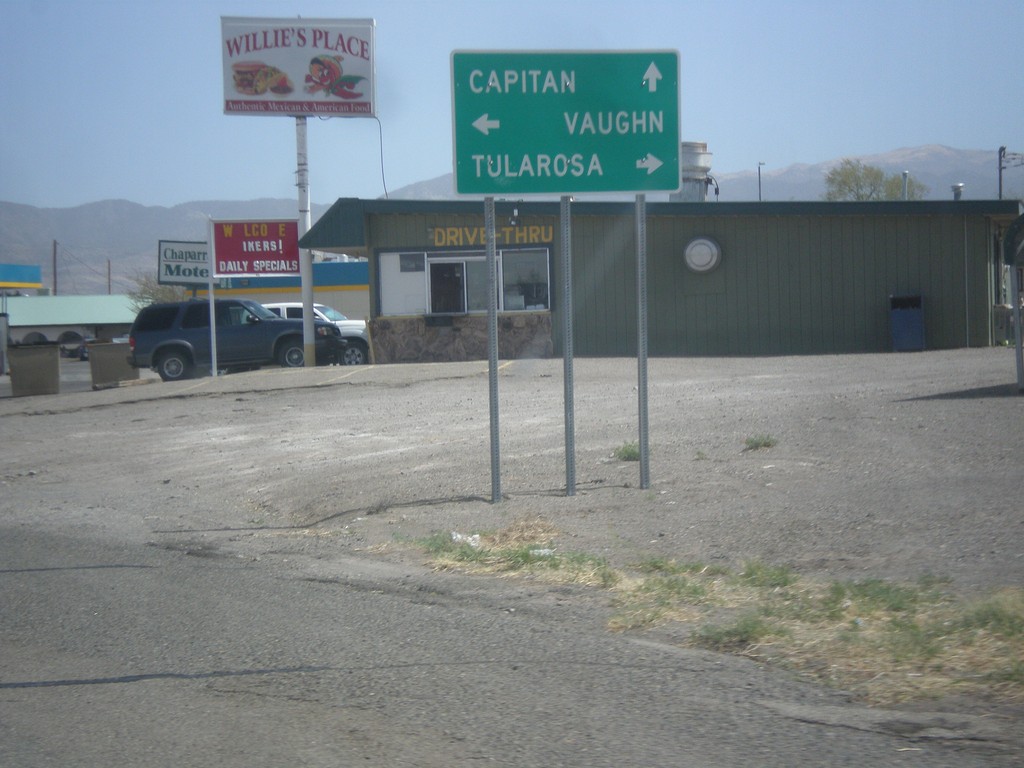
US-380 East at US-54
US-380 east at US-54. Turn right on US-54 south to Tularosa; turn left on US-54 north to Vaughn. Continue straight on US-380 east for Capitan.
Taken 04-15-2013
Carrizozo
Lincoln County
New Mexico
United States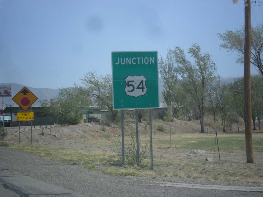
US-380 East Approaching US-54
US-380 east approaching US-54 in Carrizozo.
Taken 04-15-2013
Carrizozo
Lincoln County
New Mexico
United States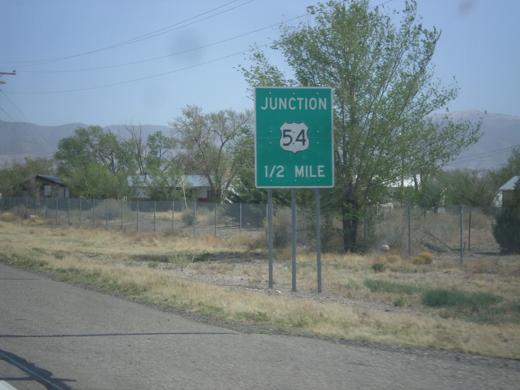
US-380 East Approaching US-54
US-380 east approaching US-54 in Carrizozo.
Taken 04-15-2013
Carrizozo
Lincoln County
New Mexico
United States
US-380 East at NM-1
US-380 east at NM-1 junction in San Antonio. NM-1 parallels I-25 between Truth of Consequences and Socorro.
Taken 04-15-2013
 San Antonio
Socorro County
New Mexico
United States
San Antonio
Socorro County
New Mexico
United States
US-380 East Approaching NM-1
US-380 east approaching NM-1 in San Antonio.
Taken 04-15-2013
San Antonio
Socorro County
New Mexico
United States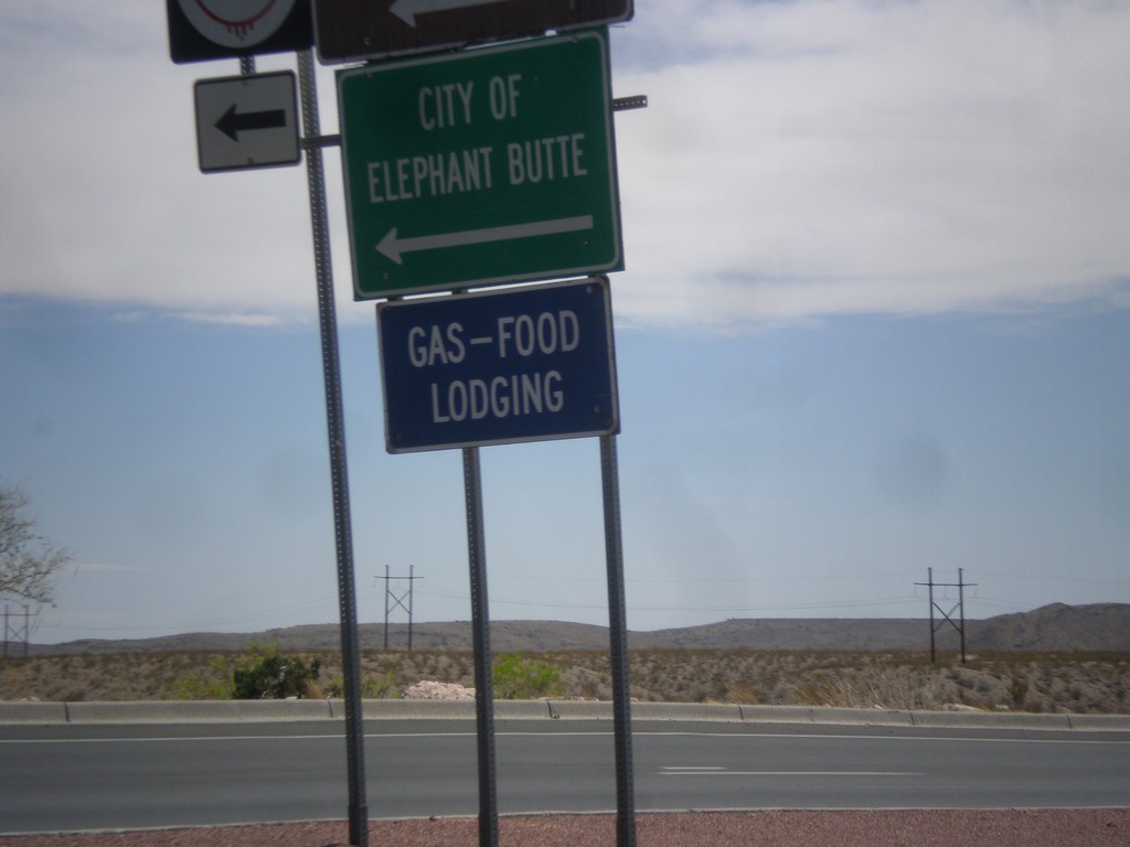
BL-25 South at NM-181
BL-25 south at NM-181 north to City of Elephant Butte.
Taken 04-15-2013

 Truth or Consequences
Sierra County
New Mexico
United States
Truth or Consequences
Sierra County
New Mexico
United States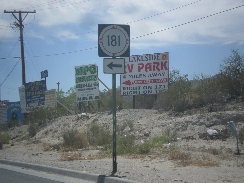
BL-25 South at NM-181
BL-25 south at NM-181 in Truth or Consequences.
Taken 04-15-2013
Truth or Consequences
Sierra County
New Mexico
United States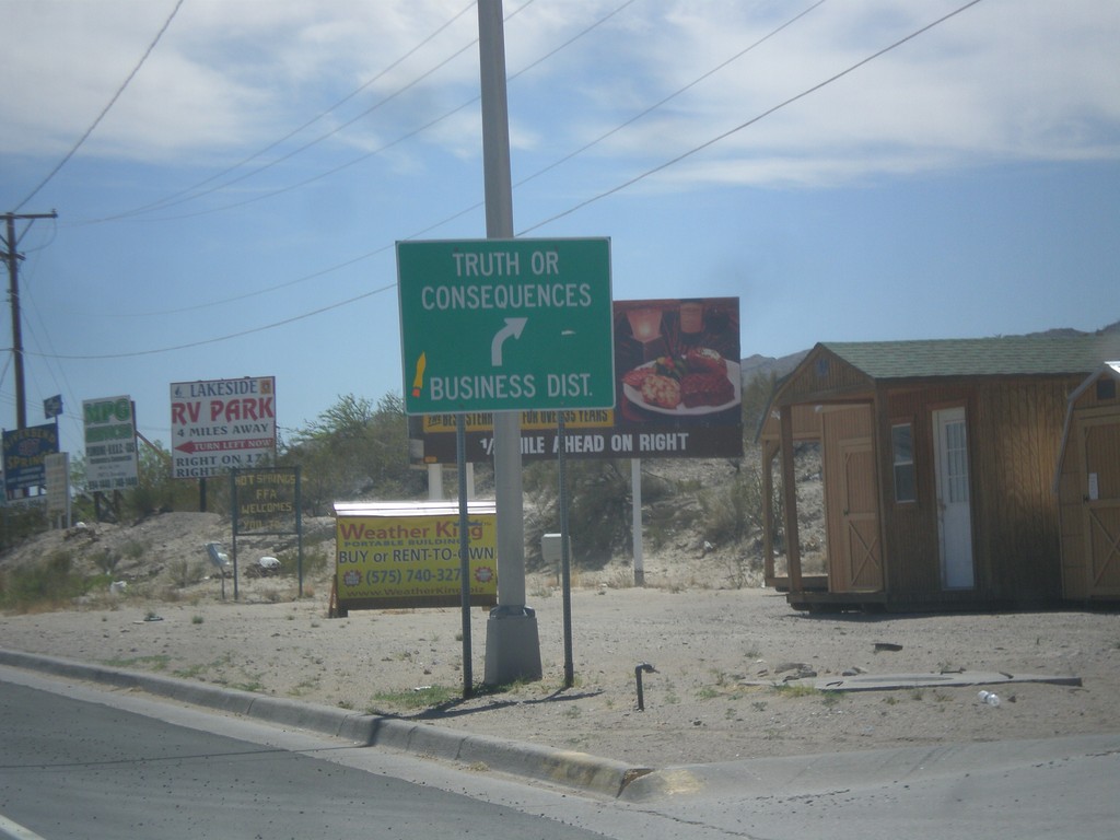
BL-25 South at NM-118
BL-25 south at NM-118. Merge right for BL-25 to Truth or Consequences business district.
Taken 04-15-2013
 Truth or Consequences
Sierra County
New Mexico
United States
Truth or Consequences
Sierra County
New Mexico
United States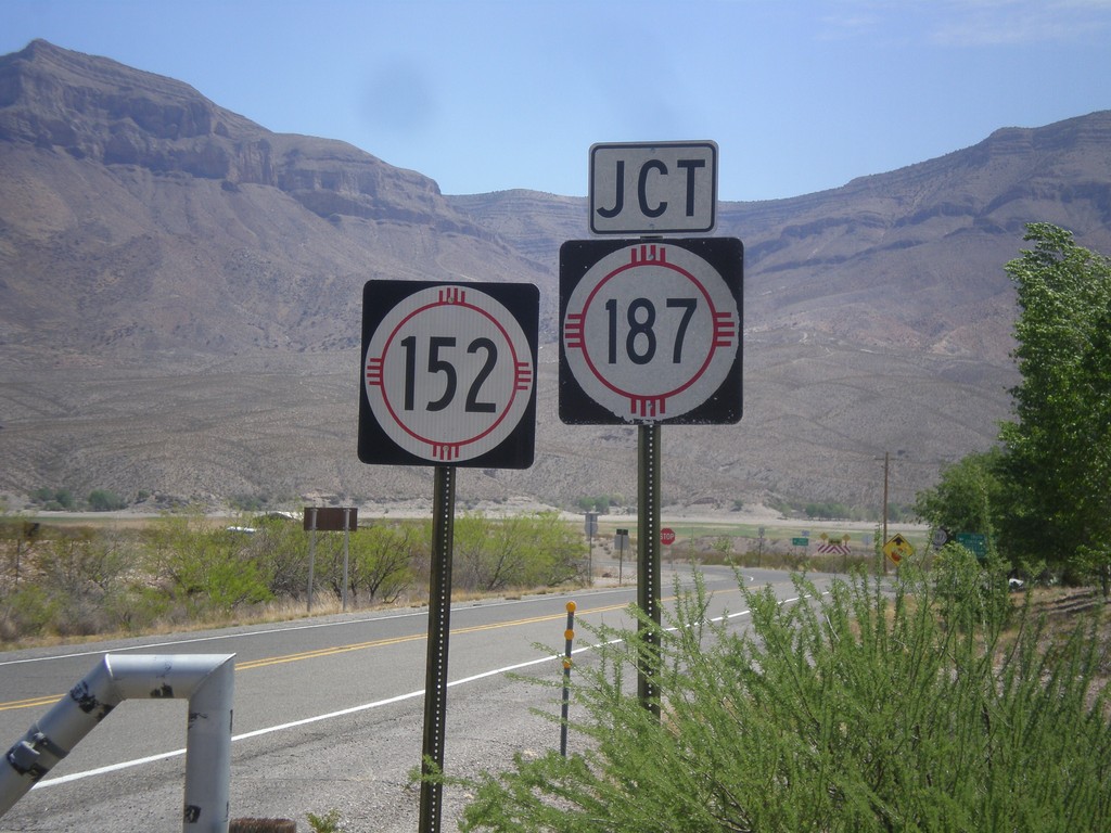
NM-152 East Approaching NM-187
End NM-152 east approaching NM-187, in rural Sierra County.
Taken 04-15-2013

 Caballo
Sierra County
New Mexico
United States
Caballo
Sierra County
New Mexico
United States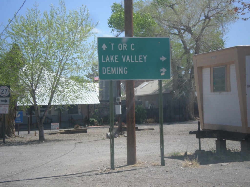
NM-152 East at NM-27
NM-152 east at NM-27 south to Deming and Lake Valley. Continue east on NM-152 for Truth or Consequences (T or C).
Taken 04-15-2013
 Hillsboro
Sierra County
New Mexico
United States
Hillsboro
Sierra County
New Mexico
United States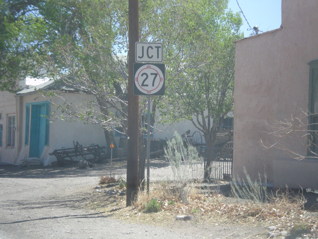
NM-152 East Approaching NM-27
NM-152 east approaching NM-27 south in Hillsboro.
Taken 04-15-2013
Hillsboro
Sierra County
New Mexico
United States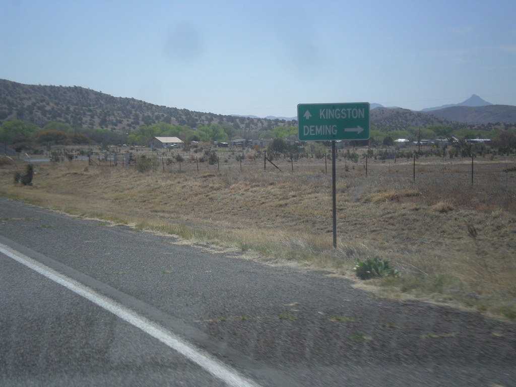
NM-152 East at NM-61 South
NM-152 east at NM-61 south. Turn right for NM-61 south to Deming; continue straight for NM-152 east for Kingston.
Taken 04-14-2013
 Hanover
Grant County
New Mexico
United States
Hanover
Grant County
New Mexico
United States