Signs Tagged With Intersection
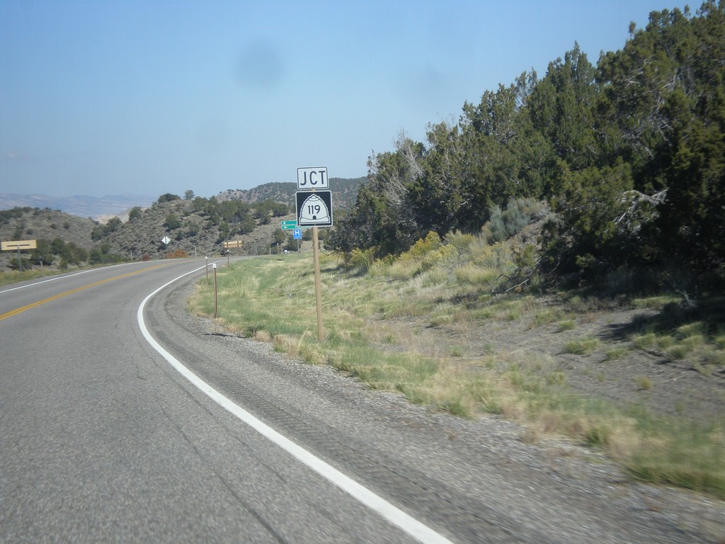
UT-24 West Approaching UT-119
UT-24 west approaching UT-119 in Sevier County.
Taken 10-18-2013

 Richfield
Sevier County
Utah
United States
Richfield
Sevier County
Utah
United States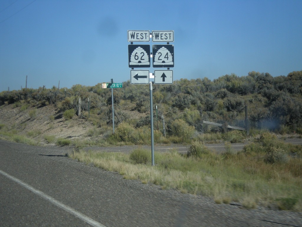
UT-24 West at UT-62 West
UT-24 west at UT-62 west in Sevier County.
Taken 10-18-2013
 Richfield
Sevier County
Utah
United States
Richfield
Sevier County
Utah
United States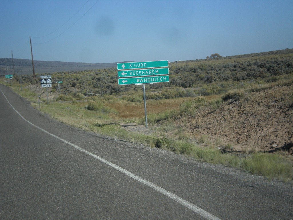
UT-24 West Approaching UT-62
UT-24 west approaching UT-62 west to Koosharem and Panguitch.
Taken 10-18-2013
Richfield
Sevier County
Utah
United States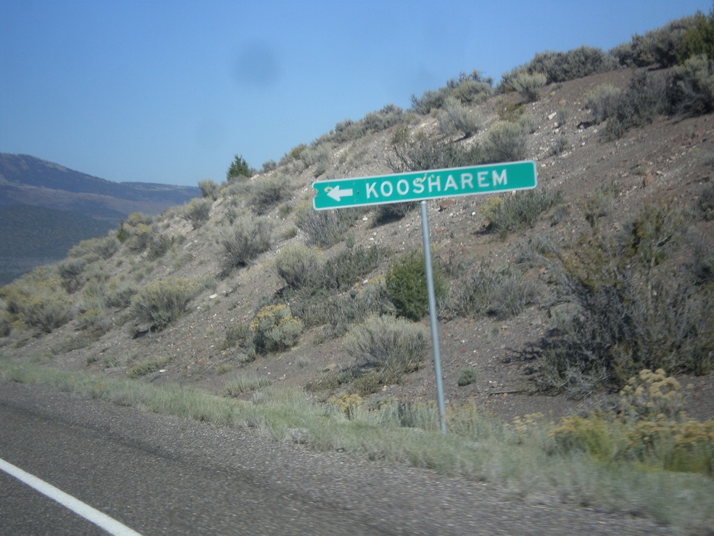
UT-24 West at Koosharem Cutoff
UT-24 West at Koosharem Cutoff in Sevier County.
Taken 10-18-2013
Koosharem
Sevier County
Utah
United States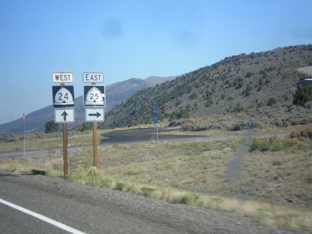
UT-24 West Approaching UT-25
UT-24 west approaching UT-25 in Piute County.
Taken 10-18-2013
 Koosharem
Piute County
Utah
United States
Koosharem
Piute County
Utah
United States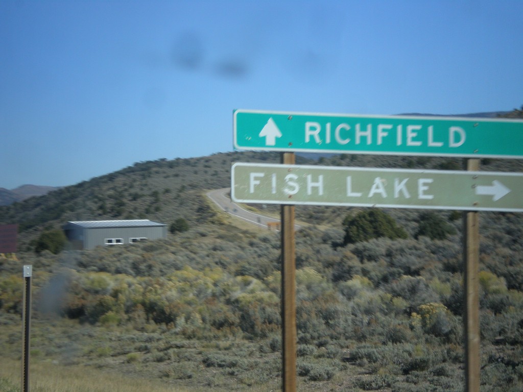
UT-24 West at UT-25
UT-24 west at UT-25 to Fishlake. Continue west on UT-24 for Richfield.
Taken 10-18-2013
Koosharem
Piute County
Utah
United States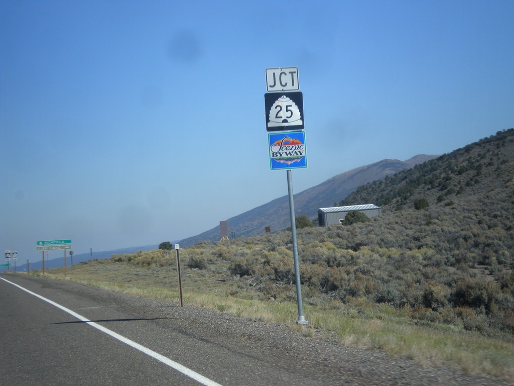
UT-24 West Approaching UT-25
UT-24 west approaching UT-25 in Piute County. UT-25 is part of the Fish Lake Scenic Byway.
Taken 10-18-2013
Koosharem
Piute County
Utah
United States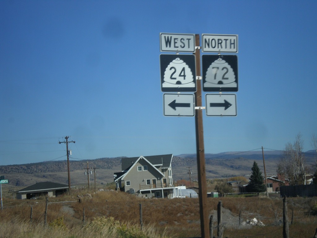
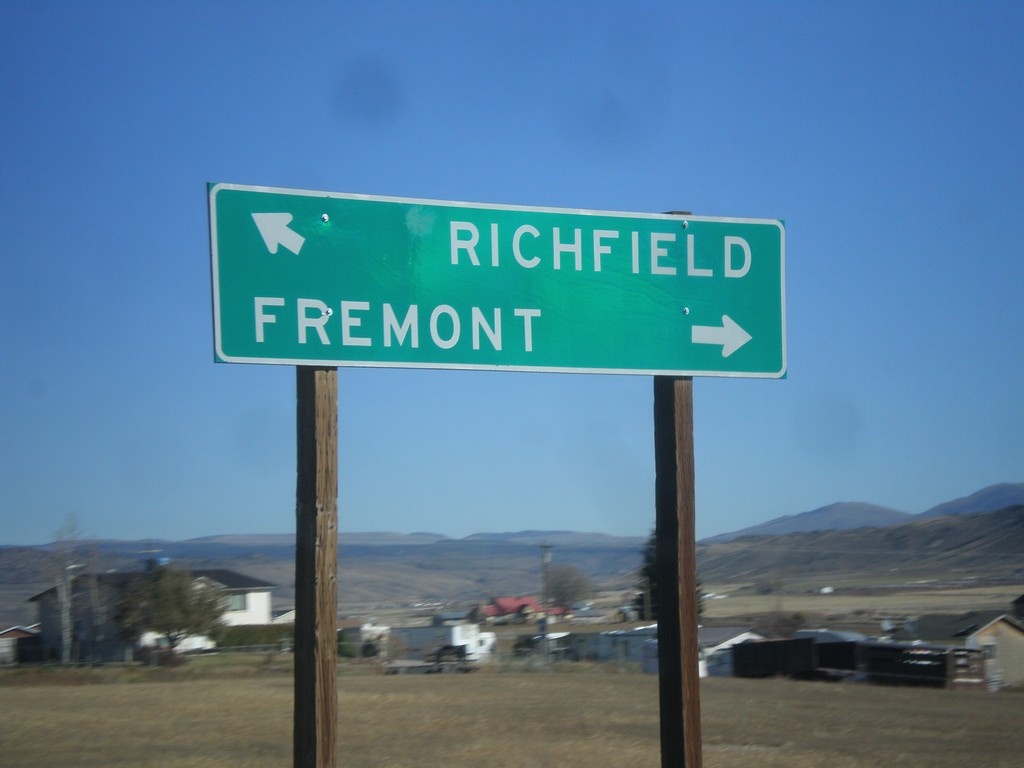
UT-24 West Approaching UT-72
UT-24 west approaching UT-72. Turn right on UT-72 for Fremont. Merge left on UT-24 for Richfield.
Taken 10-18-2013
 Loa
Wayne County
Utah
United States
Loa
Wayne County
Utah
United States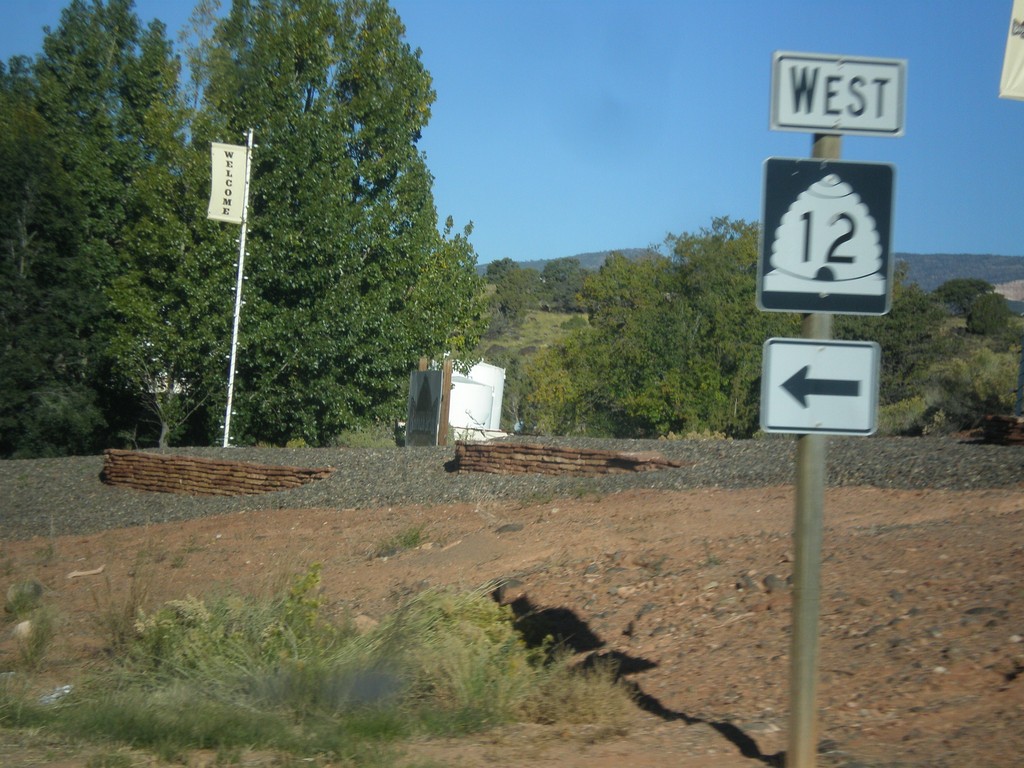
UT-24 West at UT-12
UT-24 west at UT-12 near Torrey.
Taken 10-18-2013
 Torrey
Wayne County
Utah
United States
Torrey
Wayne County
Utah
United States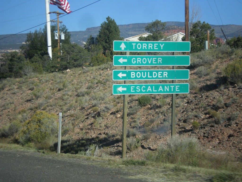
UT-24 West Approaching UT-12
UT-24 west approaching UT-12 west to Grover, Boulder, and Escalante. Continue west on UT-24 for Torrey.
Taken 10-18-2013
Torrey
Wayne County
Utah
United States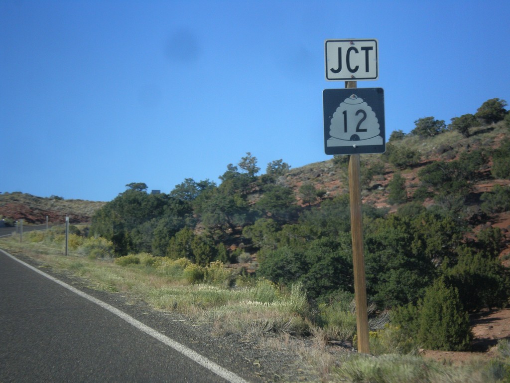
UT-24 West Approaching UT-12
UT-24 west approaching UT-12 near Torrey.
Taken 10-18-2013
Torrey
Wayne County
Utah
United States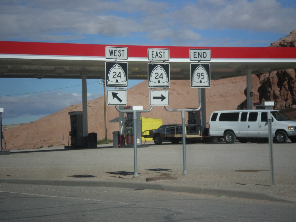
End UT-95 at UT-24
End UT-95 at UT-24 in Hanksville.
Taken 10-14-2013
 Hanksville
Wayne County
Utah
United States
Hanksville
Wayne County
Utah
United States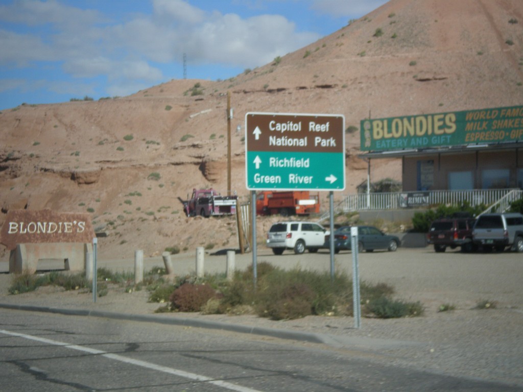
UT-95 West Approaching UT-24
UT-95 west approaching UT-24 in Hanksville. Use UT-24 east for Green River; use UT-24 west for Capitol Reef National Park and Richfield.
Taken 10-14-2013
Hanksville
Wayne County
Utah
United States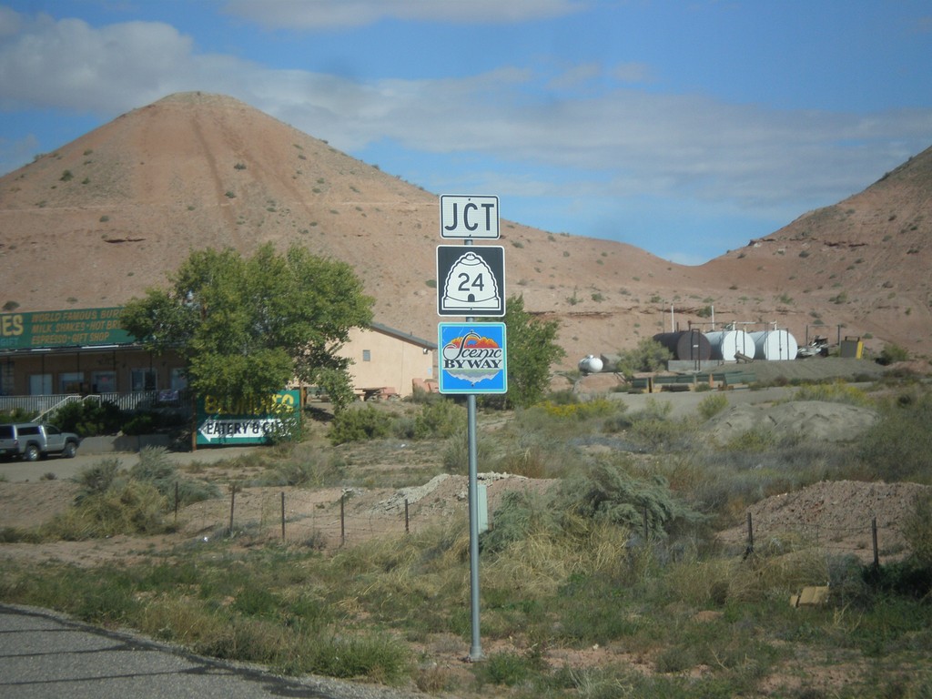
UT-95 West Approaching UT-24
UT-95 west approaching UT-24 in Hanksville. UT-24 west of Hanksville is designated the Capitol Reef Country Scenic Byway.
Taken 10-14-2013
Hanksville
Wayne County
Utah
United States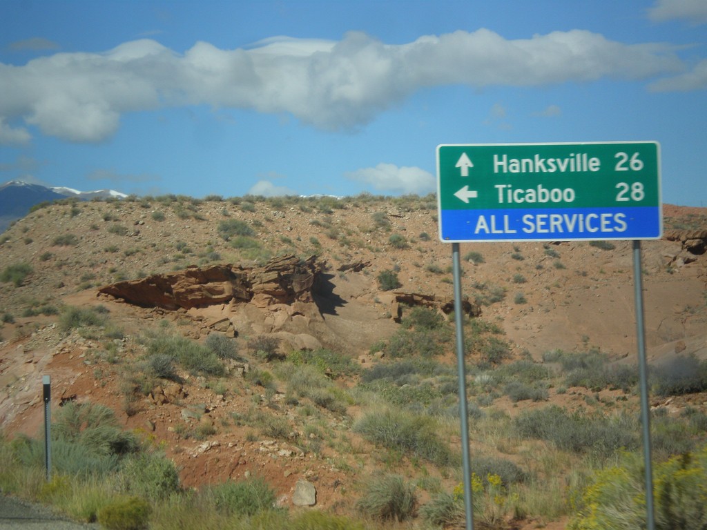
UT-95 West at UT-276
UT-95 west at UT-276 to Ticaboo. Continue west on UT-95 for Blanding.
Taken 10-14-2013
 Lake Powell
Garfield County
Utah
United States
Lake Powell
Garfield County
Utah
United States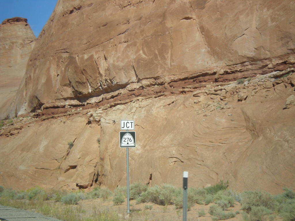
UT-95 West Approaching UT-276
UT-95 west approaching UT-276 in Garfield County.
Taken 10-14-2013
Lake Powell
Garfield County
Utah
United States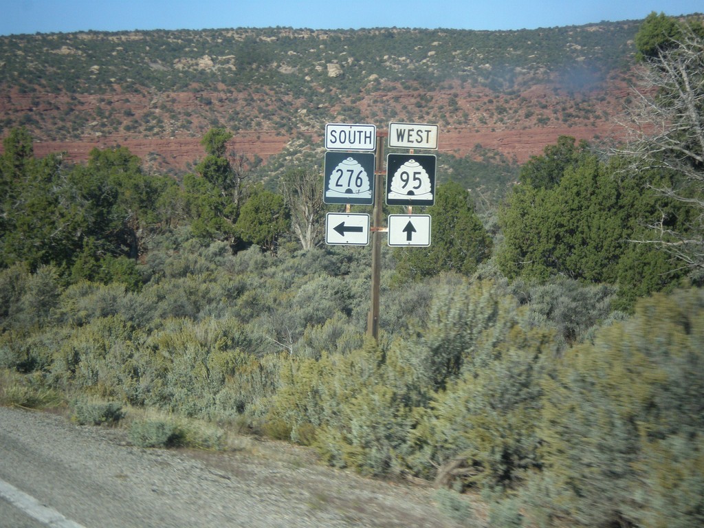
UT-95 West at UT-276 South
UT-95 west at UT-276 south in San Juan County.
Taken 10-14-2013
Lake Powell
San Juan County
Utah
United States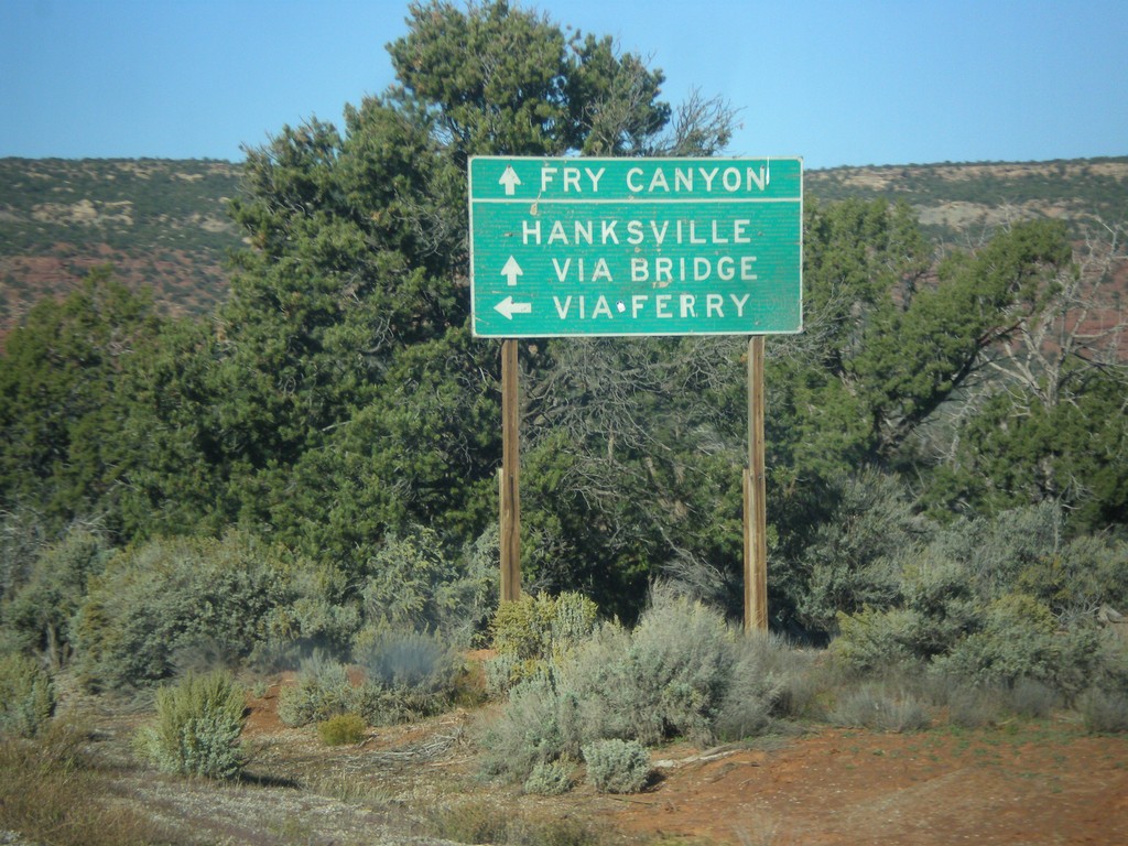
UT-95 West At UT-276 South
UT-95 west at UT-276 south. Use UT-276 for access to Lake Powell, and Hanksville via the ferry. Continue west on UT-95 for Hanksville via the bridge at Hite and Fry Canyon. At the time this picture was taken, the UT-276 ferry was not running.
Taken 10-14-2013
Lake Powell
San Juan County
Utah
United States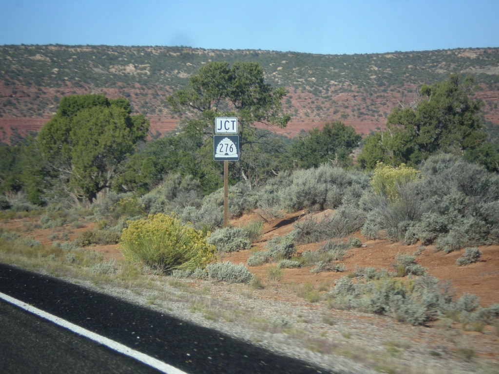
UT-95 West Approaching UT-276
UT-95 west approaching UT-276 in San Juan County.
Taken 10-14-2013
Lake Powell
San Juan County
Utah
United States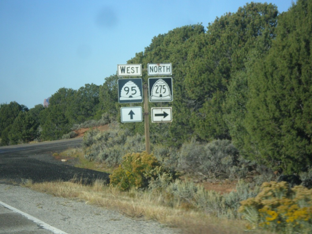
UT-95 West at UT-275
UT-95 west at UT-275 north in San Juan County.
Taken 10-14-2013
 Lake Powell
San Juan County
Utah
United States
Lake Powell
San Juan County
Utah
United States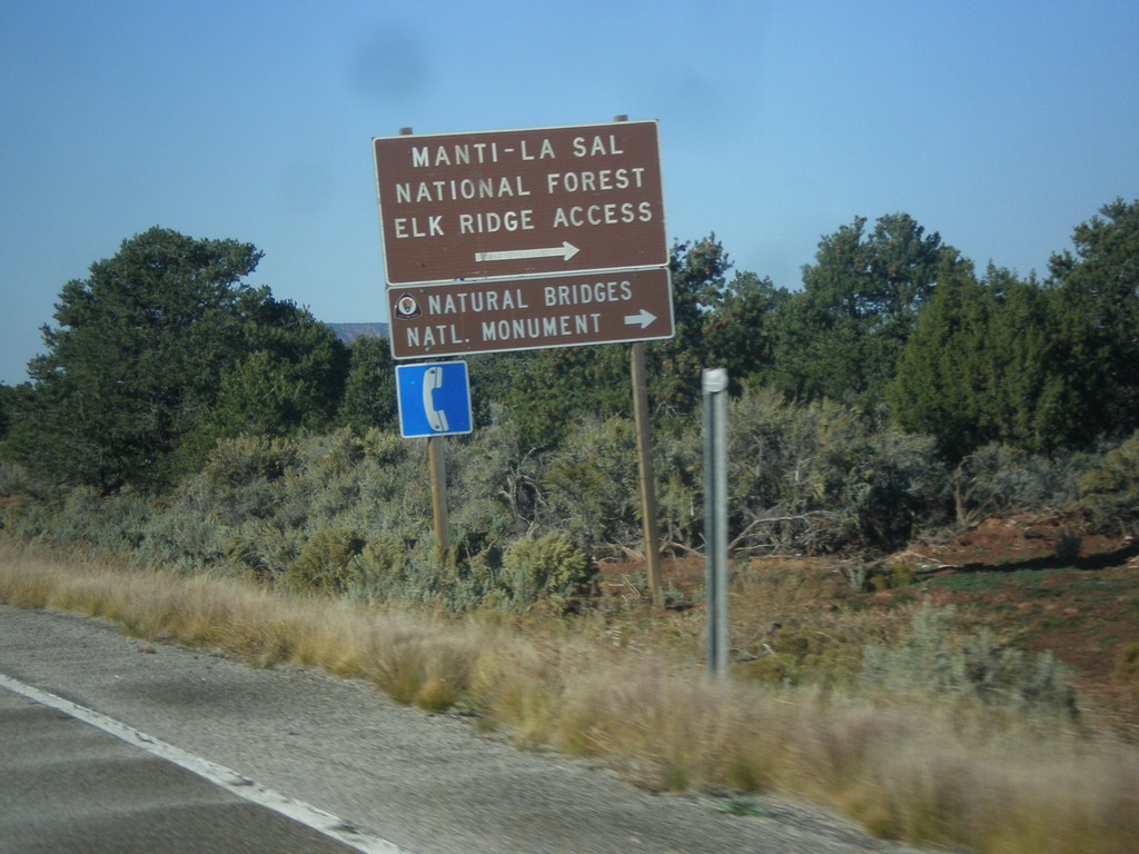
UT-95 West Approaching UT-275
UT-95 west approaching UT-275 north to Natural Bridges National Monument and Manti-La Sal Forest Elk Ridge Access. This is the entrance to Natural Bridges National Monument.
Taken 10-14-2013
Lake Powell
San Juan County
Utah
United States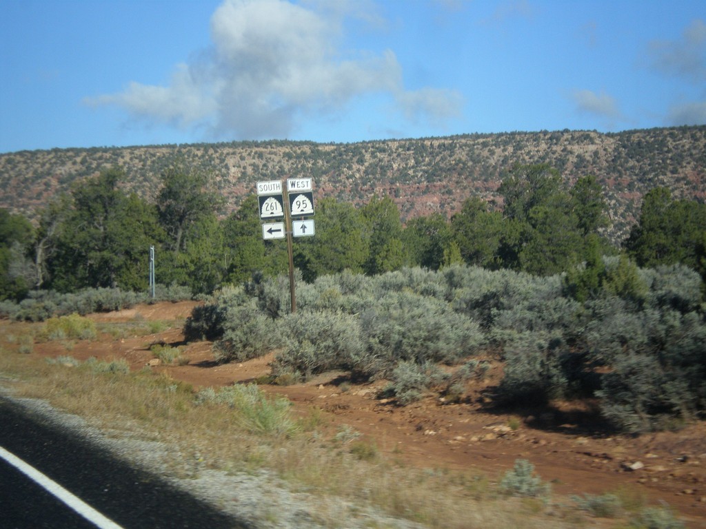
UT-95 West at UT-261
UT-95 west at UT-261 south in San Juan County.
Taken 10-14-2013
 Lake Powell
San Juan County
Utah
United States
Lake Powell
San Juan County
Utah
United States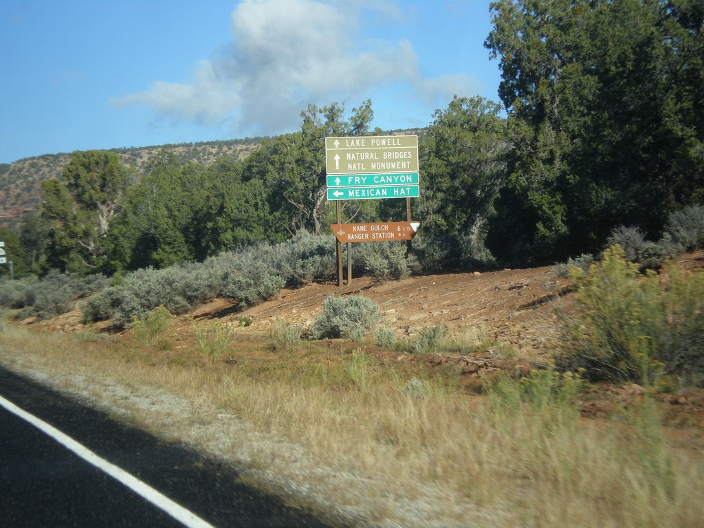
UT-95 West at UT-261
UT-95 west at UT-261 south to Mexican Hat. Continue west on UT-95 for Natural Bridges National Monument, Fry Canyon, Lake Powell, and Hanksville.
Taken 10-14-2013
Lake Powell
San Juan County
Utah
United States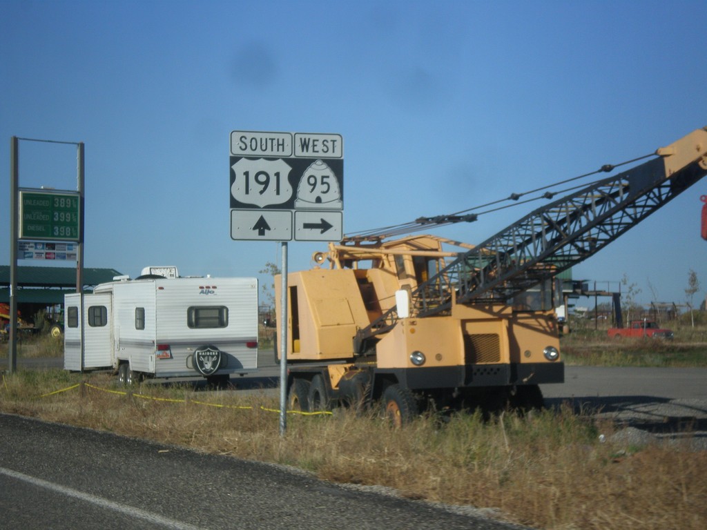
US-191 South at UT-95
US-191 south at UT-95 west, just south of Blanding.
Taken 10-14-2013
 Blanding
San Juan County
Utah
United States
Blanding
San Juan County
Utah
United States