Signs Tagged With Intersection
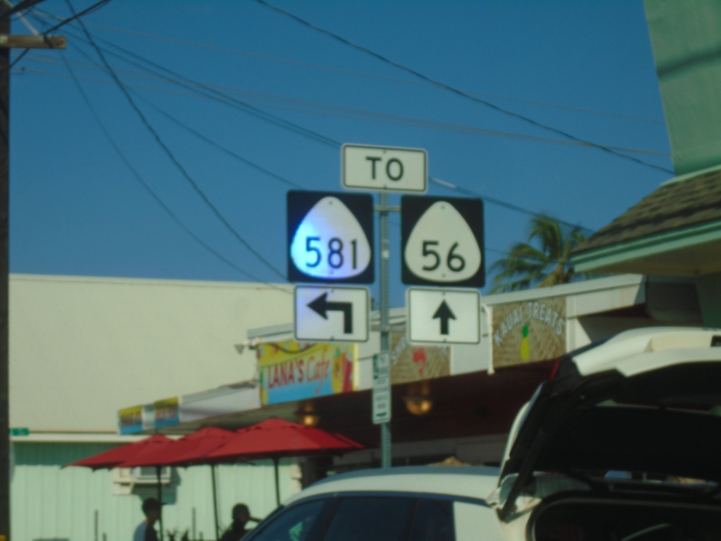
HI-56 North at HI-581 in Kapa'a
HI-56 north (Kūhiō Highway) at HI-581 (Kukui St.) in Kapa’a. The intersection is marked as “TO” but both routes intersect here.
Taken 02-15-2025

 Kapaʻa
Kauai County
Hawaii
United States
Kapaʻa
Kauai County
Hawaii
United States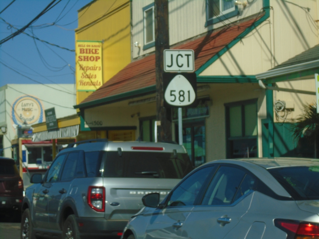
HI-56 North Approaching HI-581
HI-56 North (Kūhiō Highway) approaching HI-581 (Kukui St.) in Kapa’a.
Taken 02-15-2025
Kapaʻa
Kauai County
Hawaii
United States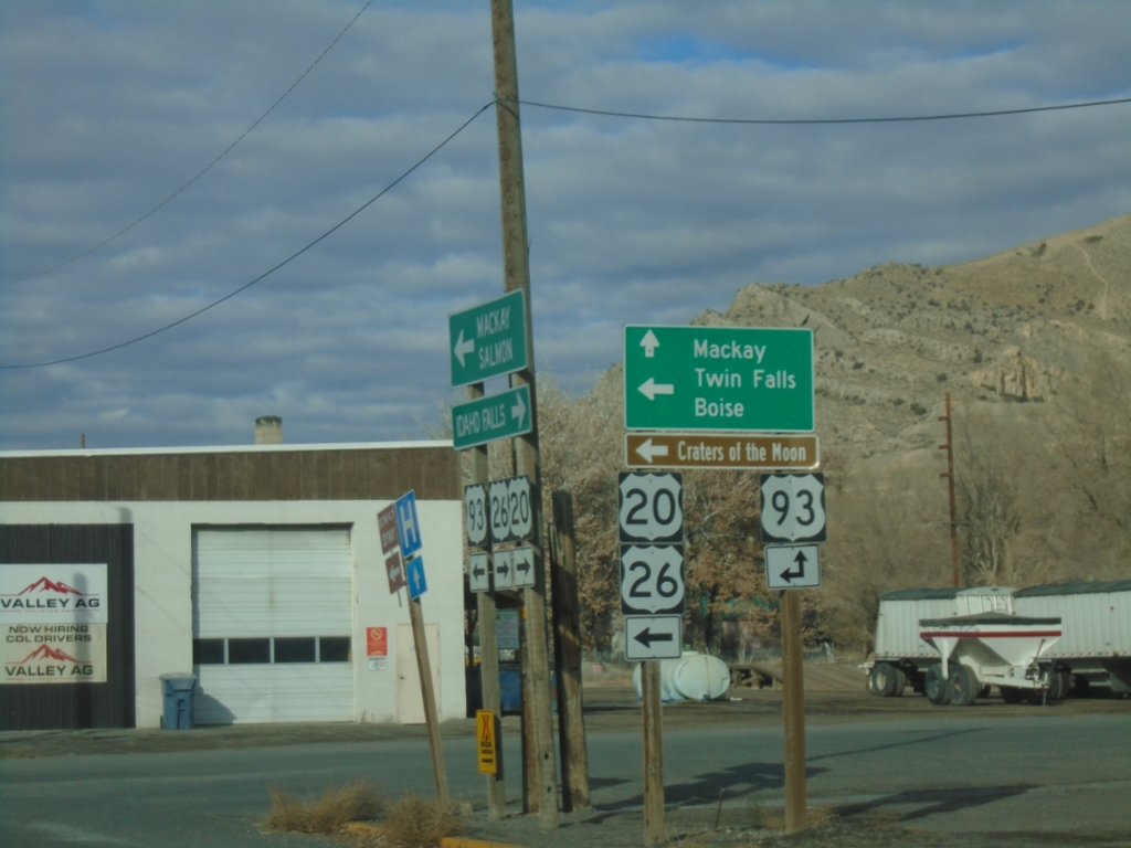
US-20/US-26 West at US-93
US-20/US-26 west at US-93. Use US-93 north for Mackay. Use US-20/US-26 west/US-93 south for Twin Falls, Boise, and Craters of the Moon National Monument.
Taken 12-01-2024


 Arco
Butte County
Idaho
United States
Arco
Butte County
Idaho
United States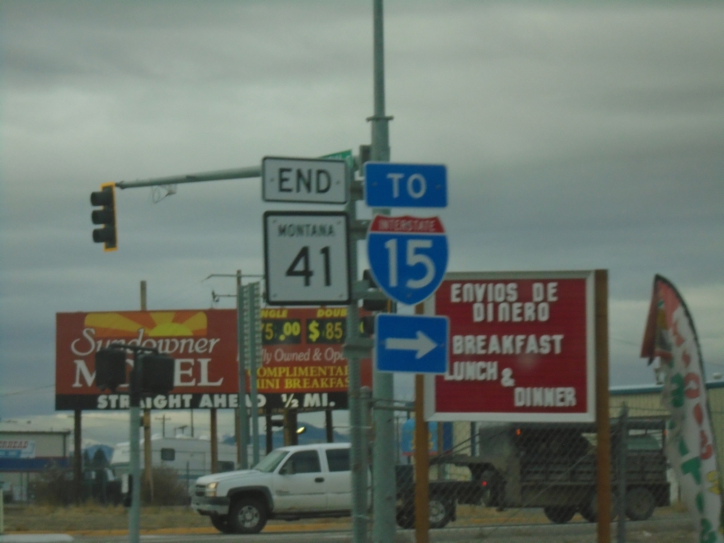
End MT-41 South at BL-15
End MT-41 South at BL-15 - To I-15 in Dillon.
Taken 12-01-2024


 Dillon
Beaverhead County
Montana
United States
Dillon
Beaverhead County
Montana
United States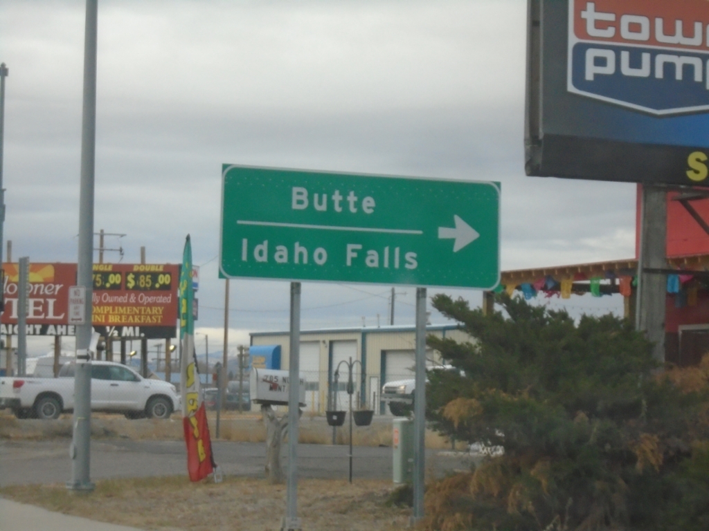
End MT-41 South at BL-15
End MT-41 South at BL-15 in Dillon. Turn right for BL-15 North for access to I-15 to Butte and Idaho Falls (Idaho).
Taken 12-01-2024
Dillon
Beaverhead County
Montana
United States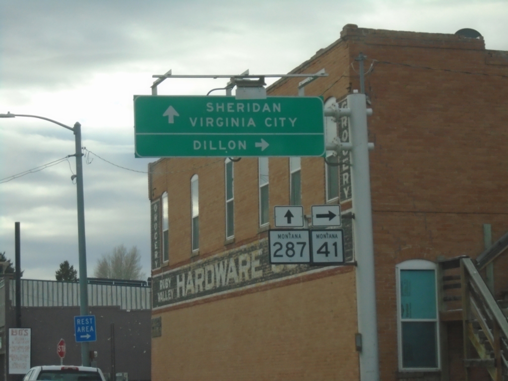
MT-41 South at MT-287
MT-41 South at MT-287 in Twin Bridges. Turn right to continue south on MT-41 to Dillon. Continue straight for MT-287 south to Sheridan and Virginia City.
Taken 12-01-2024
 Twin Bridges
Madison County
Montana
United States
Twin Bridges
Madison County
Montana
United States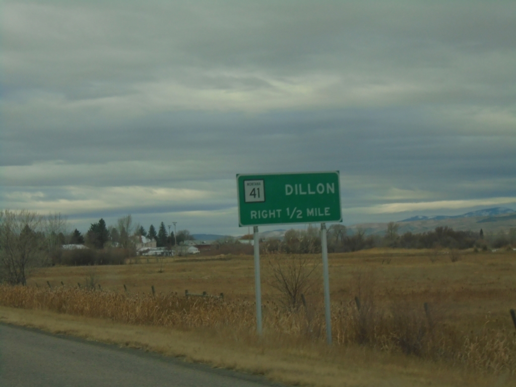
MT-41 South Approaching MT-287
MT-41 South approaching MT-287. Use MT-41 south for Dillon. Drivers will need to turn right in Twin Bridges to continue south on MT-41.
Taken 12-01-2024
Twin Bridges
Madison County
Montana
United States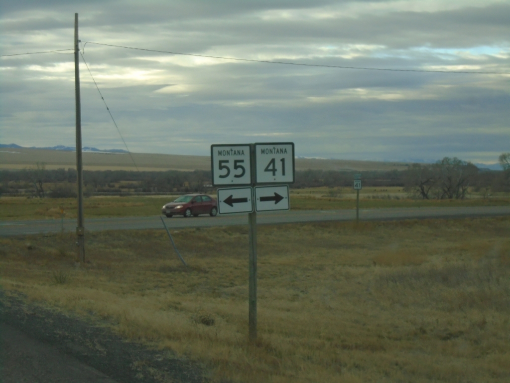
MT-41 South at MT-55
MT-41 South at MT-55 in Jefferson County.
Taken 12-01-2024
 Silver Star
Madison County
Montana
United States
Silver Star
Madison County
Montana
United States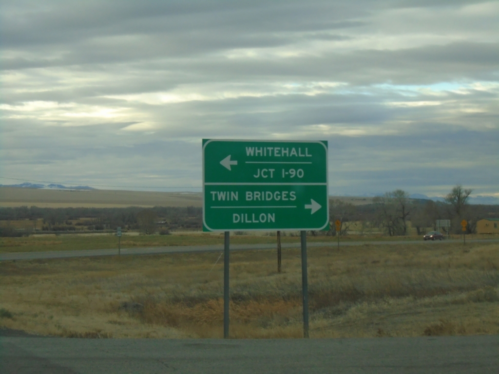
MT-41 South at MT-55
MT-41 South at MT-55 in Madison County. Use MT-55 north to Whitehall and I-90; MT-41 south to Twin Bridges and Dillon.
Taken 12-01-2024
Silver Star
Madison County
Montana
United States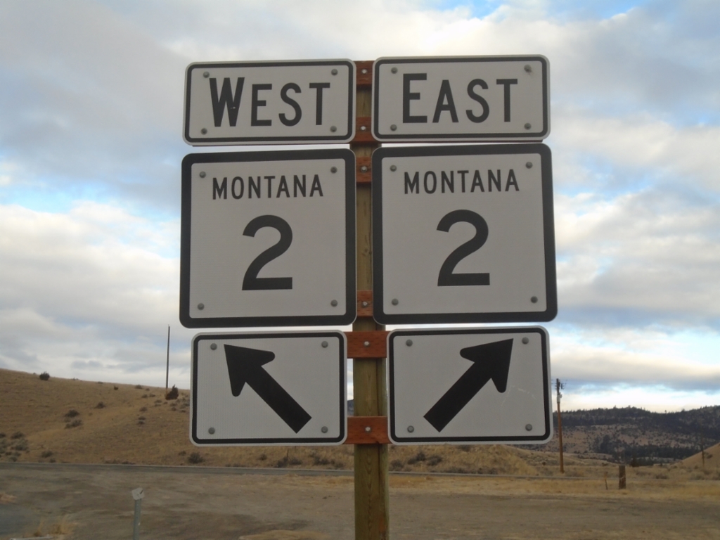
End MT-41 North at MT-2
End MT-41 North at MT-2 in Jefferson County.
Taken 12-01-2024
 Whitehall
Jefferson County
Montana
United States
Whitehall
Jefferson County
Montana
United States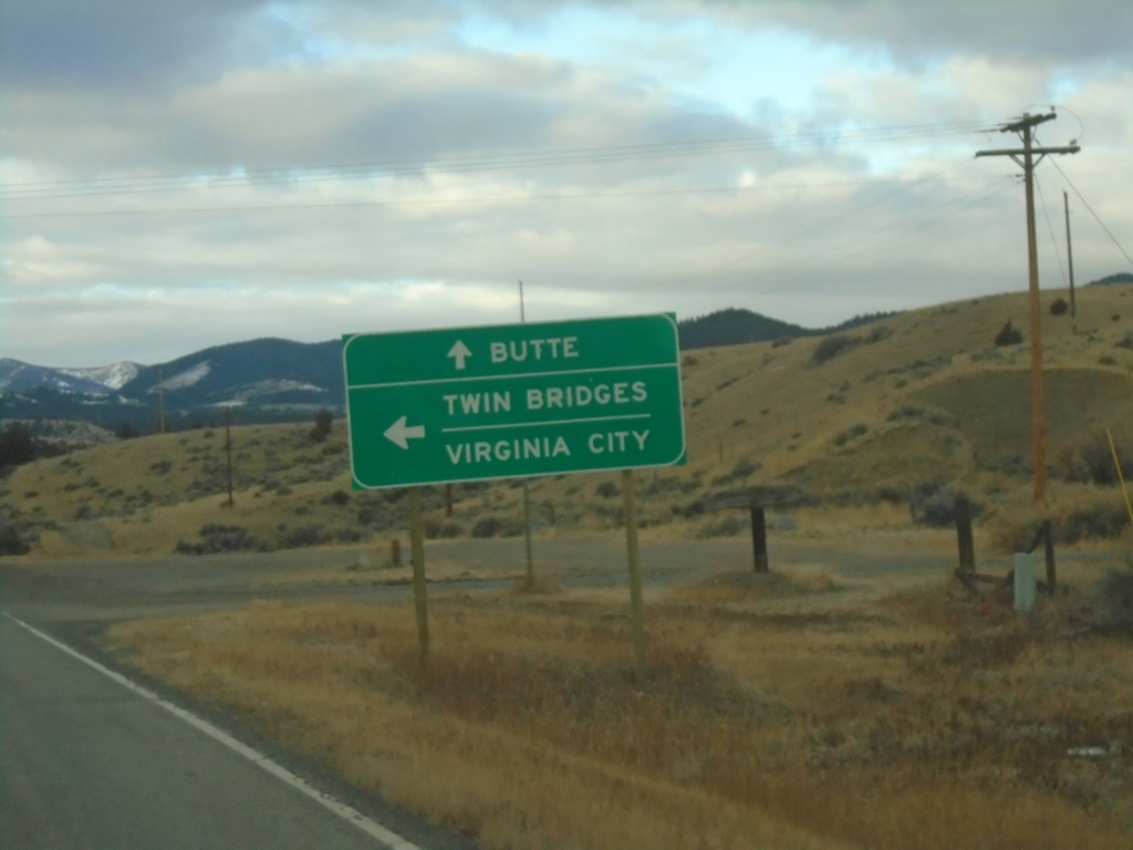
MT-2 West at MT-41 South
MT-2 West at MT-41 South to Twin Bridges and Virginia City. Continue west on MT-2 for Butte.
Taken 12-01-2024
Whitehall
Jefferson County
Montana
United States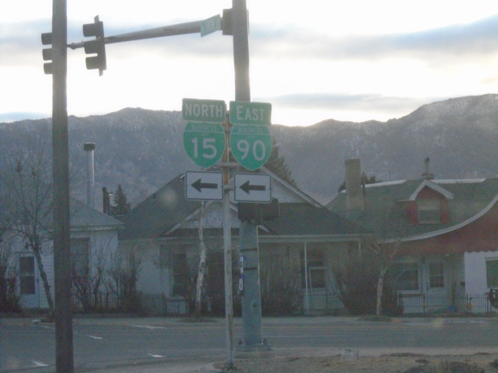
End I-115 North at Montana St.
End I-115 North at Montana St. in Butte. BL-15 North/BL-90 East continue on Montana St. north.
Taken 12-01-2024

 Butte
Silver Bow County
Montana
United States
Butte
Silver Bow County
Montana
United States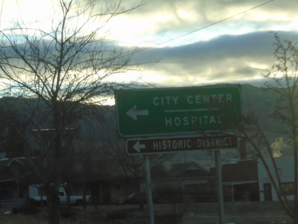
End I-115 North at Montana St.
End I-115 North at Montana St. in Butte. Turn left on Montana St. to continue on BL-15 North/BL-90 East to (Butte) City Center/Hospital.
Taken 12-01-2024
Butte
Silver Bow County
Montana
United States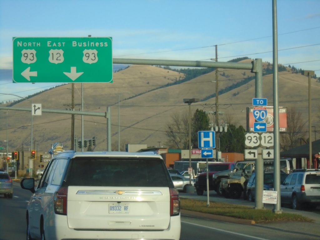
US-12 East/US-93 North at US-12/US-93 Split
US-12 East/US-93 North (Brooks St.) at Reserve St. Use Reserve St. north for US-93 North and I-90 access; continue on Brooks St. for US-12 East/Bus. US-93 North.
Taken 11-30-2024


 Missoula
 County
Montana
United States
Missoula
Missoula County
Montana
United States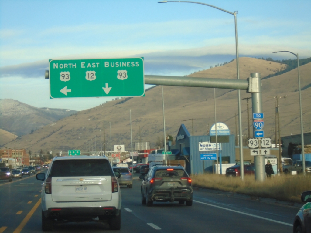
US-93 North/US-12 East at US-12/US-93 Spilt
US-93 North/US-12 East (Brooks St.) at Reserve St. Use Reserve St. north for US-93 North and for I-90. Continue on Brooks St. for US-12 East and Bus. US-93 North.
Taken 11-30-2024
Missoula
Missoula County
Montana
United States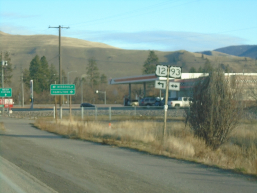
US-12 East at US-93 in Lolo
US-12 East at US-93 in Lolo. Use US-93 South to Hamilton; US-12 East/US-93 North to Missoula. US-93 North joins US-12 East to Missoula.
Taken 11-30-2024
Lolo
Missoula County
Montana
United States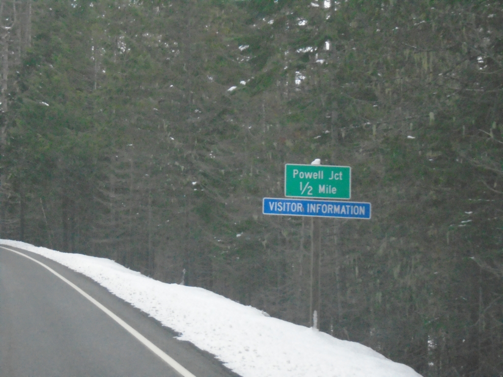
US-12 East Approaching Powell Junction
US-12 East approaching Powell Junction.
Taken 11-30-2024
Powell Junction
Idaho County
Idaho
United States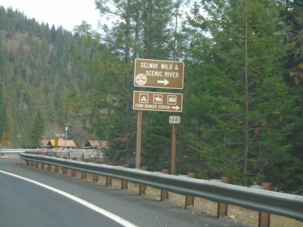
US-12 East - Selway Road Junction
US-12 East at Selway Road (FS 223) Junction to Selway Wild and Scenic River.
Taken 11-30-2024
Kooskia
Idaho County
Idaho
United States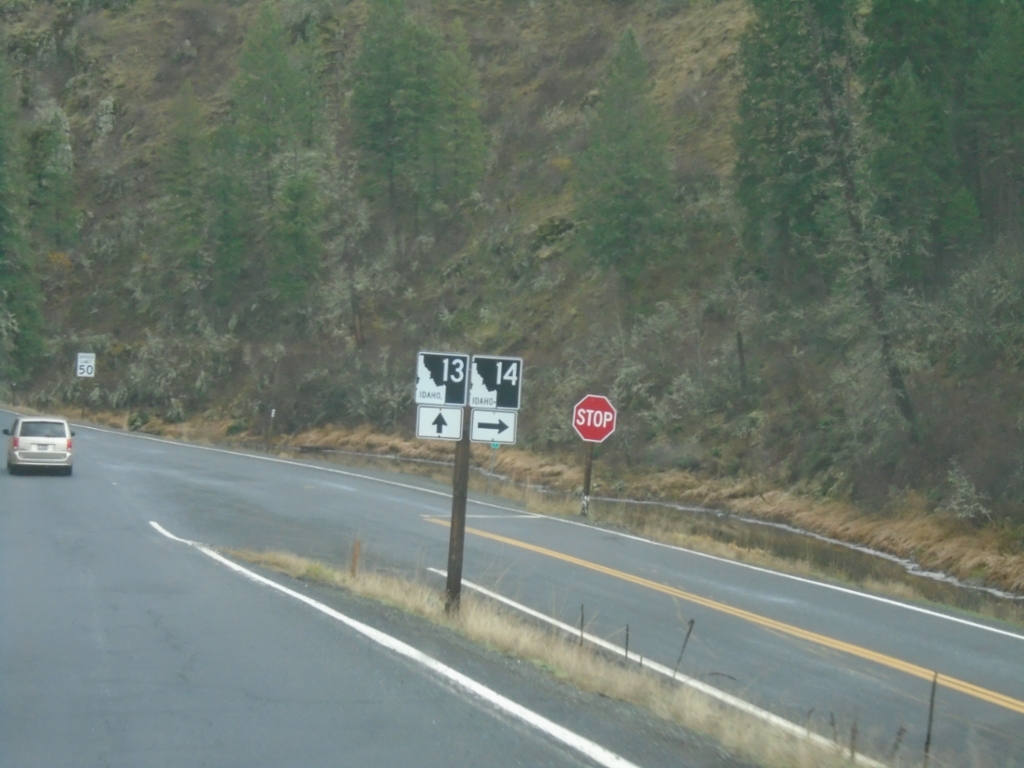
ID-13 North at ID-14
ID-13 North at ID-14 in Idaho County.
Taken 11-30-2024

 Harpster
Idaho County
Idaho
United States
Harpster
Idaho County
Idaho
United States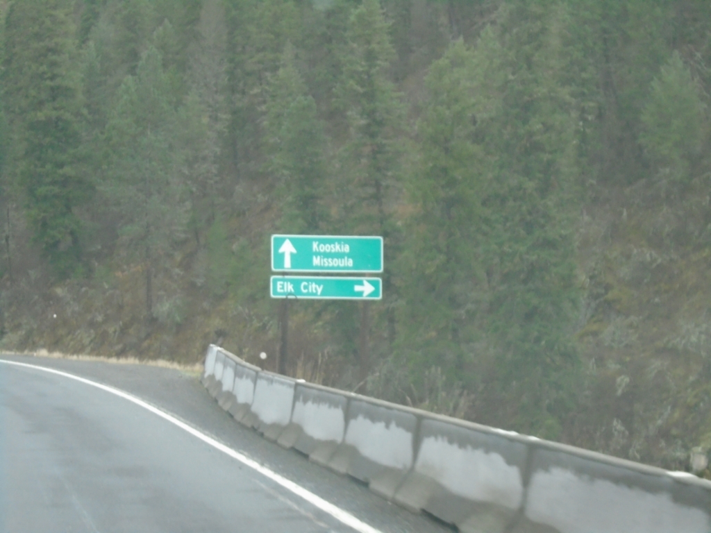
ID-13 North at ID-14
ID-13 North at ID-14 to Elk City. Continue north on ID-13 to Kooskia and Missoula (Montana).
Taken 11-30-2024
Grangeville
Idaho County
Idaho
United States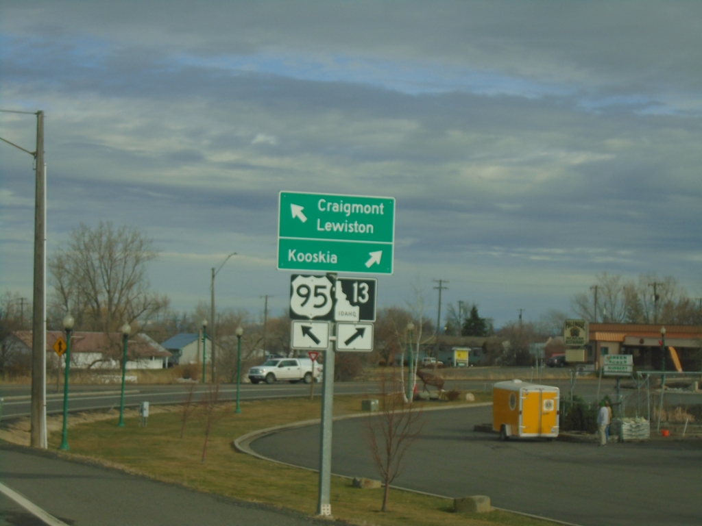
US-95 North at ID-13
US-95 North at ID-13 in Grangeville. Use ID-13 to Kooskia; continue north on US-95 to Craigmont and Lewiston.
Taken 11-30-2024
 Grangeville
Idaho County
Idaho
United States
Grangeville
Idaho County
Idaho
United States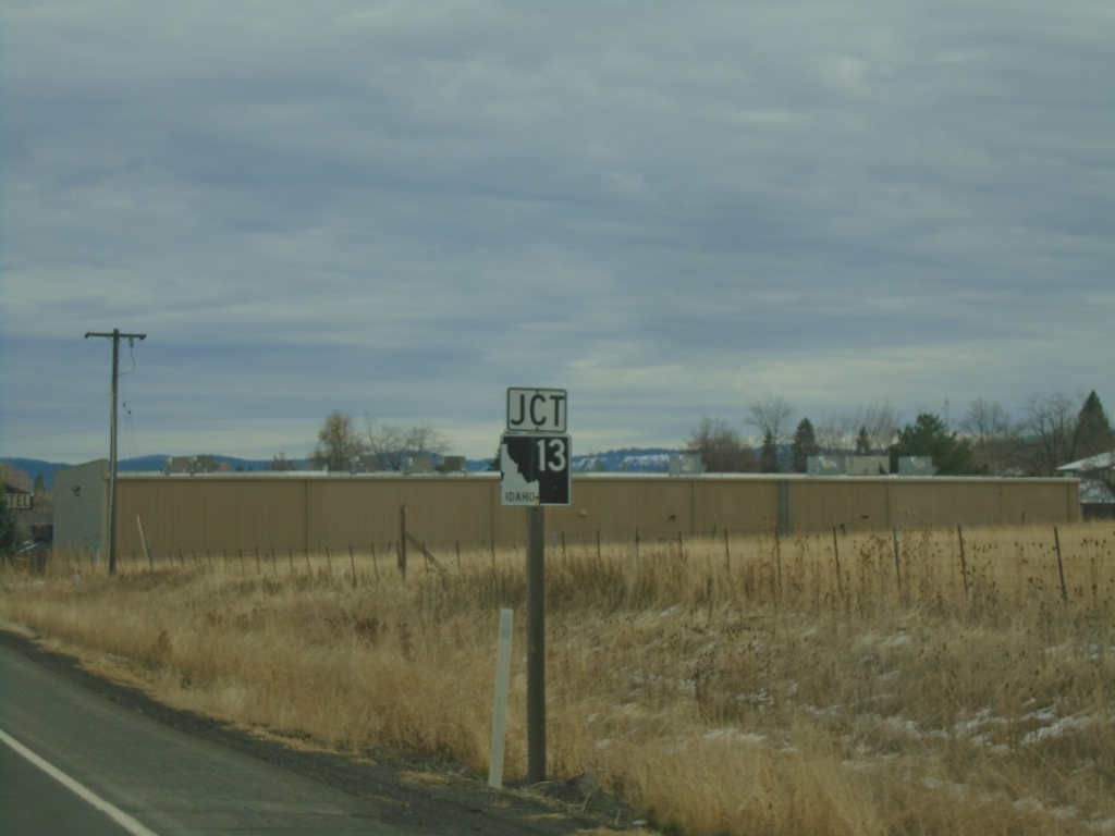
US-95 North Approaching ID-13
US-95 North approaching ID-13 in Grangeville.
Taken 11-30-2024
Grangeville
Idaho County
Idaho
United States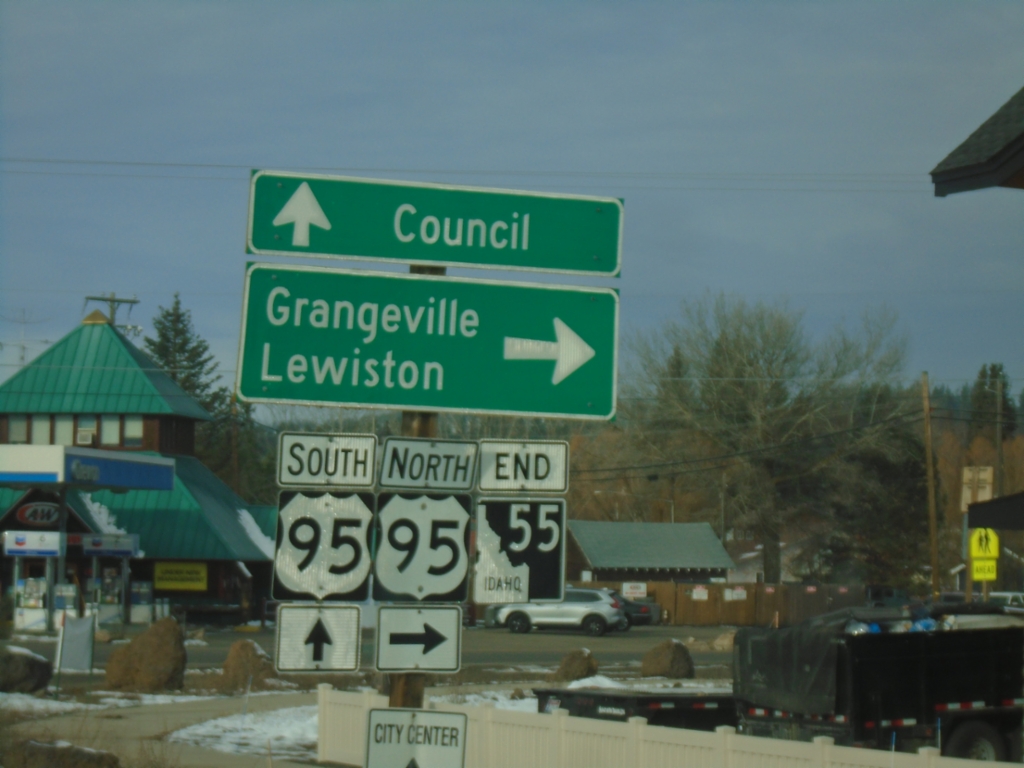
End ID-55 North at US-95
End ID-55 at US-95 south to Council, and north to Grangeville and Lewiston.
Taken 11-30-2024
 New Meadows
Adams County
Idaho
United States
New Meadows
Adams County
Idaho
United States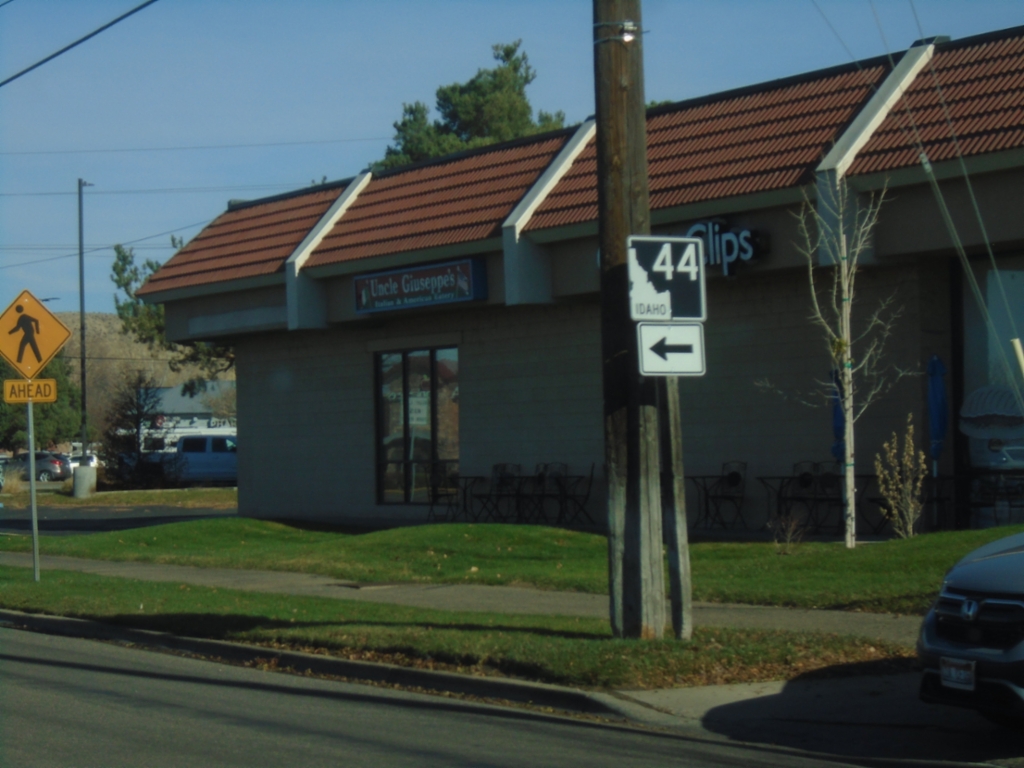
ID-44 West - Glenwood St. at State St.
ID-44 West - Glenwood St. at State Street in Garden City . Turn left on State St. to continue west on ID-44.
Taken 11-29-2024
 Garden City
Ada County
Idaho
United States
Garden City
Ada County
Idaho
United States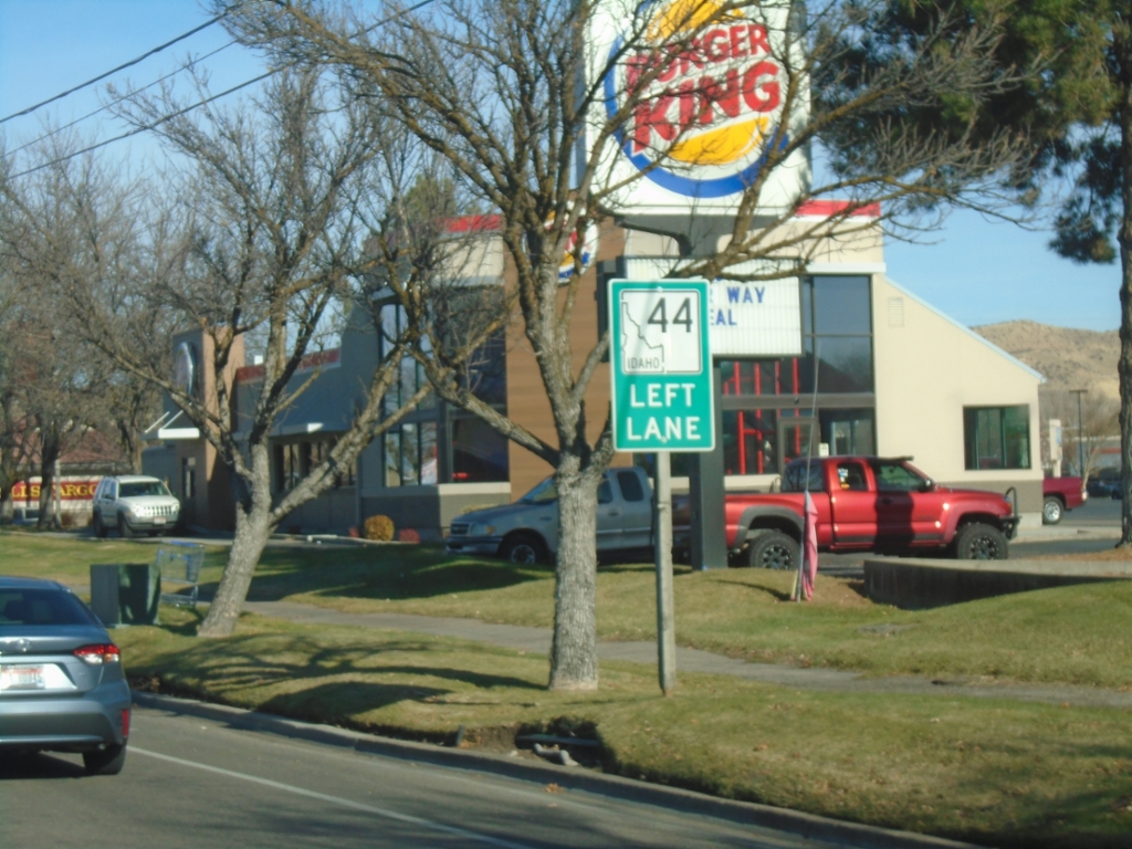
ID-44 West Approaching State St.
ID-44 West (Glenwood St.) approaching State St. Use left lanes to continue west on ID-44.
Taken 11-29-2024
Garden City
Ada County
Idaho
United States