Signs Tagged With Intersection
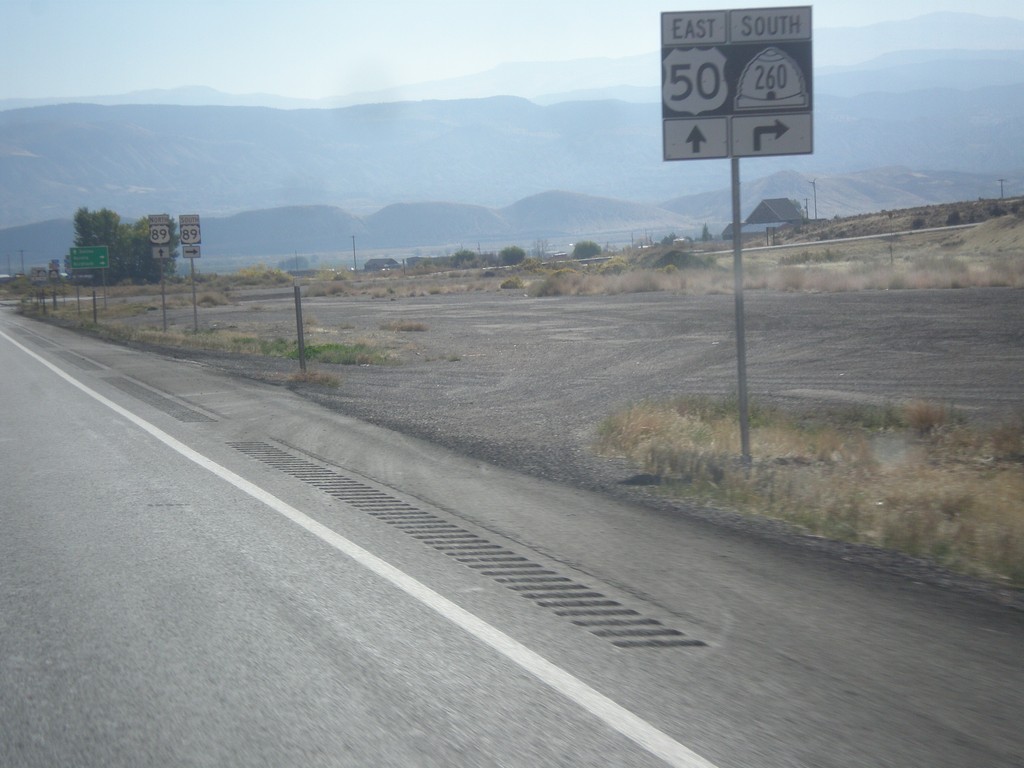
US-50 East Approaching UT-260
US-50 east approaching UT-260 south.
Taken 10-07-2012

 Aurora
Sevier County
Utah
United States
Aurora
Sevier County
Utah
United States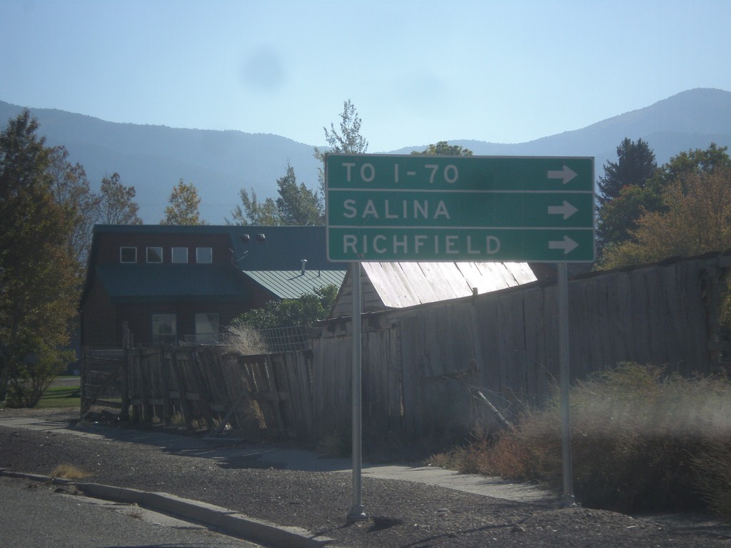
US-50 East in Scipio
US-50 east in Scipio. To continue on US-50 traffic turns right on State St. Turn right for I-70, Salina, and Richfield. US-50 provides shorter access for southbound I-15 traffic to I-70, then continuing on I-15 to I-70 jct.
Taken 10-07-2012
Scipio
Millard County
Utah
United States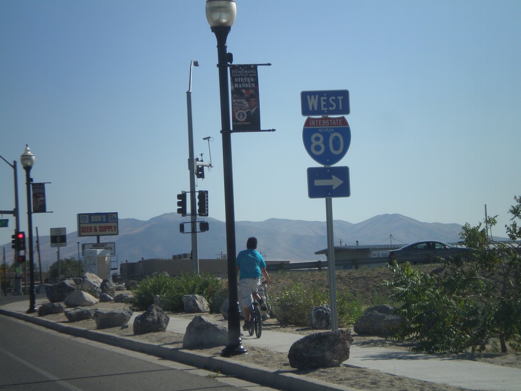
NV-294 South at NV-787
NV-294 South at NV-787 (Hanson St.) NV-787 is not signed at this intersection, and is instead signed as to I-80 (via Winnemucca Blvd.).
Taken 07-28-2012


 Winnemucca
Humboldt County
Nevada
United States
Winnemucca
Humboldt County
Nevada
United States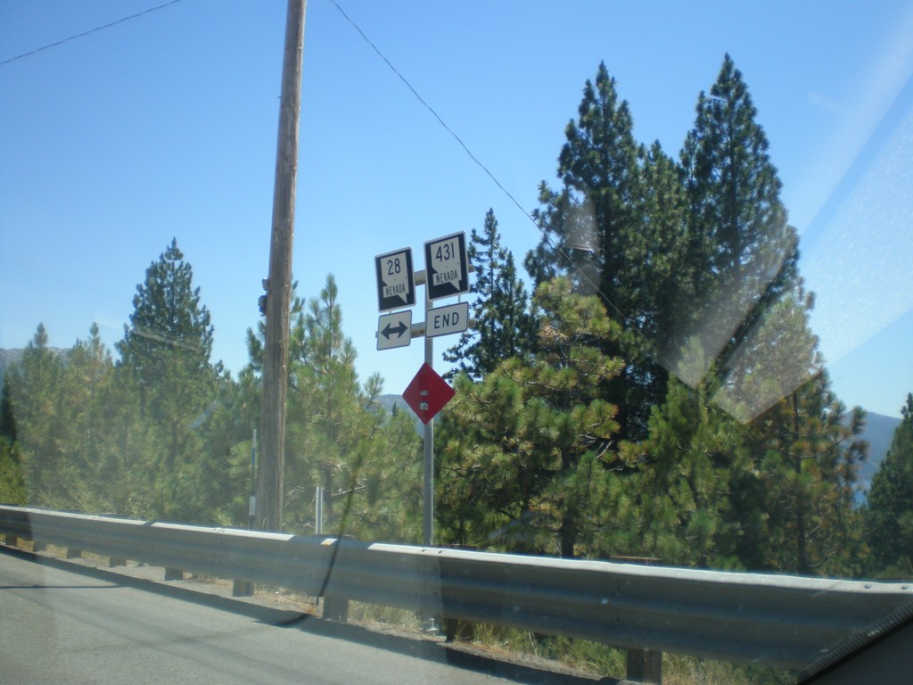
End NV-431 West at NV-28
End NV-431 West at NV-28 in Incline Village.
Taken 07-28-2012

 Incline Village
Washoe County
Nevada
United States
Incline Village
Washoe County
Nevada
United States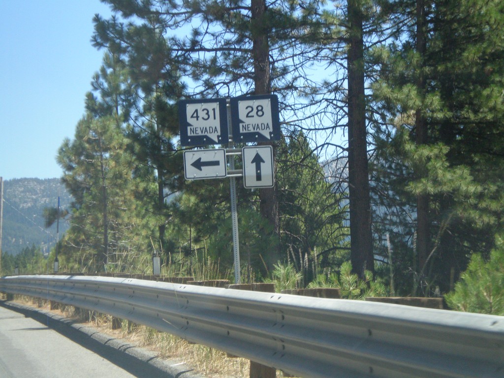
NV-28 East at NV-431
NV-28 east at NV-431 in Incline Village.
Taken 07-28-2012
Incline Village
Washoe County
Nevada
United States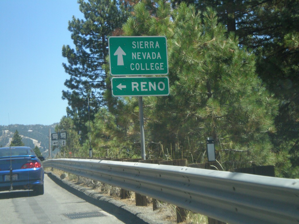
NV-28 East Approaching NV-431
NV-28 east approaching NV-431. Use NV-431 for Reno (the Mount Rose Highway); continue east on NV-28 for Sierra Nevada College.
Taken 07-28-2012
Incline Village
Washoe County
Nevada
United States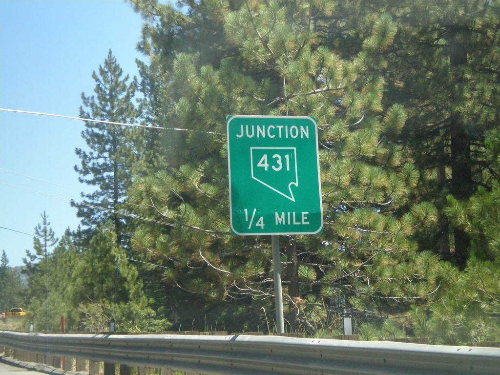
NV-28 East Approaching NV-431
NV-28 east approaching NV-431 (Mount Rose Highway).
Taken 07-28-2012
Incline Village
Washoe County
Nevada
United States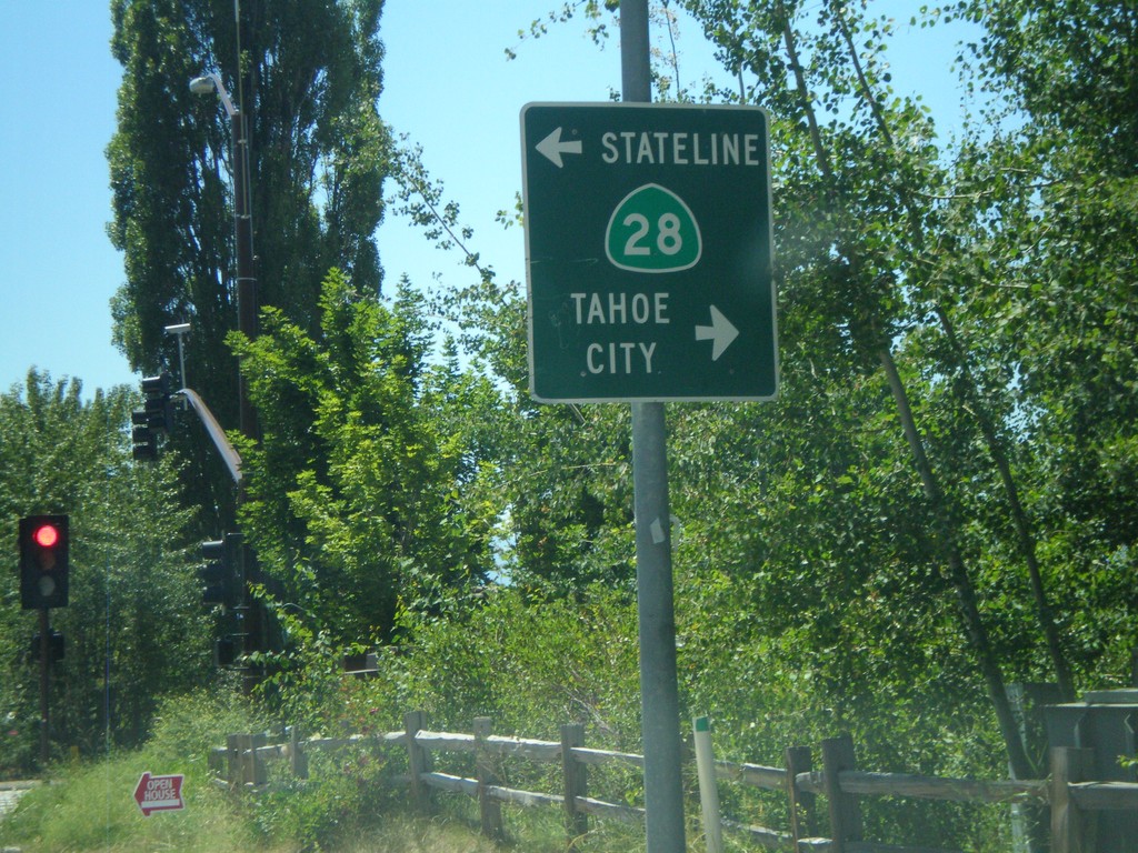
End CA-267 South at CA-28
End CA-267 south at CA-28 in Kings Beach. Turn right for CA-28 west to Tahoe City; turn left for CA-28 east to Stateline.
Taken 07-28-2012

 Kings Beach
Placer County
California
United States
Kings Beach
Placer County
California
United States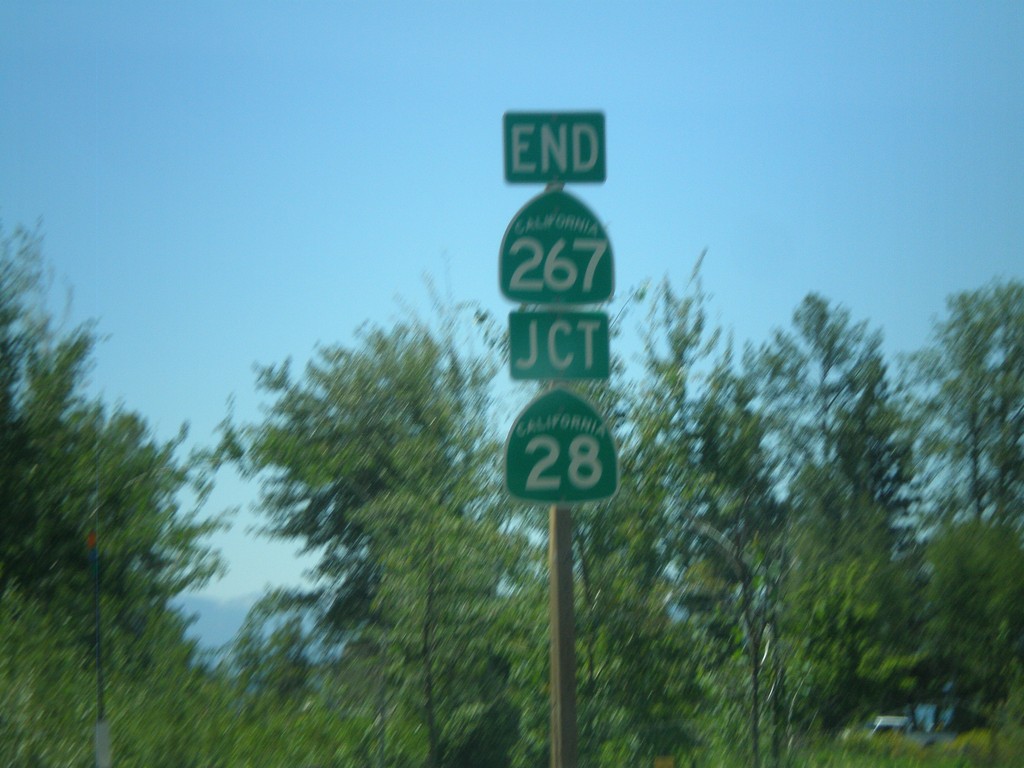
End CA-267 South at CA-28
End CA-267 south at CA-28 in Kings Beach.
Taken 07-28-2012
Kings Beach
Placer County
California
United States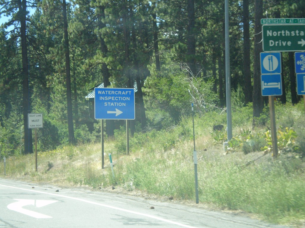
CA-267 South at Northstar Road
CA-267 South at Northstar Road. Turn right for Northstar-At-Tahoe Ski Area and for (Lake Tahoe) Watercraft Inspection. All watercraft launching in Lake Tahoe need to be inspected prior to launching.
Taken 07-28-2012
Truckee
Placer County
California
United States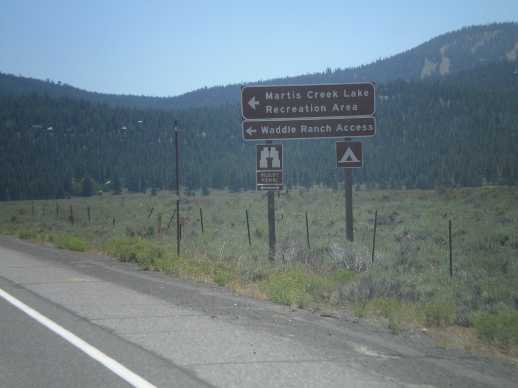
CA-267 South at Martis Creek Lake Jct.
CA-267 south at Martis Creek Lake Jct. Turn left for Martis Creek Lake Recreation Area, and Waddle Ranch Access. The ski slopes of Northstar-At-Tahoe are visible on the upper right side of the picture.
Taken 07-28-2012
Truckee
Placer County
California
United States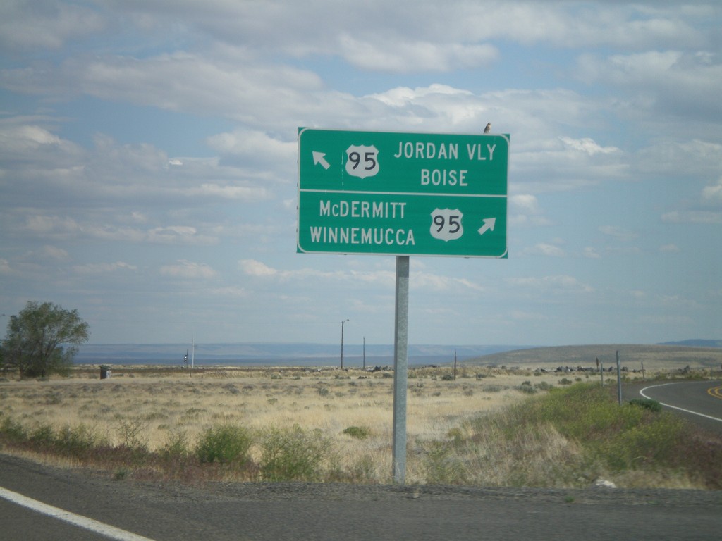
End OR-78 East at US-95
End OR-78 east at US-95. Turn right for US-95 south to McDermitt and Winnemucca (Nevada). Merge left for US-95 north to Jordan Valley and Boise (Idaho).
Taken 05-28-2012

 Jordan Valley
Malheur County
Oregon
United States
Jordan Valley
Malheur County
Oregon
United States
End OR-78 East at US-95
End OR-78 east at US-95. Continue straight for US-95 south; merge left for US-95 north.
Taken 05-28-2012
Jordan Valley
Malheur County
Oregon
United States
OR-78 East Approaching US-95
OR-78 East approaching US-95. This is the eastern end of OR-78.
Taken 05-28-2012
Jordan Valley
Malheur County
Oregon
United States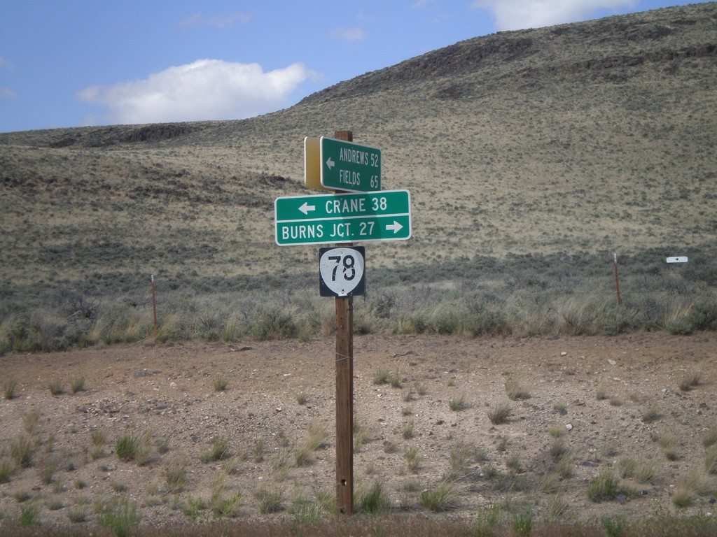
End Eastside Steens Mountain Road at OR-78
End Eastside Steens Mountain Road at OR-78. Turn right on OR-78 for Burns Junction; turn left on OR-78 for Crane. The eastside Steens Mountain road follows the east side of Steens Mountain south to Andrews, Fields, and eventually into Denio, Nevada.
Taken 05-28-2012
Jordan Valley
Malheur County
Oregon
United States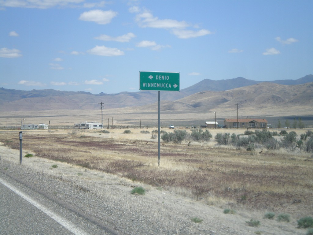
NV-140 East at NV-292 - Denio Junction
NV-140 east at NV-292 in Denio Junction. Turn left on NV-292 north for Denio. Turn right to continue east on NV-140 for Winnemucca.
Taken 05-28-2012

 Denio
Humboldt County
Nevada
United States
Denio
Humboldt County
Nevada
United States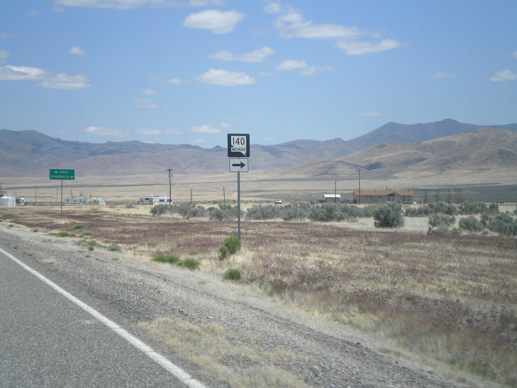
NV-140 East at NV-292 - Denio Junction
NV-140 east at NV-292. Turn right to continue east on NV-140.
Taken 05-28-2012
Denio
Humboldt County
Nevada
United States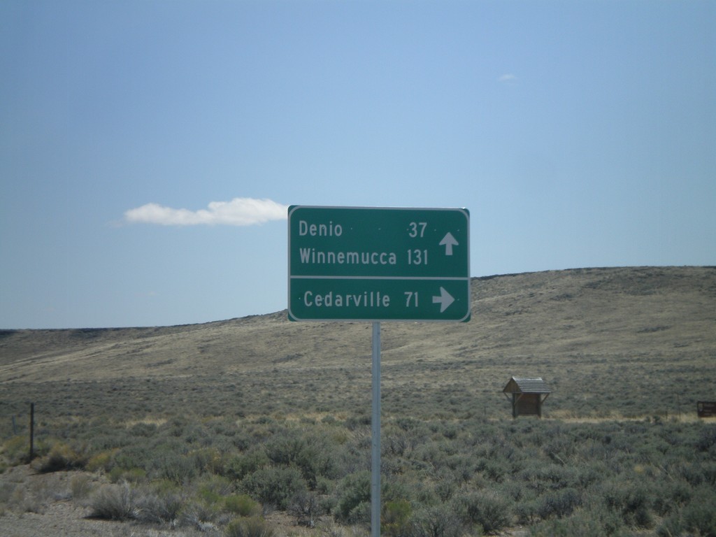
NV-140 East - Sheldon National Wildlife Refuge Jct.
NV-140 east at junction to Sheldon National Wildlife Refuge and Cedarville (California). Continue east on NV-140 for Denio and Winnemucca.
Taken 05-28-2012
Humboldt County
Nevada
United States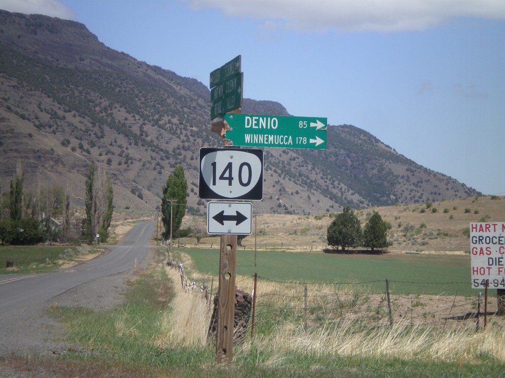
Twentymile Road North at OR-140
Twentymile Road north at OR-140 in Adel. Turn right on OR-140 for Denio and Winnemucca (both in Nevada). Westbound destinations on fingerboard are broken off.
Taken 05-28-2012
 Adel
Lake County
Oregon
United States
Adel
Lake County
Oregon
United States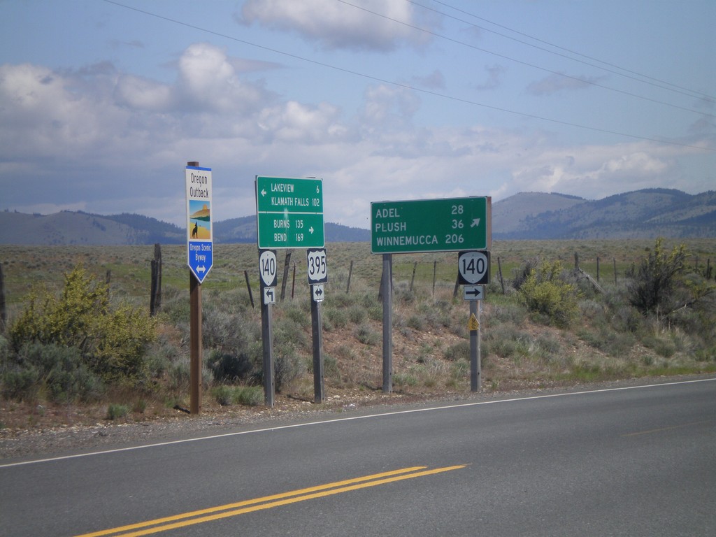
US-395 North/OR-140 East at Split
US-395 North/OR-140 East at US-395/OR-140 split. Turn right for OR-140 east to Adel, Plush, and Winnemucca (Nevada). Continue north on US-395 for Burns and Bend. US-395 is part of the Oregon Outback Scenic Byway.
Taken 05-28-2012
 Lakeview
Lake County
Oregon
United States
Lakeview
Lake County
Oregon
United States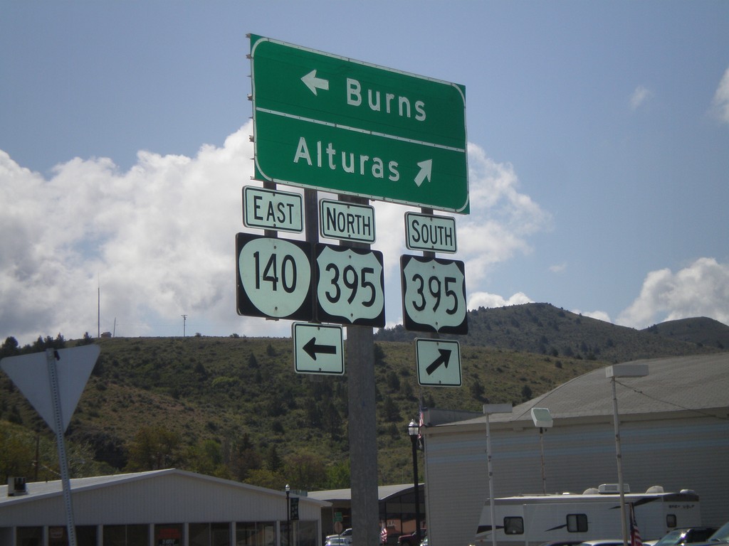
OR-140 East at US-395
OR-140 east at US-395 junction. Turn right for US-395 south to Alturas (California). Turn left for US-395 North/OR-140 east to Burns. OR-140 east joins US-395 north through Lakeview.
Taken 05-28-2012
Lakeview
Lake County
Oregon
United States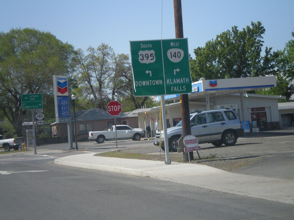
US-395 South/OR-140 West Approaching Split
US-395 South/OR-140 West approaching US-395/OR-140 split. Turn right for OR-140 west to Klamath Falls. Turn left for US-395 to Downtown (Lakeview).
Taken 05-28-2012
Lakeview
Lake County
Oregon
United States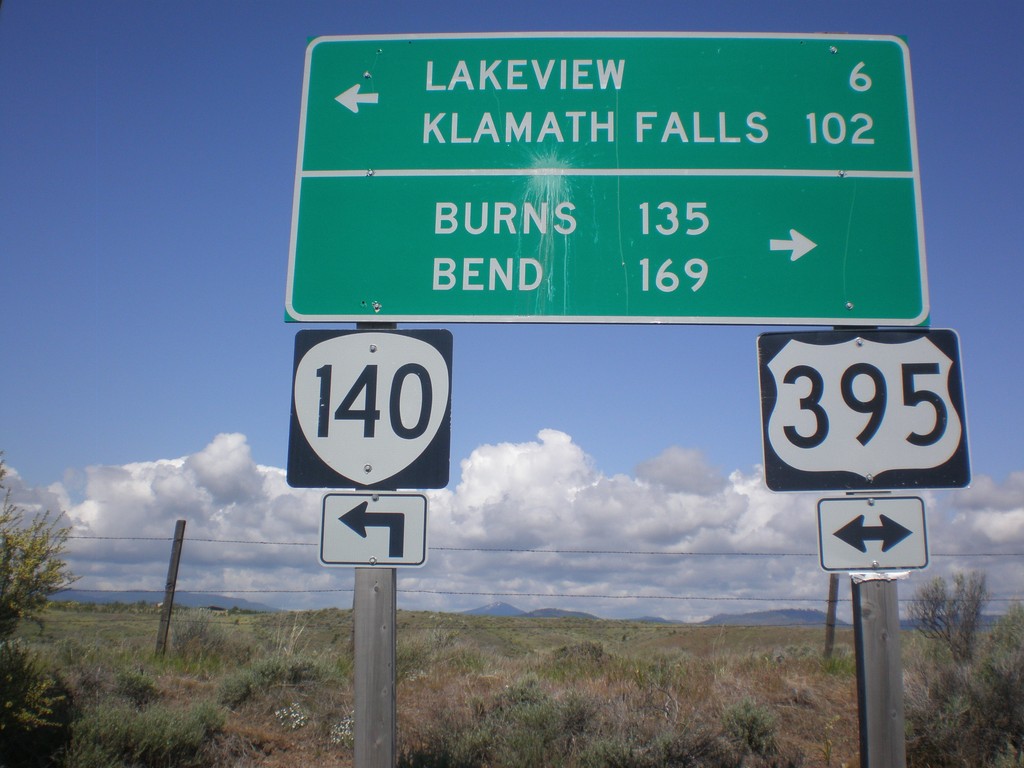
OR-140 West at US-395
OR-140 west at US-395. OR-140 west joins US-395 south into Lakeview. Use US-395 north for Burns and Bend. Use US-395 South/OR-140 West for Lakeview and Klamath Falls.
Taken 05-28-2012
Lakeview
Lake County
Oregon
United States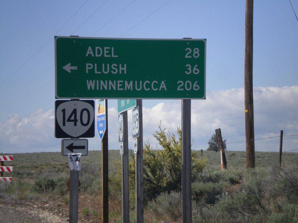
US-395 South OR-140
US-395 South at OR-140. Use OR-140 east for Adel, Plush, and Winnemucca (Nevada). OR-140 west joins US-395 into Lakeview.
Taken 05-28-2012
Lakeview
Lake County
Oregon
United States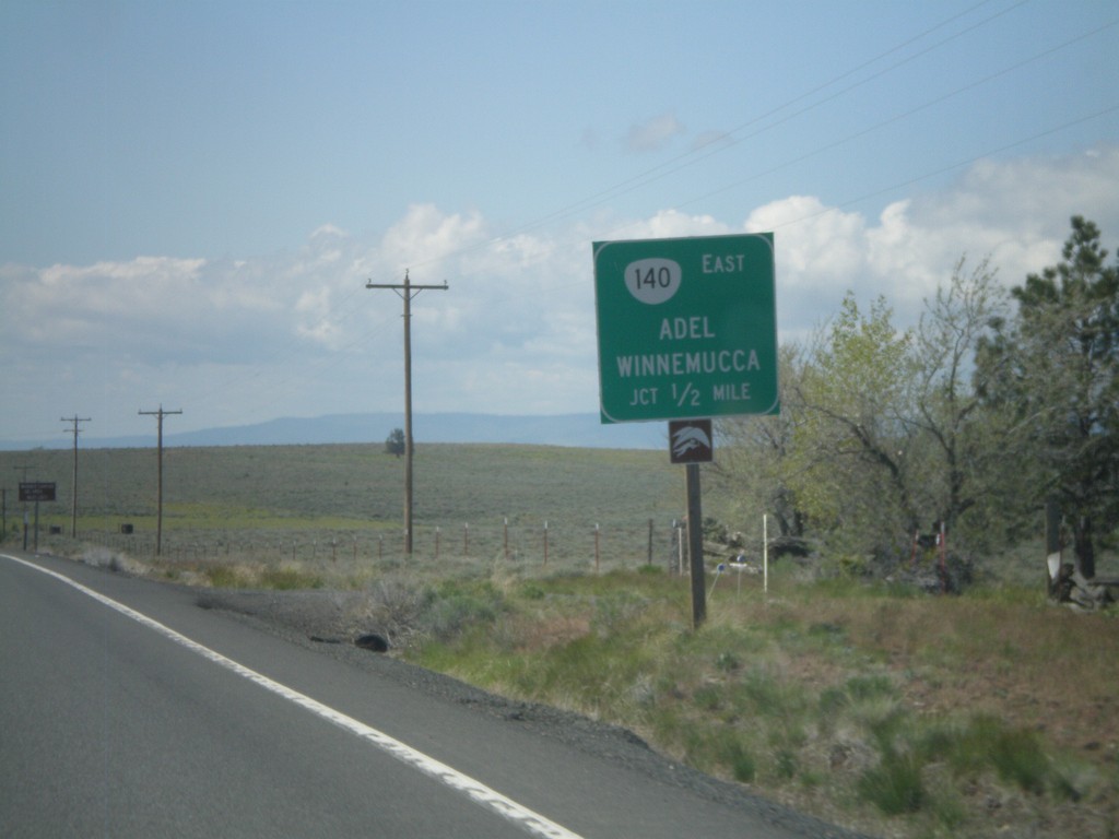
US-395 South Approaching OR-140
US-395 south approaching OR-140 east to Adel and Winnemucca (Nevada).
Taken 05-28-2012
Lakeview
Lake County
Oregon
United States