Signs Tagged With Intersection
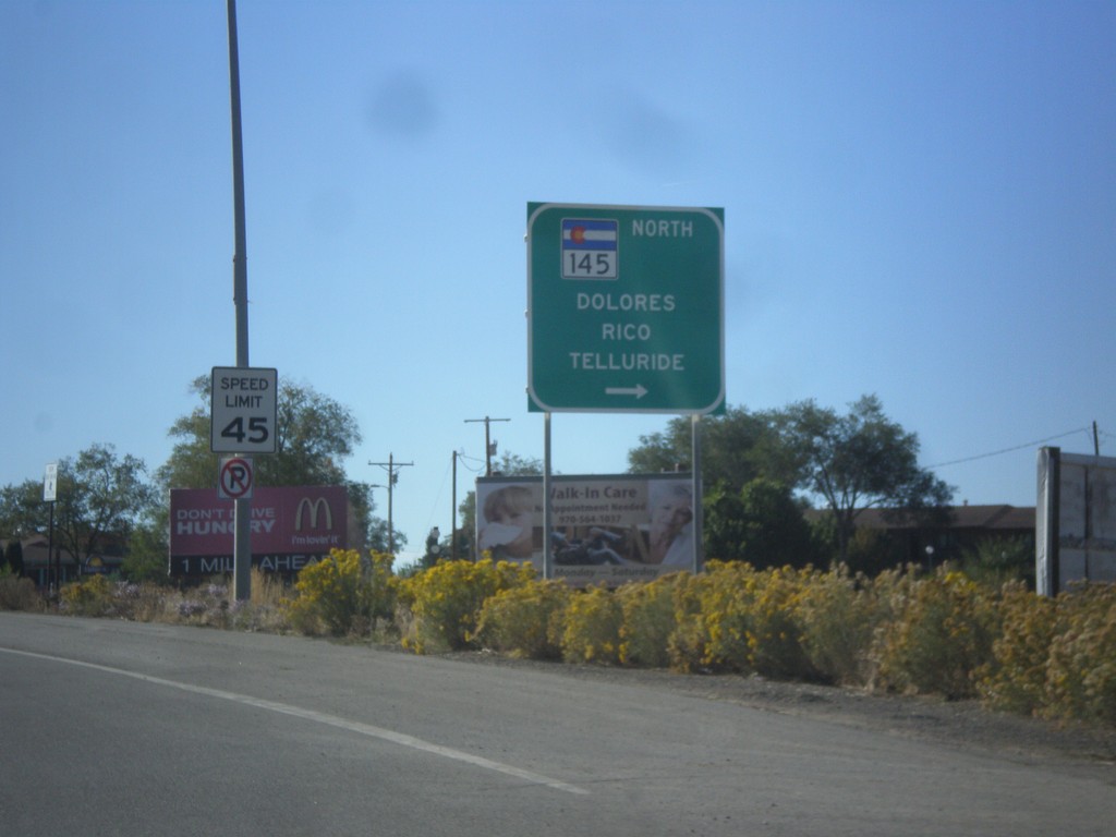
US-160 West at CO-145
US-160 west at CO-145 North to Dolores, Rico, and Telluride.
Taken 10-15-2012

 Cortez
Montezuma County
Colorado
United States
Cortez
Montezuma County
Colorado
United States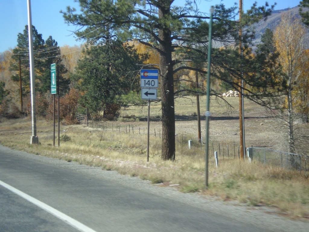
US-160 West at CO-140
US-160 west at CO-140 near Hesperus.
Taken 10-15-2012
 Hesperus
La Plata County
Colorado
United States
Hesperus
La Plata County
Colorado
United States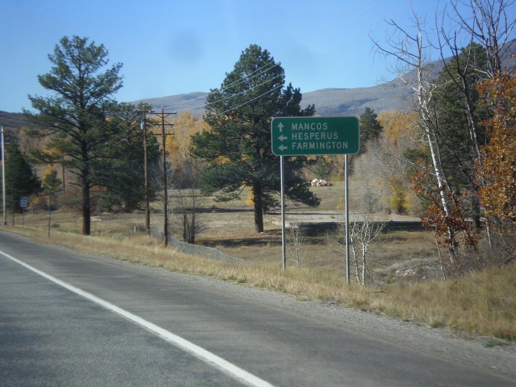
US-160 West Approaching CO-140
US-160 west approaching CO-140 south to Hesperus and Farmington (New Mexico). Continue west on US-160 for Mancos.
Taken 10-15-2012
Durango
La Plata County
Colorado
United States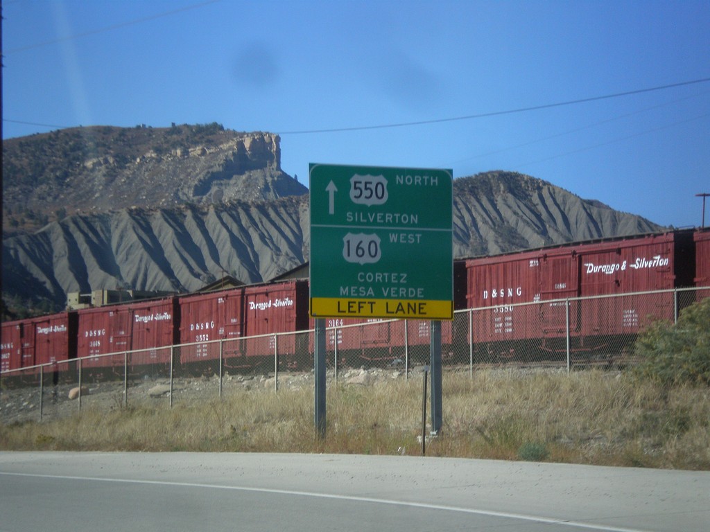
US-550 North/US-160 West at Split
US-550 North/US-160 West at US-550/US-160 split in Durango. Continue straight for US-550 north to Silverton. Turn left for US-160 west to Cortez and Mesa Verde (National Park).
Taken 10-15-2012
 Durango
La Plata County
Colorado
United States
Durango
La Plata County
Colorado
United States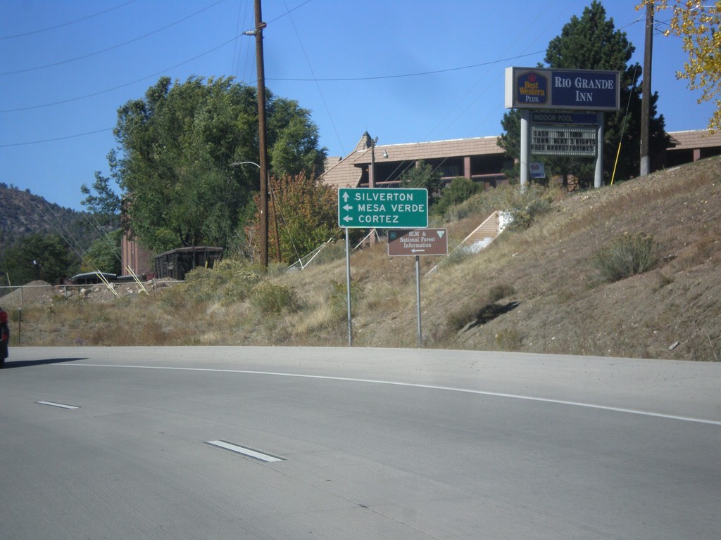
US-550 North/US-160 West Approaching US-160/US-550 Split
US-550 North/US-160 west approaching US-160/US-550 split. Continue north on US-550 for Silverton. Turn left on US-160 west for Cortez and Mesa Verde (National Park).
Taken 10-15-2012
Durango
La Plata County
Colorado
United States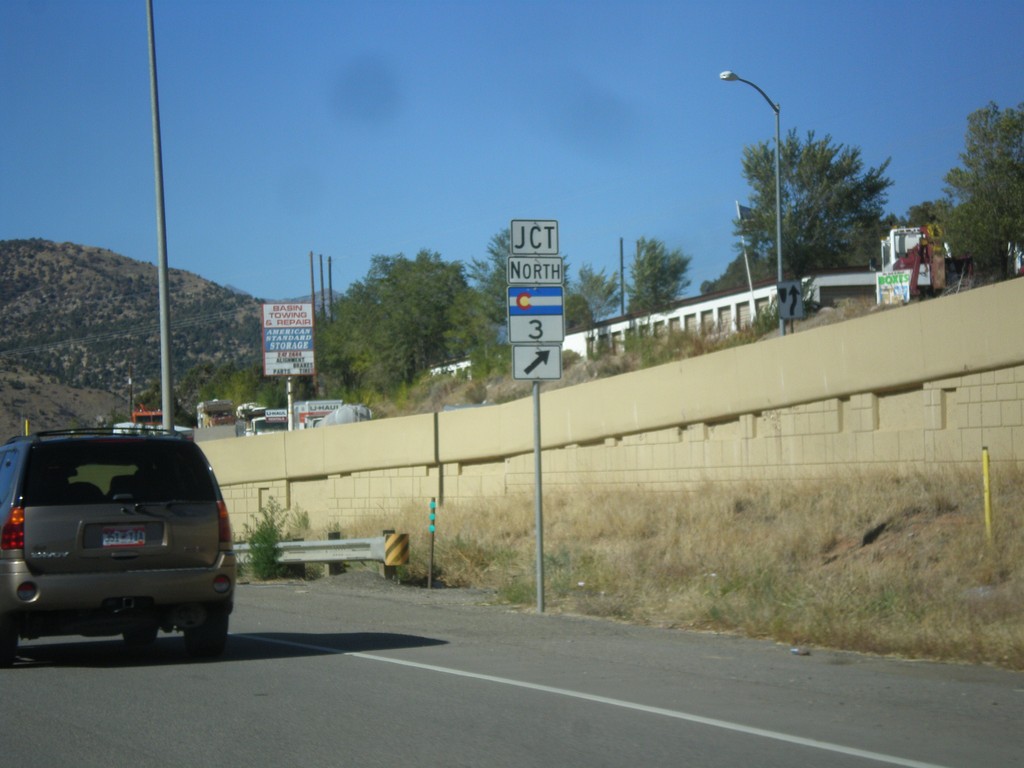
US-550 North/US-160 West at CO-3
US-550 North/US-160 West at CO-3 in Durango.
Taken 10-15-2012
 Durango
La Plata County
Colorado
United States
Durango
La Plata County
Colorado
United States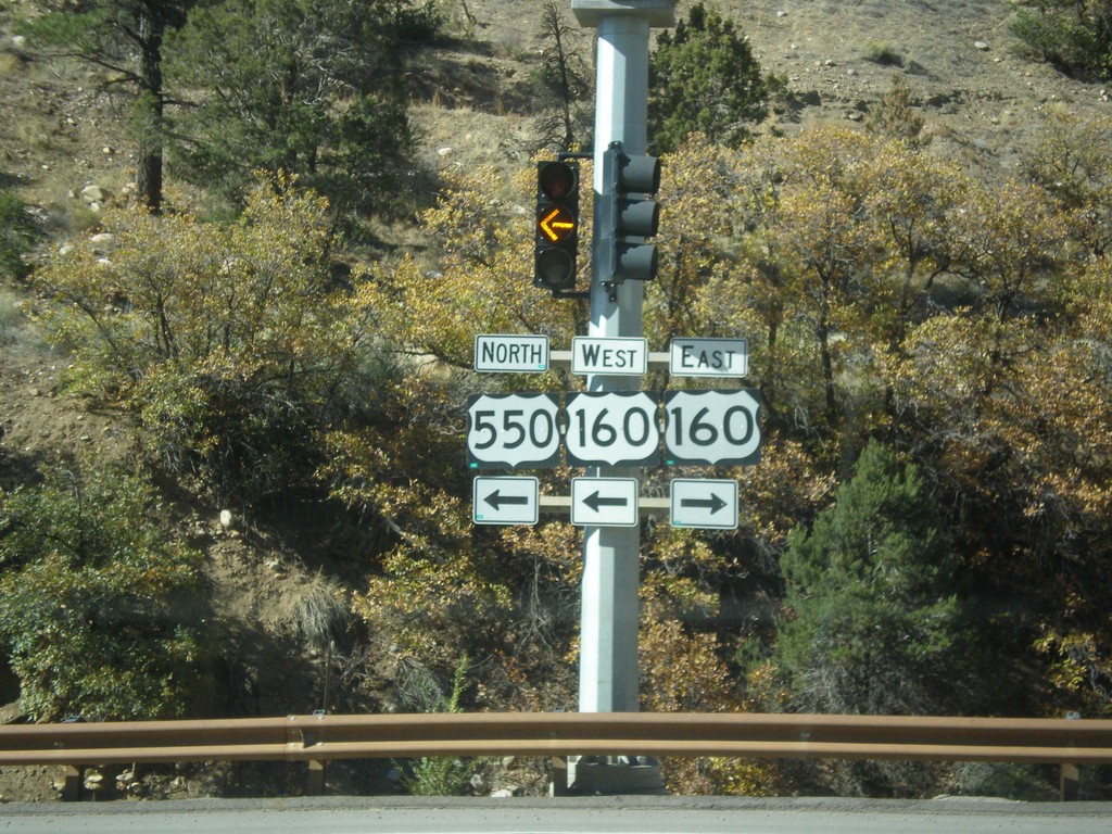
US-550 North at US-160
US-550 north at US-160. US-550 north joins US-160 west through Durango.
Taken 10-15-2012
Durango
La Plata County
Colorado
United States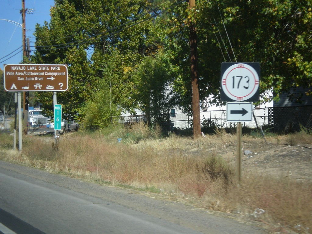
US-550 North at NM-173
US-550 north at NM-173 west to Navajo Lake State Park.
Taken 10-15-2012
 Aztec
San Juan County
New Mexico
United States
Aztec
San Juan County
New Mexico
United States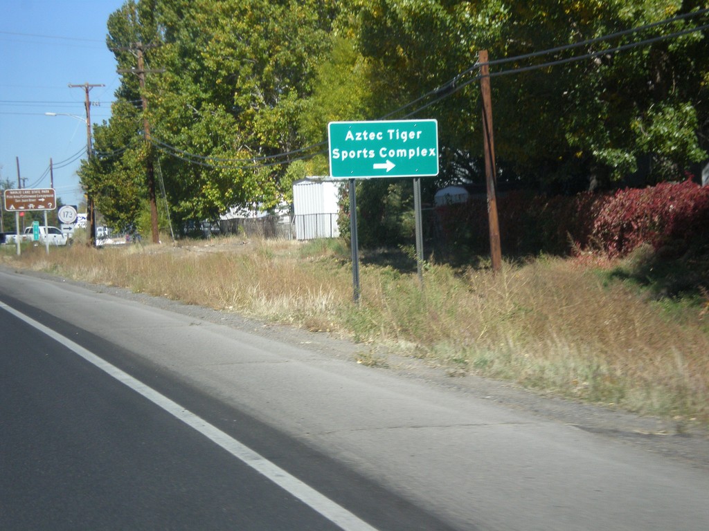
US-550 North Approaching NM-173
US-550 north approaching NM-173. Turn right on NM-173 for the Aztec Tiger Sports Complex.
Taken 10-15-2012
Aztec
San Juan County
New Mexico
United States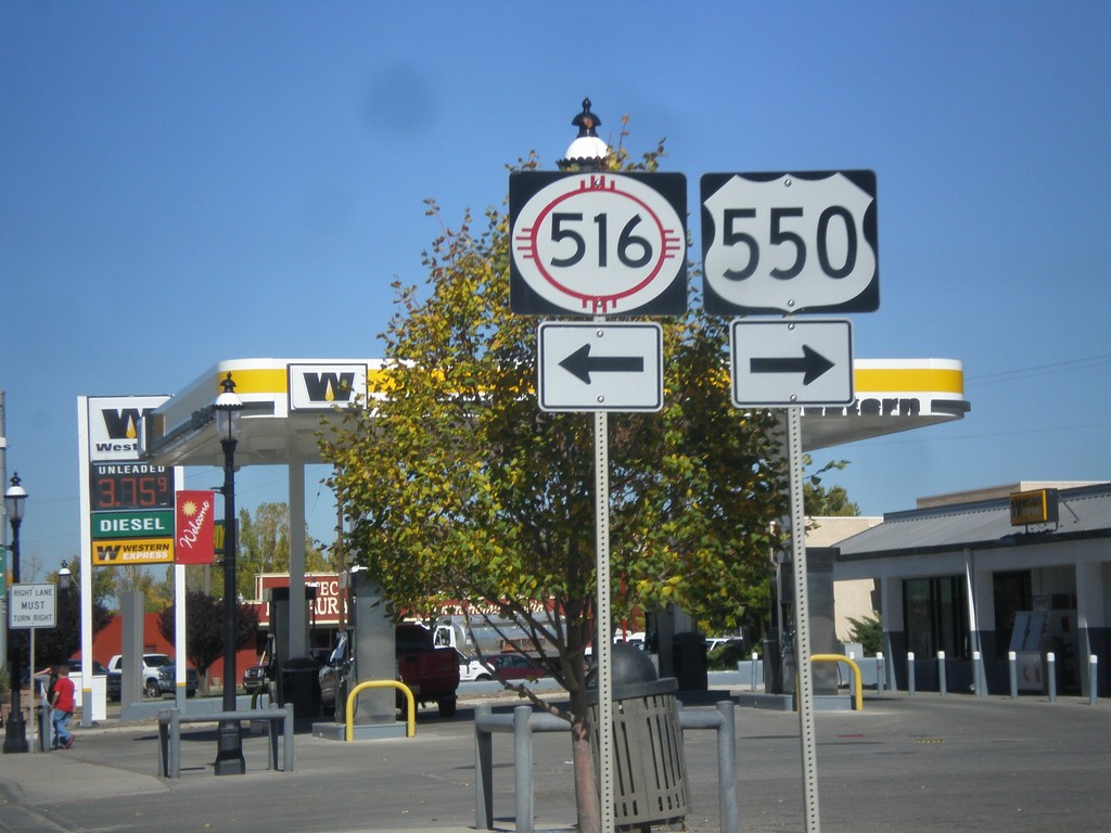
US-550 North at NM-516
US-550 north at NM-516 in Aztec. Turn right to continue north on US-550.
Taken 10-15-2012
 Aztec
San Juan County
New Mexico
United States
Aztec
San Juan County
New Mexico
United States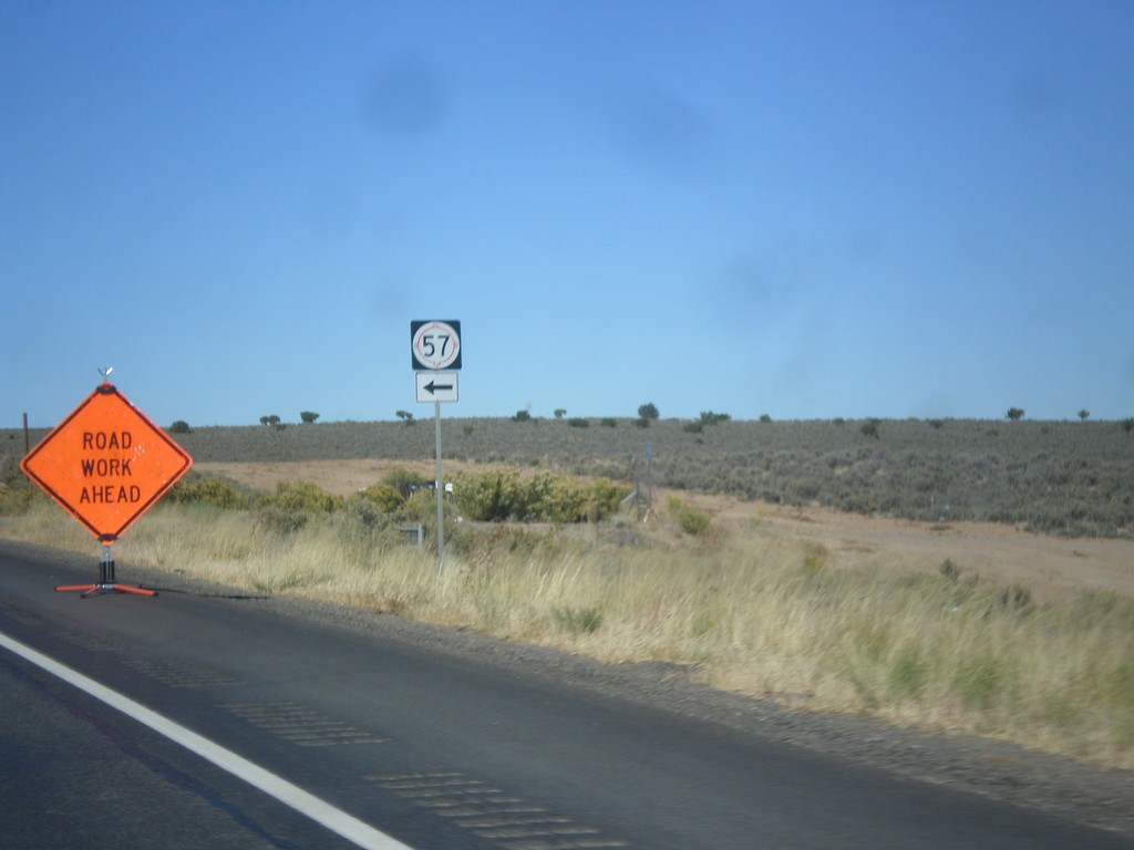
US-550 North at NM-57
US-550 north at NM-57. While many maps appear to show NM-57 as connecting US-550 to Chaco Canyon from the north, NM-57 does not provide access to Chaco Canyon.
Taken 10-15-2012
 Bloomfield
San Juan County
New Mexico
United States
Bloomfield
San Juan County
New Mexico
United States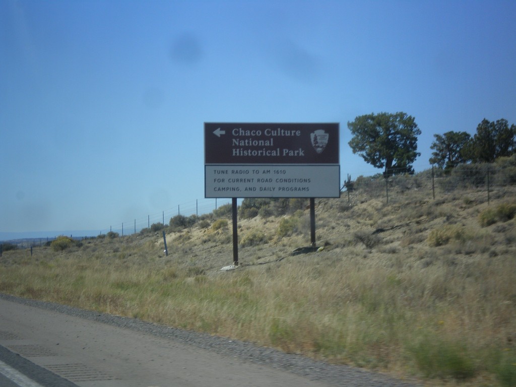
US-550 North - Chaco Canyon Jct.
US-550 north at turn off to Chaco Culture National Historic Park.
Taken 10-15-2012
Nageezi
San Juan County
New Mexico
United States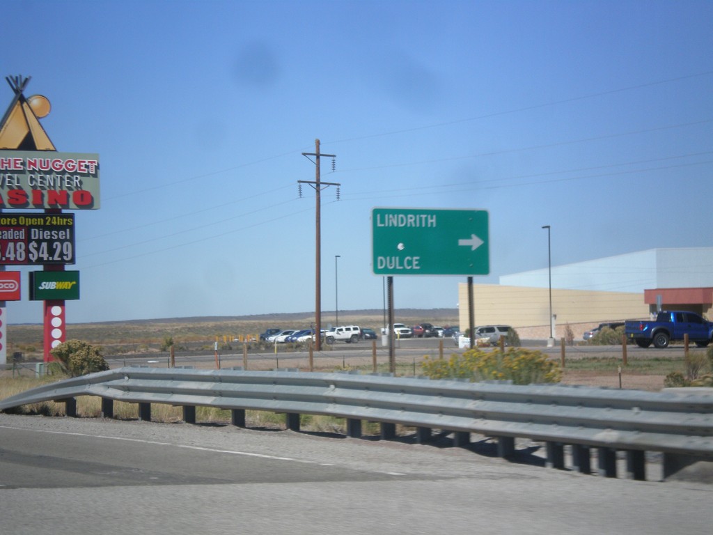
US-550 North at NM-573
US-550 north at NM-573 north to Dulce and Lindrith.
Taken 10-15-2012
 Cuba
Sandoval County
New Mexico
United States
Cuba
Sandoval County
New Mexico
United States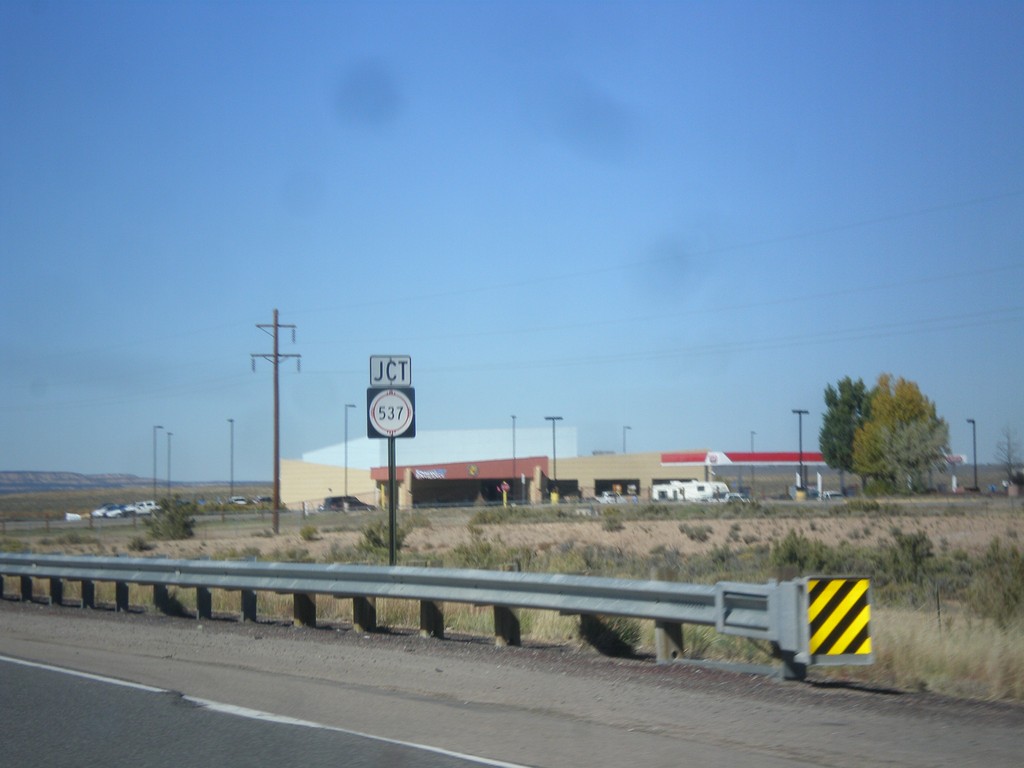
US-550 North Approaching NM-537
US-550 north approaching NM-537.
Taken 10-15-2012
Cuba
Sandoval County
New Mexico
United States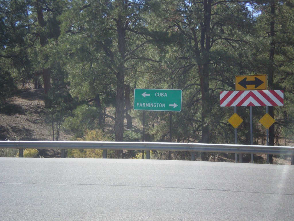
End NM-96 West at US-550
End NM-96 west at US-550. Turn right for Farmington; turn left for Cuba.
Taken 10-15-2012
 Cuba
Sandoval County
New Mexico
United States
Cuba
Sandoval County
New Mexico
United States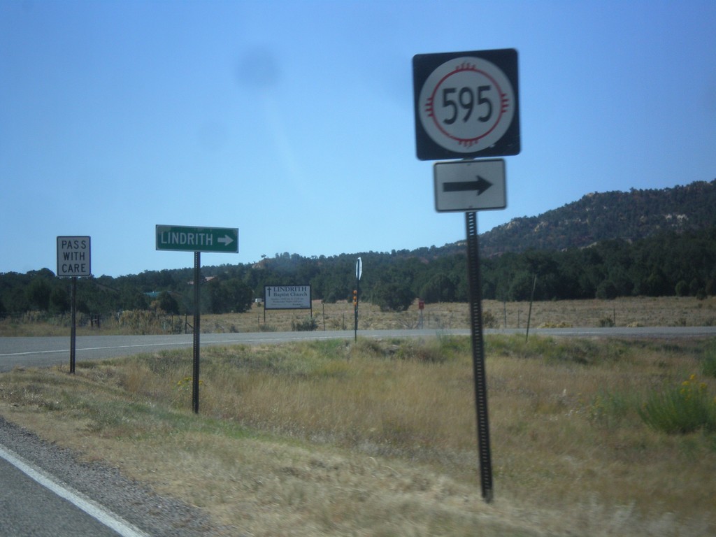
NM-96 West at NM-595
NM-96 west at NM-595 to Lindrith.
Taken 10-15-2012
 Regina
Rio Arriba County
New Mexico
United States
Regina
Rio Arriba County
New Mexico
United States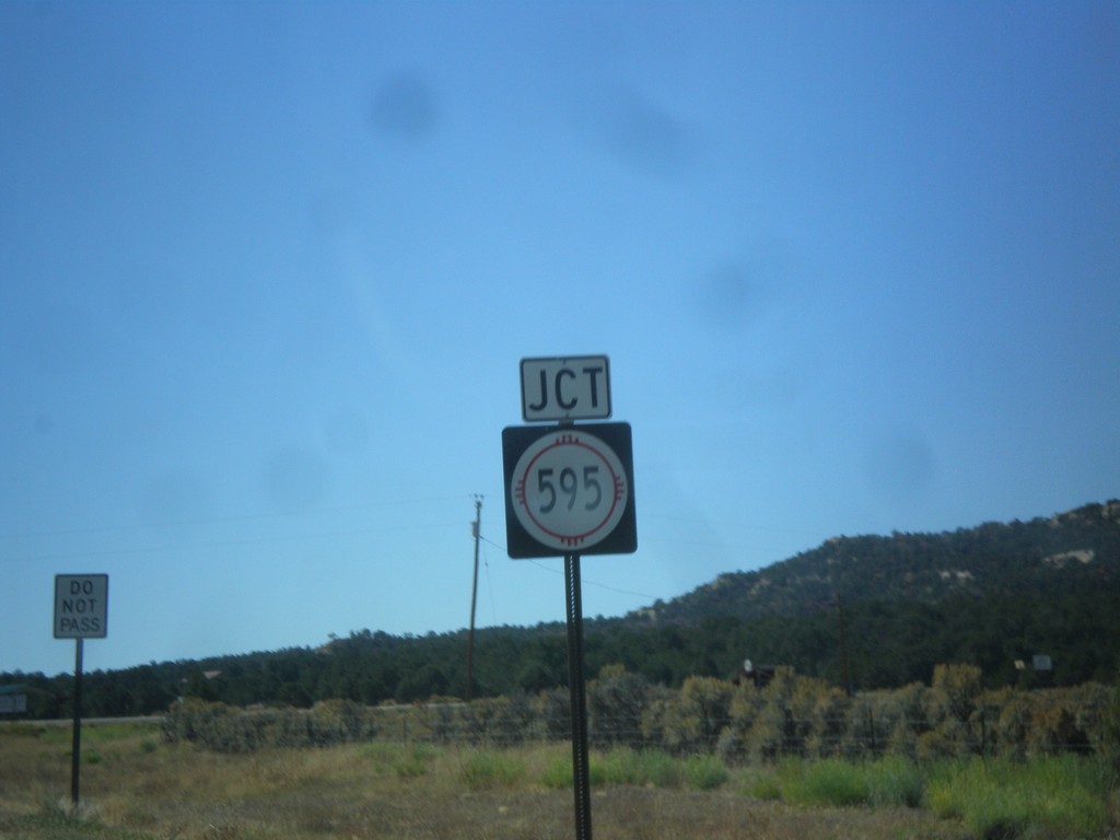
NM-95 West Approaching NM-595
NM-95 west approaching NM-595.
Taken 10-15-2012
 Regina
Rio Arriba County
New Mexico
United States
Regina
Rio Arriba County
New Mexico
United States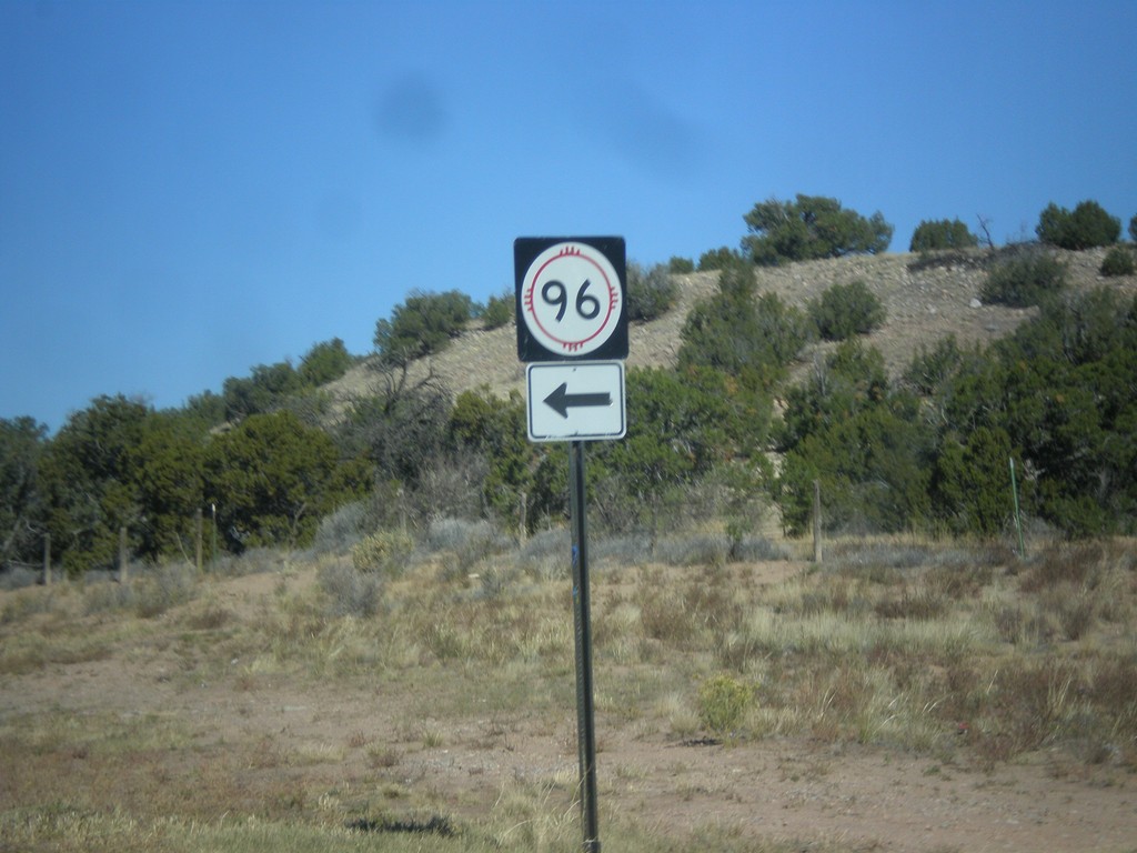
US-84 West At NM-96
US-84 west at NM-96.
Taken 10-15-2012
 Gallina
Rio Arriba County
New Mexico
United States
Gallina
Rio Arriba County
New Mexico
United States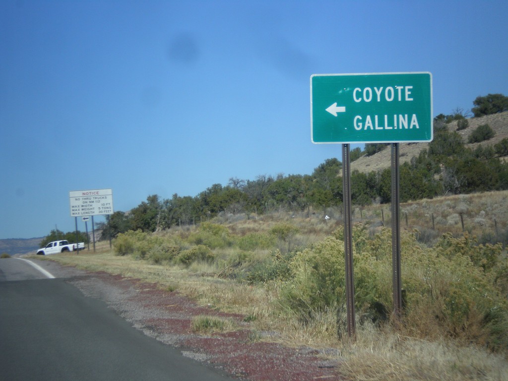
US-84 West Approaching NM-96
US-84 west approaching NM-96. Turn left for NM-96 west to Coyote and Gallina.
Taken 10-15-2012
Gallina
Rio Arriba County
New Mexico
United States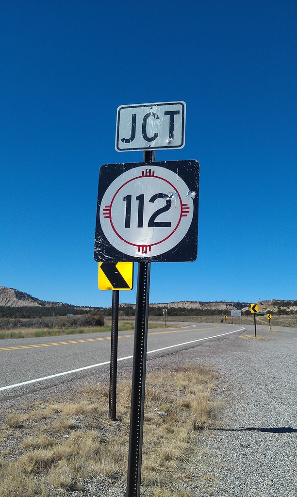
NM-96 South Approaching NM-112
NM-96 South approaching NM-112.
Taken 10-15-2012
 Regina
Rio Arriba County
New Mexico
United States
Regina
Rio Arriba County
New Mexico
United States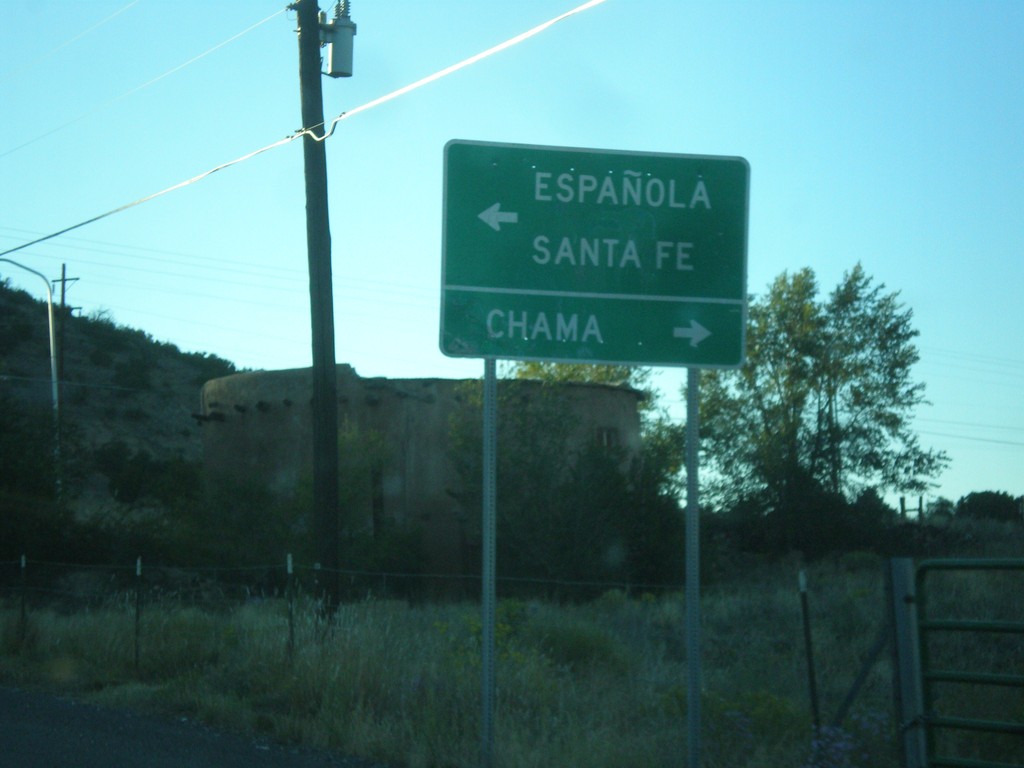
End NM-74 West at US-84/US-285
End NM-74 west at US-84/US-285. Use US-84 West/US-285 North to Chama; use US-84 East/US-285 South to Espanola and Santa Fe.
Taken 10-14-2012

 Hernandez
Rio Arriba County
New Mexico
United States
Hernandez
Rio Arriba County
New Mexico
United States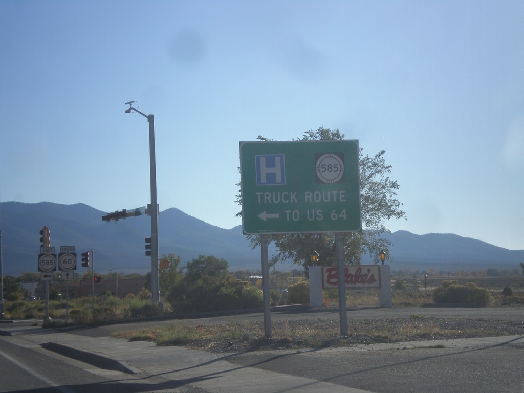
NM-68 South at NM-585 East
NM-68 South at NM-585 East to US-64. NM-585 is the truck route to US-64 east towards Raton.
Taken 10-14-2012


 Taos
Taos County
New Mexico
United States
Taos
Taos County
New Mexico
United States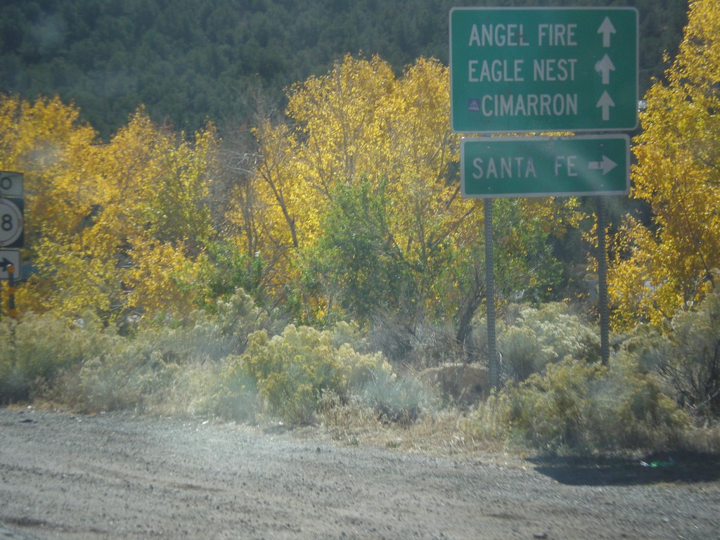
US-64 East at NM-585
US-64 east at NM-585. Use NM-585 west for NM-68 and Santa Fe. Continue east on US-64 for Cimarron, Angel Fire, and Eagle Nest.
Taken 10-14-2012
Taos
Taos County
New Mexico
United States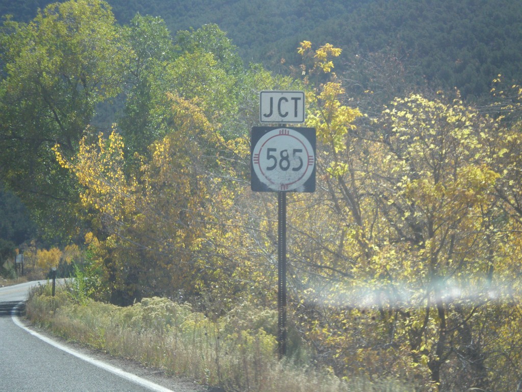
US-64 East Approaching NM-585
US-64 East approaching NM-585.
Taken 10-14-2012
Taos
Taos County
New Mexico
United States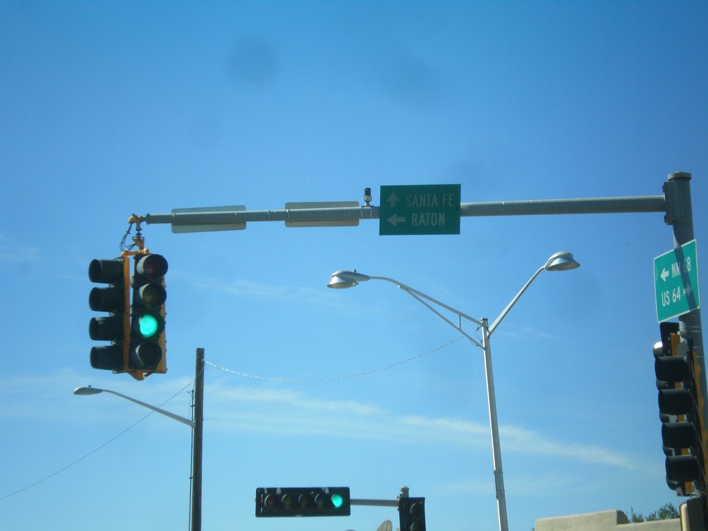
US-64 East at NM-68
US-64 east at NM-68. Turn left to continue on US-64 east to Raton. Continue ahead for NM-68 to Santa Fe.
Taken 10-14-2012
Taos
Taos County
New Mexico
United States