Signs Tagged With Intersection
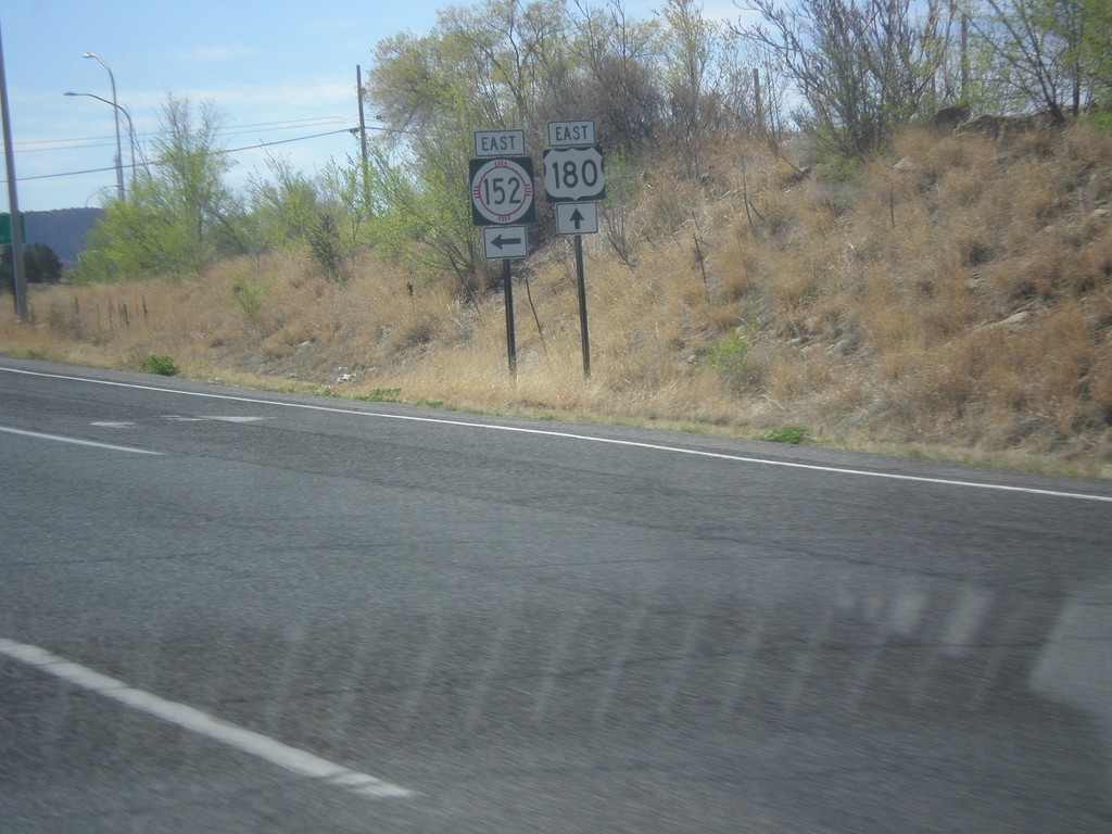
US-180 East at NM-152
US-180 east at NM-152 junction in Santa Clara.
Taken 04-14-2013

 Bayard
Grant County
New Mexico
United States
Bayard
Grant County
New Mexico
United States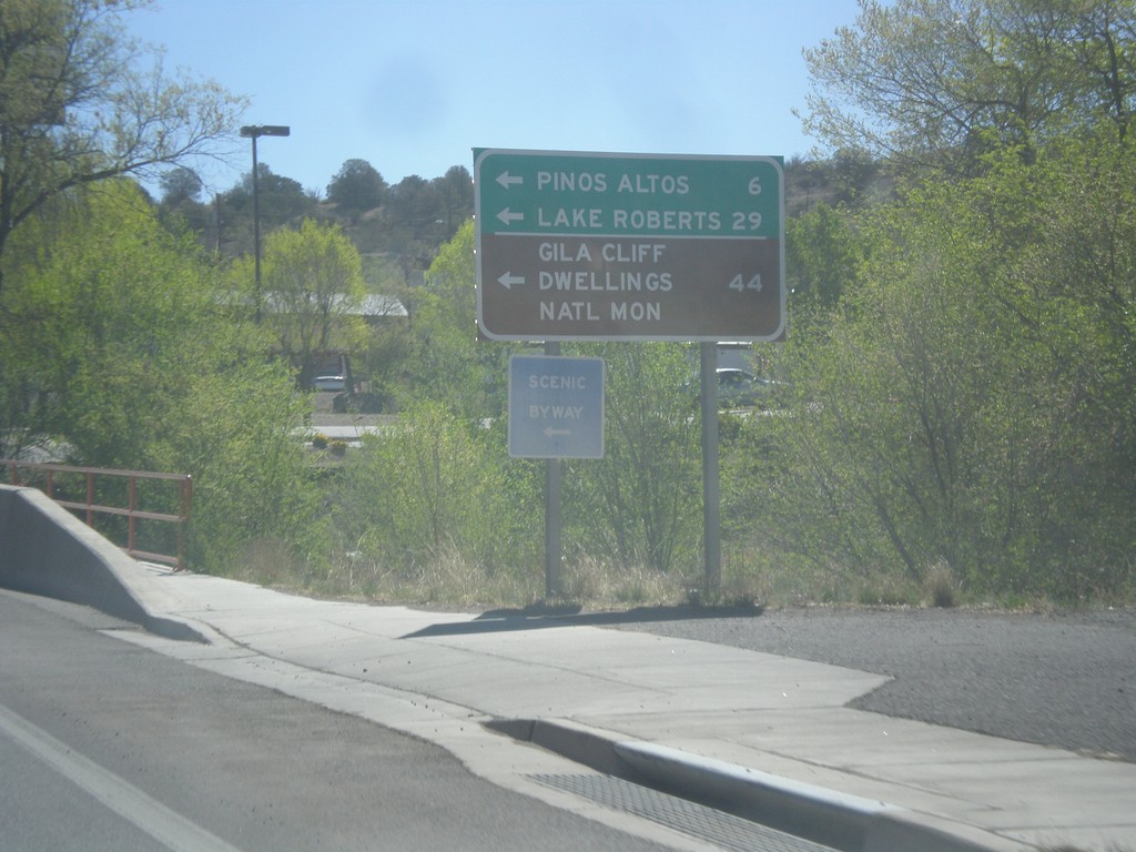
US-180 East at NM-15
US-180 east at NM-15 north to Pinos Altos, Lake Roberts, and Gila Cliff Dwellings National Monument.
Taken 04-14-2013
 Silver City
Grant County
New Mexico
United States
Silver City
Grant County
New Mexico
United States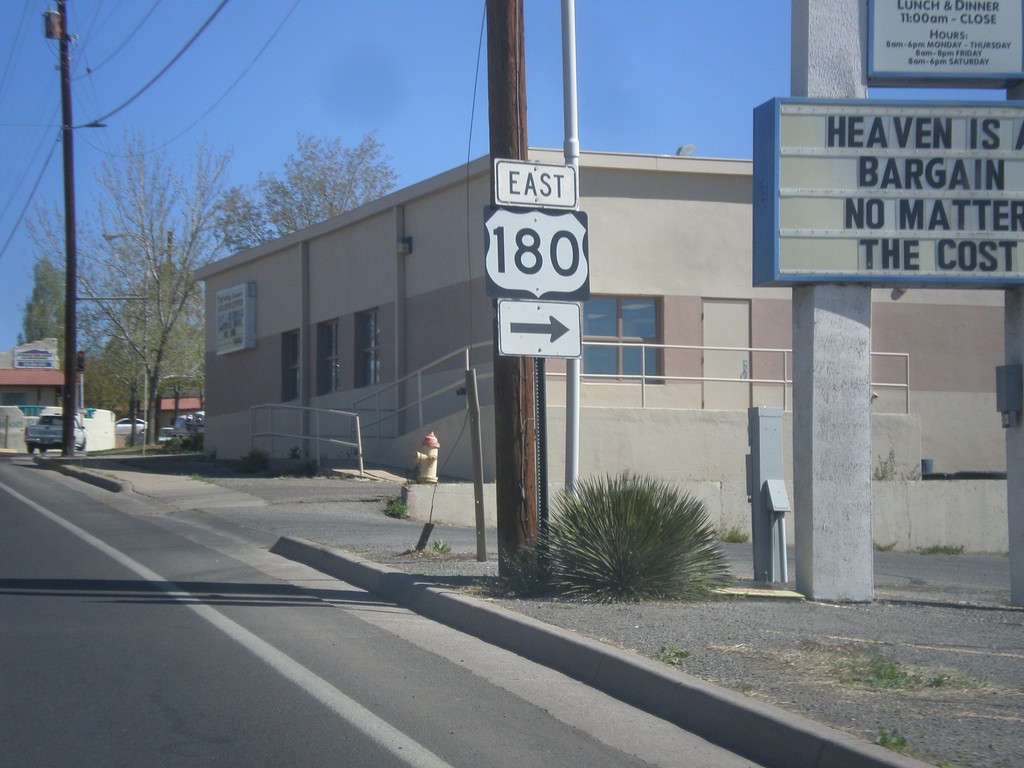
End NM-90 North at US-180
End NM-90 north at US-180 east.
Taken 04-14-2013
 Silver City
Grant County
New Mexico
United States
Silver City
Grant County
New Mexico
United States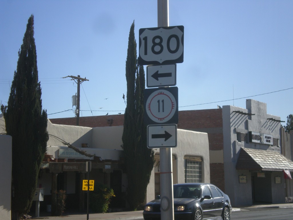
BL-10 East at US-180/NM-11
BL-10 east at US-180/NM-11. Turn left for US-180 west; turn right for NM-11 south.
Taken 04-14-2013

 Deming
Luna County
New Mexico
United States
Deming
Luna County
New Mexico
United States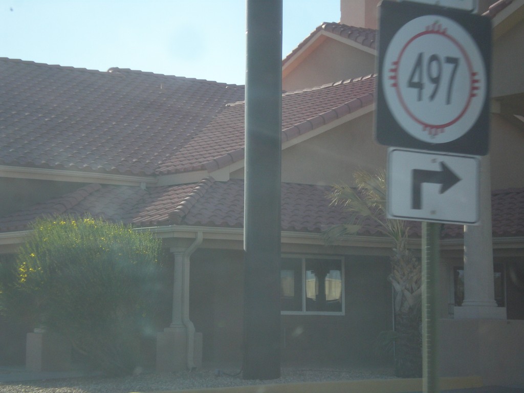
BL-10 East at NM-497
BL-10 east at NM-497 in Deming.
Taken 04-14-2013
 Deming
Luna County
New Mexico
United States
Deming
Luna County
New Mexico
United States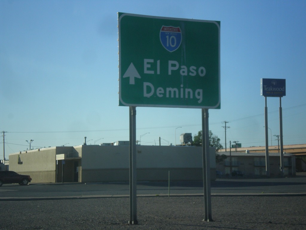
NM-188 East Approaching I-10
NM-188 east approaching I-10. Use I-10 for El Paso (Texas) and Deming.
Taken 04-14-2013

 Las Cruces
Doña Ana County
New Mexico
United States
Las Cruces
Doña Ana County
New Mexico
United States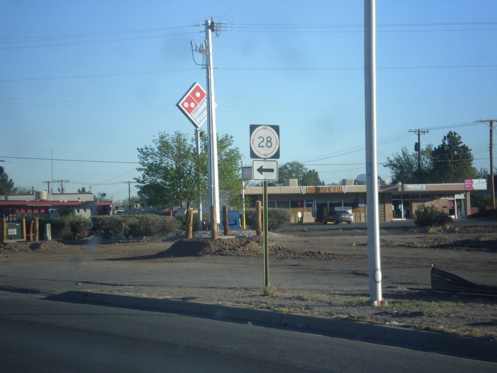
NM-188 West at NM-28
NM-188 west at NM-28 junction.
Taken 04-14-2013
 Las Cruces
Doña Ana County
New Mexico
United States
Las Cruces
Doña Ana County
New Mexico
United States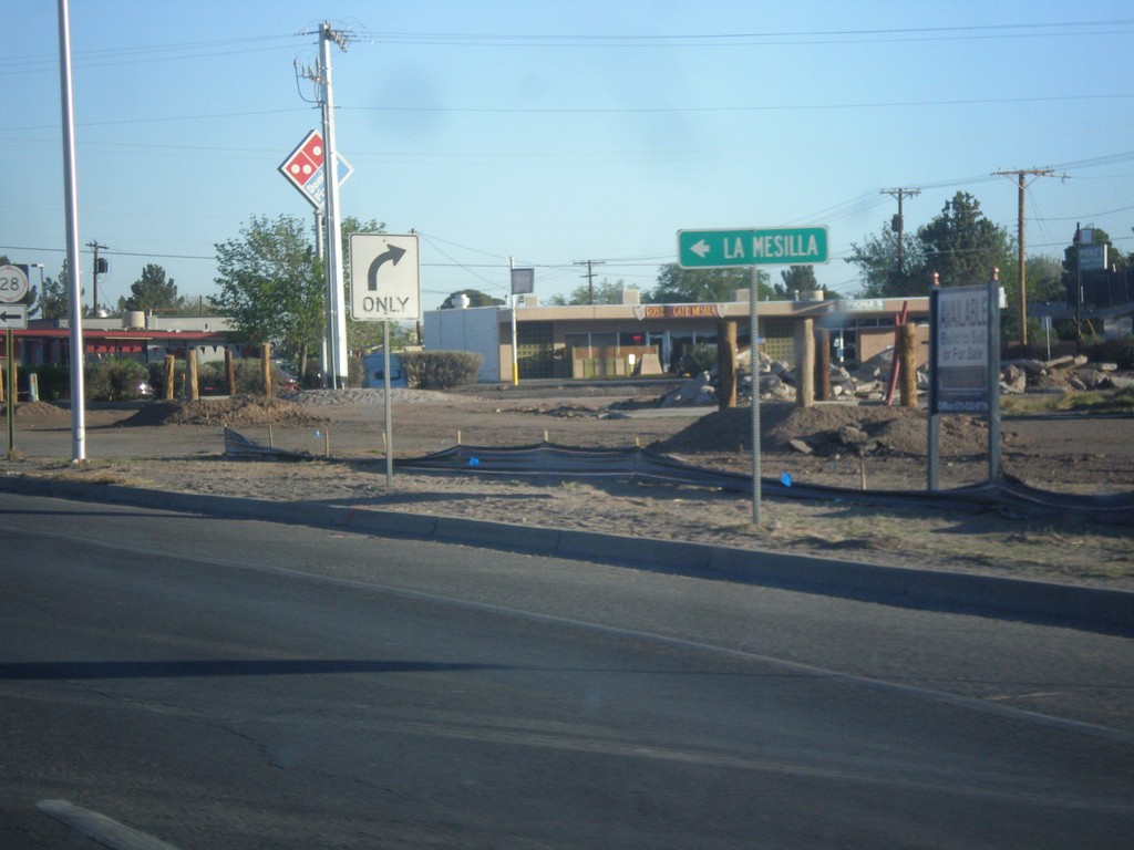
NM-188 West Approaching NM-28
NM-188 west approaching NM-28. Use NM-28 south for La Mesilla.
Taken 04-14-2013
Las Cruces
Doña Ana County
New Mexico
United States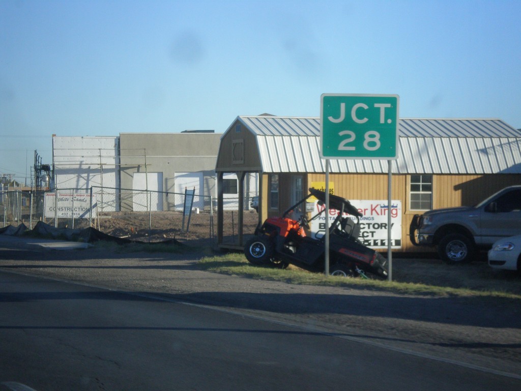
NM-188 West at NM-28
NM-118 west approaching NM-28 junction. This sign is missing the highway shield.
Taken 04-14-2013
Las Cruces
Doña Ana County
New Mexico
United States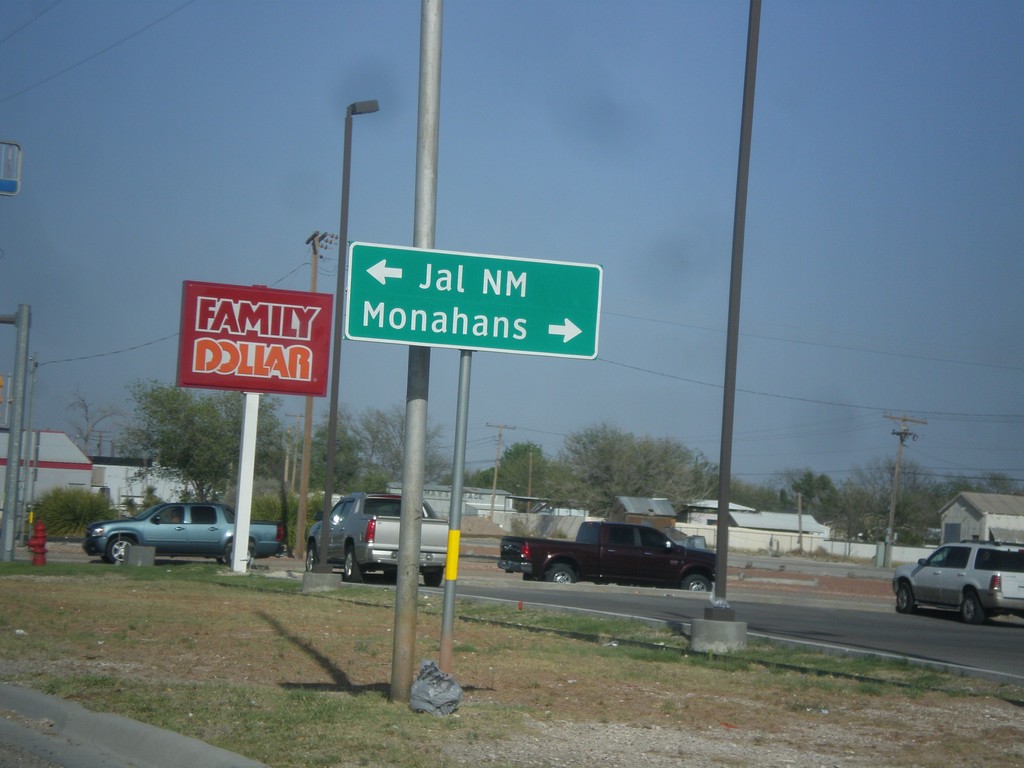
TX-302 East at TX-18
TX-302 east at TX-18. Use TX-18 south for Monahans; TX-18 north for Jal, NM.
Taken 04-14-2013

 Kermit
Winkler County
Texas
United States
Kermit
Winkler County
Texas
United States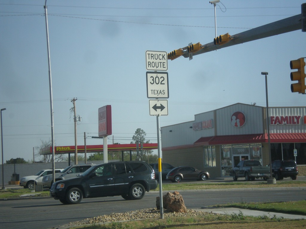
TX-18 South at TX-302
TX-18 south at TX-302. TX-302 is a truck route through Kermit.
Taken 04-14-2013
Kermit
Winkler County
Texas
United States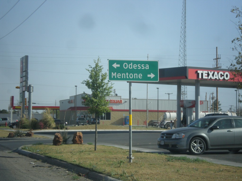
TX-18 South at TX-302
TX-18 south at TX-302. Use TX-302 east for Odessa; TX-302 west for Mentone.
Taken 04-14-2013
Kermit
Winkler County
Texas
United States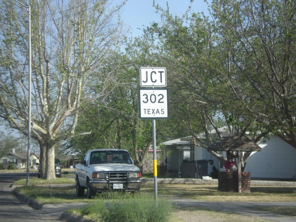
TX-18 South Approaching TX-302
TX-18 south approaching TX-302 in Kermit.
Taken 04-14-2013
Kermit
Winkler County
Texas
United States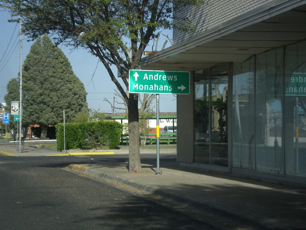
TX-18 South/TX-115 West at TX-18
TX-18 South/TX-115 West at TX-18/TX-115 Split. Turn left for TX-18 south to Monahans; continue straight for TX-115 east to Andrews.
Taken 04-14-2013
 Kermit
Winkler County
Texas
United States
Kermit
Winkler County
Texas
United States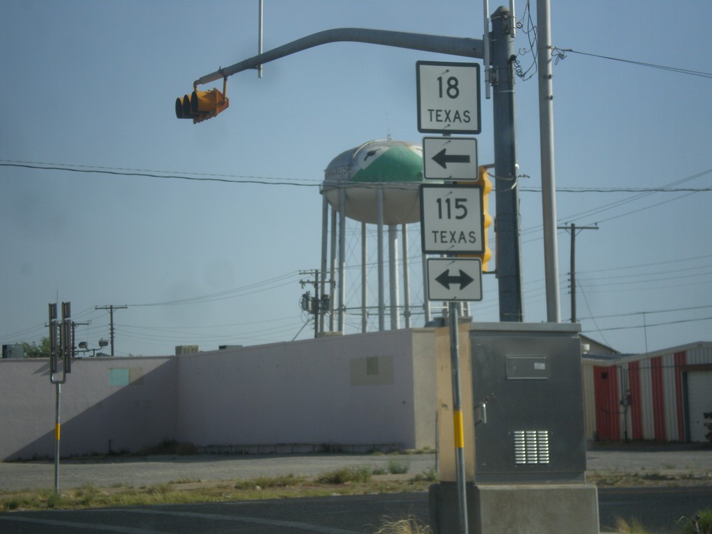
TX-18 South at TX-115
TX-18 south at TX-115. Turn left for TX-18 South/TX-115 East; turn right for TX-115 West.
Taken 04-14-2013
Kermit
Winkler County
Texas
United States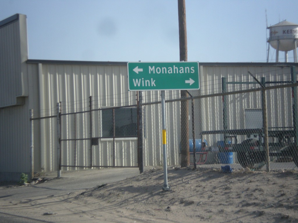
TX-18 South at TX-115
TX-18 south at TX-115. Turn right on TX-115 west for Wink; left on TX-115 west/TX-18 south for Monahans. TX-18 joins TX-115 for a few blocks through Kermit.
Taken 04-14-2013
Kermit
Winkler County
Texas
United States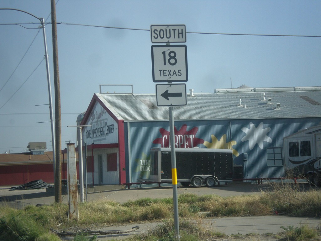
TX-18 South Approaching TX-115
TX-18 south approaching TX-115. Turn left to continue south on TX-18.
Taken 04-14-2013
Kermit
Winkler County
Texas
United States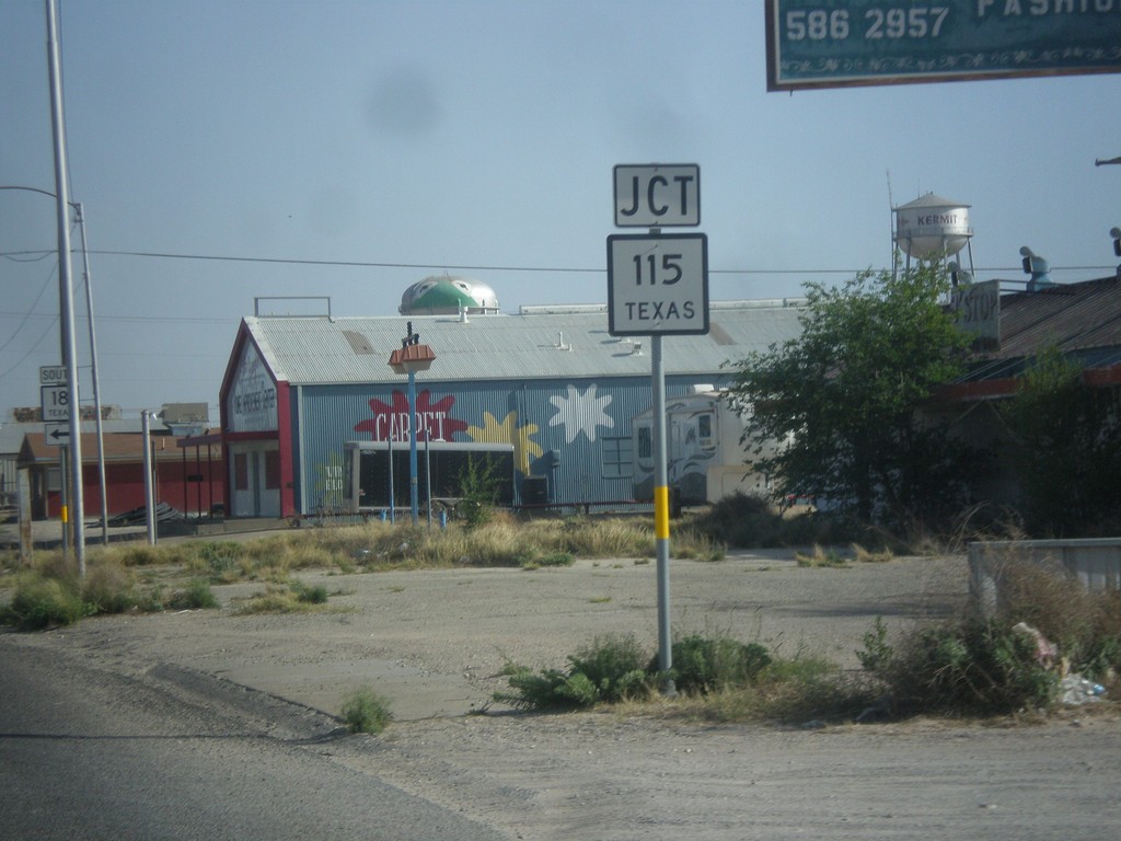
TX-18 South Approaching TX-115
TX-18 south approaching TX-115 in Kermit.
Taken 04-14-2013
Kermit
Winkler County
Texas
United States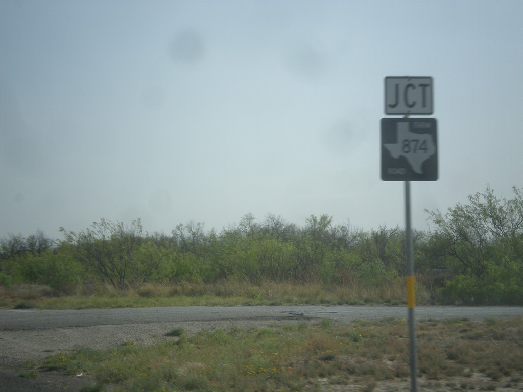
TX-18 South at FM-874
TX-18 south at FM-874 junction.
Taken 04-14-2013
 Kermit
Winkler County
Texas
United States
Kermit
Winkler County
Texas
United States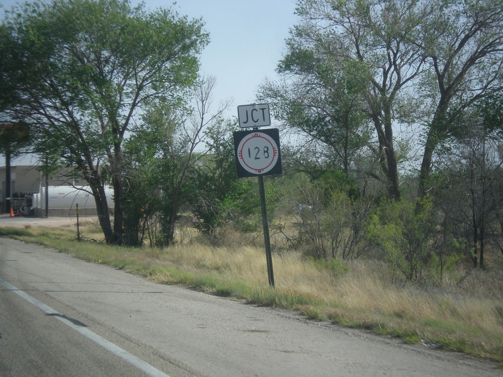
NM-18 South at NM-128
NM-18 south at NM-128 in Jal.
Taken 04-14-2013

 Jal
Lea County
New Mexico
United States
Jal
Lea County
New Mexico
United States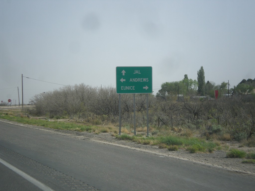
NM-18 South at NM-176
NM-18 south at NM-176. Continue south on NM-18 for Jal. Turn left on NM-176 for Andrews (TX); left on NM-176 for Eunice.
Taken 04-14-2013
 Eunice
Lea County
New Mexico
United States
Eunice
Lea County
New Mexico
United States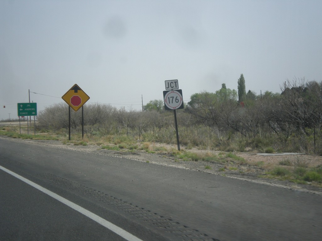
NM-18 South Approaching NM-176
NM-18 south approaching NM-176 in Eunice.
Taken 04-14-2013
Eunice
Lea County
New Mexico
United States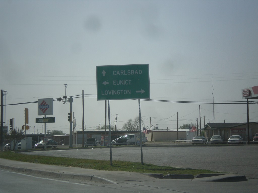
US-62/US-180 West at NM-18
US-62/US-180 west at NM-18 junction. Turn right for NM-18 north to Lovington; left for NM-18 south to Eunice. Continue straight for US-62/US-180 to Carlsbad.
Taken 04-14-2013
 Hobbs
Lea County
New Mexico
United States
Hobbs
Lea County
New Mexico
United States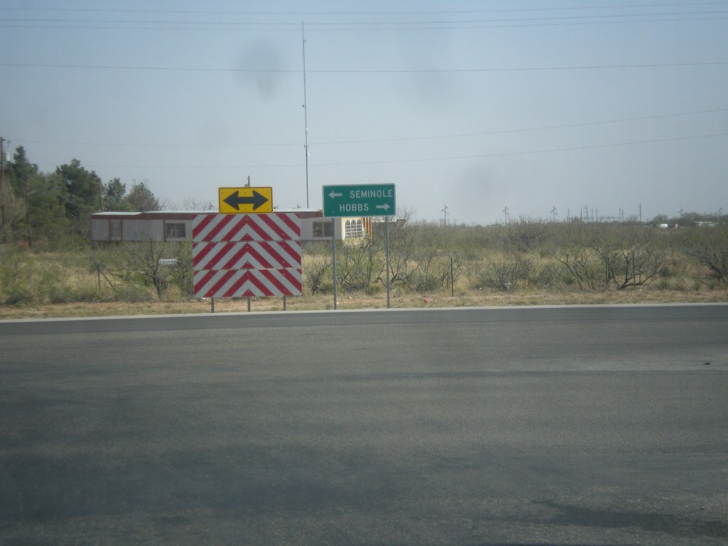
End NM-218 at US-62
End NM-218 east at US-62. Turn right for US-62 west to Hobbs; left for US-62 east to Seminole (TX).
Taken 04-14-2013
 Hobbs
Lea County
New Mexico
United States
Hobbs
Lea County
New Mexico
United States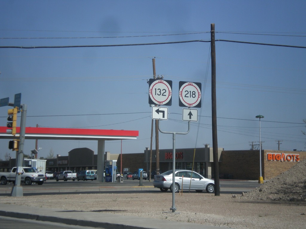
NM-18 South at NM-218/NM-132
NM-18 south at NM-218/NM-132 junction (Dal Paso St.) in Hobbs.
Taken 04-14-2013
 Hobbs
Lea County
New Mexico
United States
Hobbs
Lea County
New Mexico
United States