Signs Tagged With Intersection
US-285 North Approaching NM-2
US-285 north approaching NM-2. Use NM-2 north for Hagerman and Lake Arthur. Continue north on US-285 for Roswell.
Taken 04-14-2013

 Artesia
Eddy County
New Mexico
United States
Artesia
Eddy County
New Mexico
United States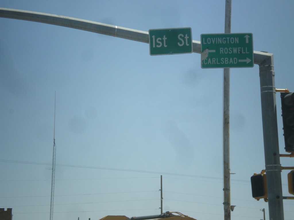
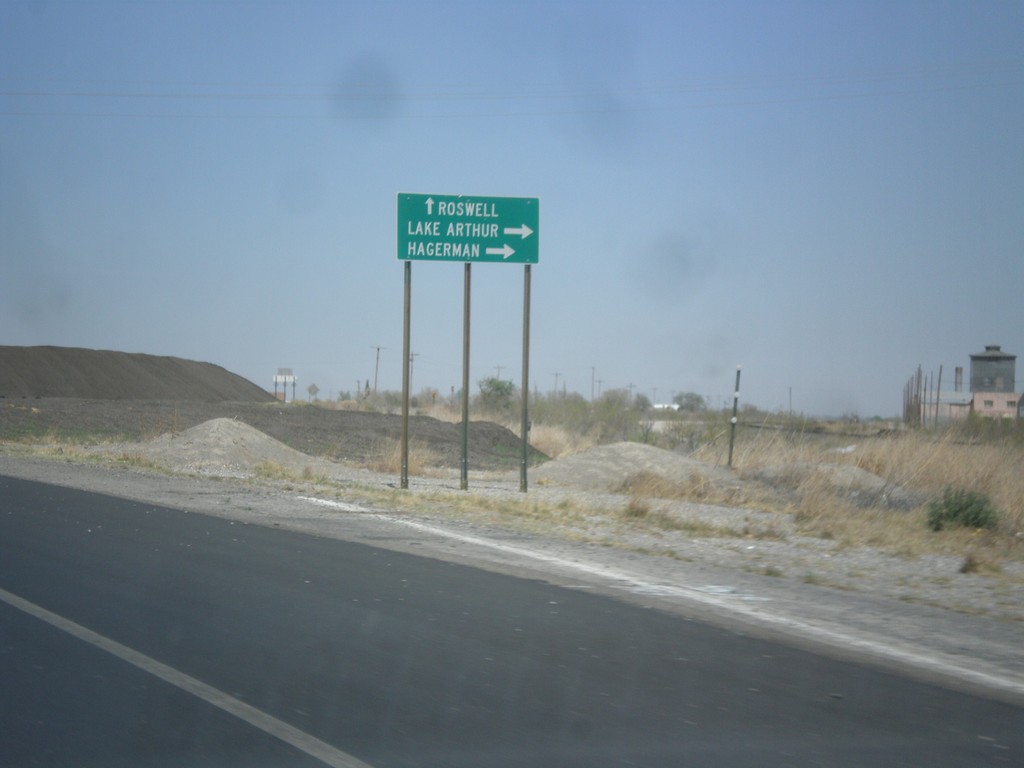
US-82 East at US-285
US-82 east at US-285. Turn right on US-285 south for Carlsbad; left on US-285 north to Roswell; straight on US-82 east for Lovington.
Taken 04-14-2013
 Artesia
Eddy County
New Mexico
United States
Artesia
Eddy County
New Mexico
United States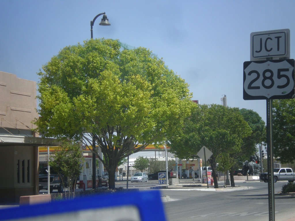
US-82 East Approaching US-285
US-82 east approaching US-285 junction in Artesia.
Taken 04-14-2013
Artesia
Eddy County
New Mexico
United States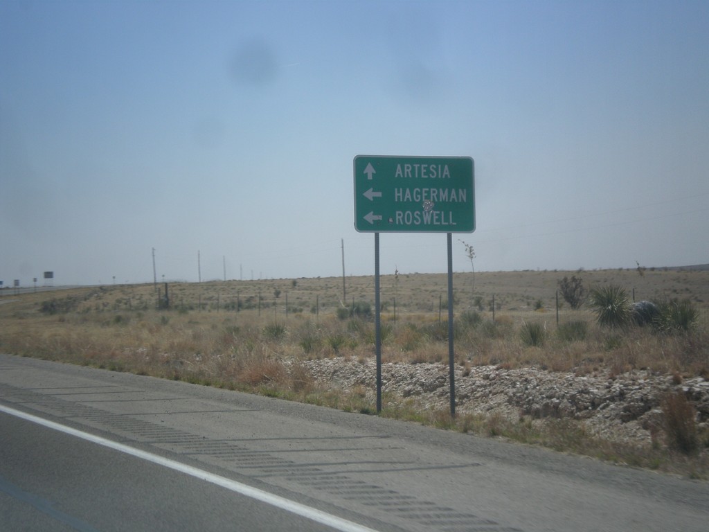
US-82 East at NM-13
US-82 east at NM-13 to Roswell and Hagerman. Continue east on US-82 to Artesia.
Taken 04-14-2013
 Hope
Chaves County
New Mexico
United States
Hope
Chaves County
New Mexico
United States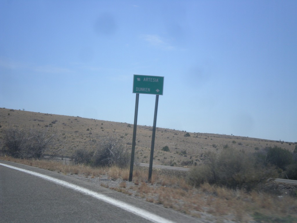
US-82 East at NM-24
US-82 east at NM-24 south to Dunken. Continue east on US-82 for Artesia.
Taken 04-14-2013
 Mayhill
Chaves County
New Mexico
United States
Mayhill
Chaves County
New Mexico
United States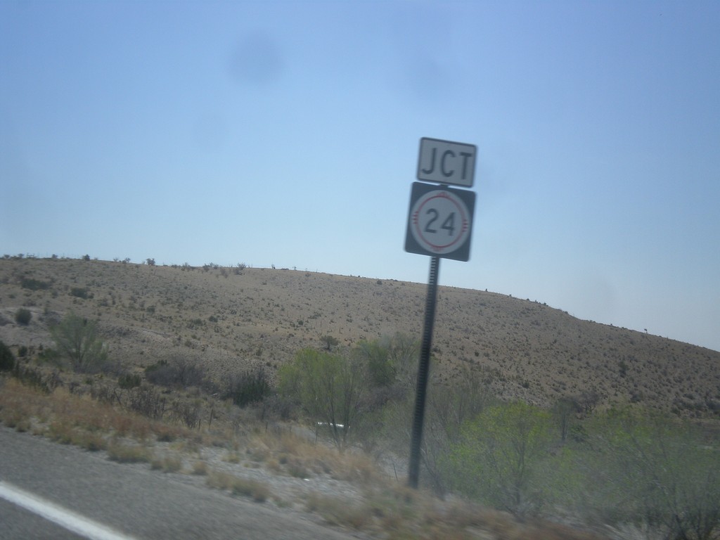
US-82 East Approaching NM-24
US-82 east approaching NM-24 junction, in rural Chaves County.
Taken 04-14-2013
Mayhill
Chaves County
New Mexico
United States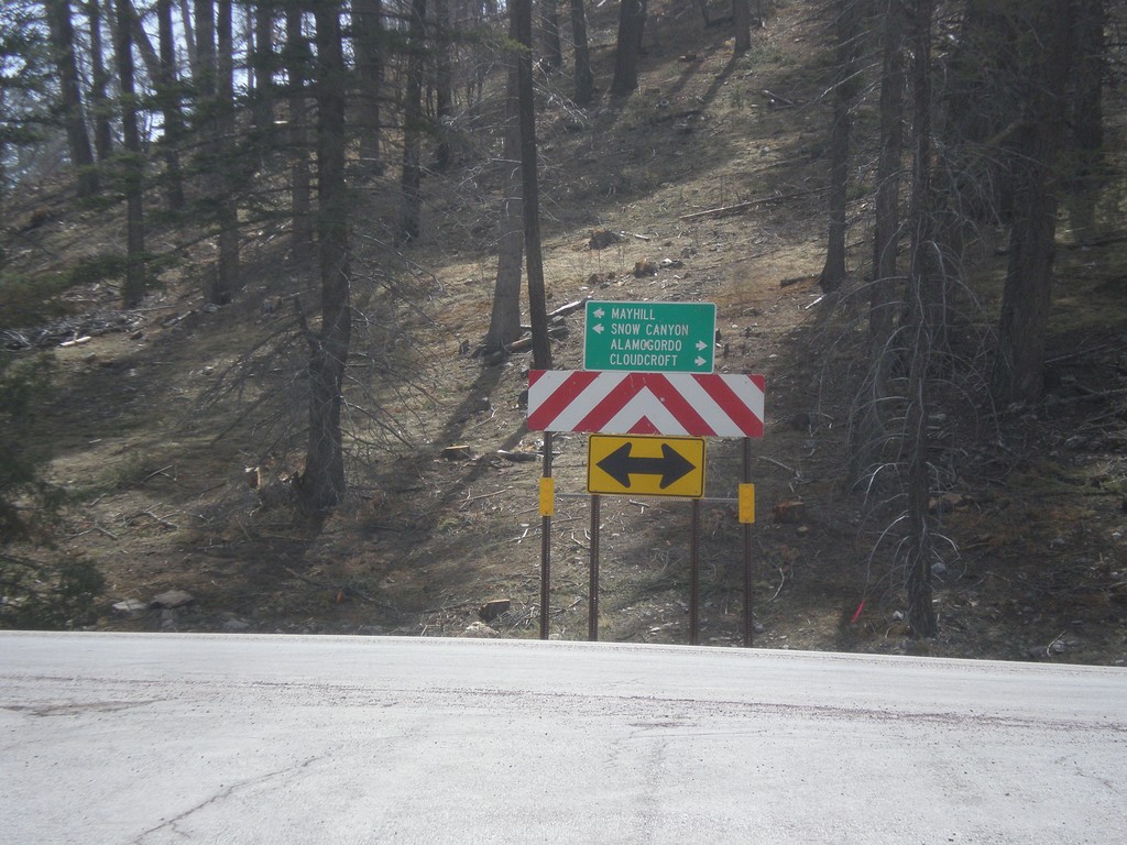
End NM-244 South at US-82
End NM-244 south at US-82. Turn right on US-82 for Alamogordo and Cloudcroft; turn left on US-82 for Mayhill and Snow Canyon.
Taken 04-14-2013
 Cloudcroft
Otero County
New Mexico
United States
Cloudcroft
Otero County
New Mexico
United States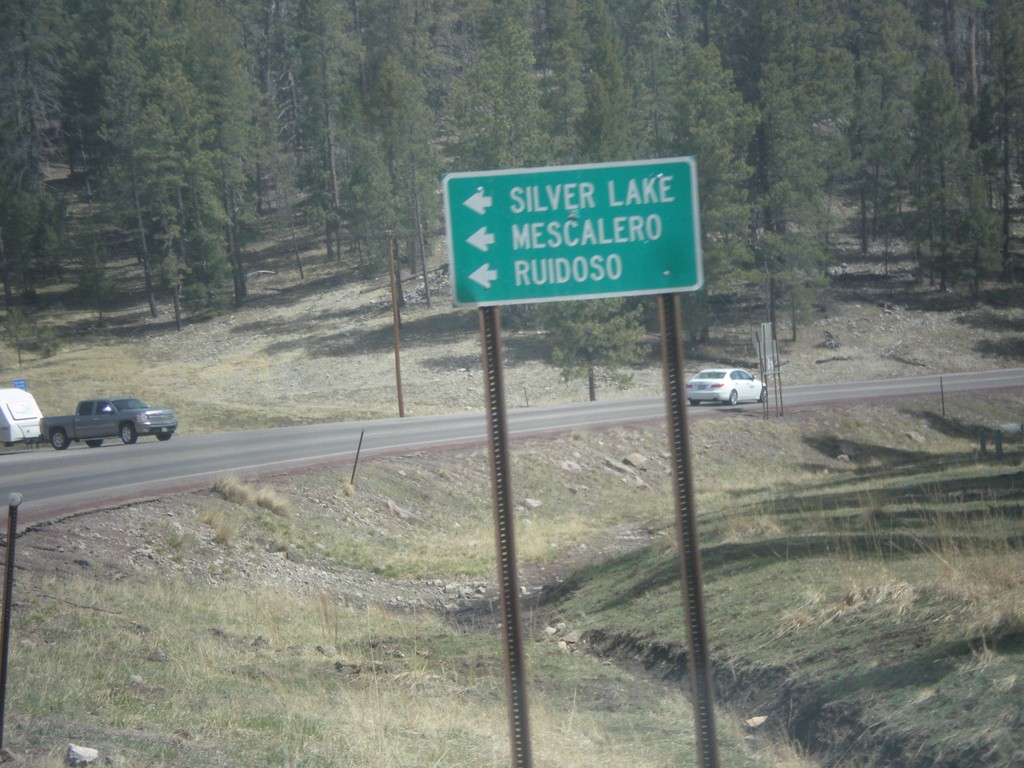
US-82 East at NM-244
US-82 east at NM-244. Turn left for NM-244 north to Mescalero, Ruidoso, and Silver Lake.
Taken 04-14-2013
Cloudcroft
Otero County
New Mexico
United States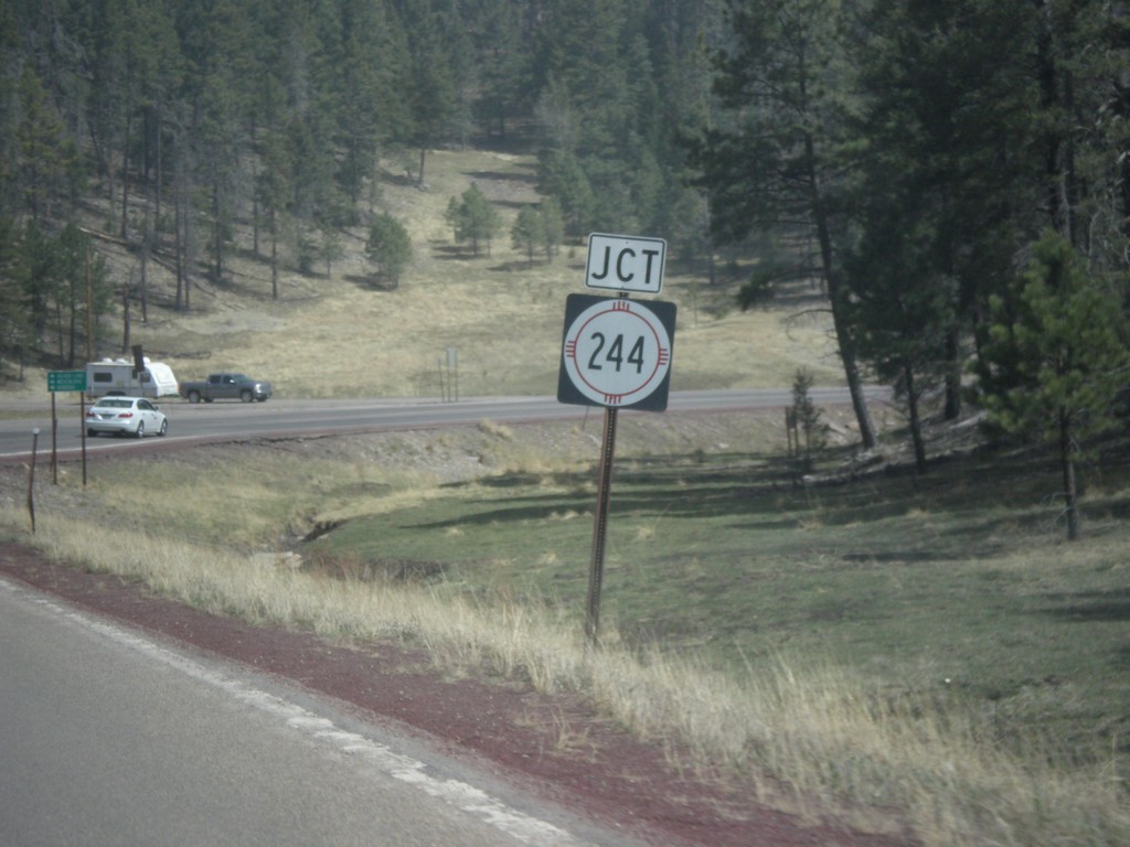
US-82 East Approaching NM-244
US-82 east approaching NM-244 junction.
Taken 04-14-2013
Cloudcroft
Otero County
New Mexico
United States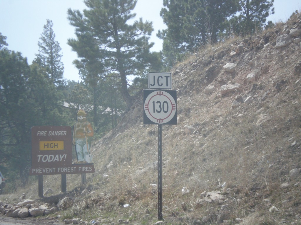
US-82 East at NM-130
US-82 east at NM-130 junction in Cloudcroft.
Taken 04-14-2013
 Mayhill
Otero County
New Mexico
United States
Mayhill
Otero County
New Mexico
United States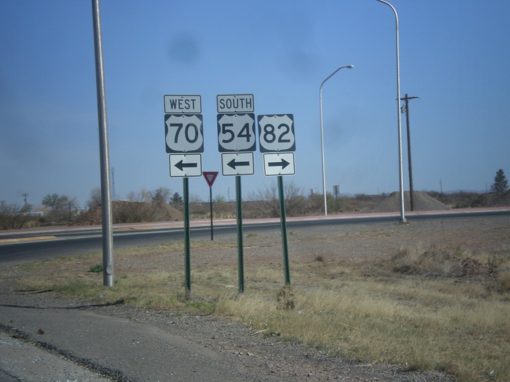
White Sands Blvd. North at US-54/US-70/US-82
White Sands Blvd. north at US-54/US-70/US-82 junction. Turn right for US-82 east; left for US-54 South/US-70 West; straight for US-54 North/US-70 East.
Taken 04-14-2013

 Alamogordo
Otero County
New Mexico
United States
Alamogordo
Otero County
New Mexico
United States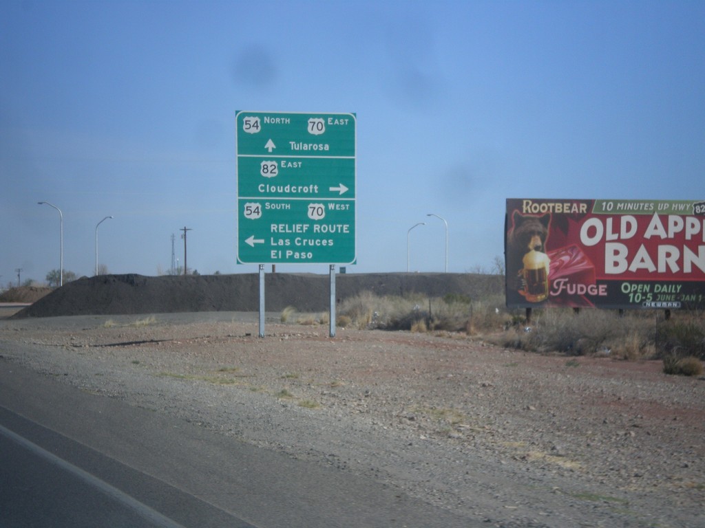
White Sands Blvd. North at US-54/US-70/US-82
White Sands Blvd. North at US-54/US-70/US-82 in Alamogordo. Turn left for US-54 South/US-70 West/Relief Route/Las Cruces/El Paso. Turn right for US-82/Cloudcroft. Continue straight for US-54 North/US-70 East/Tularosa. This is the northern end of the Alamogordo Relief Route. This is also the western terminus of US-82.
Taken 04-14-2013
Alamogordo
Otero County
New Mexico
United States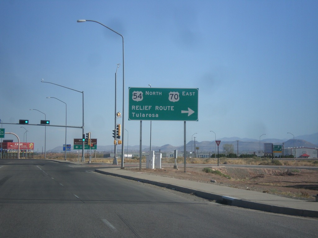
US-54 North at US-70
US-54 north at US-70 west, the southern end of the Alamogordo Relief Route. Turn right for US-54 North/US-70 East/Relief Route/Tularosa. Continue north for US-70 west, and downtown Alamogordo.
Taken 04-14-2013
Alamogordo
Otero County
New Mexico
United States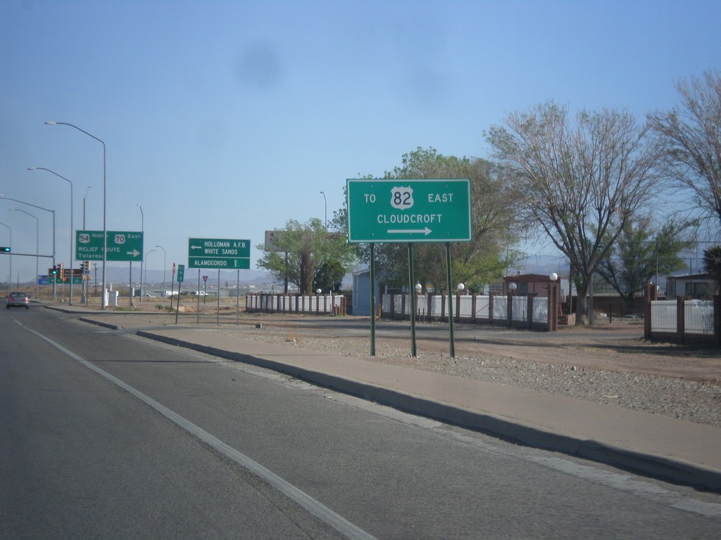
US-54 North at US-70 - Alamogordo Relief Route
US-54 north at US-70. Turn right to access US-82/Cloudcroft (via Alamogordo Relief Route).
Taken 04-14-2013
Alamogordo
Otero County
New Mexico
United States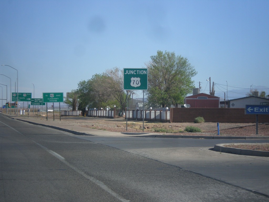
US-54 North Approaching US-70
US-54 north approaching US-70 at the southern end of the Alamogordo Relief Route.
Taken 04-14-2013
Alamogordo
Otero County
New Mexico
United States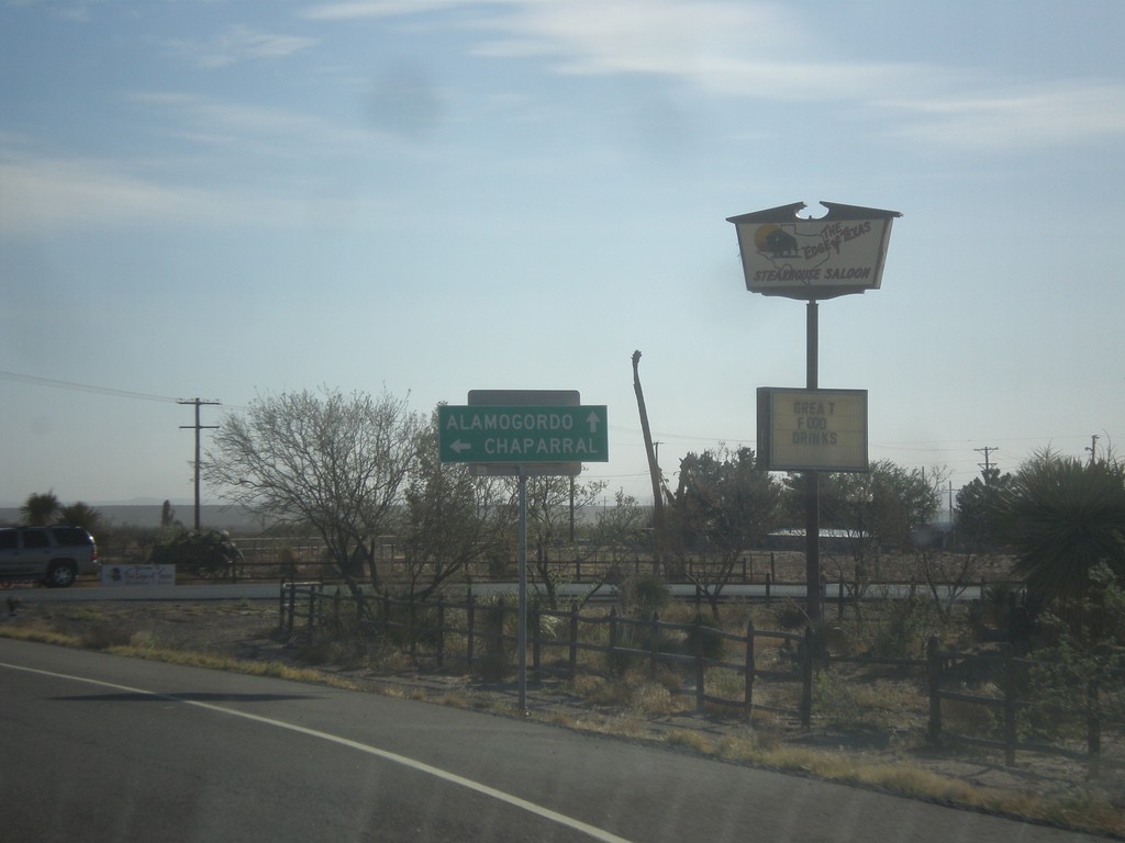
US-54 North at State Line Road
US-54 north at State Line Road west to Chaparral (New Mexico). Continue north on US-54 for Alamogordo (New Mexico). The highway crosses into New Mexico just north of this junction.
Taken 04-14-2013
El Paso County
Texas
United States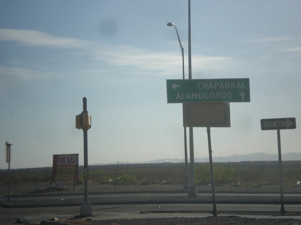
US-54 North at FM-2529
US-54 north at FM-2529/McCombs St. Turn left on FM-2529 for Chaparral (New Mexico). Continue north on US-54 for Alamogordo (New Mexico).
Taken 04-14-2013
 El Paso
 County
Texas
United States
El Paso
El Paso County
Texas
United States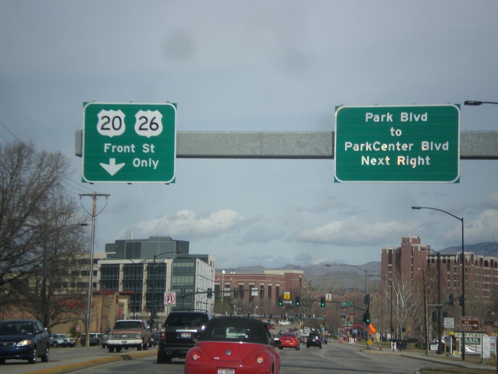
US-20/US-26 West - Broadway Ave at Front St
US-20/US-26 west (Broadway Ave.) approaching Front St. US-20/US-26 traffic turns left on Front St. Turn right at the next light for Park Blvd. to Park Center Blvd.
Taken 03-16-2013

 Boise
Ada County
Idaho
United States
Boise
Ada County
Idaho
United States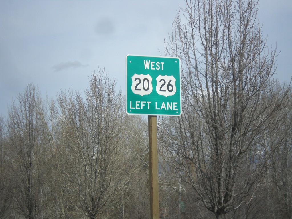
US-20/US-26 West - Broadway Ave Approaching Front St
US-20/US-26 West (Broadway Ave.) approaching Front St. US-20/US-26 traffic need to get in the left lanes to turn onto Front St.
Taken 03-16-2013
Boise
Ada County
Idaho
United States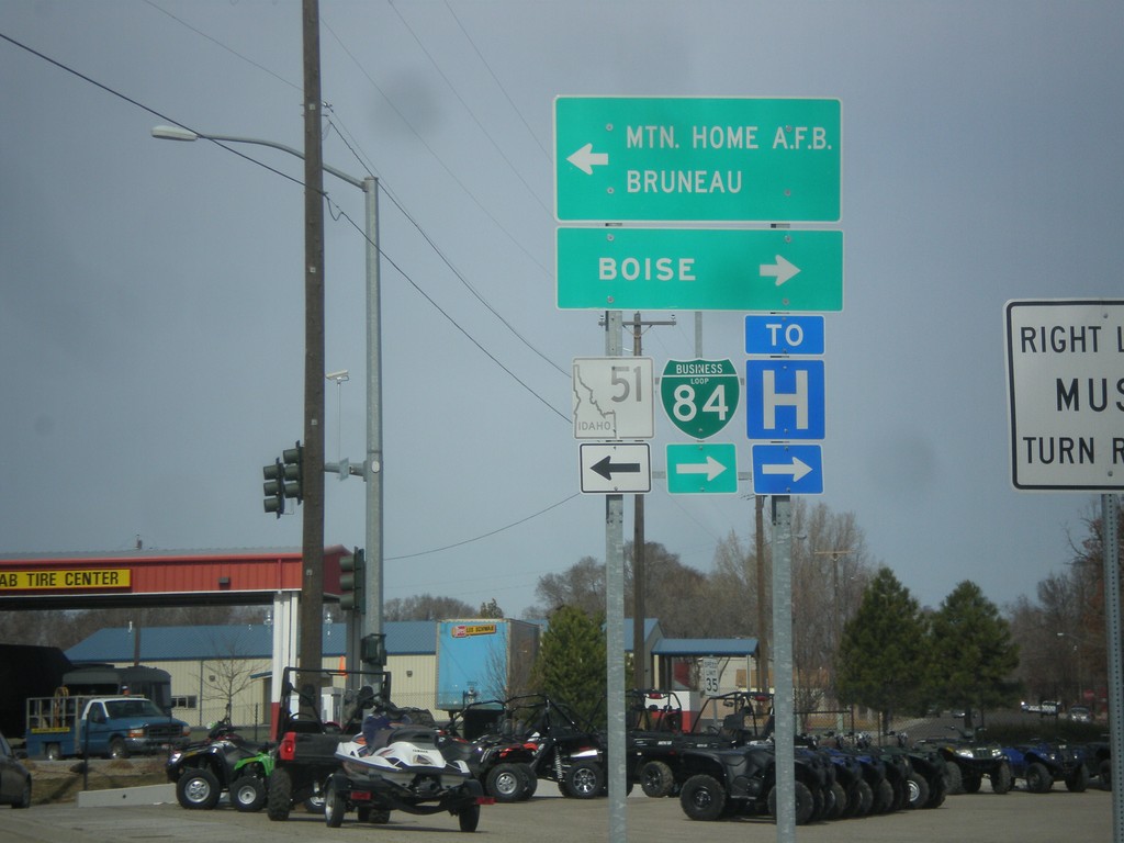
S 3rd St. (Old BL-84) at ID-51
S 3rd St. (Old BL-84) at ID-51 (to BL-84). Turn left for ID-51 south to Mountain Home AFB and Bruneau. Turn right for ID-51 north (to BL-84) to Boise. BL-84 was formerly routed along S 3rd St. into Mountain Home.
Taken 03-16-2013

 Mountain Home
Elmore County
Idaho
United States
Mountain Home
Elmore County
Idaho
United States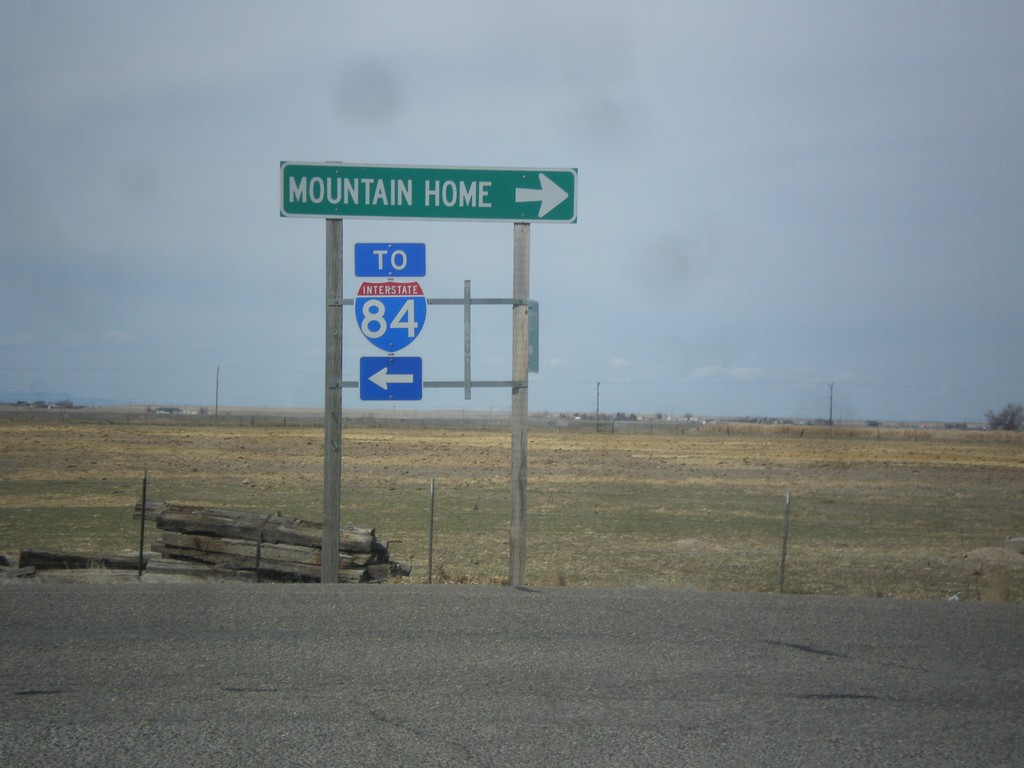
Old US-30 at Old Oregon Trail Road
Old US-30 at Old Oregon Trail Road. Turn left for I-84 (at Exit 99); turn right for Mountain Home. This is the old Mountain Home business loop.
Taken 03-16-2013
 Mountain Home
Elmore County
Idaho
United States
Mountain Home
Elmore County
Idaho
United States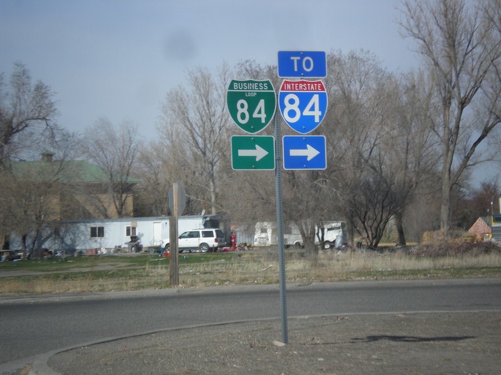
BL-84 - Hammett
BL-84 in Hammett. Turn right to continue west on BL-84 and for I-84.
Taken 03-16-2013
Hammett
Elmore County
Idaho
United States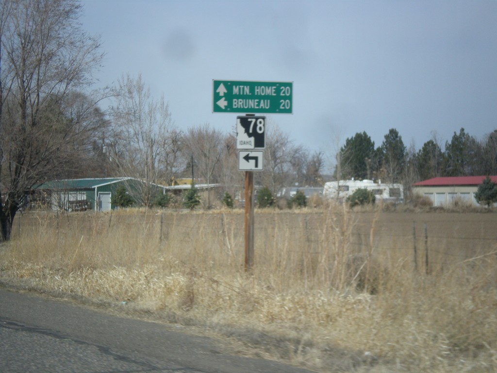
BL-84 West at ID-78
BL-84 west at ID-78 in Hammett. Use ID-78 west for Bruneau; continue west on BL-84 to Mountain Home.
Taken 03-16-2013
 Hammett
Elmore County
Idaho
United States
Hammett
Elmore County
Idaho
United States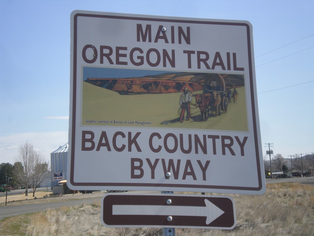
Old Oregon Trail at BL-84 (1st St.)
East Old Oregon Trail Highway at BL-84 (1st St) in Glenns Ferry. Turn right to take 1st St. into Glenns Ferry. The 1st St. is part of the Main Oregon Trail Back Country Byway.
Taken 03-16-2013
Glenns Ferry
Elmore County
Idaho
United States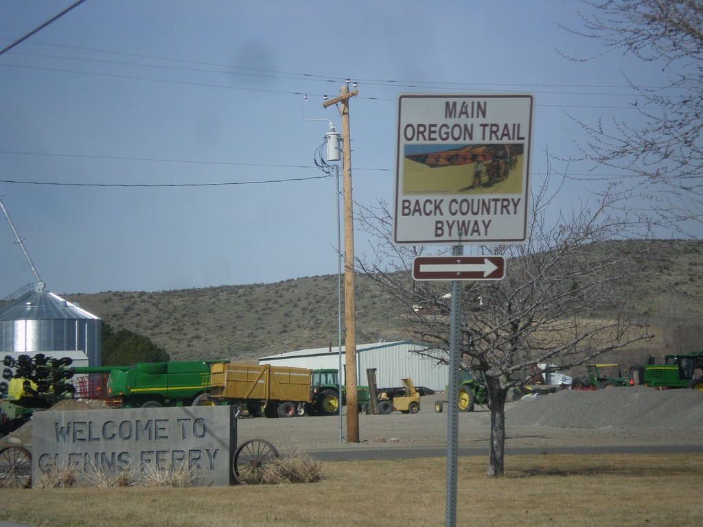
BL-84 West - Main Oregon Trail Back Country Byway
Turn right on to continue on the Oregon Trail Back Country Byway and BL-84 (Railroad Ave) in Glenns Ferry.
Taken 03-16-2013
Glenns Ferry
Elmore County
Idaho
United States