Signs Tagged With Intersection
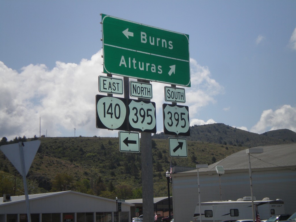
OR-140 East at US-395
OR-140 east at US-395 junction. Turn right for US-395 south to Alturas (California). Turn left for US-395 North/OR-140 east to Burns. OR-140 east joins US-395 north through Lakeview.
Taken 05-28-2012

 Lakeview
Lake County
Oregon
United States
Lakeview
Lake County
Oregon
United States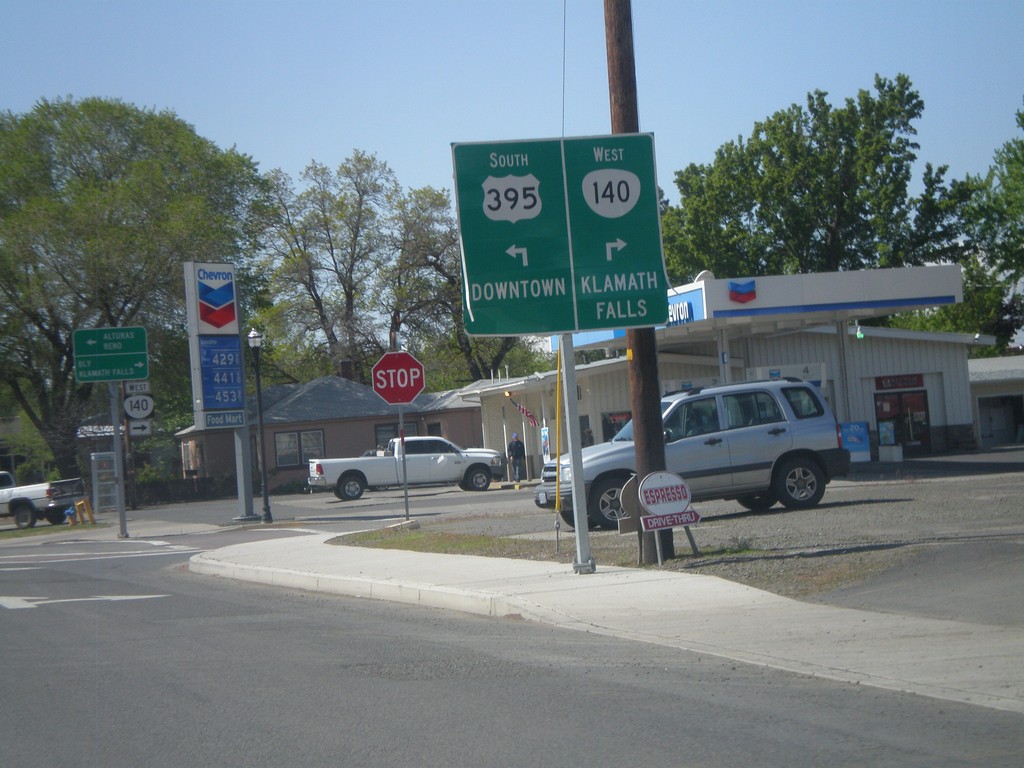
US-395 South/OR-140 West Approaching Split
US-395 South/OR-140 West approaching US-395/OR-140 split. Turn right for OR-140 west to Klamath Falls. Turn left for US-395 to Downtown (Lakeview).
Taken 05-28-2012
Lakeview
Lake County
Oregon
United States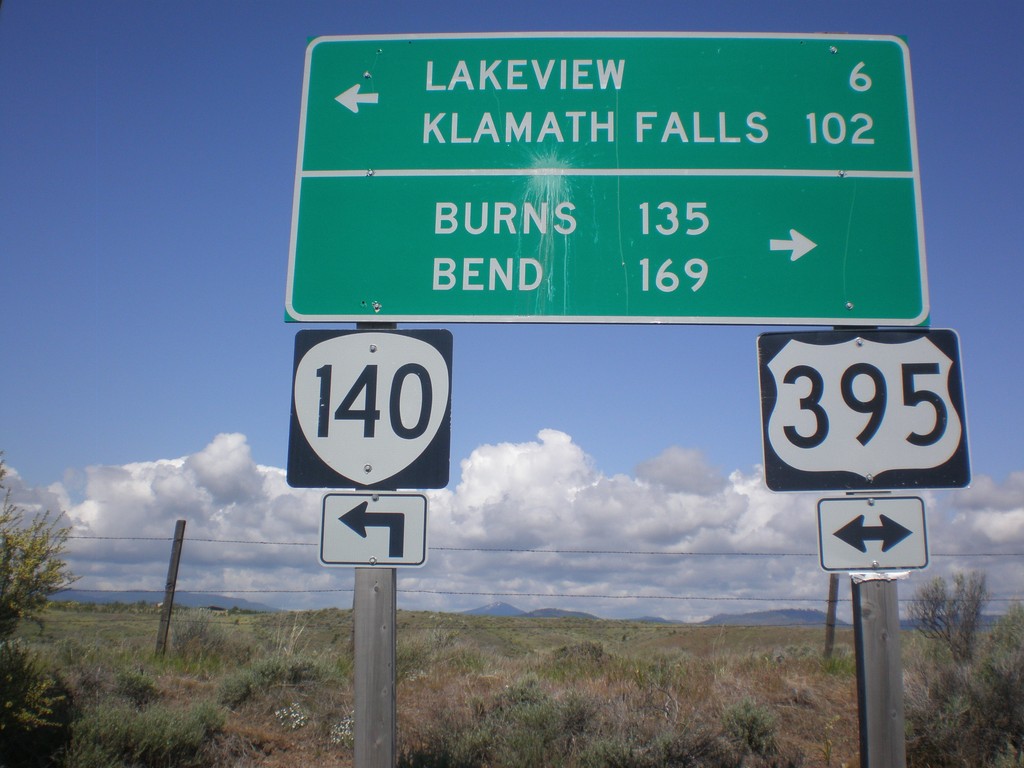
OR-140 West at US-395
OR-140 west at US-395. OR-140 west joins US-395 south into Lakeview. Use US-395 north for Burns and Bend. Use US-395 South/OR-140 West for Lakeview and Klamath Falls.
Taken 05-28-2012
Lakeview
Lake County
Oregon
United States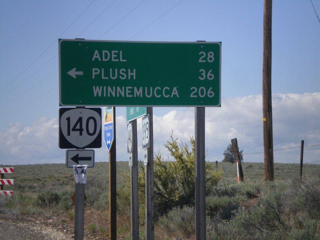
US-395 South OR-140
US-395 South at OR-140. Use OR-140 east for Adel, Plush, and Winnemucca (Nevada). OR-140 west joins US-395 into Lakeview.
Taken 05-28-2012
Lakeview
Lake County
Oregon
United States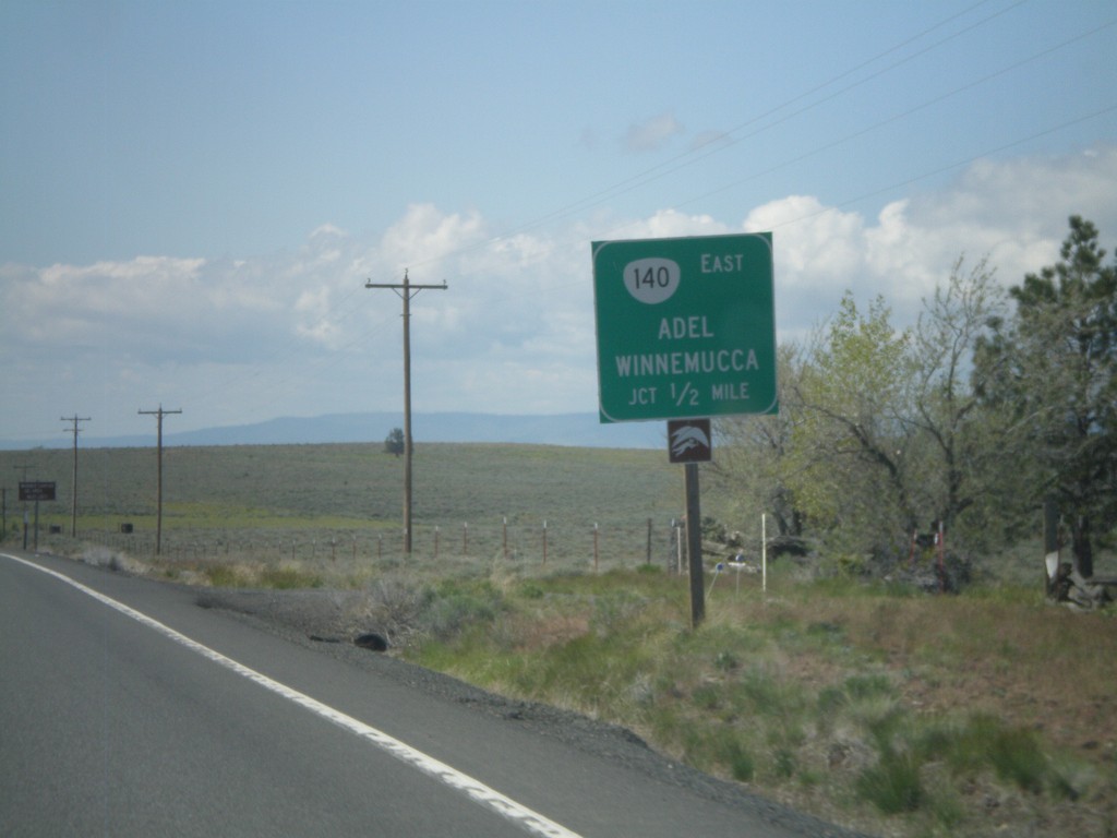
US-395 South Approaching OR-140
US-395 south approaching OR-140 east to Adel and Winnemucca (Nevada).
Taken 05-28-2012
Lakeview
Lake County
Oregon
United States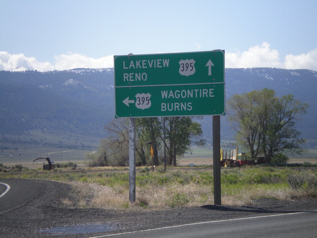
End OR-31 South at US-395
End OR-31 south at US-395. Use US-395 south for Lakeview and Reno (Nevada). Use US-395 north for Wagontire and Burns.
Taken 05-28-2012
 Lakeview
Lake County
Oregon
United States
Lakeview
Lake County
Oregon
United States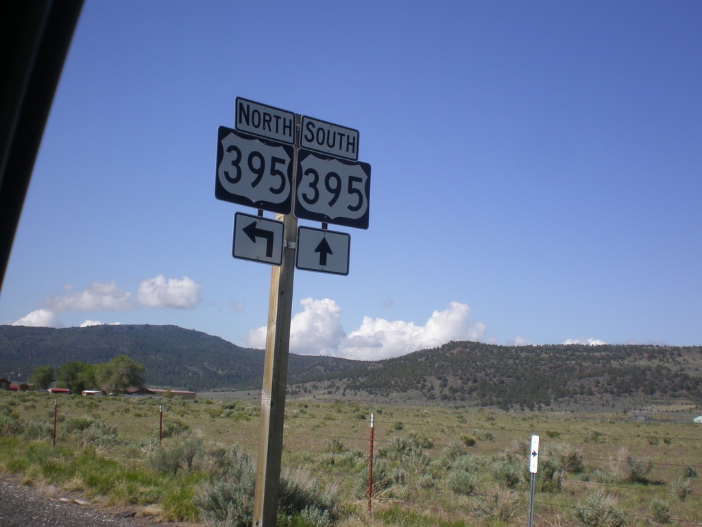
OR-31 South Approaching US-395
OR-31 south approaching US-395. This is the southern end of OR-31.
Taken 05-28-2012
Lakeview
Lake County
Oregon
United States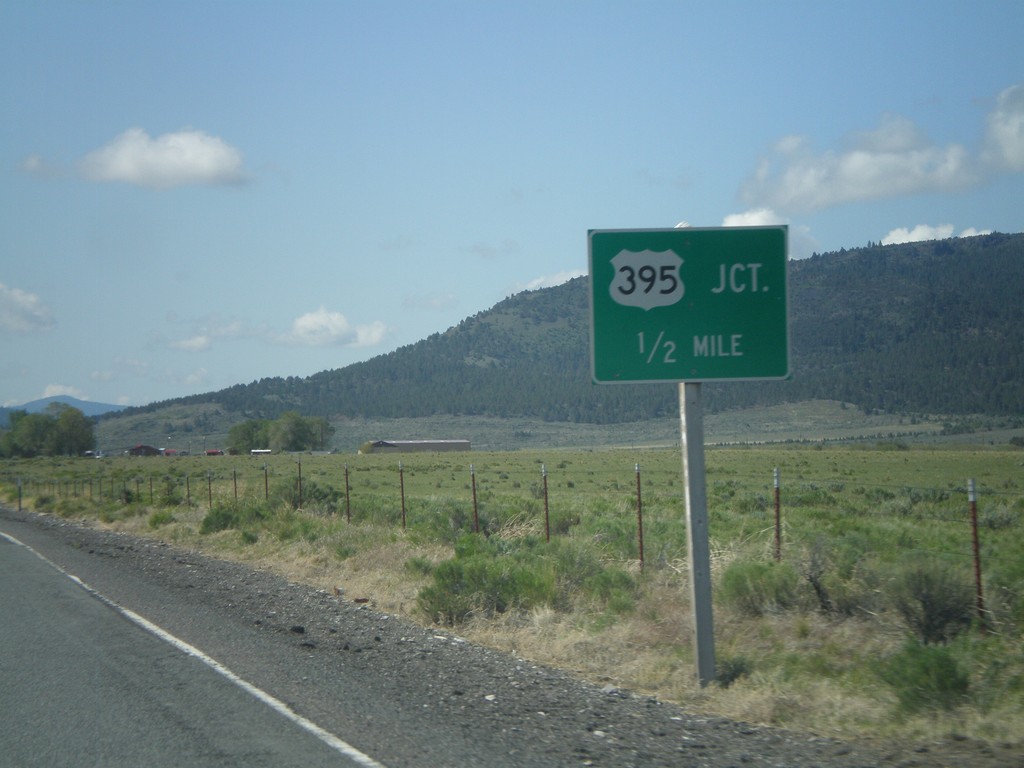
OR-31 South Approaching US-395
OR-31 South at US-395 junction. This is the southern end of OR-31.
Taken 05-28-2012
Lakeview
Lake County
Oregon
United States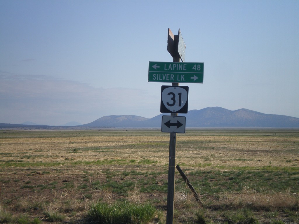
End Silver Lake Marsh Road at OR-31
End Silver Lake Marsh Road at OR-31. Turn right on OR-31 for Silver Lake. Turn left on OR-31 for La Pine.
Taken 05-28-2012
Silver Lake
Lake County
Oregon
United States
End Fort Rock Road at OR-31
End Fort Rock Road at OR-31 in rural Lake County.
Taken 05-27-2012
Fort Rock
Lake County
Oregon
United States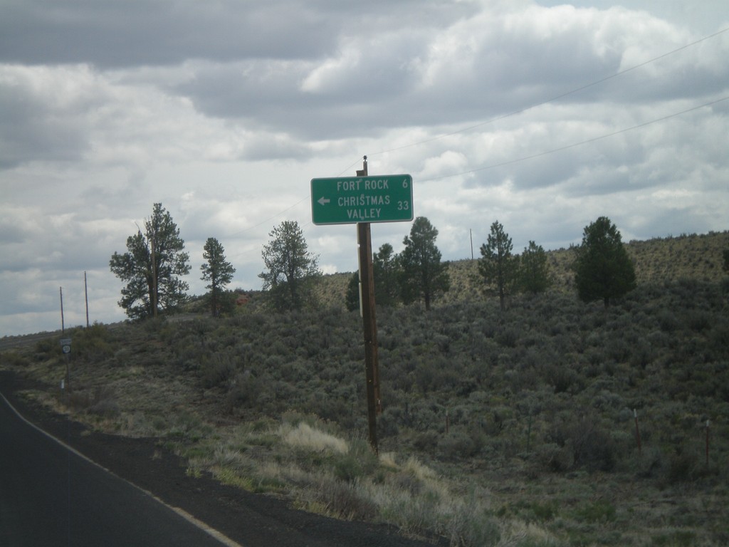
OR-31 South at Fort Rock Jct.
OR-31 south at Fort Rock/Christmas Valley Jct.
Taken 05-27-2012
Fort Rock
Lake County
Oregon
United States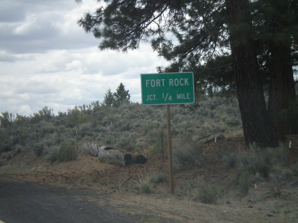
OR-31 South Approaching Fort Rock Jct.
OR-31 south approaching Fort Rock junction.
Taken 05-27-2012
Fort Rock
Lake County
Oregon
United States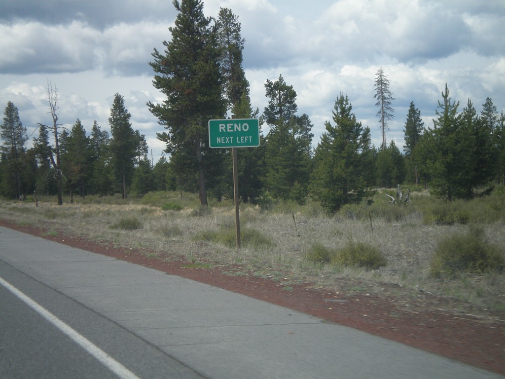
US-97 South Approaching OR-31
US-97 south approaching OR-31. Use OR-31 south for Reno (Nevada).
Taken 05-27-2012
 La Pine
Deschutes County
Oregon
United States
La Pine
Deschutes County
Oregon
United States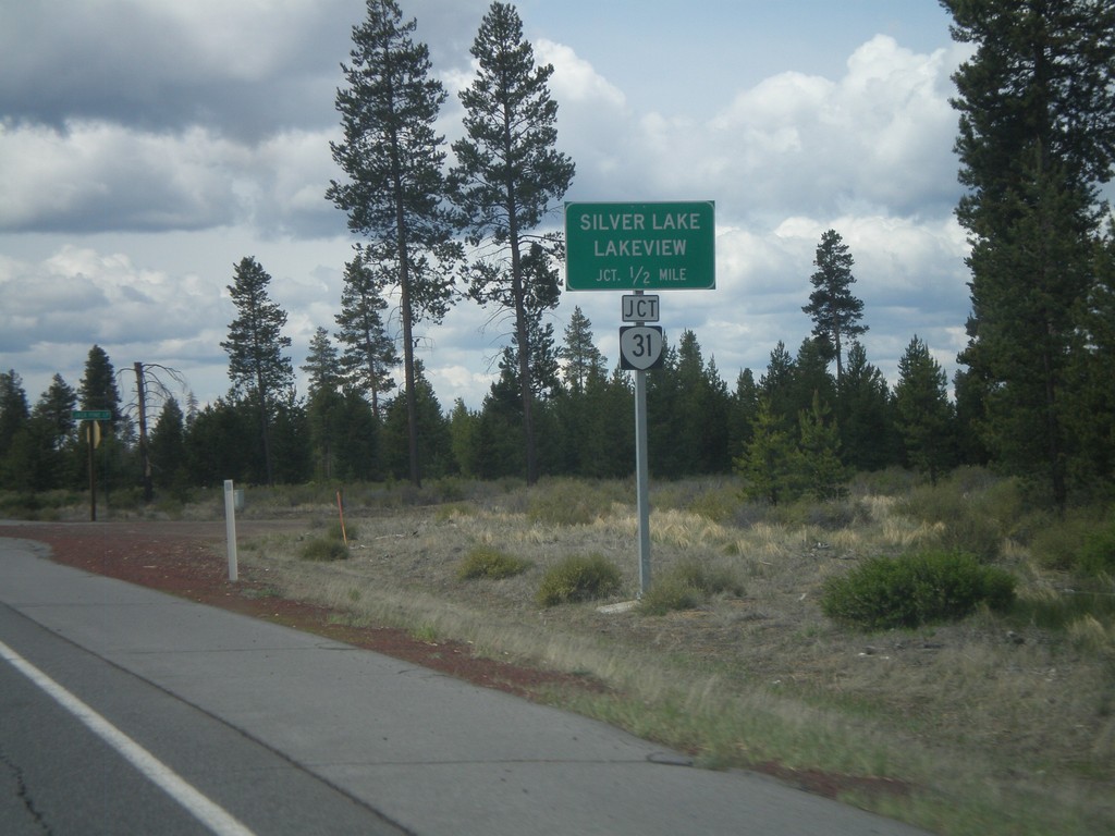
US-97 South Approaching OR-31
US-97 south approaching OR-31. Use OR-31 south for Silver Lake and Lakeview.
Taken 05-27-2012
La Pine
Deschutes County
Oregon
United States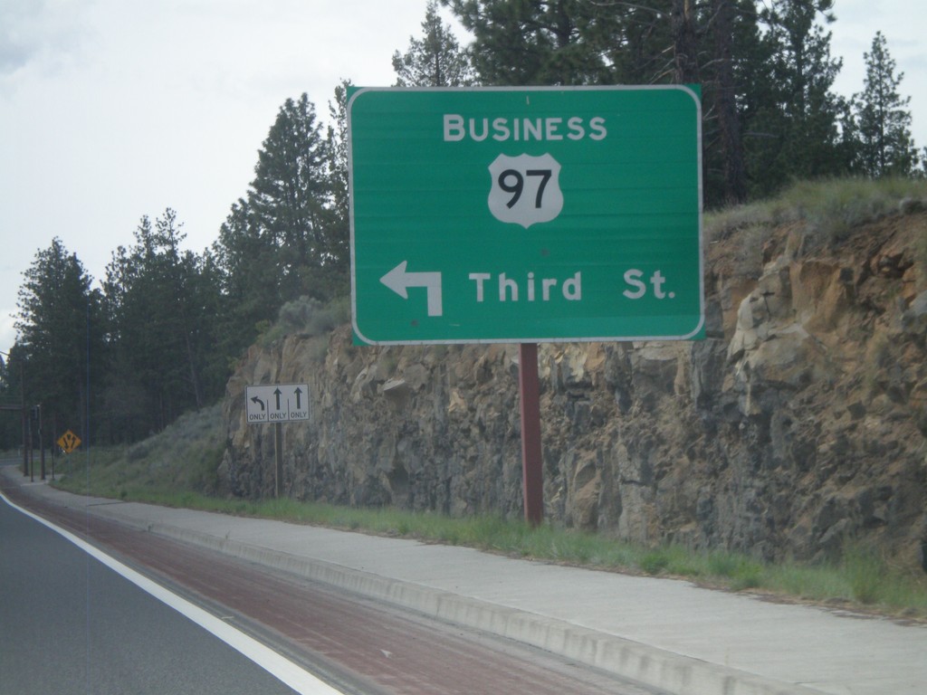
US-97 South at Bus. US-97 Jct.
US-97 South at Bus. US-97/Third St. junction. This is the southern end of the Bend, Oregon business loop, and also the southern end of the Bend Parkway section of US-97.
Taken 05-27-2012
 Bend
Deschutes County
Oregon
United States
Bend
Deschutes County
Oregon
United States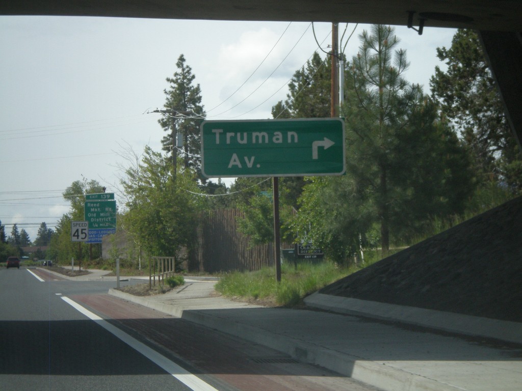
US-97 South at Truman Avenue
US-97 south at Truman Ave. intersection.
Taken 05-27-2012
Bend
Deschutes County
Oregon
United States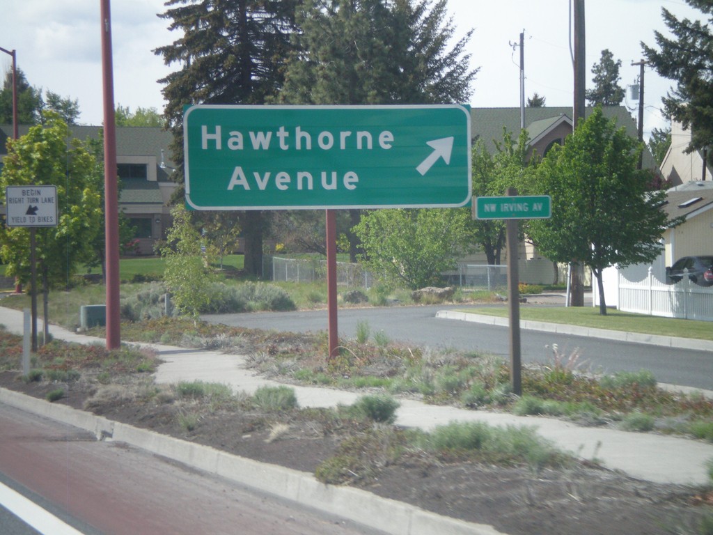
US-97 South - Hawthorne Ave.
US-97 south at Hawthorne Ave. junction.
Taken 05-27-2012
Bend
Deschutes County
Oregon
United States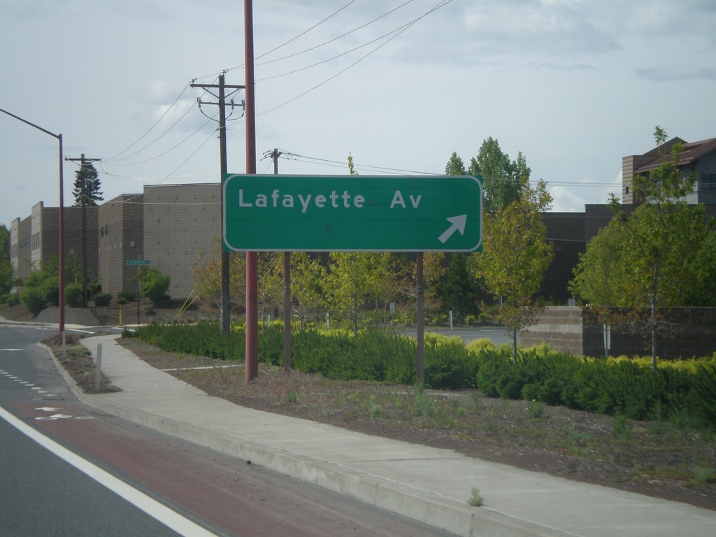
US-97 South - Lafayette Ave
US-97 south at Lafayette Ave. intersection.
Taken 05-27-2012
Bend
Deschutes County
Oregon
United States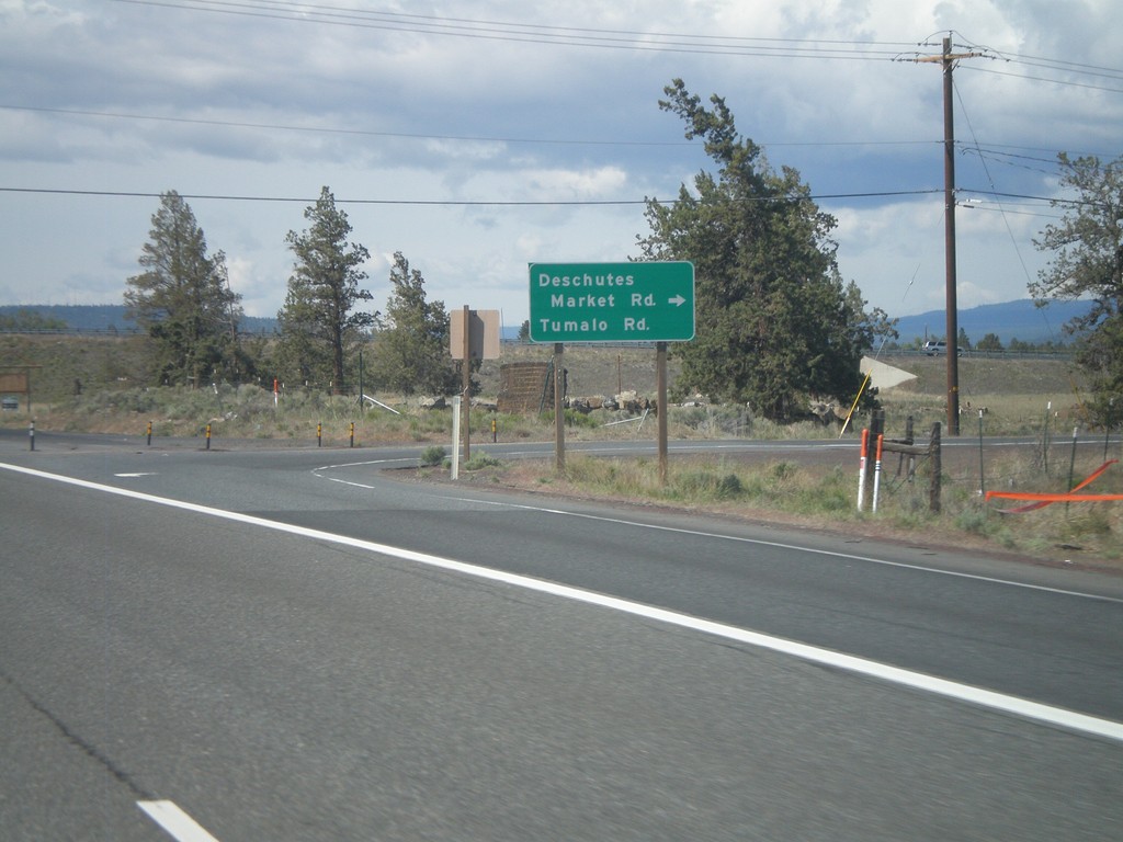
US-97 South at Tumalo Road Jct.
US-97 South at Tumalo Road/Deschutes Market Road junction.
Taken 05-27-2012
Bend
Deschutes County
Oregon
United States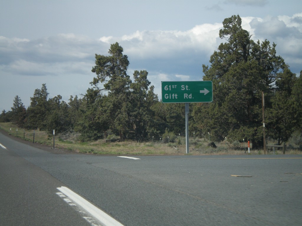
US-97 South At 61st St. Jct.
US-97 South At 61st St./Gift Road junction.
Taken 05-27-2012
Redmond
Deschutes County
Oregon
United States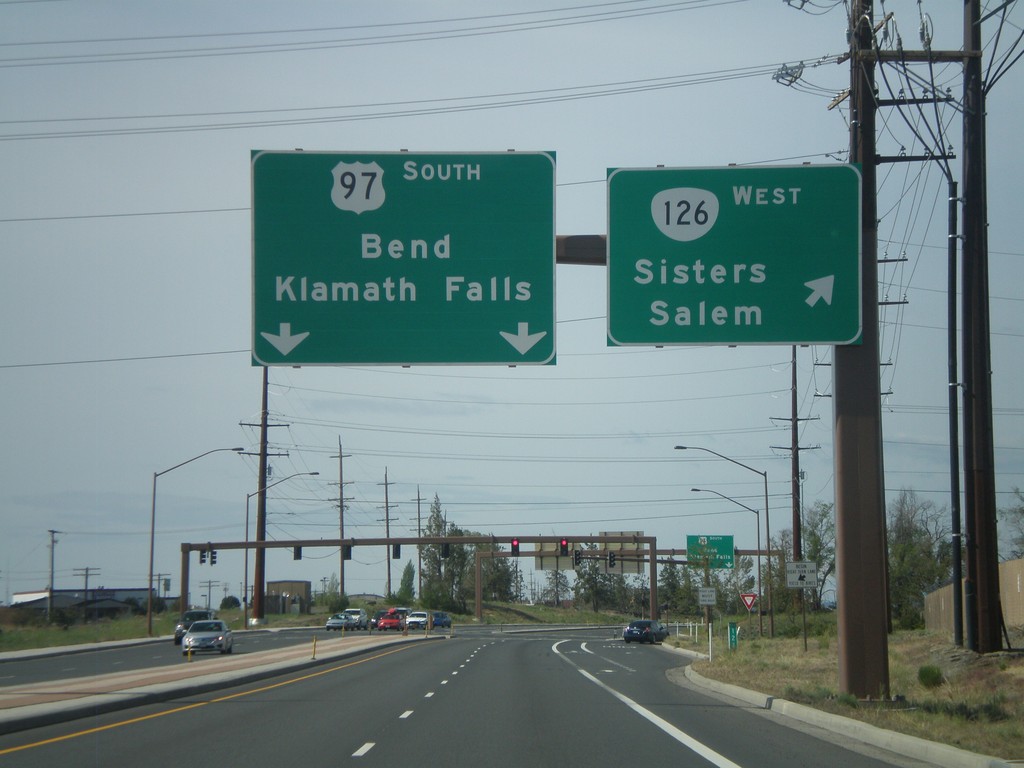
US-97 South at OR-126 West
US-97 south at OR-126 west to Sisters and Salem. US-97 continues south towards Bend and Klamath Falls.
Taken 05-27-2012
 Redmond
Deschutes County
Oregon
United States
Redmond
Deschutes County
Oregon
United States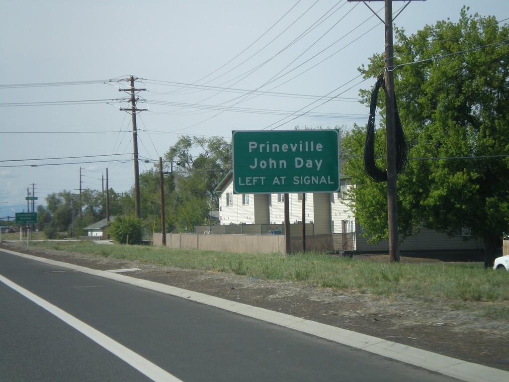
US-97 South Approaching OR-126 East
US-97 South approaching OR-126 East (Evergreen Ave.) Use OR-126 east for Prineville and John Day.
Taken 05-27-2012
Redmond
Deschutes County
Oregon
United States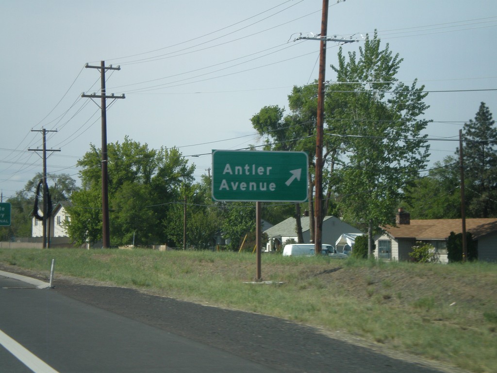
US-97 South at Antler Ave
US-97 south at Antler Ave junction.
Taken 05-27-2012
Redmond
Deschutes County
Oregon
United States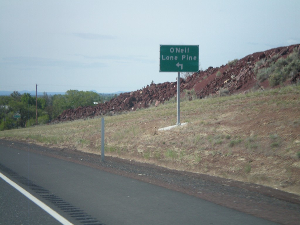
US-97 South at OR-370 (O'Neil Highway)
US-97 south at OR-370 to O’Neill and Lone Pine. OR-370 is not signed as such at this junction, but is part of the O’Neil Highway. This is part of the Oregon State Highway system that did not have a posted route number. In recent years the Oregon Department of Transportation has been assigning numbers to routes that have previously been unsigned.
Taken 05-27-2012
 Redmond
Deschutes County
Oregon
United States
Redmond
Deschutes County
Oregon
United States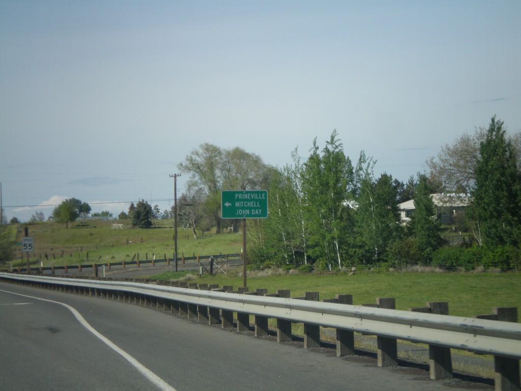
US-97 South/US-26 East at Split
US-97 South/US-26 East at US-97/US-26 split. Turn left for US-26 east to Prineville, Mitchell, and John Day.
Taken 05-27-2012
 Madras
Jefferson County
Oregon
United States
Madras
Jefferson County
Oregon
United States