Signs Tagged With Intersection
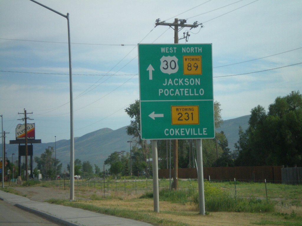
US-30 West/WY-89 North Approaching WY-231/WY-232
US-30 West/WY-89 North approaching WY-231/WY-232 (not signed). Use WY-231 for Cokeville. Continue on US-30 West/WY-89 North for Jackson and Pocatello.
Taken 07-05-2011


 Cokeville
Lincoln County
Wyoming
United States
Cokeville
Lincoln County
Wyoming
United States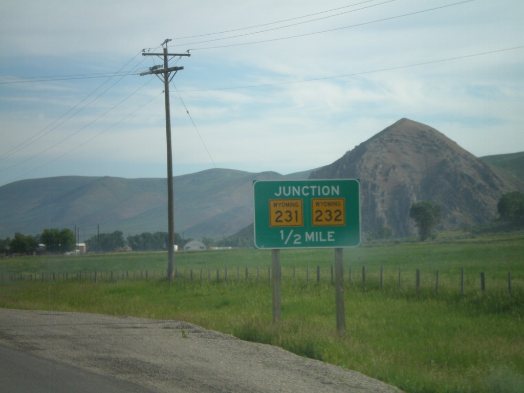
US-30 West/WY-89 North Approaching WY-231/WY-232
US-30 West/WY-89 North approaching WY-231/WY-232.
Taken 07-05-2011
Cokeville
Lincoln County
Wyoming
United States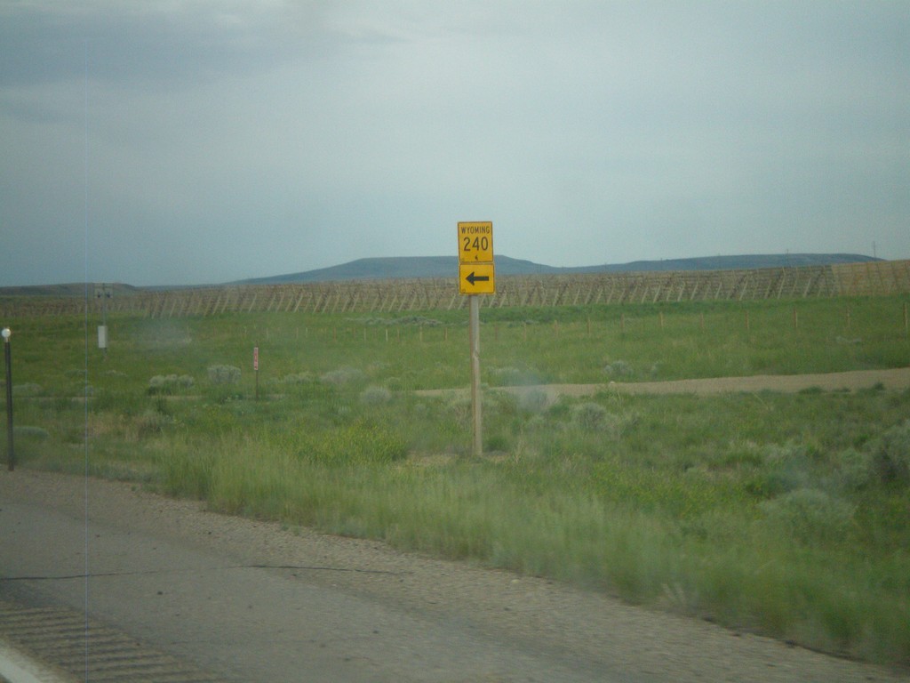
US-189 South at WY-240
US-189 south at WY-240. Use WY-240 south for Opal.
Taken 07-05-2011

 Kemmerer
Lincoln County
Wyoming
United States
Kemmerer
Lincoln County
Wyoming
United States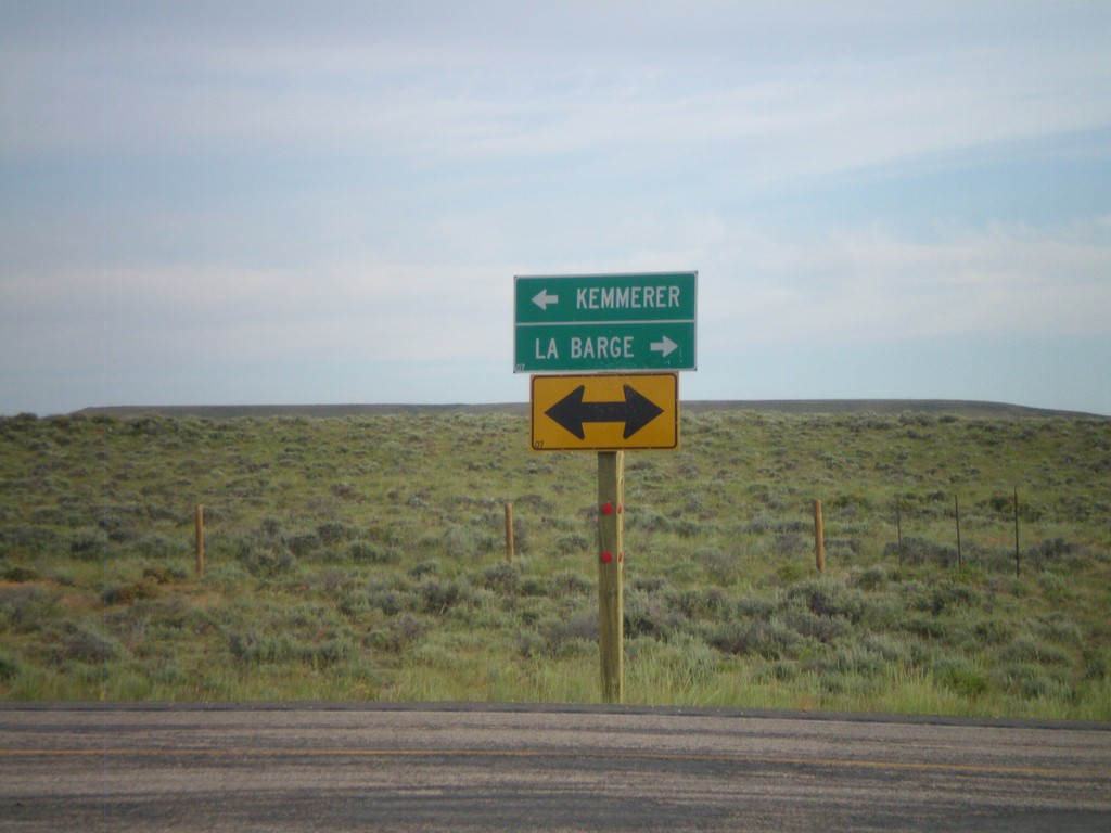
End WY-372 at US-189
End WY-372 at US-189. Use US-189 north for La Barge; use US-189 south for Kemmerer.
Taken 07-05-2011
 Fontenelle
Lincoln County
Wyoming
United States
Fontenelle
Lincoln County
Wyoming
United States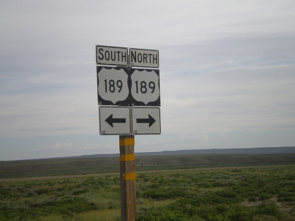
End WY-372 at US-189
End WY-372 at US-189.
Taken 07-05-2011
Kemmerer
Lincoln County
Wyoming
United States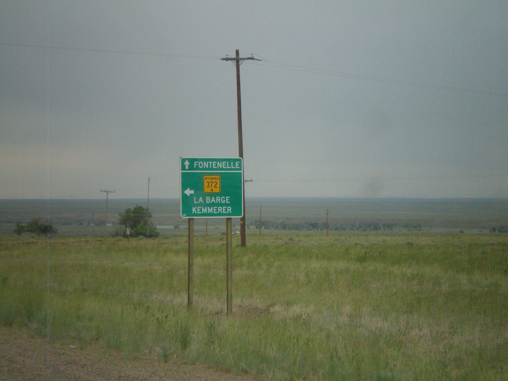
WY-372 in Fontenelle
WY-372 in Fontenelle. Turn left to continue on WY-372 towards La Barge and Kemmerer. Continue ahead for the community of Fontenelle.
Taken 07-04-2011
Fontenelle
Lincoln County
Wyoming
United States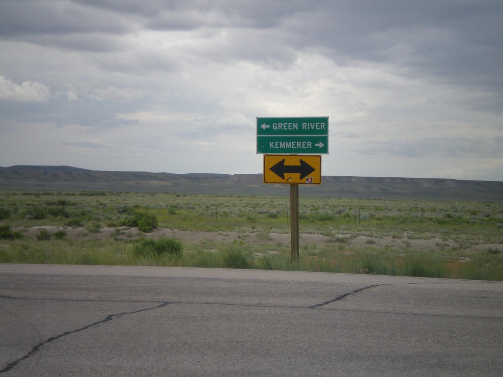
End WY-28 West at WY-372
End WY-28 west at WY-372. Use WY-372 north for Kemmerer; use WY-372 south for Green River.
Taken 07-04-2011
 Green River
Sweetwater County
Wyoming
United States
Green River
Sweetwater County
Wyoming
United States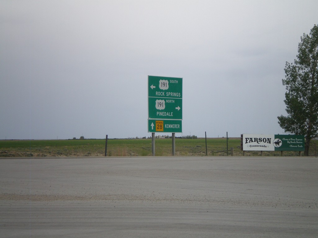
WY-28 West at US-191
WY-28 west at US-191. Use US-191 north for Pinedale; US-191 south for Rock Springs. Continue west on WY-28 for Kemmerer.
Taken 07-04-2011
 Eden
Sweetwater County
Wyoming
United States
Eden
Sweetwater County
Wyoming
United States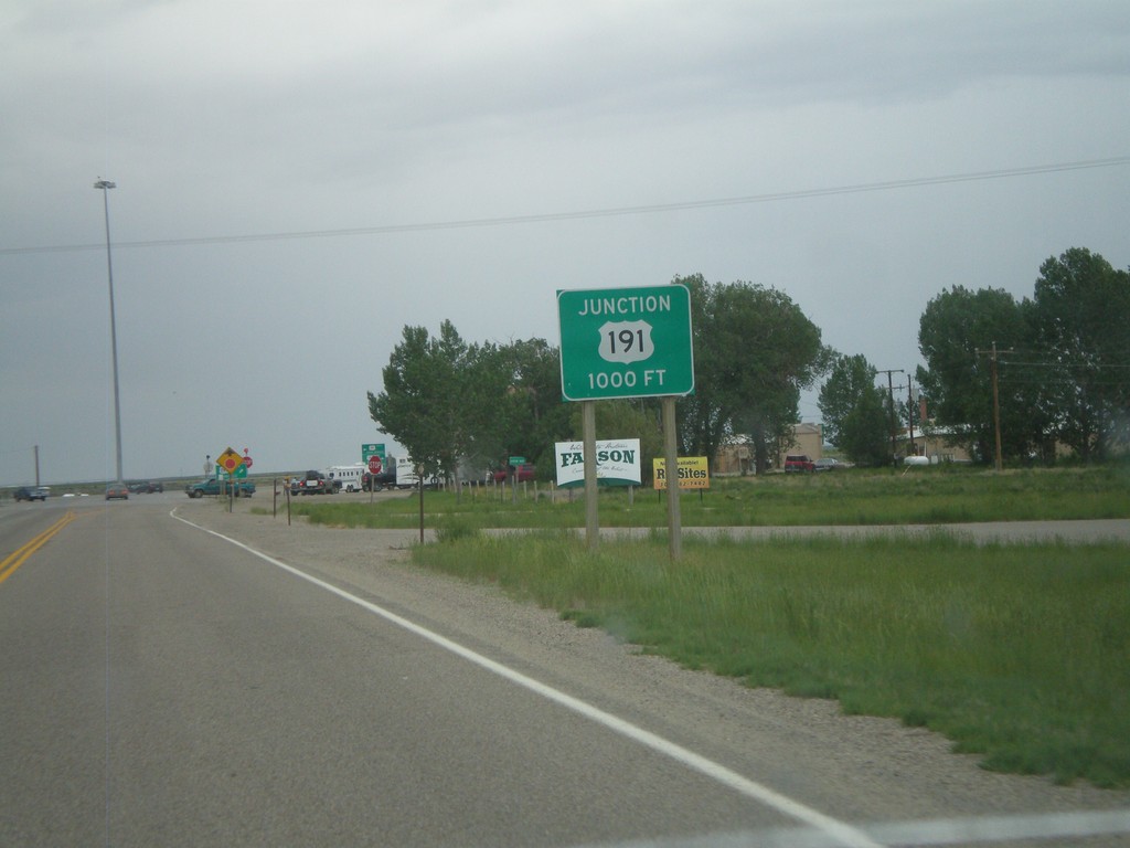
WY-28 West Approaching US-191
WY-28 west approaching US-191 in Farson.
Taken 07-04-2011
Farson
Sweetwater County
Wyoming
United States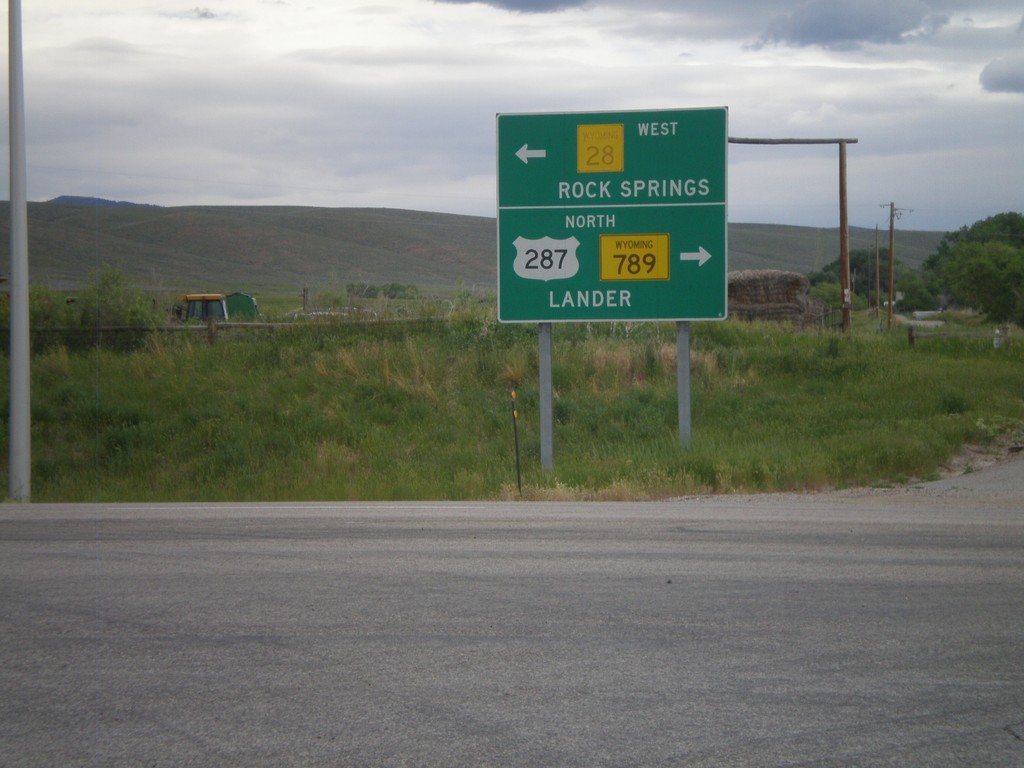
US-287/WY-789 North at WY-28
US-287 North/WY-789 North at WY-28. Turn left for WY-28 to Rock Springs; turn right for US-287/WY-789 to Lander.
Taken 07-04-2011

 Lander
Fremont County
Wyoming
United States
Lander
Fremont County
Wyoming
United States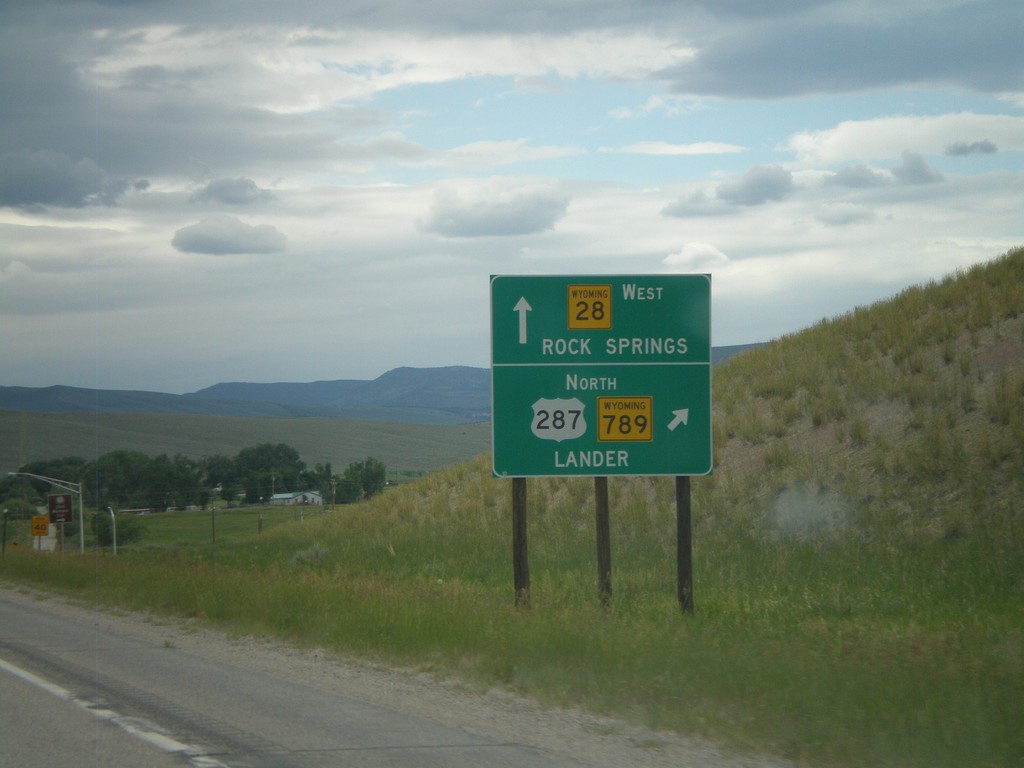
US-287/WY-789 North Approaching WY-28
US-287/WY-789 North approaching WY-28. Use US-287/WY-789 north for Lander. Use WY-28 west for Rock Springs.
Taken 07-04-2011
Kotey Place
Fremont County
Wyoming
United States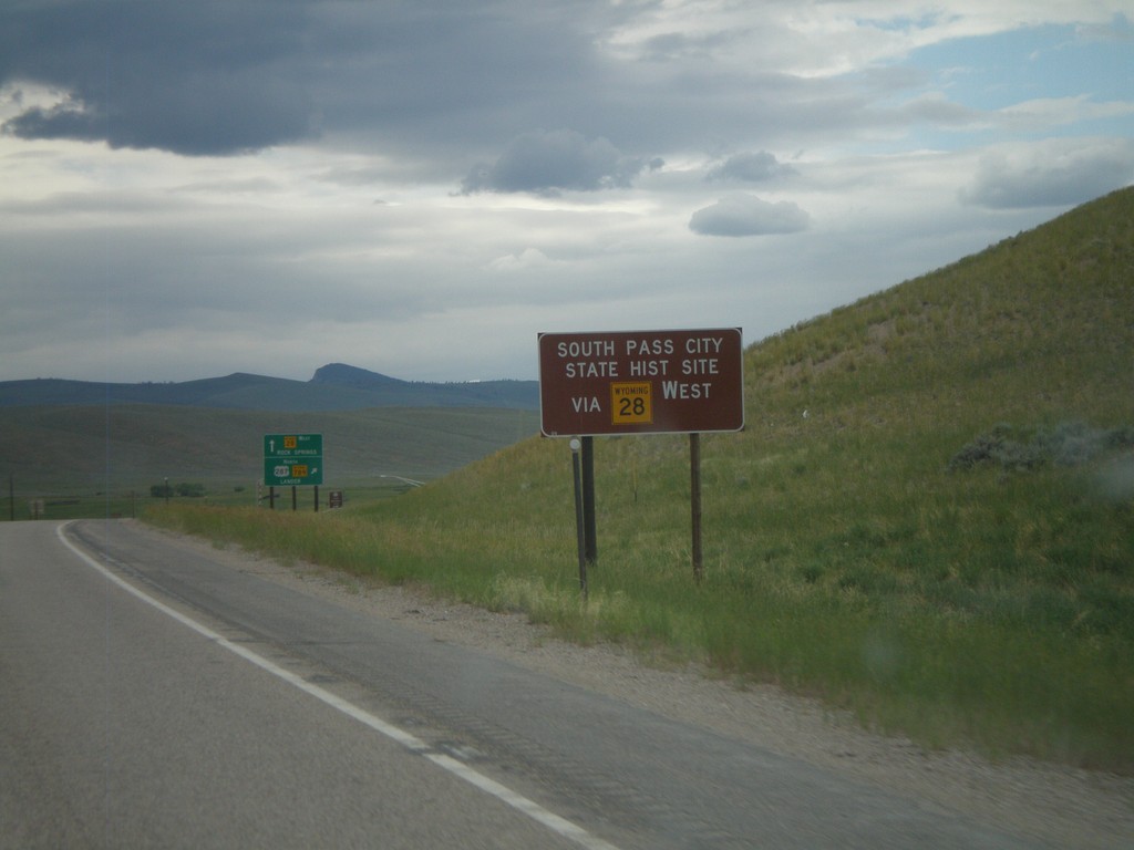
US-287/WY-789 North Approaching WY-28
US-287/WY-789 North approaching WY-28. Use WY-28 west for South Pass City State Historic Site.
Taken 07-04-2011
Kotey Place
Fremont County
Wyoming
United States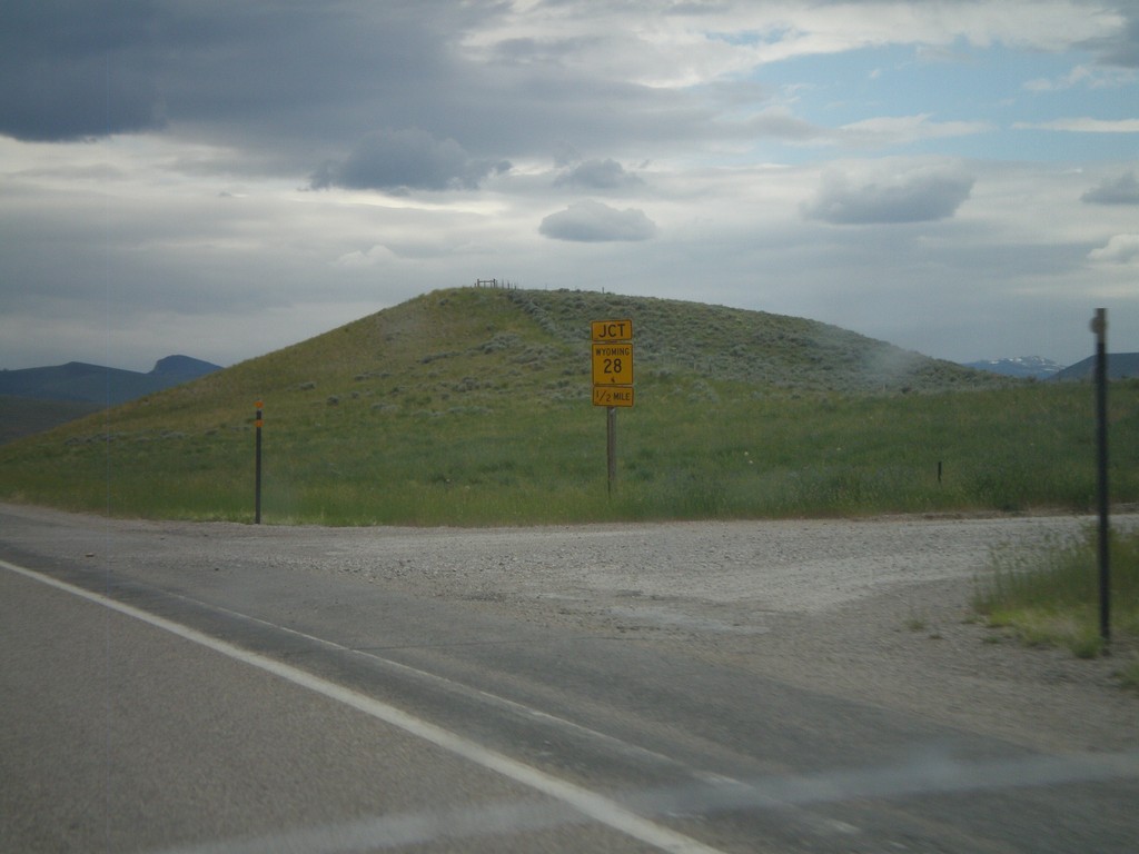
US-287/WY-789 North Approaching WY-28
US-287/WY-789 North approaching WY-28.
Taken 07-04-2011
Lander
Fremont County
Wyoming
United States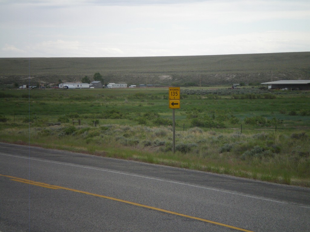
US-287/WY-789 South at WY-135
US-287/WY-789 South at WY-135 North.
Taken 07-04-2011
 Sweetwater Station
Fremont County
Wyoming
United States
Sweetwater Station
Fremont County
Wyoming
United States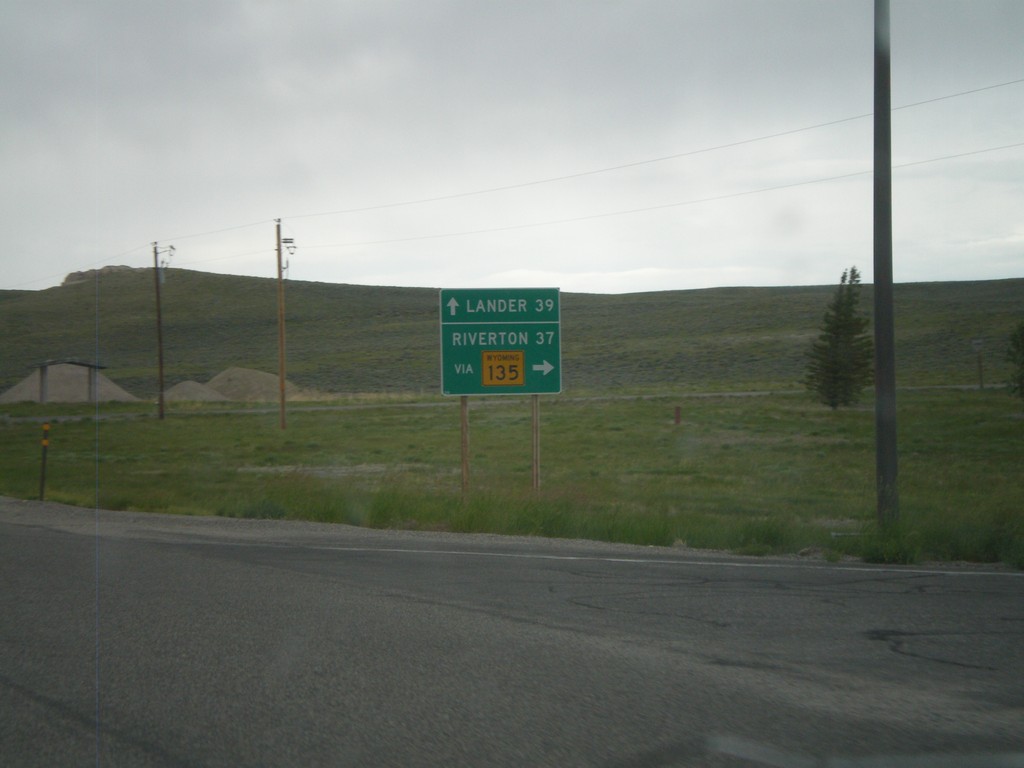
US-287/WY-789 North at WY-135
US-287/WY-789 North at WY-135 junction. Use WY-135 north for Riverton, continue on US-287/WY-789 for Lander. Taken in the community of Sweetwater Station.
Taken 07-04-2011
Sweetwater Station
Fremont County
Wyoming
United States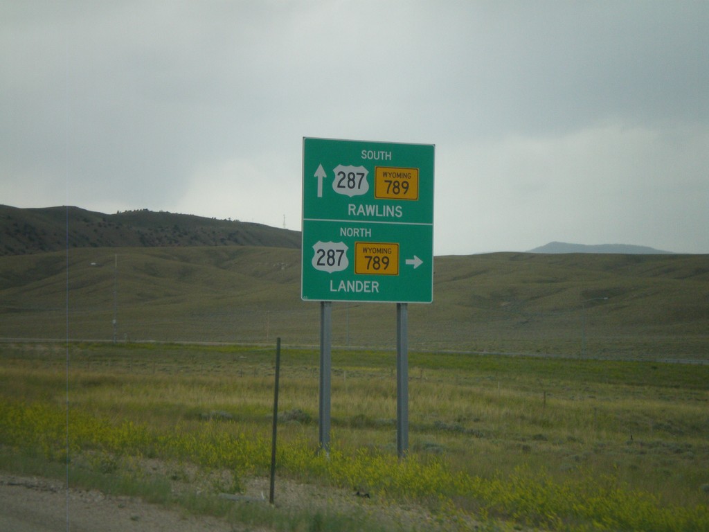
End WY-220 West At US-287/WY-789
End WY-220 West at US-287/WY-789. Use US-287/WY-789 North for Lander; use US-287/WY-789 South for Rawlins.
Taken 07-04-2011
 Rawlins
Carbon County
Wyoming
United States
Rawlins
Carbon County
Wyoming
United States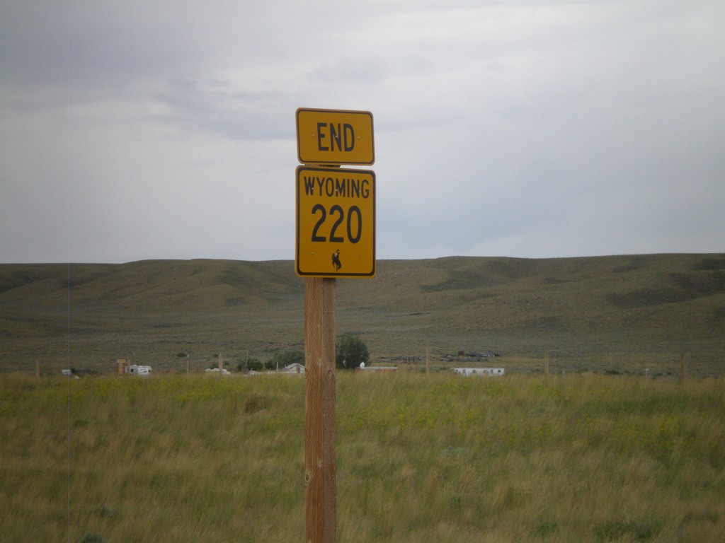
End WY-220 West at US-287/WY-789
End WY-220 west at US-287/WY-789 in Muddy Gap Junction.
Taken 07-04-2011
Rawlins
Carbon County
Wyoming
United States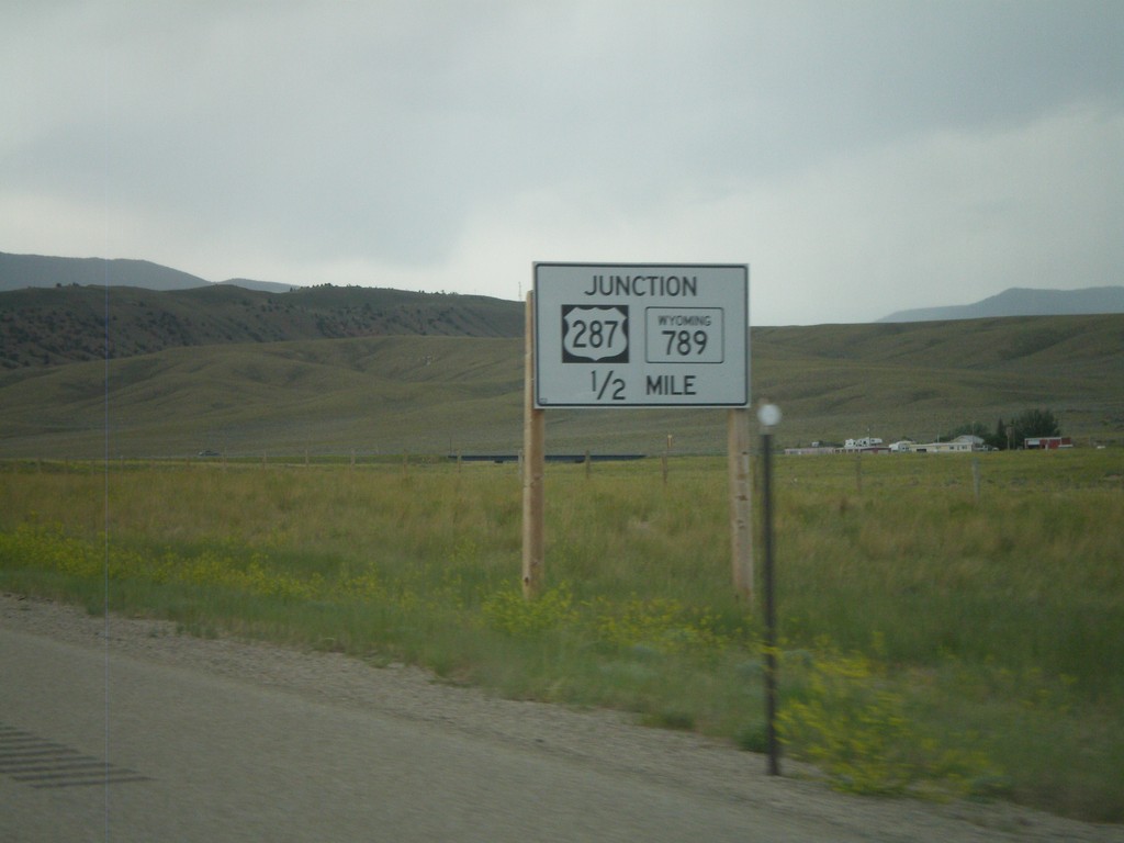
WY-220 West Approaching US-287/WY-789
WY-220 West approaching US-287/WY-789. This is a non standard Wyoming junction sign that is in black and white.
Taken 07-04-2011
Rawlins
Carbon County
Wyoming
United States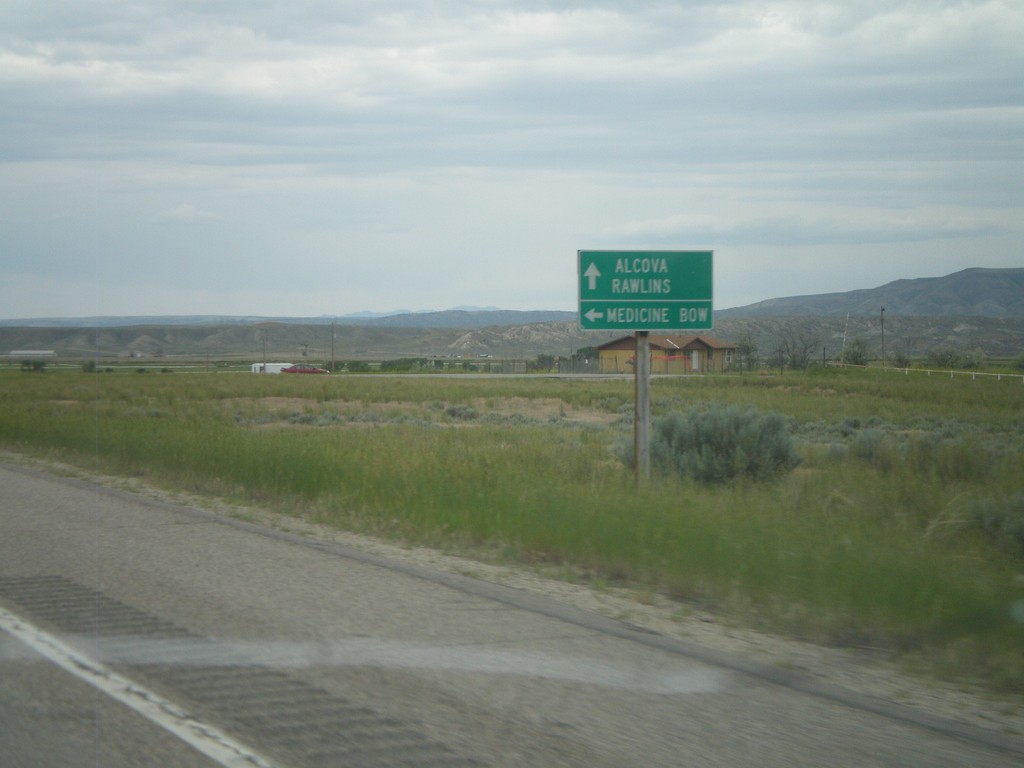
WY-220 West at WY-487
WY-220 west at WY-487 south to Medicine Bow. Continue west on WY-220 for Alcova and Rawlins.
Taken 07-04-2011
 Casper
Natrona County
Wyoming
United States
Casper
Natrona County
Wyoming
United States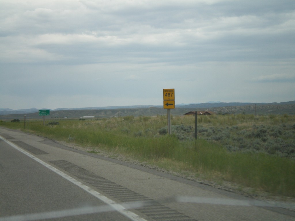
WY-220 West at WY-487 South
WY-220 west at WY-487 south.
Taken 07-04-2011
Casper
Natrona County
Wyoming
United States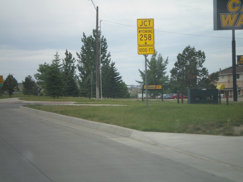
WY-220 West Approaching WY-258
WY-220 West (CY Ave) approaching WY-258 (Wyoming Blvd). WY-258 is the belt line across the south side of Casper.
Taken 07-04-2011
 Casper
Natrona County
Wyoming
United States
Casper
Natrona County
Wyoming
United States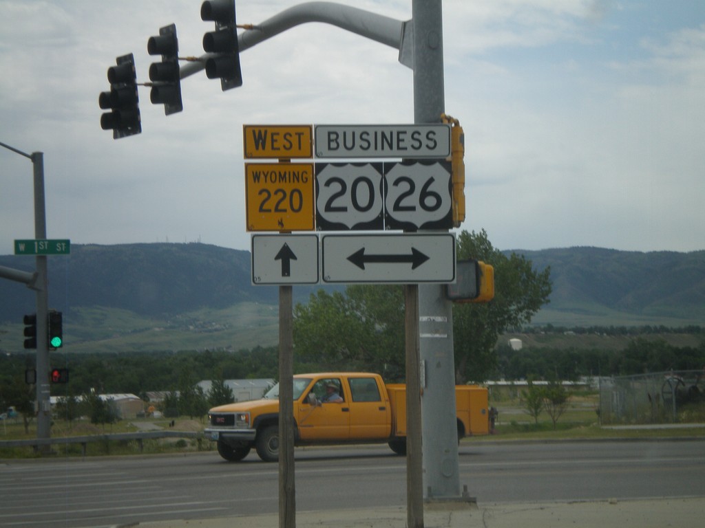
WY-220 West at Business US-20/Business US-26
WY-220 west at Business US-20/Business US-26 (1st Ave) in Casper.
Taken 07-04-2011

 Casper
Natrona County
Wyoming
United States
Casper
Natrona County
Wyoming
United States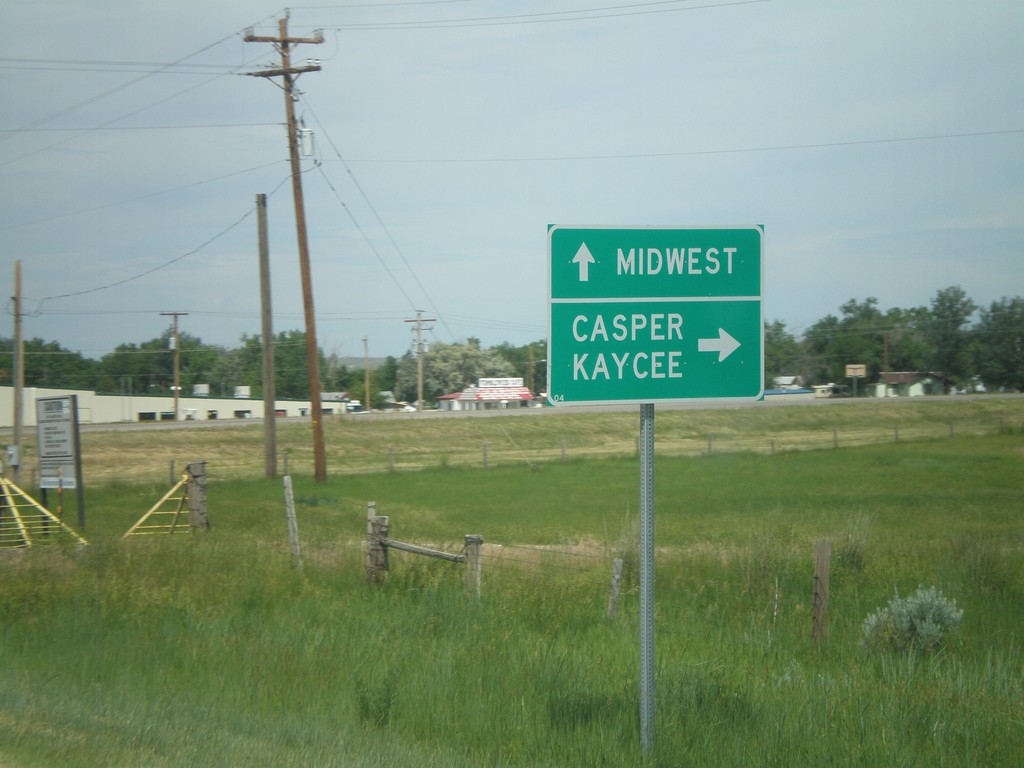
WY-387 South Approaching WY-259
WY-387 south approaching WY-259. Continue ahead (via county road) for Midwest. Turn right to continue on WY-387 south for Kaycee and Casper. Destinations via WY-259 (left turn) are not signed.
Taken 07-04-2011

 Edgerton
Natrona County
Wyoming
United States
Edgerton
Natrona County
Wyoming
United States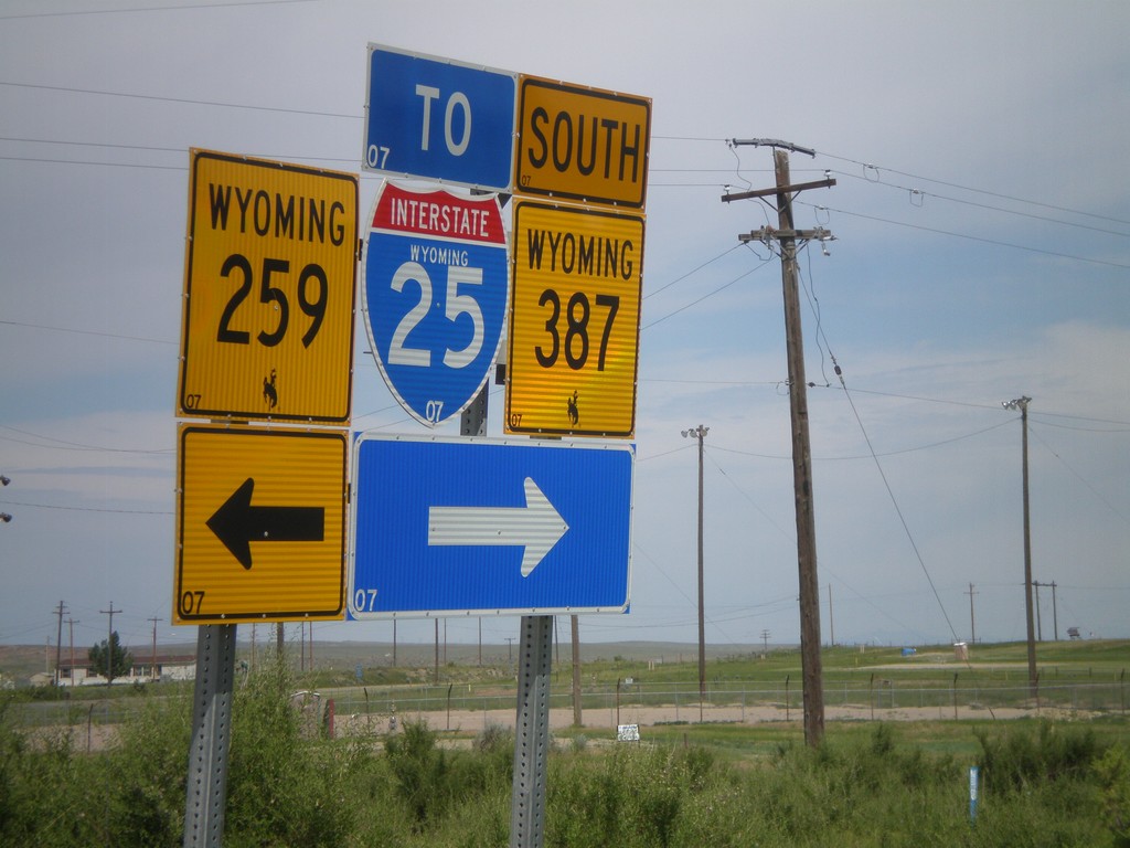
WY-387 West at WY-258
WY-387 south at WY-258 in Midwest. Turn right to continue west on WY-387, and for I-25 traffic. It is probably shorter for I-25 south traffic to use WY-259 south, even though it is signed otherwise.
Taken 07-04-2011
 Midwest
Natrona County
Wyoming
United States
Midwest
Natrona County
Wyoming
United States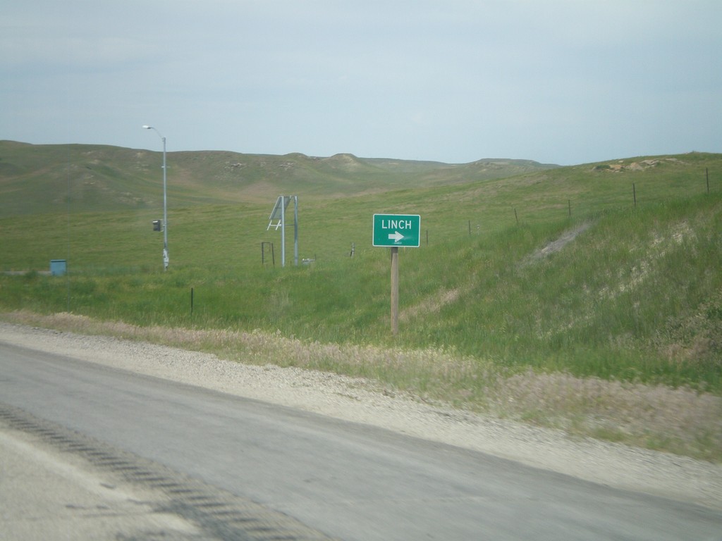
WY-387 South at WY-192
WY-387 South at WY-192. Use WY-192 north for Linch.
Taken 07-04-2011
Linch
Johnson County
Wyoming
United States