Signs Tagged With Intersection
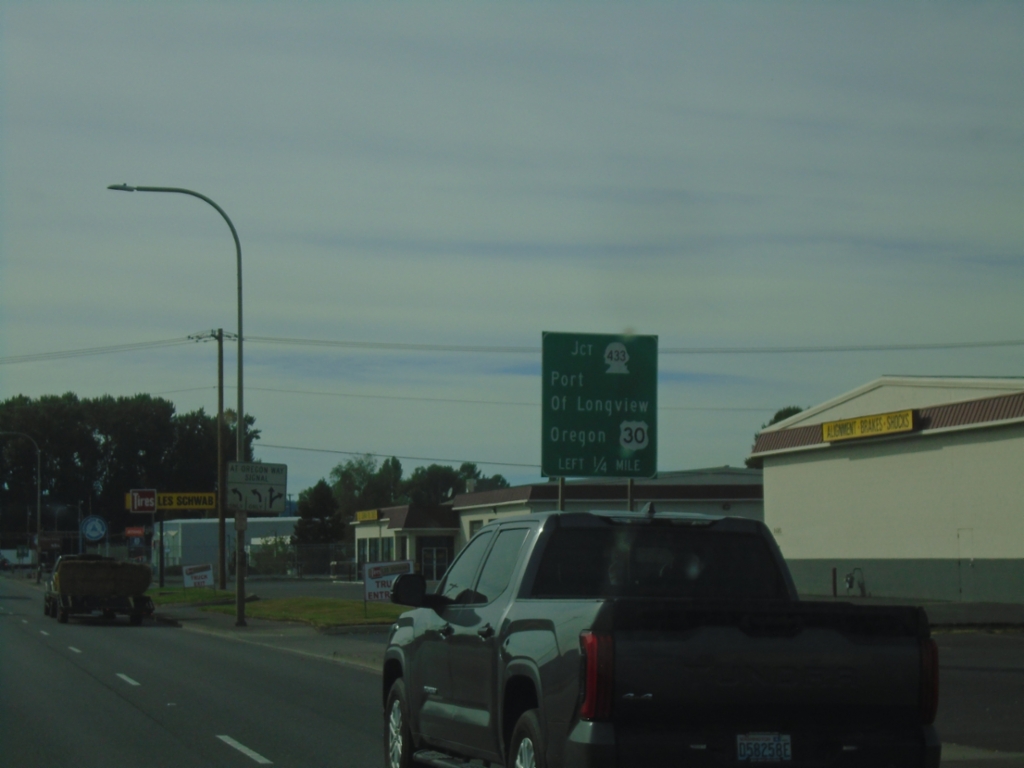
WA-432 West Approaching WA-433
WA-432 West approaching WA-433. Use WA-432 for the Port of Longview; WA-433 for the bridge to Oregon.
Taken 09-22-2024

 Longview
Cowlitz County
Washington
United States
Longview
Cowlitz County
Washington
United States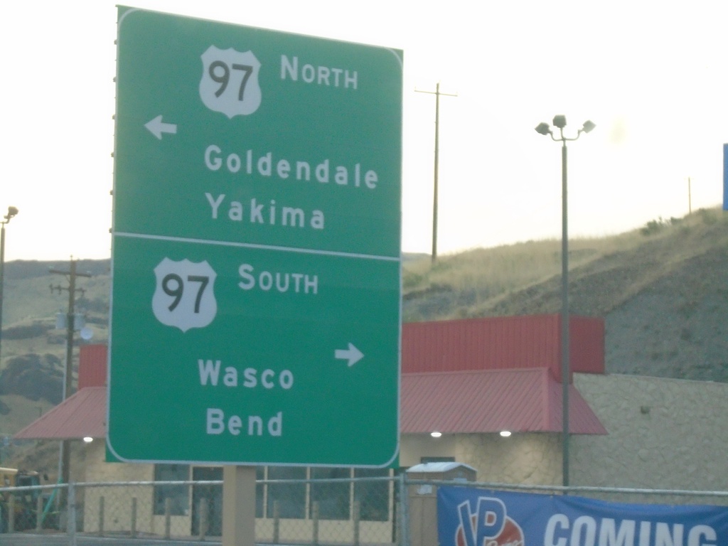
Biggs-Rufus Highway East at US-97
Biggs-Rufus Highway East at US-97 - Biggs Junction. Use US-97 south to Wasco and Bend; US-97 north to Goldendale (WA) and Yakima (WA).
Taken 08-10-2024
 Wasco
Sherman County
Oregon
United States
Wasco
Sherman County
Oregon
United States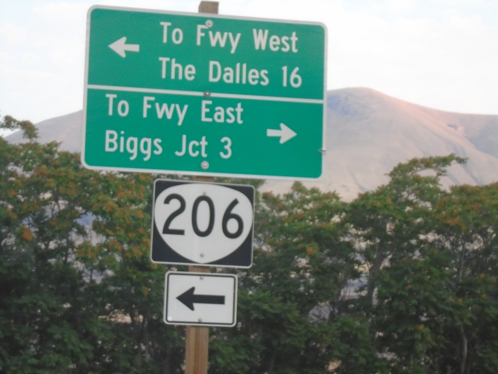
OR-206 West at Biggs-Rufus Highway
OR-206 West at Biggs-Rufus Highway. Turn left to continue on OR-206 west to Freeway West (I-84) and The Dalles. Turn right for Biggs-Rufus Highway to Freeway East (I-84) and Biggs Junction.
Taken 08-10-2024
 Wasco
Sherman County
Oregon
United States
Wasco
Sherman County
Oregon
United States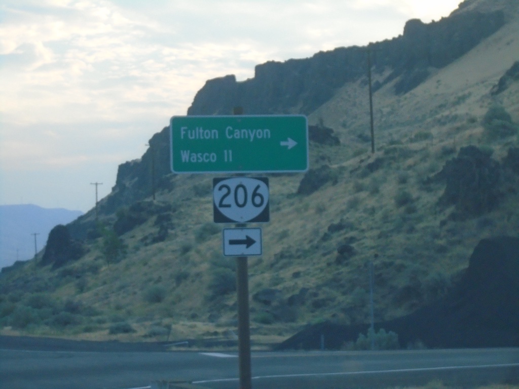
OR-206 East Approaching Biggs-Rufus Highway Junction
OR-206 East Approaching Biggs-Rufus Highway Junction. Turn right to continue east on OR-206 to Fulton Canyon and Wasco.
Taken 08-10-2024
Wasco
Sherman County
Oregon
United States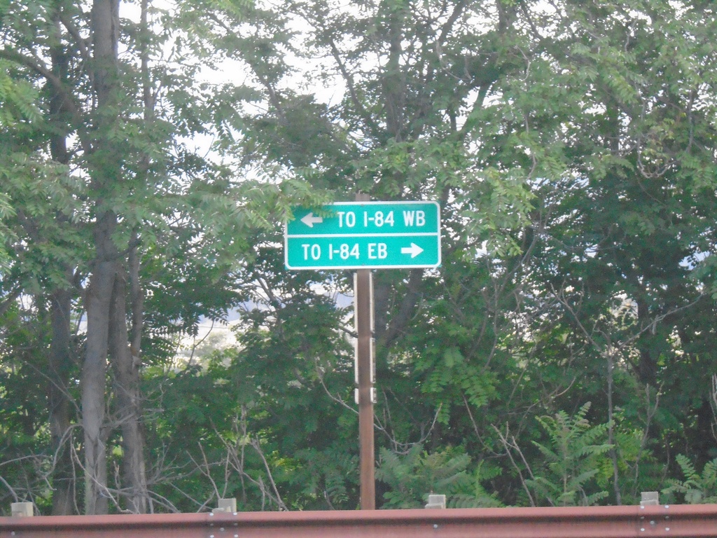
Deschutes State Park Access Road at OR-206
Deschutes State Park Access Road at OR-206. Use OR-206 East for I-84 Eastbound; OR-206 West for I-84 Westbound.
Taken 08-10-2024
 Wasco
Sherman County
Oregon
United States
Wasco
Sherman County
Oregon
United States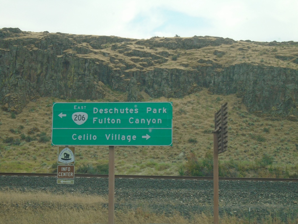
OR-206 - Celilo Village Junction
OR-206 at Celilo Village Junction. Turn right for Celilo Village; left for OR-206 East to Deschutes Park and Fulton Canyon.
Taken 08-09-2024
The Dalles
Wasco County
Oregon
United States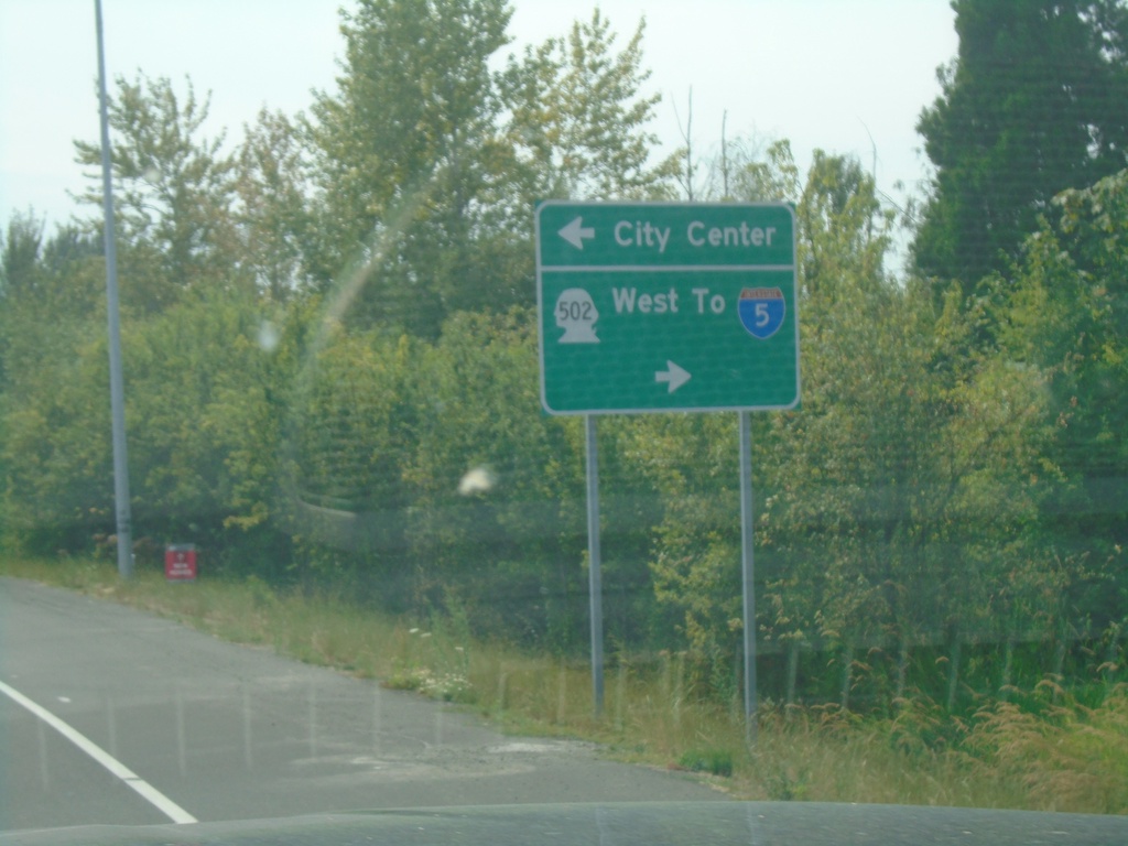
WA-503 South at WA-502 (Main St.)
WA-503 South at WA-502 (Main St.) in Battle Ground. Use WA-502 West to I-5; use Main St. east for City Center.
Taken 08-09-2024

 Battle Ground
Clark County
Washington
United States
Battle Ground
Clark County
Washington
United States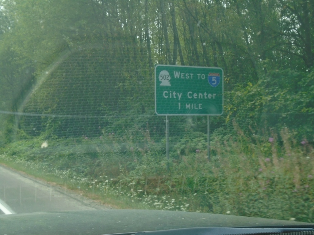
WA-503 South Approaching WA-502
WA-503 South approaching WA-502 in Battle Ground. Use WA-502 west to I-5 and City Center.
Taken 08-09-2024
 Battle Ground
Clark County
Washington
United States
Battle Ground
Clark County
Washington
United States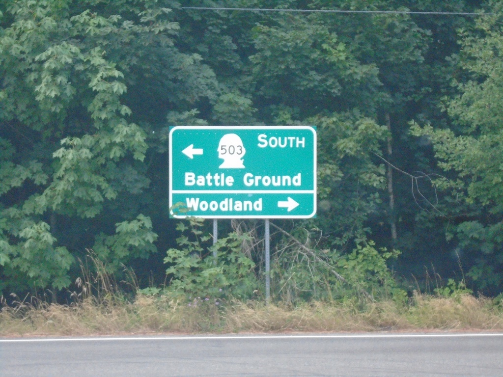
WA-503 South at NE 221st Ave.
WA-503 South at NE 221st Ave in Amboy. Turn right for Woodland; left to continue south on WA-503 to Battle Ground.
Taken 08-09-2024
Amboy
Clark County
Washington
United States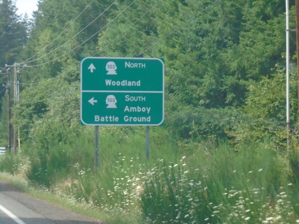
End WA-503 Spur West at WA-503
End WA-503 Spur West at WA-503. Turn left for WA-503 South to Amboy and Battle Ground. Continue straight for WA-503 North to Woodland.
Taken 08-09-2024
 Ariel
Cowlitz County
Washington
United States
Ariel
Cowlitz County
Washington
United States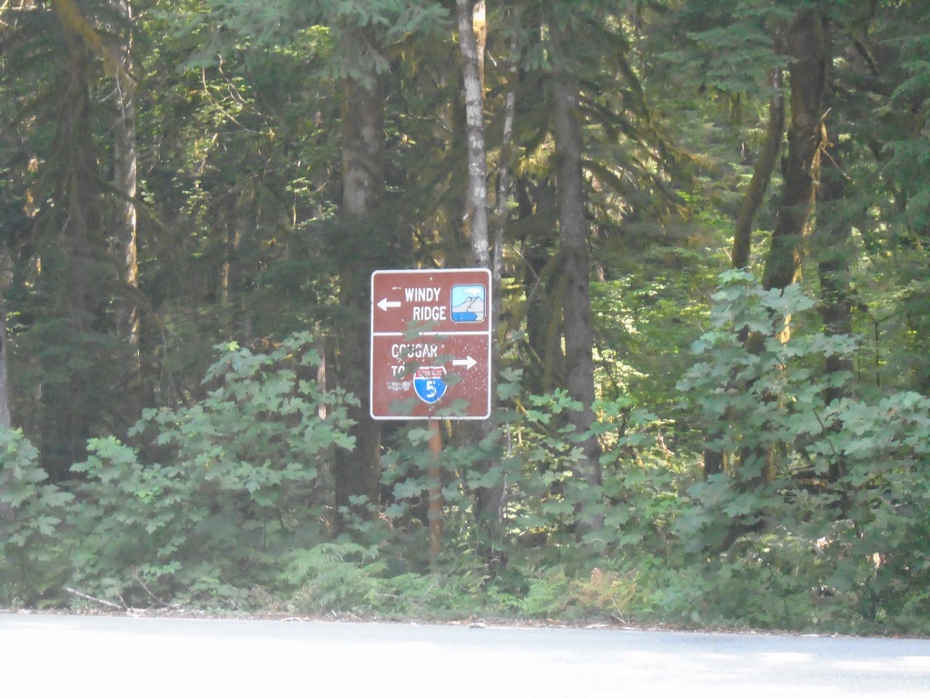
Lava Canyon Road South at Lewis River Road
Lava Canyon Road South at Lewis River Road. Turn left for Windy Ridge (part of the Mt. St. Helens National Monument). Turn right for I-5 and Cougar.
Taken 08-09-2024
Ariel
Skamania County
Washington
United States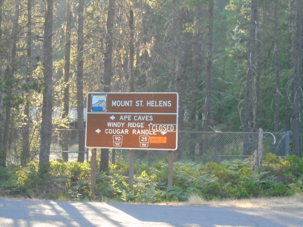
Lewis River Road (FR-90) at Lewis River-Randle Road (FR-25)
Lewis River Road (FR-90) at Lewis River-Randle Road (FR-25) in Northwoods. Use FR-25 north to Windy Ridge and Randle; FR-90 west to Ape Cave and Cougar. FR-25 is closed due to a slide between Northwoods and Wind Ridge when this photograph was taken.
Taken 08-08-2024
Cougar Skamania County Washington United States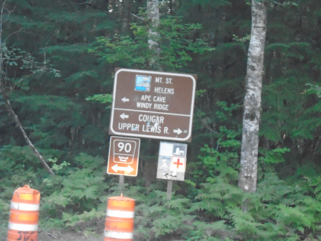
Curly Creek Road North at Lewis River Road (FR-90)
Curly Creek Road North at Lewis River Road (FR-90). Turn right for Upper Lewis River; left for Mt. St. Helens, Ape Cave, and Windy Ridge.
Taken 08-08-2024
Northwoods Skamania County Washington United States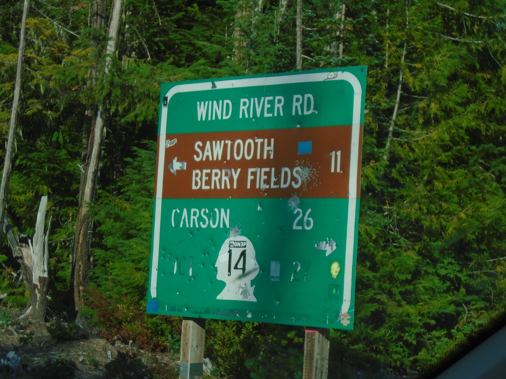
Curly Creek Road at Wind River Road
Curly Creek Road at Wind River Road. Use Wind River Road south to WA-14 and Carson. Use Wind River Road north to Sawtooth Berry Fields.
Taken 08-08-2024
 Northwoods
Skamania County
Washington
United States
Northwoods
Skamania County
Washington
United States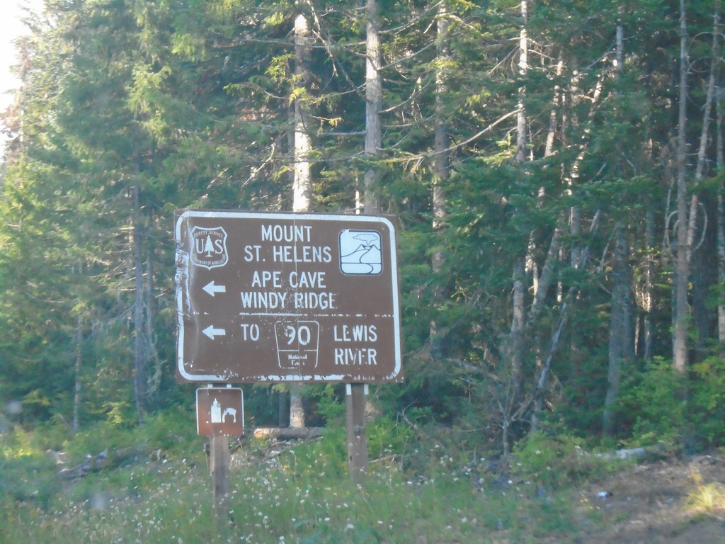
Wind River Road North at Curly Creek Road
Wind River Road North at Curly Creek Road to Mount St. Helens, Ape Cave, Windy Ridge, and FR-90 to Lewis River.
Taken 08-08-2024
Northwoods Skamania County Washington United States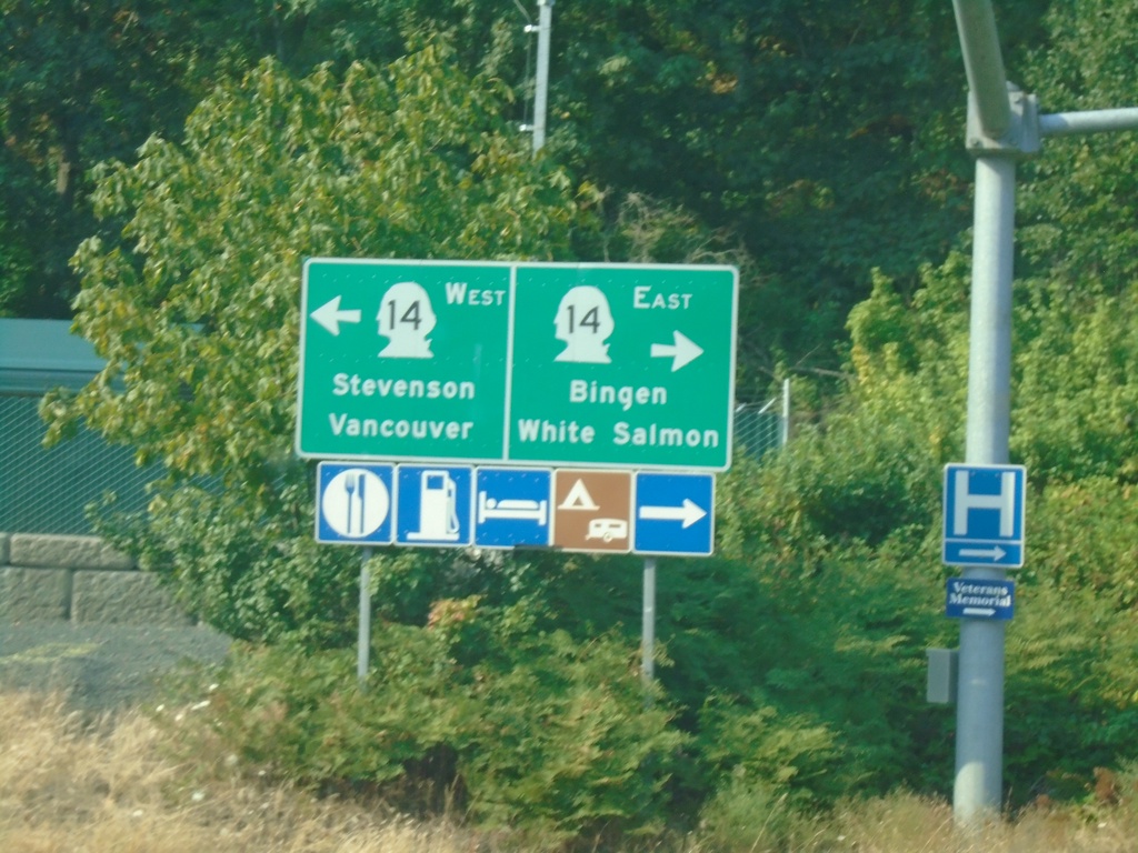
Hood River Bridge at WA-14
Hood River Bridge at WA-14. Use WA-14 East to Bingen and White Salmon; WA-14 west to Stevenson and Vancouver.
Taken 08-08-2024
White Salmon
Klickitat County
Washington
United States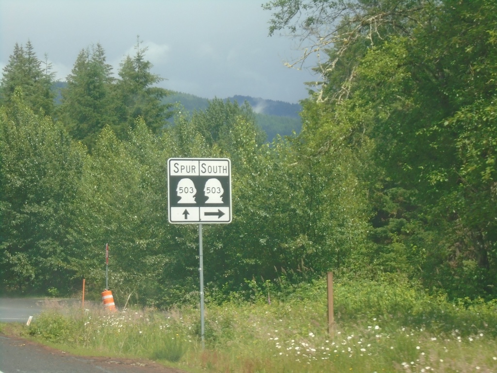
WA-503 South at WA-503 Spur
WA-503 South at WA-503 Spur. Turn right to continue south on WA-503.
Taken 06-15-2024
Ariel
Cowlitz County
Washington
United States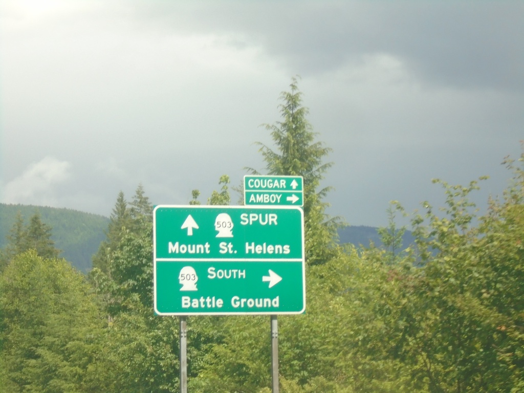
WA-503 South Approaching WA-503 Spur
WA-503 South Approaching WA-503 Spur in Cowlitz County. Turn right to continue south on WA-503 to Battle Ground and Amboy. Continue straight on roadway for WA-503 Spur to Mount St. Helens and Cougar.
Taken 06-15-2024
Ariel
Cowlitz County
Washington
United States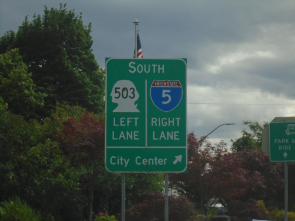
Pacific Ave. South at I-5/WA-503
Pacific Ave. South at I-5/WA-503. Use right lane for I-5 South and City Center; left lane for WA-503 south.
Taken 06-15-2024
Woodland
Cowlitz County
Washington
United States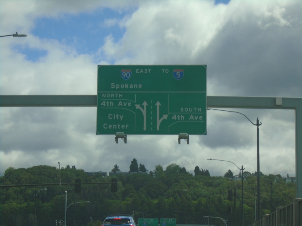
Martinez Drive East at 4th Ave. and I-90 Junction
Martinez Drive East at 4th Ave. and I-90 Junction. Turn left on 4th Ave for (Seattle) City Center. Continue straight for I-90 East to Spokane and I-5. This is the beginning of I-90 eastbound.
Taken 06-15-2024
 Seattle
King County
Washington
United States
Seattle
King County
Washington
United States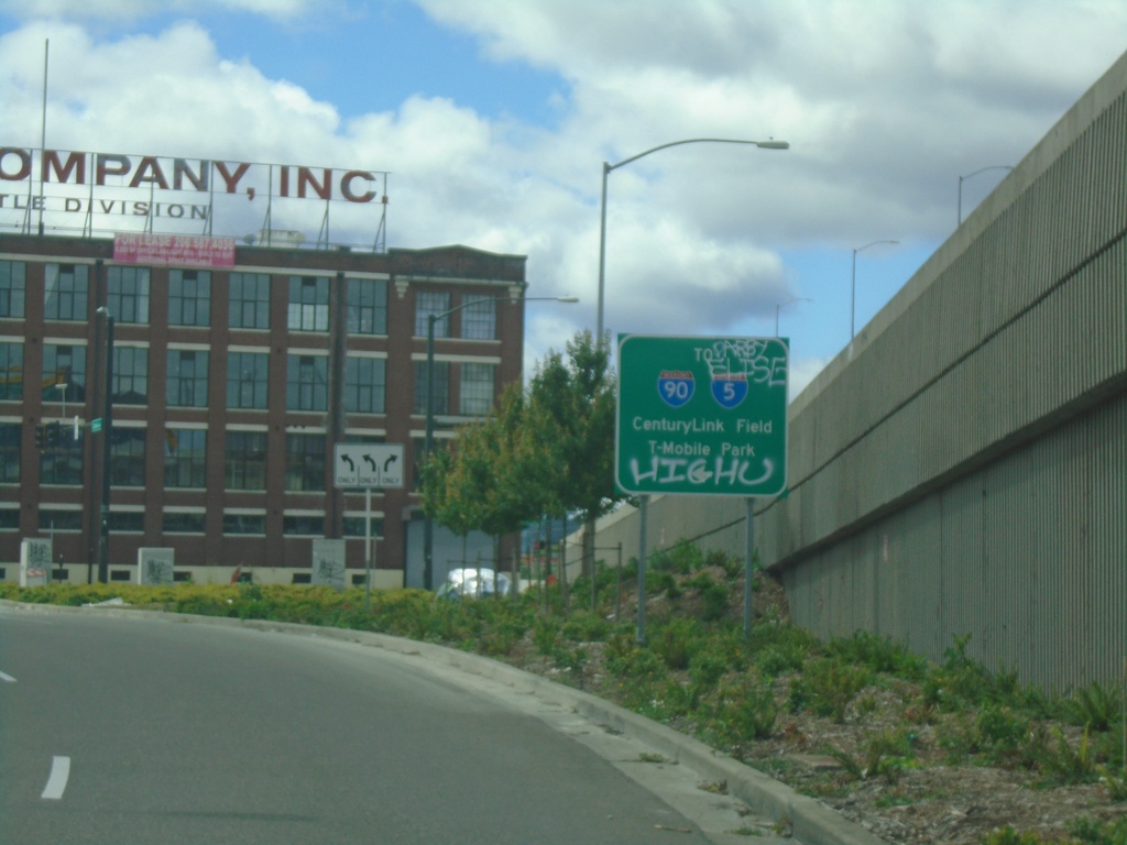
Colorado Ave. South approaching Edgar Martinez Drive
Colorado Ave. South (ramp from WA-99) approaching Edgar Martinez Drive. Turn left for I-90/I-5/Century Link Field/T-Mobile Park.
Taken 06-15-2024
 Seattle
King County
Washington
United States
Seattle
King County
Washington
United States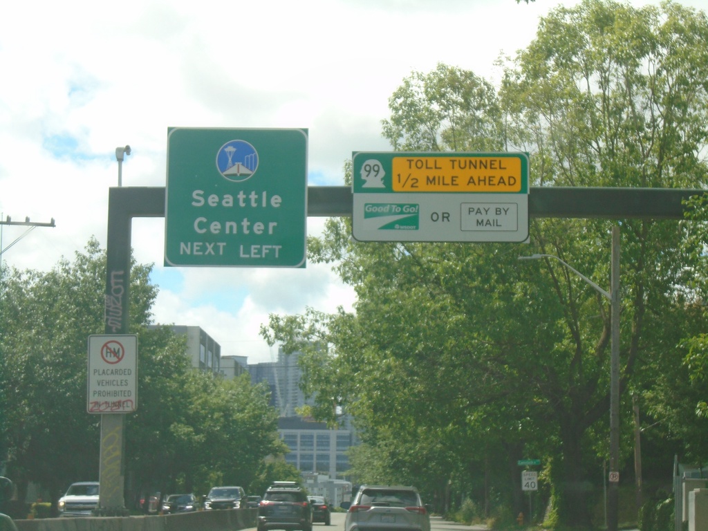
WA-99 South Approaching Toll Tunnel
WA-99 south approaching toll tunnel in Seattle. Use left lanes for Seattle Center.
Taken 06-15-2024
Seattle
King County
Washington
United States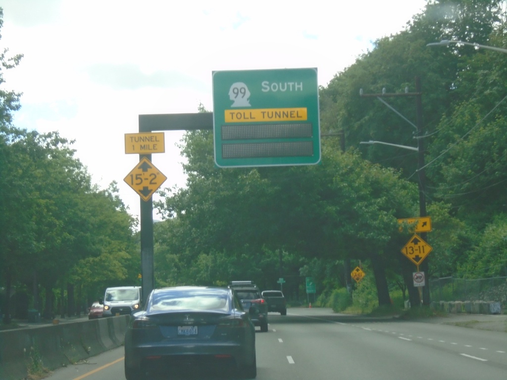
WA-99 South Approaching Toll Tunnel
WA-99 South approaching Toll Tunnel in Seattle.
Taken 06-15-2024
Seattle
King County
Washington
United States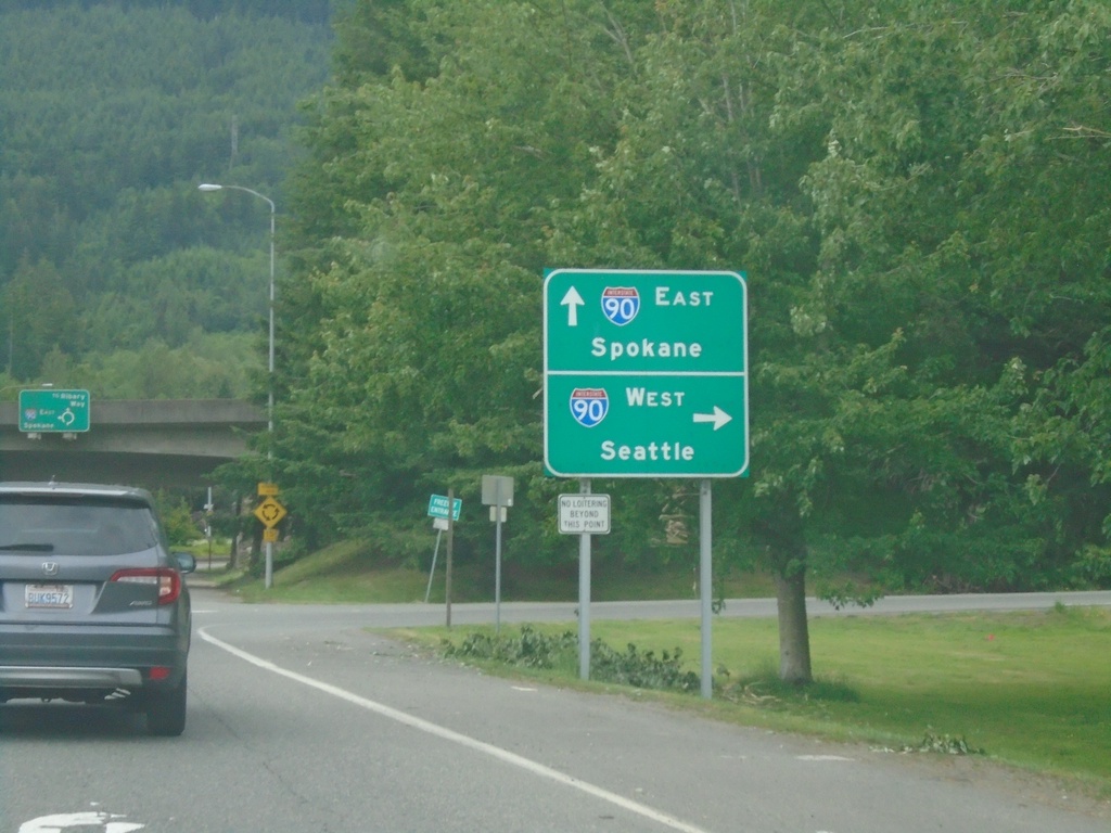
WA-202 East at I-90 Junction
WA-202 East at I-90 Junction. Use I-90 west to Seattle; I-90 east to Spokane.
Taken 06-13-2024
 North Bend
King County
Washington
United States
North Bend
King County
Washington
United States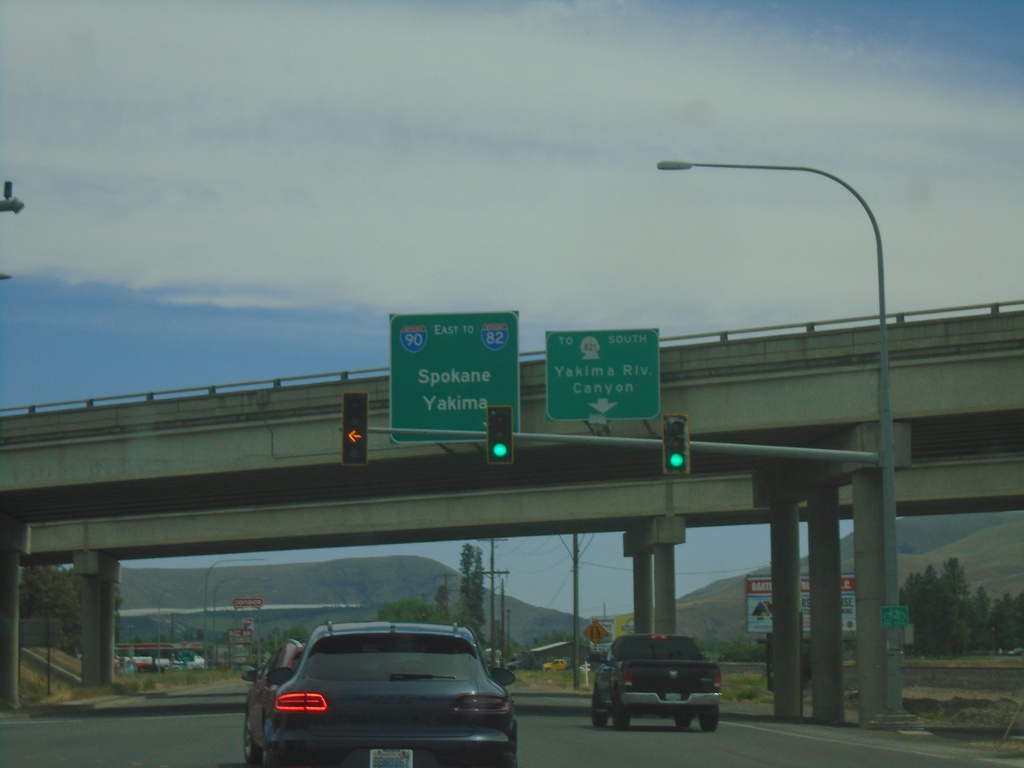
Canyon Road at I-90/US-97
Canyon Road at I-90/US-97 (Exit 109) in Ellensburg. Use I-90 East/To I-82 to Spokane and Yakima. Continue on Canyon Road for WA-821 South to Yakima River Canyon.
Taken 06-13-2024

 Ellensburg
Kittitas County
Washington
United States
Ellensburg
Kittitas County
Washington
United States