Signs Tagged With Intersection
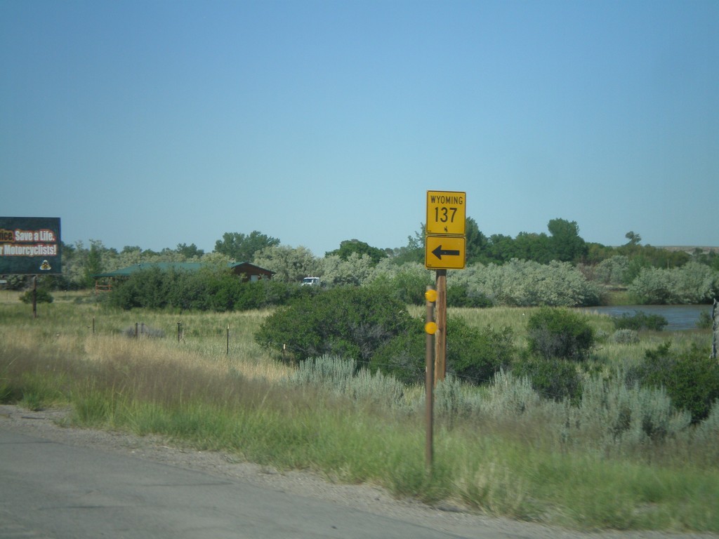
WY-789 North Approaching WY-137
WY-789 north approaching WY-137.
Taken 07-02-2011

 Riverton
Fremont County
Wyoming
United States
Riverton
Fremont County
Wyoming
United States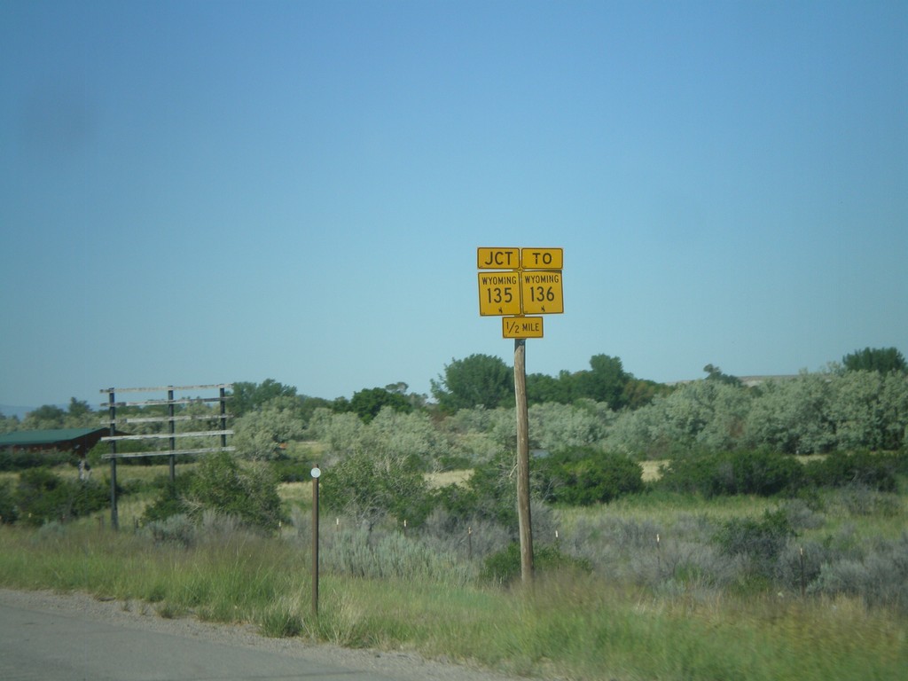
WY-789 North Approaching WY-135/To WY-136
WY-789 North Approaching WY-135/To WY-136 - 1/2 mile.
Taken 07-02-2011

 Riverton
Fremont County
Wyoming
United States
Riverton
Fremont County
Wyoming
United States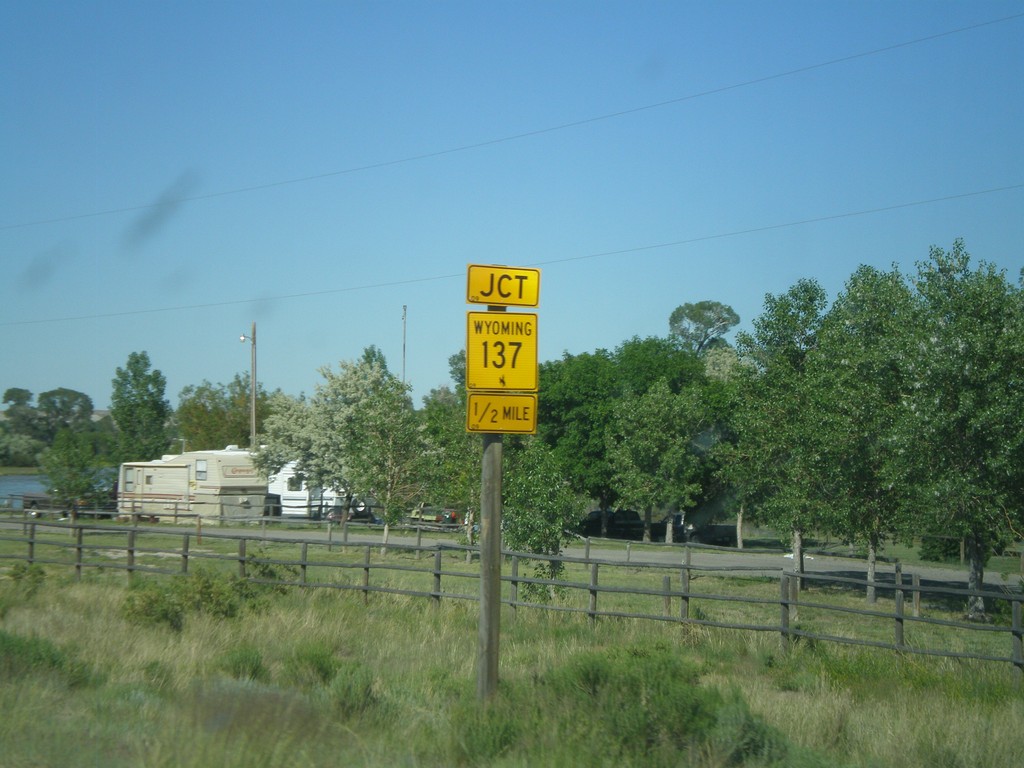
WY-789 North Approaching WY-137
WY-789 north approaching WY-137 near Riverton.
Taken 07-02-2011
Riverton
Fremont County
Wyoming
United States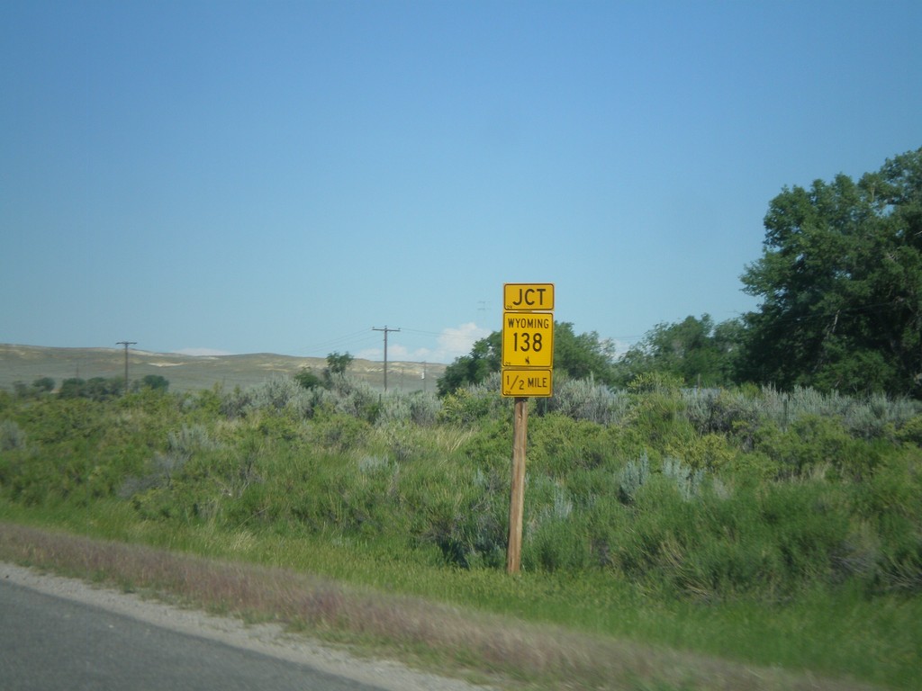
WY-789 North Approaching WY-138
WY-789 North Approaching WY-138 between Lander and Riverton.
Taken 07-02-2011
 Riverton
Fremont County
Wyoming
United States
Riverton
Fremont County
Wyoming
United States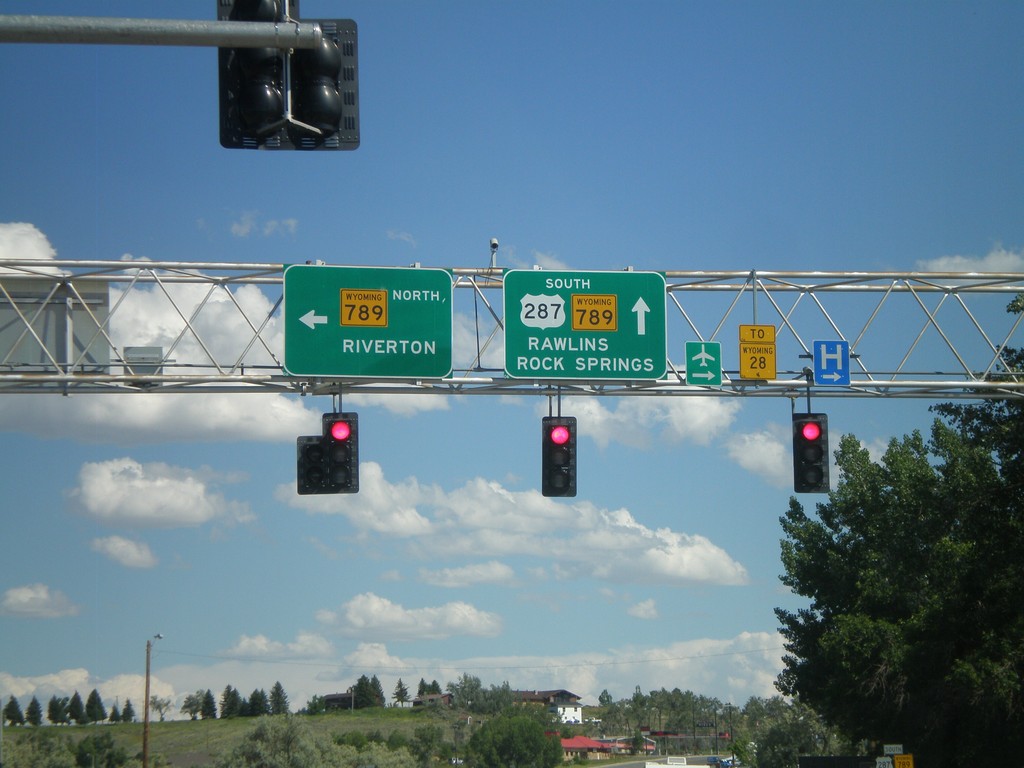
US-287 South at WY-789
US-287 South at WY-789. Turn left for WY-789 north to Riverton. Continue ahead for US-287/WY-789 South to WY-28, Rawlins, and Rock Springs.
Taken 07-02-2011

 Lander
Fremont County
Wyoming
United States
Lander
Fremont County
Wyoming
United States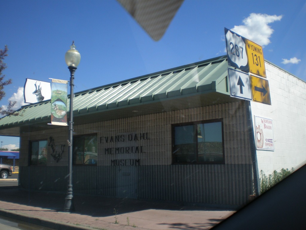
US-287 South at WY-131
US-287 South at WY-131 in downtown Lander.
Taken 07-02-2011
 Lander
Fremont County
Wyoming
United States
Lander
Fremont County
Wyoming
United States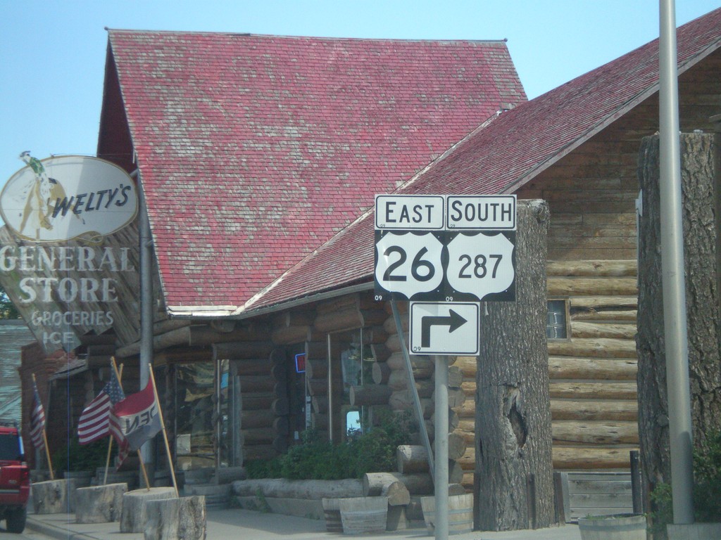
US-287 South/US-26 East - Dubois
To continue south on US-287 South/US-26 East turns turn right Dubois.
Taken 07-02-2011
 Dubois
Fremont County
Wyoming
United States
Dubois
Fremont County
Wyoming
United States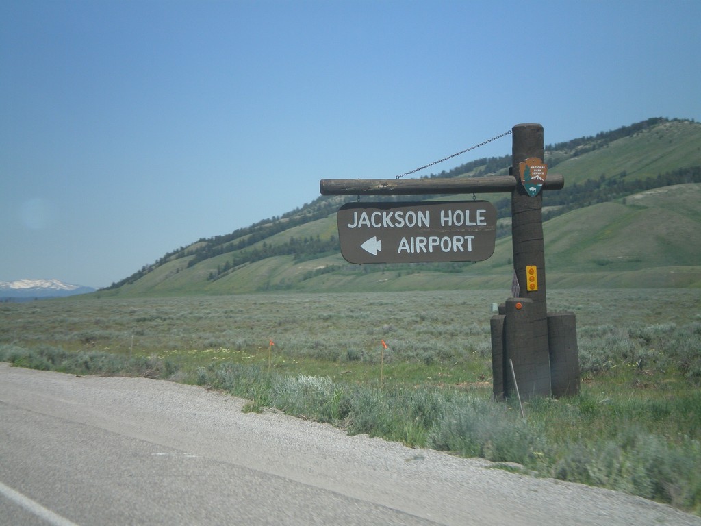
US-26 East/US-191 North at Jackson Hole Airport
US-26 East/US-191 North at Jackson Hole Airport in Grand Teton National Park.
Taken 07-02-2011
 Jackson
Teton County
Wyoming
United States
Jackson
Teton County
Wyoming
United States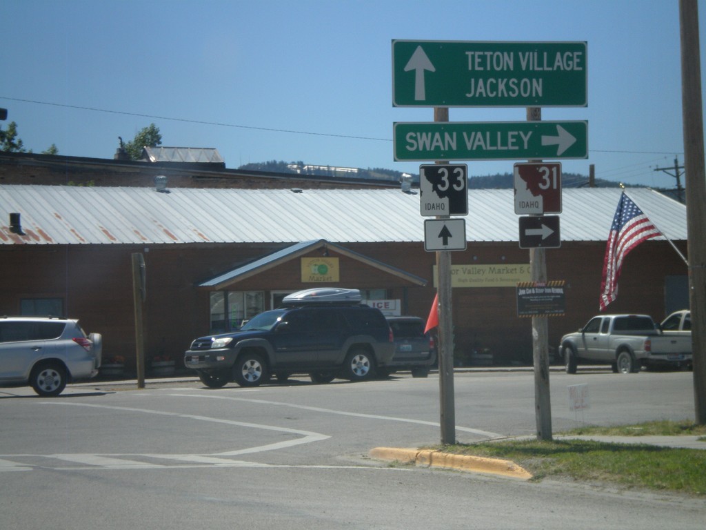
ID-33 East at ID-31
ID-33 East at ID-31 in Victor. Turn right on ID-31 south for Swan Valley. Continue ahead on ID-33 for Teton Village and Jackson (both in Wyoming). Teton Scenic Byway leaves ID-33 here and follows ID-31 south.
Taken 07-02-2011

 Victor
Teton County
Idaho
United States
Victor
Teton County
Idaho
United States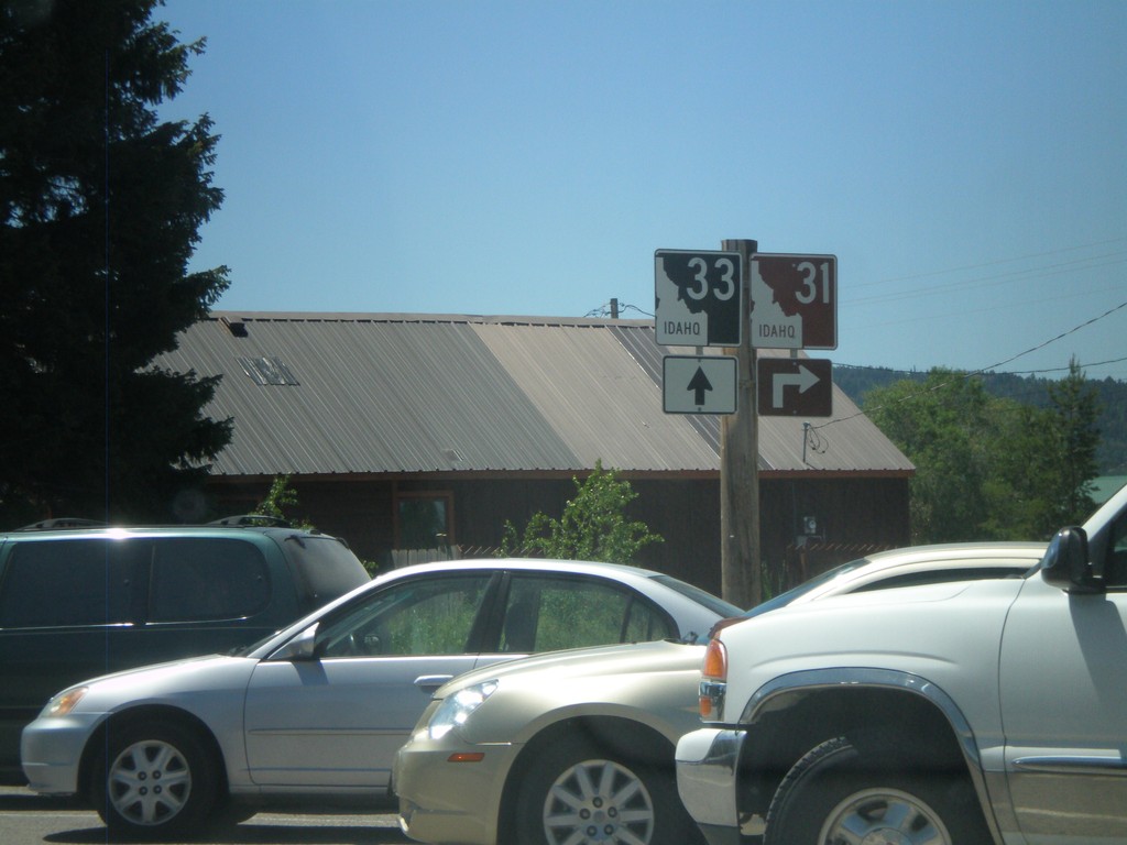
ID-33 East at ID-31
ID-33 east at ID-32 in Victor. The Teton Scenic Byway turns right here onto ID-31.
Taken 07-02-2011
Victor
Teton County
Idaho
United States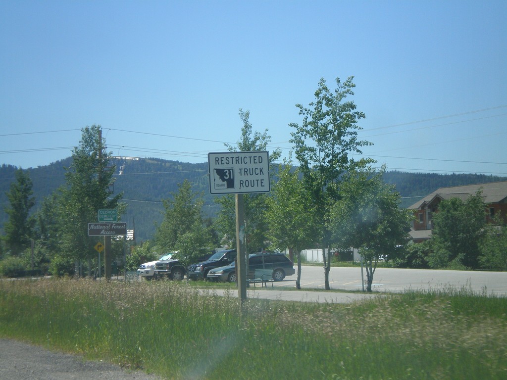
ID-33 East Approaching ID-31
ID-33 east approaching ID-31. ID-31 between Victor and Swan Valley is a restricted route for trucking.
Taken 07-02-2011
Victor
Teton County
Idaho
United States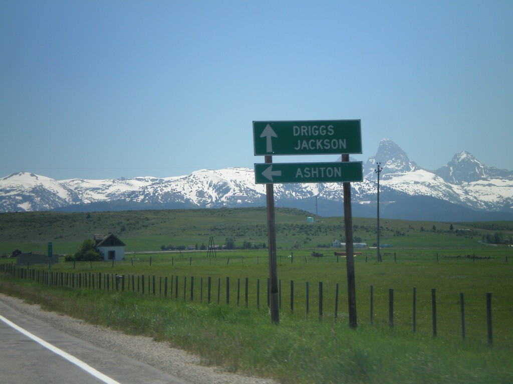
ID-33 East at ID-32
ID-33 east at ID-32 north to Ashton. Continue east on ID-33 for Driggs and Jackson (Wyoming). The Teton Mountain Range are in the background. The Teton Scenic Byway follows ID-32 south and turns east onto ID-33 east here.
Taken 07-02-2011
 Tetonia
Teton County
Idaho
United States
Tetonia
Teton County
Idaho
United States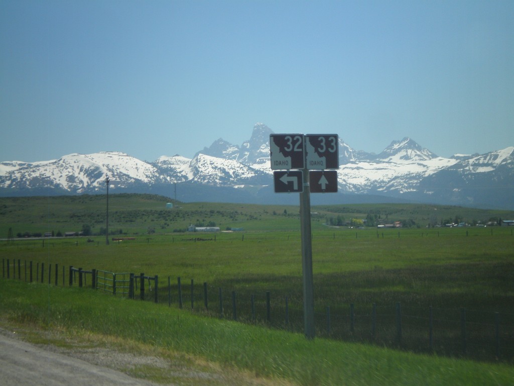
ID-33 East at ID-32 North
ID-33 East at ID-32 North. The Teton Scenic Byway joins ID-33 east here. The Teton Range is in the background of the photo.
Taken 07-02-2011
Felt
Teton County
Idaho
United States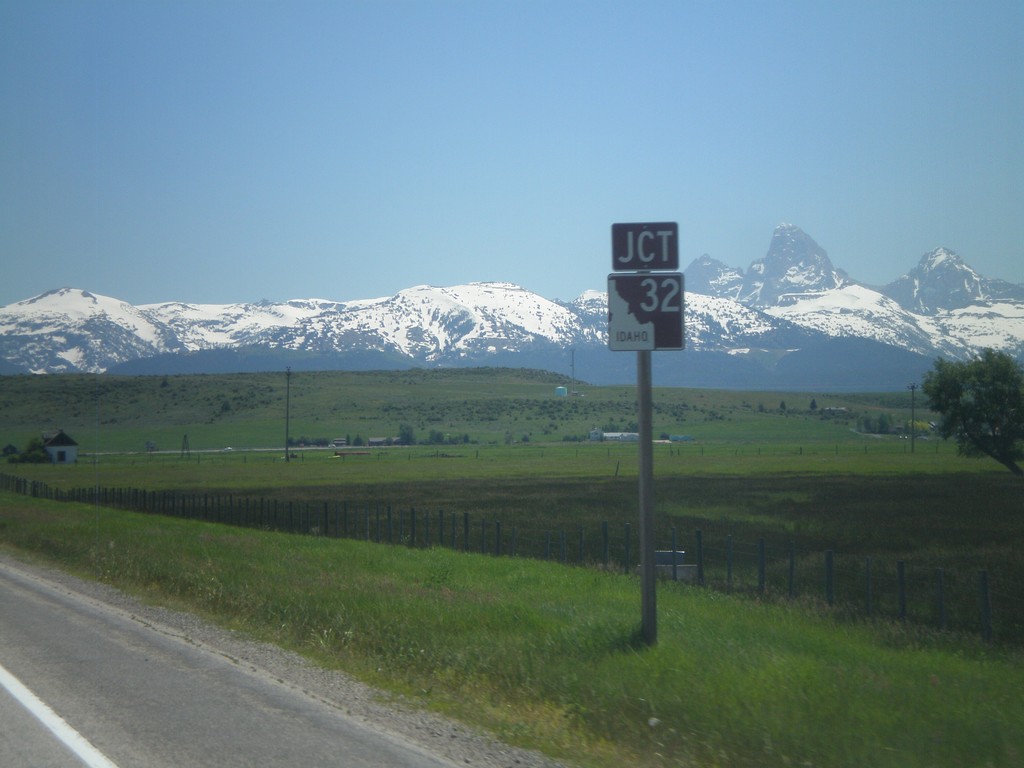
ID-33 East Approaching ID-32
ID-33 east approaching ID-32 in Tetonia. The peaks of the Teton Range are in the background.
Taken 07-02-2011
Tetonia
Teton County
Idaho
United States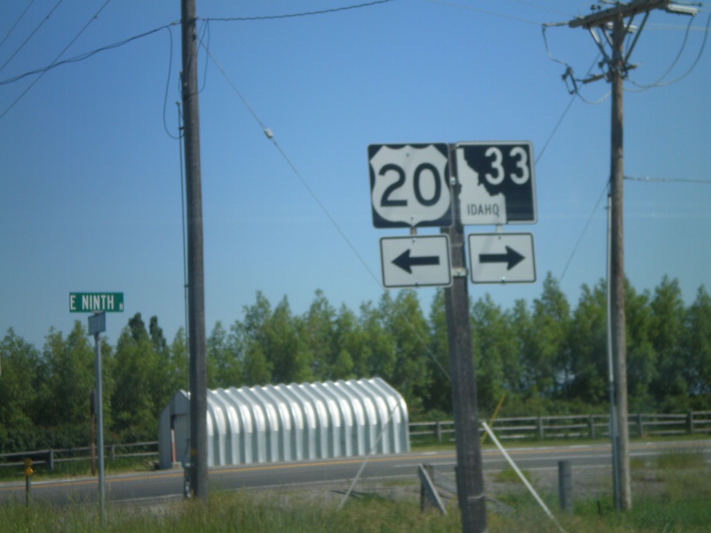
ID-33 East at US-20 Access Road
ID-33 East at US-20 access road. Turn left for US-20; turn right to continue on ID-33 east.
Taken 07-02-2011
 Sugar City
Madison County
Idaho
United States
Sugar City
Madison County
Idaho
United States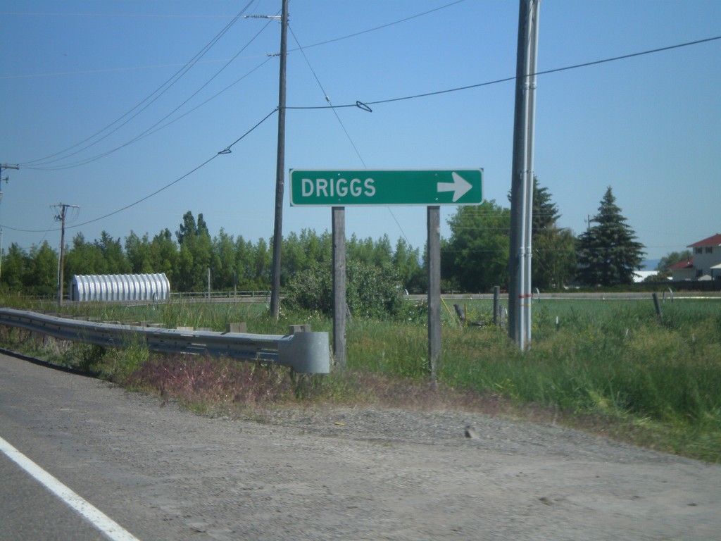
ID-33 East at US-20 Access Road
ID-33 east at access road that connects ID-33 and US-20. Turn right to continue on ID-33 east towards Driggs.
Taken 07-02-2011
Sugar City
Madison County
Idaho
United States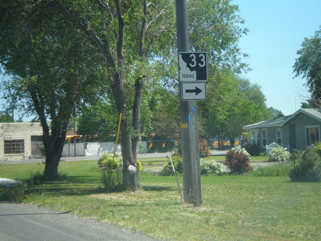
ID-33 East - Sugar City
ID-33 east in Sugar City. Turn right to continue on ID-33.
Taken 07-02-2011
Sugar City
Madison County
Idaho
United States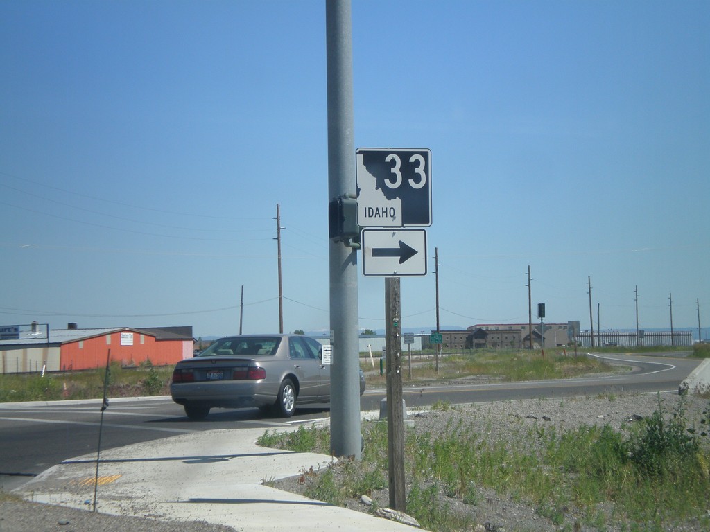
ID-33 East in Rexburg
ID-33 north (N 2nd St.) at Yellowstone Highway in Rexburg. Turn right to continue on ID-33.
Taken 07-02-2011
Rexburg
Madison County
Idaho
United States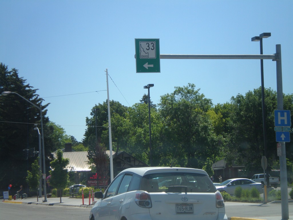
ID-33 East - Rexburg
ID-33 east in downtown Rexburg. Turn left on N 2nd St. to continue on ID-33.
Taken 07-02-2011
Rexburg
Madison County
Idaho
United States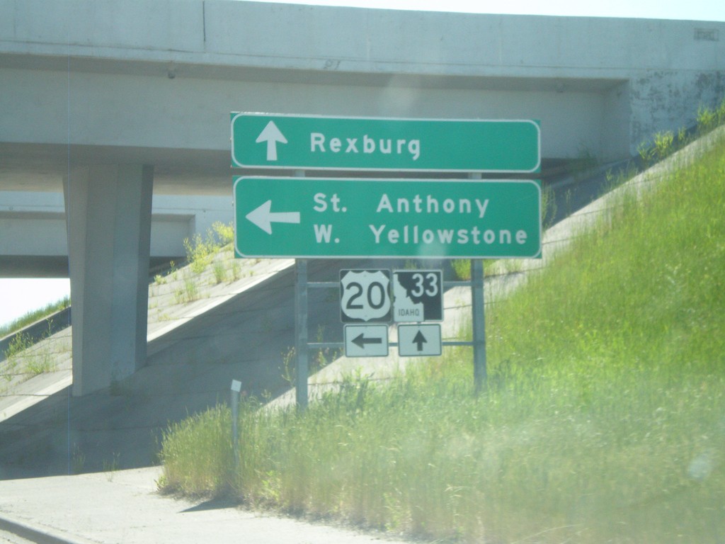
ID-33 East at US-20 East
ID-33 east at US-20 east. Use US-20 east for St. Anthony and West Yellowstone (Montana). Continue east on ID-33 for downtown Rexburg.
Taken 07-02-2011
Rexburg
Madison County
Idaho
United States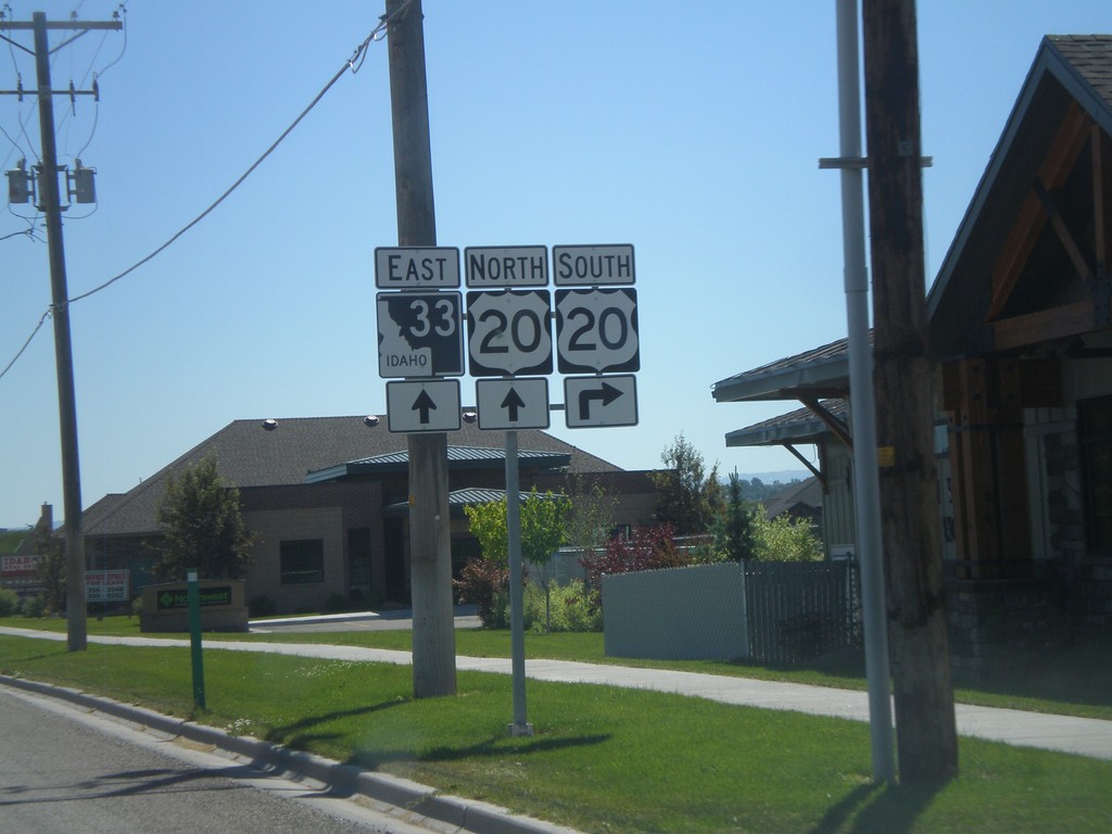
ID-33 East Approaching US-20
ID-33 east approaching US-20 in Rexburg.
Taken 07-02-2011
Rexburg
Madison County
Idaho
United States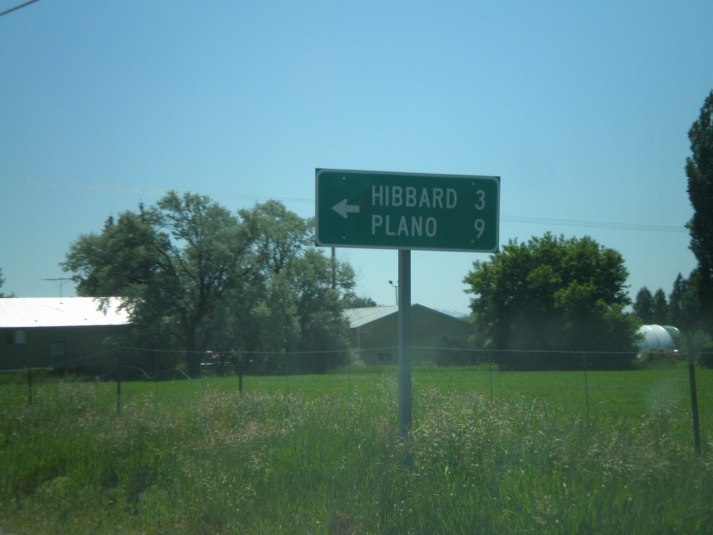
ID-33 East at N 3000 West
ID-33 east at N 3000 West to Hibbard and Plano.
Taken 07-02-2011
Rexburg
Madison County
Idaho
United States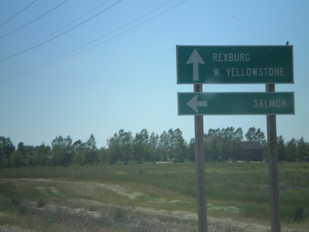
ID-33 East at ID-28
ID-33 east at ID-28 north to Salmon. Continue east on ID-33 for Rexburg and West Yellowstone (Montana). This is the southern end of ID-33. The Sacajawea Historic Byway turns from ID-28 to ID-33 east here.
Taken 07-02-2011
 Mud Lake
Jefferson County
Idaho
United States
Mud Lake
Jefferson County
Idaho
United States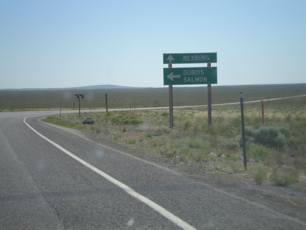
ID-33 East at ID-22 East
ID-33 east at ID-22 east to Dubois and Salmon. Continue east on ID-33 for Rexburg.
Taken 07-02-2011
 Howe
Butte County
Idaho
United States
Howe
Butte County
Idaho
United States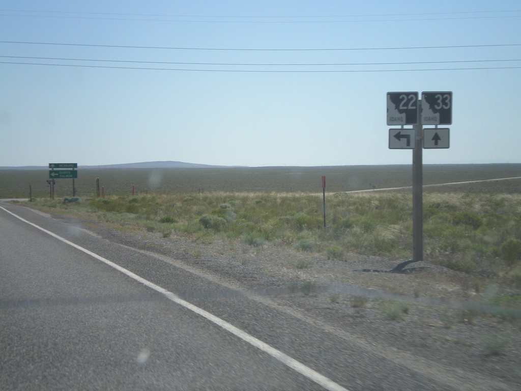
ID-33 East Approaching ID-22
ID-33 east approaching ID-22. Turn left for ID-22 east.
Taken 07-02-2011
Berenice
Butte County
Idaho
United States