Signs Tagged With Intersection
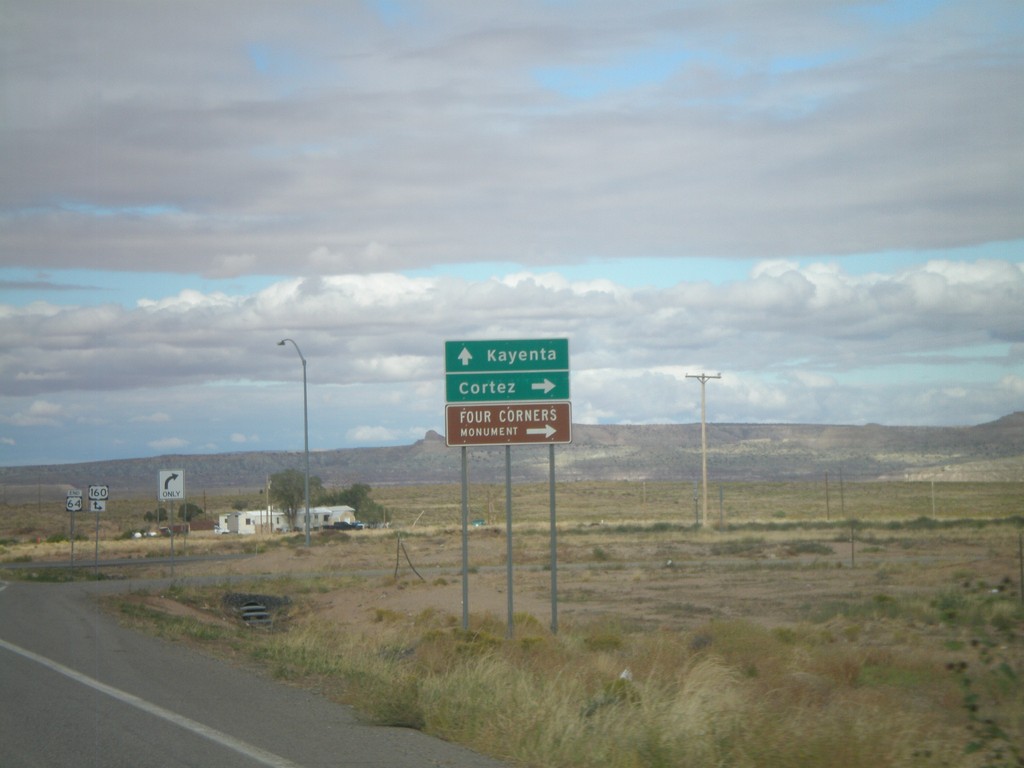
End US-64 West Approaching US-160
End US-6A4 west approaching US-160. Turn right for US-160 east to Cortez (Colorado) and Four Corners National Monument. Continue ahead for US-160 east to Kayenta.
Taken 10-08-2011

 Teec Nos Pos
Apache County
Arizona
United States
Teec Nos Pos
Apache County
Arizona
United States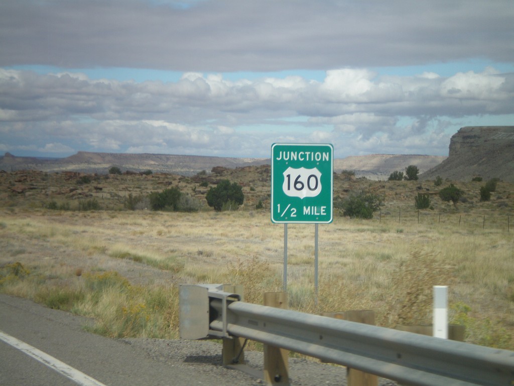
US-64 West Approaching US-160
US-64 West approaching US-160. This is the western end of US-64. The eastern end of US-64 is in Nags Head, North Carolina.
Taken 10-08-2011
Teec Nos Pos
Apache County
Arizona
United States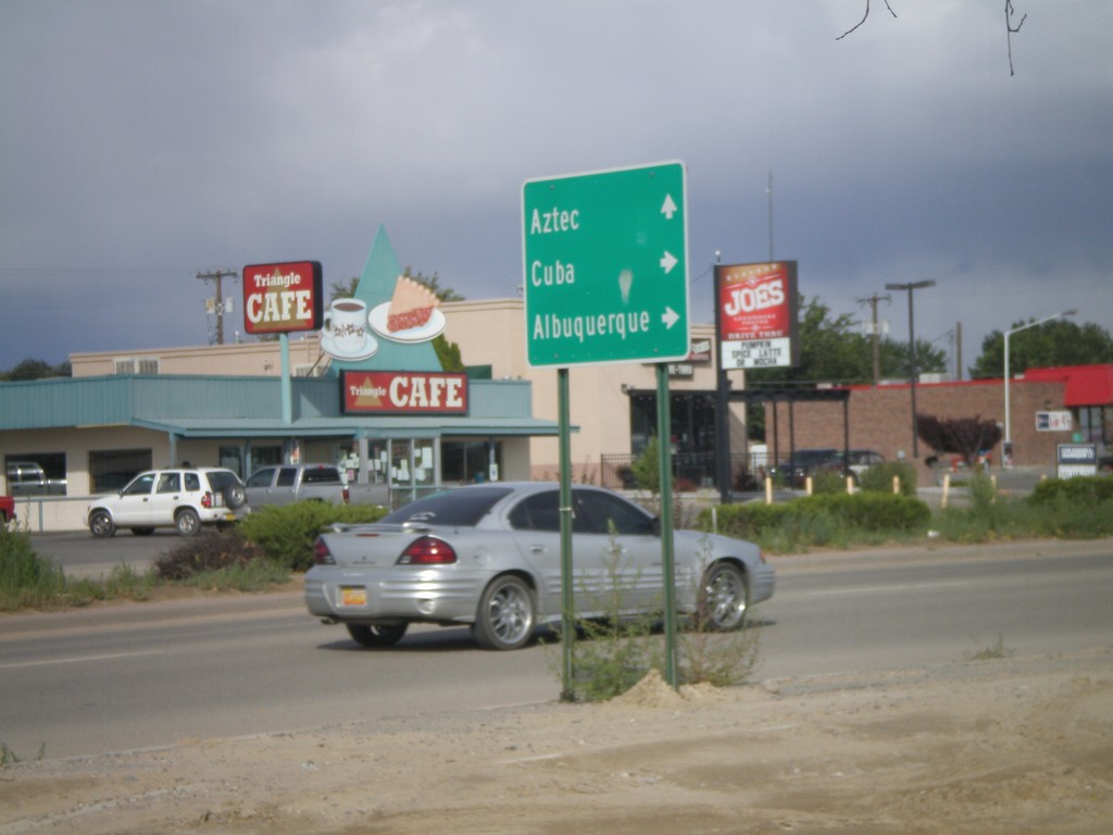
US-64 East at US-550 South
US-64 east at US-550 South. US-550 joins US-64 east through Bloomfield. Turn south on US-550 for Cuba and Albuquerque; continue ahead on US-64 East/US-550 North for Aztec.
Taken 10-07-2011
 Bloomfield
San Juan County
New Mexico
United States
Bloomfield
San Juan County
New Mexico
United States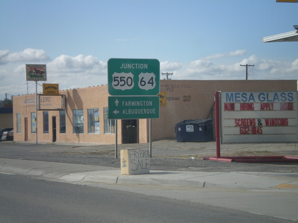
US-64 West/US-550 South at US-550 South
US-64 West/US-550 South at US-550 South. Turn left on US-550 south for Albuquerque. Continue ahead for US-64 west to Farmington.
Taken 10-07-2011
Bloomfield
San Juan County
New Mexico
United States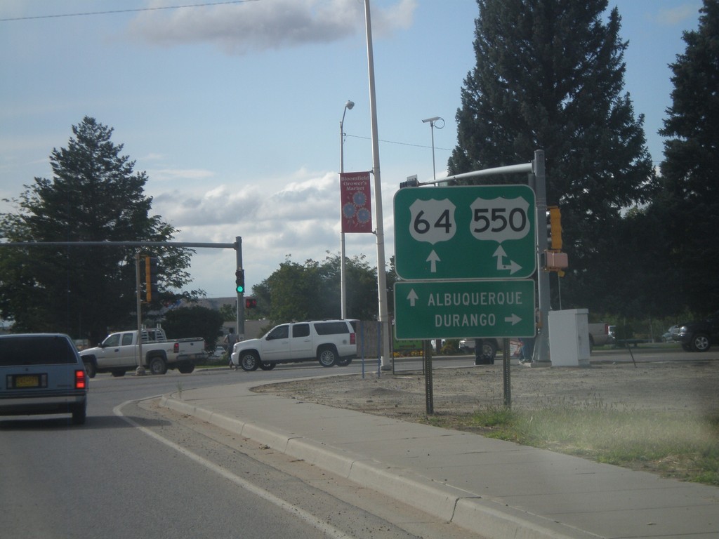
US-64 West at US-550
US-64 west at US-550. US-550 south joins US-64 west through Bloomfield. Turn north on US-550 for Durango (Colorado). Continue ahead on US-64/US-550 for Albuquerque.
Taken 10-07-2011
Bloomfield
San Juan County
New Mexico
United States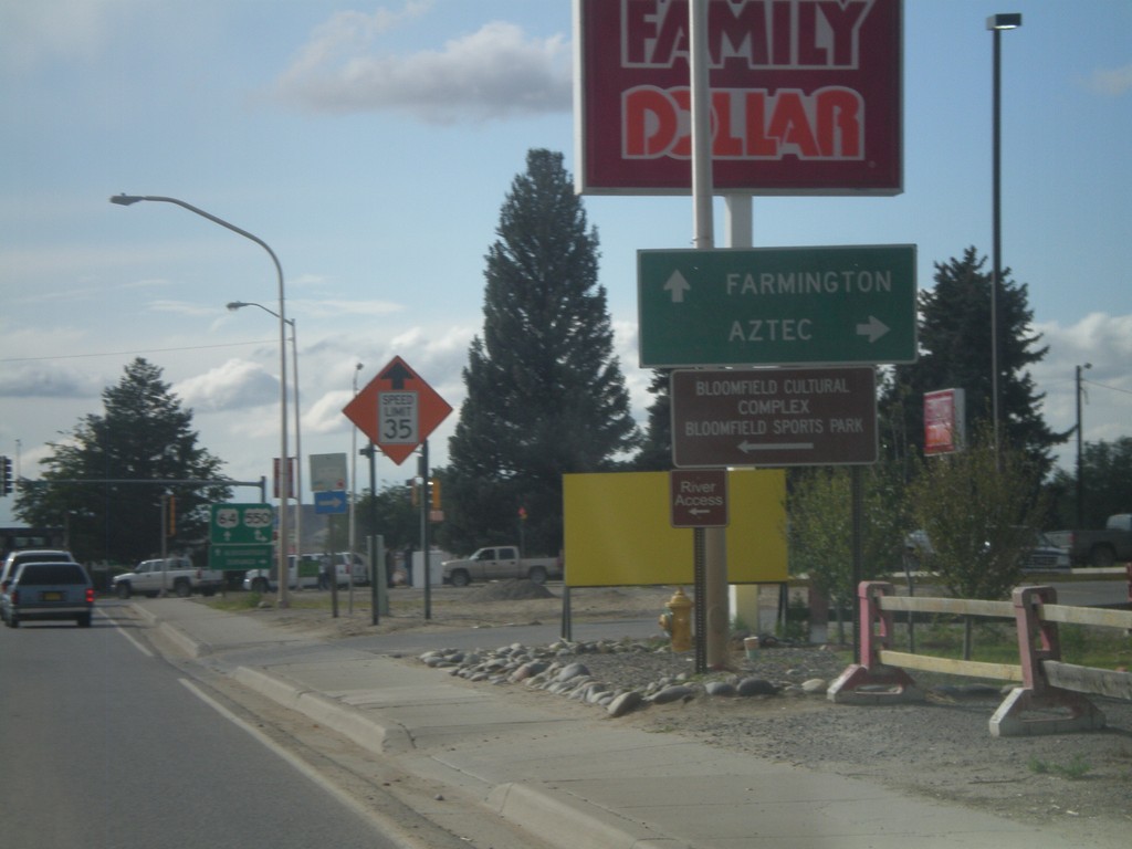
US-64 West Approaching US-550
US-64 west approaching US-550. Use US-550 north for Aztec. Continue ahead for US-64 West/US-550 South to Farmington.
Taken 10-07-2011
Bloomfield
San Juan County
New Mexico
United States
US-64 West Approaching US-550
US-64 west approaching US-550. US-550 joins US-64 through Bloomfield.
Taken 10-07-2011
Bloomfield
San Juan County
New Mexico
United States
NM-575 South Approaching US-64
NM-575 south approaching US-64
Taken 10-07-2011
 Blanco
San Juan County
New Mexico
United States
Blanco
San Juan County
New Mexico
United States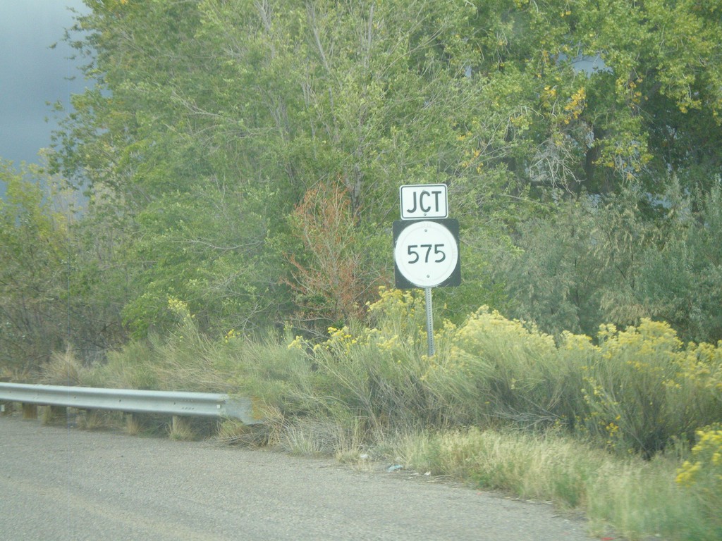
US-64 East Approaching NM-575
US-64 East approaching NM-575 near the community of Blanco.
Taken 10-07-2011
Bloomfield
San Juan County
New Mexico
United States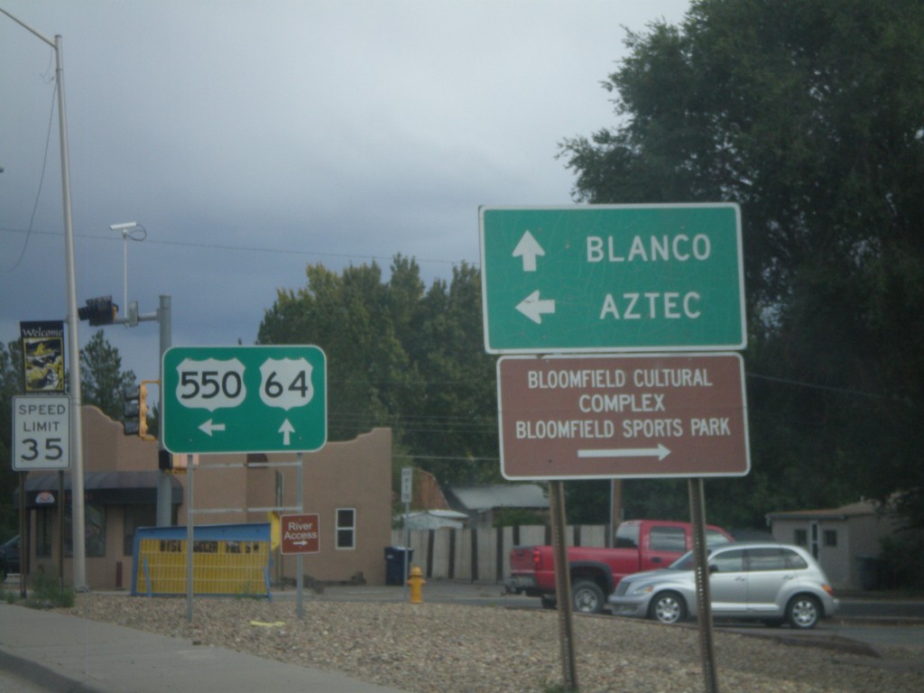
US-64 East/US-550 North at US-550 North
US-64 East/US-550 North at US-550 North. Use US-550 north for Aztec; continue east on US-64 for Blanco.
Taken 10-07-2011
Bloomfield
San Juan County
New Mexico
United States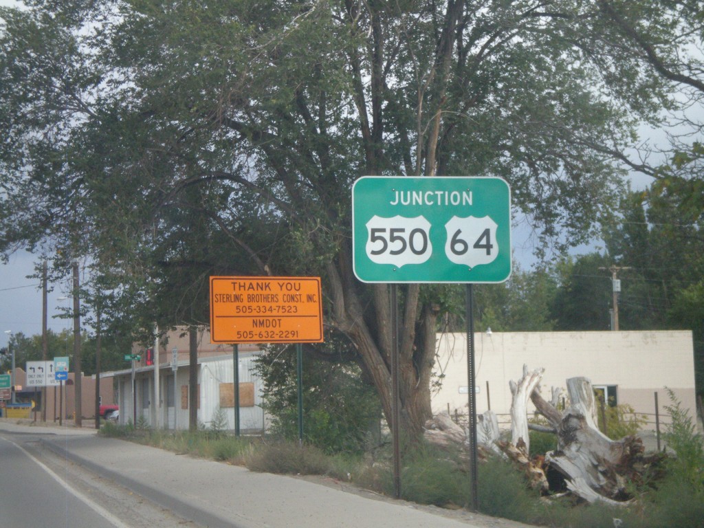
US-64 East/US-550 North Approaching US-550 North
US-64 East/US-550 North approaching US-550 north in Bloomfield.
Taken 10-07-2011
Bloomfield
San Juan County
New Mexico
United States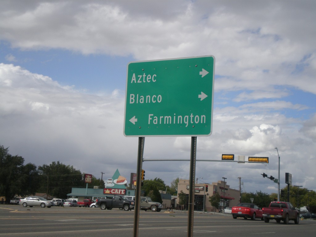
US-550 North at US-64
US-550 north at US-64. Turn right for US-550 North/US-64 East for Aztec and Blanco. Turn left for US-64 West to Farmington.
Taken 10-07-2011
Bloomfield
San Juan County
New Mexico
United States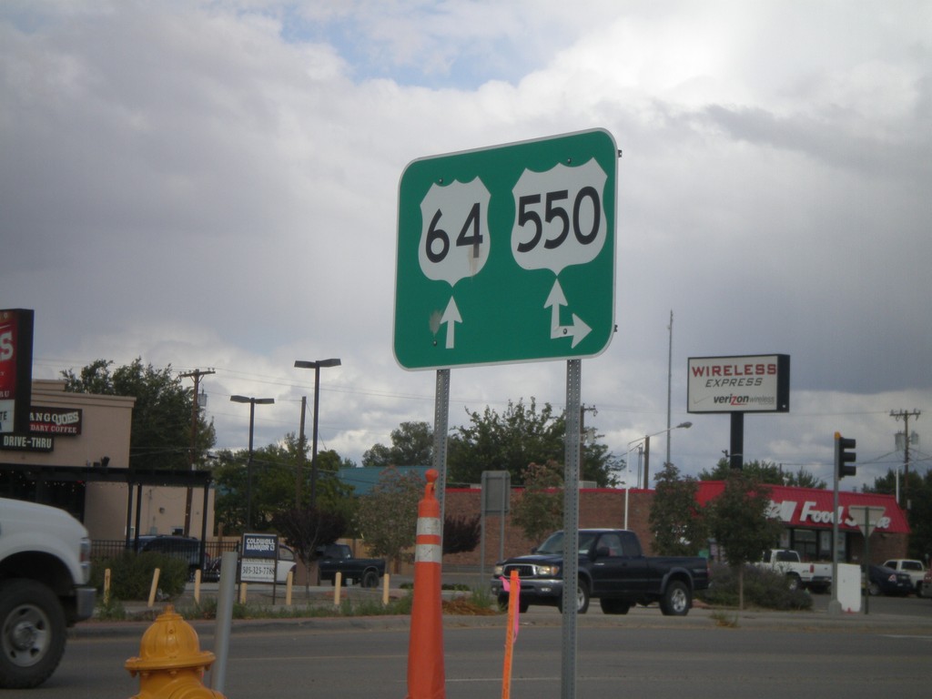
US-64 East at US-550
US-64 east at US-550. Turn right for US-550 south; continue ahead for US-64 East/US-550 North. US-550 joins US-64 through Bloomfield.
Taken 10-07-2011
Bloomfield
San Juan County
New Mexico
United States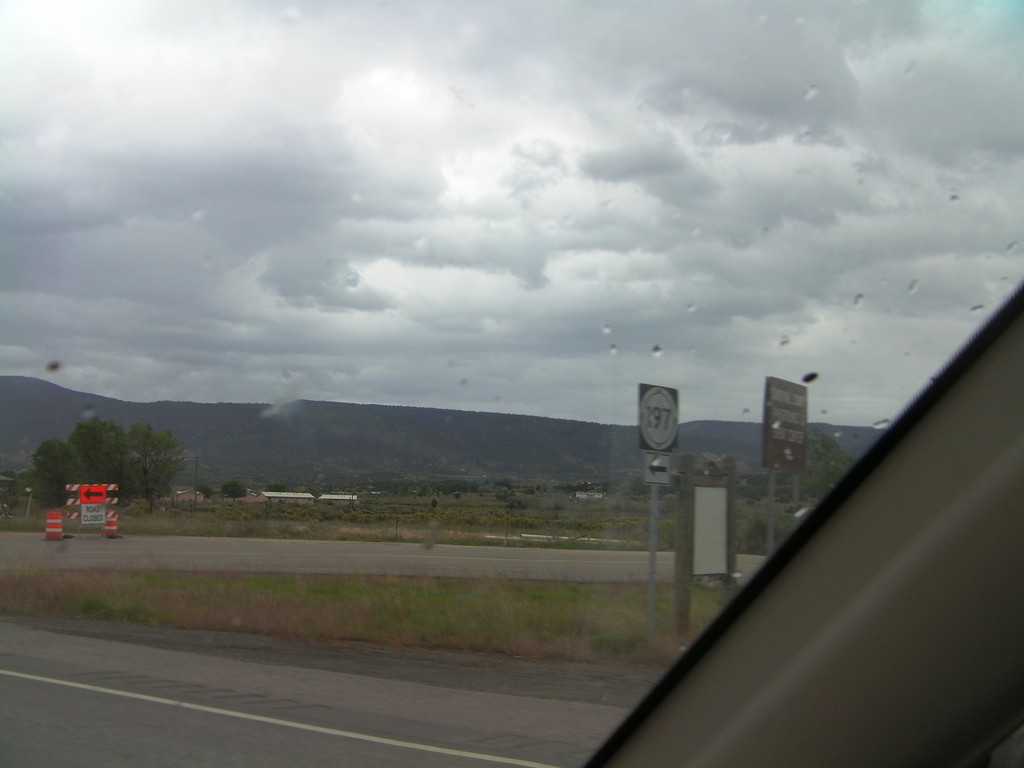
US-550 North at NM-197
US-550 North at NM-197 in Cuba.
Taken 10-06-2011
 Cuba
Sandoval County
New Mexico
United States
Cuba
Sandoval County
New Mexico
United States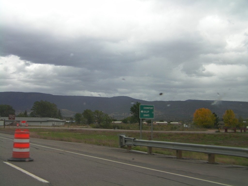
US-550 North at NM-197
US-550 north at NM-197 south to Crownpoint, Grants, and Gallup.
Taken 10-06-2011
Cuba
Sandoval County
New Mexico
United States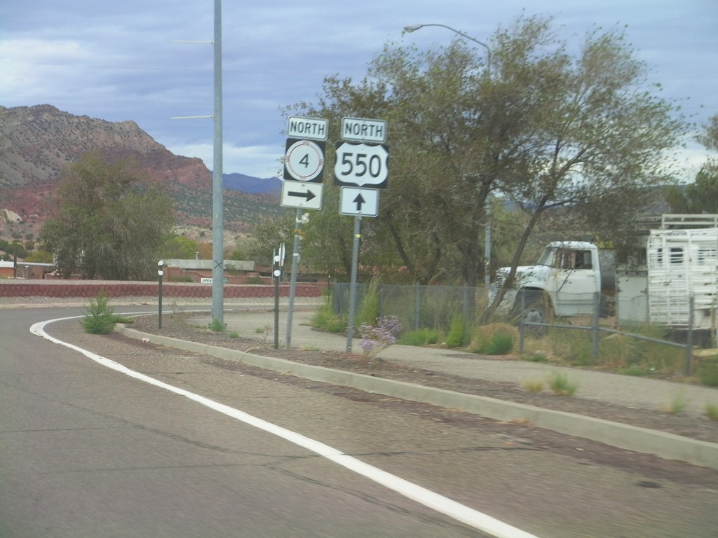
US-550 North at NM-4
US-550 north at NM-4 North in San Ysidro.
Taken 10-06-2011
 San Ysidro
Sandoval County
New Mexico
United States
San Ysidro
Sandoval County
New Mexico
United States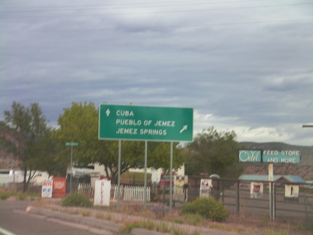
US-550 North at NM-4
US-550 north at NM-4 north to Jemez Pueblo and Jemez Springs. Continue north on US-550 for Cuba.
Taken 10-06-2011
Rio Rancho
Sandoval County
New Mexico
United States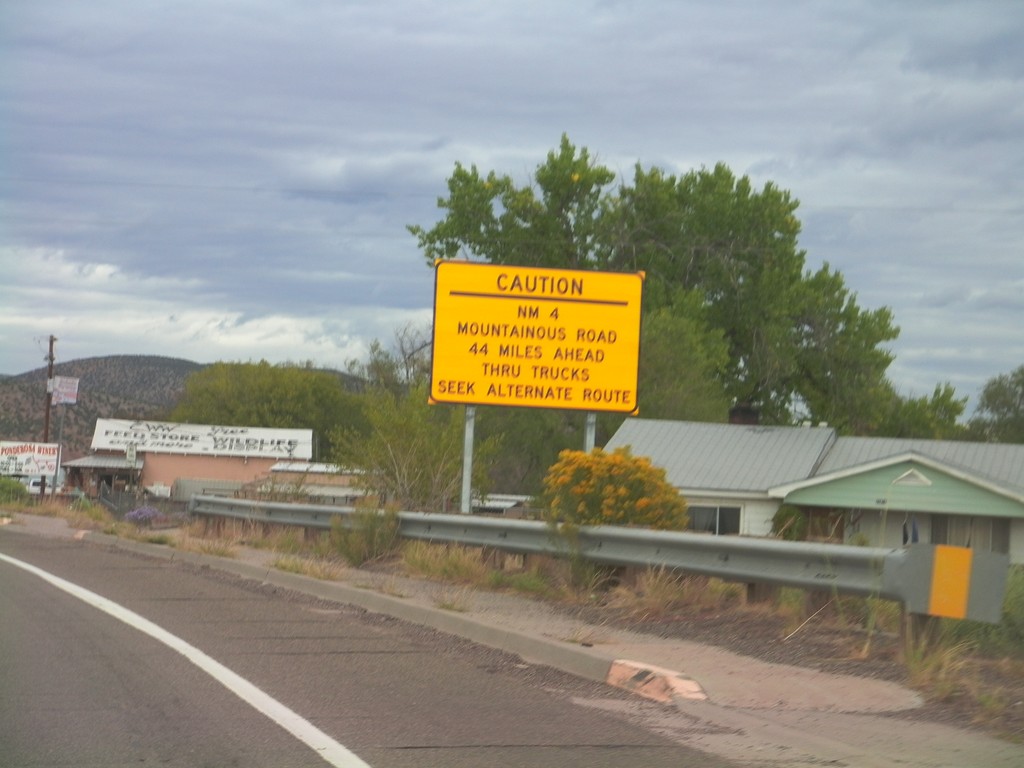
US-550 North Approaching NM-4
US-550 north approaching NM-4. NM-4 is a mountainous road 44 miles north of here and is not advised for trucks.
Taken 10-06-2011
San Ysidro
Sandoval County
New Mexico
United States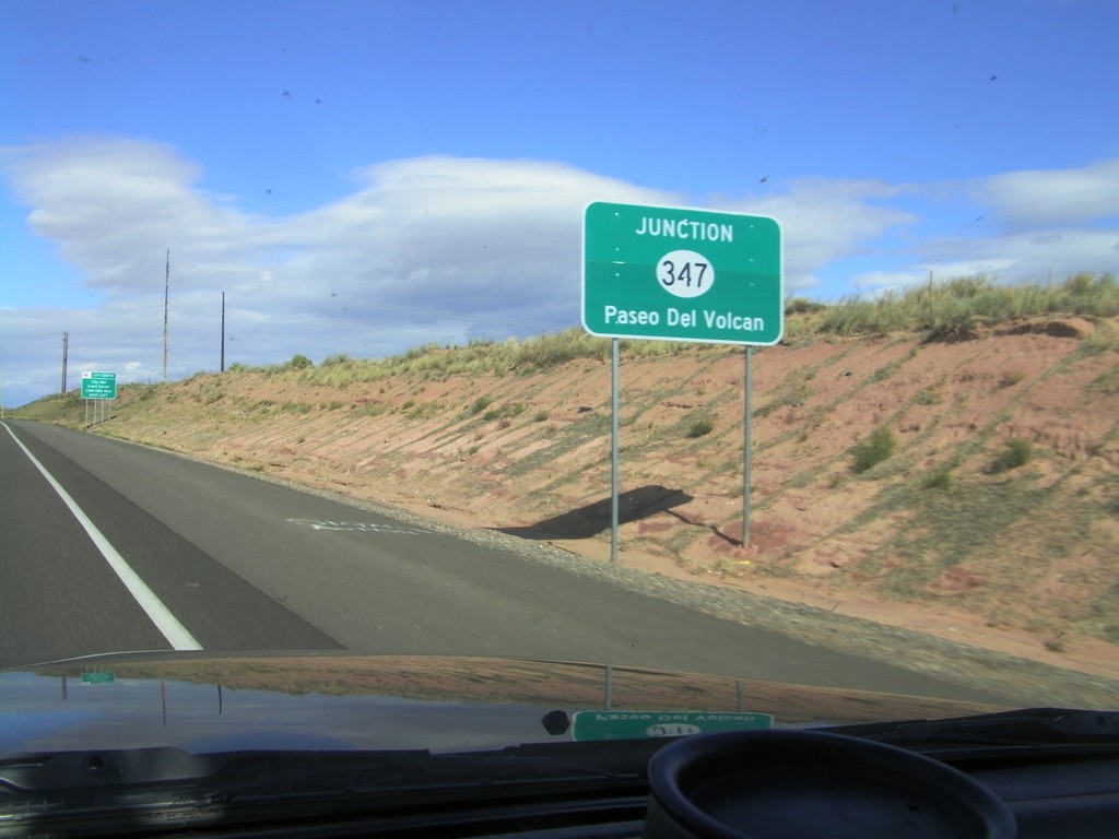
US-550 North Approaching NM-347
US-550 North approaching NM-347 - Paseo Del Volcan.
Taken 10-06-2011
 Rio Rancho
Sandoval County
New Mexico
United States
Rio Rancho
Sandoval County
New Mexico
United States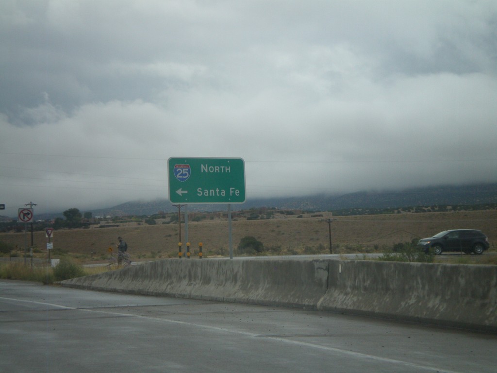
End US-550 South at I-25 North
End US-550 South at I-25 north to Santa Fe. NM-165 begins here and heads towards Placitas.
Taken 10-04-2011

 Bernalillo
Sandoval County
New Mexico
United States
Bernalillo
Sandoval County
New Mexico
United States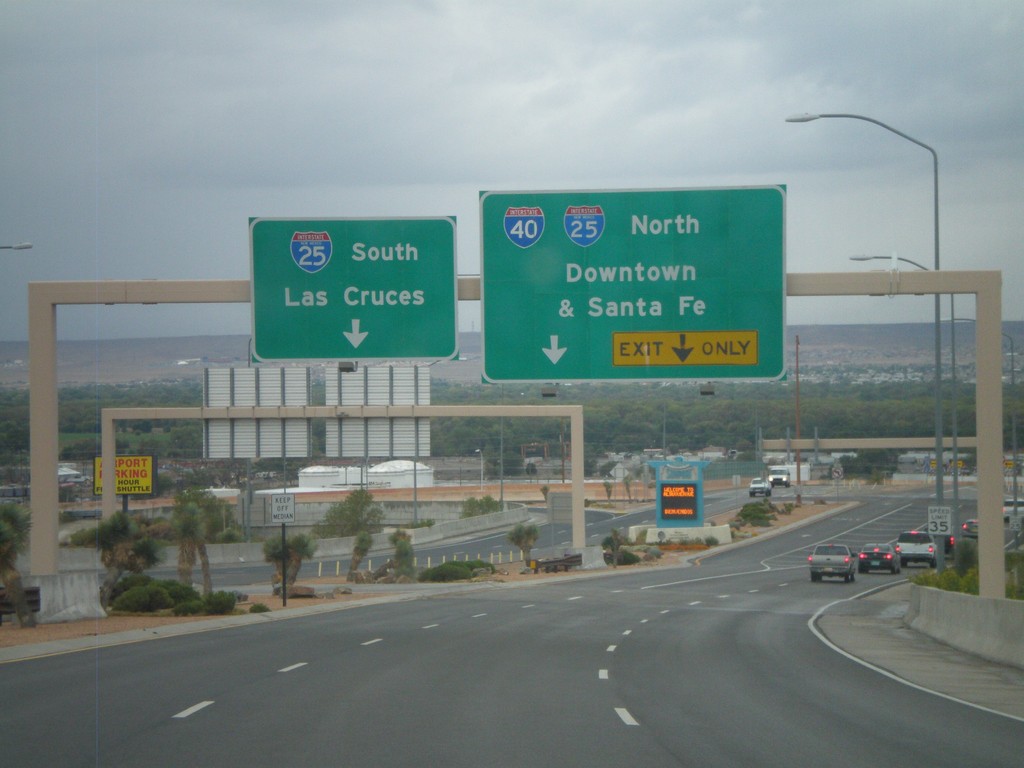
Sunport Blvd. West Approaching I-25
Sunport Blvd. West approaching I-25. Use right lanes for I-25 North/(To)I-40/Downtown (Albuquerque)/Santa Fe. Use left lanes for I-25 South/Las Cruces.
Taken 10-04-2011
 Albuquerque
Bernalillo County
New Mexico
United States
Albuquerque
Bernalillo County
New Mexico
United States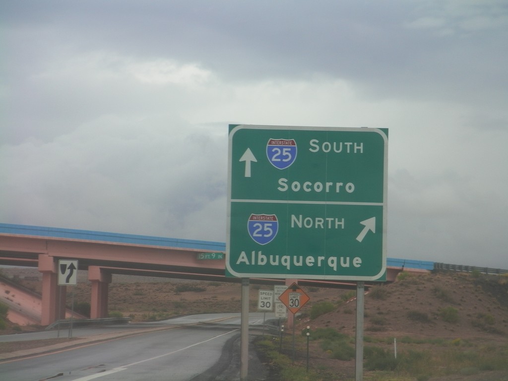
End BL-25 North at I-25
End BL-25 north at I-25. Use I-25 north for Albuquerque; use I-25 south for Socorro. This is the northern end of the Belen business loop.
Taken 10-04-2011
 Belen
Valencia County
New Mexico
United States
Belen
Valencia County
New Mexico
United States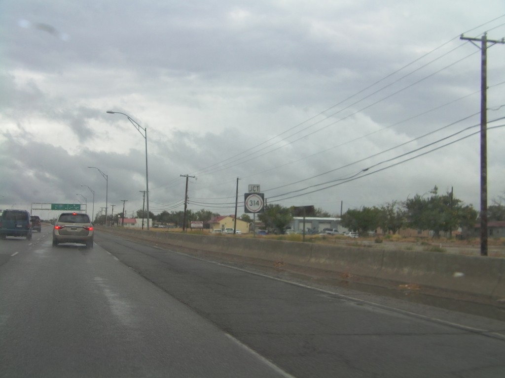
NM-314 North/BL-25 North Approaching Split
NM-314 North/BL-25 North approaching split. Use right lanes for NM-314 north towards Las Lunas. Use left lanes for BL-25 North towards I-25.
Taken 10-04-2011
 Belen
Valencia County
New Mexico
United States
Belen
Valencia County
New Mexico
United States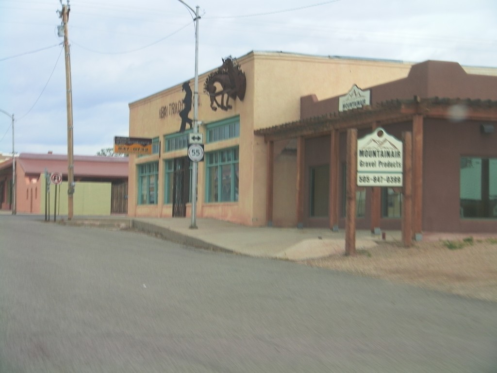
US-60 West Approaching NM-55
US-60 West approaching NM-55 in Mountainair.
Taken 10-04-2011

 Mountainair
Torrance County
New Mexico
United States
Mountainair
Torrance County
New Mexico
United States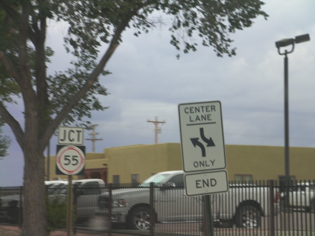
NM-41 South Approaching NM-55
NM-41 South approaching NM-55 in Estancia.
Taken 10-04-2011
 South
Torrance County
New Mexico
United States
South
Torrance County
New Mexico
United States