Signs Tagged With Intersection
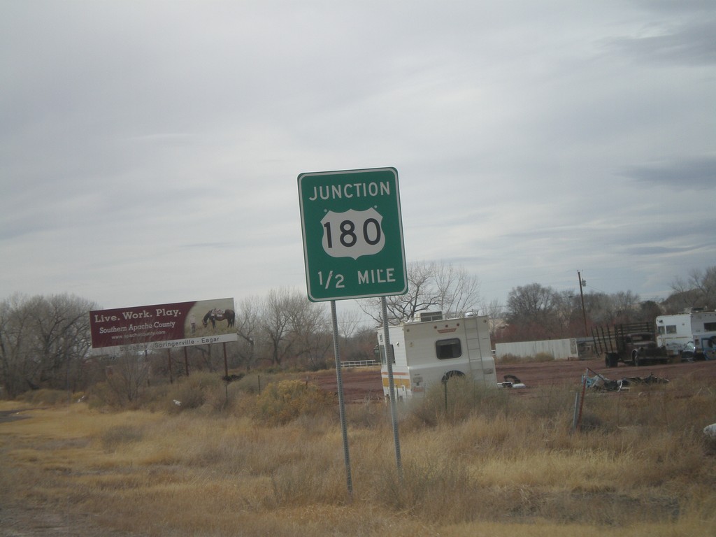
US-191 South/AZ-61 West Approaching US-180
US-191 South/AZ-61 West approaching US-180.
Taken 02-24-2011


 Saint Johns
Apache County
Arizona
United States
Saint Johns
Apache County
Arizona
United States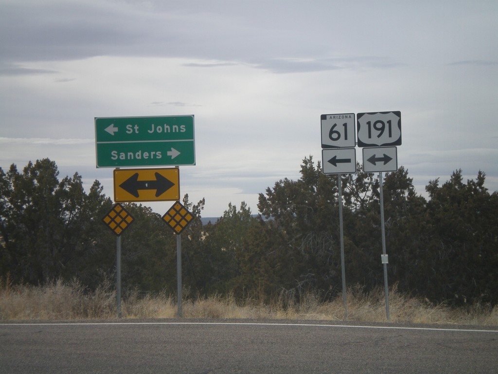
AZ-61 West at US-191
AZ-61 west at US-191. AZ-61 west joins US-191 south to St. Johns. Use US-191 South/AZ-61 West for St. Johns. Use US-191 North for Sanders.
Taken 02-24-2011
Saint Johns
Apache County
Arizona
United States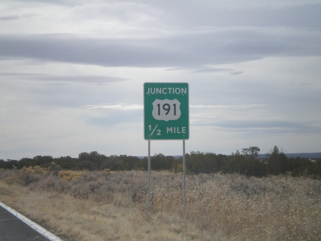
AZ-61 West Approaching US-191
AZ-61 west approaching US-191. AZ-61 west joins US-191 south to St. Johns.
Taken 02-24-2011
Saint Johns
Apache County
Arizona
United States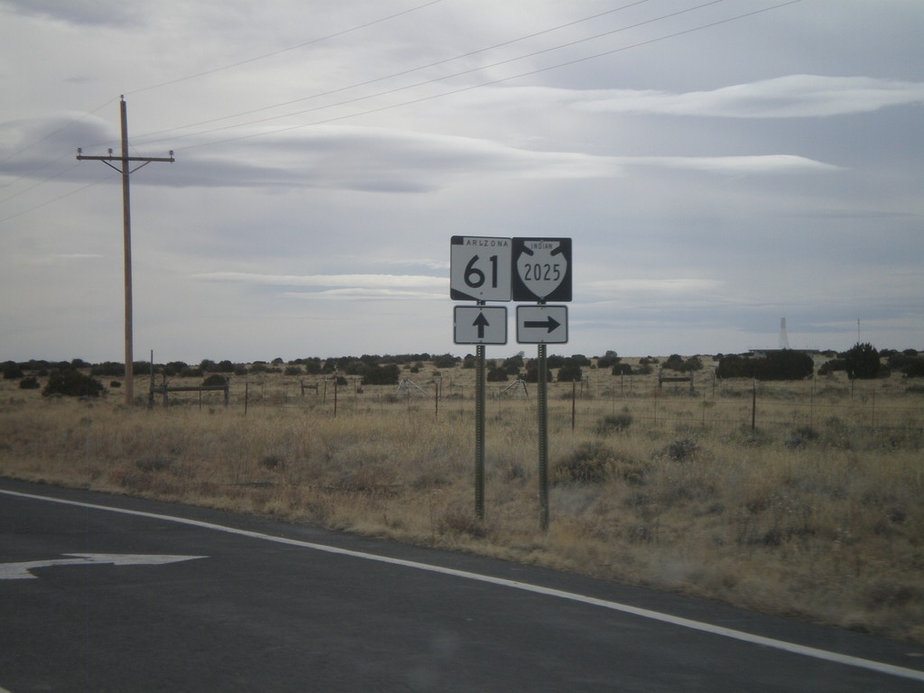
AZ-61 West Approaching Navajo-2025
AZ-61 west approaching Navajo-2025.
Taken 02-24-2011
 Sanders
Apache County
Arizona
United States
Sanders
Apache County
Arizona
United States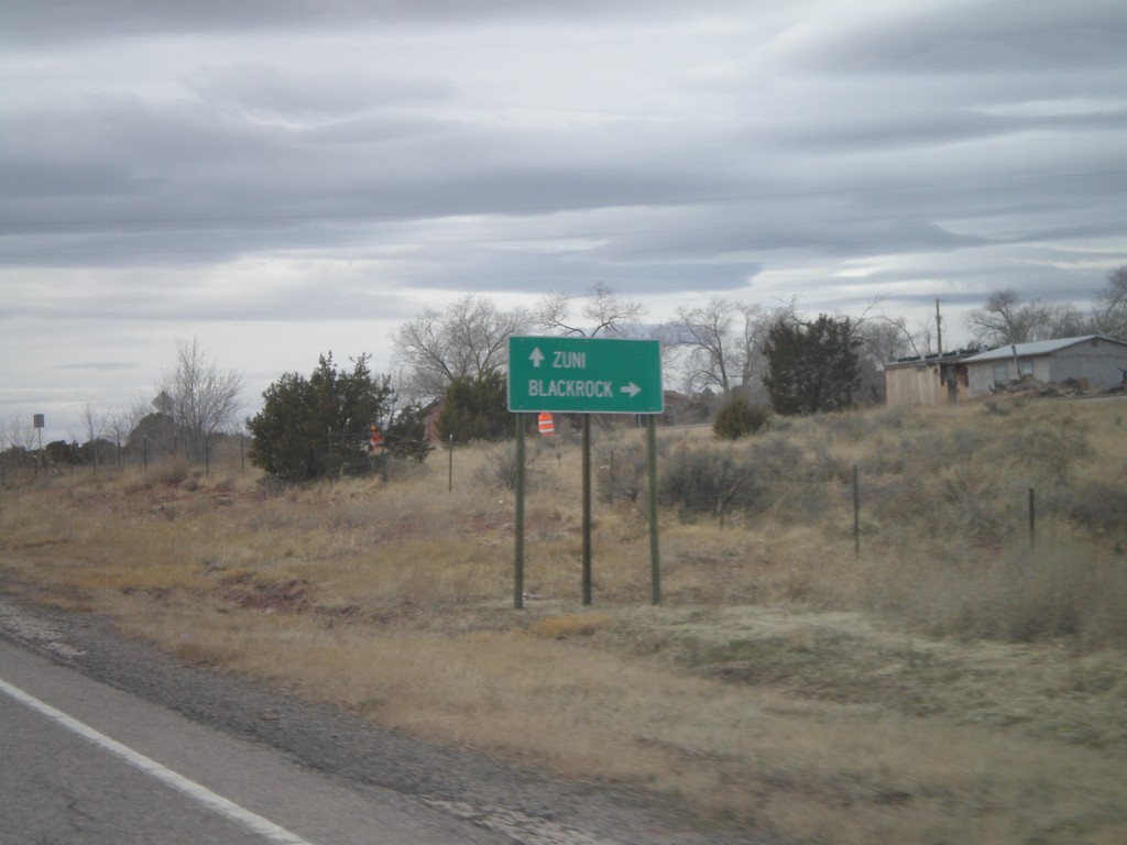
NM-53 West - Black Rock Jct.
NM-53 at Black Rock jct. Turn right for Black Rock. Continue west on NM-53 for Zuni.
Taken 02-24-2011
 Black Rock
McKinley County
New Mexico
United States
Black Rock
McKinley County
New Mexico
United States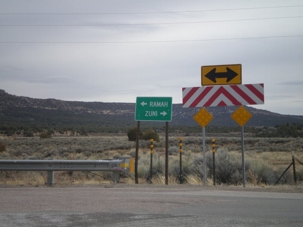
End NM-602 South at NM-53
End NM-602 South at NM-53. Use NM-53 west for Zuni; NM-53 east for Ramah.
Taken 02-24-2011
 Black Rock
McKinley County
New Mexico
United States
Black Rock
McKinley County
New Mexico
United States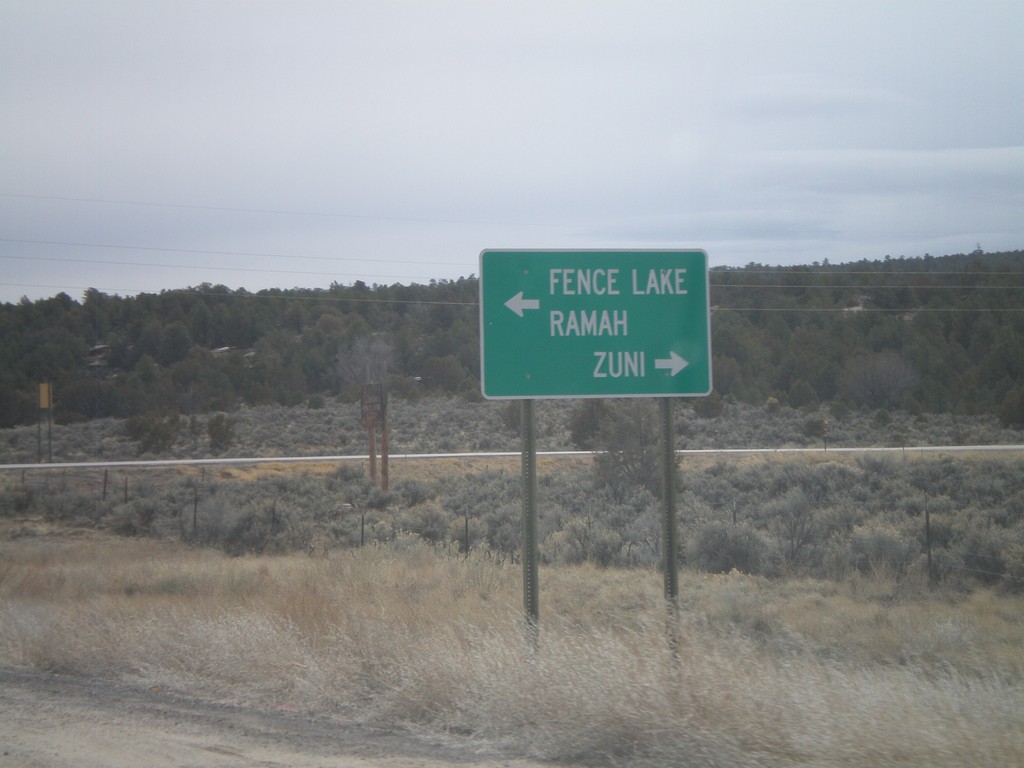
End NM-602 South At NM-53
End NM-602 South at NM-53. Use NM-53 west for Zuni; use NM-53 east for Ramah and Fence Lake.
Taken 02-24-2011
Zuni
McKinley County
New Mexico
United States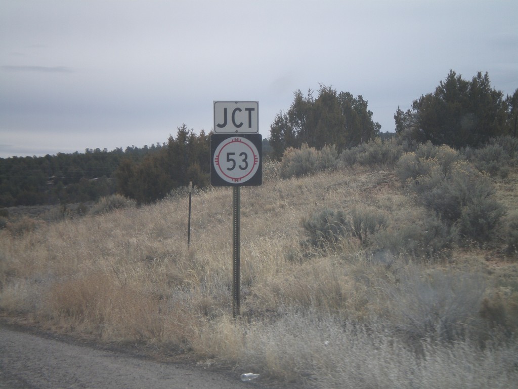
NM-602 South Approaching NM-53
NM-602 south approaching NM-53.
Taken 02-24-2011
Zuni
McKinley County
New Mexico
United States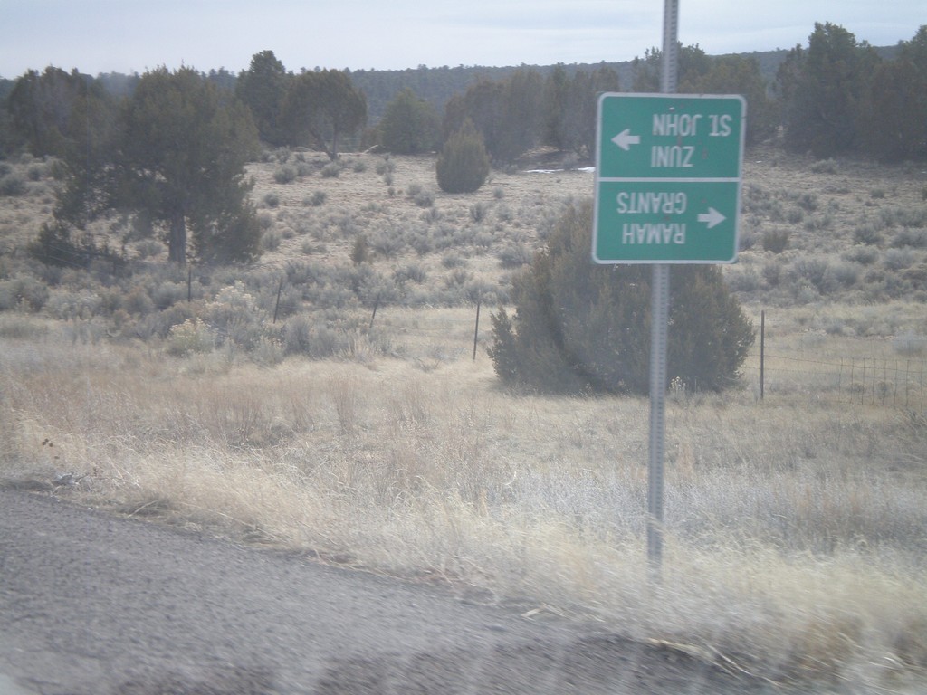
NM-602 South at Zuni-4
NM-602 south at Zuni-4 south. At the time of this photograph, Zuni-4 was closed for bridge repair, so the guide sign was turned upside town. During normal times, use Zuni-4 south for Zuni and St. John. Continue south on NM-602 for Ramah and Grants.
Taken 02-24-2011
 Zuni
McKinley County
New Mexico
United States
Zuni
McKinley County
New Mexico
United States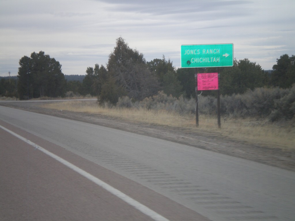
NM-602 South at Jones Ranch Road
NM-602 south at Jones Ranch Road jct. to Jones Ranch and Chichiltah.
Taken 02-24-2011
Vanderwagen
McKinley County
New Mexico
United States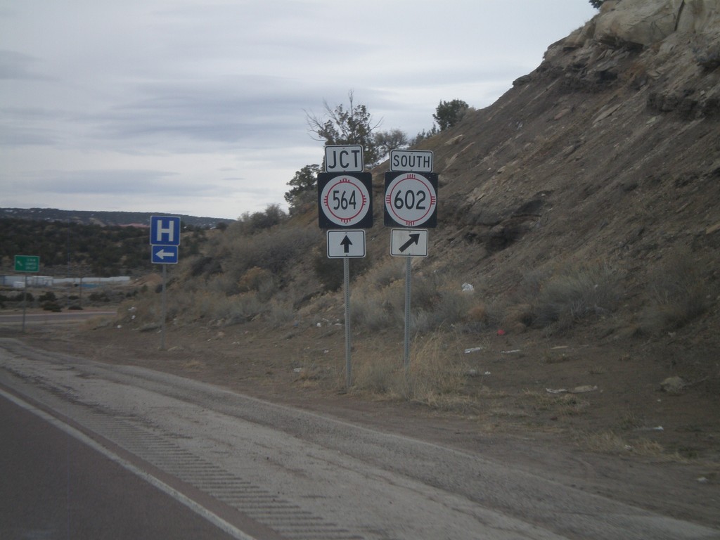
NM-602 South Approaching NM-564
NM-602 south approaching NM-564. Turn right to continue south on NM-602. NM-564 is the eastern belt route around Gallup.
Taken 02-24-2011
 Gallup
McKinley County
New Mexico
United States
Gallup
McKinley County
New Mexico
United States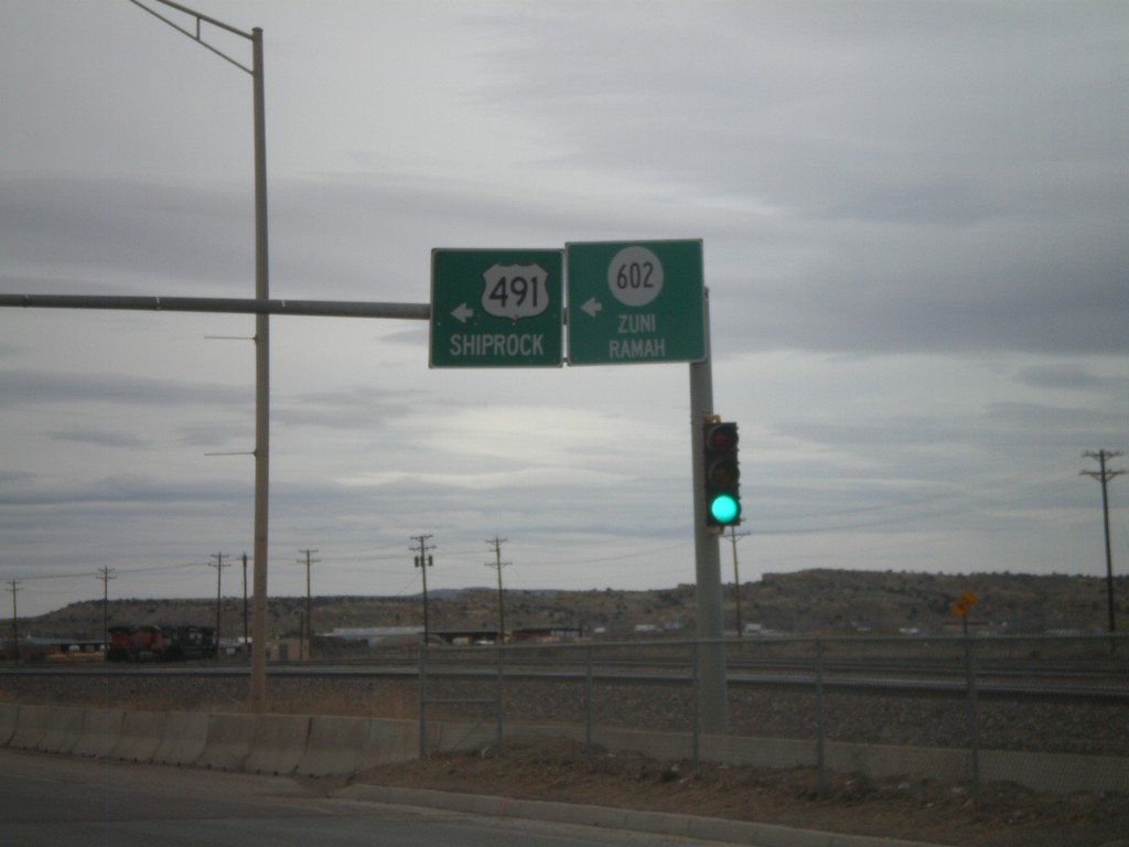
NM-118 West at NM-602/US-491
NM-118 west at Arnold St., to NM-602/Zuni/Ramah and US-491/Shiprock.
Taken 02-24-2011


 Gallup
McKinley County
New Mexico
United States
Gallup
McKinley County
New Mexico
United States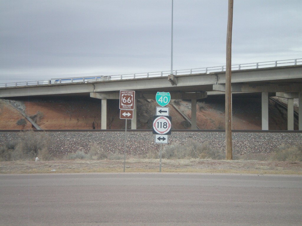
I-40 East Exit 26 offramp at NM-118
I-40 east Exit 26 offramp at NM-118/BL-40. NM-118 is the route of former US-66.
Taken 02-24-2011
 Gallup
McKinley County
New Mexico
United States
Gallup
McKinley County
New Mexico
United States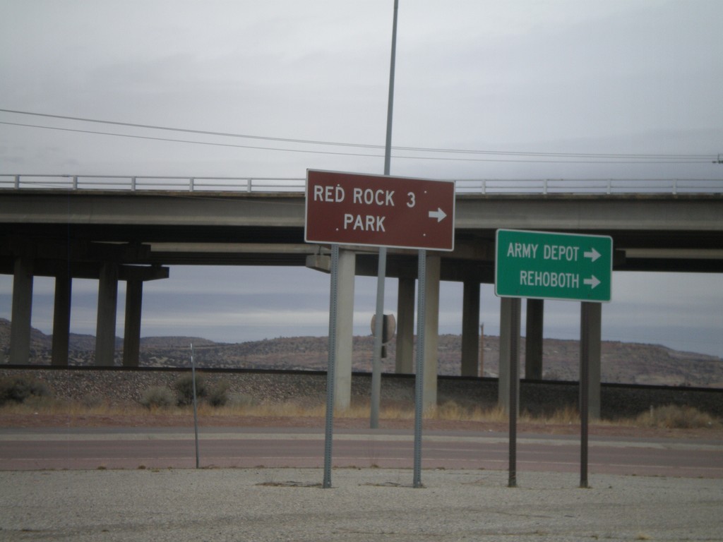
I-40 East Offramp at BL-40/NM-118
I-40 east offramp at BL-40/NM-118. Use NM-118 east for Army Depot. Rehoboth, and and Red Rock Park.
Taken 02-24-2011
Gallup
McKinley County
New Mexico
United States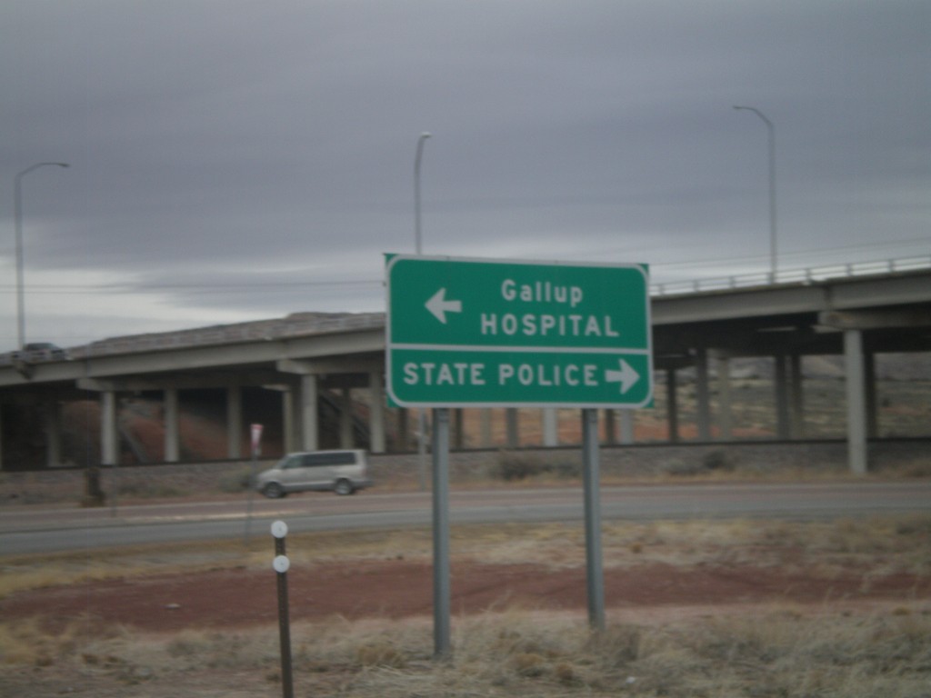
I-40 East at Exit 26 Offramp
I-40 east at Exit 26 Offramp. Turn right for State Police; turn left for Gallup and Hospital.
Taken 02-24-2011
Gallup
McKinley County
New Mexico
United States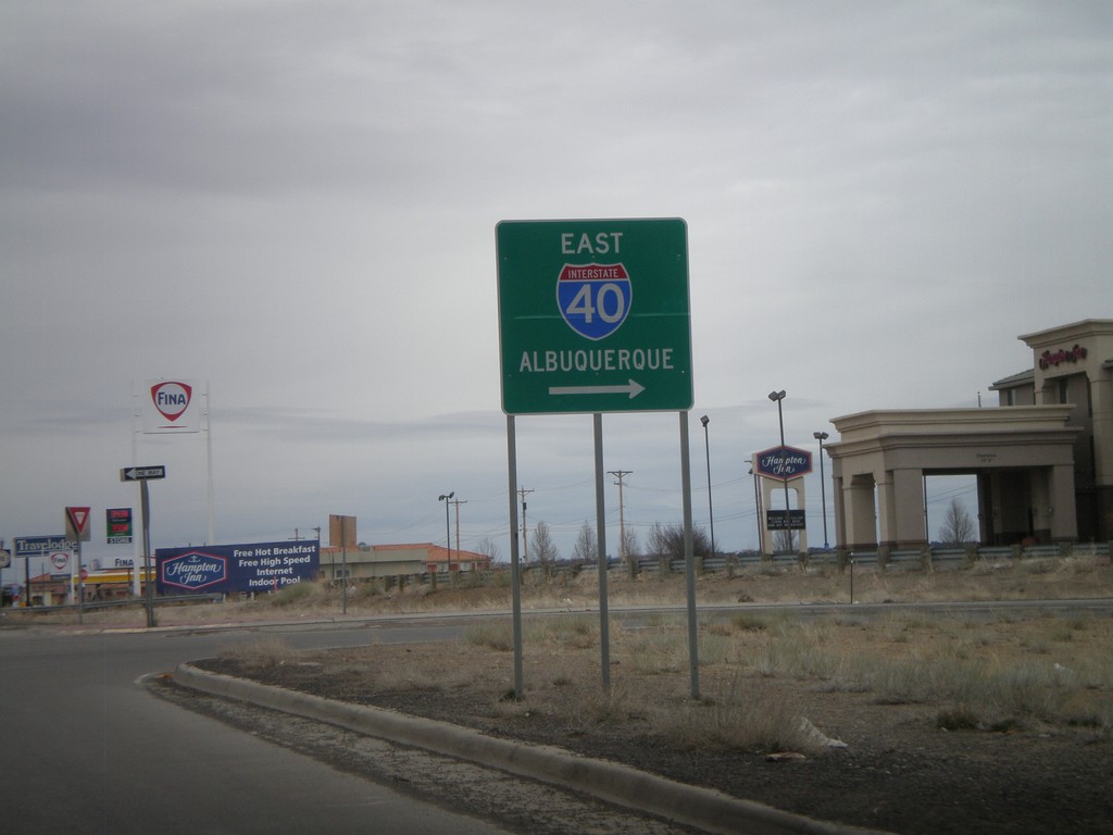
NM-118 East at I-40 East Onramp
NM-118 east at I-40 east onramp, at Exit 16. Use I-40 east for Albuquerque.
Taken 02-24-2011
Gallup
McKinley County
New Mexico
United States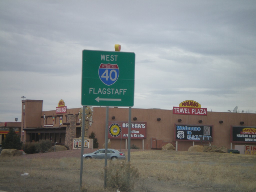
BL-40/NM-118 West at I-40 West
BL-40/NM-118 west at I-40 west to Flagstaff. This is the western end of the Gallup business loop.
Taken 02-24-2011
Gallup
McKinley County
New Mexico
United States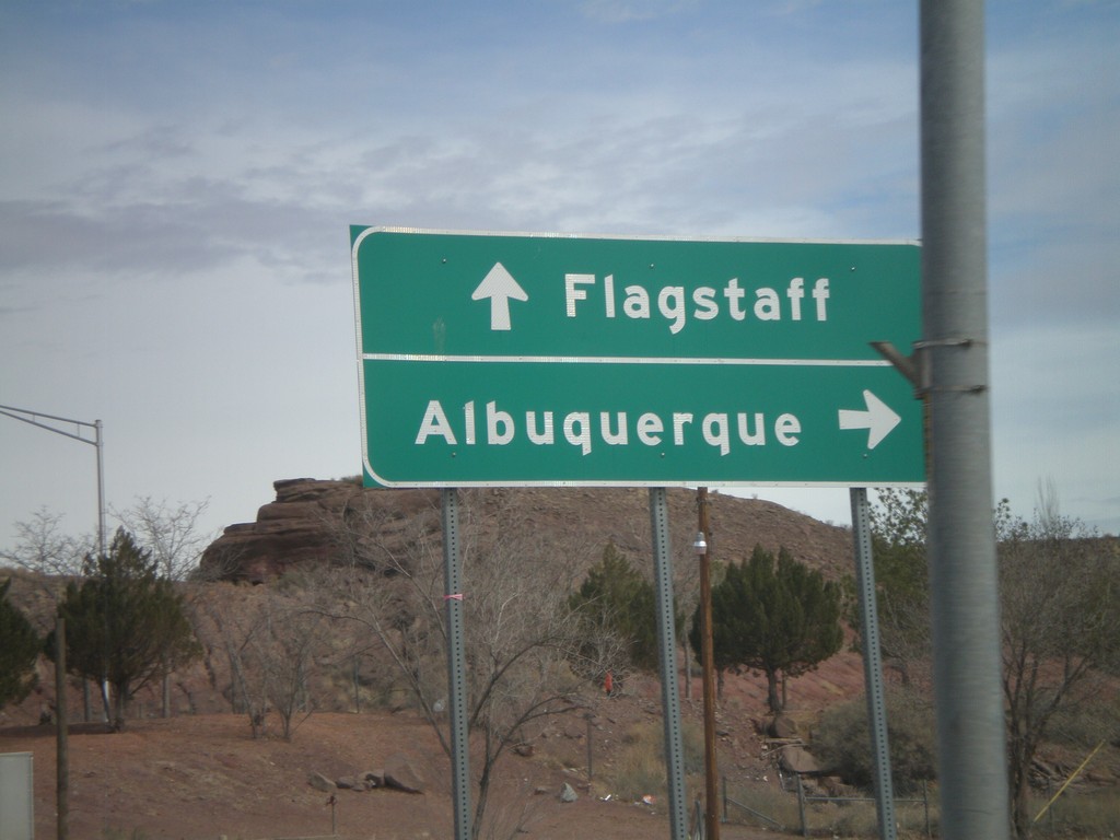
BL-40 East/AZ-77 North at I-40
BL-40 East/AZ-77 North at I-40 freeway entrance. Use I-40 west for Flagstaff; use I-40 east for Albuquerque. AZ-77 joins I-40 east through Holbrook.
Taken 02-24-2011
 Holbrook
Navajo County
Arizona
United States
Holbrook
Navajo County
Arizona
United States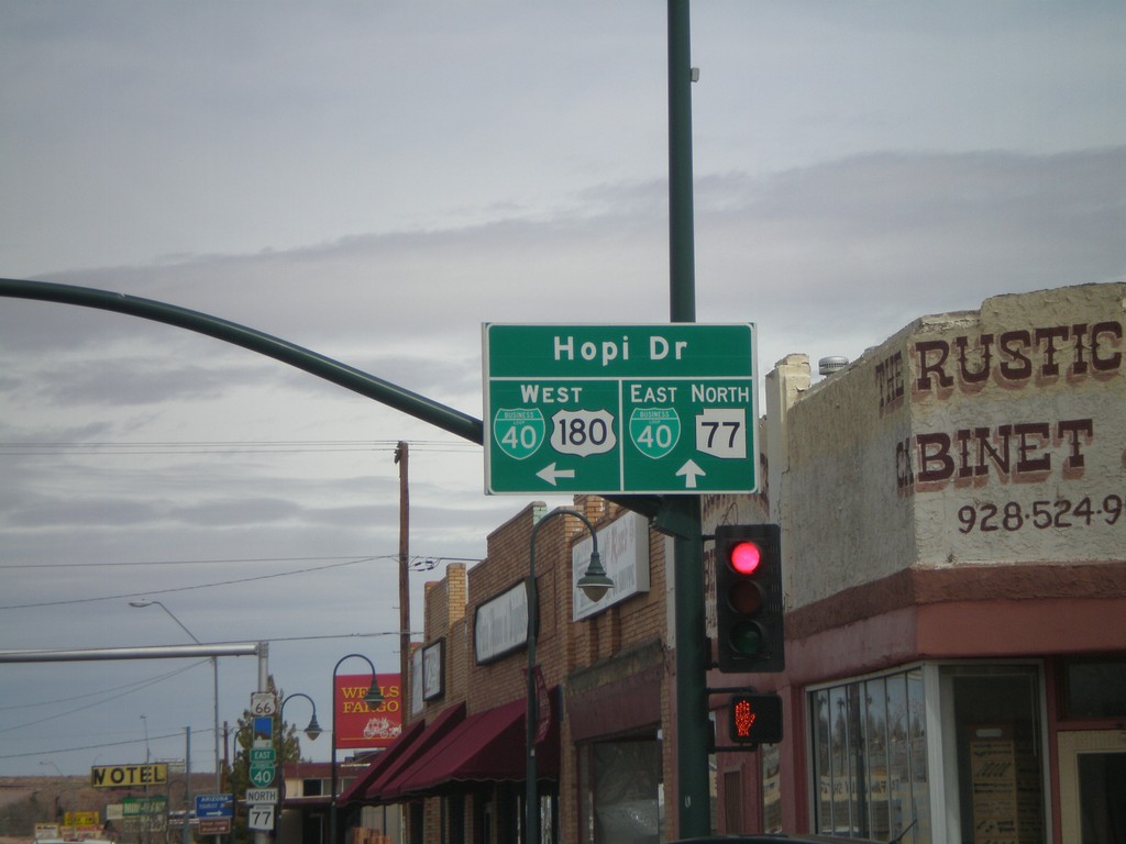
US-180 West/AZ-77 North at BL-40
US-180 West/AZ-77 North at BL-40. Continue straight for BL-40 East/AZ-77 North (Navajo Blvd.). Turn left for BL-40 West/US-180 West (Hopi Drive).
Taken 02-24-2011
Holbrook
Navajo County
Arizona
United States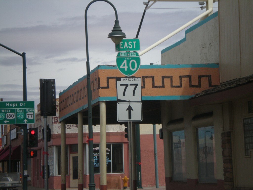
AZ-77 North/US-180 West at BL-40
AZ-77 North/US-180 West at BL-40 in downtown Holbrook. Continue straight on Navajo Blvd. for AZ-77 North/BL-40 East. Turn left on Hopi Drive for US-180 West/BL-40 west.
Taken 02-24-2011
Holbrook
Navajo County
Arizona
United States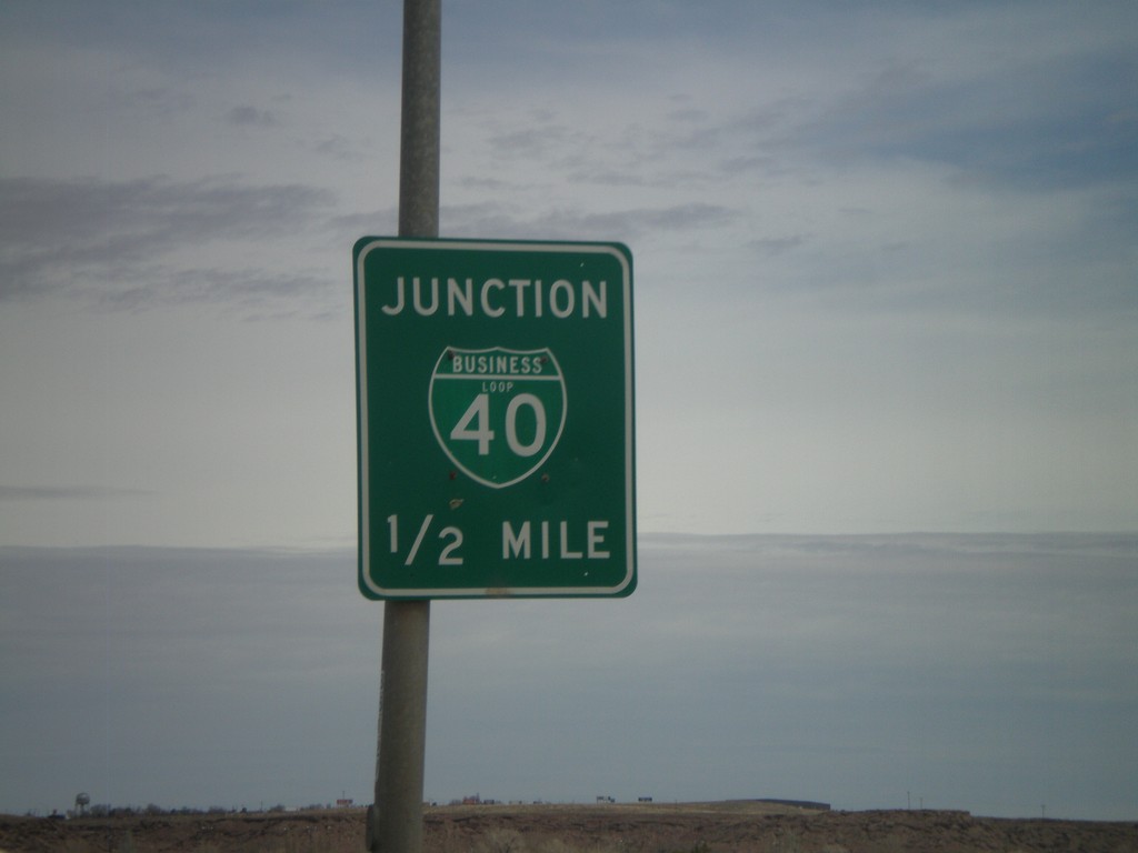
AZ-77 North/US-180 West Approaching BL-40
AZ-77 north/US-180 west approaching BL-40 in Holbrook.
Taken 02-24-2011
Holbrook
Navajo County
Arizona
United States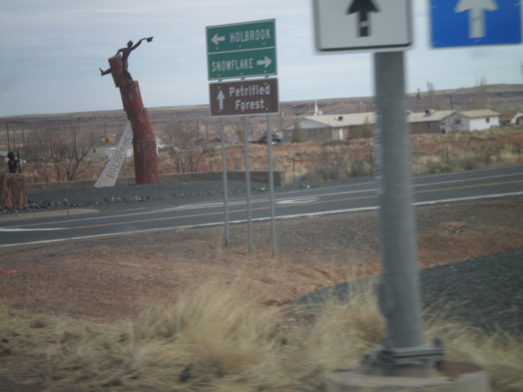
South Apache Dr. at AZ-77 and US-180
S. Apache Dr. at AZ-77 and US-180. Use AZ-77 south for Snowflake; use AZ-77 north/US-180 west for Holbrook; use US-180 east for Petrified Forest.
Taken 02-24-2011
Holbrook
Navajo County
Arizona
United States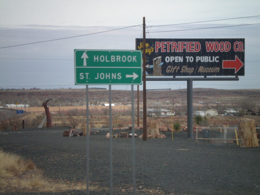
AZ-77 North at US-180
AZ-77 north at US-180. Use US-180 east for St. Johns; use US-180 west/AZ-77 north for Holbrook.
Taken 02-24-2011
Holbrook
Navajo County
Arizona
United States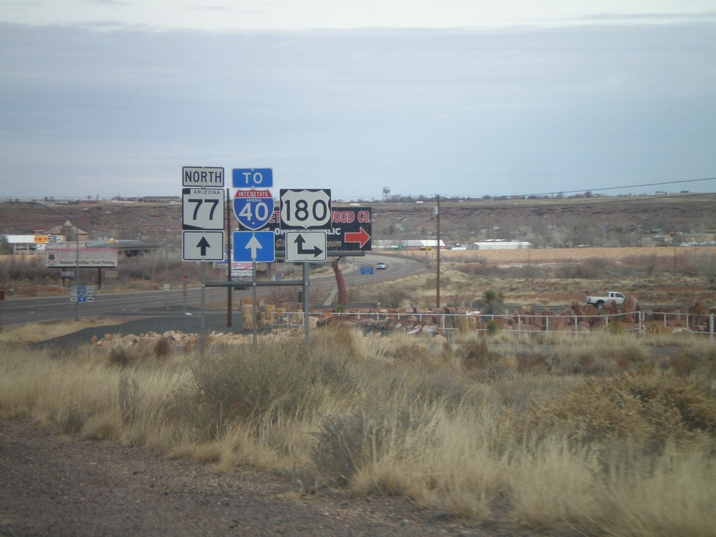
AZ-77 North at US-180
AZ-77 north at US-180. Turn right for US-180 east; continue north on AZ-77 for US-180 east to I-40.
Taken 02-24-2011
Holbrook
Navajo County
Arizona
United States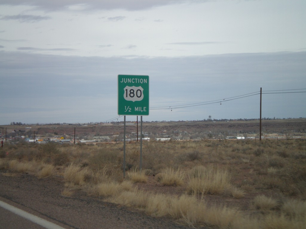
AZ-77 North Approaching US-180
AZ-77 North approaching US-180. US-180 joins AZ-77 into Holbrook.
Taken 02-24-2011
Holbrook
Navajo County
Arizona
United States