Signs Tagged With Intersection
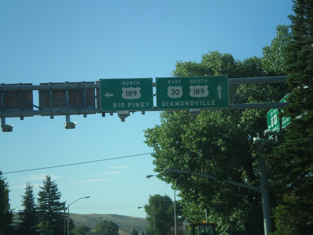
US-30 East at US-189
US-30 east at US-189 north. Use US-189 north for Big Piney. US-189 joins US-30 through Kemmerer towards Diamondville.
Taken 08-02-2010

 Kemmerer
Lincoln County
Wyoming
United States
Kemmerer
Lincoln County
Wyoming
United States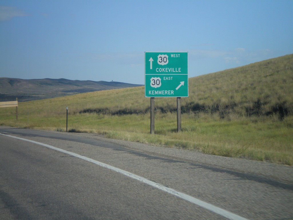
End US-30 By-Pass West at US-30
End US-30 By-Pass west at US-30. Use US-30 west for Kemmerer. Use US-30 east for Cokeville. US-30 By-Pass loops around the south side of Kemmerer and Diamondville.
Taken 08-02-2010
 Kemmerer
Lincoln County
Wyoming
United States
Kemmerer
Lincoln County
Wyoming
United States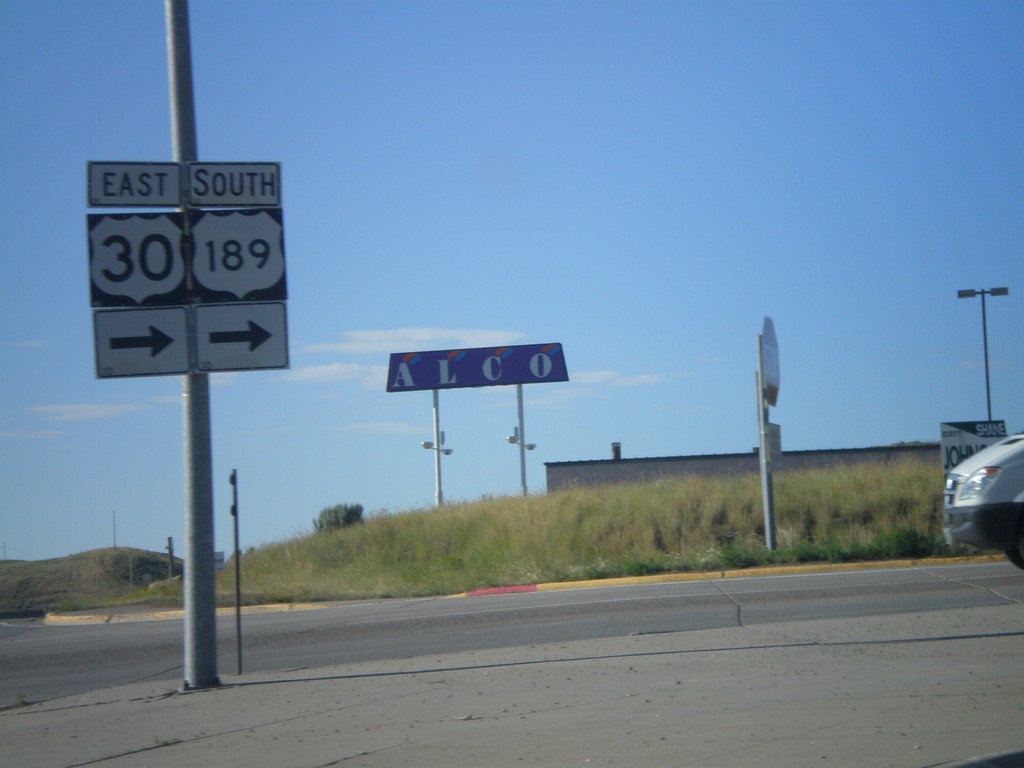
US-30 East/US-189 South - Diamondville
US-30 East/US-189 south in Diamondville. US-30 East/US-189 south turn right onto Lincoln St.
Taken 08-02-2010
Diamondville
Lincoln County
Wyoming
United States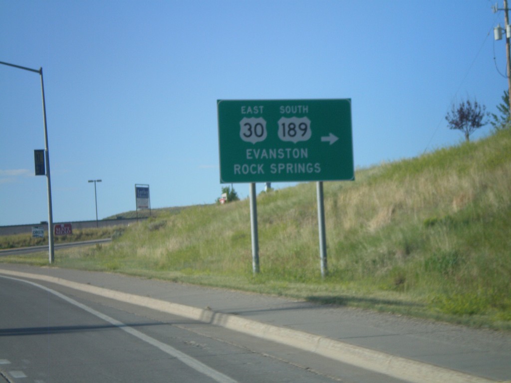
US-30 East/US-189 South - Diamondville
US-30 East/US-189 south in Diamondville. Turn right to continue on US-30 East/US-189 South. Use US-30 East/US-189 south for Evanston and Rock Springs.
Taken 08-02-2010
Kemmerer
Lincoln County
Wyoming
United States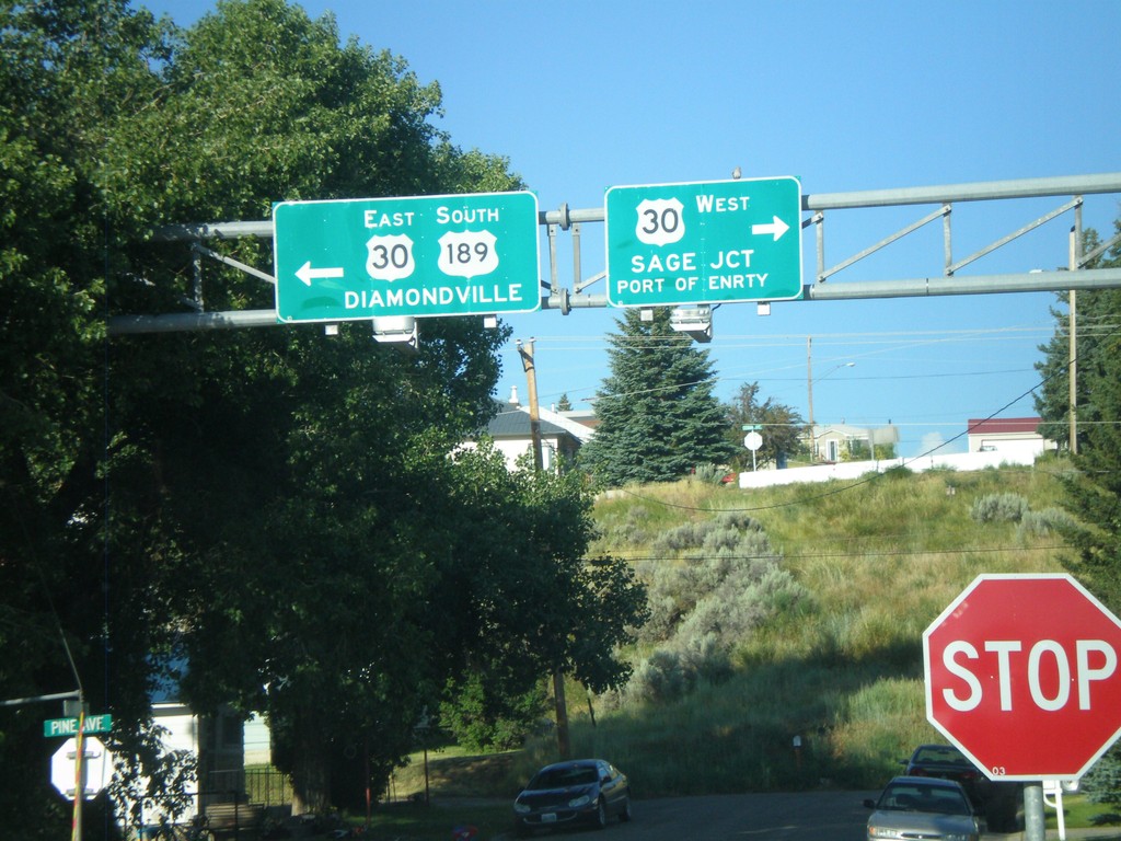
US-189 South at US-30
US-189 south at US-30. Use US-30 west for Sage Jct. and Port of Entry. Use US-30 East/US-189 South for Diamondville. US-189 joins US-30 east through the Kemmerer/Diamondville area.
Taken 08-02-2010
Kemmerer
Lincoln County
Wyoming
United States
US-189 South Approaching US-30
US-189 south approaching US-30.
Taken 08-02-2010
Kemmerer
Lincoln County
Wyoming
United States
WY-233 South Approaching US-189
WY-233 south approaching US-189
Taken 08-02-2010
 Kemmerer
Lincoln County
Wyoming
United States
Kemmerer
Lincoln County
Wyoming
United States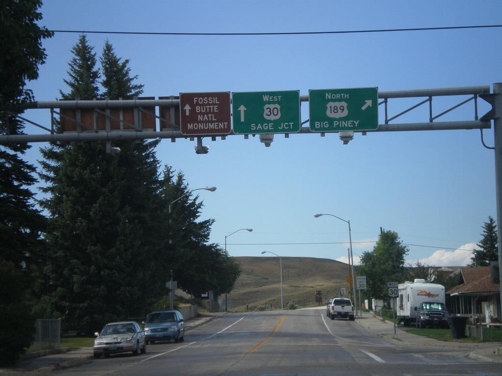
US-30 West at US-189 North
US-30 west at US-189 north. Use US-189 north for Big Piney. Continue west on US-30 for Sage Jct. and Fossil Butte National Monument.
Taken 08-01-2010
Kemmerer
Lincoln County
Wyoming
United States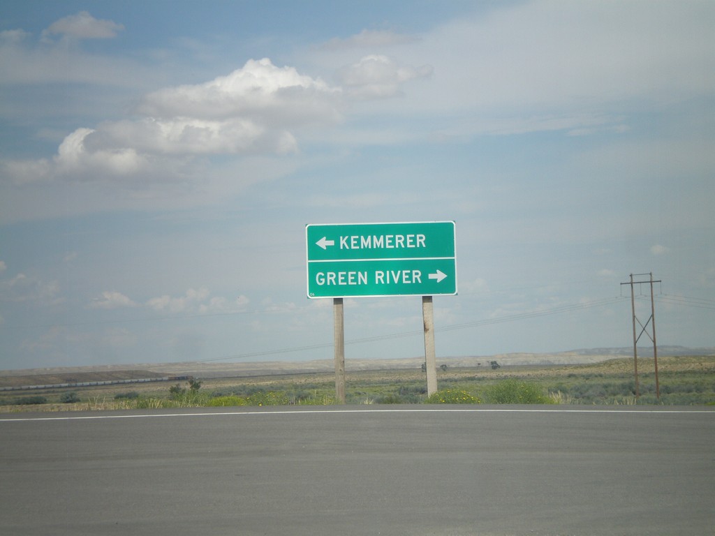
End WY-235 at US-30
End WY-235 at US-30. Use US-30 west for Kemmerer; use US-30 east for Green River.
Taken 08-01-2010
 Granger
Sweetwater County
Wyoming
United States
Granger
Sweetwater County
Wyoming
United States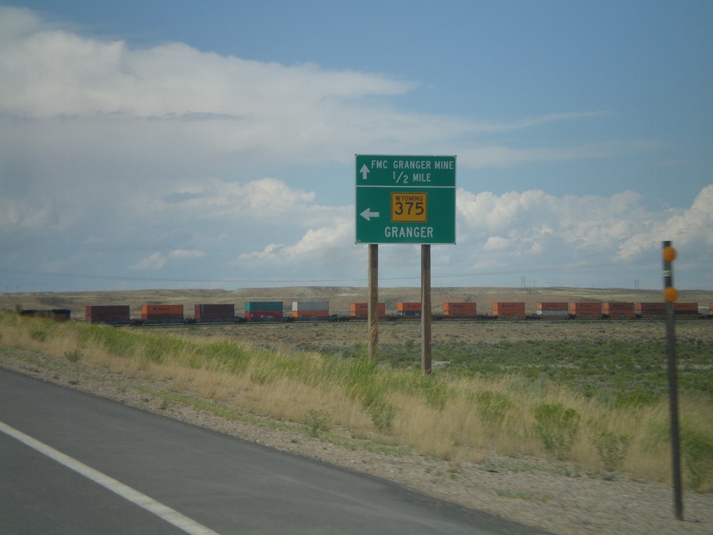
US-30 West Approaching WY-235
US-30 west approaching WY-235. Use WY-235 west for Granger. Continue west on US-30 for FMC Granger Mine.
Taken 08-01-2010
Granger
Sweetwater County
Wyoming
United States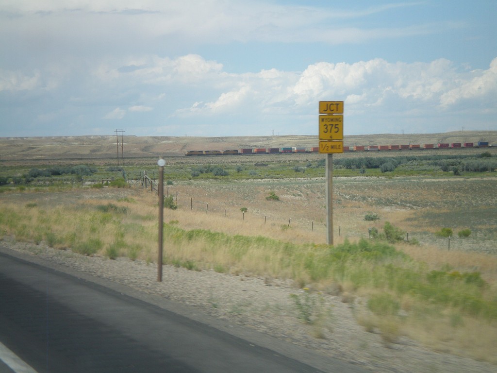
US-30 West Approaching WY-235
US-30 west approaching WY-235.
Taken 08-01-2010
Granger
Sweetwater County
Wyoming
United States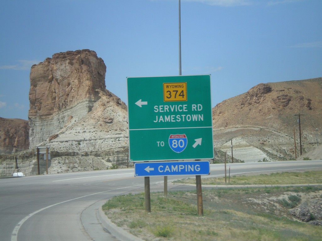
BL-80/Bus. US-30 West at WY-374
BL-80/Bus. US-30 west at WY-374/Service Road to Jamestown. Continue west on Business Loop for I-80.
Taken 08-01-2010


 Green River
Sweetwater County
Wyoming
United States
Green River
Sweetwater County
Wyoming
United States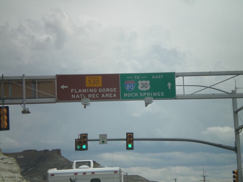
BL-80/Bus. US-30 East at WY-530
BL-80/Bus. US-30 east at WY-530. Use WY-530 south for the Flaming Gorge National Recreation Area. Continue on BL-80/Bus. US-30 east for I-80/US-30 and Rock Springs.
Taken 08-01-2010
 Green River
Sweetwater County
Wyoming
United States
Green River
Sweetwater County
Wyoming
United States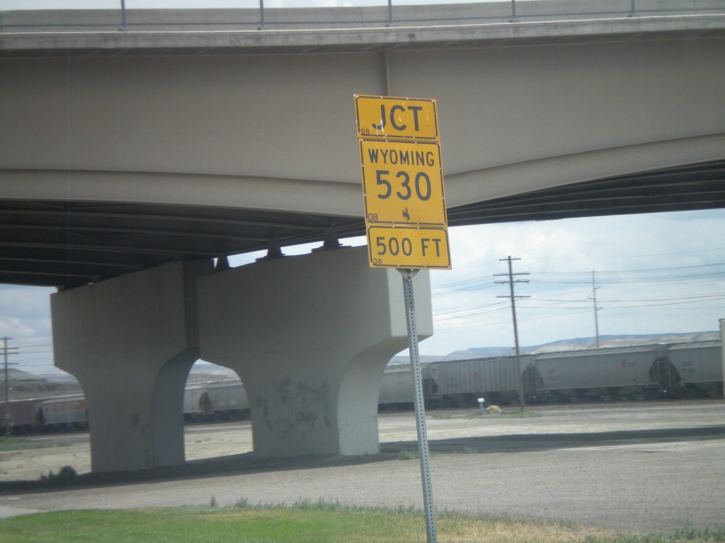
BL-80/Bus. US-30 East Approaching WY-530
BL-80/Bus. US-30 East approaching WY-530.
Taken 08-01-2010
Green River
Sweetwater County
Wyoming
United States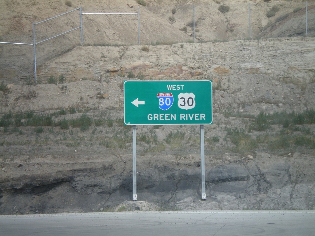
BL-80/Bus. US-30 East at I-80/US-30 West
BL-80/Bus. US-30 East at I-80/US-30 west towards Green River. This is the onramp for Exit 107.
Taken 08-01-2010
Rock Springs
Sweetwater County
Wyoming
United States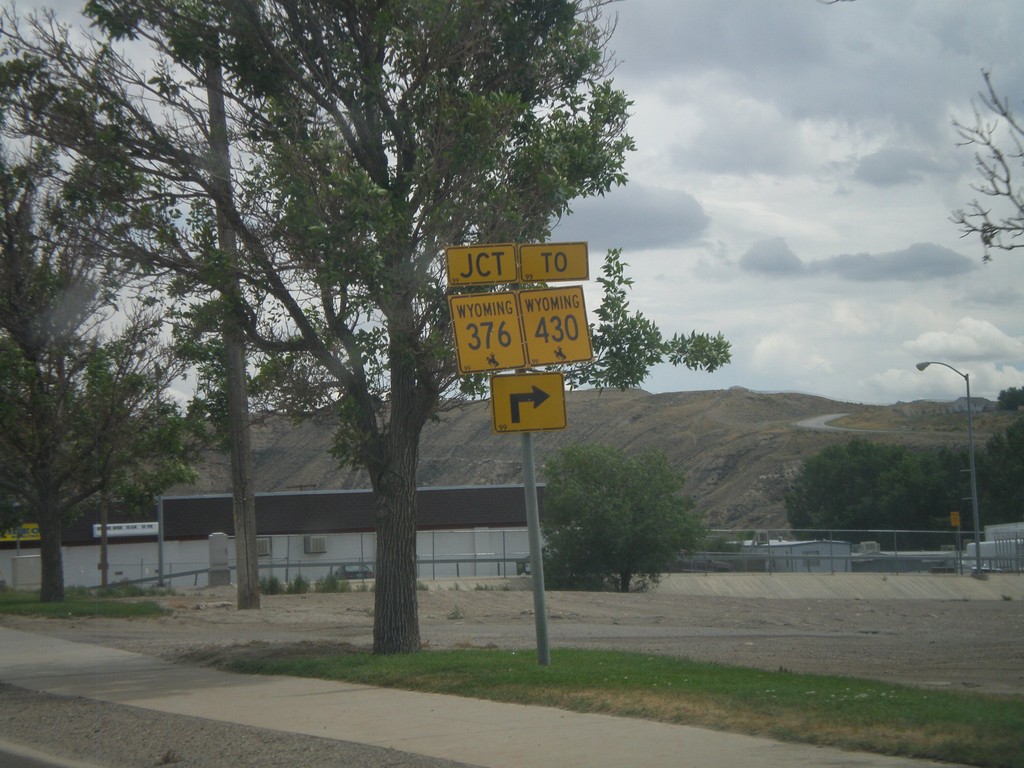
BL-80/Bus. US-30 East at WY-376
BL-80/Bus. US-30 East at WY-376/To WY-430. WY-376 is the Rock Springs Belt Line, which loops across the south side of town.
Taken 08-01-2010

 Rock Springs
Sweetwater County
Wyoming
United States
Rock Springs
Sweetwater County
Wyoming
United States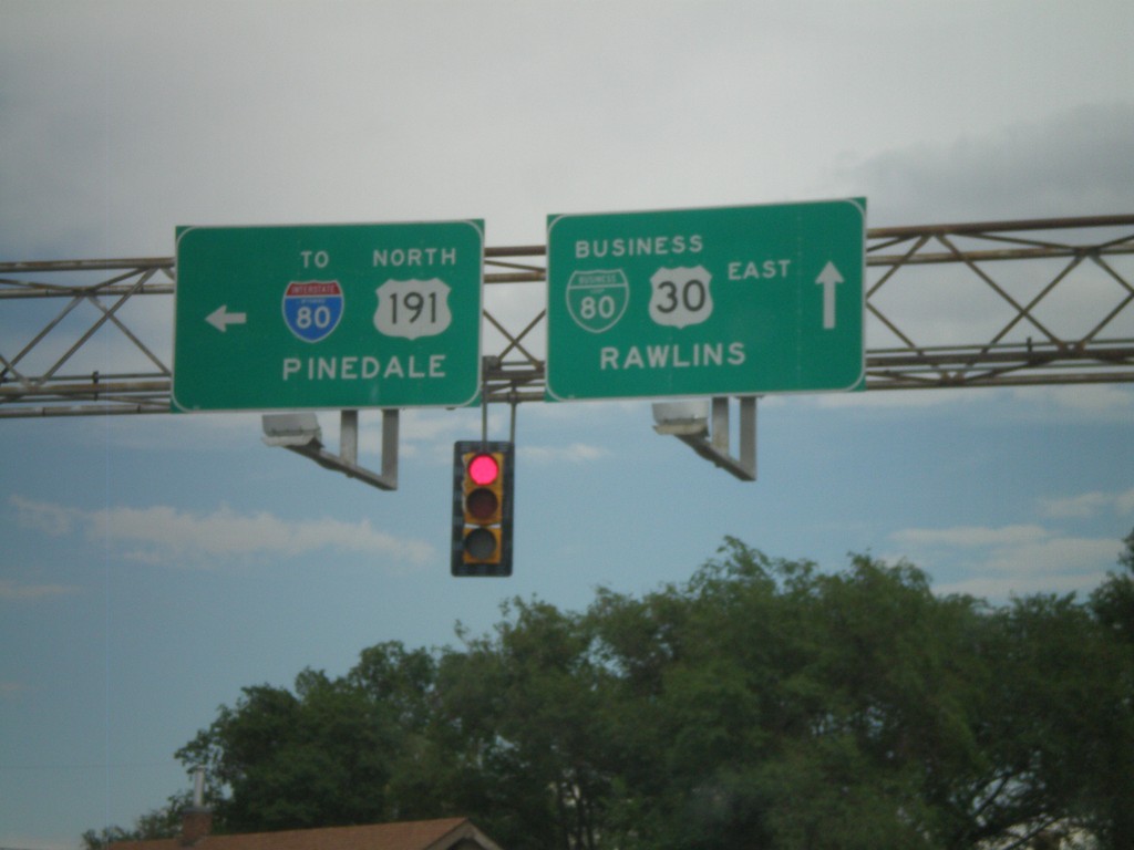
BL-80/Bus. US-30 East at Elk St.
BL-80/Bus. US-30 East at Elk St. in downtown Rock Springs. Use Elk St. north for US-191 to Pinedale and I-80. Continue east on BL-80/Bus. US-30 for Rawlins.
Taken 08-01-2010
 Rock Springs
Sweetwater County
Wyoming
United States
Rock Springs
Sweetwater County
Wyoming
United States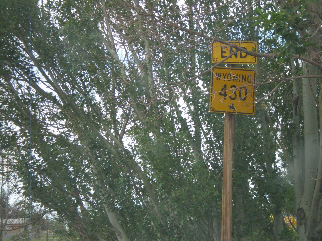
End WY-430 North at WY-376
End WY-430 north at WY-376
Taken 08-01-2010
Rock Springs
Sweetwater County
Wyoming
United States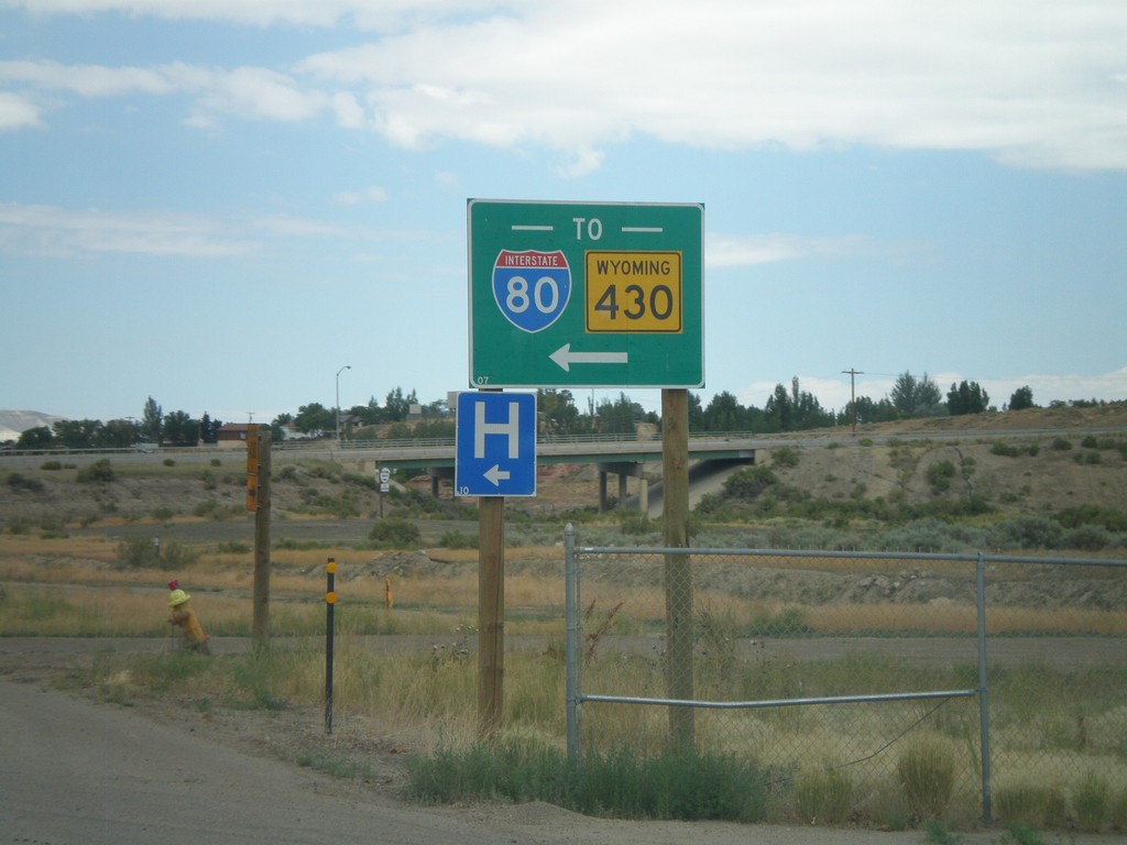
WY-430 North - To I-80
WY-430 North (New Hampshire St.) at Marchant St. Turn left on Marchant St. to continue on WY-430, and to reach I-80. WY-430 is incorrectly marked as TO here, when in reality this is a continuation of WY-430.
Taken 08-01-2010
Rock Springs
Sweetwater County
Wyoming
United States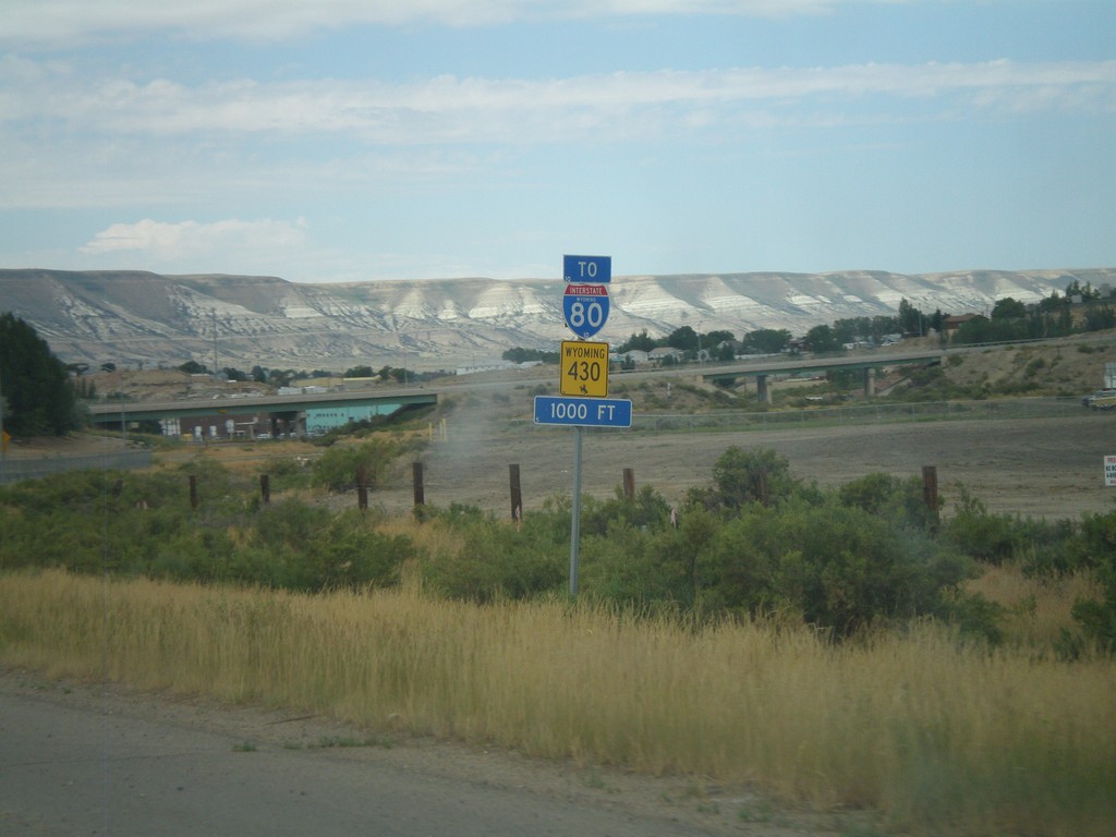
WY-430 North To I-80
WY-430 North (New Hampshire St.) approaching Marchant St. All WY-430 North and I-80 traffic must turn left on Marchant St.
Taken 08-01-2010
Rock Springs
Sweetwater County
Wyoming
United States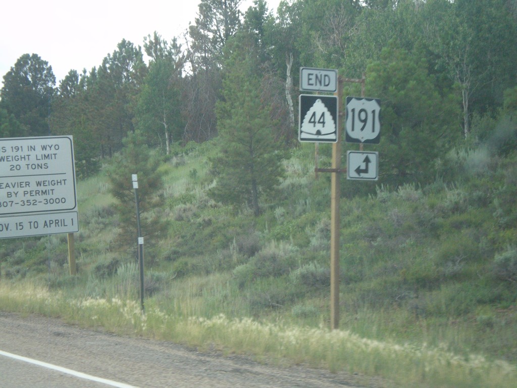
End UT-44 East at US-191
End UT-44 east at US-191.
Taken 08-01-2010
 Dutch John
Daggett County
Utah
United States
Dutch John
Daggett County
Utah
United States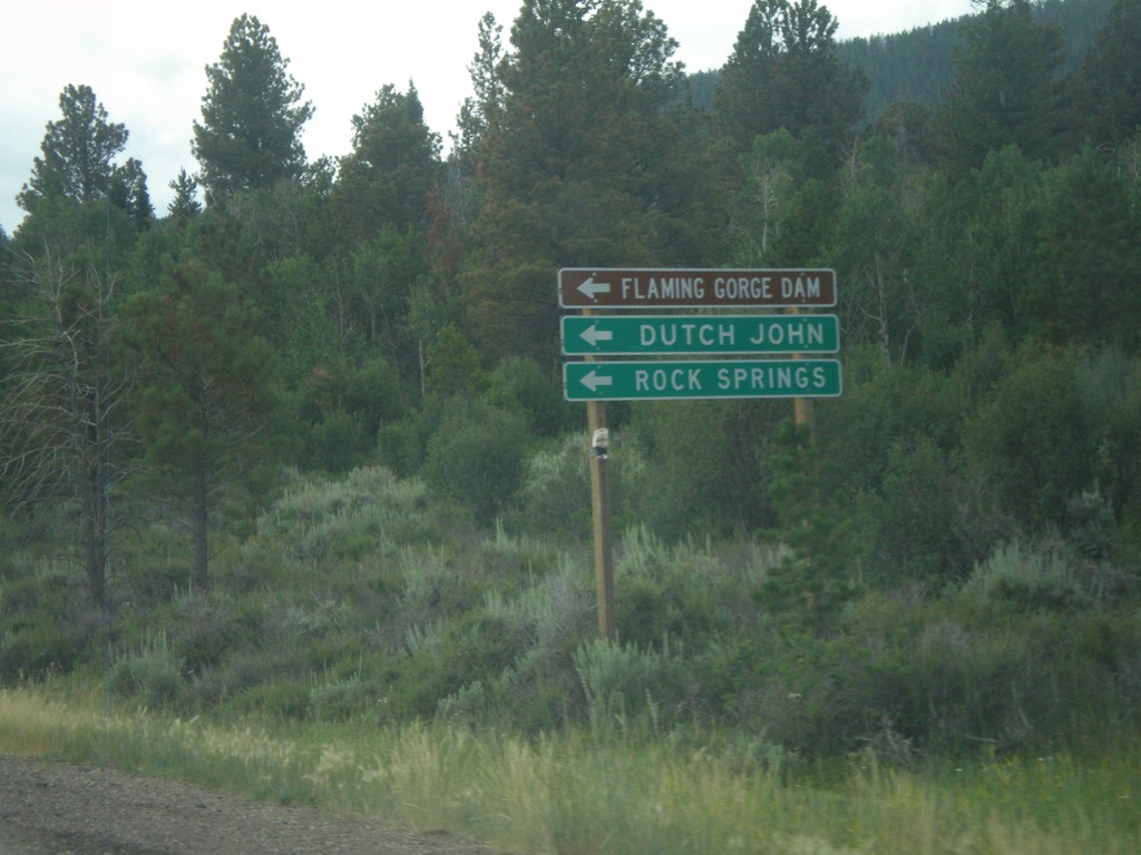
UT-44 East Approaching US-191
UT-44 east approaching US-191. Use US-191 north for Flaming Gorge Dam, Dutch John, and Rock Springs (Wyoming).
Taken 08-01-2010
Dutch John
Daggett County
Utah
United States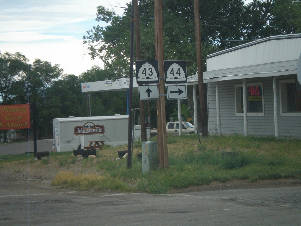
UT-43 East Approaching UT-44
UT-43 east approaching UT-44. Use UT-44 east for Vernal, Dutch John, and Flaming Gorge Dam. Continue east on UT-43 for Green River.
Taken 07-31-2010
 Manila
Daggett County
Utah
United States
Manila
Daggett County
Utah
United States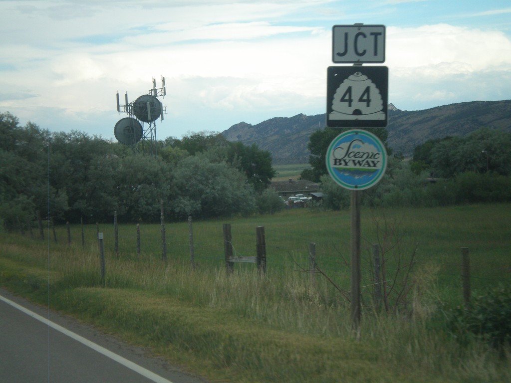
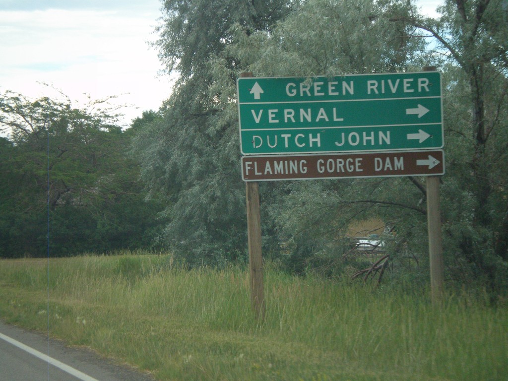
UT-43 East Approaching UT-44
UT-43 east approaching UT-44. UT-44 is a Utah Scenic Byway.
Taken 07-31-2010
Manila
Daggett County
Utah
United States