Signs Tagged With Intersection
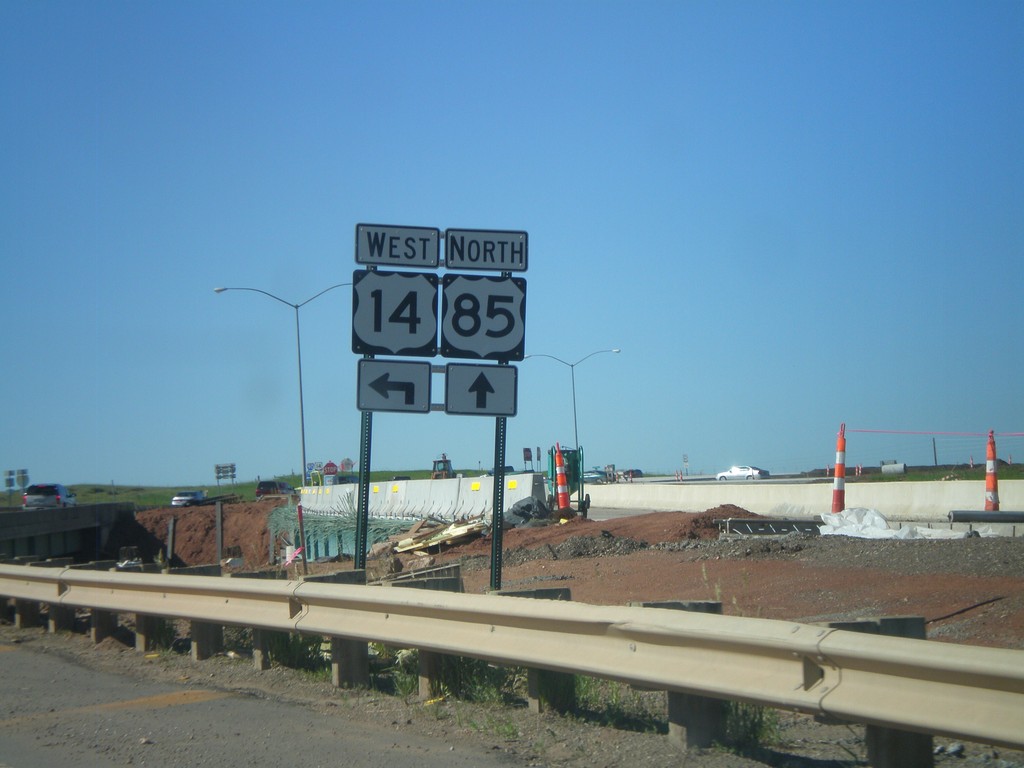
US-85 North at I-90/US-14 West
US-85 North at I-90/US-14 West (Exit 10). Turn left for US-14 and I-90 west. Interchange is currently under construction, and most of the traffic signs are temporary.
Taken 07-03-2011


 Spearfish
Lawrence County
South Dakota
United States
Spearfish
Lawrence County
South Dakota
United States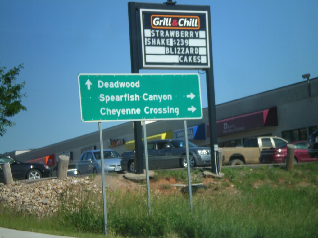
BL-90 East at US-14A
BL-90 East at US-14A. Turn right for US-14 East to Spearfish Canyon and Cheyenne Crossing. Continue ahead for BL-90 east for Deadwood. Deadwood is not directly assessable via BL-90 or I-90, but is the preferred route from Spearfish.
Taken 07-03-2011
 Spearfish
Lawrence County
South Dakota
United States
Spearfish
Lawrence County
South Dakota
United States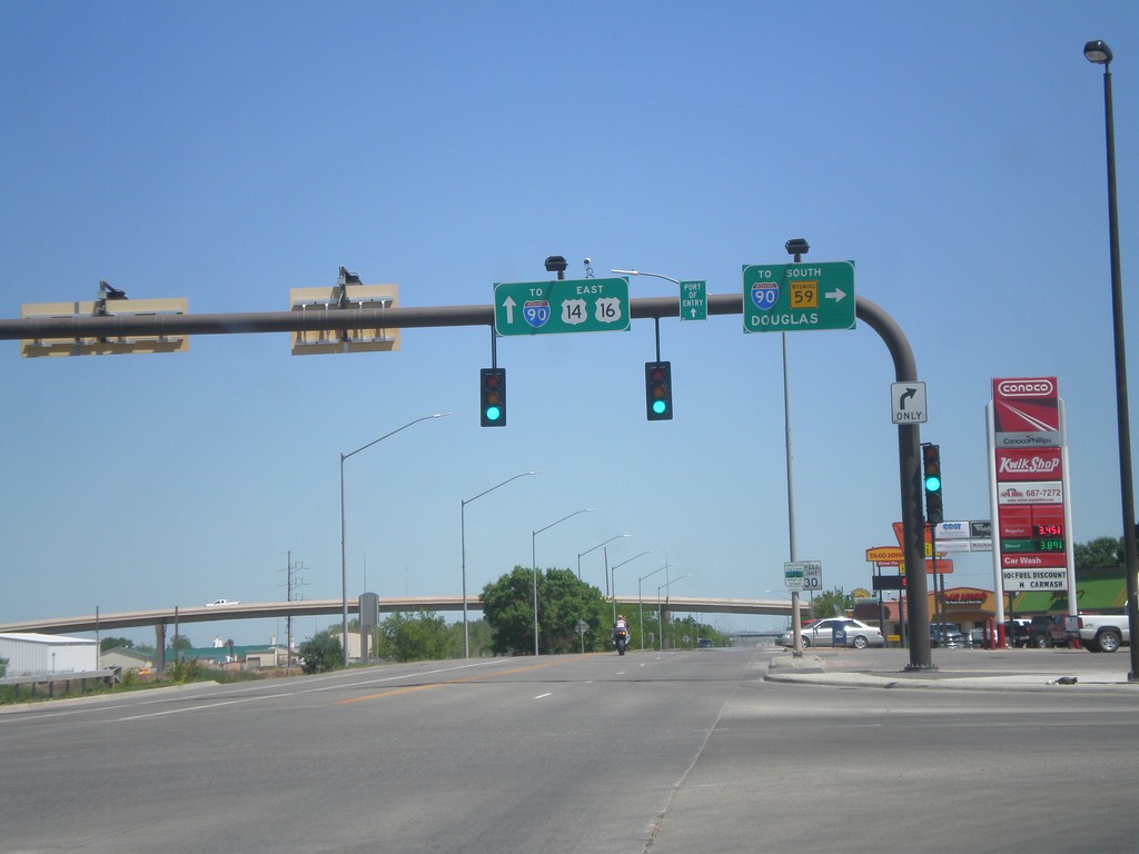
BL-90/US-14/US-16 East at WY-59
BL-90/US-14/US-16 east at WY-59. Turn right for I-90 (west)/WY-59 South to Douglas. Continue straight ahead for I-90 east.
Taken 07-03-2011

 Gillette
Campbell County
Wyoming
United States
Gillette
Campbell County
Wyoming
United States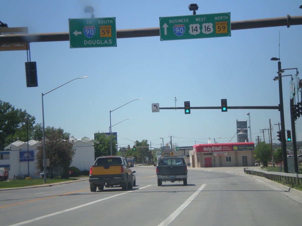
BL-90/US-14/US-16 West at WY-59
BL-90/US-14/US-16 west at WY-59. Turn left for I-90 (west)/WY-59 South to Douglas. Continue straight ahead for BL-90/US-14/US-16 West and WY-59 North. WY-59 follows US-14/US-16 through Gillette.
Taken 07-03-2011
Gillette
Campbell County
Wyoming
United States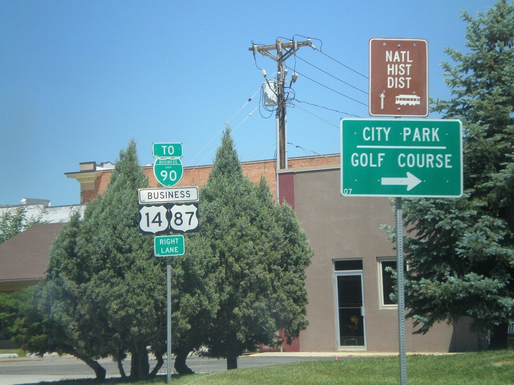
BL-90/Business US-87/Business US-14 in Sheridan
BL-90/Business US-87/Business US-14 (Coffeen Ave.) west at Main St in downtown Sheridan. Turn right on Main St. for the Sheridan City Park and Golf Course.
Taken 07-03-2011

 Sheridan
 County
Wyoming
United States
Sheridan
Sheridan County
Wyoming
United States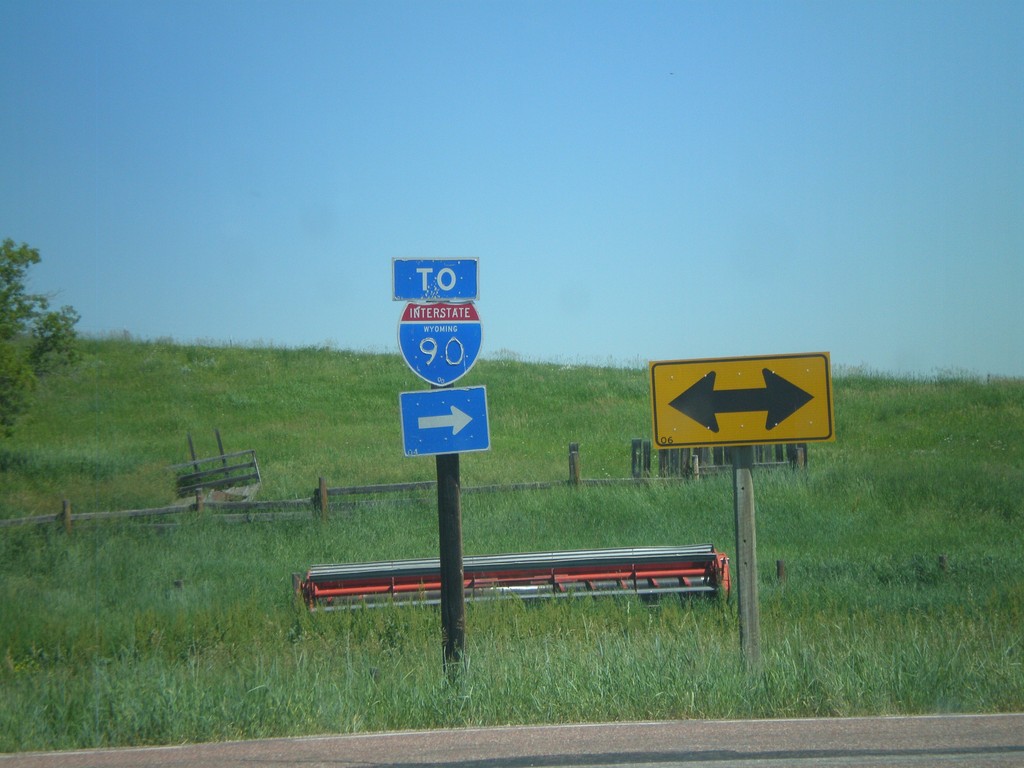
End WY-343 at WY-345
End WY-343 at WY-345. Use WY-345 east for I-90.
Taken 07-03-2011

 Parkman
Sheridan County
Wyoming
United States
Parkman
Sheridan County
Wyoming
United States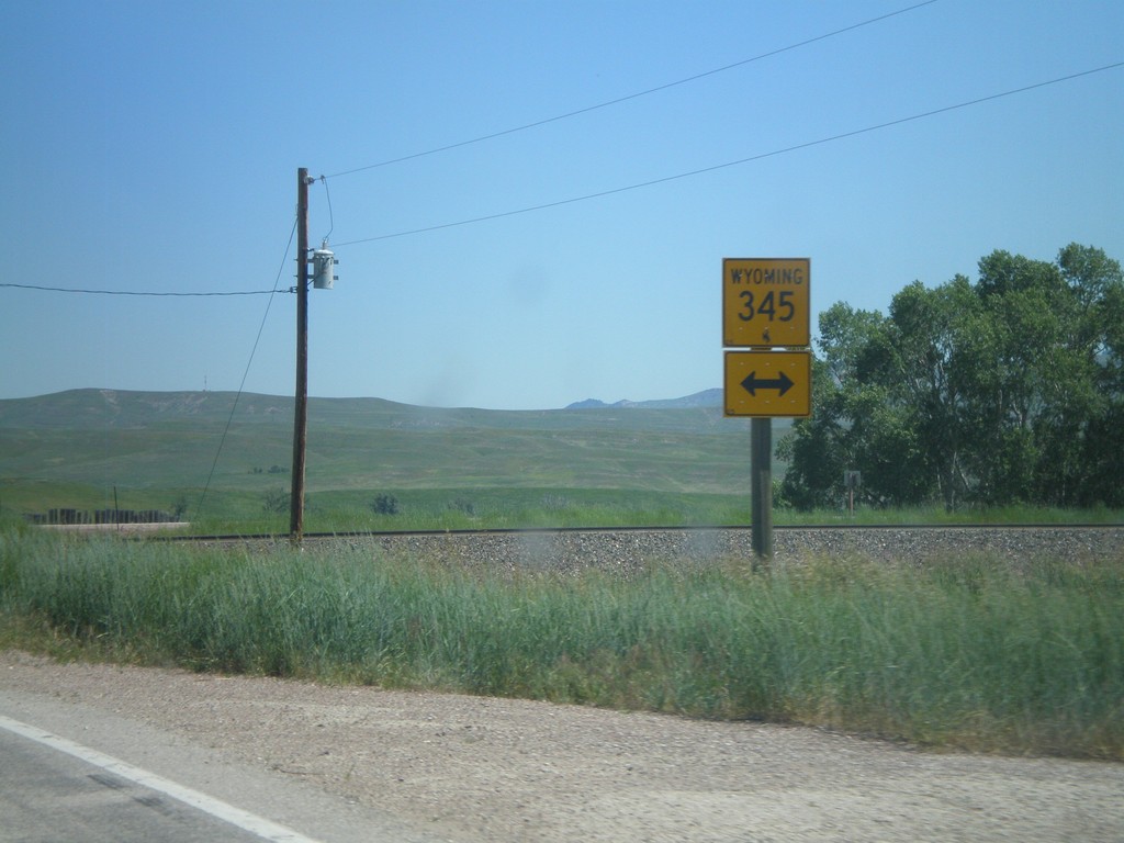
WY-343 North at WY-345
End WY-343 north at WY-345 near Parkman.
Taken 07-03-2011
Parkman
Sheridan County
Wyoming
United States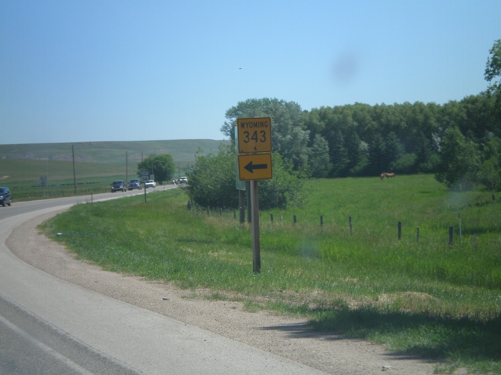
US-14 East At WY-343
US-14 east at WY-343 north.
Taken 07-03-2011
Dayton
Sheridan County
Wyoming
United States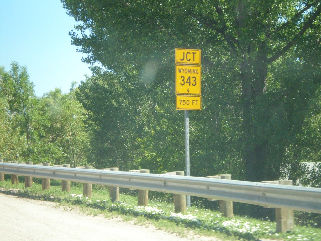
US-14 East Approaching WY-343
US-14 east approaching WY-343 east in Dayton.
Taken 07-03-2011
Ranchester
Sheridan County
Wyoming
United States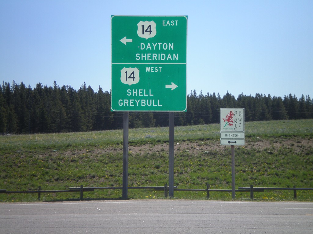
End US-14A At US-14 - Burgess Jct.
End US-14A at US-14 - Burgess Jct. Turn right for US-14 west to Shell and Greybull; turn left for US-14 east to Dayton and Sheridan. There is also a Bighorn Scenic Byway sign, of which either direction US-14 is part of.
Taken 07-03-2011
Dayton
Sheridan County
Wyoming
United States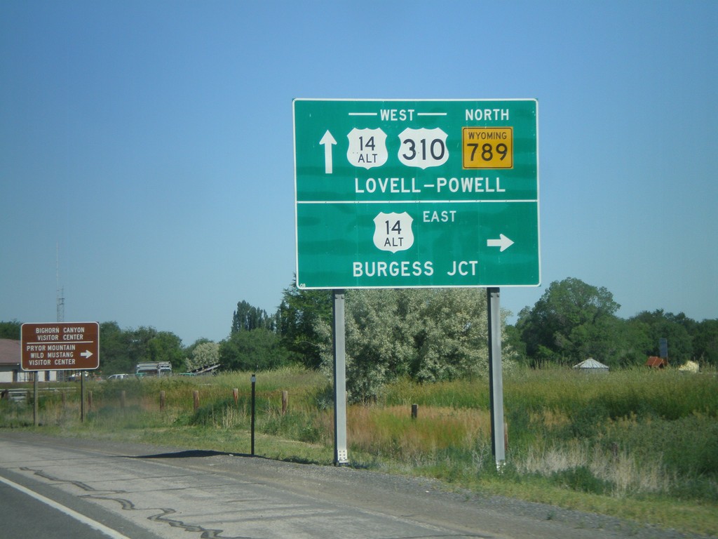
US-310 West/WY-789 North at US-14A
US-310 West/WY-789 North at US-14A in Lovell. Turn right for US-14A East to Burgess Jct.; continue ahead for US-310/US-14A West/WY-789 North to Lovell and Powell.
Taken 07-03-2011

 Lovell
Big Horn County
Wyoming
United States
Lovell
Big Horn County
Wyoming
United States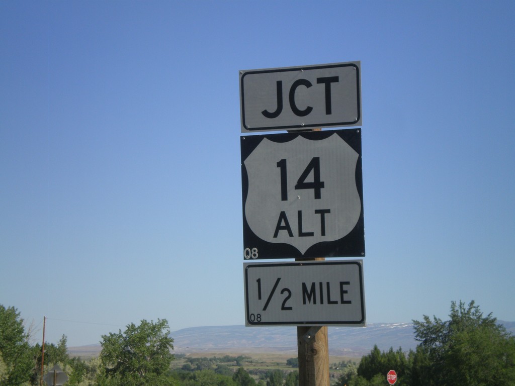
US-310/WY-789 North Approaching US-14A
US-310/WY-789 North approaching US-14A in Lovell.
Taken 07-03-2011
Lovell
Big Horn County
Wyoming
United States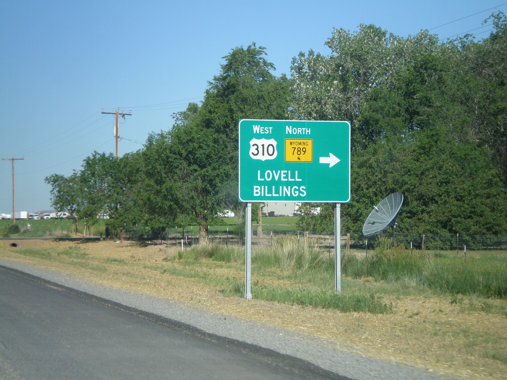
US-14/US-16/US-20 West/WY-789 North at US-310
US-14/US-16/US-20 West/WY-789 North at US-310. Turn right on US-310 West/WY-789 north for Lovell and Billings (Montana). This is the eastern end of US-310. WY-789 leaves US-14/US-16/US-20 here and turns west onto US-310.
Taken 07-03-2011
 Greybull
Big Horn County
Wyoming
United States
Greybull
Big Horn County
Wyoming
United States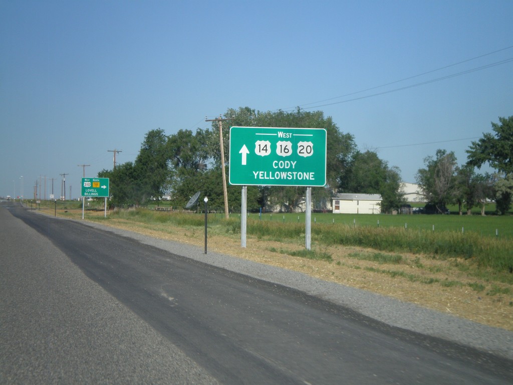
US-14/US-16/US-20 West/WY-789 at US-310/WY-789 North
US-14/US-16/US-20 West/WY-789 North at US-310/WY-789. Use US-14/US-16/US-20 West for Cody and Yellowstone. Turn right to continue north WY-789. This is the southern terminus of US-310.
Taken 07-03-2011
Greybull
Big Horn County
Wyoming
United States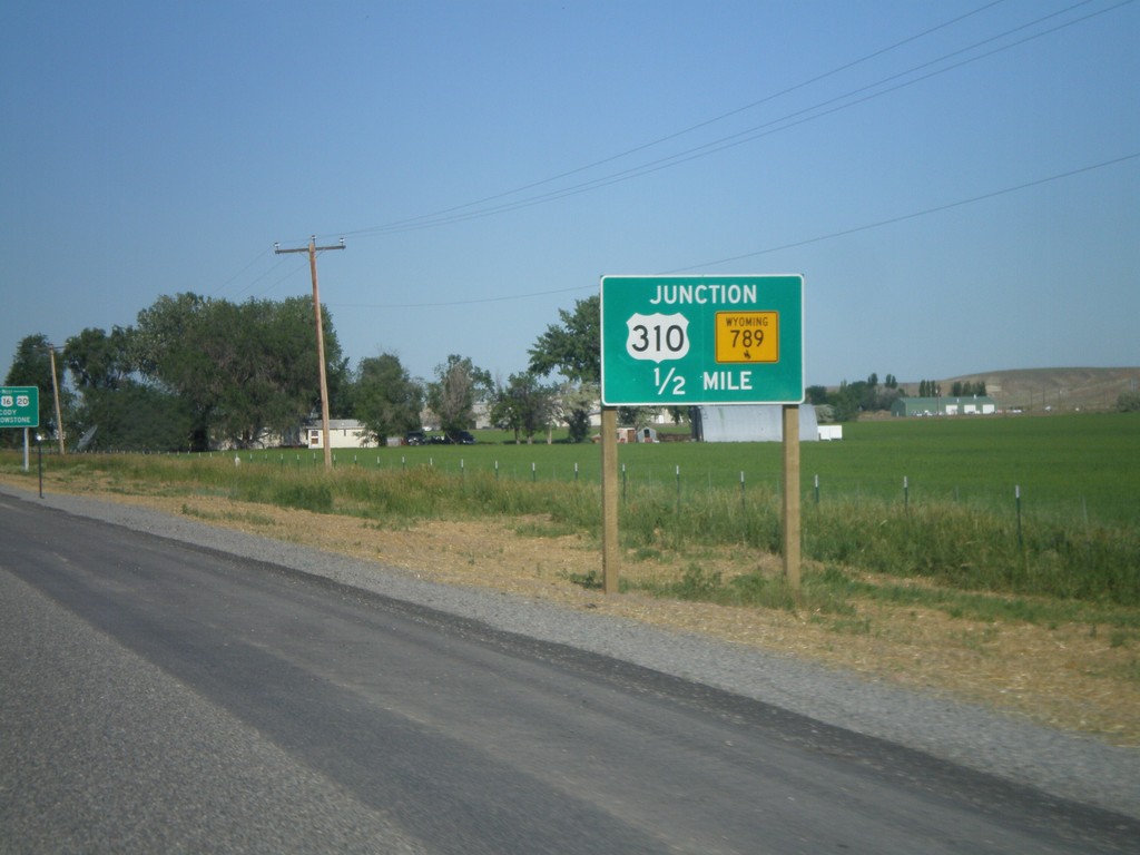
US-14/US-16/US-20 West/WY-789 North at US-310/WY-789 North
US-14/US-16/US-20 West/WY-789 North at US-310/WY-789 North. Turn right to continue on WY-789 North. This is where US-310 begins.
Taken 07-03-2011
Greybull
Big Horn County
Wyoming
United States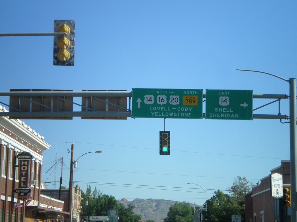
US-16/US-20 West/WY-789 North at US-14
US-16/US-20 West/WY-789 North at US-14 in Greybull. Turn right for US-14 east to Shell and Sheridan. Continue west on US-14/US-16/US-20 for Lovell, Cody, and Yellowstone.
Taken 07-03-2011
Greybull
Big Horn County
Wyoming
United States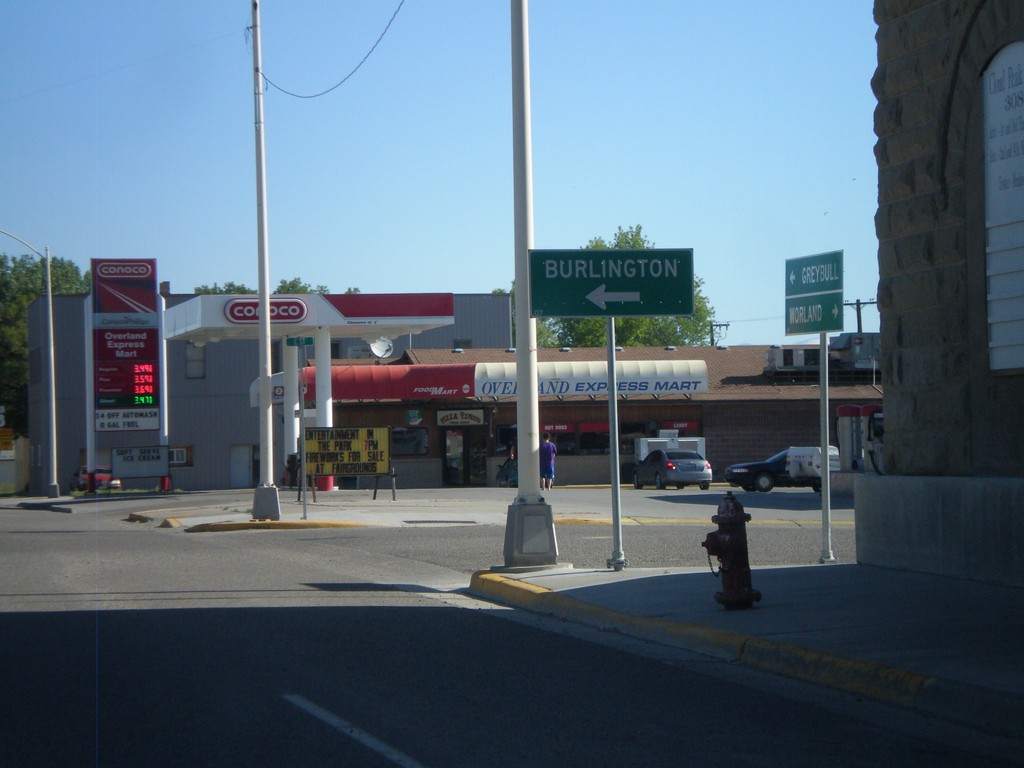
US-16/US-20 West/WY-789 North at WY-30
US-16/US-20 West/WY-789 North at WY-30. Use WY-30 west for Burlington.
Taken 07-03-2011
 Basin
Big Horn County
Wyoming
United States
Basin
Big Horn County
Wyoming
United States
US-16/US-20 West/WY-789 North At WY-30
US-16/US-20 West/WY-789 North At WY-30 in Basin.
Taken 07-03-2011
Basin
Big Horn County
Wyoming
United States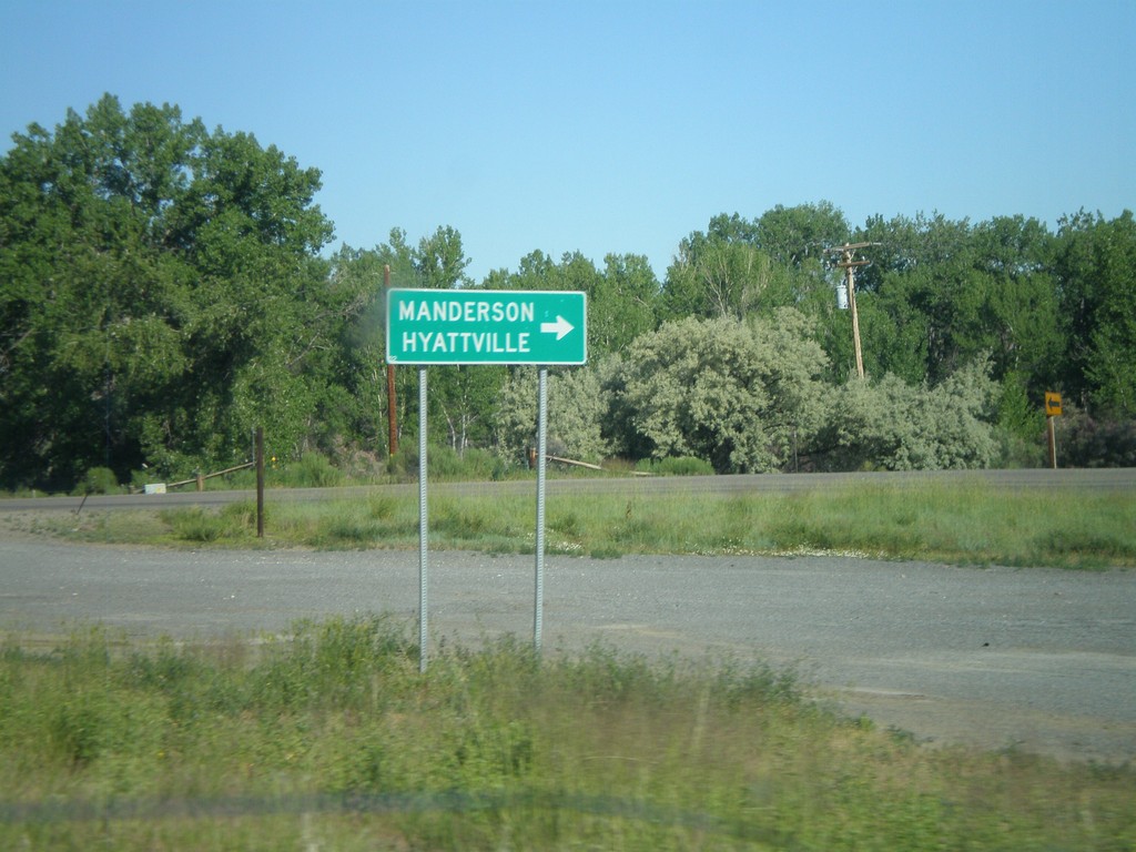
US-16/US-20 West/WY-789 North at WY-31
US-16/US-20 West/WY-789 North at WY-31 to Manderson and Hyattville.
Taken 07-03-2011
 Manderson
Big Horn County
Wyoming
United States
Manderson
Big Horn County
Wyoming
United States
US-20 West/WY-789 North - US-16 Jct
US-20 West/WY-789 North at US-16 junction in Worland. Continue straight for US-16 east to Buffalo. Turn left for US-16/US-20 West/WY-789 North to Basin and Yellowstone (National Park).
Taken 07-03-2011
Worland
Washakie County
Wyoming
United States
US-20 West/WY-789 North Approaching US-16
US-20 West/WY-789 North Approaching US-16 in Worland.
Taken 07-03-2011
Worland
Washakie County
Wyoming
United States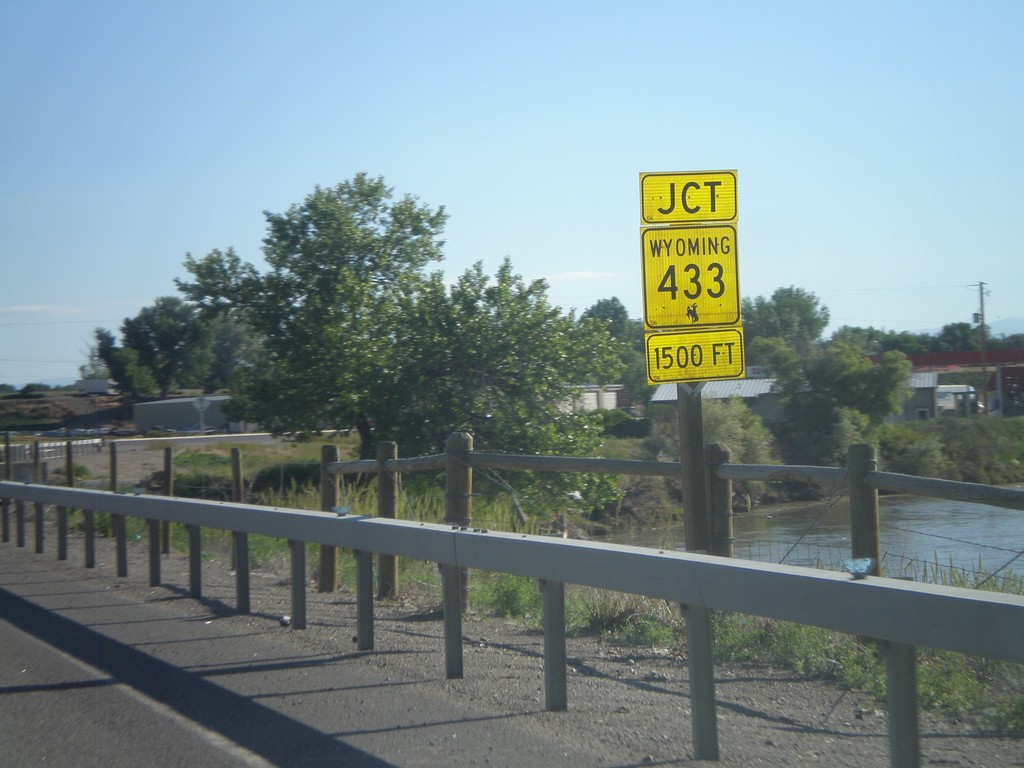
US-20/US-16 West/WY-789 North Approaching WY-433
US-20/US-16 West/WY-789 North Approaching WY-433. The river in the background is the Big Horn River.
Taken 07-03-2011
 Manderson
Big Horn County
Wyoming
United States
Manderson
Big Horn County
Wyoming
United States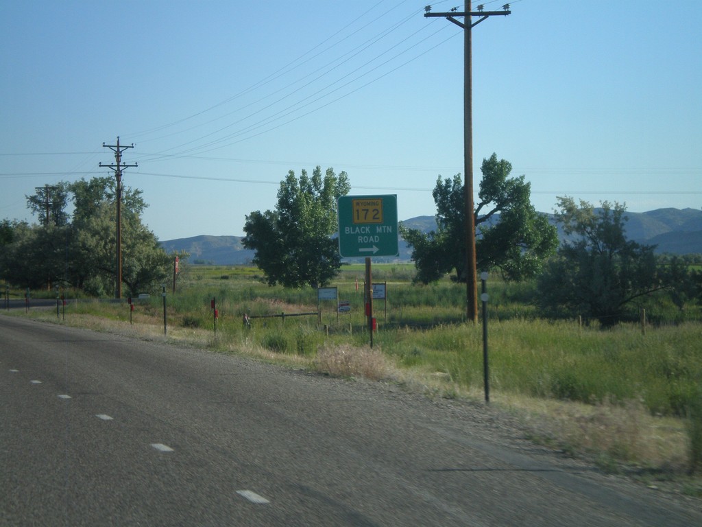
US-20 West/WY-789 North at WY-172
US-20 West/WY-789 North at WY-172 in rural Hot Springs County. Turn right for WY-172 to Black Mountain Road.
Taken 07-03-2011
 Thermopolis
Hot Springs County
Wyoming
United States
Thermopolis
Hot Springs County
Wyoming
United States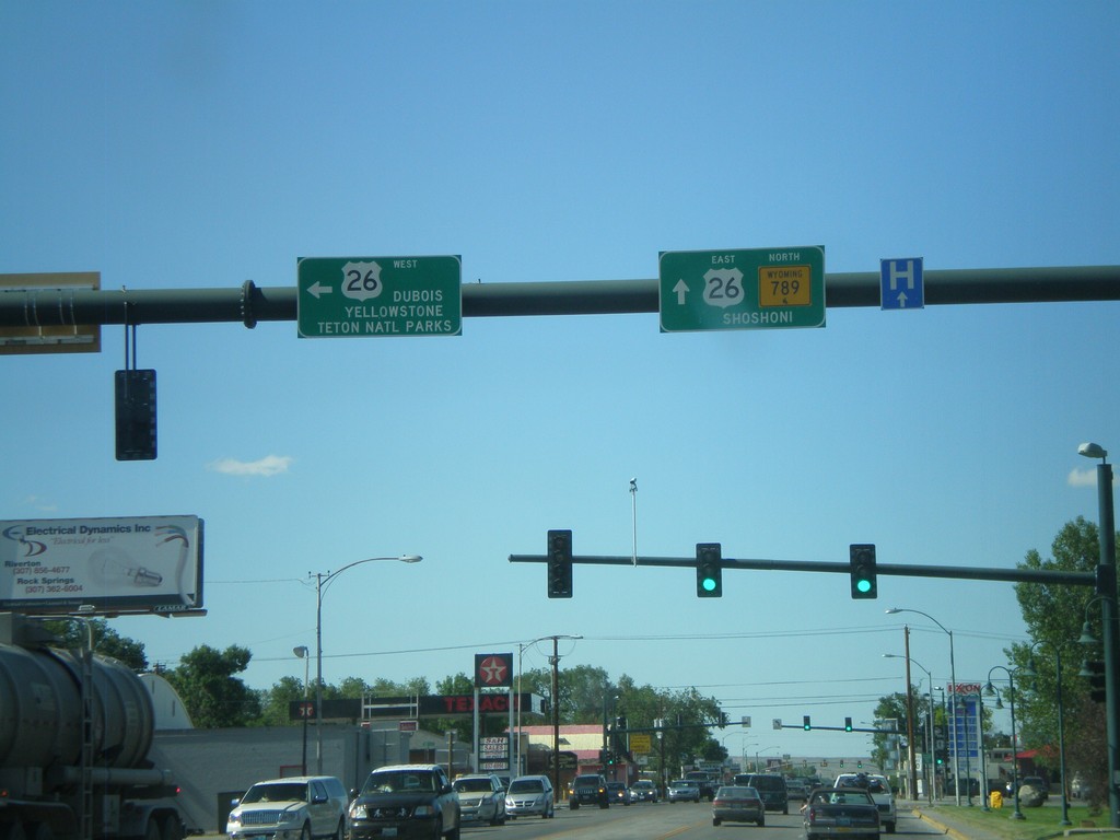
WY-789 North at US-26
WY-789 north at US-26 in Riverton. Turn left for US-26 to Dubois, and Yellowstone/Grand Teton National Parks. Continue ahead for US-26 East/WY-789 North to Shoshoni. US-26 joins WY-789 north until Shoshoni.
Taken 07-02-2011
 Riverton
Fremont County
Wyoming
United States
Riverton
Fremont County
Wyoming
United States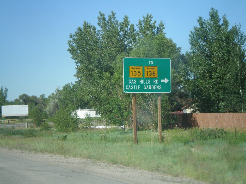
WY-789 North at WY-135/To WY-136
WY-789 North at WY-135/To WY-136. Use WY-135 east for WY-136, Gas Hills Road, and Castle Gardens.
Taken 07-02-2011

 Arapahoe
Fremont County
Wyoming
United States
Arapahoe
Fremont County
Wyoming
United States