Signs Tagged With Intersection
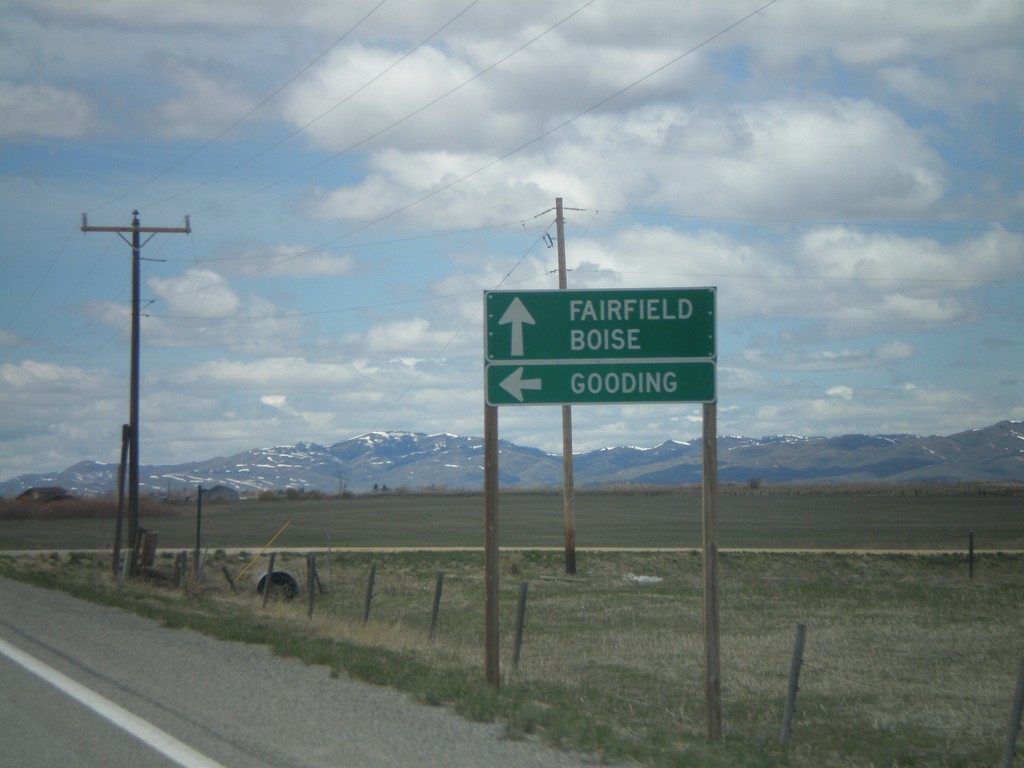
US-20 West Approaching ID-46 South
US-20 west approaching ID-46 south to Gooding. Continue west on US-20 for Fairfield and Boise.
Taken 05-02-2010

 Fairfield
Camas County
Idaho
United States
Fairfield
Camas County
Idaho
United States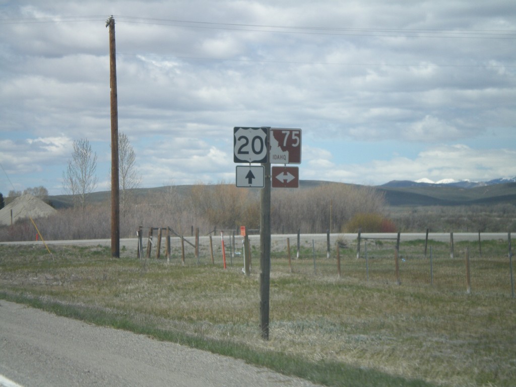
US-20 West at ID-75
US-20 west at ID-75. ID-75 is the Sawtooth Scenic Byway
Taken 05-02-2010
 Stanton Crossing
Blaine County
Idaho
United States
Stanton Crossing
Blaine County
Idaho
United States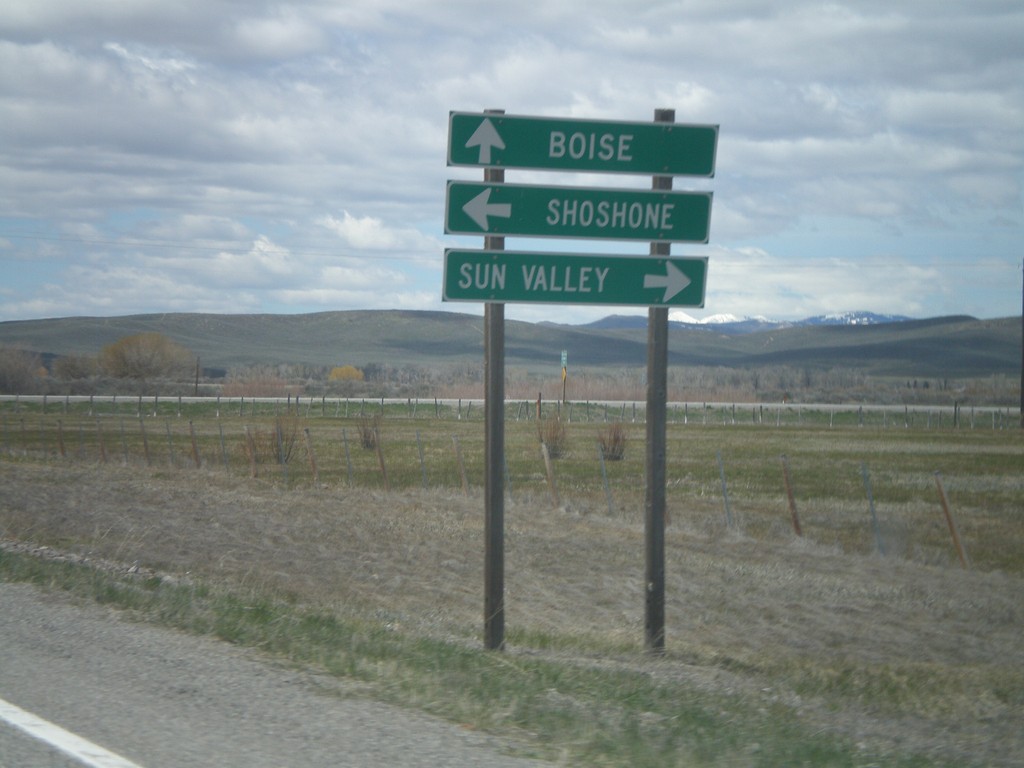
US-20 West Approaching ID-75
US-20 west approaching ID-75 north to Sun Valley, and south to Shoshone. Continue west on US-20 for Boise.
Taken 05-02-2010
Stanton Crossing
Blaine County
Idaho
United States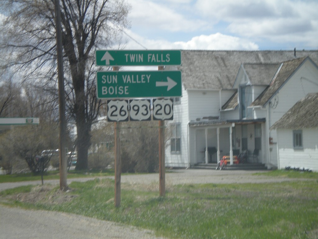
US-20/US-26 West/US-93 South Jct.
US-20/US-26 West/US-93 South at split in Carey. Use US-20 west for Sun Valley and Boise. Use US-26 West/US-93 South for Twin Falls.
Taken 05-02-2010

 Carey
Blaine County
Idaho
United States
Carey
Blaine County
Idaho
United States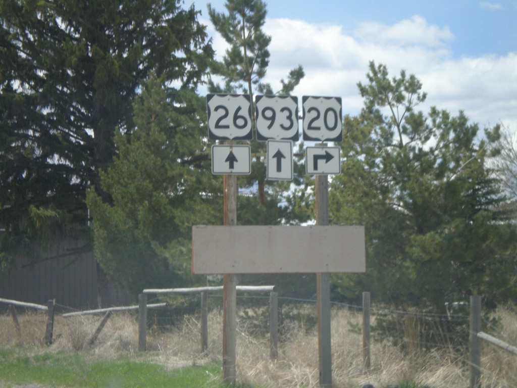
US-20/US-93/US-26 Approaching US-20 Split
US-20 West/US-26 West/US-93 South approaching US-20 split.
Taken 05-02-2010
Carey
Blaine County
Idaho
United States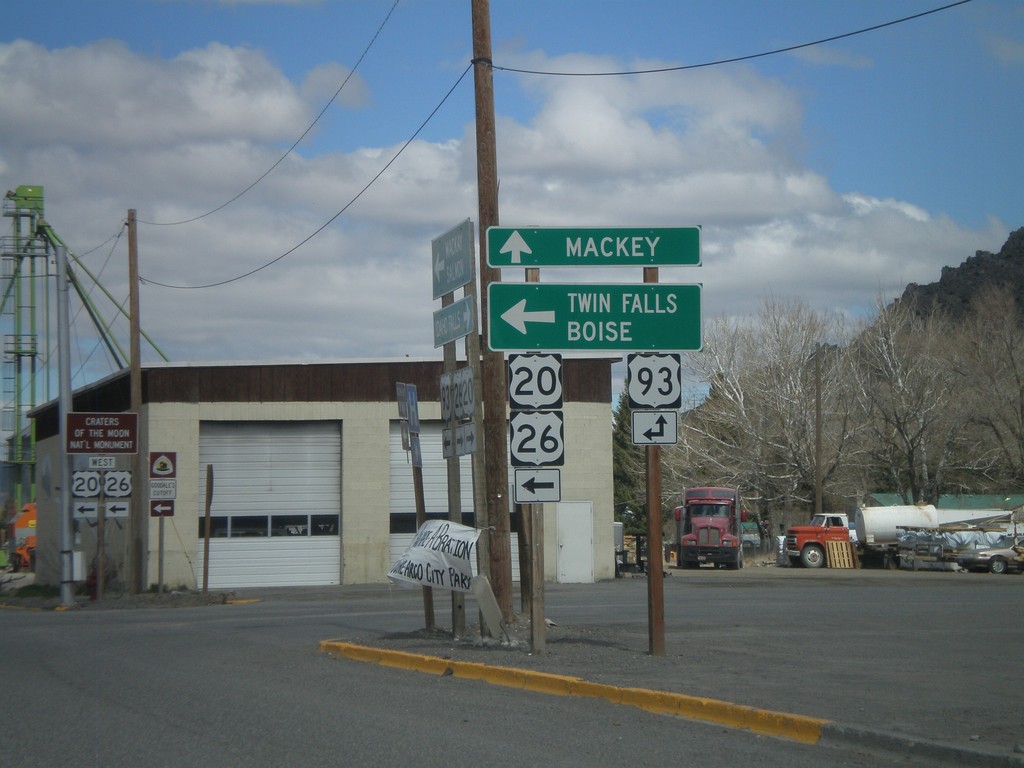
US-20/US-26 West at US-93
US-20/US-26 west at US-93. Use US-93 north for Mackay. Use US-20/US-26 west/US-93 south for Twin Falls and Boise.
Taken 05-02-2010
Arco
Butte County
Idaho
United States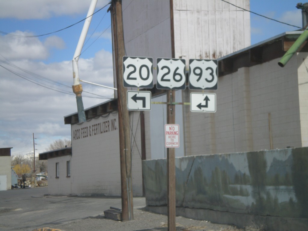
US-20/US-26 West at US-93
US-20/US-26 west approaching US-93
Taken 05-02-2010
Arco
Butte County
Idaho
United States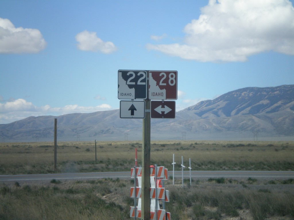
ID-22 West at ID-28
ID-22 west at ID-28. ID-28 has a brown shield because it is part of the Sacajawea Historic Byway.
Taken 05-02-2010

 Monteview
Clark County
Idaho
United States
Monteview
Clark County
Idaho
United States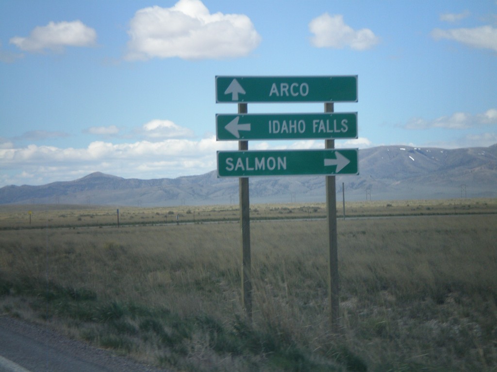
ID-22 West at ID-28
ID-22 west at ID-28 north to Salmon and south to Idaho Falls.
Taken 05-02-2010
Monteview
Clark County
Idaho
United States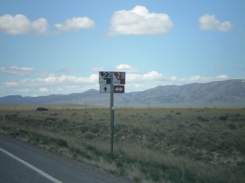
ID-22 West Approaching ID-28
ID-22 west approaching ID-28.
Taken 05-02-2010
Monteview
Clark County
Idaho
United States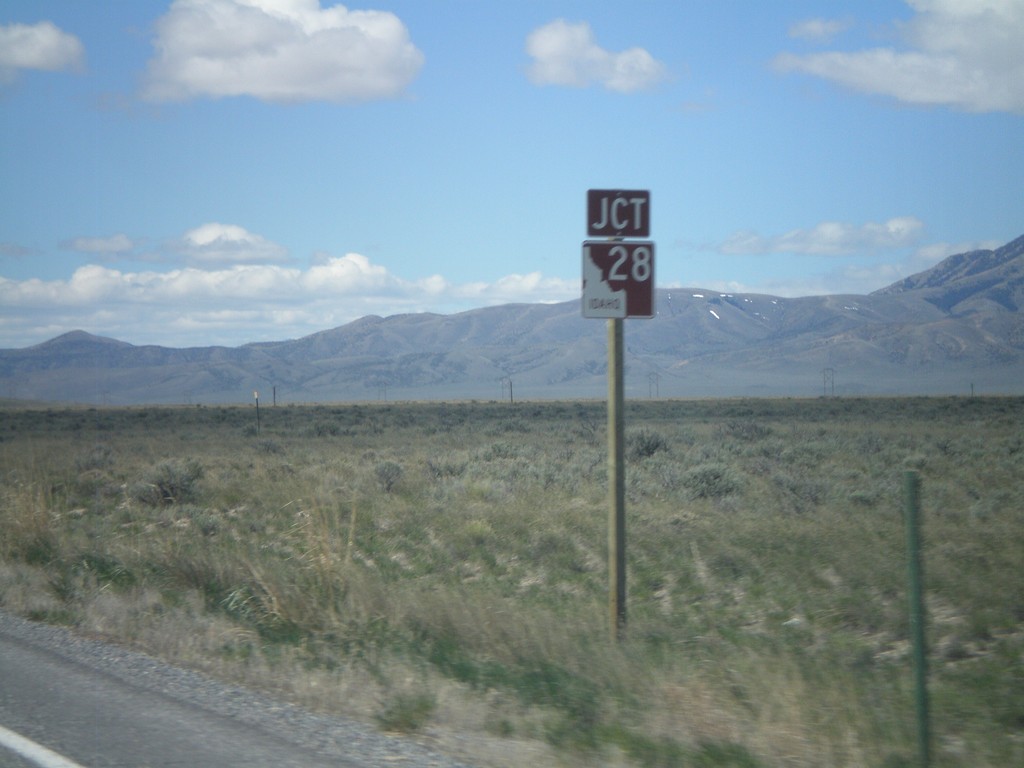
ID-22 West Approaching ID-28
ID-22 west approaching ID-28
Taken 05-02-2010
Monteview
Clark County
Idaho
United States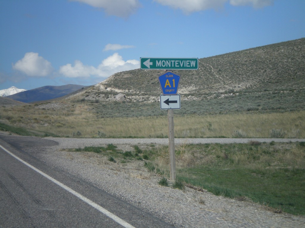
ID-22 West at Clark County A1
ID-22 west at Clark County A1 south to Monteview.
Taken 05-02-2010
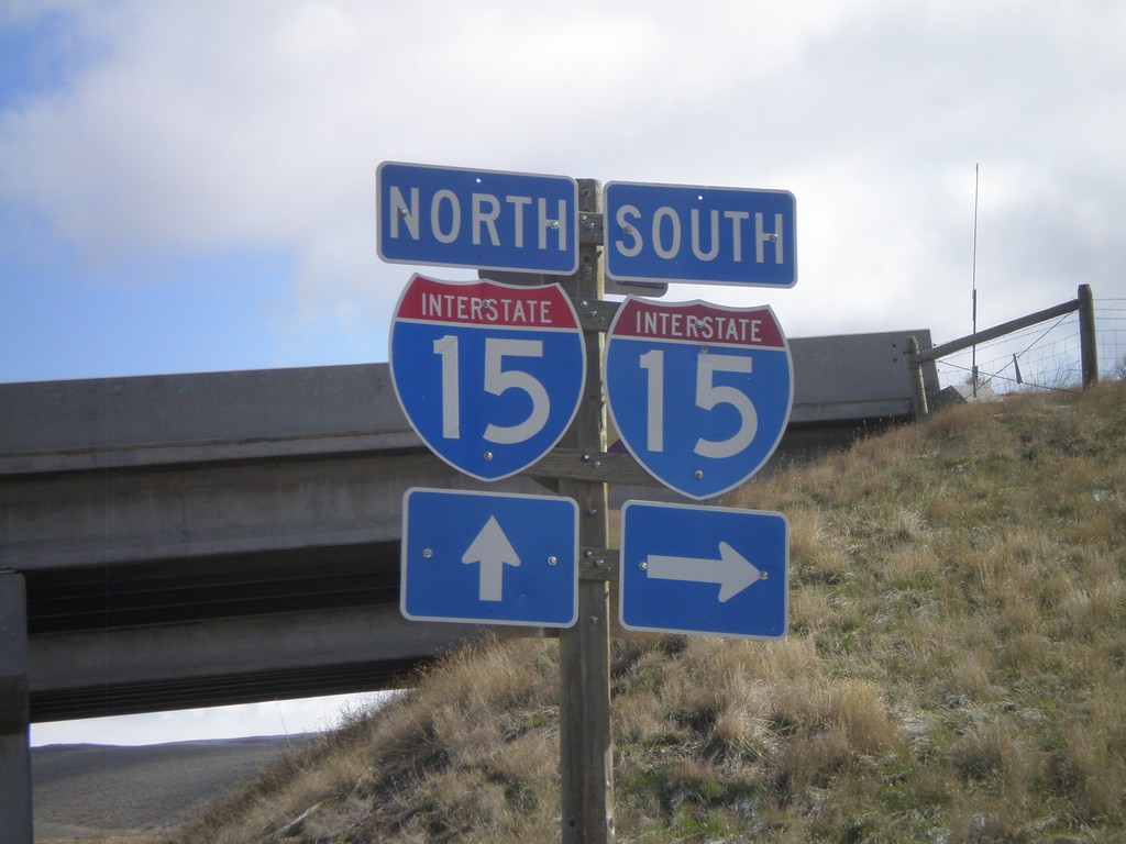
Monida Access Road at I-15
Monida Access Road at I-15 Exit 0
Taken 05-02-2010
 Monida
Beaverhead County
Montana
United States
Monida
Beaverhead County
Montana
United States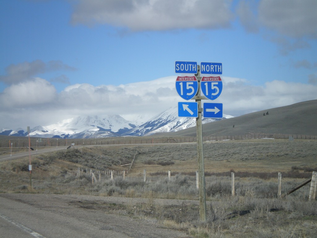
I-15 Exit 0 Onramp
Approaching I-15 Exit 0 onramp at the Monida exit.
Taken 05-02-2010
Lima
Beaverhead County
Montana
United States
End US-91 North at US-26/BL-15
Northern end of US-91 north at US-26 and BL-15. US-91 was recently extended, when US-26 was rerouted to the new Exit 116 interchange on I-15.
Taken 05-02-2010

 Idaho Falls
Bonneville County
Idaho
United States
Idaho Falls
Bonneville County
Idaho
United States
York Road West at US-91
York Road west at US-91. This is the former route of US-26, and the former end of US-91 north.
Taken 05-02-2010
Idaho Falls
Bonneville County
Idaho
United States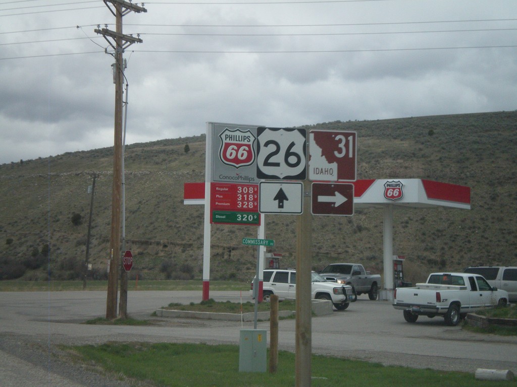
US-26 West at ID-31
US-26 west at ID-31. This is the southern end of the Teton Scenic Byway.
Taken 05-01-2010
 Swan Valley
Bonneville County
Idaho
United States
Swan Valley
Bonneville County
Idaho
United States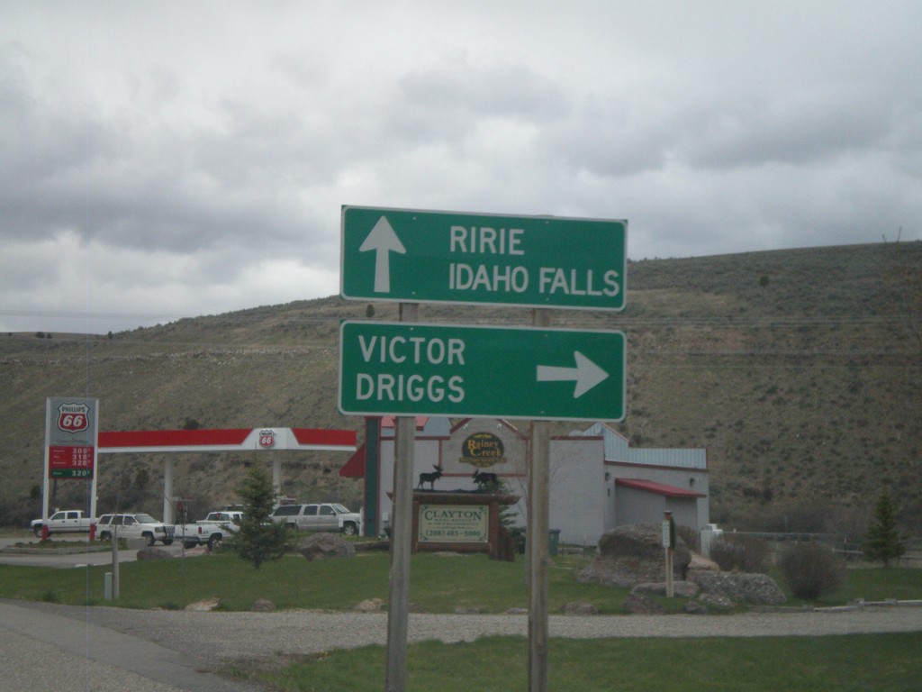
US-26 West at ID-31
US-26 west at ID-31 north to Victor and Driggs. Continue west on US-26 for Ririe and Idaho Falls. This is the southern end of the Teton Scenic Byway.
Taken 05-01-2010
Swan Valley
Bonneville County
Idaho
United States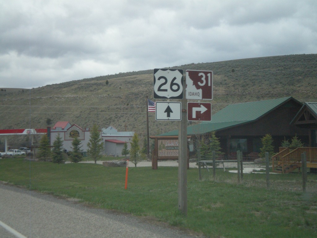
US-26 West Approaching ID-31
US-26 west approaching ID-31 in Swan Valley. This is the southern end of the Teton Scenic Byway.
Taken 05-01-2010
Swan Valley
Bonneville County
Idaho
United States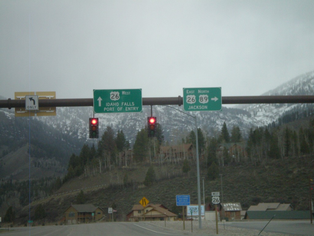
US-89 North at US-26
US-89 north at US-26. US-26 continues west to Idaho Falls and Port of Entry. US-89 North/US-26 East join north towards Jackson.
Taken 05-01-2010
 Alpine
Lincoln County
Wyoming
United States
Alpine
Lincoln County
Wyoming
United States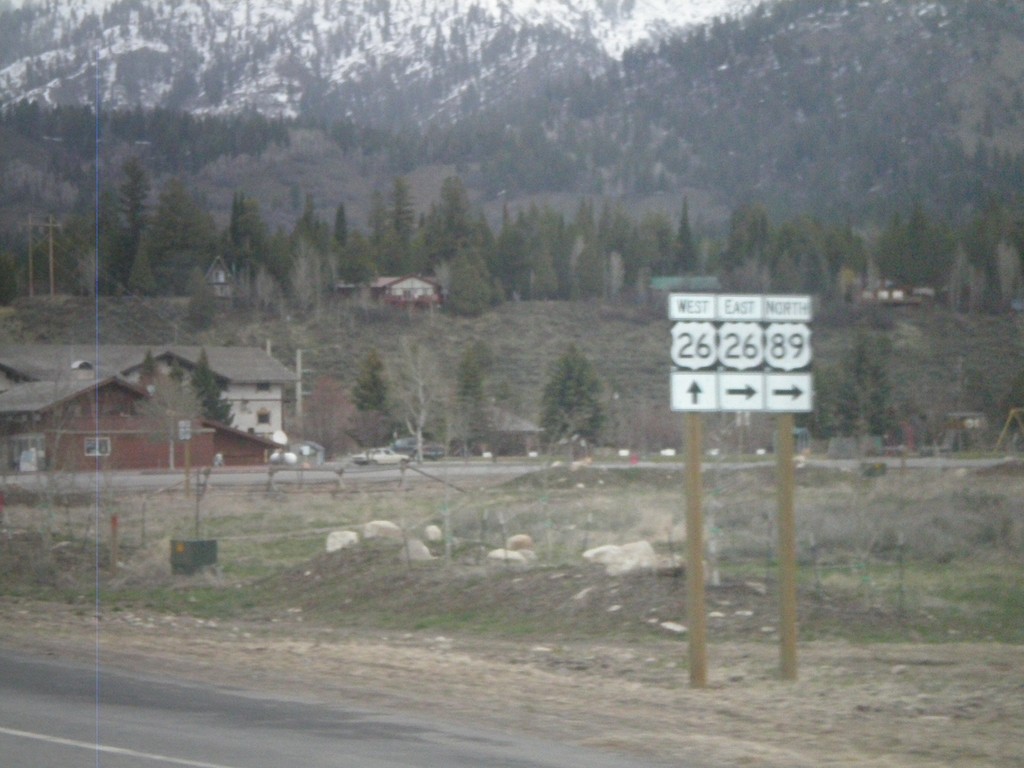
US-89 North at US-26
US-89 north at US-26. US-26 joins US-89 north to Moran Jct.
Taken 05-01-2010
Alpine
Lincoln County
Wyoming
United States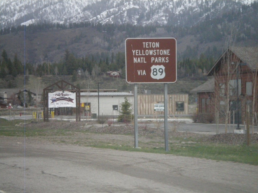
US-89 North - National Park Info
US-89 north approaching US-26. Use US-89 north for Yellowstone and Grand Teton National Parks.
Taken 05-01-2010
Alpine
Lincoln County
Wyoming
United States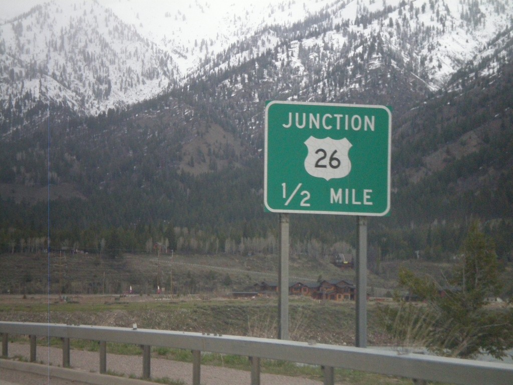
US-89 North Approaching US-26
US-89 north approaching US-26. US-26 and US-89 join north to Moran Jct. in Grand Teton National Park.
Taken 05-01-2010
Alpine
Lincoln County
Wyoming
United States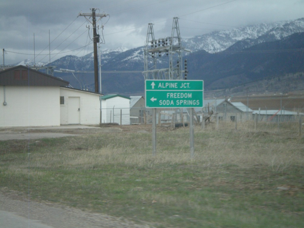
US-89 North at WY-239
US-89 north at WY-239 west to Freedom and Soda Springs (Idaho). WY-239 connects with ID-34 at the state line, via Stateline Road.
Taken 05-01-2010
 Freedom
Lincoln County
Wyoming
United States
Freedom
Lincoln County
Wyoming
United States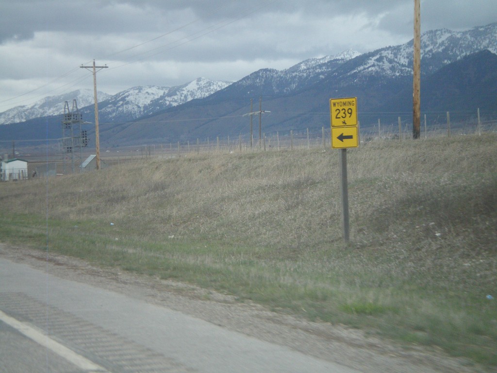
US-89 North at WY-239
US-89 north at WY-239
Taken 05-01-2010
Freedom
Lincoln County
Wyoming
United States