Signs Tagged With Intersection
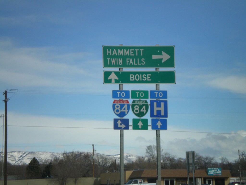
ID-51 North At Old US-30
ID-51 north at Old US-30. The Mountain Home business loop used to follow Old US-30 east to I-84. The business loop has been re-routed to follow ID-51 to I-84 instead. Turn right on Old US-30 for I-84 east towards Hammett and Twin Falls. Continue on ID-51 north for I-84/BL-84 and Boise.
Taken 02-07-2011


 Mountain Home
Elmore County
Idaho
United States
Mountain Home
Elmore County
Idaho
United States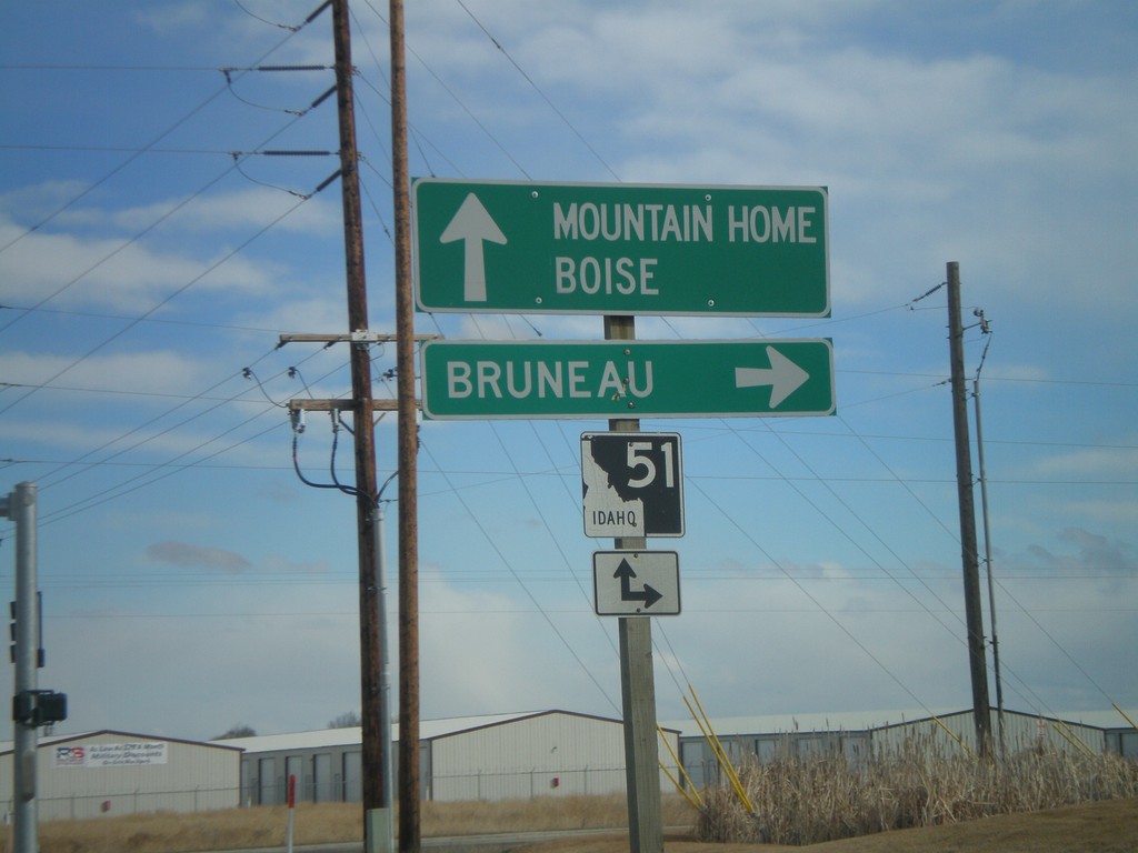
End ID-67 East At ID-51
End ID-67 east at at ID-51. Use ID-51 south for Bruneau. Use ID-51 north for Mountain Home and Boise.
Taken 02-07-2011
 Mountain Home
Elmore County
Idaho
United States
Mountain Home
Elmore County
Idaho
United States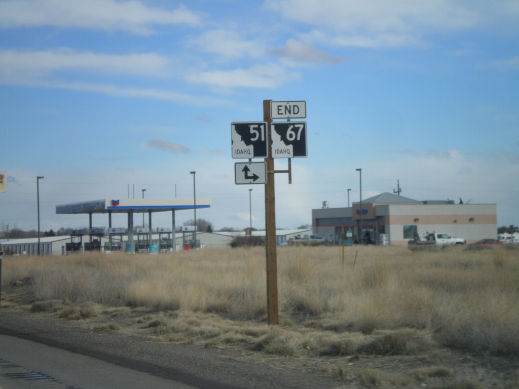
End ID-67 East at ID-51
End ID-67 east at ID-51. Turn right for ID-51 south; continue ahead for ID-51 north.
Taken 02-07-2011
Mountain Home
Elmore County
Idaho
United States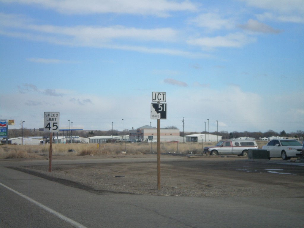
ID-67 East Approaching ID-51
ID-67 east approaching ID-51 junction.
Taken 02-07-2011
Mountain Home
Elmore County
Idaho
United States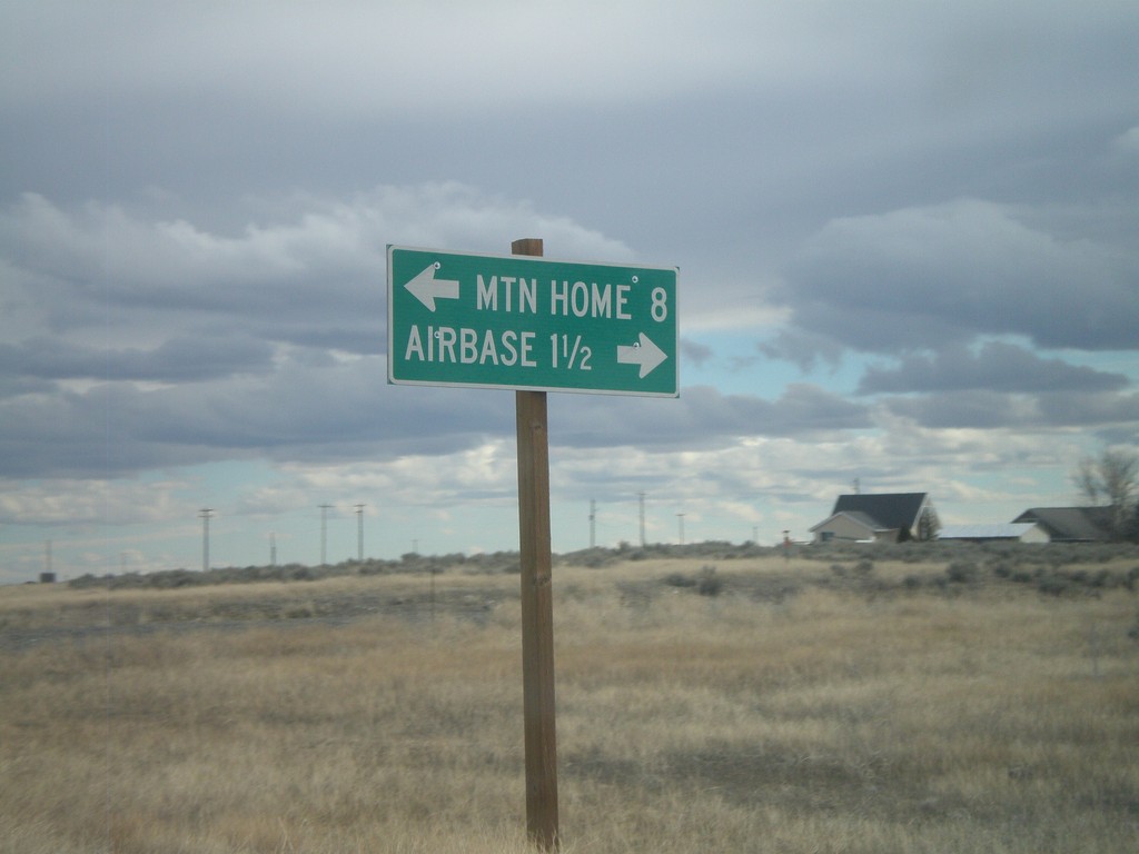
End ID-167 East at ID-67
End ID-167 east at ID-67. Use ID-67 west for the Airbase (Mountain Home AFB). Use ID-67 east for Mountain Home.
Taken 02-07-2011
 Mountain Home Air Force Base
Elmore County
Idaho
United States
Mountain Home Air Force Base
Elmore County
Idaho
United States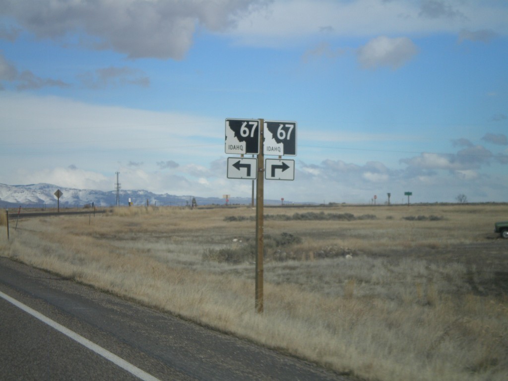
ID-167 East Approaching ID-67
ID-167 east approaching ID-67.
Taken 02-07-2011
Mountain Home
Elmore County
Idaho
United States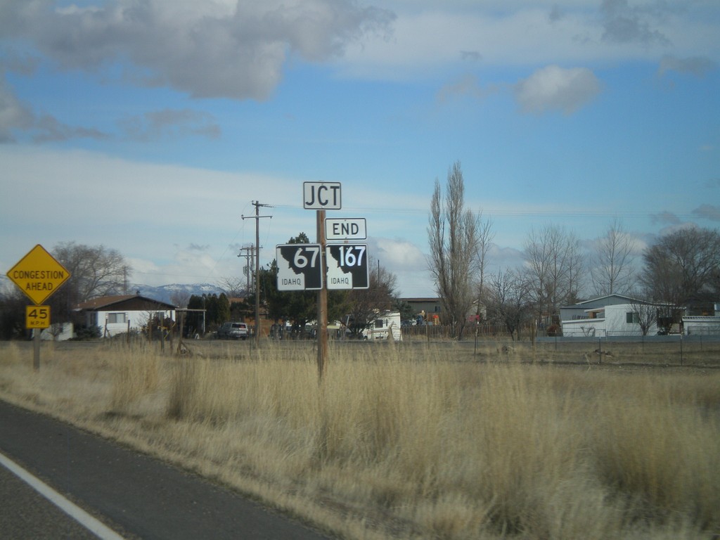
ID-167 East Approaching ID-67
ID-167 east approaching ID-67. ID-167 ends at ID-67.
Taken 02-07-2011
Mountain Home
Elmore County
Idaho
United States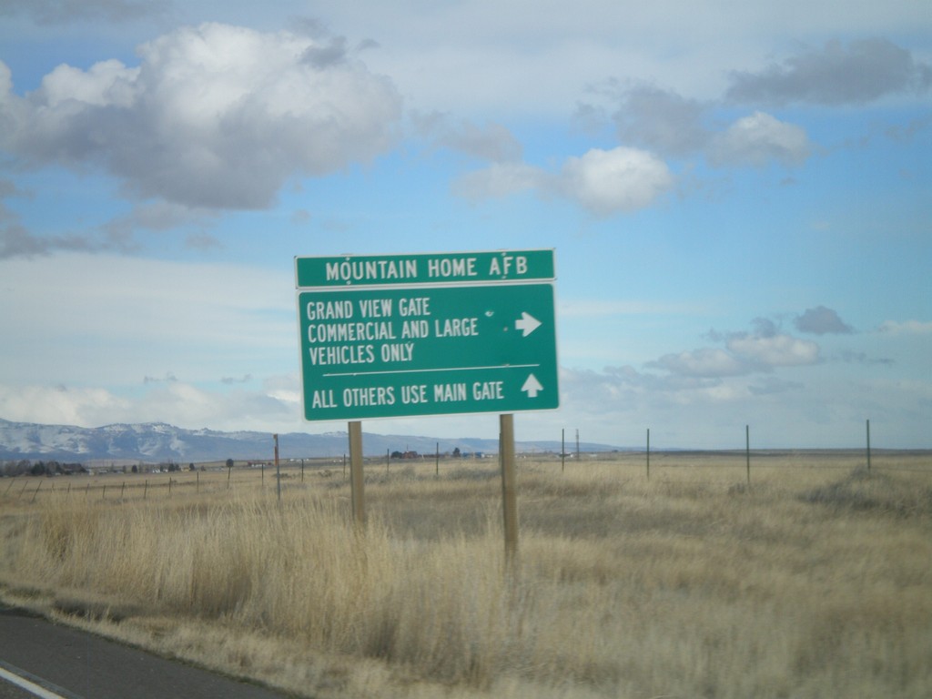
ID-167 East at Mountain Home AFB Grand View Gate
ID-167 east at Mountain Home AFB, Grand View Gate.
Taken 02-07-2011
Mountain Home
Elmore County
Idaho
United States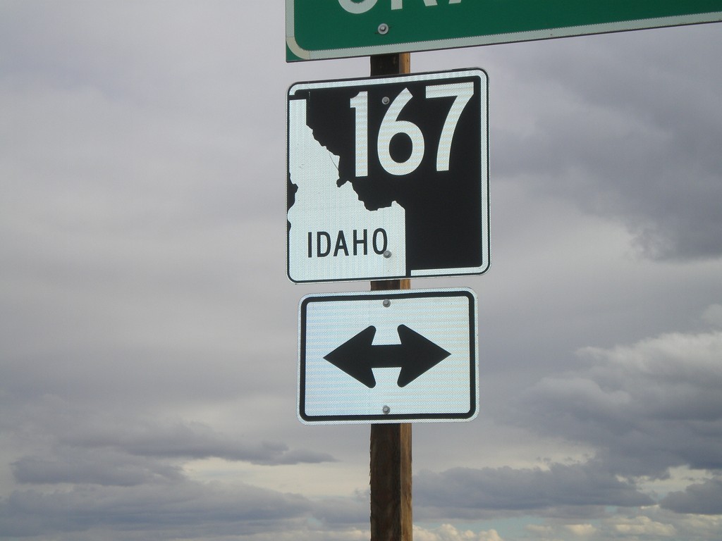
Simco Road South at ID-167
Simco Road South at ID-167.
Taken 02-07-2011
Mountain Home
Elmore County
Idaho
United States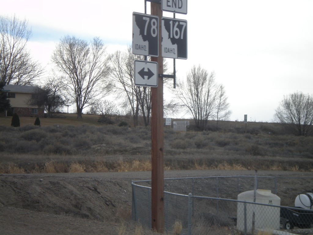
End ID-167 West at ID-78
End ID-167 west at ID-78 in Grand View. ID-167 is the newest state highway in Idaho, formed in May of 2010. ID-167 replaces ID-67 between Mountain Home Air Force Base and Grand View.
Taken 02-07-2011
 Grand View
Owyhee County
Idaho
United States
Grand View
Owyhee County
Idaho
United States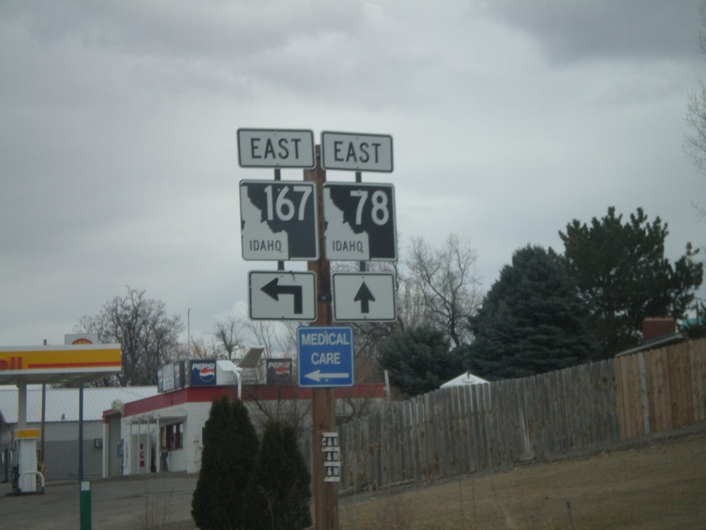
ID-78 East at ID-167
ID-78 east at ID-167.
Taken 02-07-2011
Grand View
Owyhee County
Idaho
United States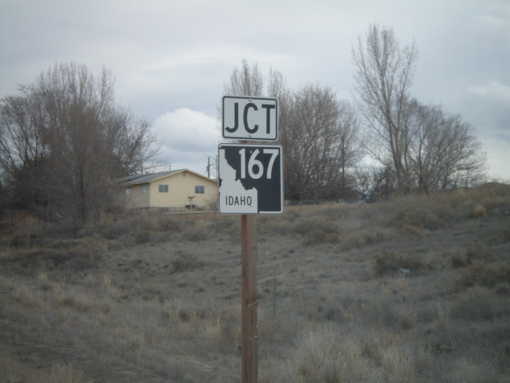
ID-78 East Approaching ID-167
ID-78 east approaching ID-167.
Taken 02-07-2011
Grand View
Owyhee County
Idaho
United States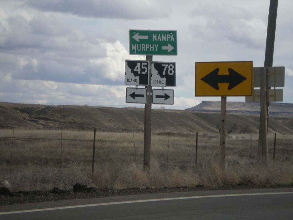
ID-78 East at ID-45
ID-78 east to Murphy at ID-45 north to Nampa.
Taken 02-07-2011
 Melba
Owyhee County
Idaho
United States
Melba
Owyhee County
Idaho
United States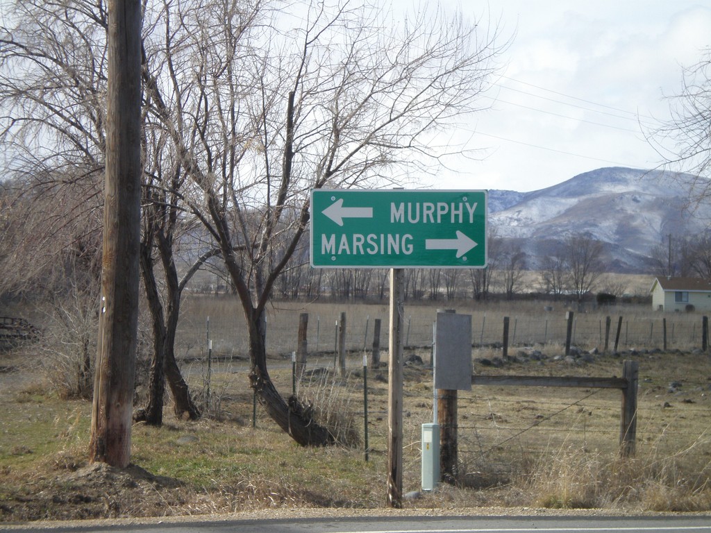
End ID-45 South at ID-78
End ID-45 south at ID-78. Use ID-78 west for Marsing. Use ID-78 east for Murphy, the Owyhee County Seat.
Taken 02-07-2011
Walters Ferry
Canyon County
Idaho
United States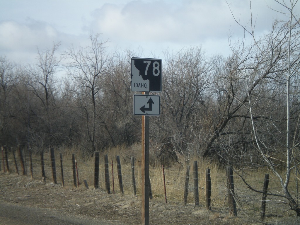
End ID-45 South at ID-78
End ID-45 south at ID-78. A short connector road links ID-45 south with ID-78 west.
Taken 02-07-2011
Melba
Owyhee County
Idaho
United States
End ID-45 South at ID-78
End ID-45 south at ID-78. Use ID-78 south for Murphy and Grand View. Use ID-78 north for Marsing.
Taken 02-07-2011
Melba
Owyhee County
Idaho
United States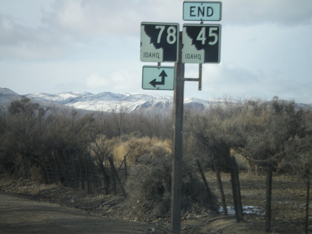
End ID-45 South at ID-78
End ID-45 south at ID-78.
Taken 02-07-2011
Melba
Owyhee County
Idaho
United States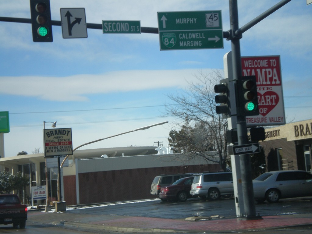
BL-84 West at ID-45
BL-84 West (11th Ave. South) at ID-45. Turn right on 2nd St. South to continue west on BL-84 towards Caldwell and Marsing. Continue ahead on 11th Ave. South for ID-45 south towards Murphy.
Taken 02-07-2011
Nampa
Canyon County
Idaho
United States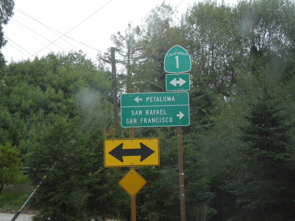
Sir Frances Drake Blvd. East at CA-1
Sir Frances Drake Blvd. east at CA-1. Use CA-1 north for Petaluma. Use CA-1 south for San Rafael and San Francisco.
Taken 10-01-2010
 Olema
Marin County
California
United States
Olema
Marin County
California
United States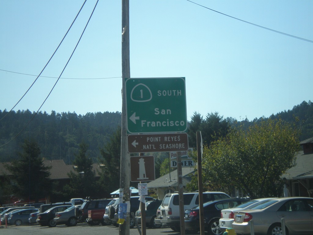
CA-1 South in Point Reyes Station
CA-1 south in Point Reyes Station. Turn left on A St. to continue south on CA-1 for San Francisco.
Taken 09-30-2010
Petaluma
Marin County
California
United States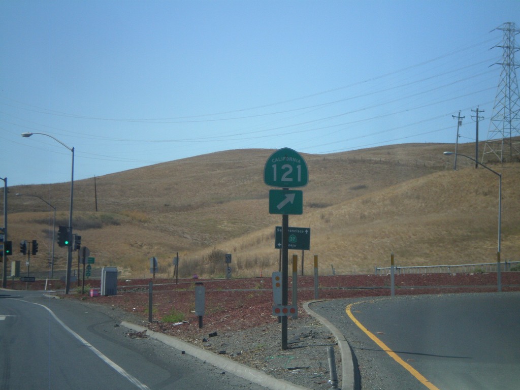
CA-37 West at CA-121
CA-37 west at CA-121
Taken 09-30-2010

 Sonoma
 County
California
United States
Sonoma
Sonoma County
California
United States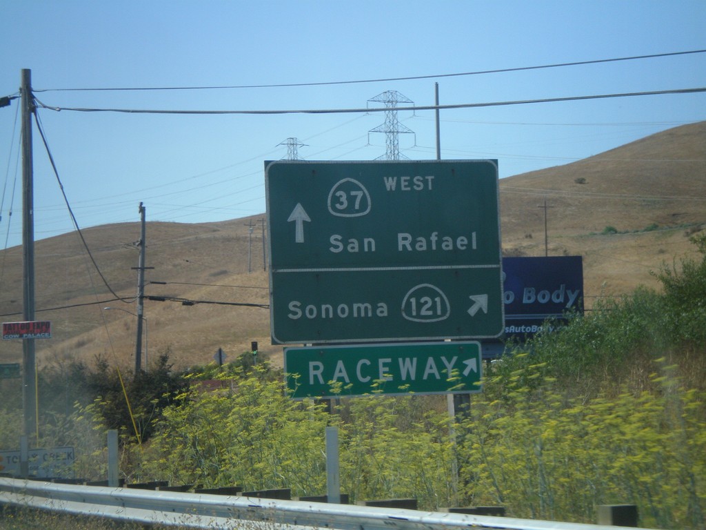
CA-37 West Approaching CA-121
CA-37 west to San Rafael approaching CA-121 north to Sonoma and the Infineon Raceway.
Taken 09-30-2010
Sonoma
Sonoma County
California
United States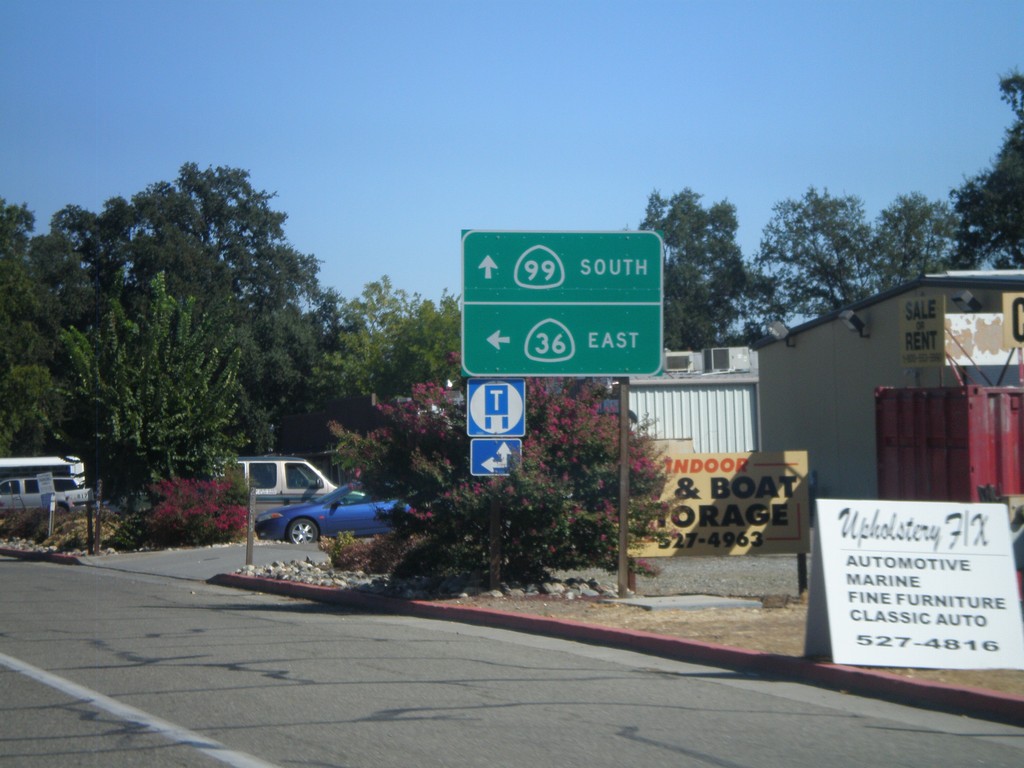
CA-36 East at CA-99
CA-36 East at CA-99. Turn left to continue east on CA-36. Continue straight ahead for CA-99.
Taken 09-25-2010

 Red Bluff
Tehama County
California
United States
Red Bluff
Tehama County
California
United States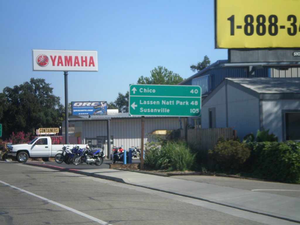
CA-36 East at CA-99
CA-36 east at CA-99. Use CA-36 east for Lassen National Park and Susanville. Continue south on CA-99 for Chico.
Taken 09-25-2010
Red Bluff
Tehama County
California
United States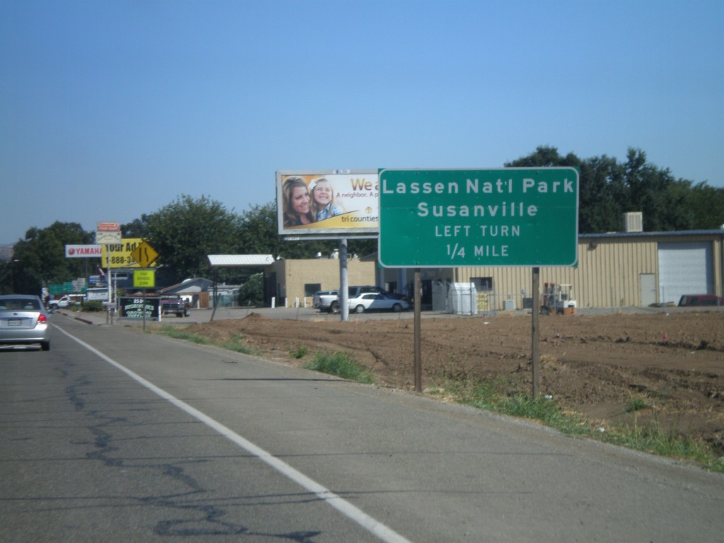
CA-36 East at CA-99
CA-36 east approaching CA-99. Turn left at junction (CA-36) for Lassen National Park and Susanville.
Taken 09-25-2010
Red Bluff
Tehama County
California
United States