Signs Tagged With Intersection
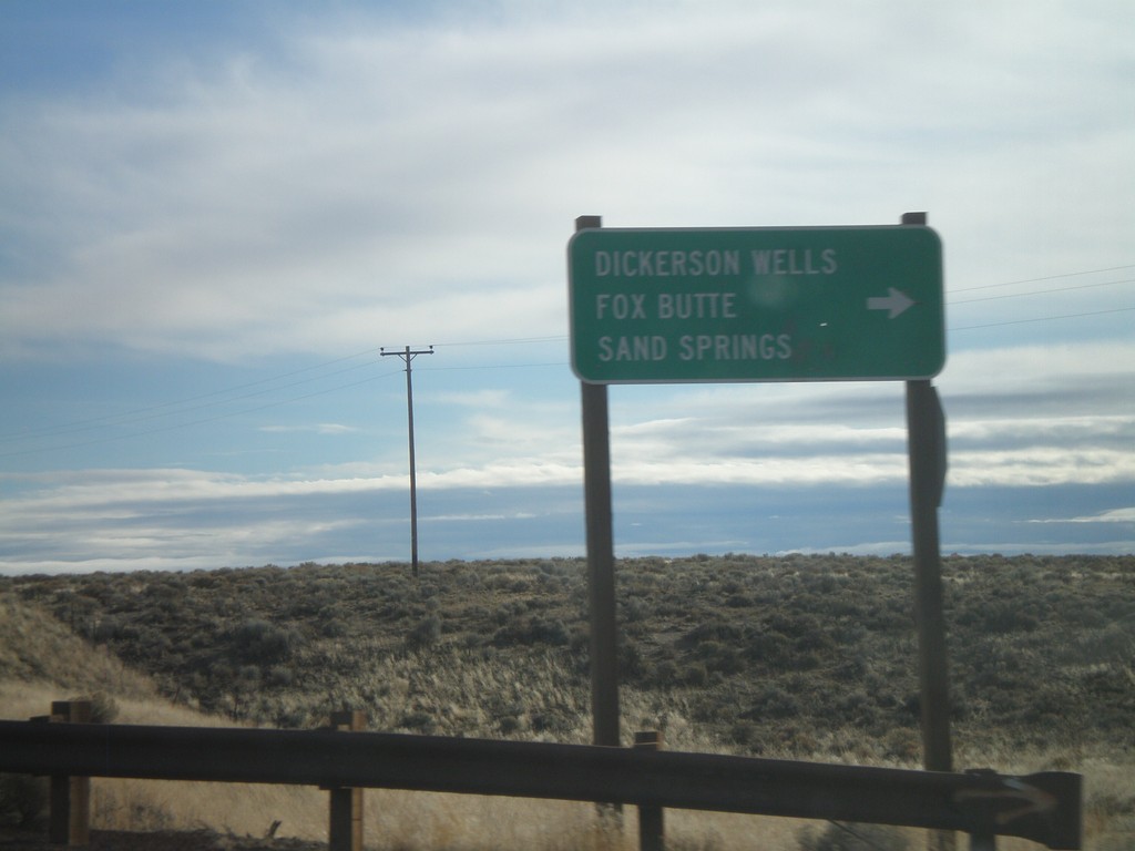
US-20 East at Dickerson Wells Jct.
US-20 east at Newt Morris Road south to Dickerson Wells, Fox Butte, and Sand Springs.
Taken 01-18-2010
 Bend
Deschutes County
Oregon
United States
Bend
Deschutes County
Oregon
United States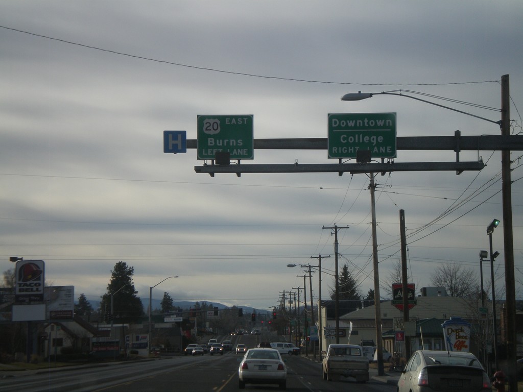
US-20 East/Business US-97 South At US-20
US-20 West/Business US-97 South approaching US-20 East towards Burns (Greenwood Ave.) Use Greenwood Ave. west for Downtown Bend and College.
Taken 01-18-2010
Bend
Deschutes County
Oregon
United States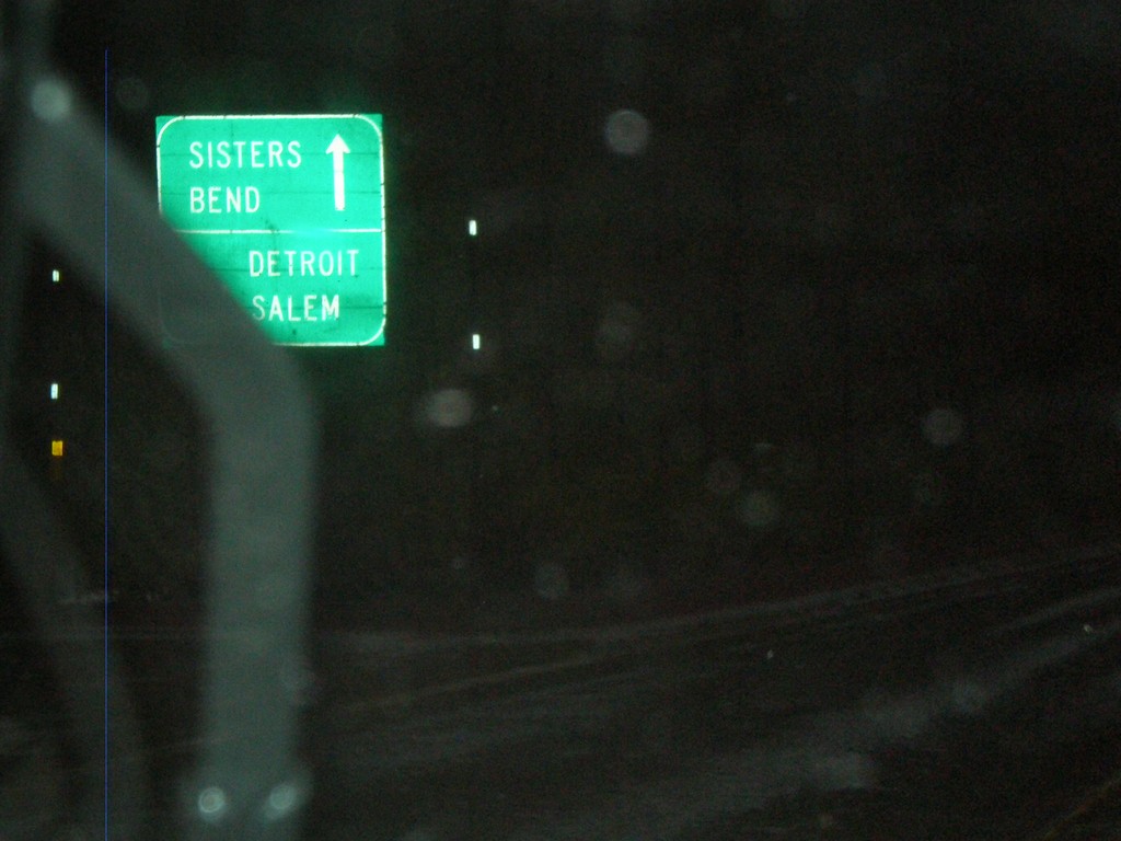
US-20 East/OR-126 East at OR-22 West
US-20 East/OR-126 East at OR-22 west. This is the western base of Santiam Pass.
Taken 01-17-2010

 Sisters
Linn County
Oregon
United States
Sisters
Linn County
Oregon
United States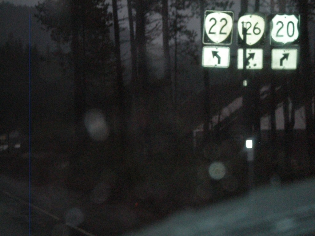
US-20/OR-126 West at OR-22
US-20 East/OR-126 East at OR-22 west. This is the western base of Santiam Pass.
Taken 01-17-2010
Sisters
Linn County
Oregon
United States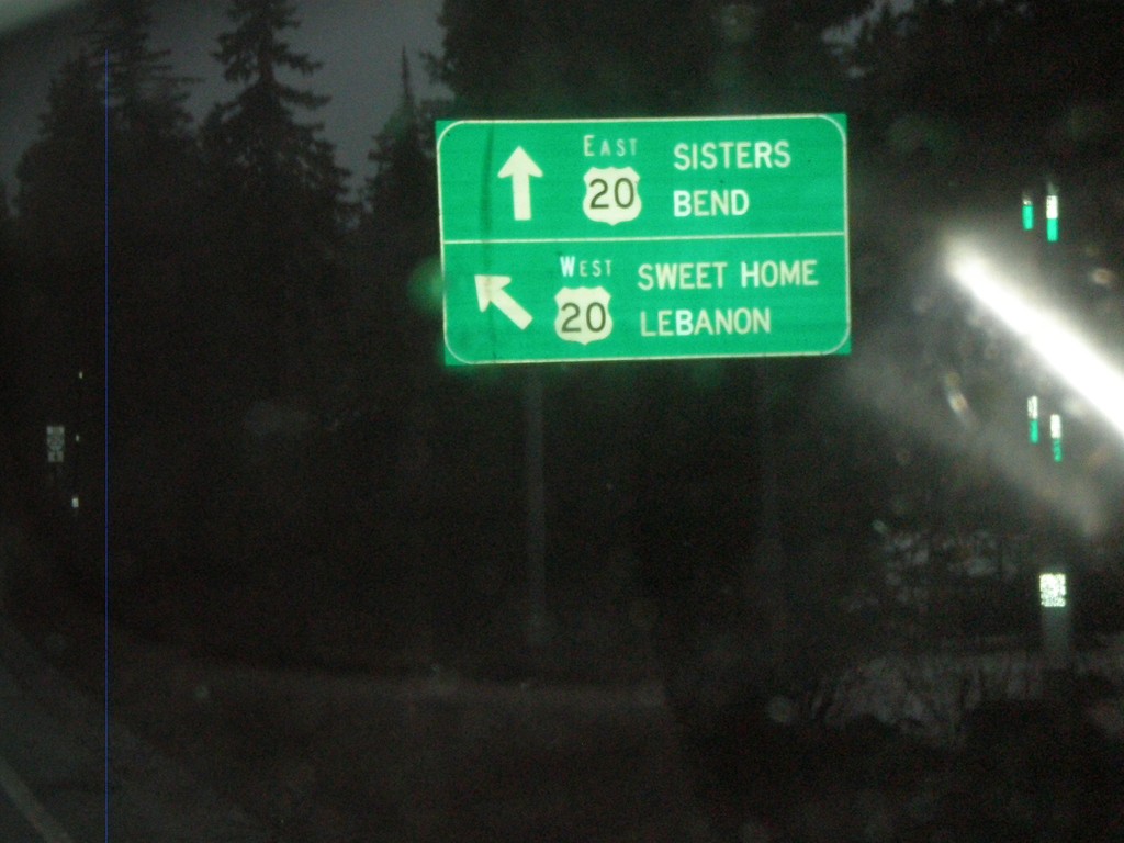
OR-126 East at US-20 Near Santiam Pass
OR-126 at US-20 nearing Santiam Pass. OR-126 joins US-20 east over Santiam Pass to Sisters.
Taken 01-17-2010
Santiam Junction
Linn County
Oregon
United States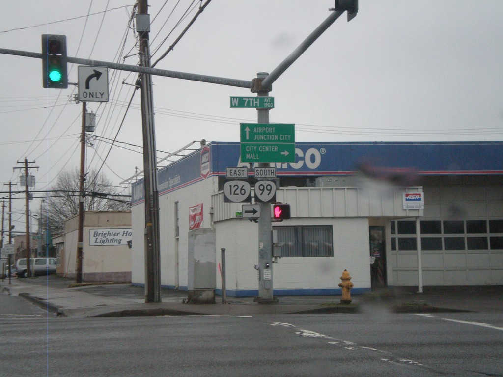
OR-126 East at OR-99
OR-126 East (Garfield St.) at 7th St. OR-126 East joins OR-99 South into downtown Eugene. Continue ahead for OR-99 north to Airport and Junction City.
Taken 01-17-2010
 Eugene
Lane County
Oregon
United States
Eugene
Lane County
Oregon
United States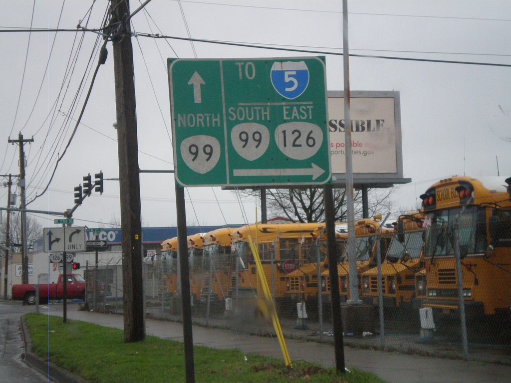
OR-126 East Approaching OR-99
OR-126 East approaching OR-99 in Eugene. OR-99 South/OR-126 East join through downtown Eugene. Use OR-99 South/OR-126 East for I-5.
Taken 01-17-2010
 Eugene
Lane County
Oregon
United States
Eugene
Lane County
Oregon
United States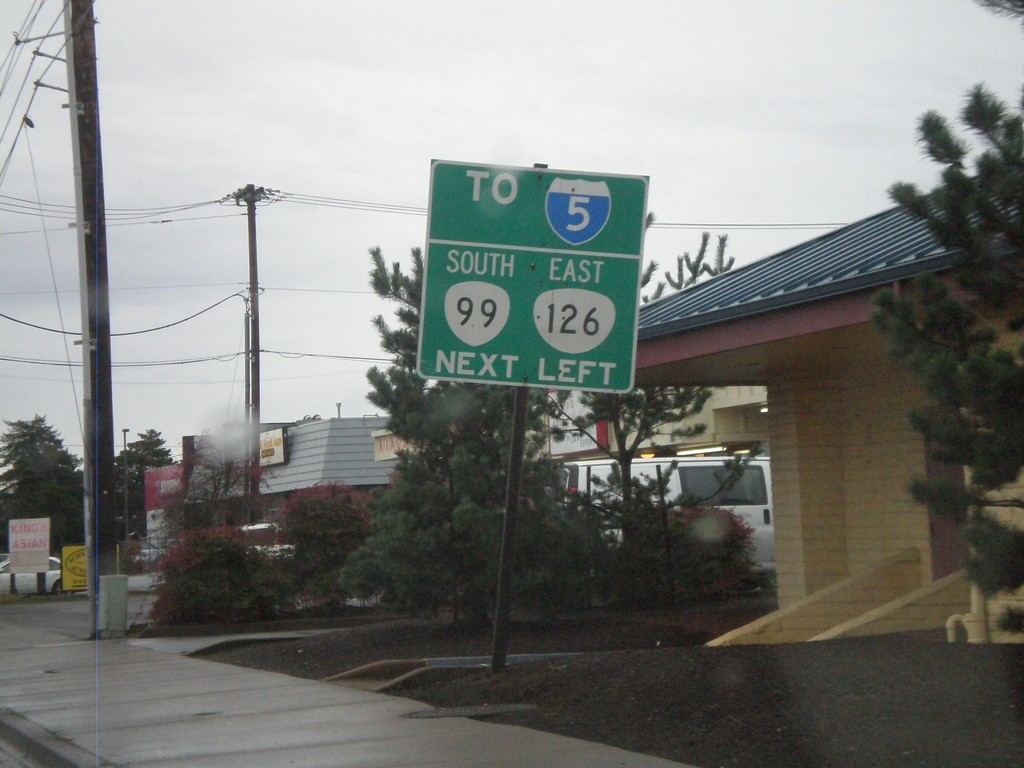
OR-126 East (11th St.) Approaching Garfield St.
OR-126 East (11th St.) Approaching Garfield St. OR-126 turns left on Garfield St. and connects with OR-99 a few blocks to the north.
Taken 01-17-2010
Eugene
Lane County
Oregon
United States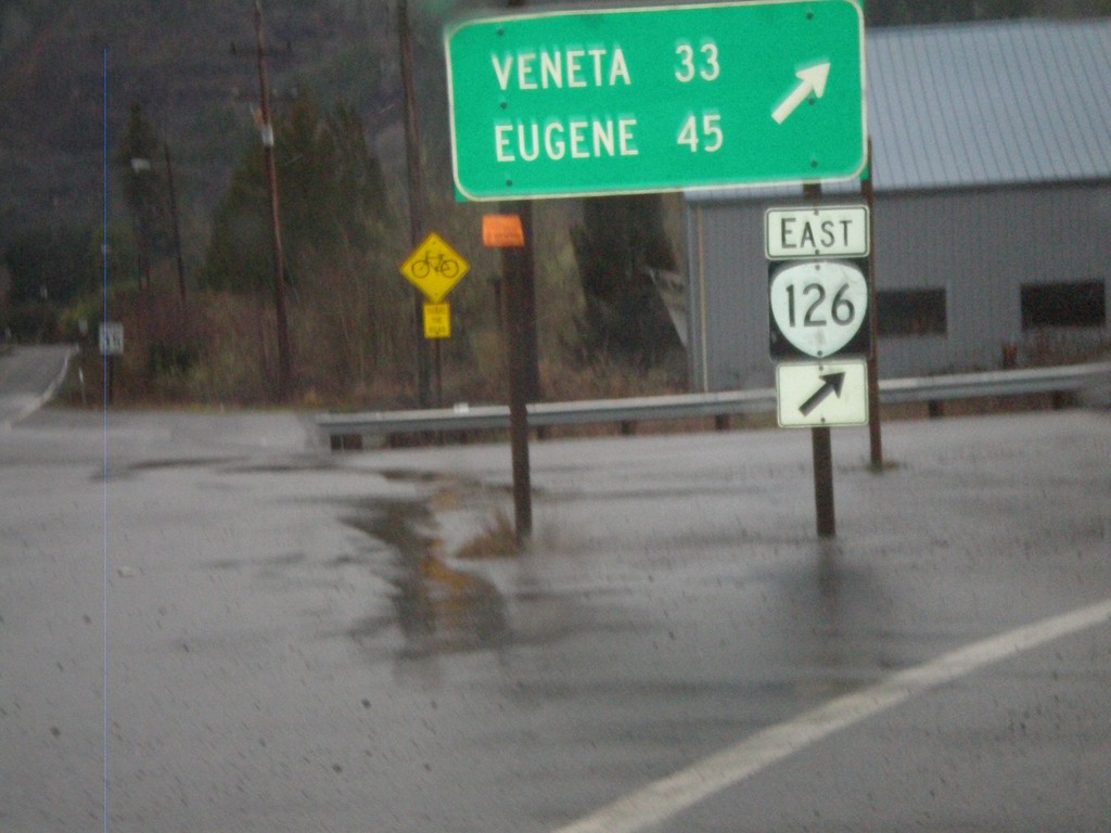
OR-126 East At OR-36
OR-126 east at OR-36 in Mapleton. Continue east on OR-126 for Veneta and Eugene.
Taken 01-17-2010
 Mapleton
Lane County
Oregon
United States
Mapleton
Lane County
Oregon
United States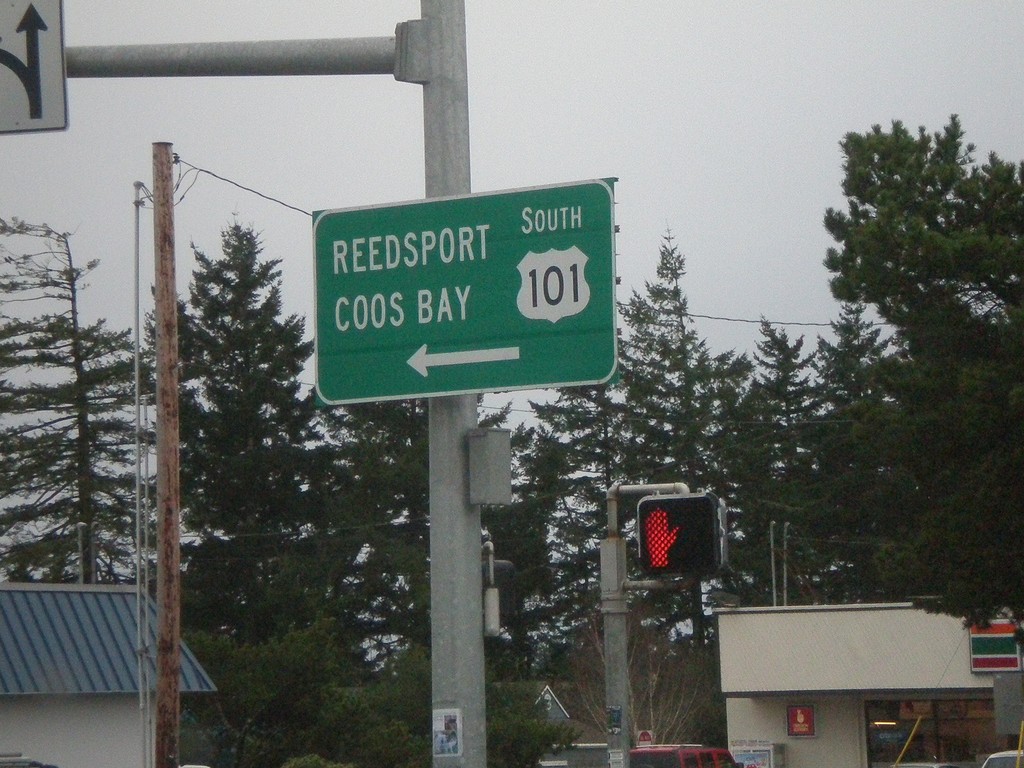
End OR-126 West at US-101
End OR-126 west at US-101 south to Reedsport and Coos Bay.
Taken 01-17-2010
 Florence
Lane County
Oregon
United States
Florence
Lane County
Oregon
United States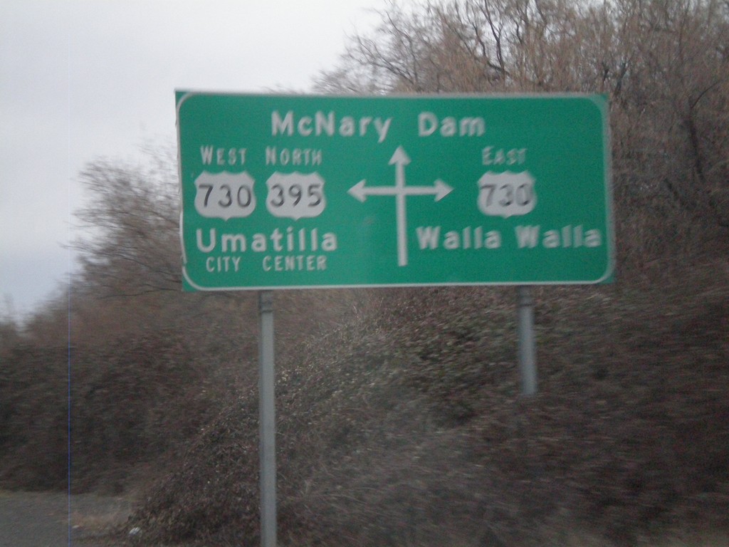
Route Diagram at US-395 North/US-730 Junction
Route diagram at US-395 north/US-730 junction. US-730 heads east to Walla Walla. US-395 North joins US-730 West into Umatilla. Continue straight for McNary Dam on the Columbia River.
Taken 01-14-2010

 Umatilla
 County
Oregon
United States
Umatilla
Umatilla County
Oregon
United States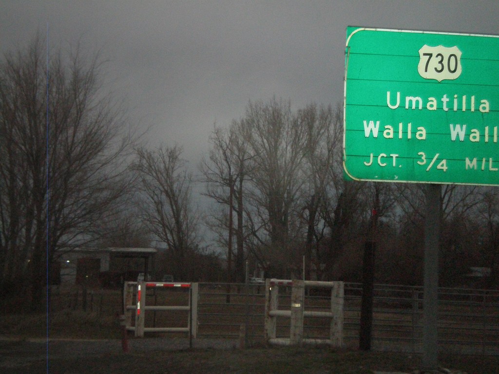
US-395 North Approaching US-730
US-395 north approaching US-730 to Umatilla and Walla Walla.
Taken 01-14-2010
Umatilla
Umatilla County
Oregon
United States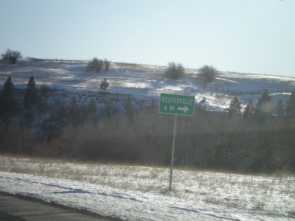
US-95 South At Cottonwood South Entrance
US-95 South at Business US-95 at the southern entrance to Cottonwood. Turn here for access to Keuterville.
Taken 12-27-2009

 Cottonwood
Idaho County
Idaho
United States
Cottonwood
Idaho County
Idaho
United States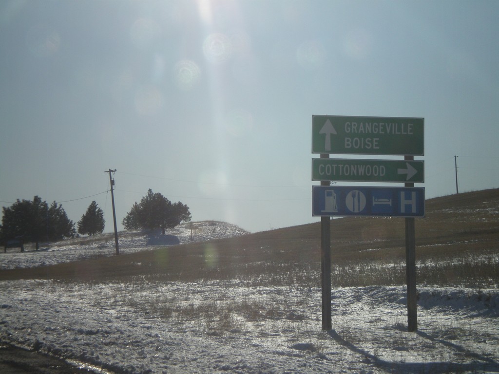
US-95 South at Cottonwood Northern Entrance
US-95 South at Business US-95 at the northern entrance to Cottonwood. Continue south on US-95 for Grangeville and Boise.
Taken 12-27-2009
Cottonwood
Idaho County
Idaho
United States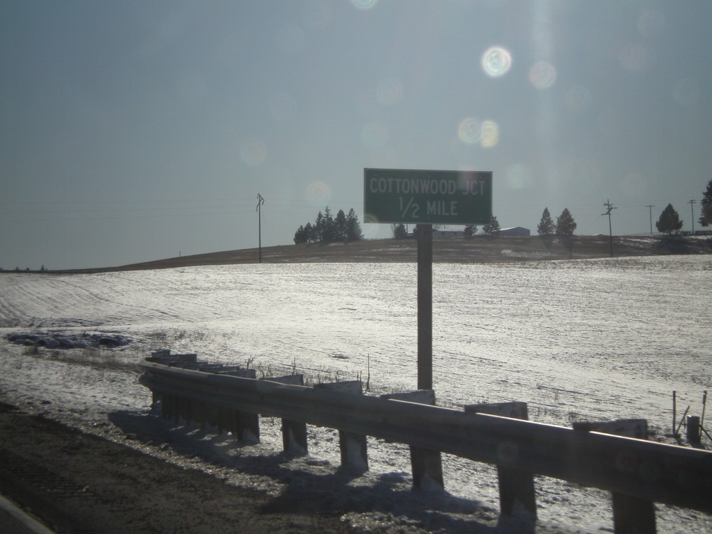
US-95 South Approaching Cottonwood
US-95 South approaching the northern entrance to Cottonwood.
Taken 12-27-2009
Cottonwood
Idaho County
Idaho
United States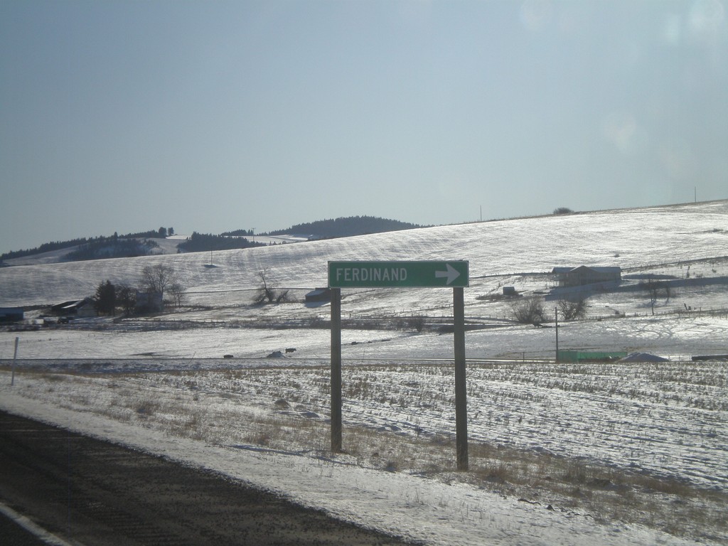
US-95 South at Ferdinand
US-95 South at Ferdinand.
Taken 12-27-2009
Ferdinand
Idaho County
Idaho
United States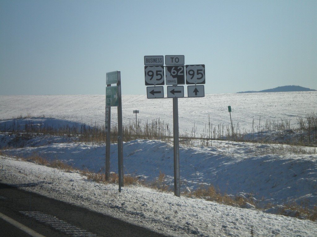
US-95 South at Business US-95/To ID-62
US-95 south at the south entrance to Craigmont at Business US-95/To ID-62 junction.
Taken 12-27-2009
Craigmont
Lewis County
Idaho
United States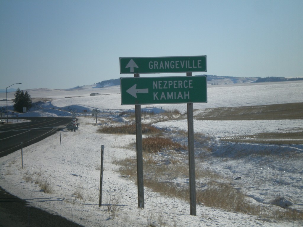
US-95 South at Craigmont South Entrance
US-95 south at Business US-95 at the southern entrance to Craigmont. Use Bus. US-95 to ID-62, Nezperce, and Kamiah. Continue south on US-95 for Grangeville.
Taken 12-27-2009
Craigmont
Lewis County
Idaho
United States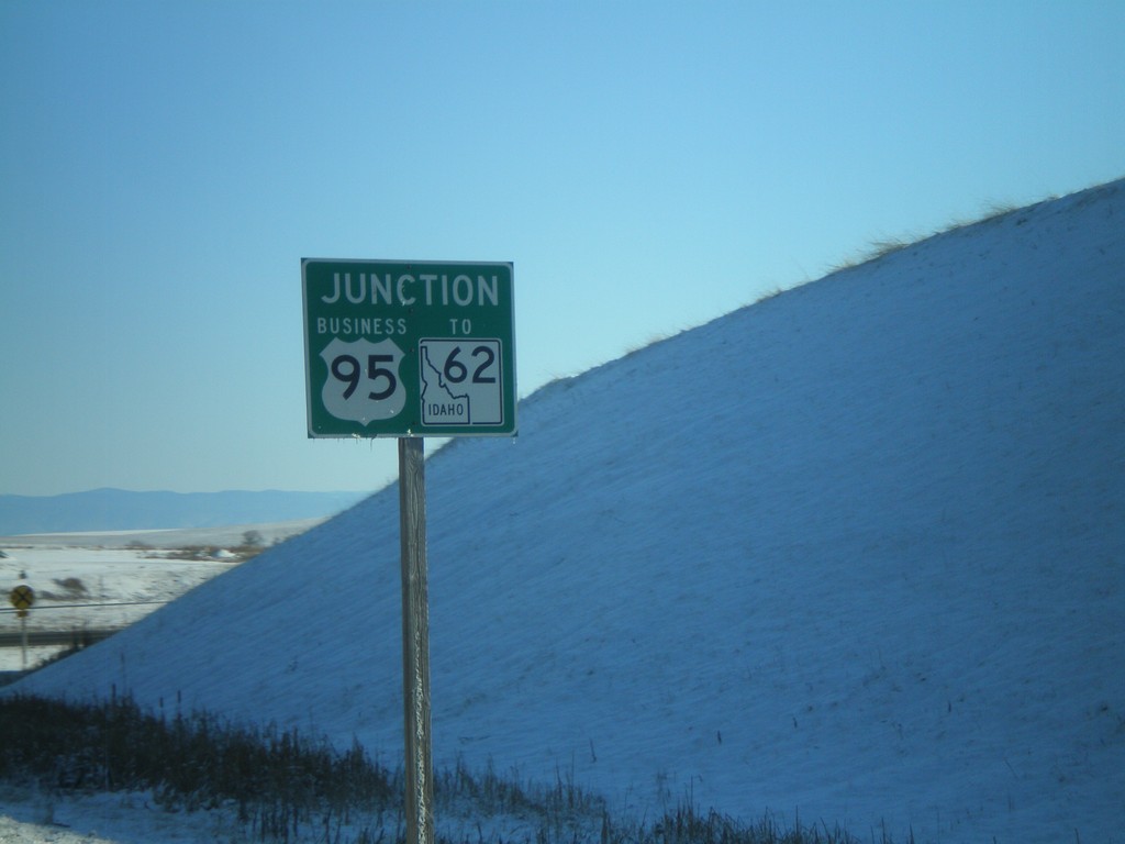
US-95 South Approaching Business US-95/To ID-62
US-95 south approaching Business US-95/To ID-62 at the southern entrance to Craigmont.
Taken 12-27-2009
Craigmont
Lewis County
Idaho
United States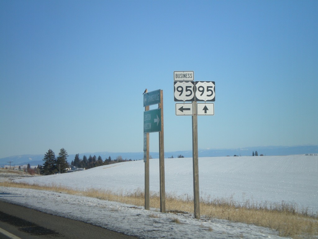
US-95 South at Craigmont Northern Entrance
US-95 south at Business US-95 at the northern entrance to Craigmont.
Taken 12-27-2009
Craigmont
Lewis County
Idaho
United States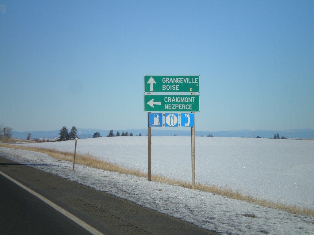
US-95 South at Business US-95
US-95 south approaching Business US-95 at the northern entrance to Craigmont. Use Business US-95 for Craigmont and Nezperce. Continue south on US-95 for Grangeville and Boise.
Taken 12-27-2009
Craigmont
Lewis County
Idaho
United States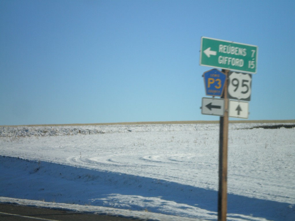
US-95 South at Lewis County Road P3
US-95 south at Lewis County Road P3 north to Reubens and Gifford.
Taken 12-27-2009
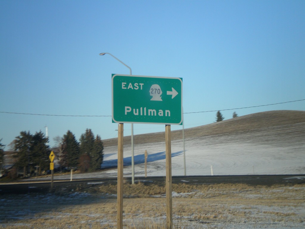
US-195 North at WA-270 East
US-195 north at WA-270 east to Pullman.
Taken 12-26-2009

 Pullman
Whitman County
Washington
United States
Pullman
Whitman County
Washington
United States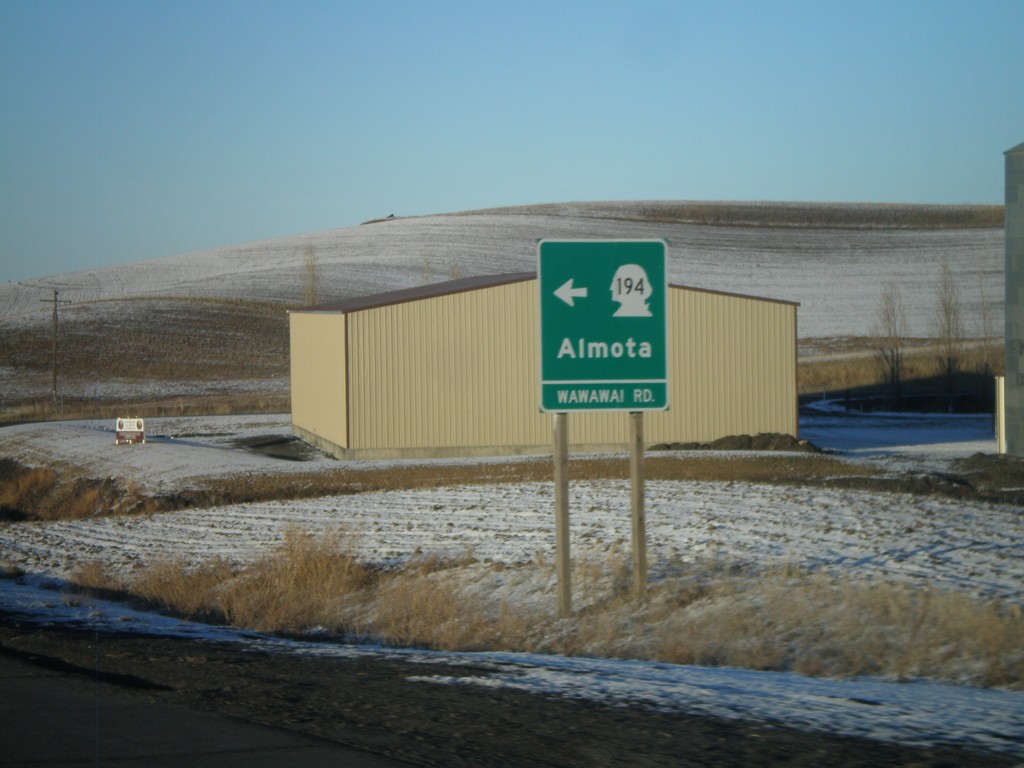
US-195 North at WA-194 West
US-195 north at WA-194 (Wawawai Road) west to Almota.
Taken 12-26-2009
 Pullman
Whitman County
Washington
United States
Pullman
Whitman County
Washington
United States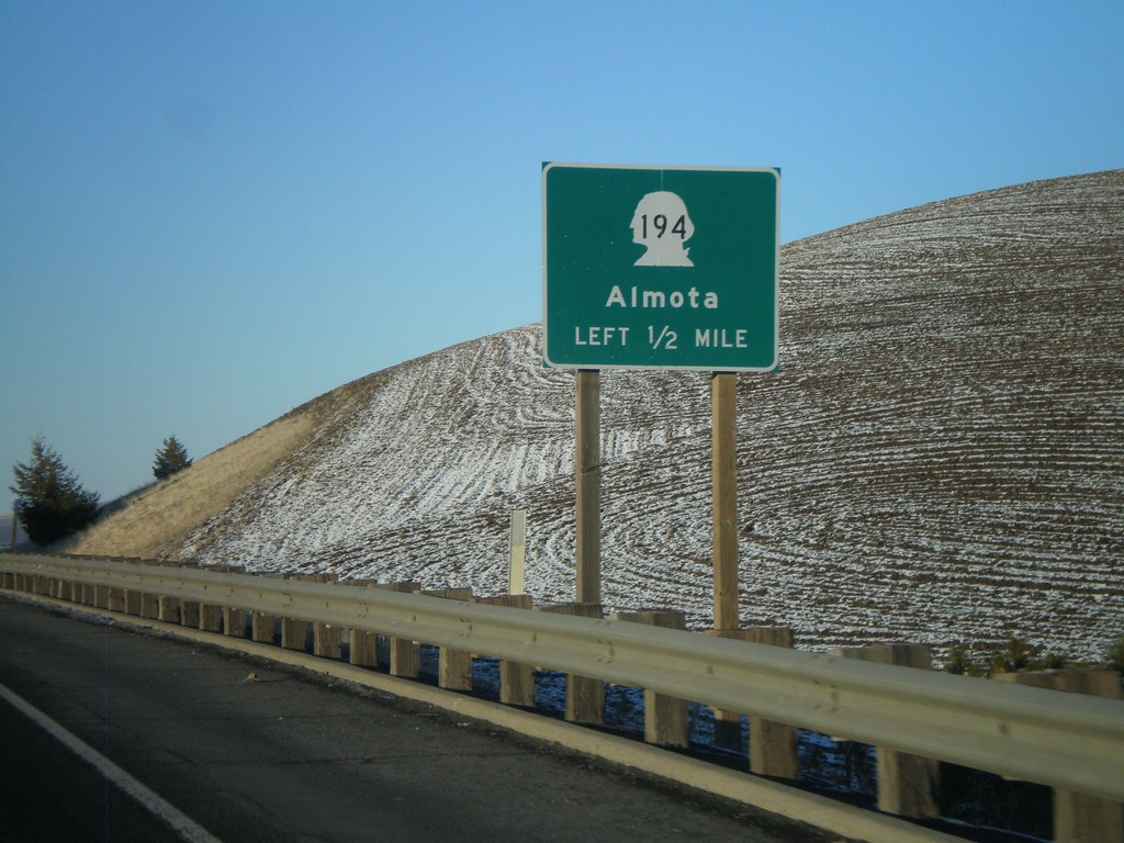
US-195 North Approaching WA-194
US-195 north approaching WA-194 west to Almota.
Taken 12-26-2009
Pullman
Whitman County
Washington
United States