Signs Tagged With Intersection
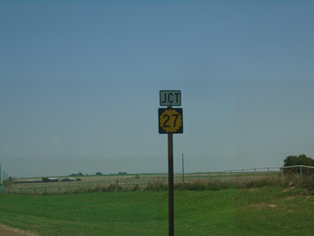
US-56 East Approaching KS-27
US-56 East approaching KS-27 in Morton County.
Taken 06-20-2026

 Rolla
Morton County
Kansas
United States
Rolla
Morton County
Kansas
United States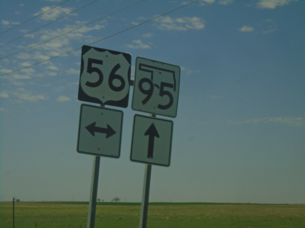
County Road South at US-56/OK-95
County Road South at US-56/OK-95 in Texas County.
Taken 06-20-2026
 Texas County
Oklahoma
United States
Texas County
Oklahoma
United States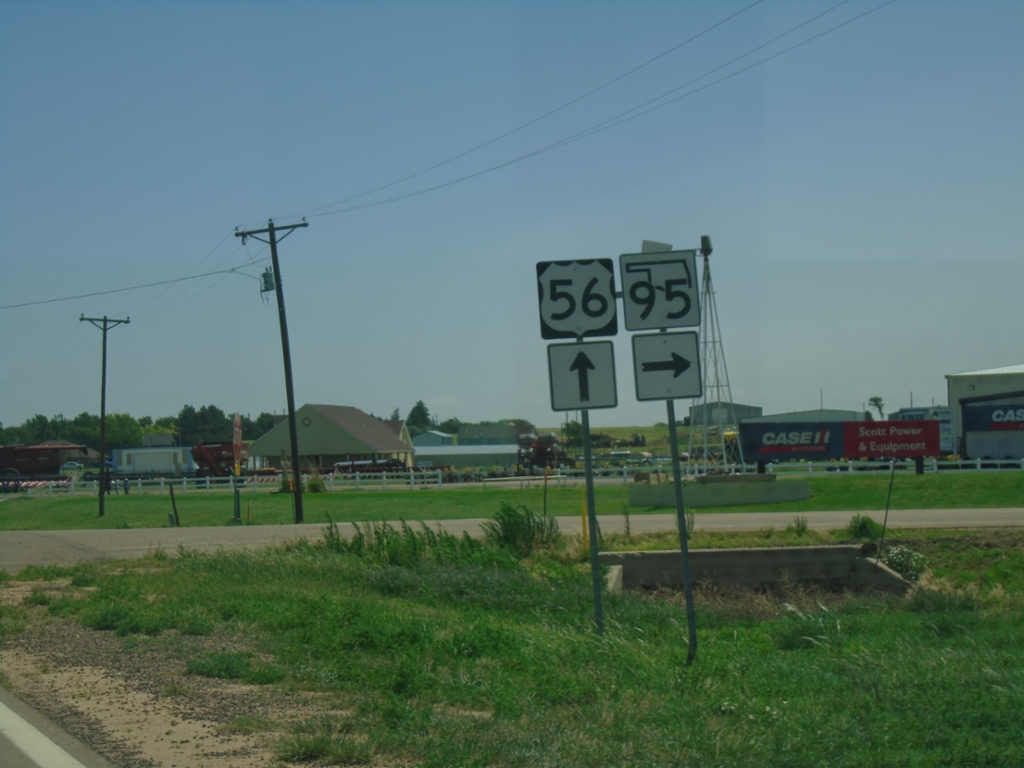
US-56 East at OK-95 South
US-56 East at OK-95 South in Texas County.
Taken 06-20-2026
Texas County
Oklahoma
United States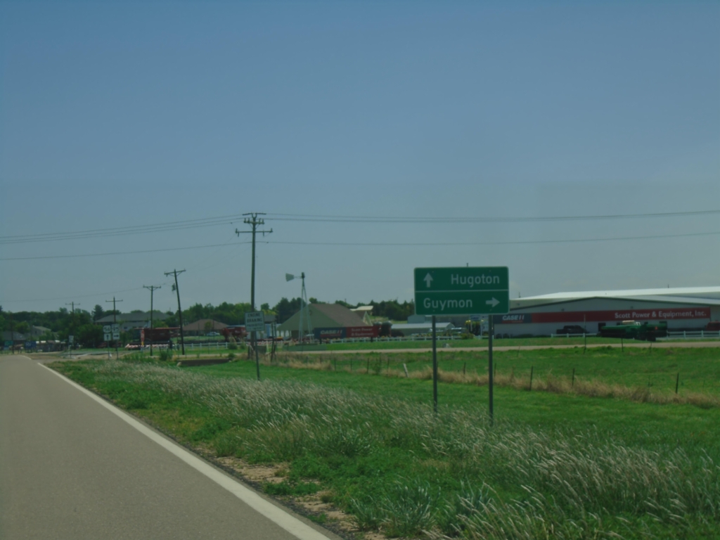
US-56 East Approaching OK-95
US-56 East approaching OK-95. Use OK-95 south to Guymon; continue east on US-56 to Hugoton, KS.
Taken 06-20-2026
Texas County
Oklahoma
United States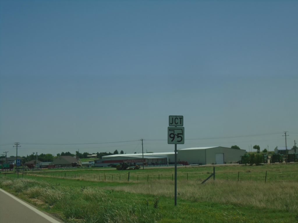
US-56 East Approaching OK-95
US-56 East approaching OK-95 South in Texas County.
Taken 06-20-2026
Texas County
Oklahoma
United States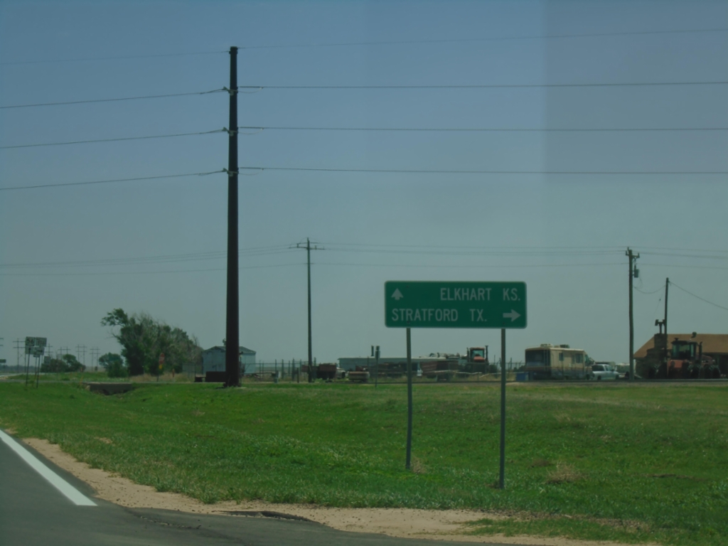
US-56 East at OK-171 South
US-56 East at OK-171 South to Stratford, Texas. Continue east on US-56 to Elkhart, Kansas.
Taken 06-20-2026
 Keyes
Cimarron County
Oklahoma
United States
Keyes
Cimarron County
Oklahoma
United States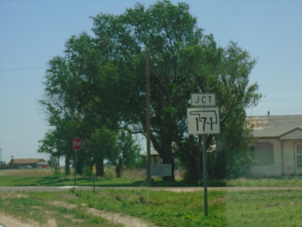
US-56 East Approaching OK-171
US-56 East approaching OK-171 in Keyes.
Taken 06-20-2026
Keyes
Cimarron County
Oklahoma
United States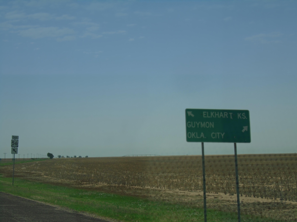
US-56/US-64/US-412/OK-3 East at US-56 East
US-56/US-64/US-412/OK-3 East at US-56 East in Cimarron County. Use US-56 East for Elkhart, Kansas; use US-64/US-412/OK-3 East for Guymon and Oklahoma City.
Taken 06-20-2026


 Cimarron County
Oklahoma
United States
Cimarron County
Oklahoma
United States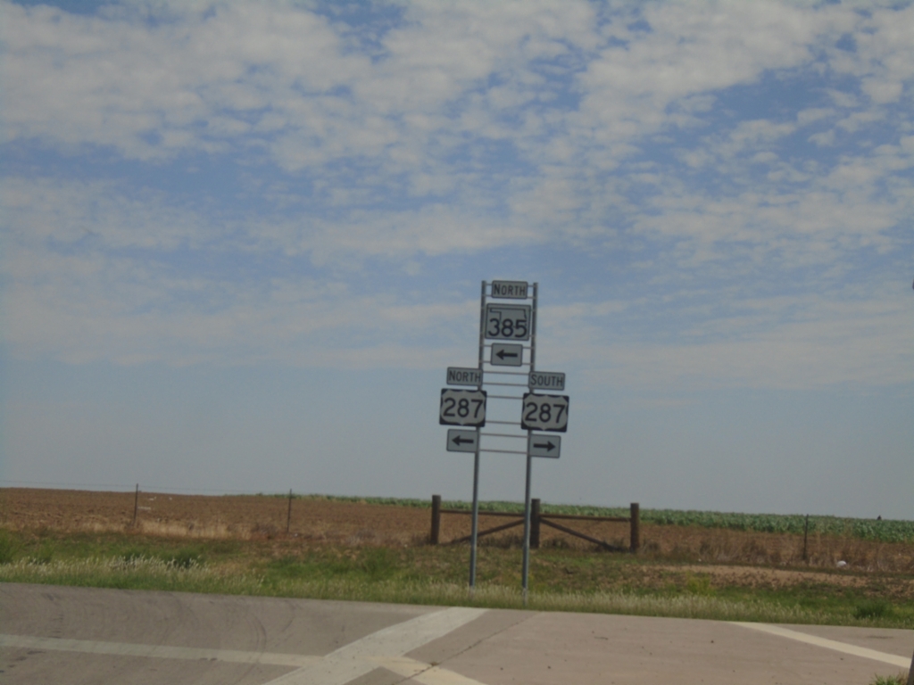
US-385 North/OK-3 West at US-287
US-385 North/OK-3 West at US-287 in Boise City. Turn left to continue north on US-385/OK-3 which joins US-287 into Colorado. The US-385 shield is incorrectly shown as OK-385.
Taken 06-20-2026

 Boise City
Cimarron County
Oklahoma
United States
Boise City
Cimarron County
Oklahoma
United States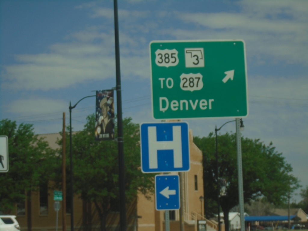
Boise City Roundabout - North Exit
Boise City Roundabout - Junction of US-56/US-64/US-385/US-412/OK-3/OK-325 at north exit of roundabout. Exit roundabout for US-385 North/OK-3 West/To US-287/Denver (Colorado). The center of the roundabout is the Cimarron County Courthouse.
Taken 06-20-2026
 Boise City
Cimarron County
Oklahoma
United States
Boise City
Cimarron County
Oklahoma
United States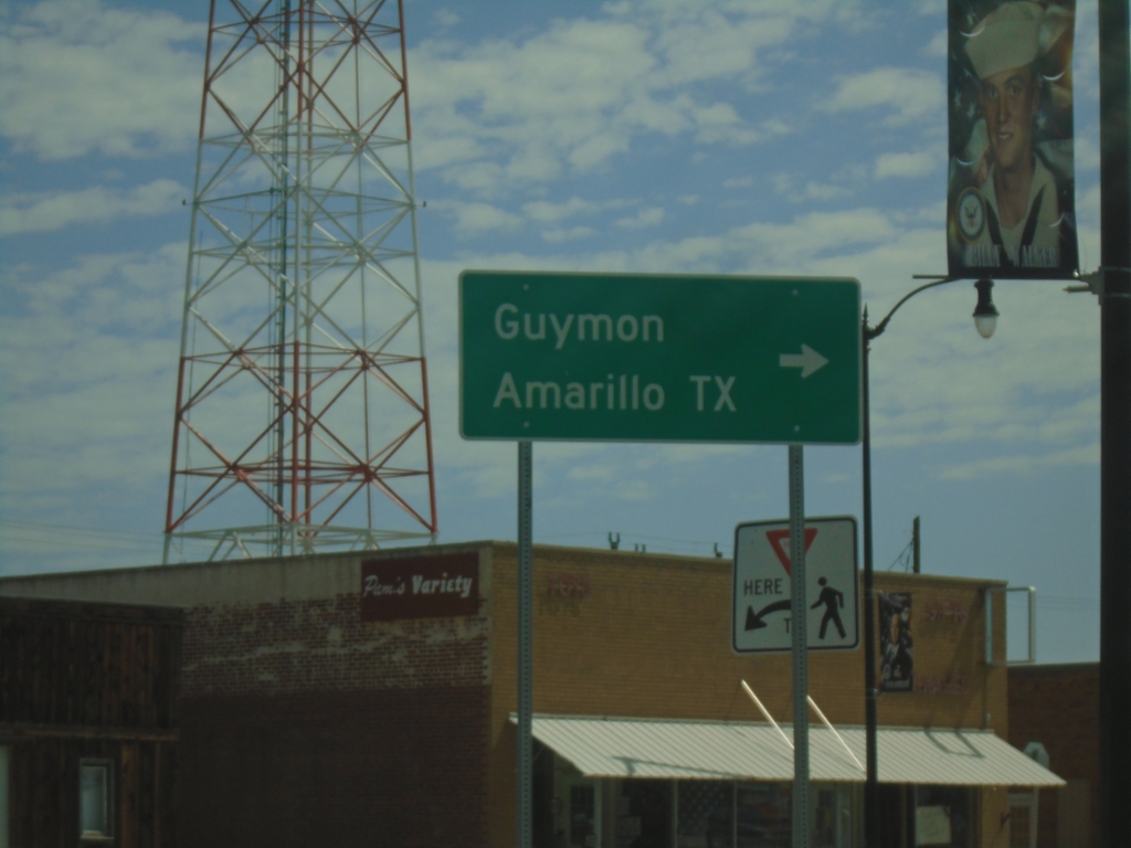
US-56/US-64/US-412 East/US-385 North at OK-3/OK-325
US-56/US-64/US-412 East/US-385 North at OK-3/OK-325 in downtown Boise City. Turn right for US-56/US-64/US-412/OK-3 East to Guymon and Amarillo, Texas.
Taken 06-20-2026
Boise City
Cimarron County
Oklahoma
United States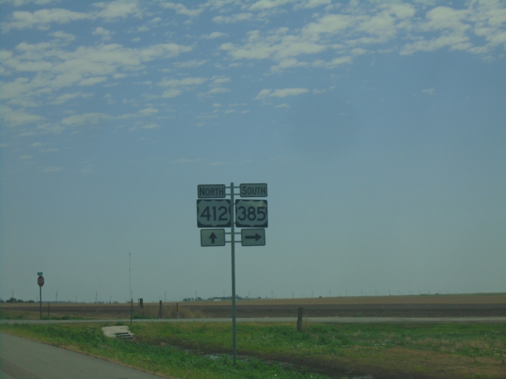
US-56/US-64/US-412 East at US-385
US-56/US-64/US-412 East at US-385 in Cimarron County. Turn right for US-385 South. US-385 North joins US-56/US-64/US-412 East. Only US-412 is shown as the current highway.
Taken 06-20-2026
Cimarron County
Oklahoma
United States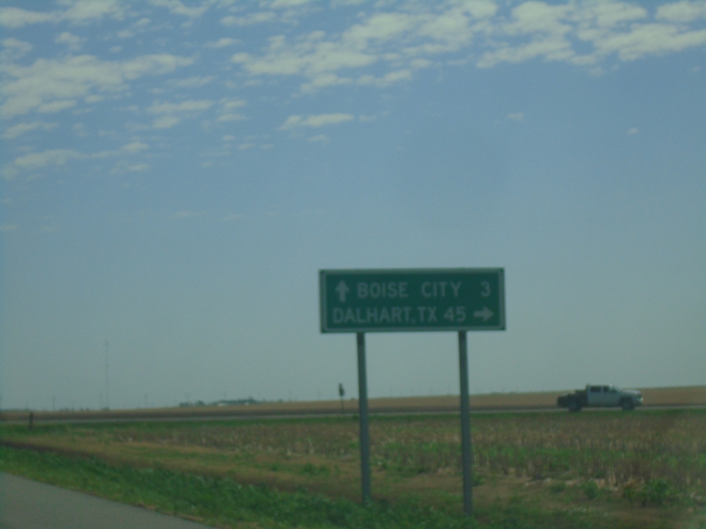
US-56/US-64/US-412 East Approaching US-385
US-56/US-64/US-412 East approaching US-385 south to Dalhart, Texas. Continue on US-56/US-64/US-412 East to Boise City.
Taken 06-20-2026
Cimarron County
Oklahoma
United States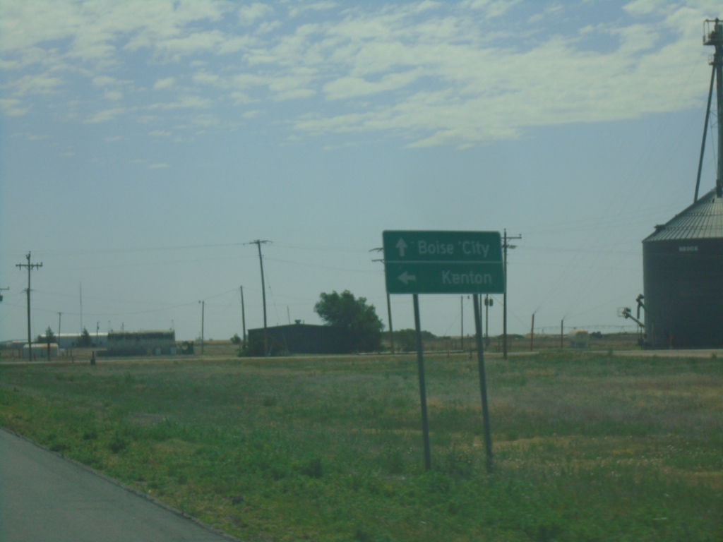
US-56/US-64/US-412 East at NS-13 Road
US-56/US-64/US-412 East at NS-13 Road. Use NS-13 Road North to Kenton. Continue on US-56/US-64/US-412 East to Boise City.
Taken 06-20-2026
Felt
Cimarron County
Oklahoma
United States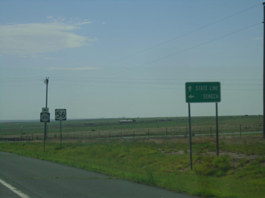
US-56/US-64/US-412 East at NM-406
US-56/US-64/US-412 East approaching NM-406 in Union County. Use NM-406 North to Seneca; continue on US-56/US-64/US-412 East to (Oklahoma) State Line. Only US-56 is shown for the current highway.
Taken 06-20-2026
 Union County
New Mexico
United States
Union County
New Mexico
United States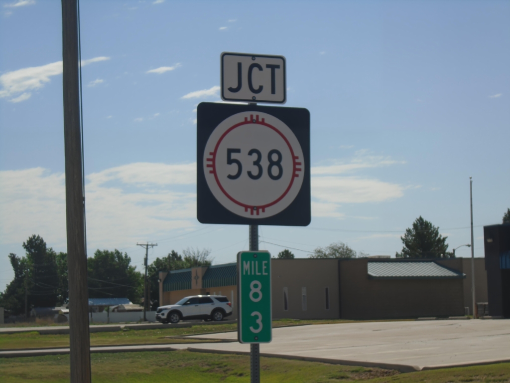
US-56/US-64/US-412 East at NM-538
US-56/US-64/US-412 East at NM-538 in Clayton. Mile 83.
Taken 06-20-2026
 Clayton
Union County
New Mexico
United States
Clayton
Union County
New Mexico
United States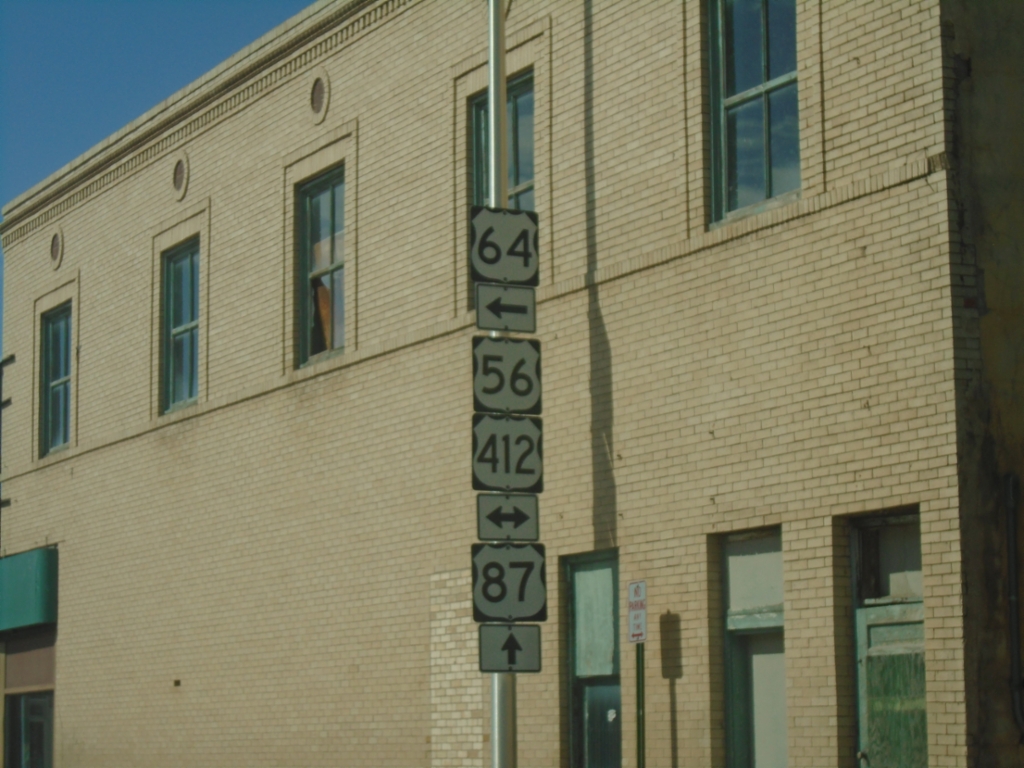
US-64 East/US-87 South at US-56/US-412
US-64 East/US-87 South at US-56/US-412 in Clayton. US-64 and US-87 split here - turn left for US-64 East - continue straight for US-87 South.
Taken 06-20-2026
 Clayton
Union County
New Mexico
United States
Clayton
Union County
New Mexico
United States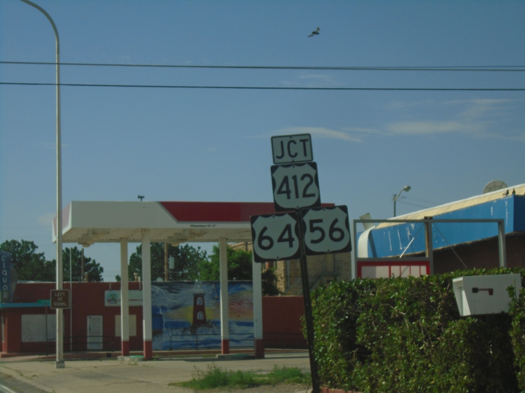
US-64 East/US-87 South at US-56/US-412
US-64 East/US-87 South at US-56/US-412. Turn left to continue east on US-64, which joins US-56/US-412. Continue straight to continue south on US-87.
Taken 06-20-2026
Clayton
Union County
New Mexico
United States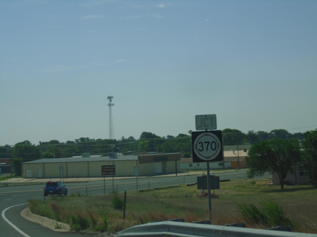
US-64 East/US-87 South Approaching NM-370
US-64 East/US-87 South approaching NM-370 in Clayton.
Taken 06-20-2026
Clayton
Union County
New Mexico
United States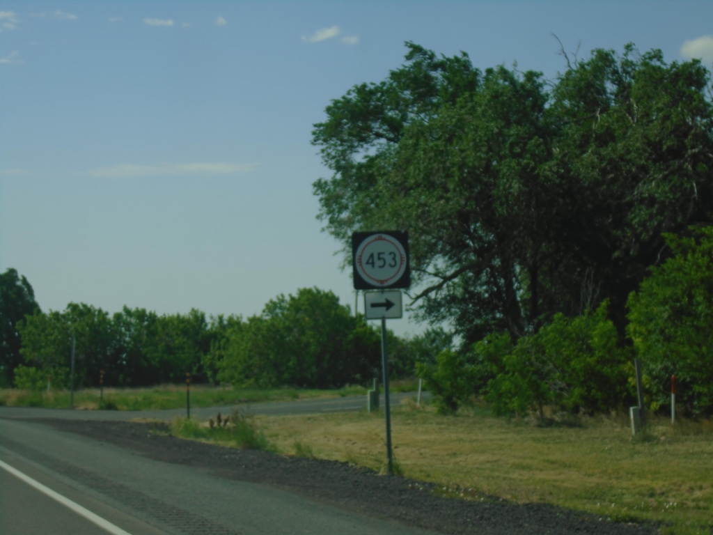
US-64 East/US-87 South at NM-453
US-64 East/US-87 South at NM-453 in Grenville.
Taken 06-20-2026
 Grenville
Union County
New Mexico
United States
Grenville
Union County
New Mexico
United States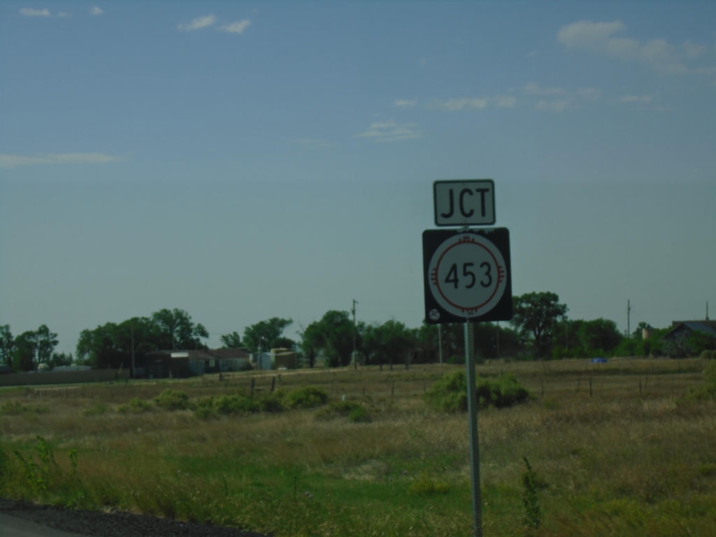
US-64 East/US-87 South Approaching NM-453
US-64 East/US-87 South approaching NM-453 in Grenville.
Taken 06-20-2026
Grenville
Union County
New Mexico
United States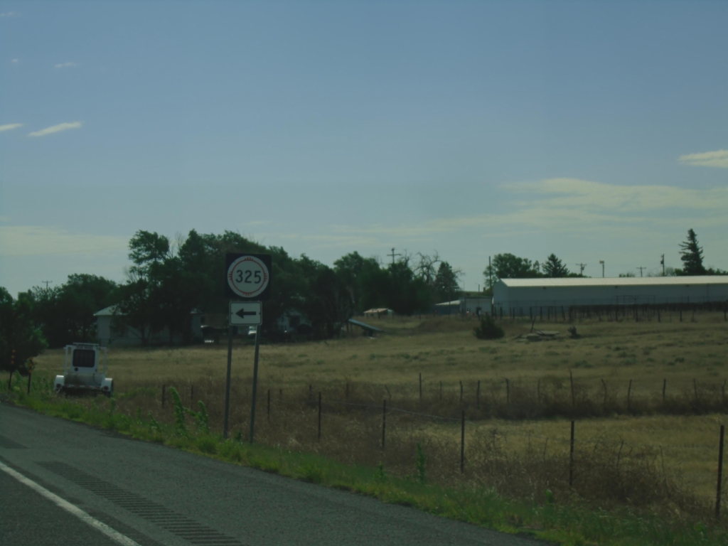
US-64 East/US-87 South at NM-325
US-64 East/US-87 South at NM-325 in Des Moines.
Taken 06-20-2026
 Des Moines
Union County
New Mexico
United States
Des Moines
Union County
New Mexico
United States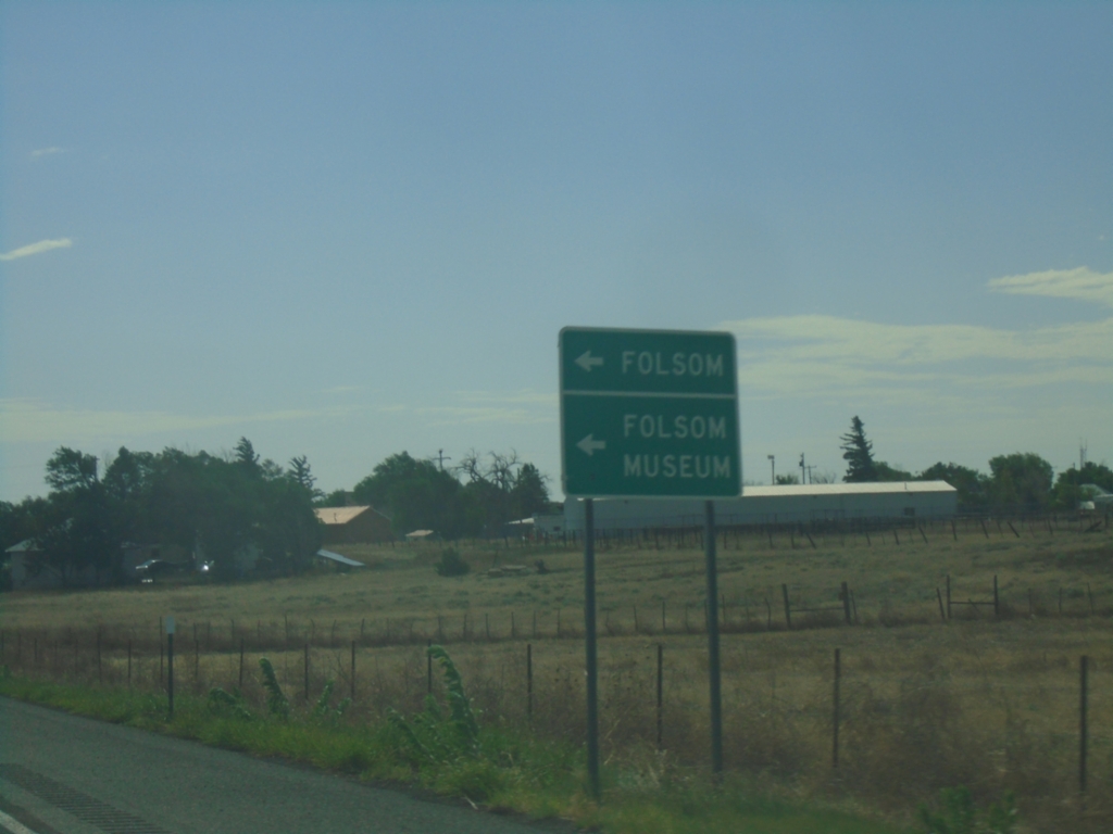
US-64 East/US-87 South at NM-325
US-64 East/US-87 South at NM-325 to Folsom and Folsom Museum.
Taken 06-20-2026
Des Moines
Union County
New Mexico
United States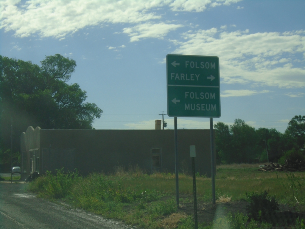
US-64/US-87 East Approaching NM-325
US-64/US-87 East approaching NM-325 north to Folsom and Folsom Museum (in Folsom). Turn right for the county road to Farley.
Taken 06-20-2026
Capulin
Union County
New Mexico
United States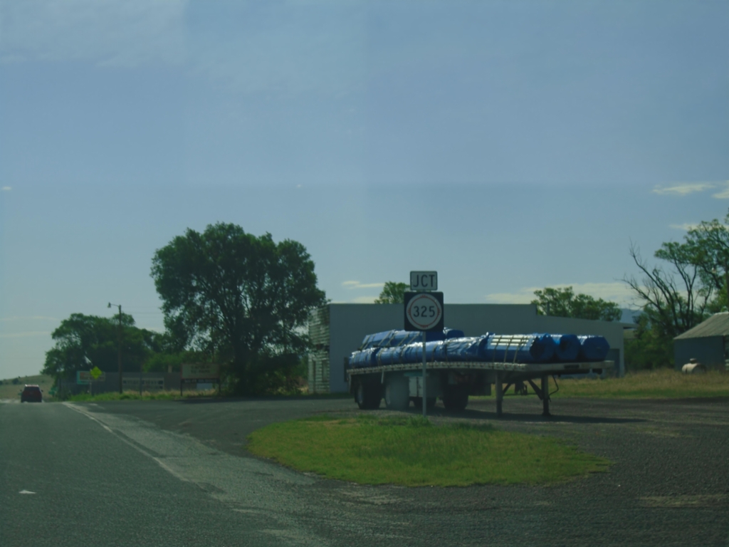
US-64/US-87 East Approaching NM-325
US-64/US-87 East approaching NM-325 in Capulin.
Taken 06-20-2026
Des Moines
Union County
New Mexico
United States