Signs Tagged With Intersection
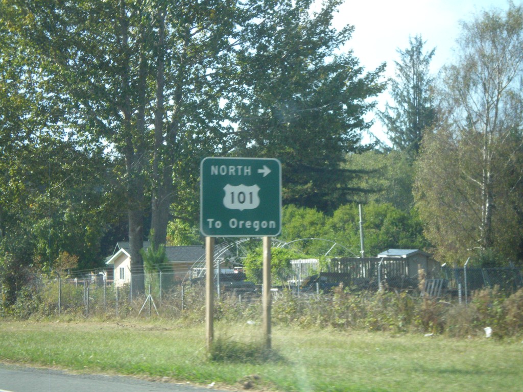
US-199 West at US-101 North
US-199 west at Elk Valley Cross Road, which provides access to US-101 north to Oregon. This is the western terminus of US-199.
Taken 09-23-2009

 Crescent City
Del Norte County
California
United States
Crescent City
Del Norte County
California
United States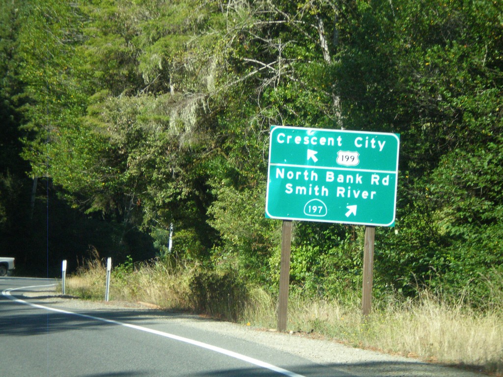
US-199 South At CA-197
US-199 west at CA-197/North Bank Road/Smith River. US-199 continues west towards Crescent City.
Taken 09-23-2009
 Crescent City
Del Norte County
California
United States
Crescent City
Del Norte County
California
United States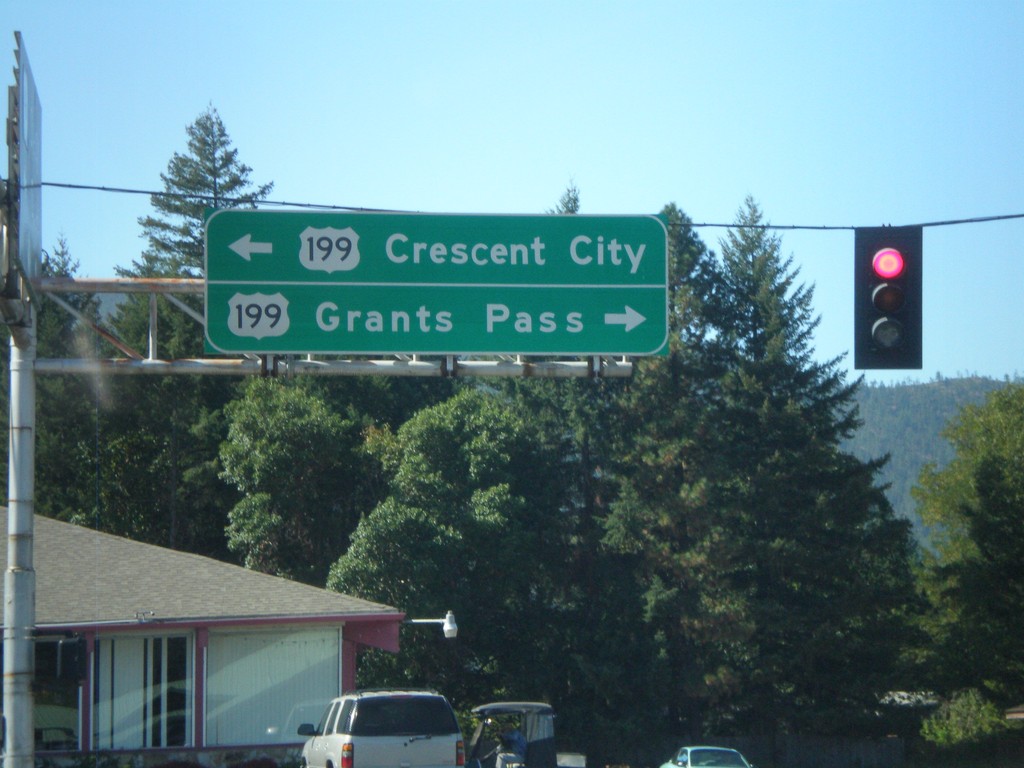
End OR-46 West at US-199
End OR-46 west at US-199. Use US-199 east for Grants Pass. Use US-199 west for Crescent City.
Taken 09-23-2009
 Cave Junction
Josephine County
Oregon
United States
Cave Junction
Josephine County
Oregon
United States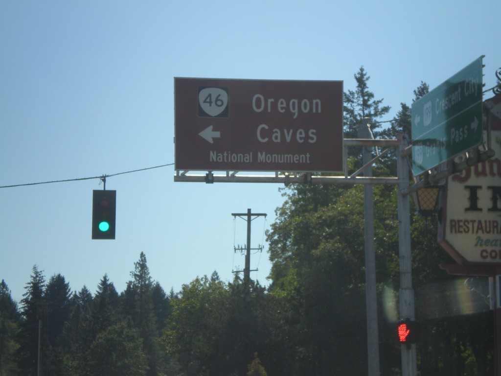
US-199 South at OR-46
US-199 south at OR-46 east to Oregon Cavess National Monument.
Taken 09-23-2009
Cave Junction
Josephine County
Oregon
United States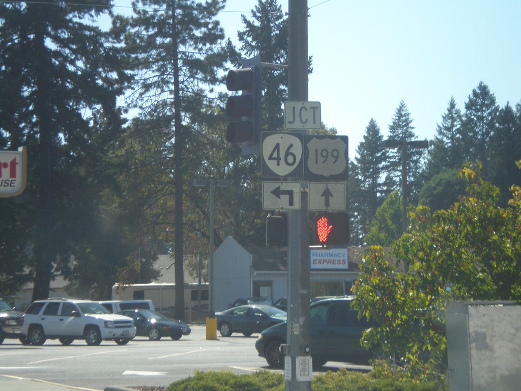
US-199 South Approaching OR-46
US-199 south approaching OR-46 east.
Taken 09-23-2009
Cave Junction
Josephine County
Oregon
United States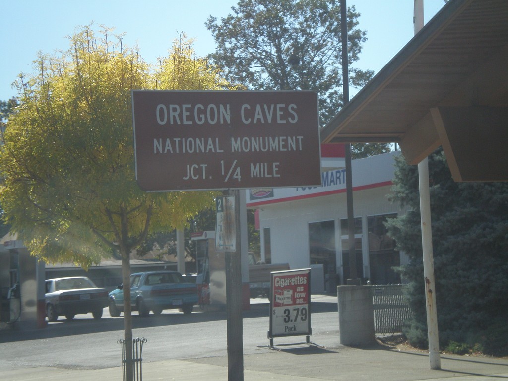
US-199 South Approaching OR-46
US-199 south approaching OR-46 east to Oregon Caves National Monument
Taken 09-23-2009
Cave Junction
Josephine County
Oregon
United States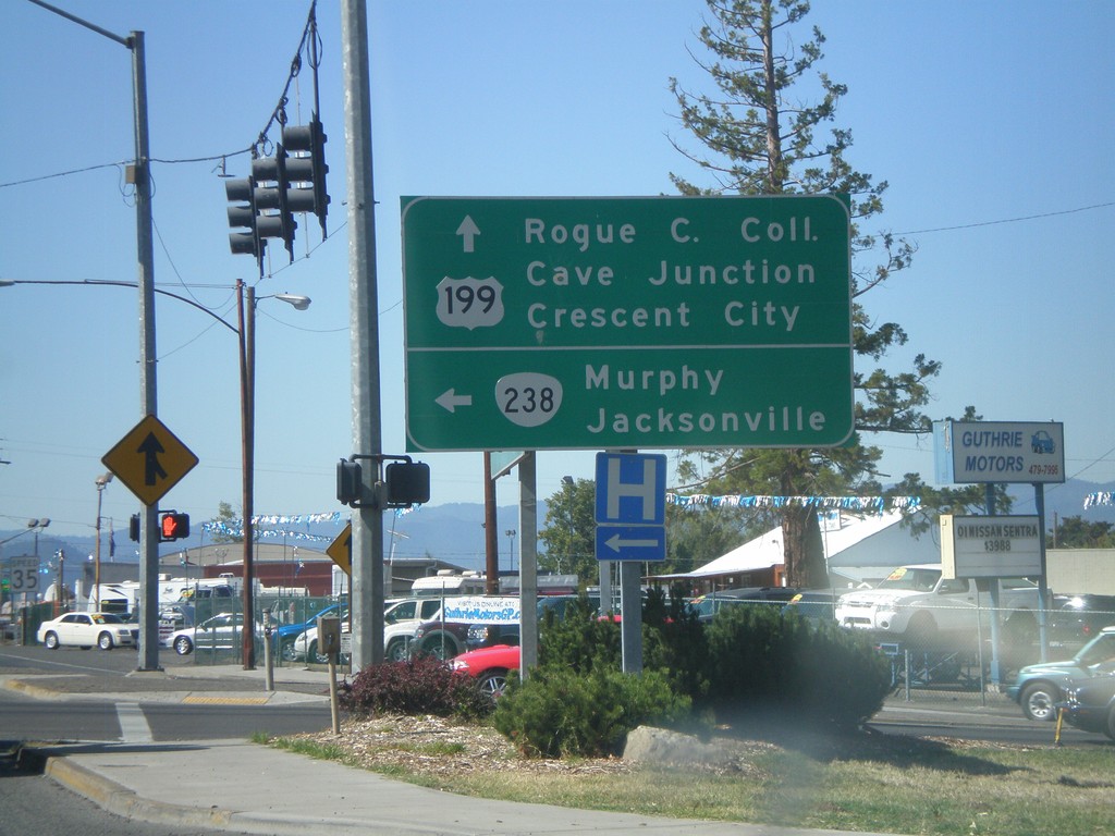
US-199 South at OR-238
US-199 south at E. Park St. Turn right on E. Park St. for the Grants Pass City Center. Turn left for access to OR-99 and Rogue River.
Taken 09-23-2009
 Grants Pass
Josephine County
Oregon
United States
Grants Pass
Josephine County
Oregon
United States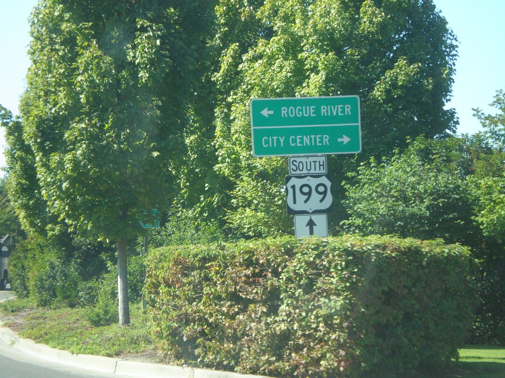
US-199 South At Park St.
US-199 south at E. Park St. Use Park St. south to connect to OR-99/Rogue River Highway.
Taken 09-23-2009
Grants Pass
Josephine County
Oregon
United States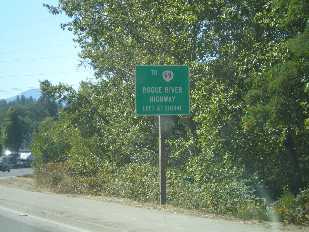
US-199 South Approaching Park St.
US-199 south approaching E. Park St. Use Park St. south to connect to OR-99/Rogue River Highway.
Taken 09-23-2009
 Grants Pass
Josephine County
Oregon
United States
Grants Pass
Josephine County
Oregon
United States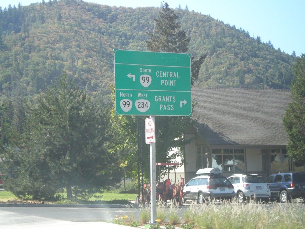
OR-234 West Approaching OR-99
OR-234 west approaching OR-99 in Gold Hill. Use OR-99 South for Central Point. OR-234 west joins OR-99 north towards Grants Pass.
Taken 09-23-2009
 Gold Hill
Jackson County
Oregon
United States
Gold Hill
Jackson County
Oregon
United States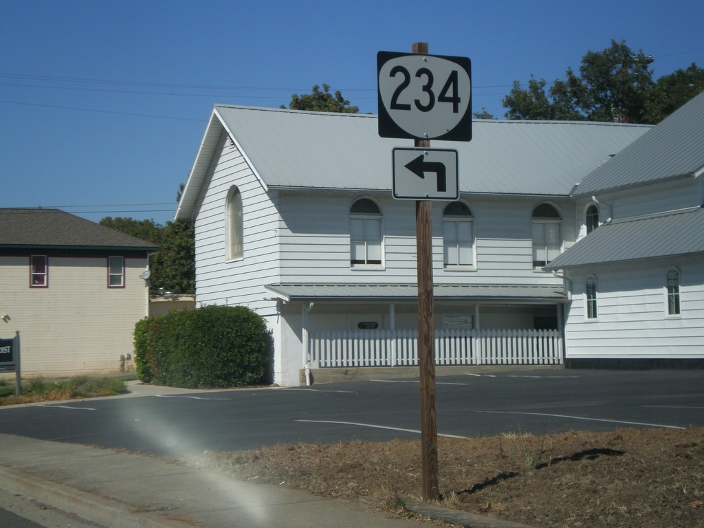
OR-234 West - Gold Hill
OR-234 west at the corner of 4th Ave. and 7th St. in Gold Hill.
Taken 09-23-2009
Gold Hill
Jackson County
Oregon
United States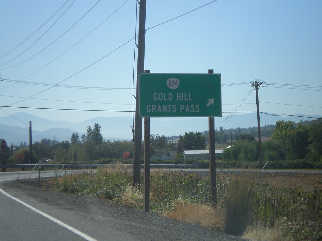
OR-62 South at OR-234 West
OR-62 south at OR-234 west to Gold Hill and Grants Pass.
Taken 09-23-2009
 Eagle Point
Jackson County
Oregon
United States
Eagle Point
Jackson County
Oregon
United States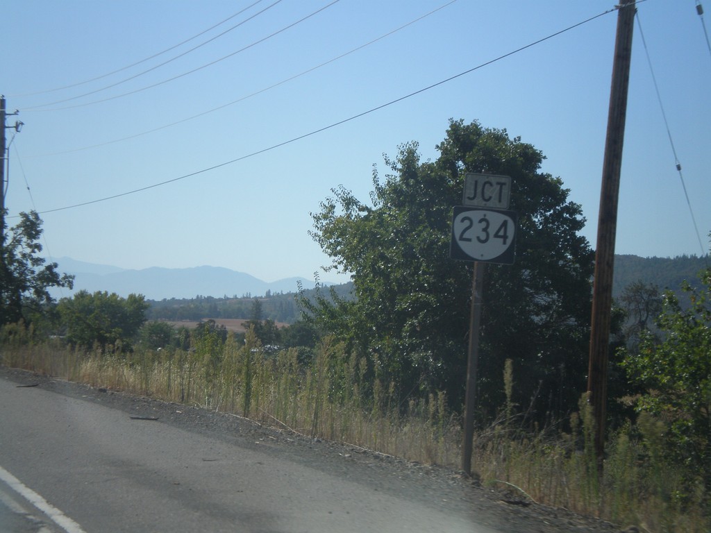
OR-62 South Approaching OR-234
OR-62 south approaching OR-234.
Taken 09-23-2009
Eagle Point
Jackson County
Oregon
United States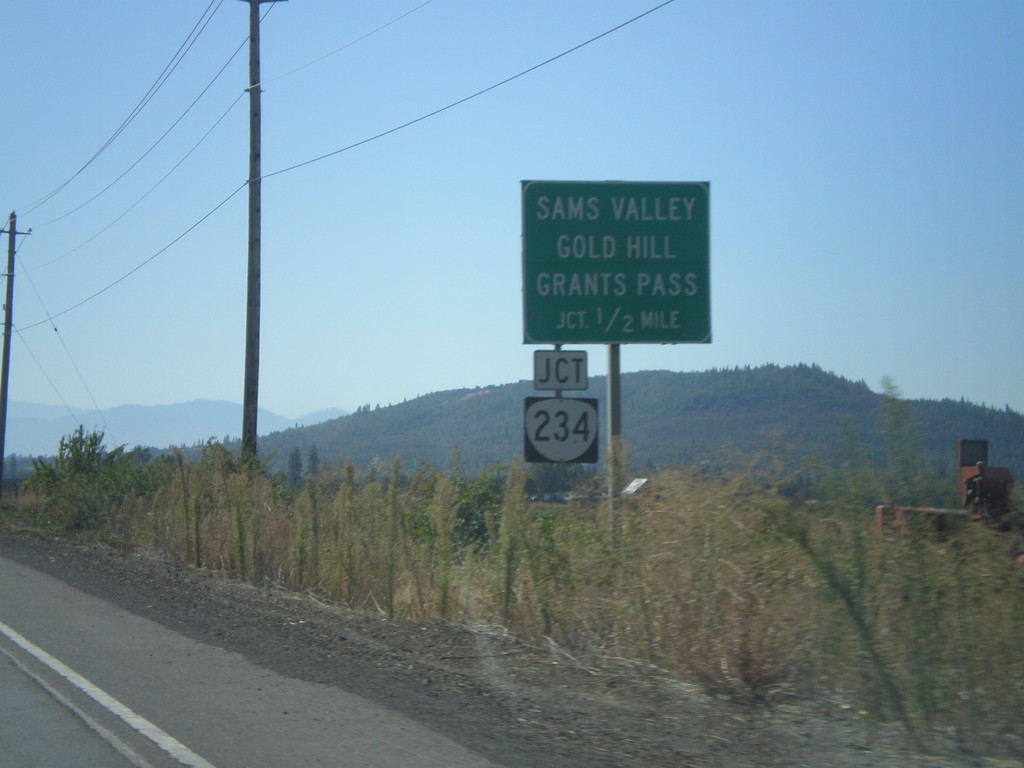
OR-62 South Approaching OR-234
OR-62 south approaching OR-234 to Sams Valley, Gold Hill, and Grants Pass.
Taken 09-23-2009
Eagle Point
Jackson County
Oregon
United States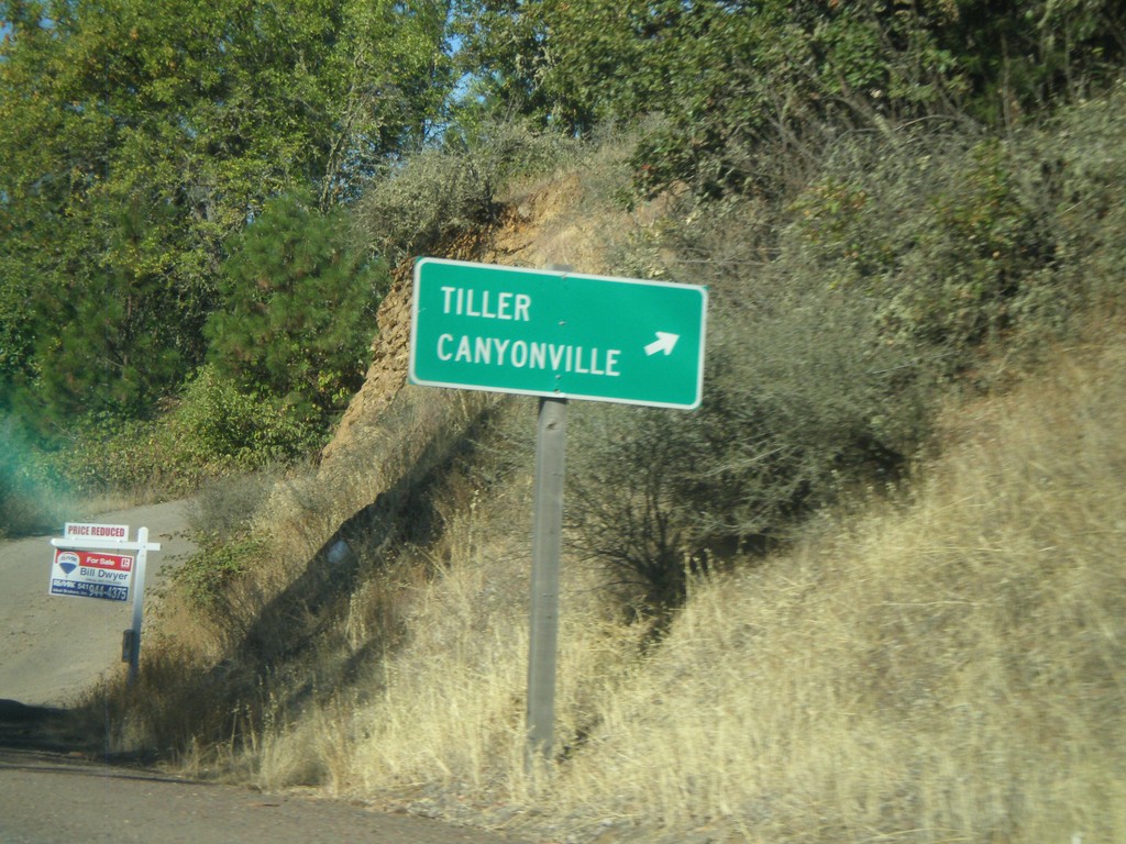
OR-62 South at OR-227
OR-62 south at OR-227 to Tiller and Canyonville.
Taken 09-23-2009
 Trail
Jackson County
Oregon
United States
Trail
Jackson County
Oregon
United States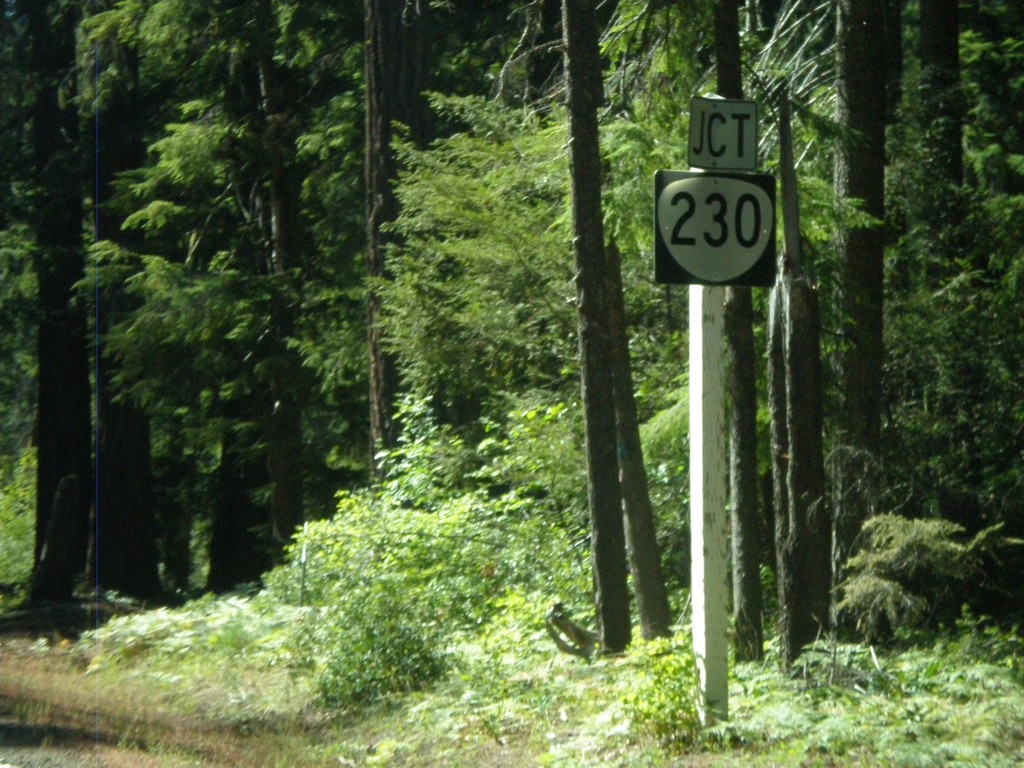
OR-62 West Approaching OR-230 East
OR-62 west approaching OR-230.
Taken 09-20-2009
 Prospect
Jackson County
Oregon
United States
Prospect
Jackson County
Oregon
United States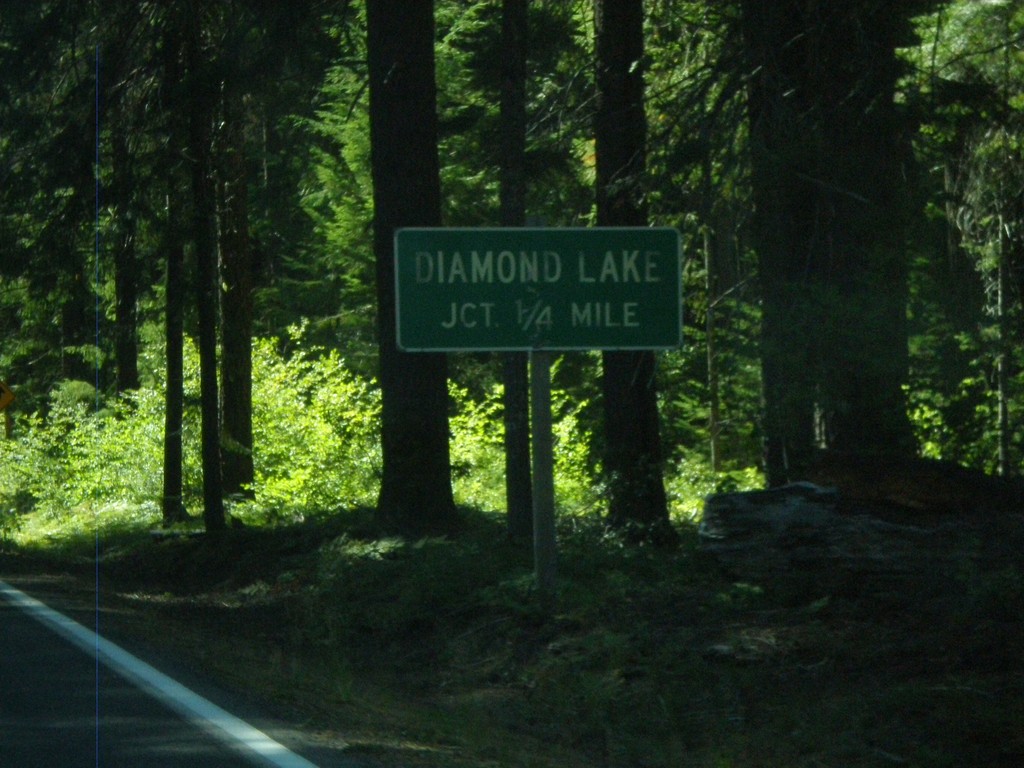
OR-62 West Approching OR-230
OR-62 west approaching OR-230 east to Diamond Lake.
Taken 09-20-2009
Prospect
Jackson County
Oregon
United States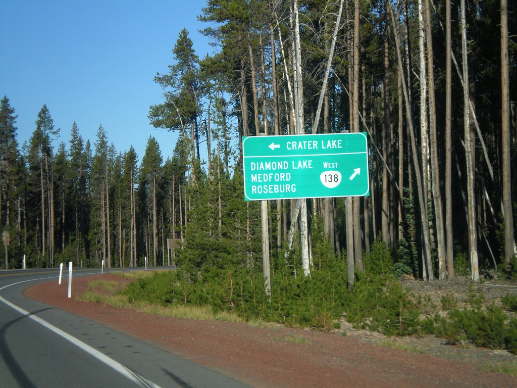
OR-138 west at Crater Lake North Entrance
OR-138 west at Crater Lake north entrance. Continue right for OR-138 west to Diamond Lake, Medford, and Roseburg.
Taken 09-20-2009
 Crescent
Douglas County
Oregon
United States
Crescent
Douglas County
Oregon
United States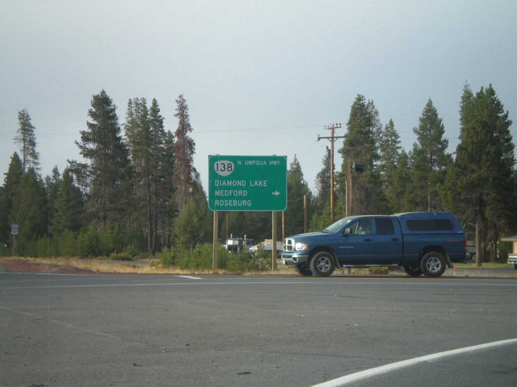
US-97 South at OR-138
US-97 south at OR-138 (North Umpqua Highway) west to Diamond Lake, Medford, and Roseburg.
Taken 09-20-2009
 Chemult
Klamath County
Oregon
United States
Chemult
Klamath County
Oregon
United States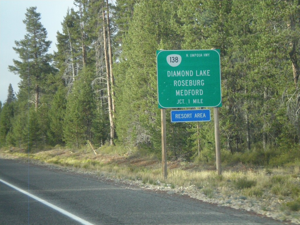
US-97 South Approaching OR-138
US-97 south approaching OR-138 (North Umpqua Highway) to Diamond Lake, Roseburg, and Medford.
Taken 09-20-2009
Chemult
Klamath County
Oregon
United States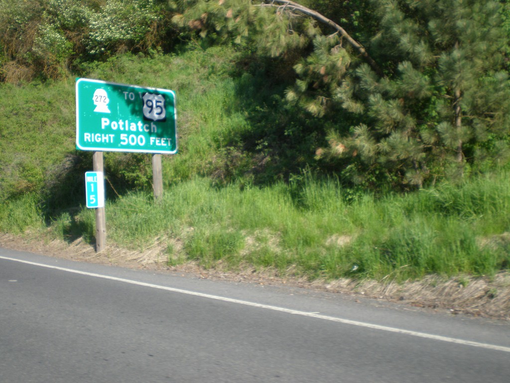
WA-27 North Approaching WA-272 to US-95
WA-27 north approaching WA-272 to US-95 to Potlatch (Idaho). Normally US highway shields on big green signs in Washington are cutout and do not have the black box around the shield.
Taken 05-25-2009

 Palouse
Whitman County
Washington
United States
Palouse
Whitman County
Washington
United States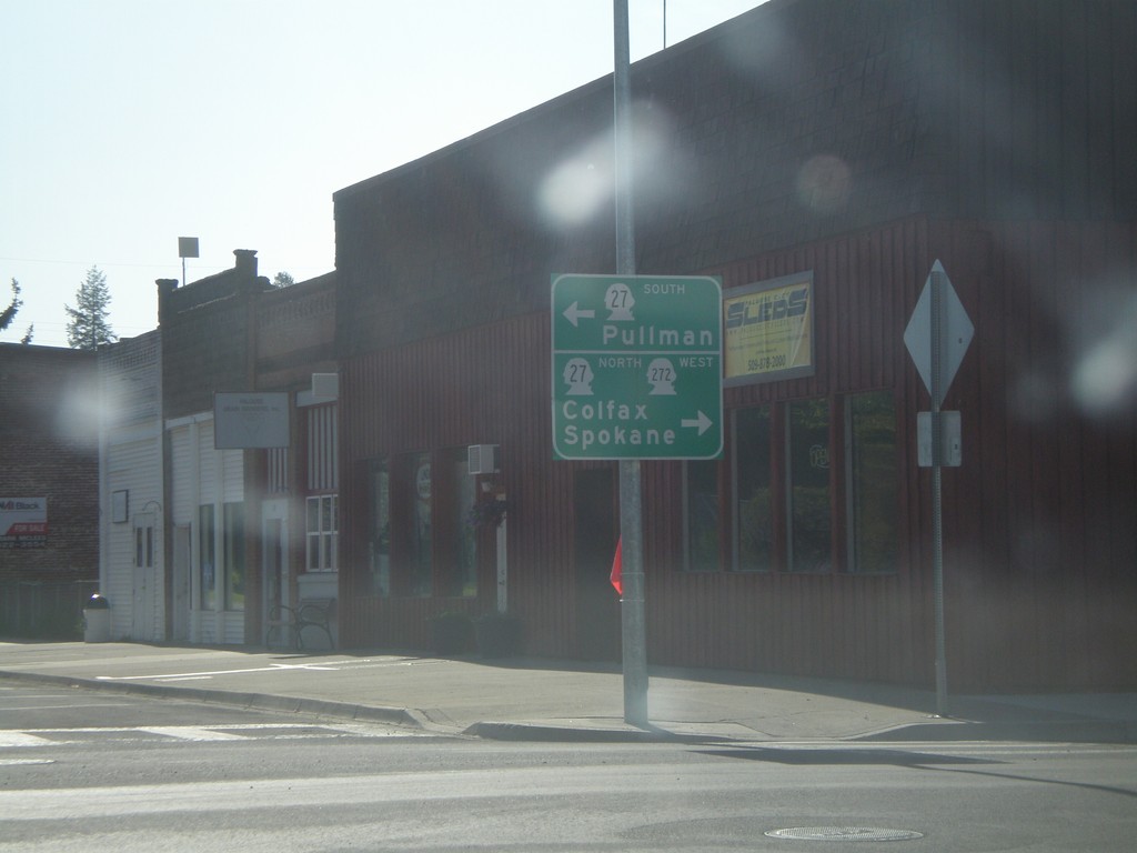
WA-272 West at WA-27
WA-272 west at WA-27. Use WA-27 south for Pullman. Use WA-27 North/WA-272 West for Colfax and Spokane. WA-272 joins WA-27 north through Palouse.
Taken 05-25-2009
Palouse
Whitman County
Washington
United States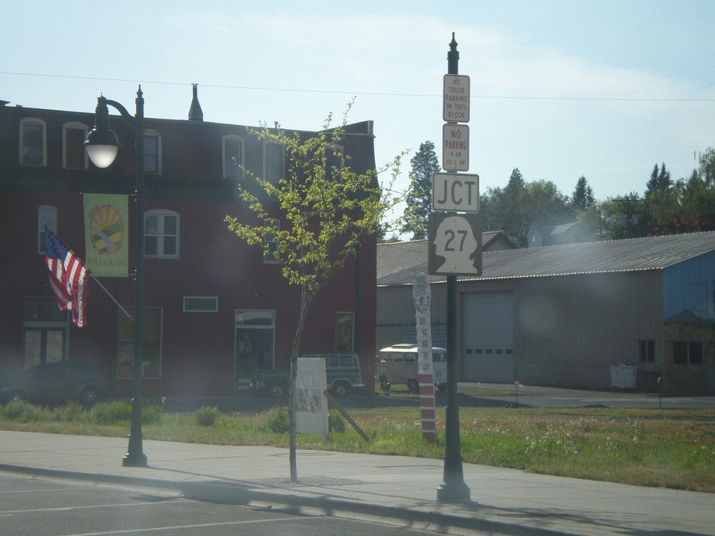
WA-272 West Approaching WA-27
WA-272 west approaching WA-27.
Taken 05-25-2009
Palouse
Whitman County
Washington
United States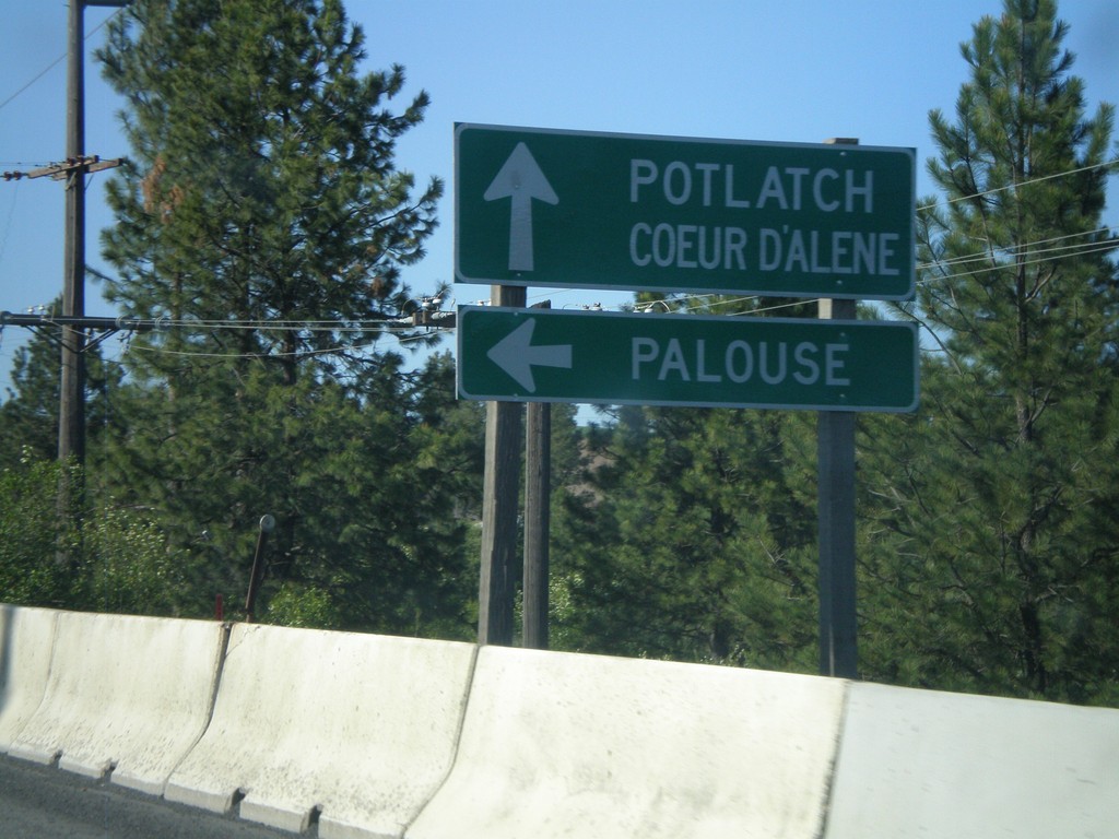
US-95 north at ID-6 West
US-95 north at ID-6 west to Palouse. ID-6 joins US-95 north to Potlatch.
Taken 05-25-2009

 Potlatch
Latah County
Idaho
United States
Potlatch
Latah County
Idaho
United States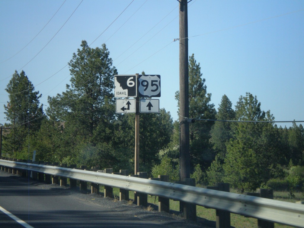
UD-95 north at ID-6 West
US-95 north at ID-6 west.
Taken 05-25-2009
Potlatch Latah County Idaho United States