Signs Tagged With Intersection
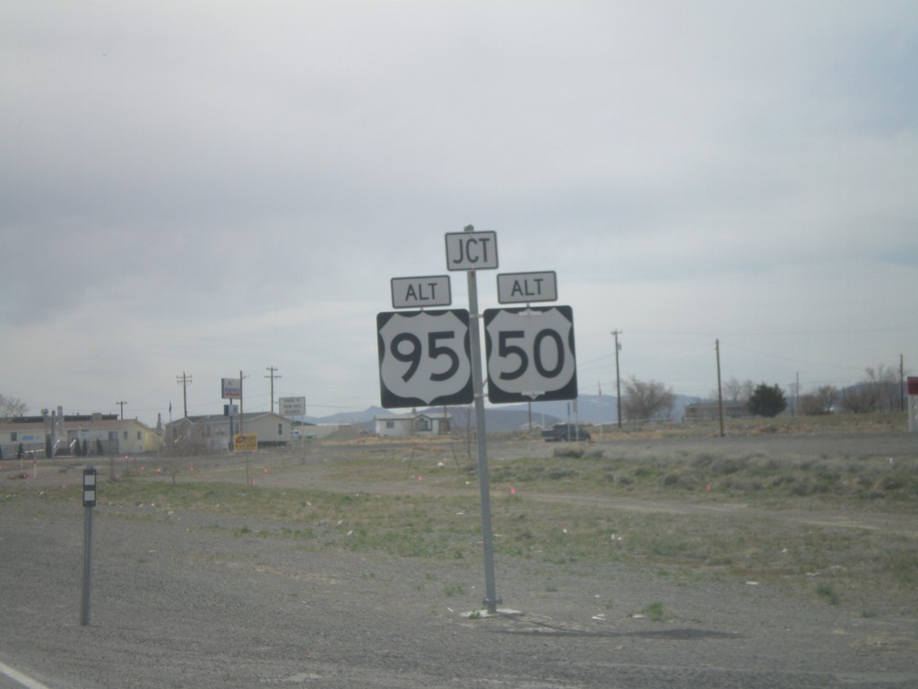
US-50 West Approaching Alt. US-50 and Alt. US-95
US-50 west at Alt US-50/Alt US-95 junction in Silver Springs.
Taken 04-15-2010


 Silver Springs
Lyon County
Nevada
United States
Silver Springs
Lyon County
Nevada
United States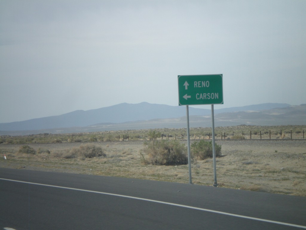
US-50 West at Alt. US-50 West
US-50 west at Alt. US-50 west. Use US-50 west for Carson (City). Continue ahead for Alt. US-50 west to Reno.
Taken 04-15-2010
Fallon
Churchill County
Nevada
United States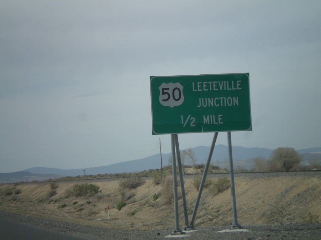
US-50 West - Leeteville Junction
US-50 west approaching Leeteville Junction of US-50 and Alt. US-50.
Taken 04-15-2010
Fallon
Churchill County
Nevada
United States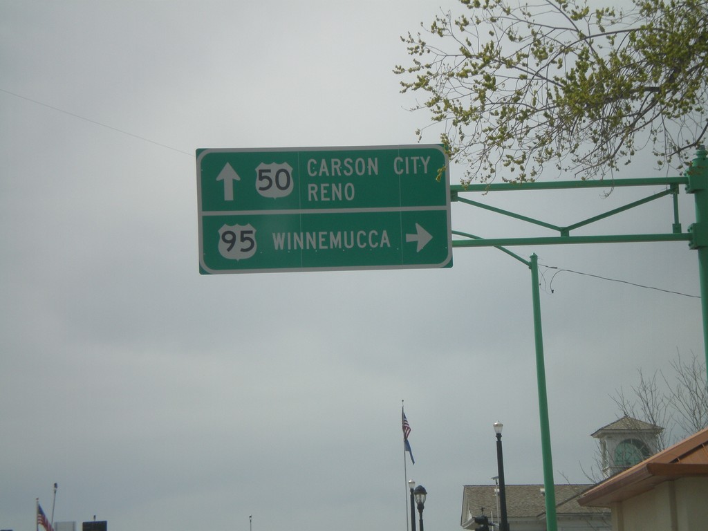
US-50 West at US-95 North
US-50 west at US-95 north to Winnemucca. Continue on US-50 west for Carson City and Reno.
Taken 04-15-2010
 Fallon
Churchill County
Nevada
United States
Fallon
Churchill County
Nevada
United States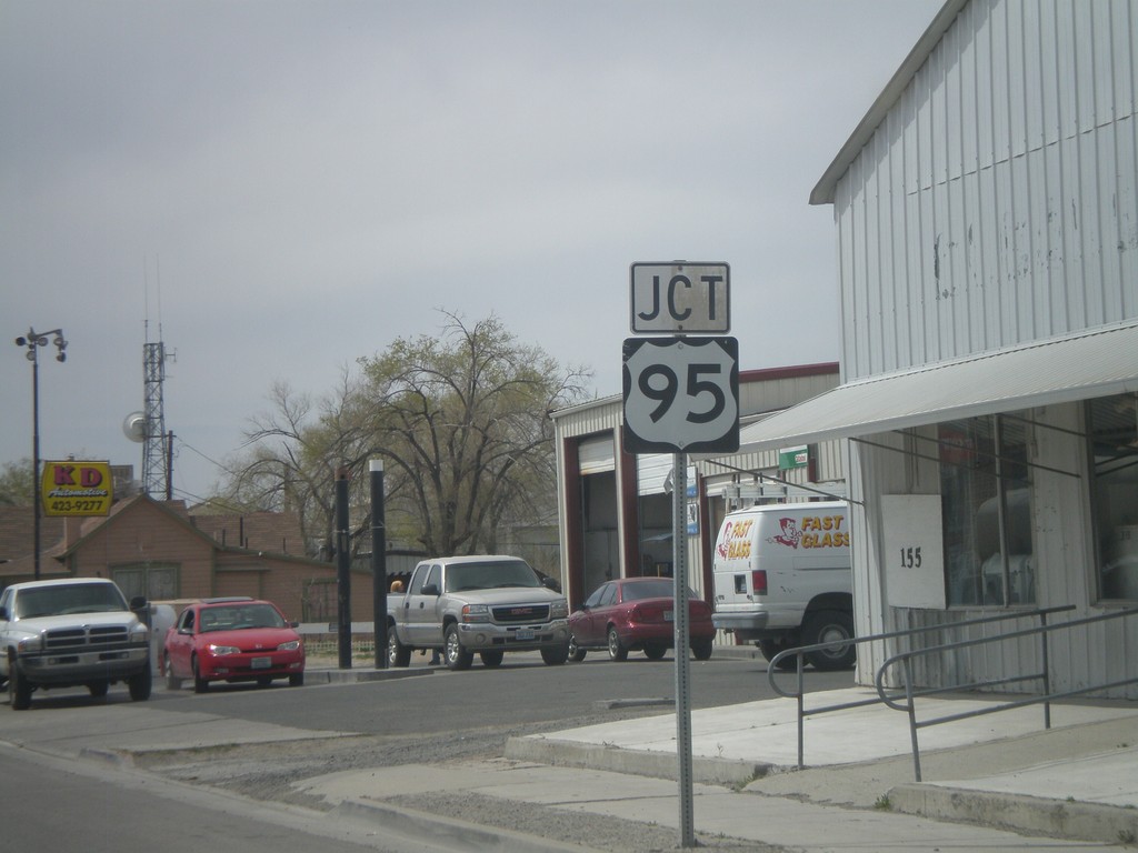
US-50 West Approaching US-95
US-50 west approaching US-95.
Taken 04-15-2010
Fallon
Churchill County
Nevada
United States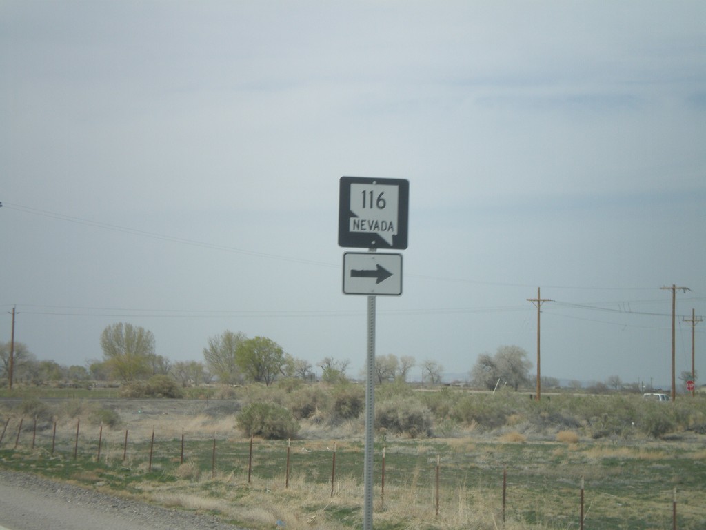
US-50 West Approaching NV-116
US-50 west approaching NV-116
Taken 04-15-2010
 Fallon
Churchill County
Nevada
United States
Fallon
Churchill County
Nevada
United States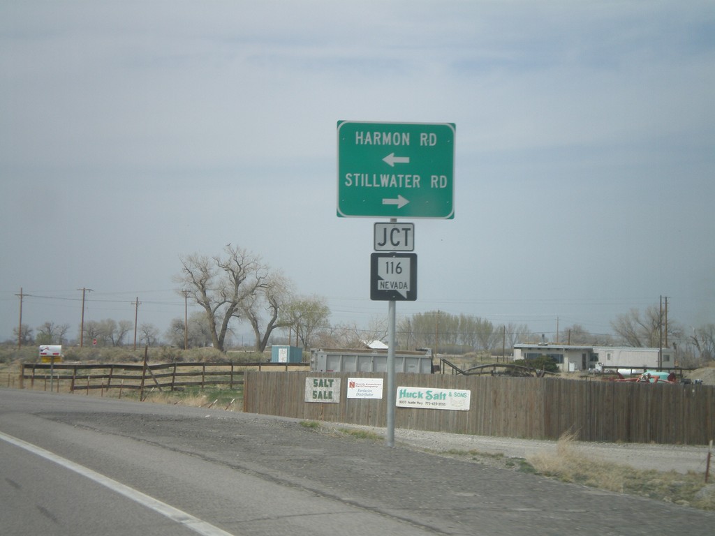
US-50 West at NV-116
US-50 west at NV-116 - Stillwater Road and Harmon Road.
Taken 04-15-2010
Fallon
Churchill County
Nevada
United States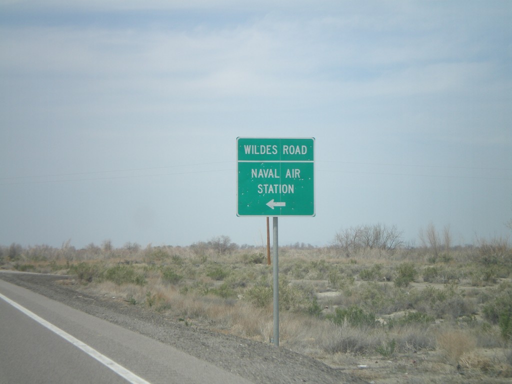
US-50 West at NV-118
US-50 west at NV-118 - Wildes Road to the Naval Air Station.
Taken 04-15-2010
 Fallon Station
Churchill County
Nevada
United States
Fallon Station
Churchill County
Nevada
United States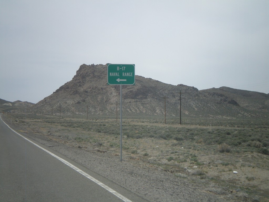
US-50 West at NV-839 South
US-50 west at NV-839 south to B-17 Naval Range.
Taken 04-15-2010
 Fallon
Churchill County
Nevada
United States
Fallon
Churchill County
Nevada
United States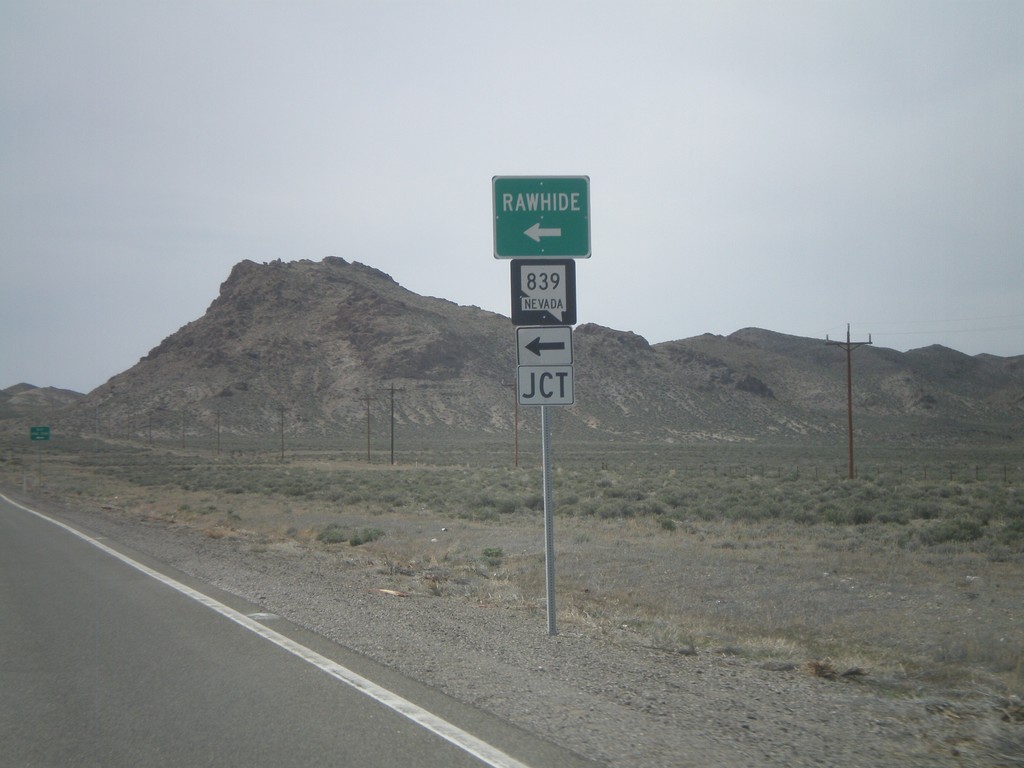
US-50 West at NV-839
US-50 west at NV-839 south to Rawhide.
Taken 04-15-2010
Fallon
Churchill County
Nevada
United States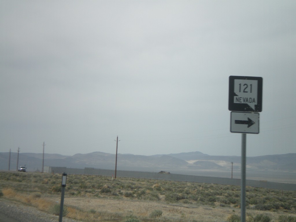
US-50 West Approaching NV-121
US-50 west approaching NV-121
Taken 04-15-2010
 Fallon
Churchill County
Nevada
United States
Fallon
Churchill County
Nevada
United States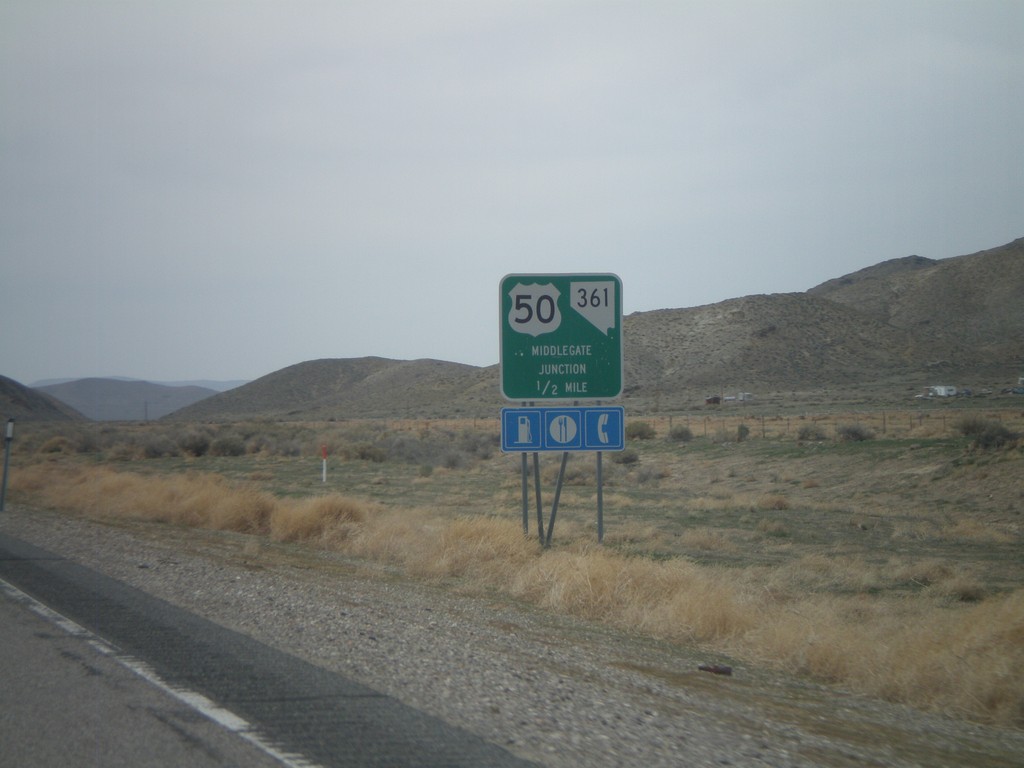
US-50 West Approaching Middlegate Jct.
US-50 west approaching Middlegate Junction (NV-361).
Taken 04-15-2010
 Fallon
Churchill County
Nevada
United States
Fallon
Churchill County
Nevada
United States
US-50 West at NV-722 West
US-50 west at NV-722 west
Taken 04-15-2010
 Austin
Lander County
Nevada
United States
Austin
Lander County
Nevada
United States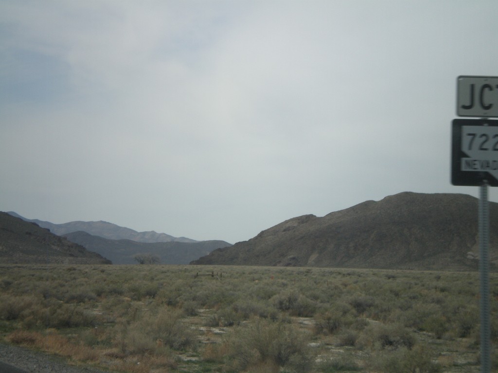
US-50 West Approaching NV-722
US-50 west approaching NV-722
Taken 04-15-2010
Fallon
Churchill County
Nevada
United States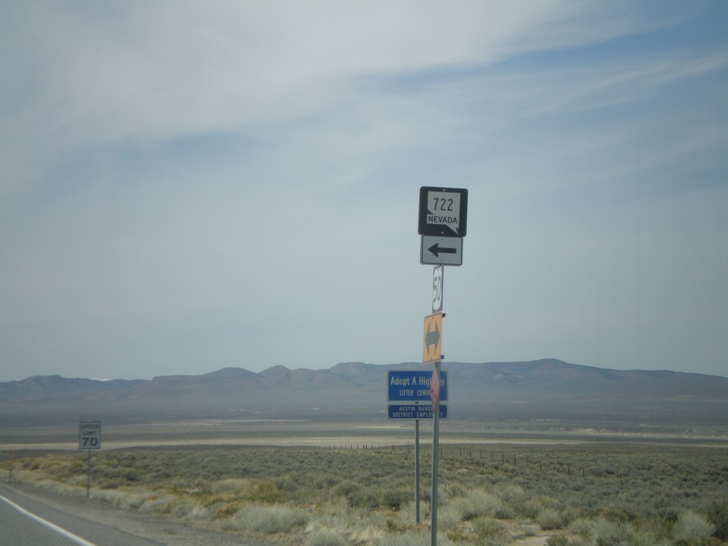
US-50 West at NV-722 East
US-50 west at NV-722 east
Taken 04-15-2010
Middlegate
Churchill County
Nevada
United States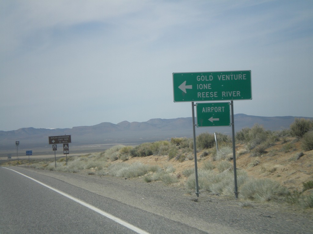
US-50 West Approaching NV-722
US-50 west approaching NV-722 west to Ione, Reese River, Gold Venture, and the Austin Airport.
Taken 04-15-2010
Austin
Lander County
Nevada
United States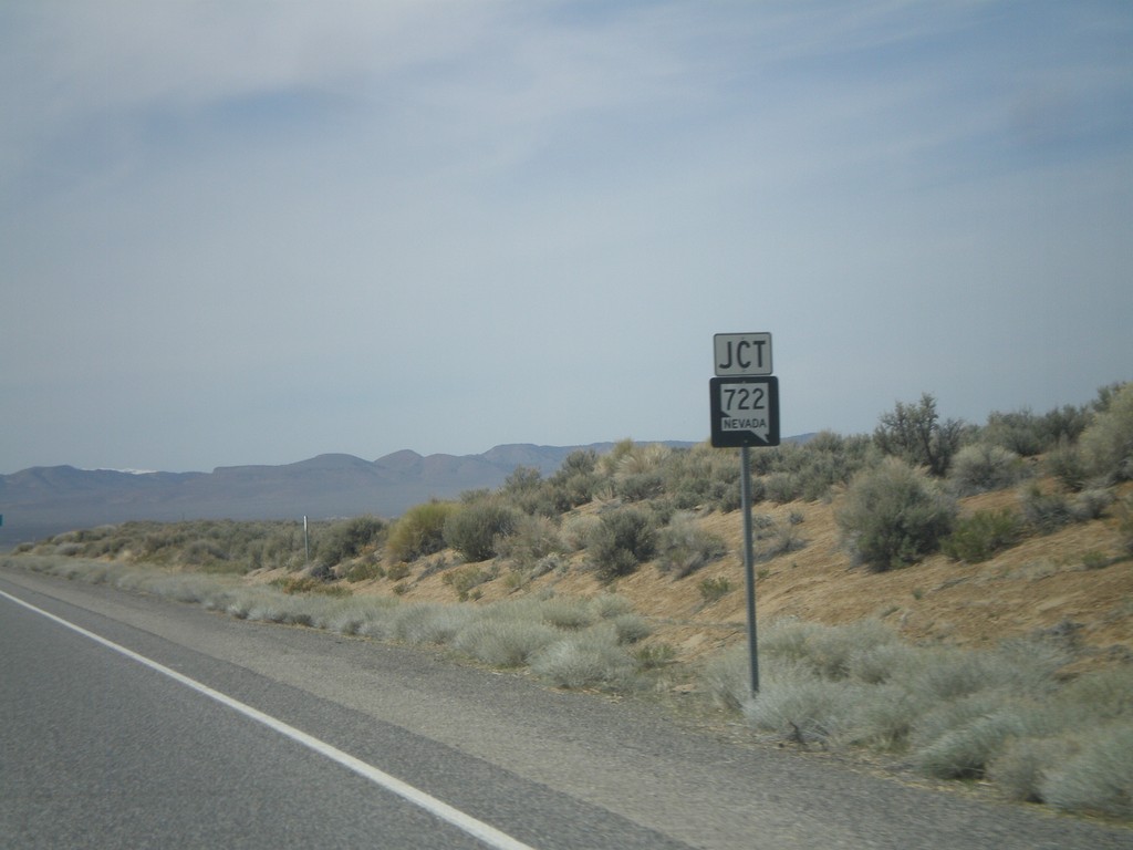
US-50 West Approaching NV-722
US-50 west approaching NV-722
Taken 04-15-2010
Austin
Lander County
Nevada
United States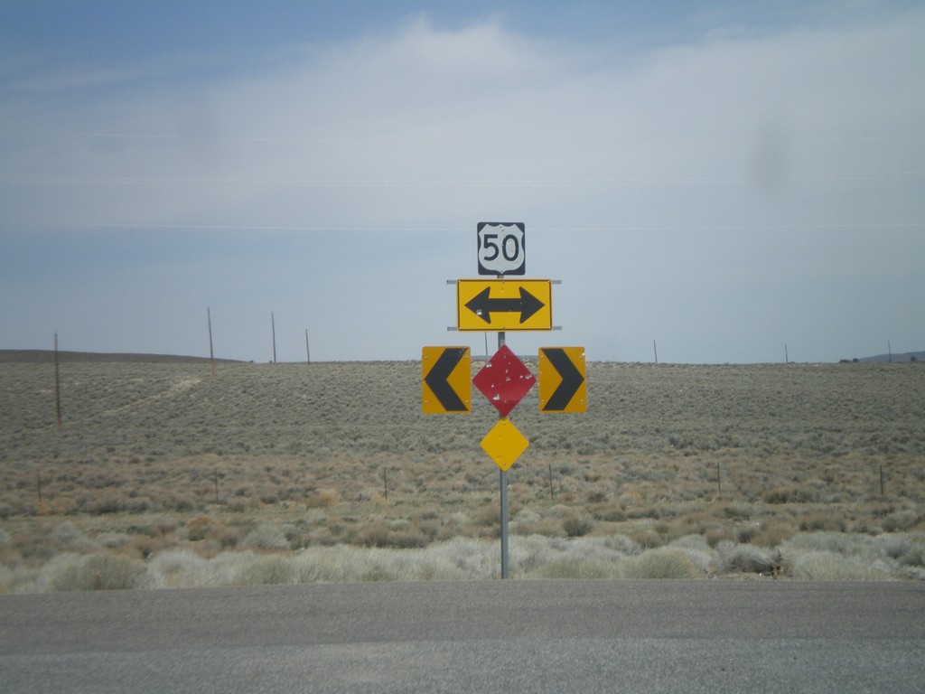
End NV-376 North at US-50
End NV-376 north at US-50
Taken 04-15-2010
 Austin
Lander County
Nevada
United States
Austin
Lander County
Nevada
United States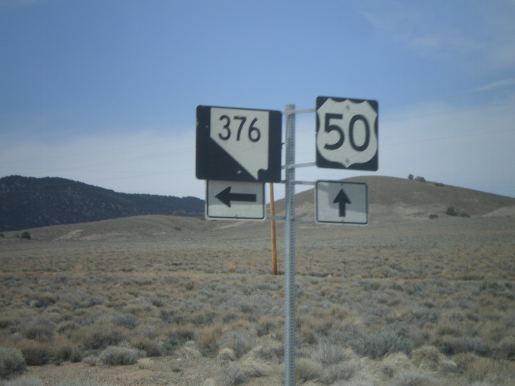
US-50 West approaching NV-376
US-50 west approaching NV-376
Taken 04-15-2010
Austin
Lander County
Nevada
United States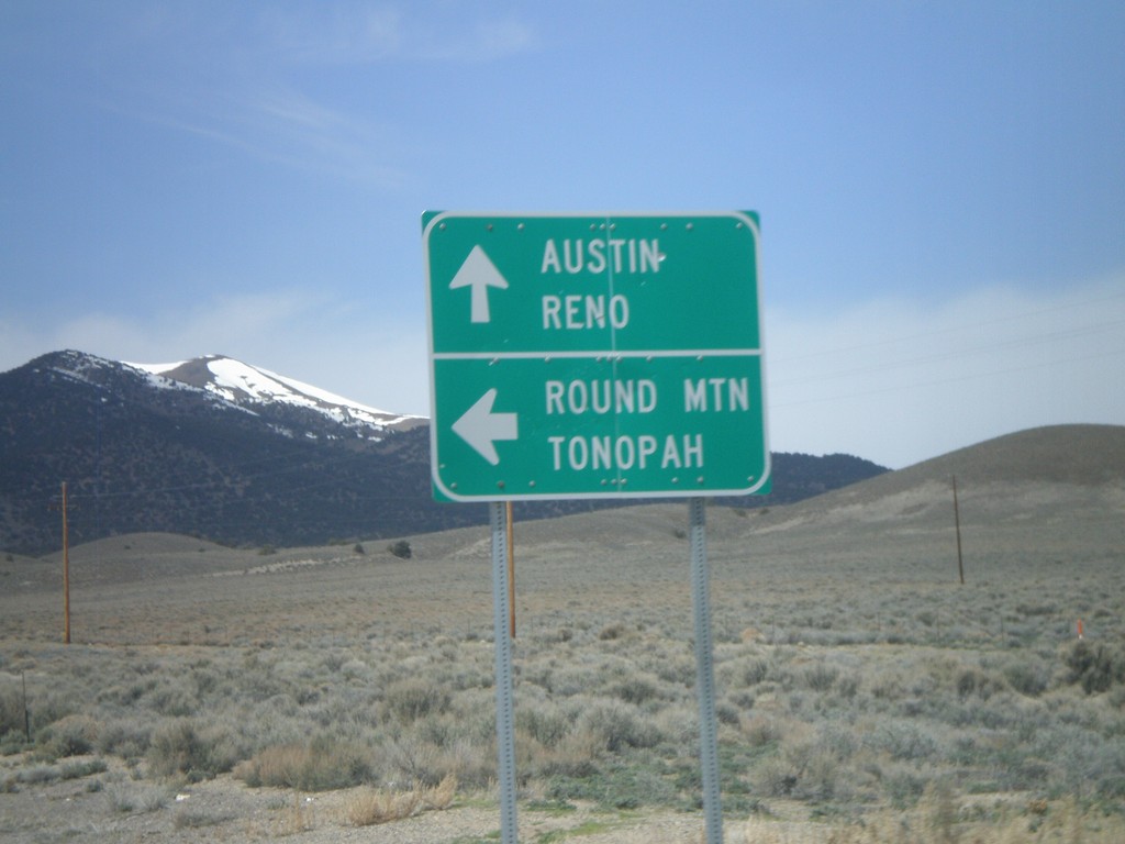
US-50 West at NV-376 South
US-50 west at NV-376 south for Round Mountain and Tonopah. Continue west for Austin and Reno.
Taken 04-15-2010
Austin
Lander County
Nevada
United States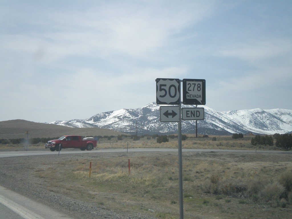
NV-278 South Approaching US-50
NV-278 south approaching US-50
Taken 04-15-2010
 Eureka
 County
Nevada
United States
Eureka
Eureka County
Nevada
United States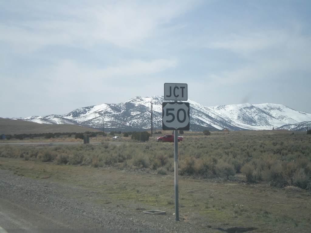
Jct. US-50 On NV-278 South
Jct. US-50 on NV-278 South
Taken 04-15-2010
Eureka
Eureka County
Nevada
United States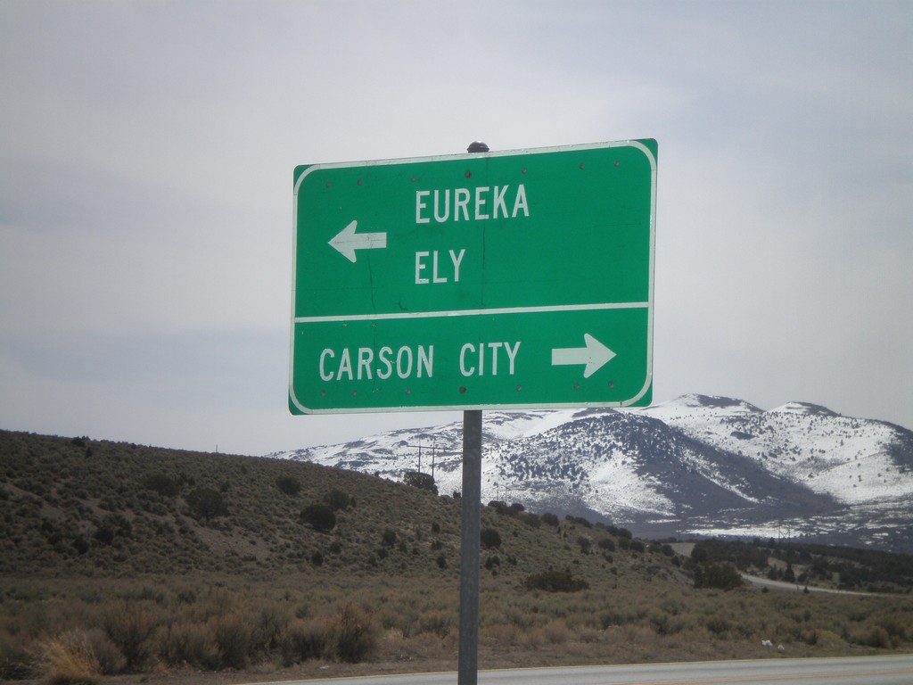
End NV-278 South at US-50
End NV-278 south at US-50. Use US-50 west for Carson City. Use US-50 east for Eureka and Ely.
Taken 04-15-2010
Eureka
Eureka County
Nevada
United States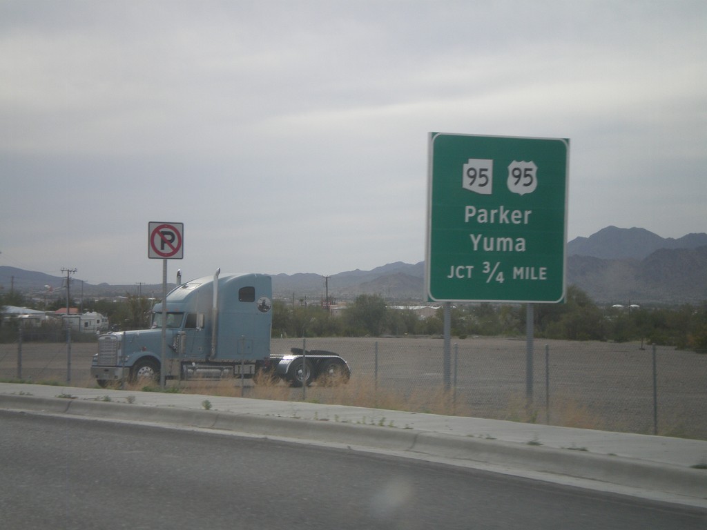
BL-10 West Approaching US-95/AZ-95
BL-10 west approaching US-95 south to Yuma, and AZ-95 north to Parker.
Taken 03-22-2010

 Quartzsite
La Paz County
Arizona
United States
Quartzsite
La Paz County
Arizona
United States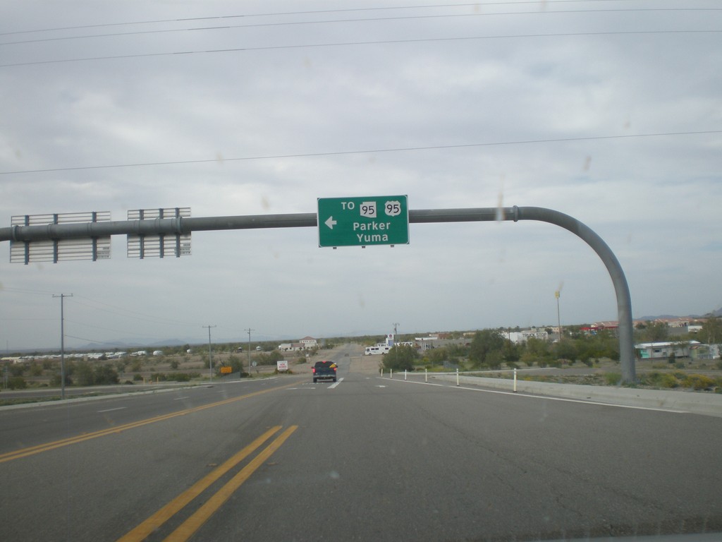
BL-10 West at Main St. - Quartzsite
BL-10 west at Main St. in Quartzsite. Turn left on Main St. for US-95, AZ-95 to Yuma and Parker. Turn left to continue on BL-10.
Taken 03-22-2010
Quartzsite
La Paz County
Arizona
United States