Signs Tagged With Intersection
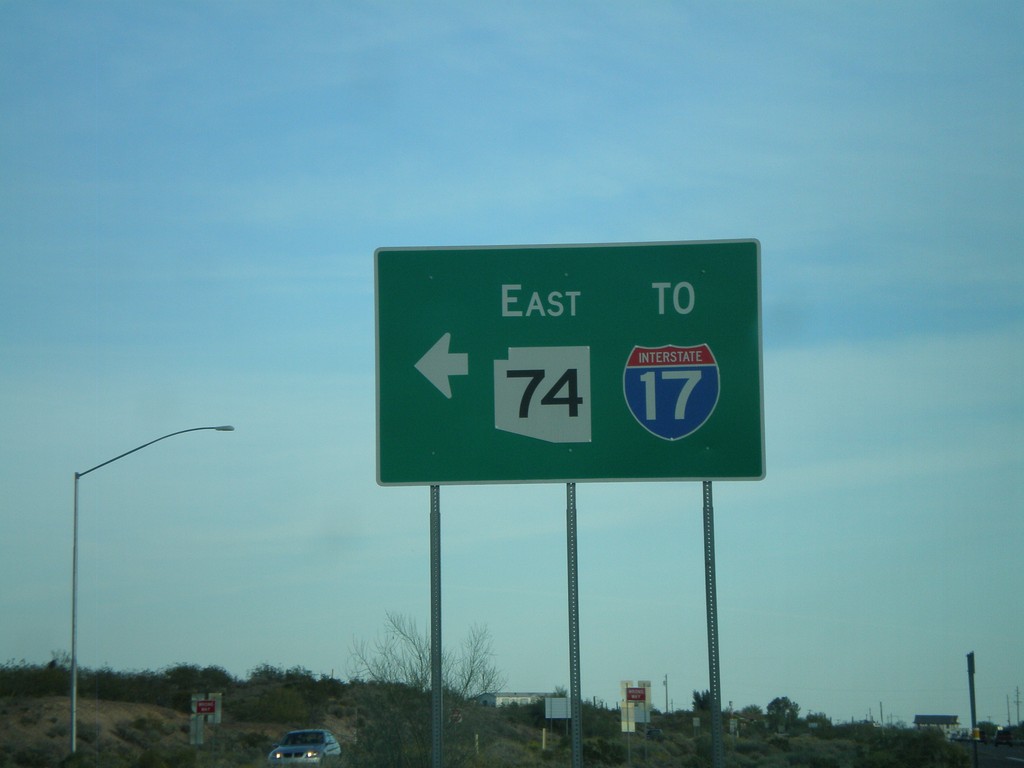
US-60 East at AZ-74
US-60 east at AZ-74 east to I-17.
Taken 03-21-2009


 Morristown
Maricopa County
Arizona
United States
Morristown
Maricopa County
Arizona
United States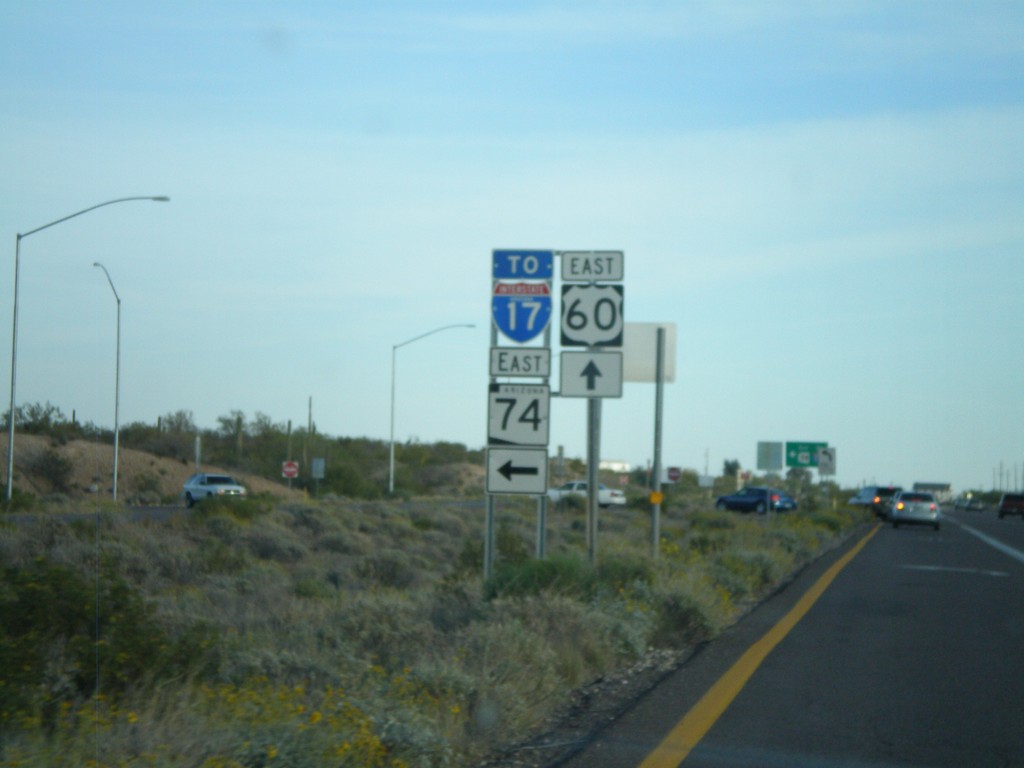
US-60 East Approaching AZ-74
US-60 east approaching AZ-74 east to I-17.
Taken 03-21-2009
Morristown
Maricopa County
Arizona
United States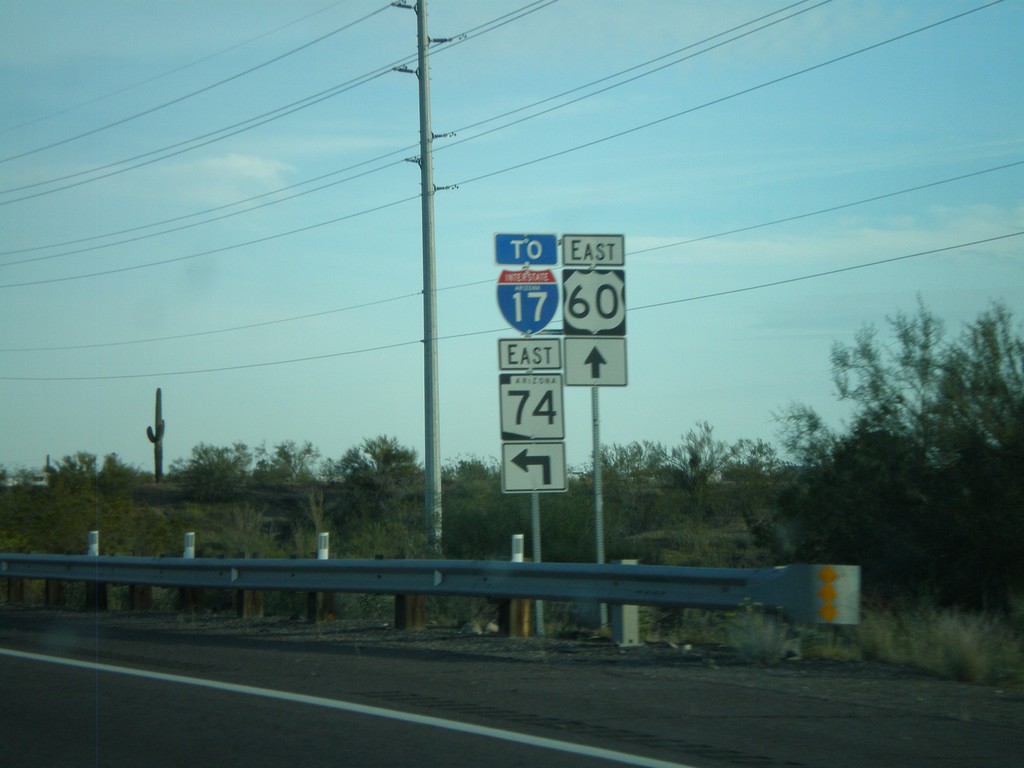
US-60 East Approaching AZ-74
US-60 east approaching AZ-74 east to I-17.
Taken 03-21-2009
Morristown
Maricopa County
Arizona
United States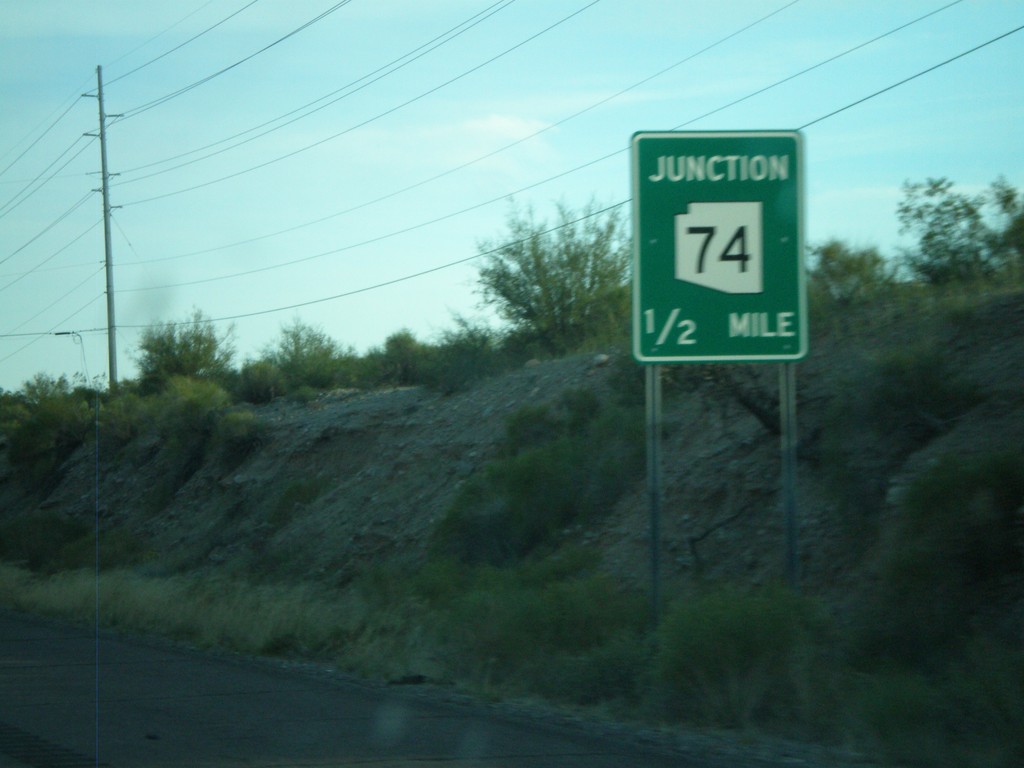
US-60 East Approaching AZ-74
US-60 east approaching AZ-74.
Taken 03-21-2009
Morristown
Maricopa County
Arizona
United States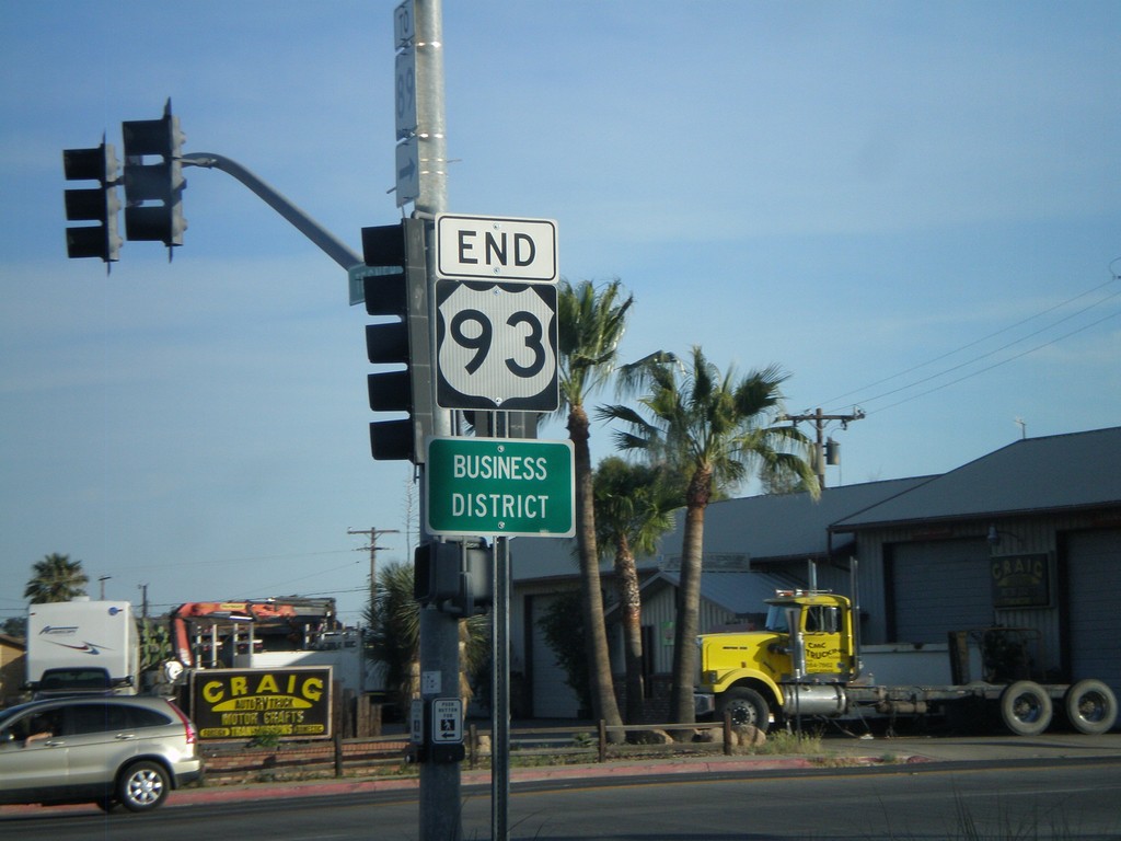
End US-93 South at US-60
End US-93 south at US-60. US-93 continues north from here to Eureka, MT and crosses into Canada at the Port of Roosville. US-93 becomes BC-93 and later AB-93 ending in Jasper, Alberta.
Taken 03-21-2009
 Wickenburg
Maricopa County
Arizona
United States
Wickenburg
Maricopa County
Arizona
United States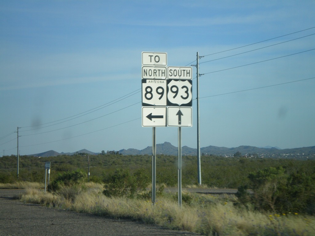
US-93 South at AZ-89
US-93 South at access road to AZ-89 in Yavapai County.
Taken 03-21-2009
 Wickenburg
Yavapai County
Arizona
United States
Wickenburg
Yavapai County
Arizona
United States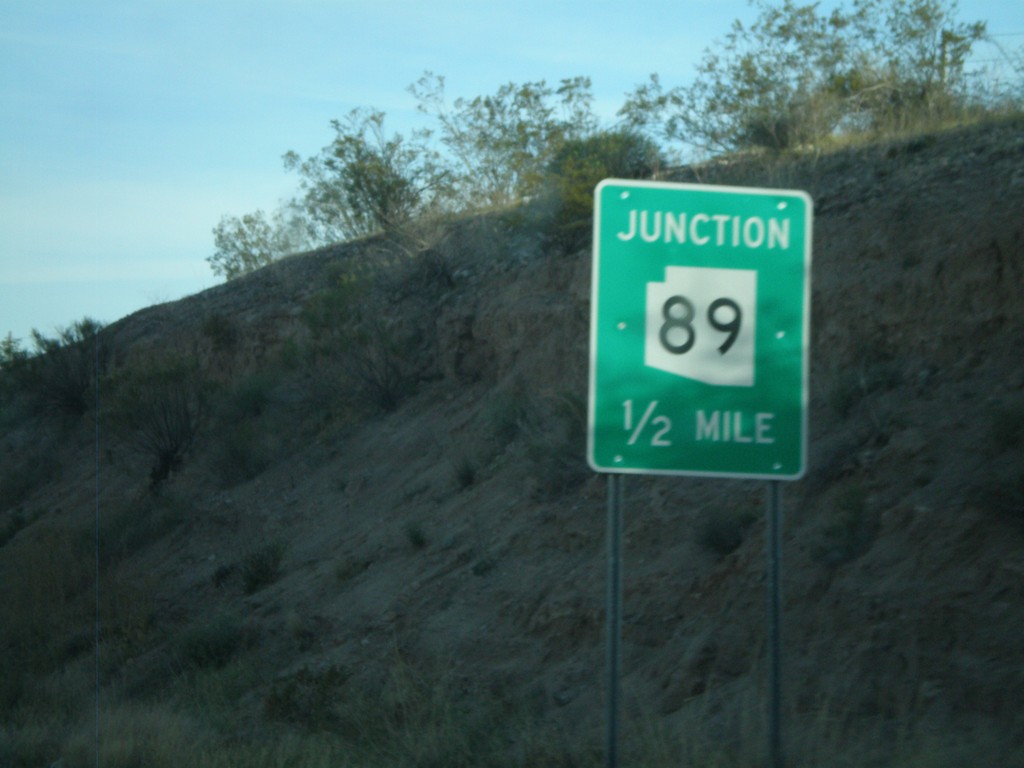
US-93 South Approaching AZ-89
US-93 south approaching AZ-89.
Taken 03-21-2009
Wickenburg
Yavapai County
Arizona
United States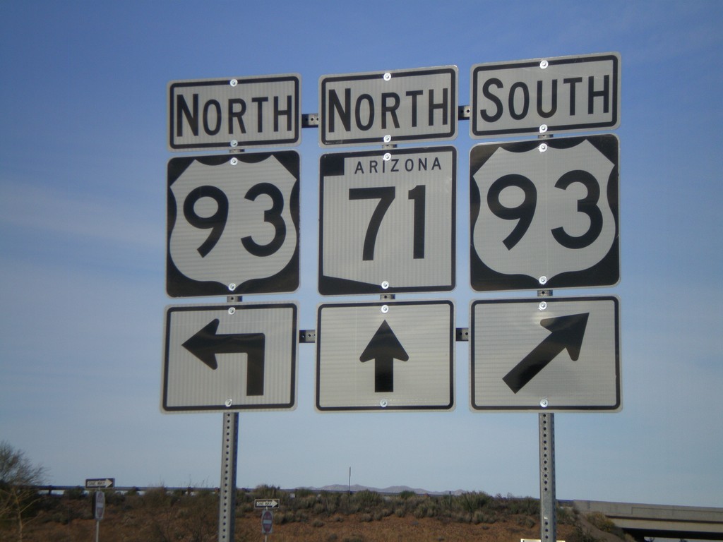
AZ-71 North at US-93
AZ-71 north at US-93.
Taken 03-21-2009
 Congress
Yavapai County
Arizona
United States
Congress
Yavapai County
Arizona
United States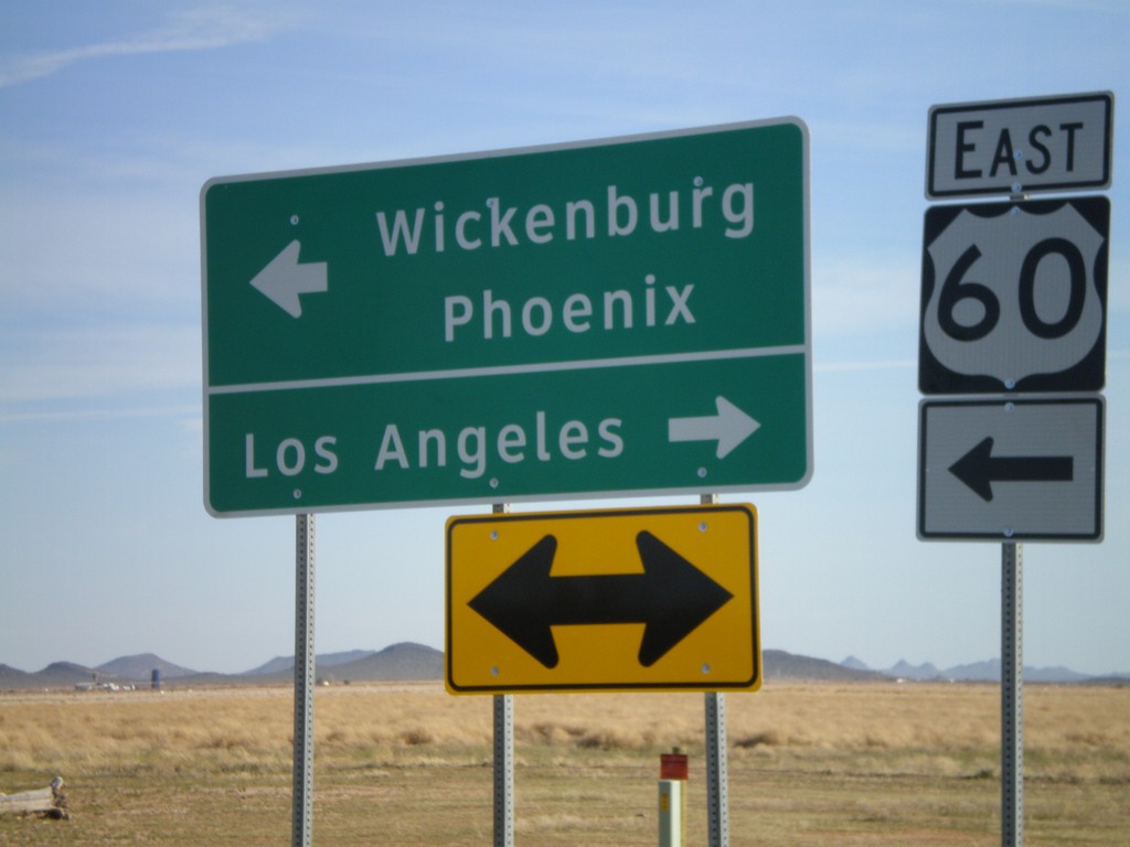
End AZ-71 South at US-60
End AZ-71 south at US-60. Use US-60 east for Wickenburg and Phoenix. Use US-60 west for Los Angeles.
Taken 03-21-2009
Aguila
Maricopa County
Arizona
United States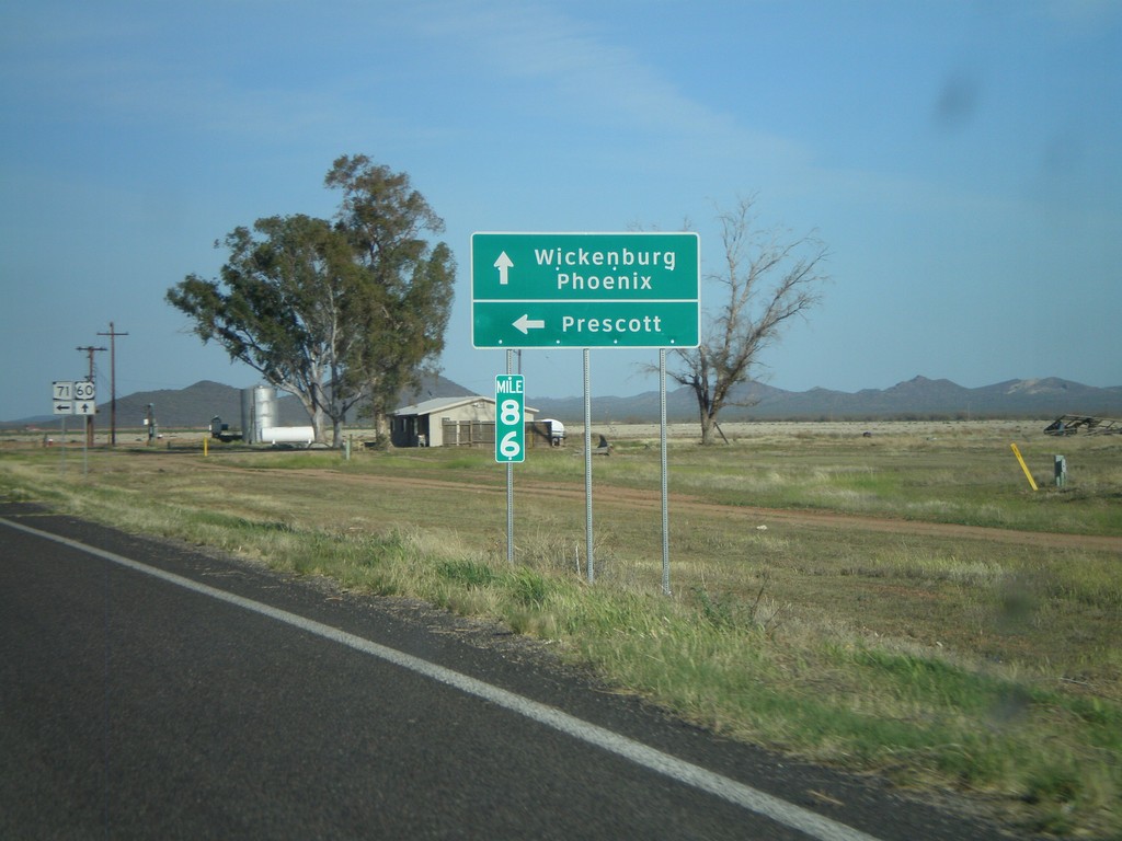
US-60 East at AZ-71
US-60 east at AZ-71 north to Prescott. Continue on US-60 for Wickenburg and Phoenix.
Taken 03-21-2009
Wickenburg
Maricopa County
Arizona
United States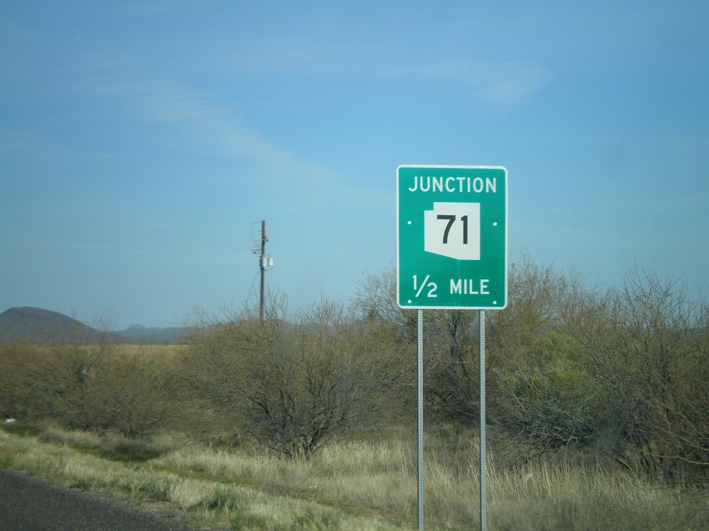
US-60 East Approaching AZ-71
US-60 east approaching AZ-71.
Taken 03-21-2009
Aguila
Maricopa County
Arizona
United States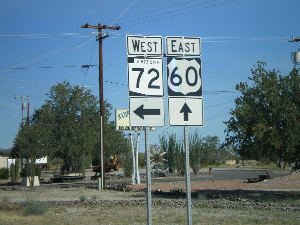
US-60 East at AZ-72
US-60 east at AZ-72 west.
Taken 03-21-2009
 Salome
La Paz County
Arizona
United States
Salome
La Paz County
Arizona
United States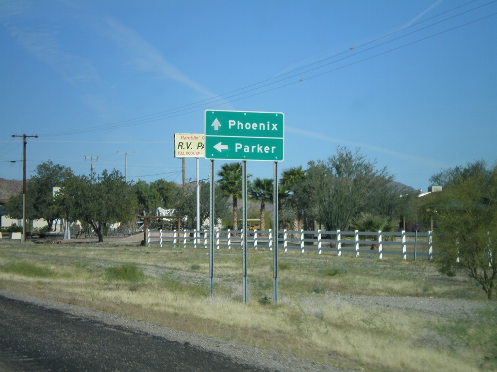
US-60 East Approaching AZ-72
US-60 east approaching AZ-72 west to Parker. Continue on US-60 east towards Phoenix.
Taken 03-21-2009
Salome
La Paz County
Arizona
United States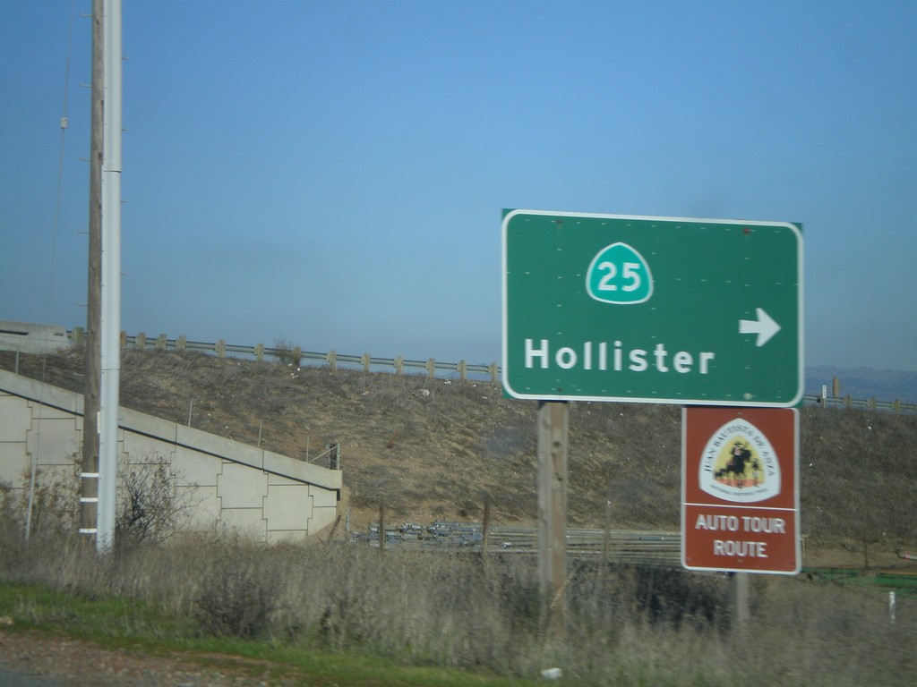
US-101 North at CA-25
US-101 north at CA-25 south to Hollister
Taken 01-01-2009

 Gilroy
Santa Clara County
California
United States
Gilroy
Santa Clara County
California
United States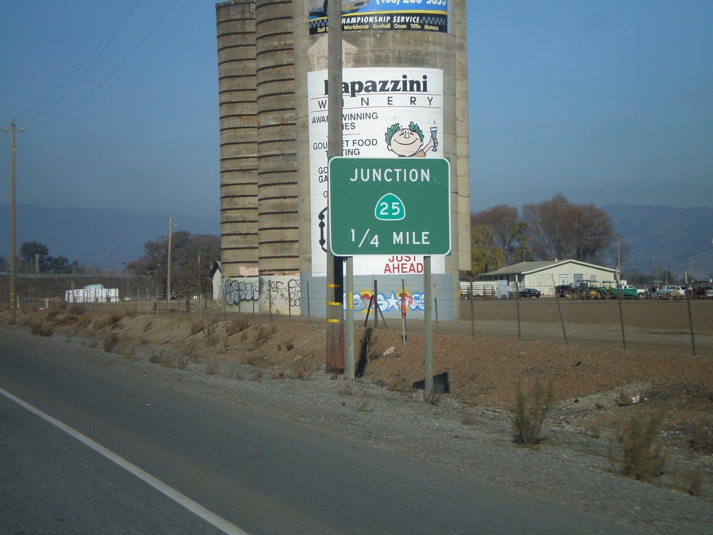
US-101 North Approaching CA-25
US-101 north approaching CA-25.
Taken 01-01-2009
Gilroy
Santa Clara County
California
United States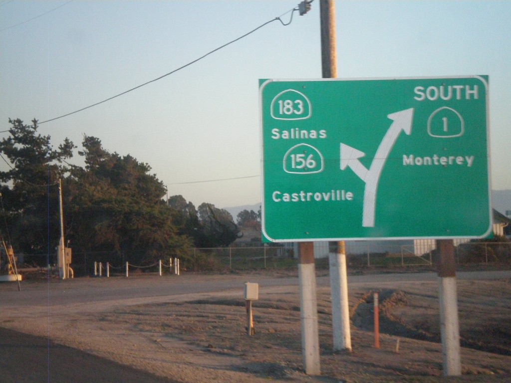
CA-1 South at CA-183 South (To CA-156)
Diagram of CA-1 south at CA-183. Use CA-183 south for CA-156 to Castroville and Salinas.
Taken 12-31-2008


 Castroville
Monterey County
California
United States
Castroville
Monterey County
California
United States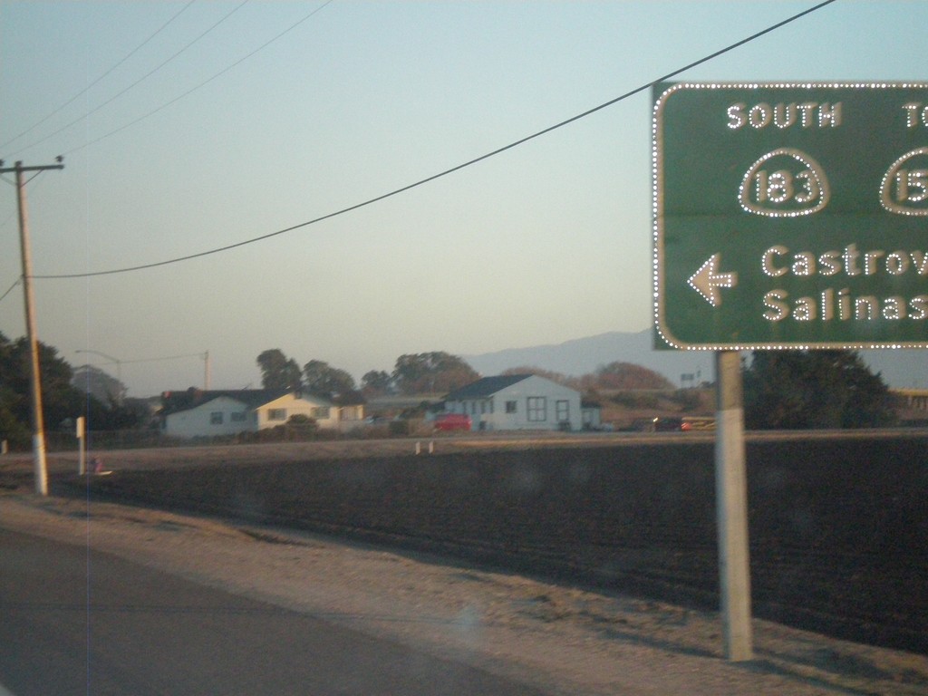
CA-1 South at CA-183
CA-1 south at CA-183/To CA-156/Castroville/Salinas.
Taken 12-31-2008
Castroville
Monterey County
California
United States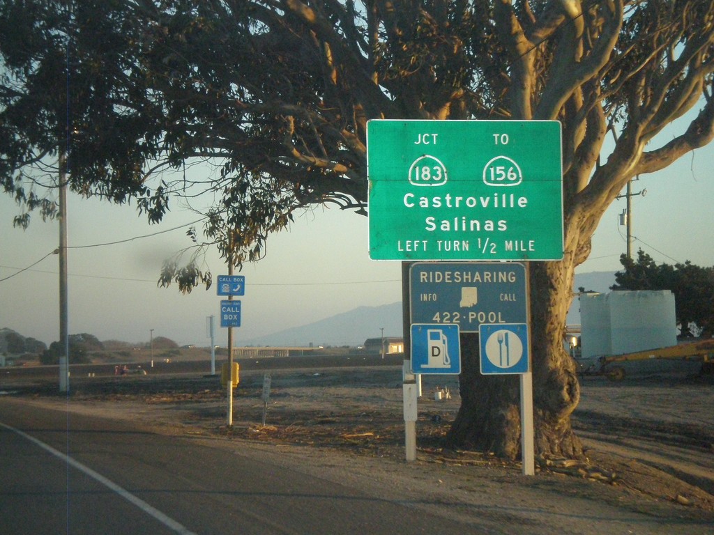
CA-1 South at CA-183
CA-1 south at CA-183/To CA-156/Castroville/Salinas.
Taken 12-31-2008
Castroville
Monterey County
California
United States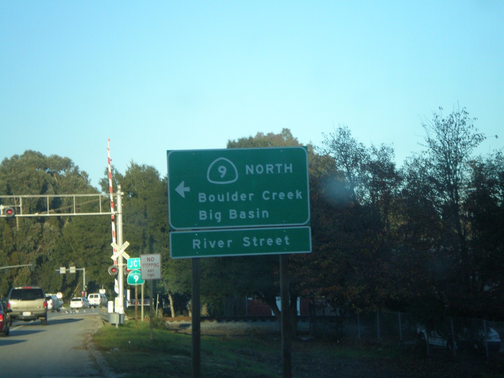
CA-1 South at CA-9 North
CA-1 South at CA-9 (River St.). Turn left for CA-9 North to Boulder creek/Big Basin.
Taken 12-31-2008
 Santa Cruz
 County
California
United States
Santa Cruz
Santa Cruz County
California
United States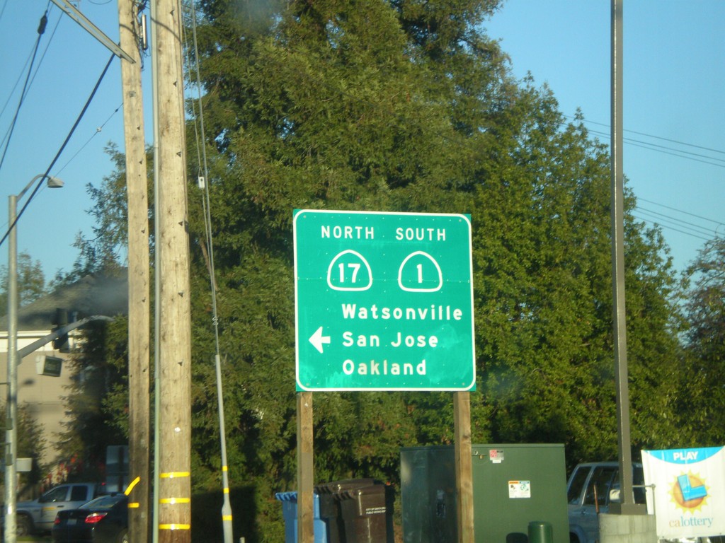
CA-1 South (Mission St.) at Cabrillo Highway
CA-1 South (Mission St.) at left turn for CA-1 (Cabrillo Highway). Left turn goes to CA-1 South/CA-17 North/Watsonville/San Jose/Oakland.
Taken 12-31-2008
 Santa Cruz
 County
California
United States
Santa Cruz
Santa Cruz County
California
United States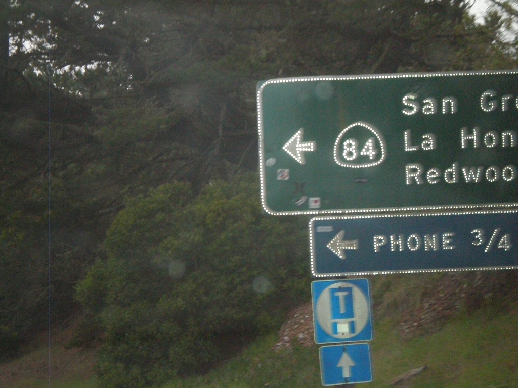
CA-1 South at CA-84
CA-1 south at CA-84 east to San Gregorio, La Honda, and Redwood City.
Taken 12-31-2008
 San Gregorio
San Mateo County
California
United States
San Gregorio
San Mateo County
California
United States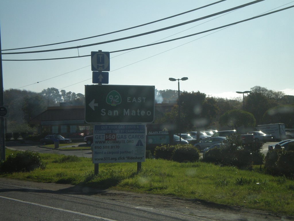
CA-1 South at CA-92 East
CA-1 South at CA-92 east to San Mateo.
Taken 12-31-2008
 Half Moon Bay
San Mateo County
California
United States
Half Moon Bay
San Mateo County
California
United States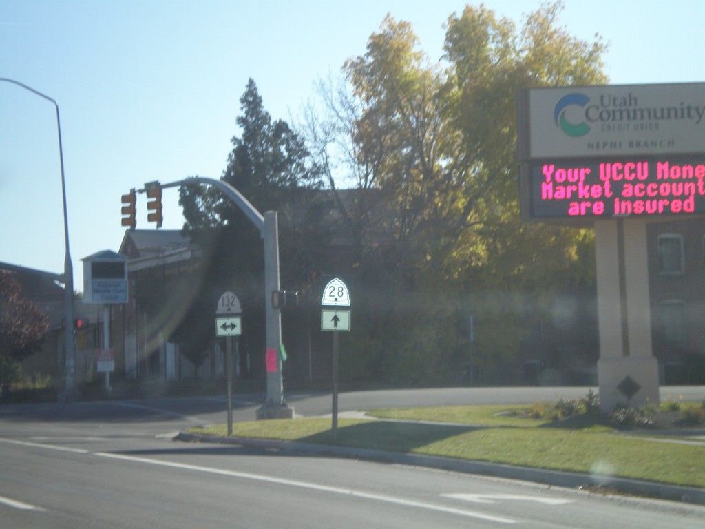
UT-28 South at UT-132
UT-28 south at UT-132. Notice the different shields used for UT-28 and UT-132. The UT-28 style is the newer style.
Taken 10-25-2008

 Nephi
Juab County
Utah
United States
Nephi
Juab County
Utah
United States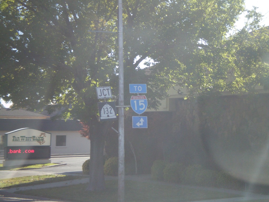
UT-28 South Approaching UT-132
UT-28 south approaching UT-132. For I-15 north use UT-132 east. For I-15 south use UT-28 south.
Taken 10-25-2008
 Nephi
Juab County
Utah
United States
Nephi
Juab County
Utah
United States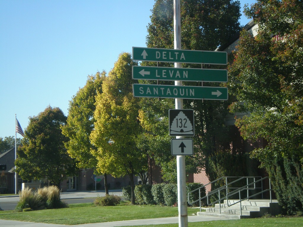
UT-132 West at UT-28
UT-132 west at UT-28. Use UT-28 north for Santaquin. Use UT-28 south for Levan. Continue on UT-132 for Delta.
Taken 10-25-2008
Nephi
Juab County
Utah
United States