Signs Tagged With Intersection
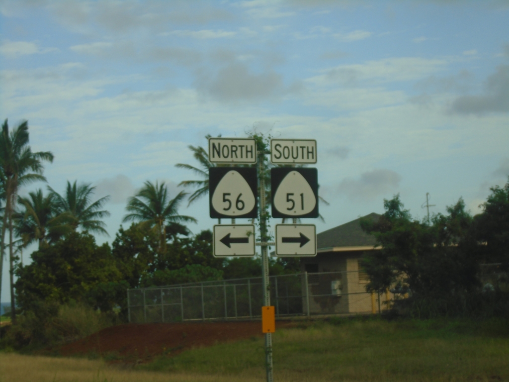
HI-56 North At HI-51 (Kapule Highway)
HI-56 North (Kūhiō Highway) at HI-51 (Kapule Highway).
Taken 02-18-2025

 Lihue
Kauai County
Hawaii
United States
Lihue
Kauai County
Hawaii
United States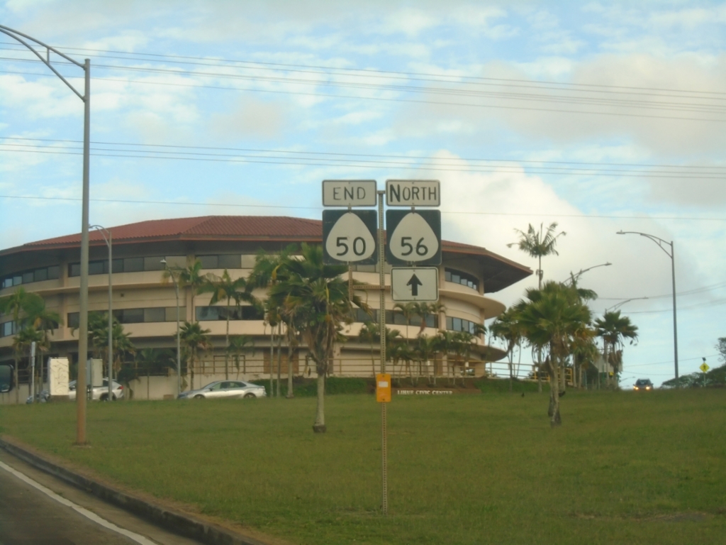
End HI-50 East at HI-56 and Rice St.
End HI-50 East (Kaumualiʻi Highway) at HI-56 North (Kūhiō Highway) and Rice St.
Taken 02-18-2025
 Lihue
Kauai County
Hawaii
United States
Lihue
Kauai County
Hawaii
United States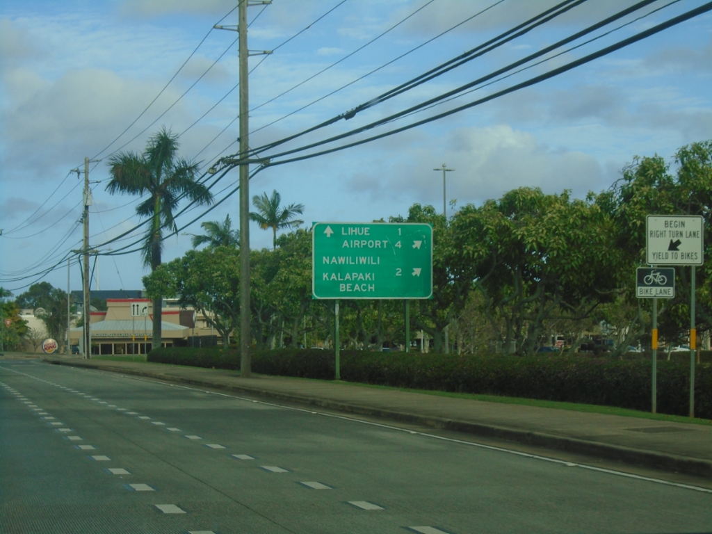
HI-50 East at HI-58 (Nāwiliwili Road)
HI-50 East (Kaumualiʻi Highway) at HI-58 (Nāwiliwili Road). Use HI-58 for Nāwiliwili and Kalapiki Beach. Continue east on HI-50 for Airport and Līhuʻe.
Taken 02-18-2025
 Lihue
Kauai County
Hawaii
United States
Lihue
Kauai County
Hawaii
United States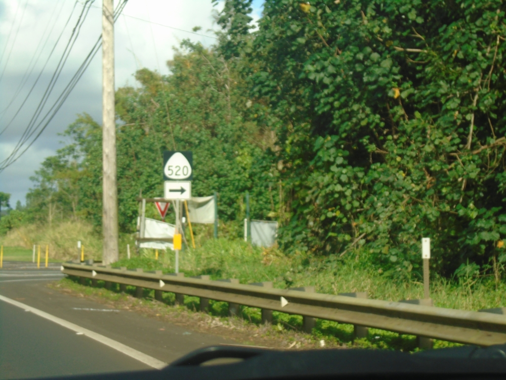
HI-50 East at HI-520 South (Kaumualiʻi Highway)
HI-50 East (Kaumualiʻi Highway) at HI-520 South (Maluhia Road).
Taken 02-18-2025
 Kalaheo
Kauai County
Hawaii
United States
Kalaheo
Kauai County
Hawaii
United States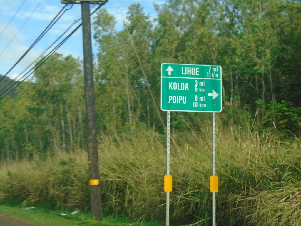
HI-50 East Approaching HI-520 (Maluhia Road)
HI-50 East (Kaumualiʻi Highway) approaching HI-520 (Maluhia Road) to Kōloa and Poʻipū. Continue east on HI-50 to Līhuʻe. This sign is in both miles and kilometers.
Taken 02-18-2025
Kalaheo
Kauai County
Hawaii
United States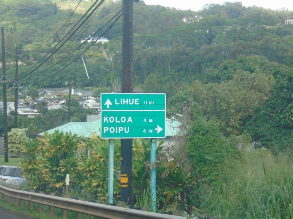
HI-50 East Approaching HI-530 (Kōloa Road)
HI-50 East (Kaumualiʻi Highway) approaching HI-530 (Kōloa Road) to Kōloa and Poʻipū. Continue east on HI-50 to Līhuʻe.
Taken 02-18-2025
 Kalaheo
Kauai County
Hawaii
United States
Kalaheo
Kauai County
Hawaii
United States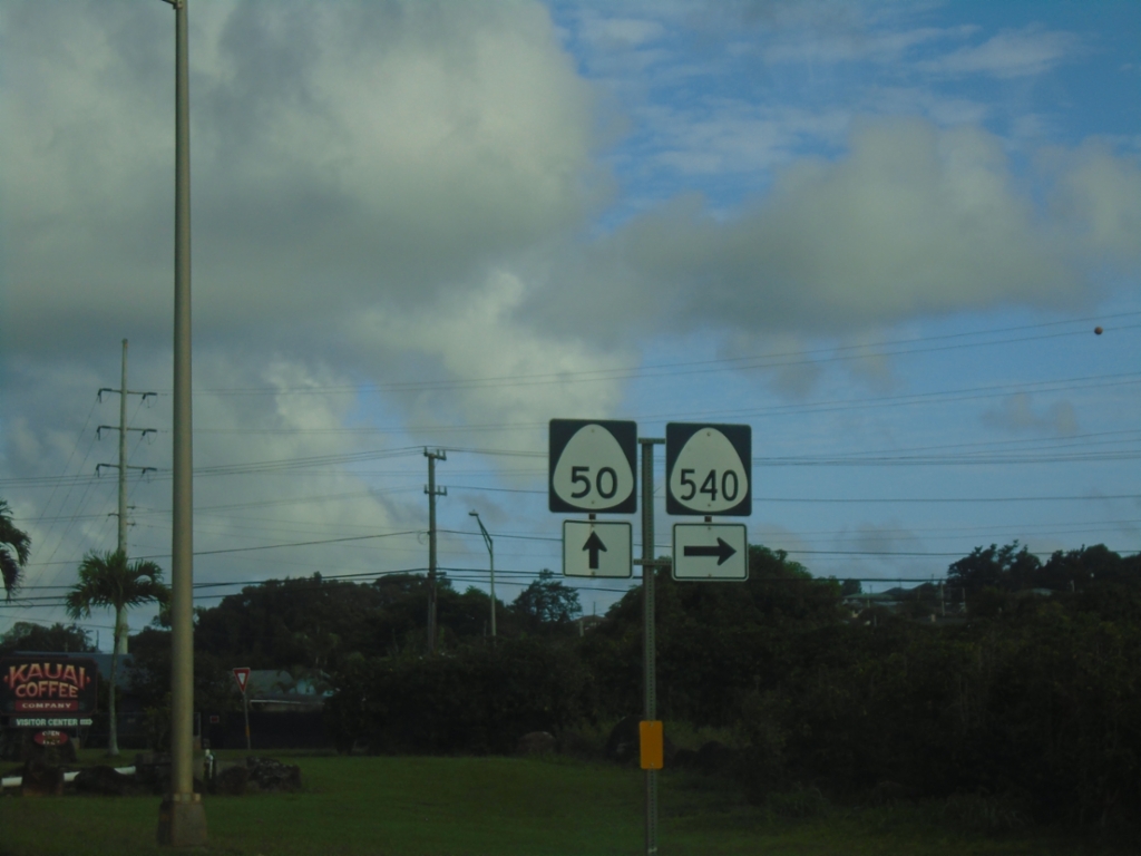
HI-50 East at HI-540 (Halewili Road)
HI-50 East (Kaumualiʻi Highway) at HI-540 (Halewili Road) in Kalāheo
Taken 02-18-2025
 Kalaheo
Kauai County
Hawaii
United States
Kalaheo
Kauai County
Hawaii
United States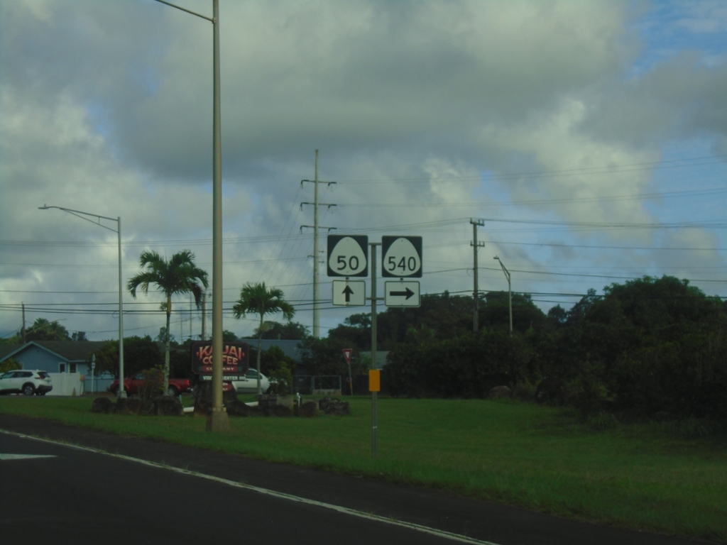
HI-50 East at HI-540 (Halewili Road)
HI-50 East (Kaumualiʻi Highway) at HI-540 (Halewili Road) in Kalāheo
Taken 02-18-2025
Kalaheo
Kauai County
Hawaii
United States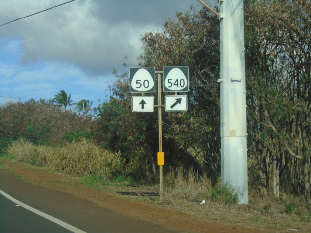
HI-50 East at HI-540 (Halewili Road)
HI-50 East (Kaumualiʻi Highway) at HI-540 (Halewili Road)
Taken 02-18-2025
Eleele
Kauai County
Hawaii
United States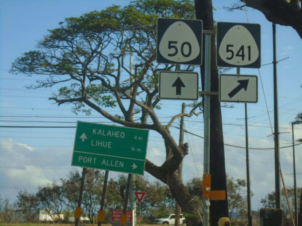
HI-50 East at HI-541 (Waialo Road)
HI-50 East (Kaumualiʻi Highway) at HI-541 (Waialo Road) to Port Allen. Continue east on HI-50 to Kalaheo and Līhuʻe.
Taken 02-18-2025
 Eleele
Kauai County
Hawaii
United States
Eleele
Kauai County
Hawaii
United States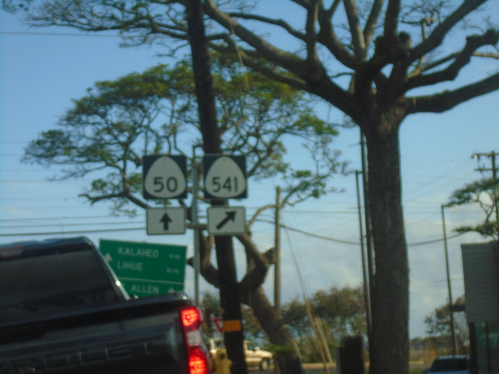
HI-50 East at HI-541 (Waialo Road)
HI-50 East (Kaumualiʻi Highway) at HI-541 (Waialo Road)
Taken 02-18-2025
Eleele
Kauai County
Hawaii
United States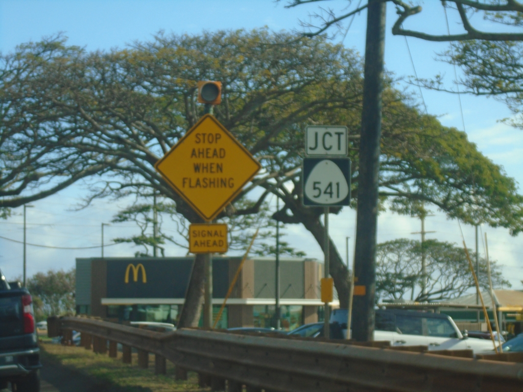
HI-50 East Approaching HI-541 (Waialo Road)
HI-50 East (Kaumualiʻi Highway) approaching HI-541 (Waialo Road)
Taken 02-18-2025
Eleele
Kauai County
Hawaii
United States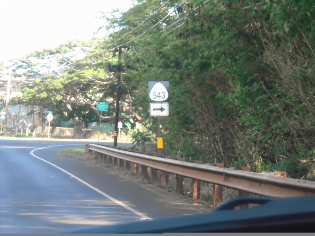
HI-50 East at HI-543 (Lele Road)
HI-50 East (Kaumualiʻi Highway) at HI-543 (Lele Road)
Taken 02-18-2025
 Eleele
Kauai County
Hawaii
United States
Eleele
Kauai County
Hawaii
United States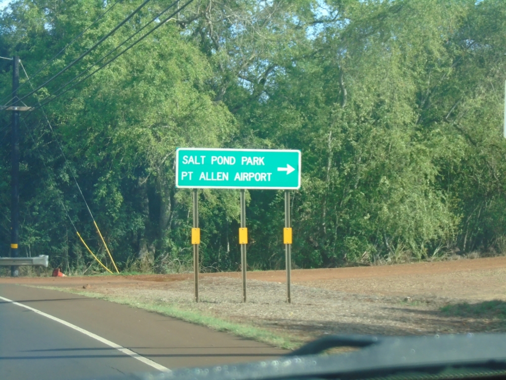
HI-50 East at HI-543 (Lele Road)
HI-50 East (Kaumualiʻi Highway) at HI-543 (Lele Road) to Salt Pond Park and Port Allen Airport.
Taken 02-18-2025
Hanapepe
Kauai County
Hawaii
United States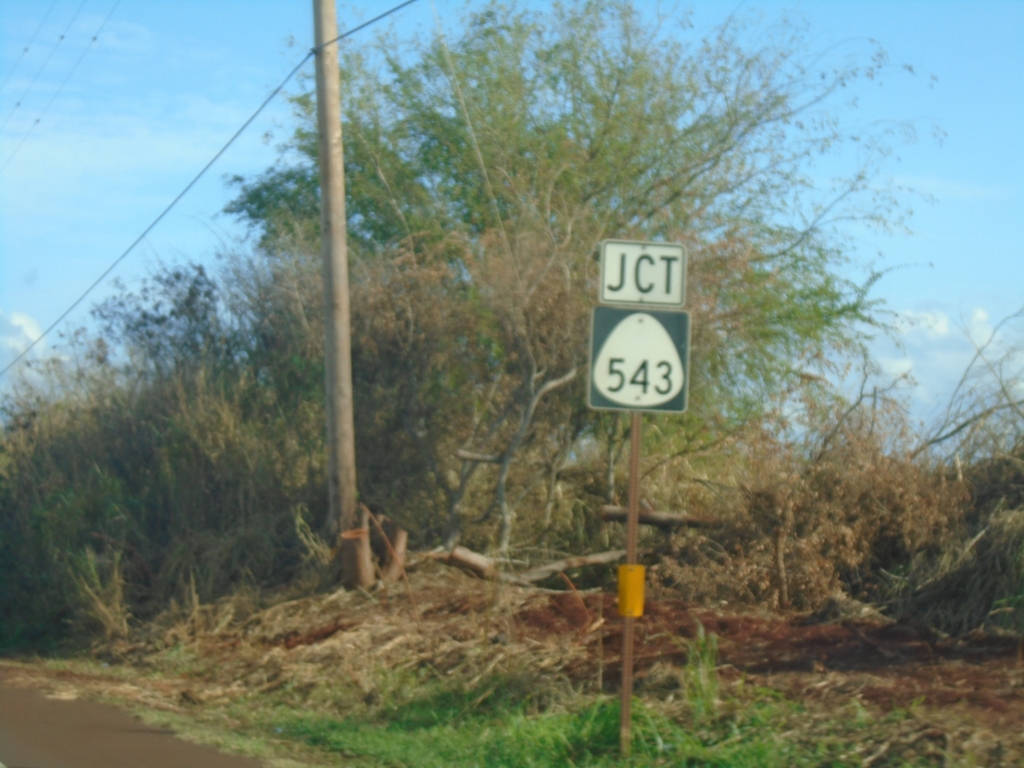
HI-50 East Approaching HI-543
HI-50 East (Kaumualiʻi Highway) approaching HI-543 (Lele Road).
Taken 02-18-2025
Hanapepe
Kauai County
Hawaii
United States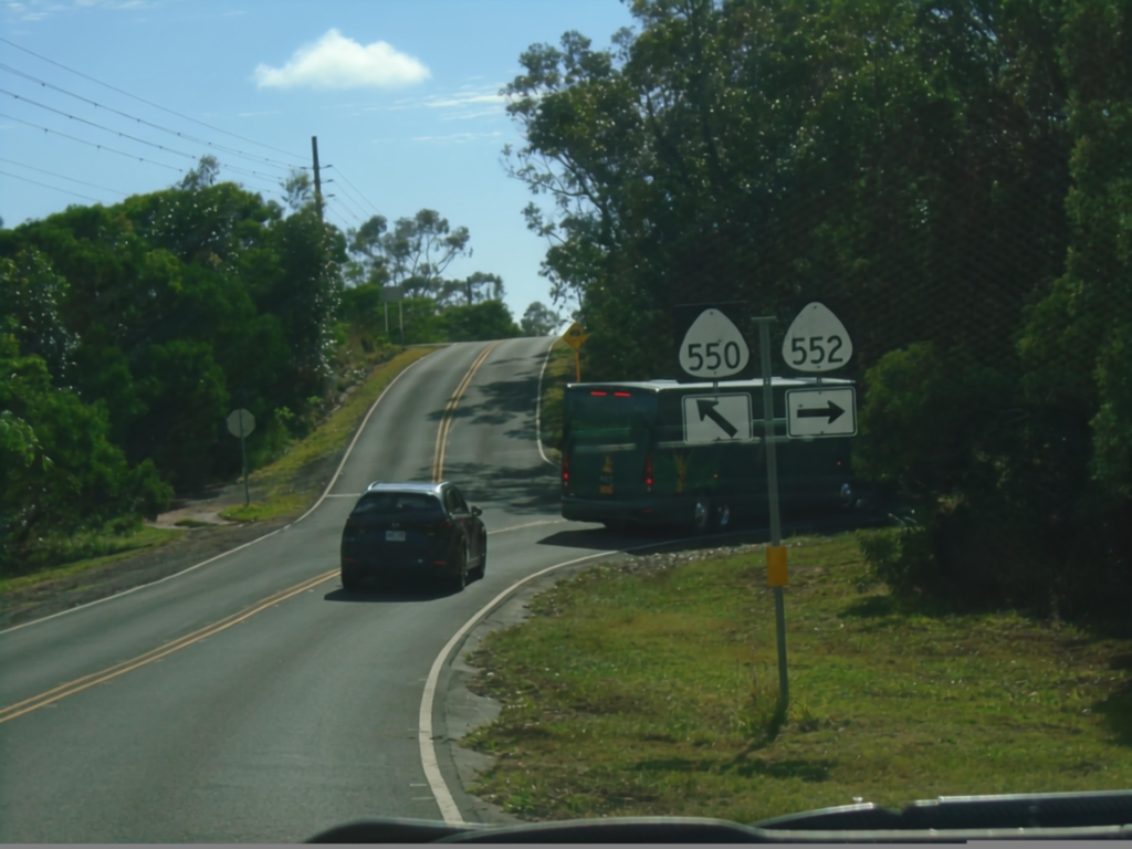
HI-550 South at HI-552 (Kōkeʻe Road)
HI-550 South at HI-552 (Kōkeʻe Road). Merge left to continue south on HI-550 (Waimea Canyon Drive).
Taken 02-18-2025

 Waimea
Kauai County
Hawaii
United States
Waimea
Kauai County
Hawaii
United States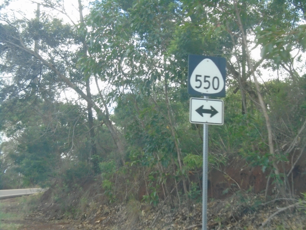
End HI-552 North at HI-550 (Waimea Canyon Drive).
End HI-552 North (Kōkeʻe Road) at HI-550 (Waimea Canyon Drive).
Taken 02-18-2025
Kekaha
Kauai County
Hawaii
United States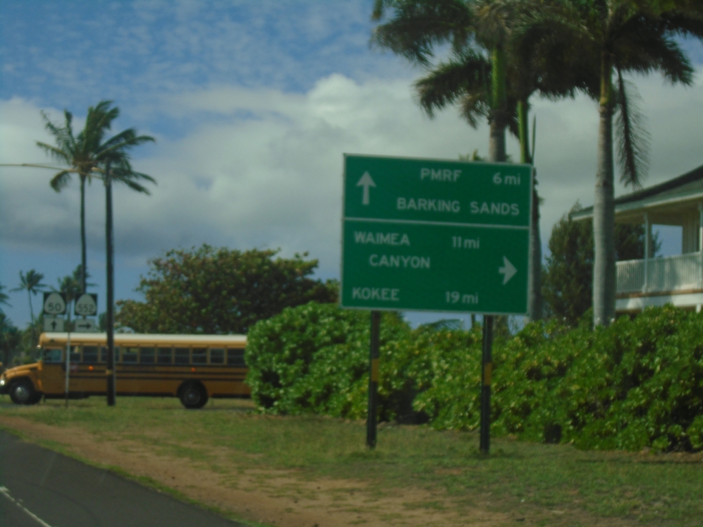
HI-50 West at HI-552 (Alae Road)
HI-50 West (Kaumualiʻi Highway) at HI-552 (Alae Road) to Waimea Canyon and Kōkeʻe. Continue west on HI-50 for Pacific Missile Range Facility (PMRF) Barking Sands.
Taken 02-18-2025
Kekaha
Kauai County
Hawaii
United States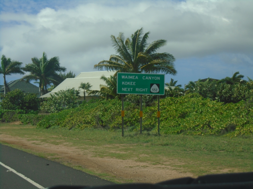
HI-50 West Approaching HI-552 (Alae Road)
HI-50 West (Kaumualiʻi Highway) approaching HI-552 (Alae Road). Use HI-552 north for Waimea Canyon and Kōkeʻe.
Taken 02-18-2025
Kekaha
Kauai County
Hawaii
United States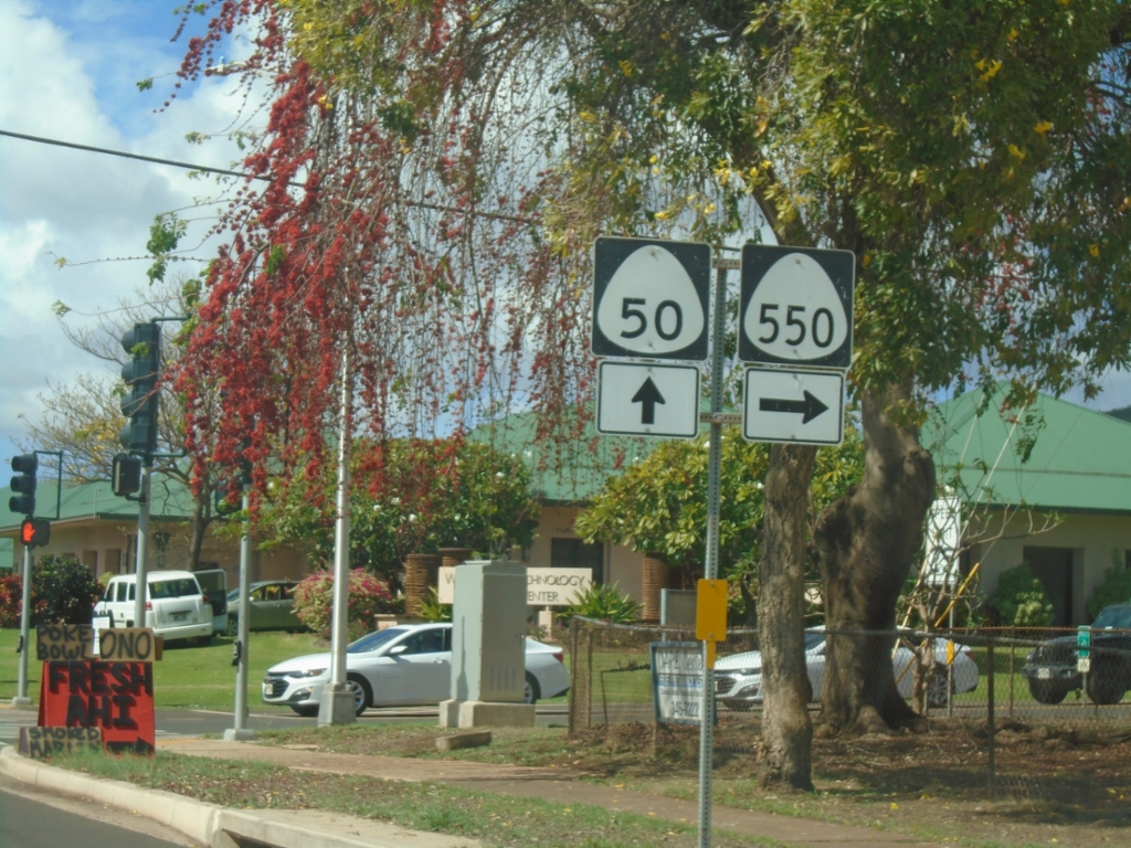
HI-50 West at HI-550 (Waimea Canyon Drive)
HI-50 West (Kaumualiʻi Highway) at HI-550 (Waimea Canyon Drive) in Waimea.
Taken 02-18-2025
Waimea
Kauai County
Hawaii
United States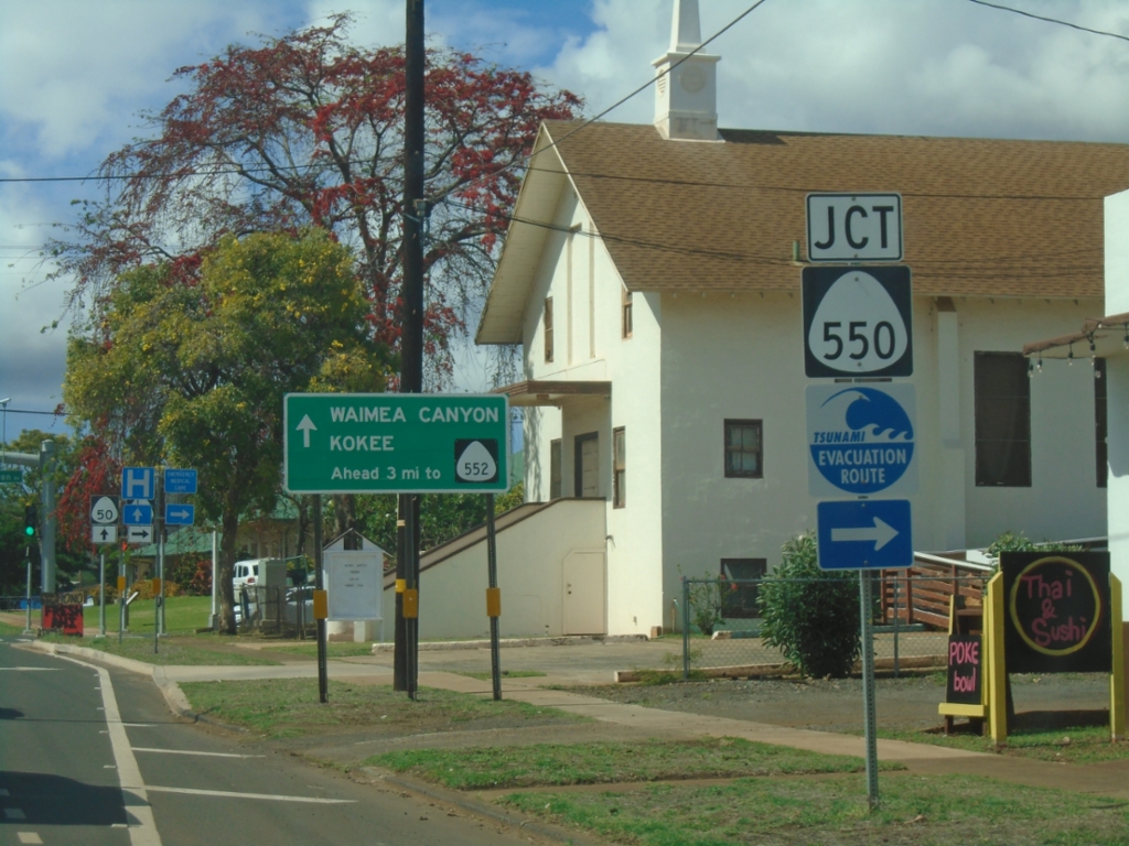
HI-50 West Approaching HI-550 (Waimea Canyon Drive)
HI-50 West (Kaumualiʻi Highway) approaching HI-550 (Waimea Canyon Drive) in Waimea. The sign in the background indicates for Waimea Canyon and Kōkeʻe traffic to use HI-552 instead.
Taken 02-18-2025
Waimea
Kauai County
Hawaii
United States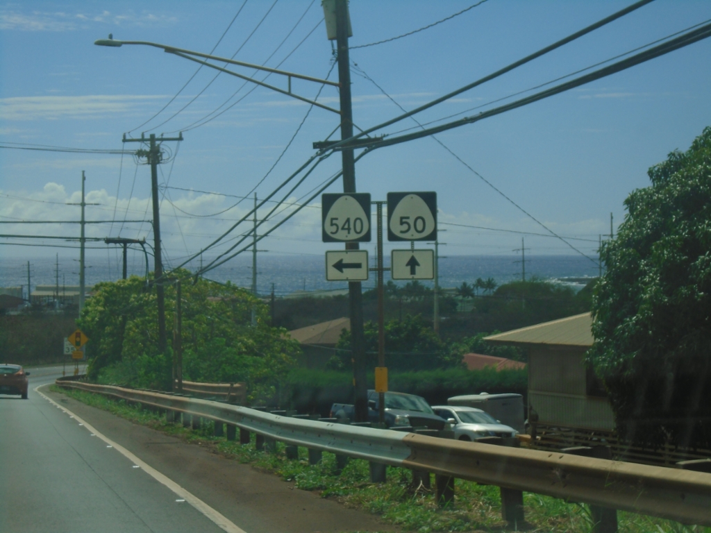
HI-50 West at HI-540 East (Halewili Road)
HI-50 West (Kaumualiʻi Highway) at HI-540 East (Halewili Road) in ʻEleʻele.
Taken 02-18-2025
Eleele
Kauai County
Hawaii
United States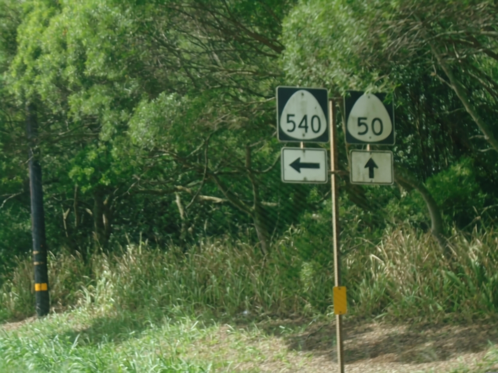
HI-50 West at HI-540 (Halewili Road)
HI-50 West (Kaumualiʻi Highway) at HI-540 (Halewili Road) in Kalāheo
Taken 02-18-2025
Kalaheo
Kauai County
Hawaii
United States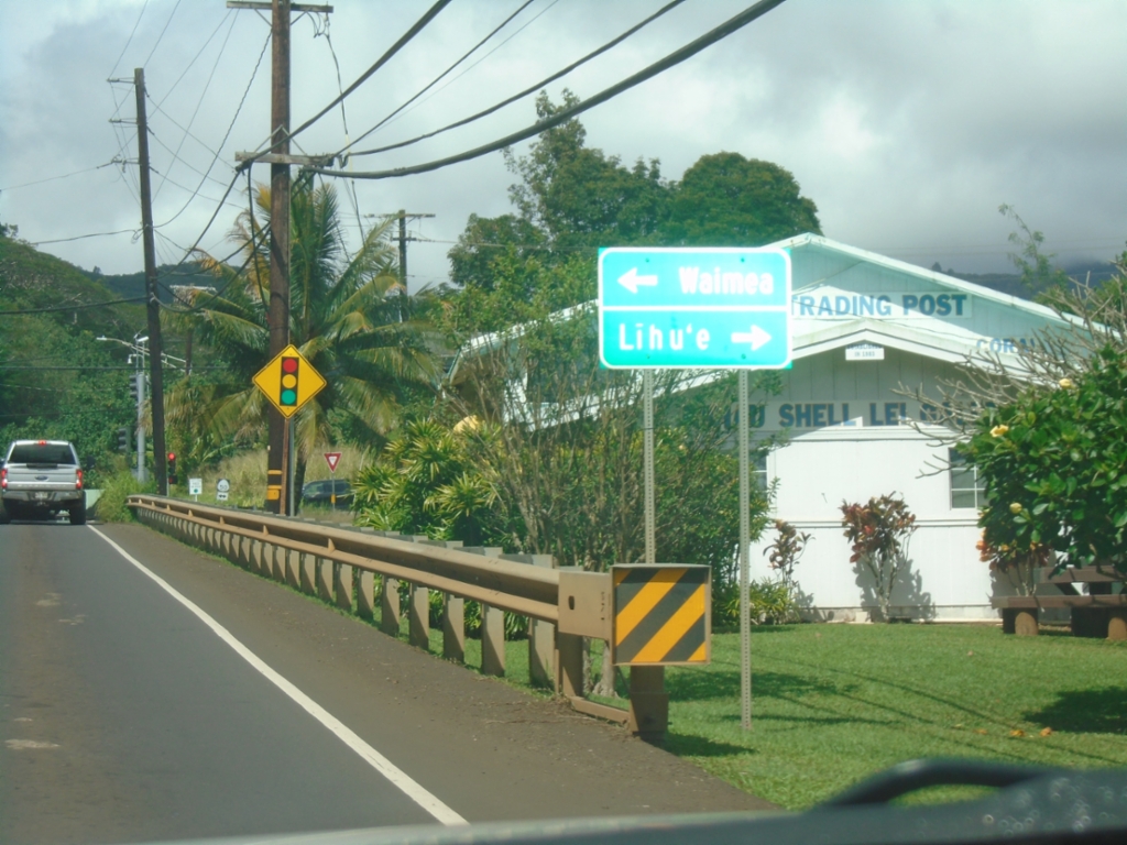
End HI-530 West at HI-50 (Kaumualiʻi Highway)
End HI-530 West (Kōloa Road) at HI-50 (Kaumualiʻi Highway) in Lawai. Use HI-50 East to Līhuʻe; HI-50 West to Waimea.
Taken 02-18-2025
Kalaheo
Kauai County
Hawaii
United States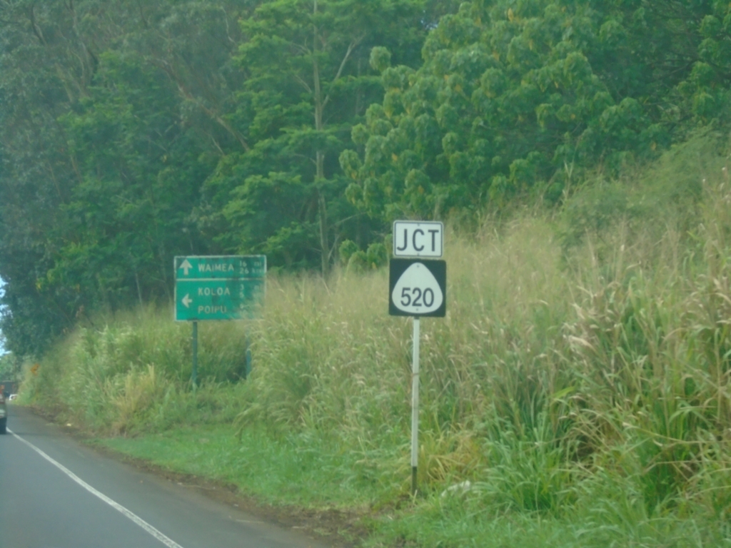
HI-50 West Approaching HI-520
HI-50 West (Kaumualiʻi Highway) approaching HI-520 (Kōloa Road).
Taken 02-18-2025
Omao
Kauai County
Hawaii
United States