Signs Tagged With Intersection
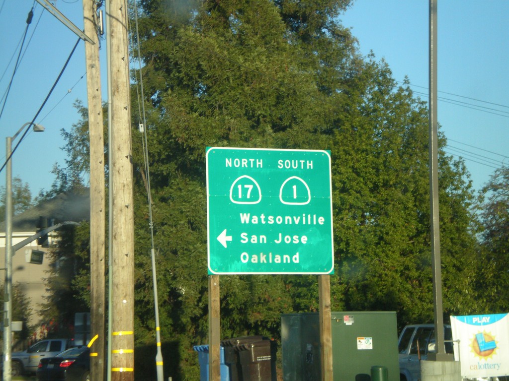
CA-1 South (Mission St.) at Cabrillo Highway
CA-1 South (Mission St.) at left turn for CA-1 (Cabrillo Highway). Left turn goes to CA-1 South/CA-17 North/Watsonville/San Jose/Oakland.
Taken 12-31-2008

 Santa Cruz
 County
California
United States
Santa Cruz
Santa Cruz County
California
United States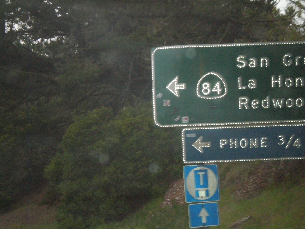
CA-1 South at CA-84
CA-1 south at CA-84 east to San Gregorio, La Honda, and Redwood City.
Taken 12-31-2008
 San Gregorio
San Mateo County
California
United States
San Gregorio
San Mateo County
California
United States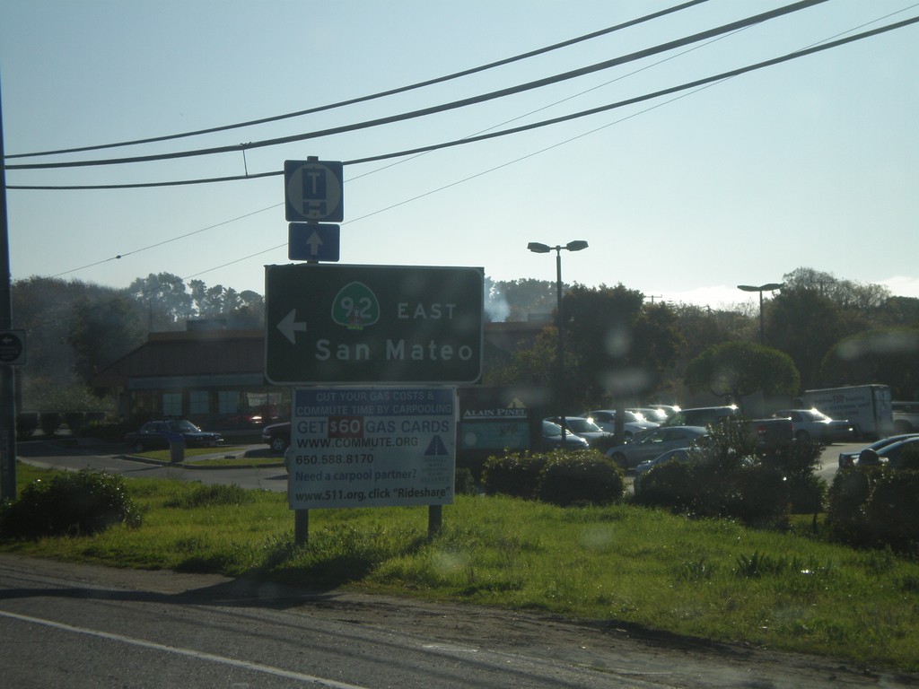
CA-1 South at CA-92 East
CA-1 South at CA-92 east to San Mateo.
Taken 12-31-2008
 Half Moon Bay
San Mateo County
California
United States
Half Moon Bay
San Mateo County
California
United States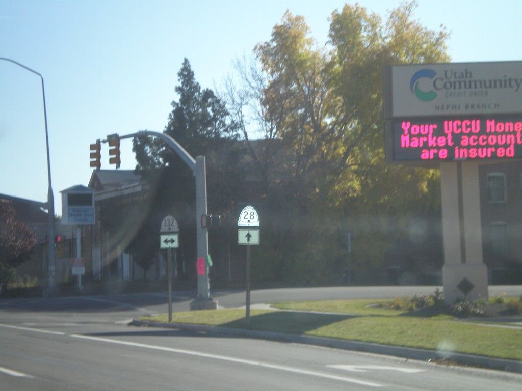
UT-28 South at UT-132
UT-28 south at UT-132. Notice the different shields used for UT-28 and UT-132. The UT-28 style is the newer style.
Taken 10-25-2008

 Nephi
Juab County
Utah
United States
Nephi
Juab County
Utah
United States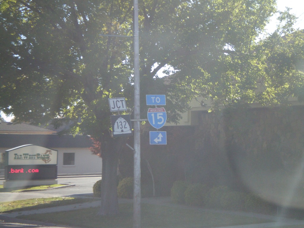
UT-28 South Approaching UT-132
UT-28 south approaching UT-132. For I-15 north use UT-132 east. For I-15 south use UT-28 south.
Taken 10-25-2008
 Nephi
Juab County
Utah
United States
Nephi
Juab County
Utah
United States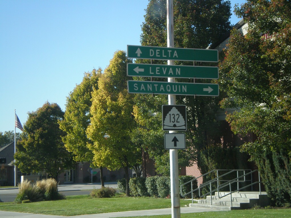
UT-132 West at UT-28
UT-132 west at UT-28. Use UT-28 north for Santaquin. Use UT-28 south for Levan. Continue on UT-132 for Delta.
Taken 10-25-2008
Nephi
Juab County
Utah
United States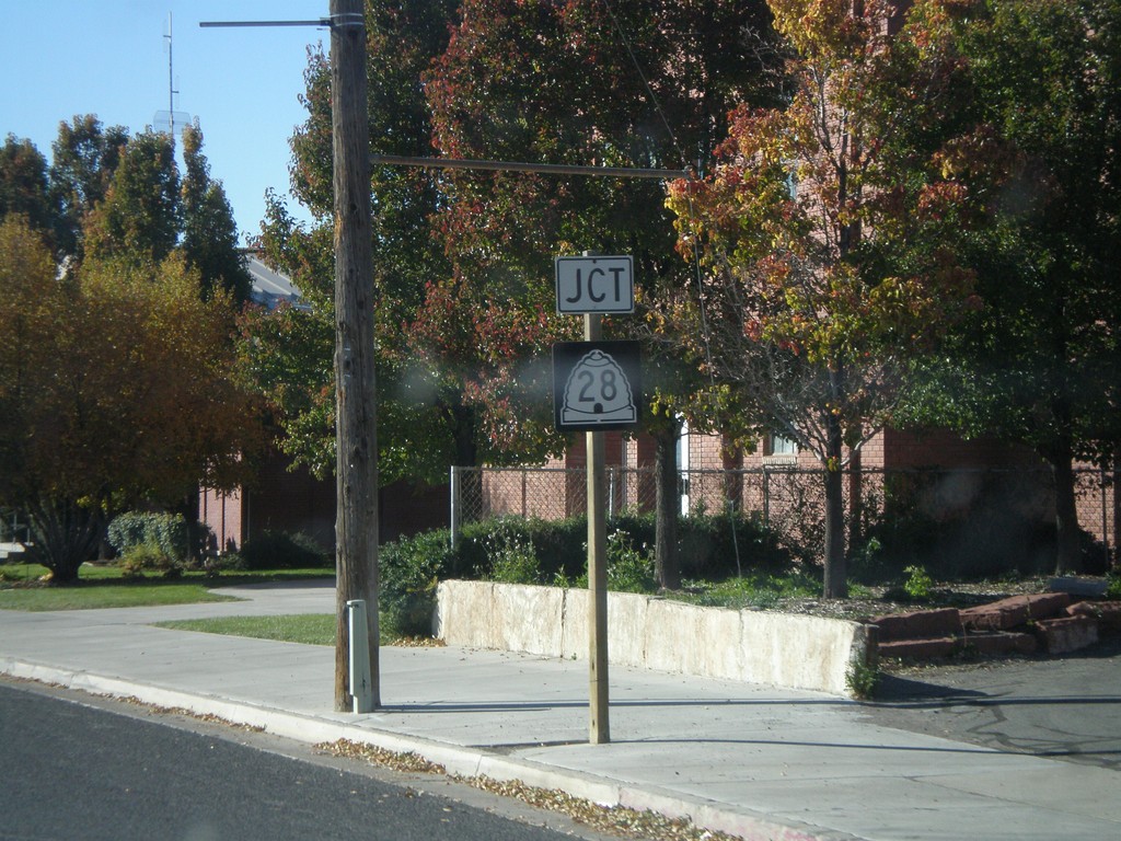
UT-131 West Approaching UT-28
UT-132 west approaching UT-28.
Taken 10-25-2008
Nephi
Juab County
Utah
United States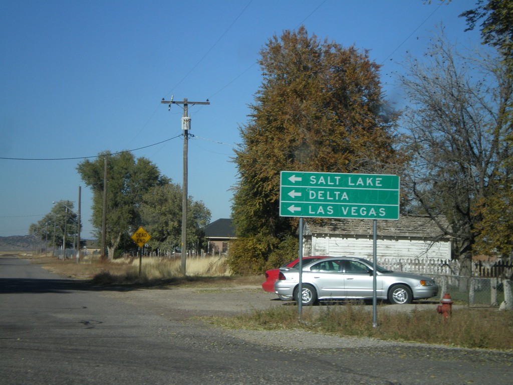
US-50 West in Scipio
US-50 west (State St.) at W 400 North. US-50 makes a left turn here. Use US-50 west for Delta, Salt Lake, and Las Vegas.
Taken 10-25-2008
 Scipio
Millard County
Utah
United States
Scipio
Millard County
Utah
United States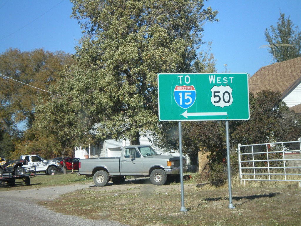
US-50/To I-15 - Scipio
US-50 west (State St.) approaching W 400 North. US-50 makes a left turn here. Use US-50 west for I-15.
Taken 10-25-2008
Scipio
Millard County
Utah
United States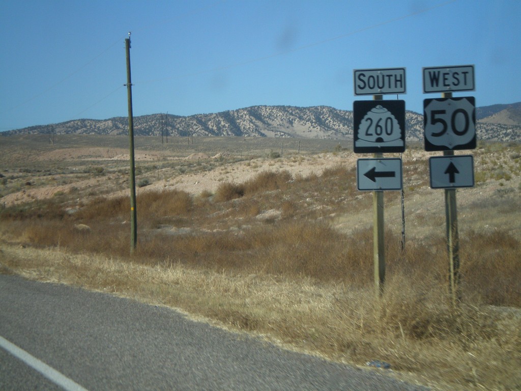
US-50 West at UT-260 South
US-50 west at UT-260 south.
Taken 10-25-2008
 Salina
Sevier County
Utah
United States
Salina
Sevier County
Utah
United States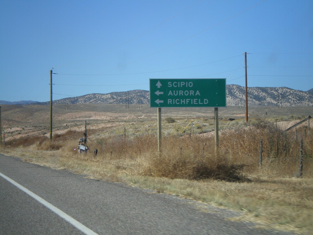
US-50 West Approaching UT-260
US-50 west approaching UT-260 south to Richfield and Aurora. US-50 continues west to Scipio.
Taken 10-25-2008
Salina
Sevier County
Utah
United States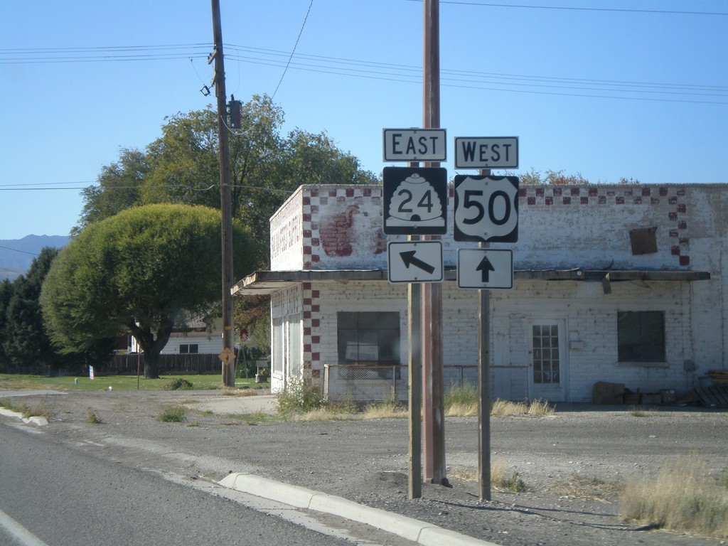
US-50 West at UT-24 East
UT-24 south on US-50 west.
Taken 10-25-2008
 Salina
Sevier County
Utah
United States
Salina
Sevier County
Utah
United States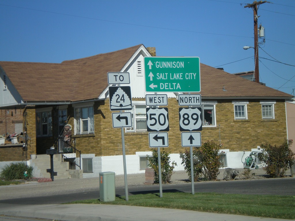
US-89 North/US-50 Jct. - Salina
US-50 west/US-89 north split. Continue on US-89 for Gunnison and Salt Lake. Use US-50 west for UT-24 and Delta.
Taken 10-25-2008
 Salina
Sevier County
Utah
United States
Salina
Sevier County
Utah
United States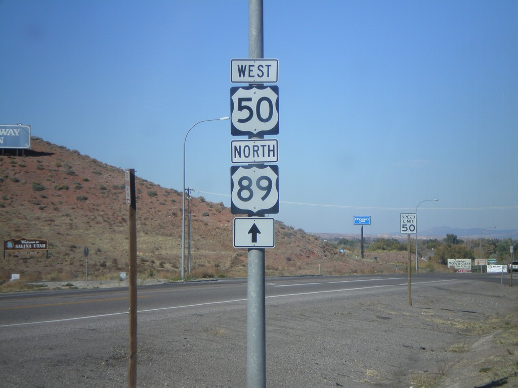
US-50 West/US-89 North - Entering Salina
US-50 west to US-89 north, just north of I-70.
Taken 10-25-2008
Salina
Sevier County
Utah
United States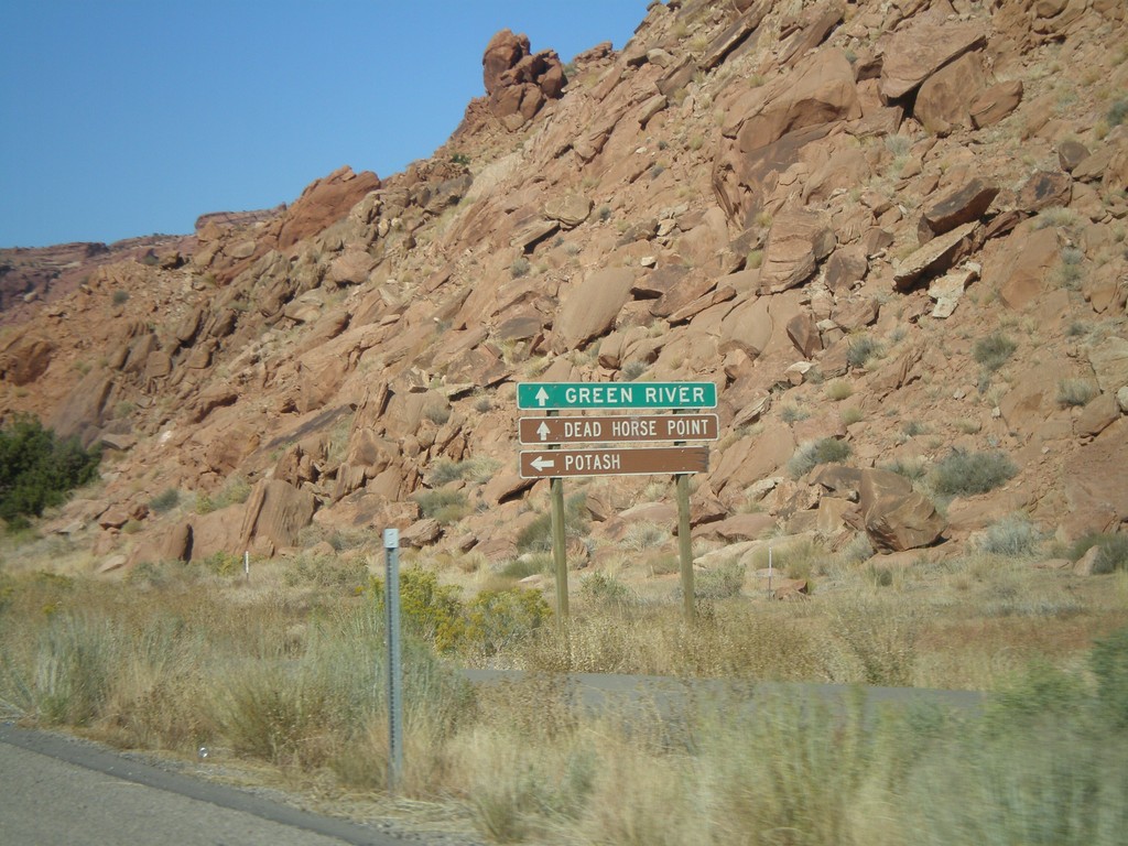
US-191 North Approaching UT-279
US-191 north approaching UT-279. Use UT-279 west for Potash. Use US-191 north for Green River and Dead Horse Point State Park.
Taken 10-25-2008

 Moab
Grand County
Utah
United States
Moab
Grand County
Utah
United States
US-191 North Approaching UT-279
US-191 north approaching UT-279. UT-279 is signed as a Utah scenic byway.
Taken 10-24-2008
Moab
Grand County
Utah
United States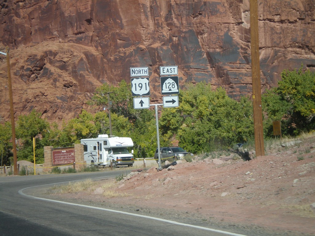
US-191 North at UT-128 East
US-191 north at UT-128 east.
Taken 10-24-2008
 Moab
Grand County
Utah
United States
Moab
Grand County
Utah
United States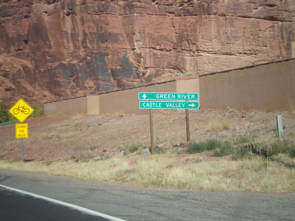
US-191 North Approaching UT-128
US-191 north approaching UT-128 east to Castle Valley.
Taken 10-24-2008
Moab
Grand County
Utah
United States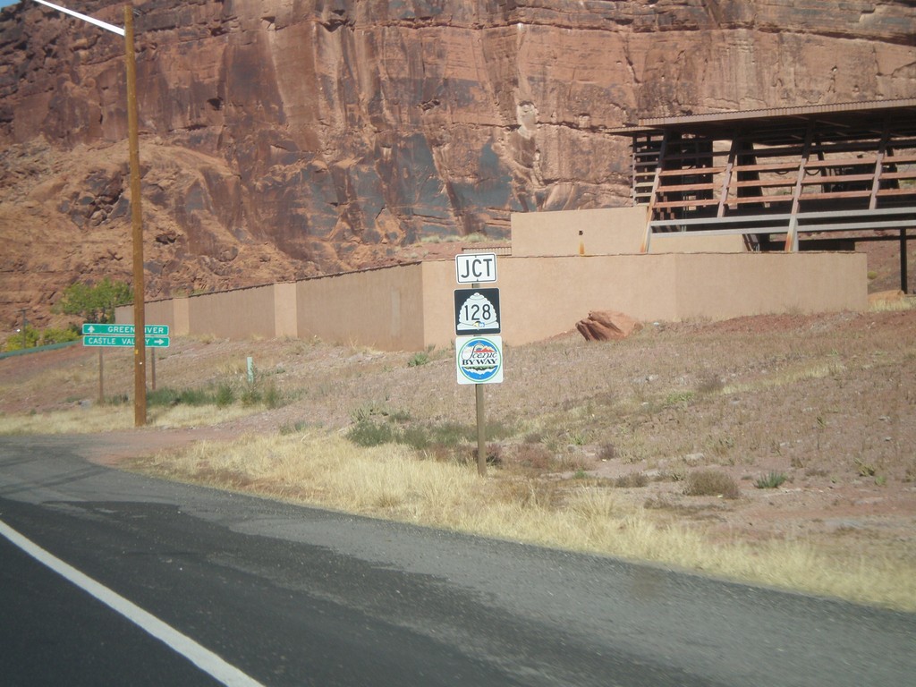
US-191 North Approaching UT-128
US-191 north approaching UT-128. UT-128 is signed as a Utah scenic byway.
Taken 10-24-2008
Moab
Grand County
Utah
United States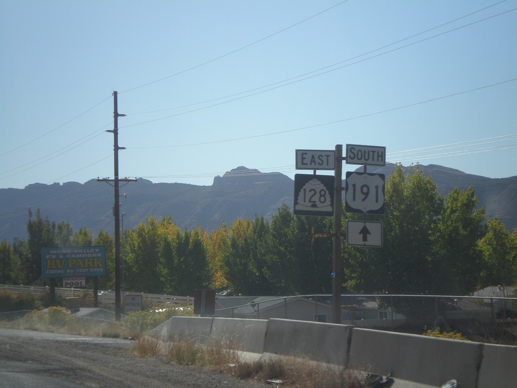
US-191 South at UT-128
US-191 south at UT-128 east.
Taken 10-24-2008
Moab
Grand County
Utah
United States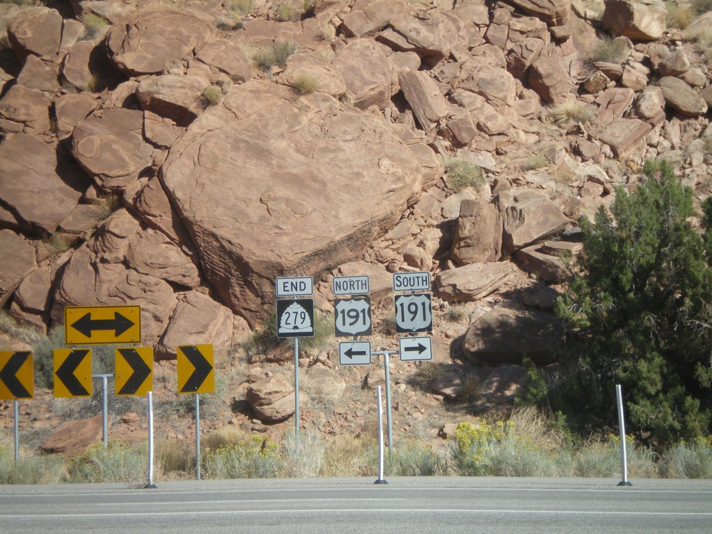
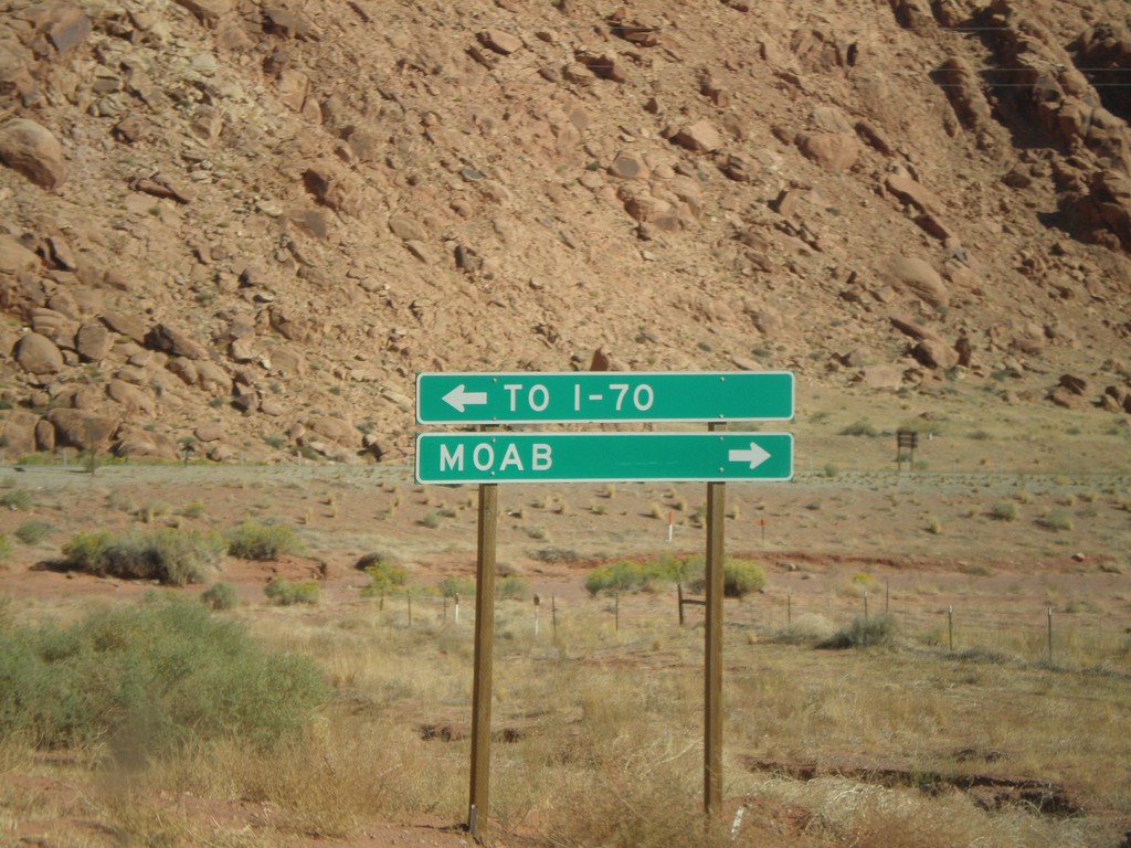
End UT-279 East at US-191
UT-279 east approaching US-191. Use US-191 north for I-70. Use US-191 south for Moab.
Taken 10-24-2008
Moab
Grand County
Utah
United States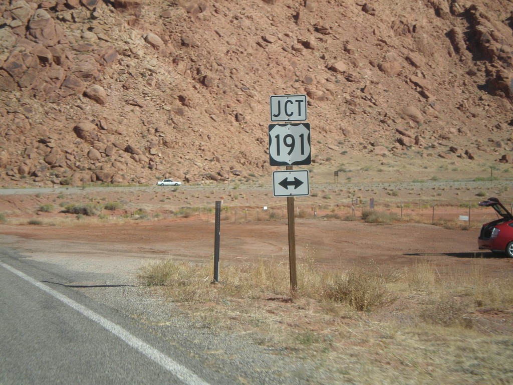
End UT-279 East at US-191
UT-279 east approaching US-191.
Taken 10-24-2008
Moab
Grand County
Utah
United States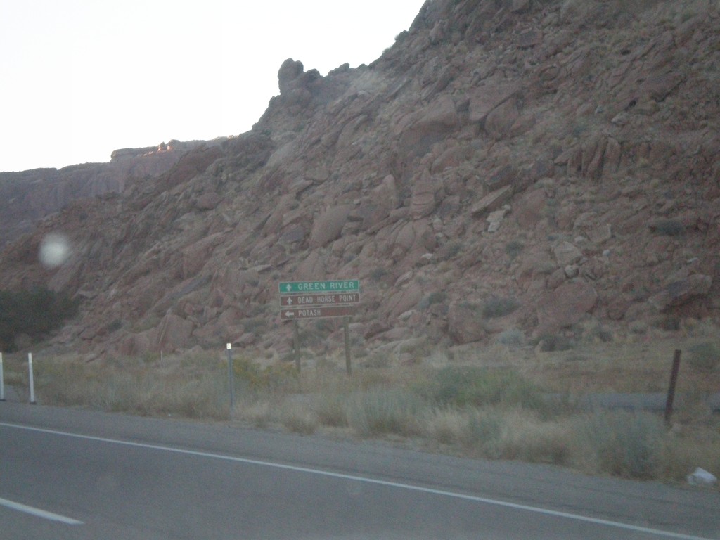
US-191 North Approaching UT-279
US-191 north approaching UT-279. Use UT-279 west for Potash. Use US-191 north for Green River and Dead Horse Point State Park.
Taken 10-23-2008
Moab
Grand County
Utah
United States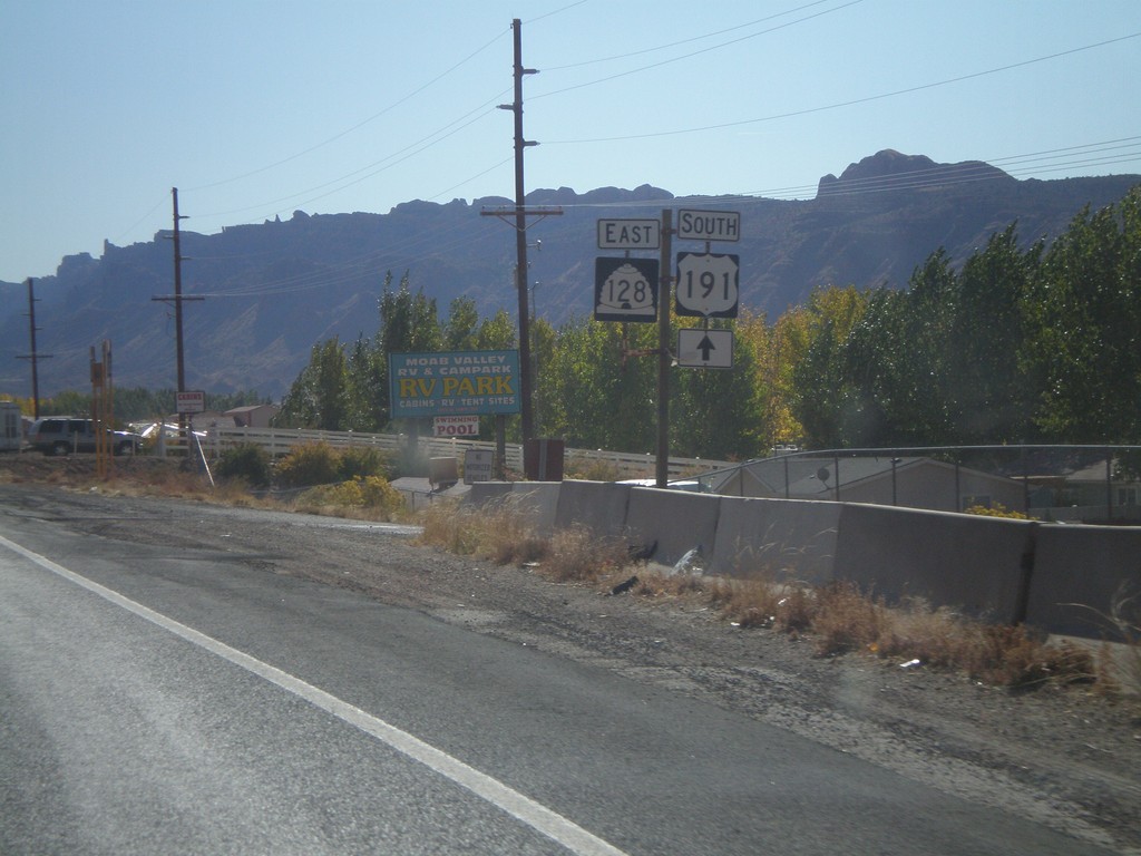
US-191 South at UT-128 East
US-191 south at UT-128 east.
Taken 10-22-2008
Moab
Grand County
Utah
United States