Signs Tagged With Intersection
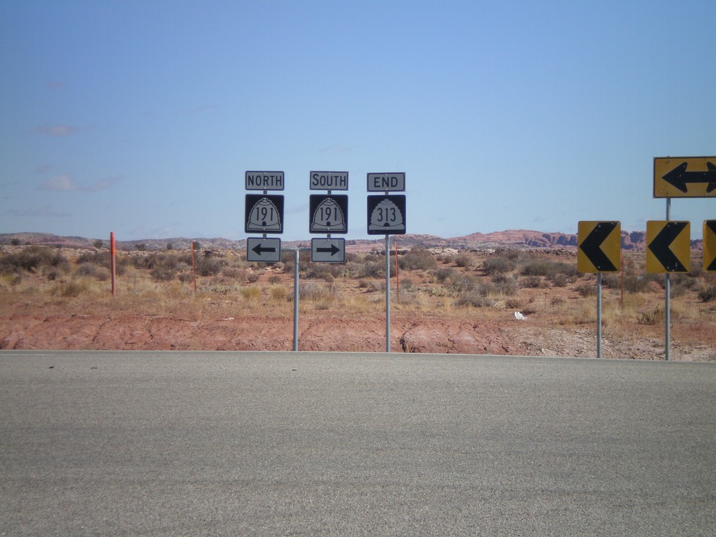
End UT-313 North at US-191
End UT-313 north at US-191. US-191 shields are incorrectly signed as UT-191.
Taken 10-22-2008

 Moab
Grand County
Utah
United States
Moab
Grand County
Utah
United States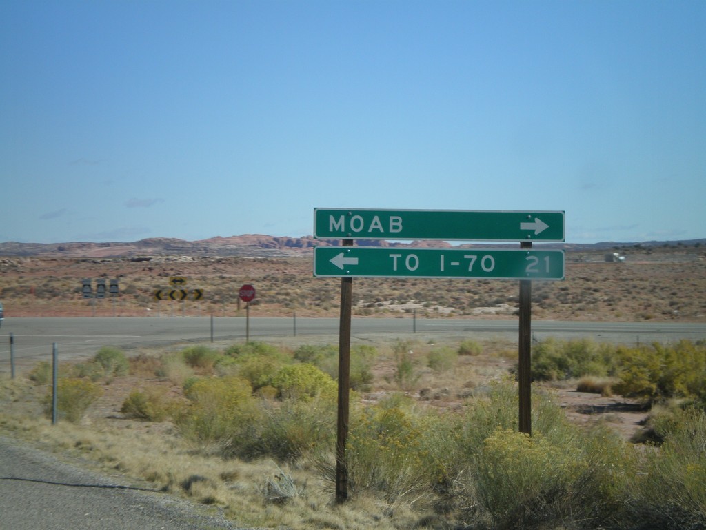
End UT-313 at US-191
End UT-313 north approaching US-191. Use US-191 north for I-70. Use US-191 south for Moab.
Taken 10-22-2008
Moab
Grand County
Utah
United States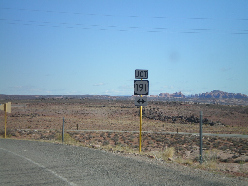
End UT-313 At US-191
End UT-313 north approaching US-191.
Taken 10-22-2008
Moab
Grand County
Utah
United States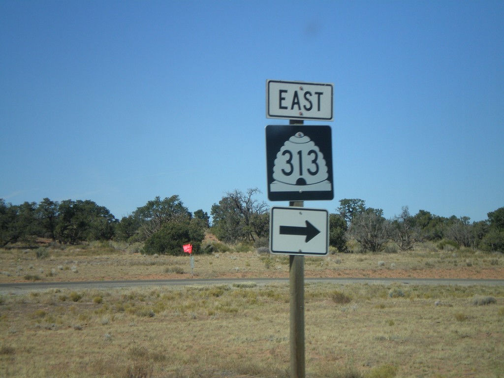
UT-313 East at Canyonlands National Park
UT-313 east at Canyonlands NP access road.
Taken 10-22-2008
Moab
Grand County
Utah
United States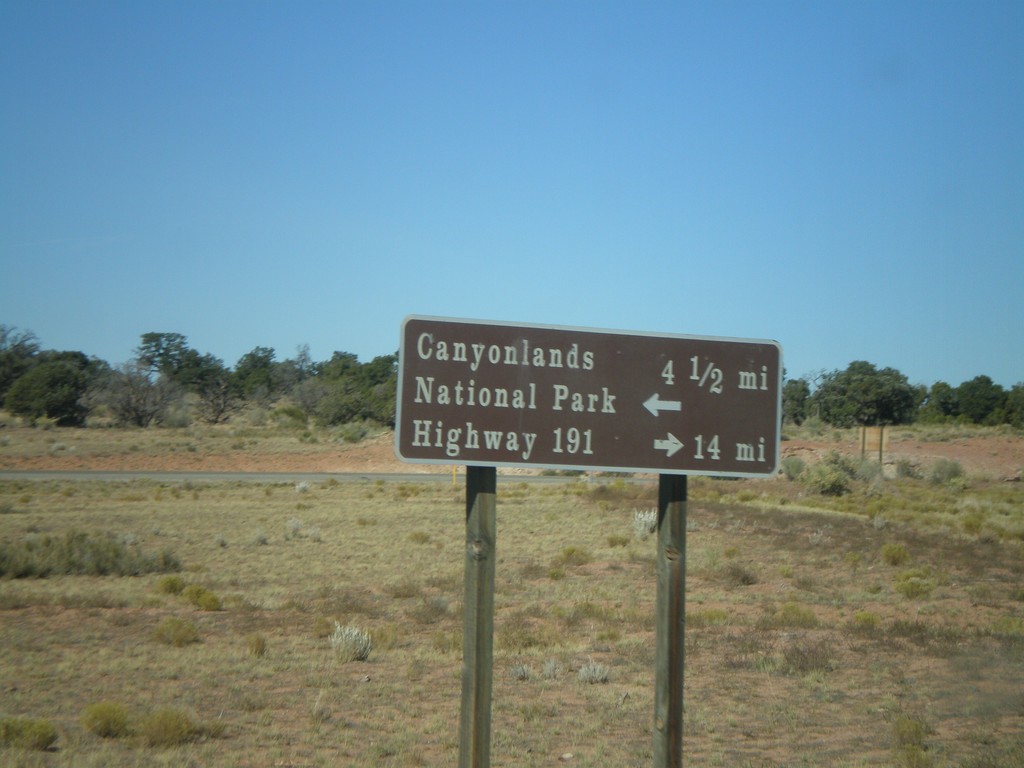
UT-313 at Canyonlands National Park Jct.
UT-313 north approaching Canyonlands NP access road. Turn right to continue on UT-313 to US-191.
Taken 10-22-2008
Moab
Grand County
Utah
United States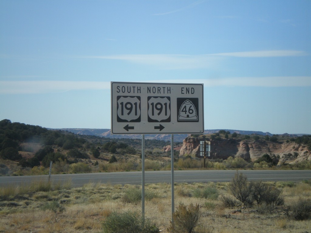
End UT-46 West at US-191
End UT-46 west at US-191.
Taken 10-21-2008
 La Sal
San Juan County
Utah
United States
La Sal
San Juan County
Utah
United States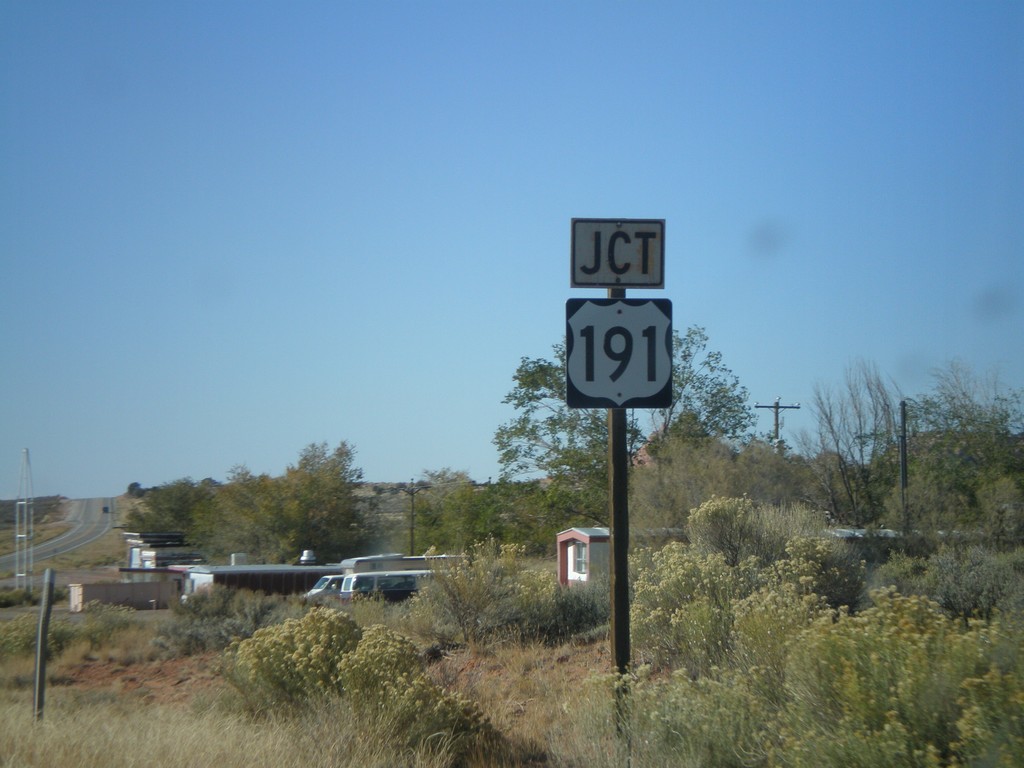
UT-46 West Approaching US-191
UT-46 west approaching US-191.
Taken 10-21-2008
La Sal
San Juan County
Utah
United States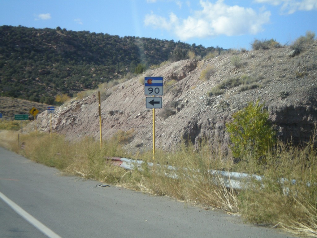
CO-141 North at CO-91
CO-141 north at CO-90 west.
Taken 10-21-2008

 Naturita
Montrose County
Colorado
United States
Naturita
Montrose County
Colorado
United States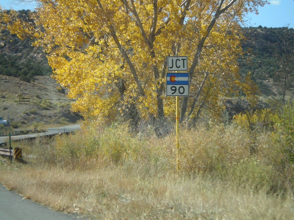
CO-141 North Approaching CO-90
CO-141 north approaching CO-90 west.
Taken 10-21-2008
Nucla
Montrose County
Colorado
United States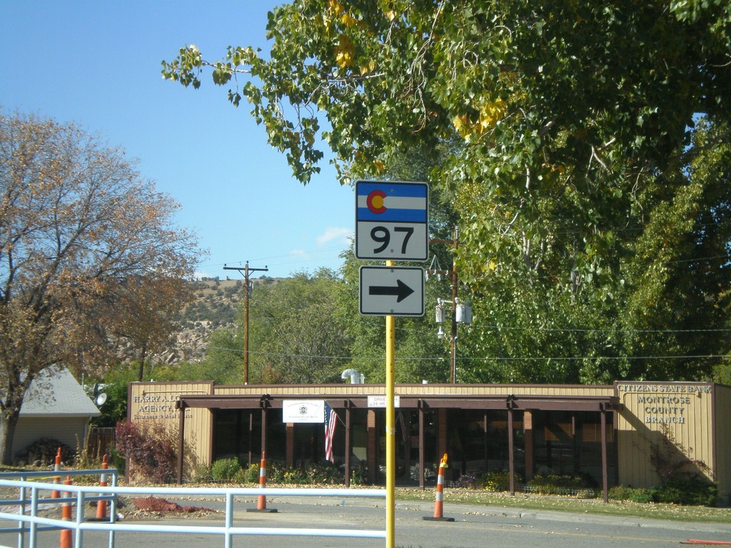
CO-141 North at CO-97
CO-141 north at CO-97 north.
Taken 10-21-2008
 Naturita
Montrose County
Colorado
United States
Naturita
Montrose County
Colorado
United States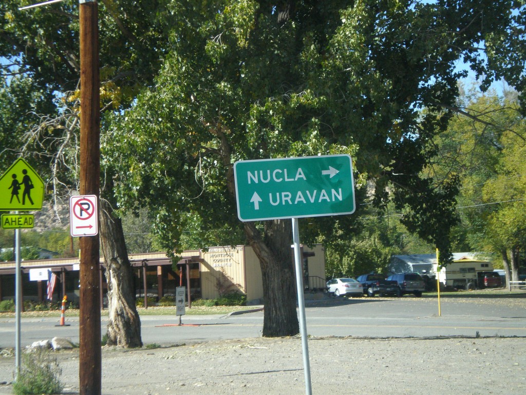
CO-141 North Approaching CO-97
CO-141 north approaching CO-97 north to Nucla. Continue on CO-141 for Uravan.
Taken 10-21-2008
Nucla
Montrose County
Colorado
United States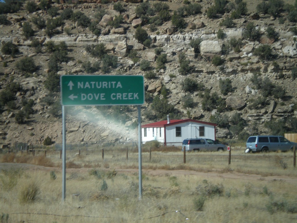
CO-145 West at CO-141
End CO-145 west at CO-141. Use CO-141 south for Dove Creek. Use CO-141 north for Naturita.
Taken 10-21-2008
 Redvale
Montrose County
Colorado
United States
Redvale
Montrose County
Colorado
United States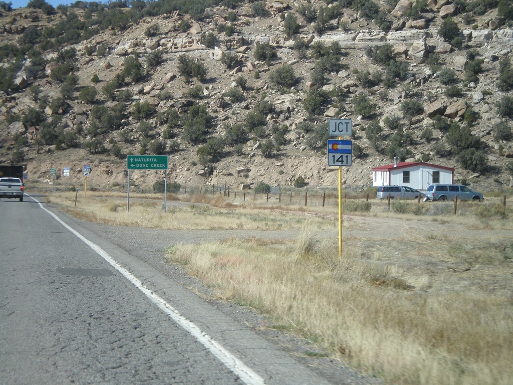
CO-145 West Approaching CO-141
CO-145 west approaching CO-141. Use CO-141 south for Dove Creek. Use CO-141 north for Naturita.
Taken 10-21-2008
Nucla
Montrose County
Colorado
United States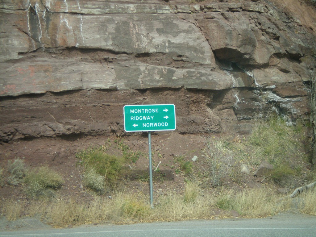
CO-145 West at CO-62
CO-145 west at CO-62 east to Montrose and Ridgway. Turn left to continue on CO-145 to Norwood.
Taken 10-21-2008
 Placerville
San Miguel County
Colorado
United States
Placerville
San Miguel County
Colorado
United States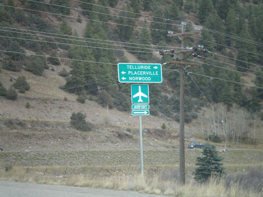
CO-145 North - Telluride Jct.
CO-145 at Telluride junction.
Taken 10-21-2008
Telluride
San Miguel County
Colorado
United States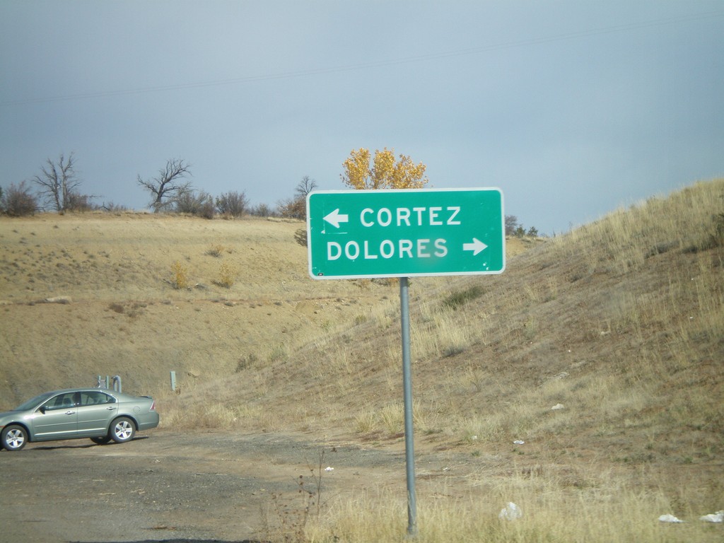
CO-184 West Approaching CO-145
CO-184 west approaching CO-145 to Delores and Cortez.
Taken 10-21-2008
 Dolores
Montezuma County
Colorado
United States
Dolores
Montezuma County
Colorado
United States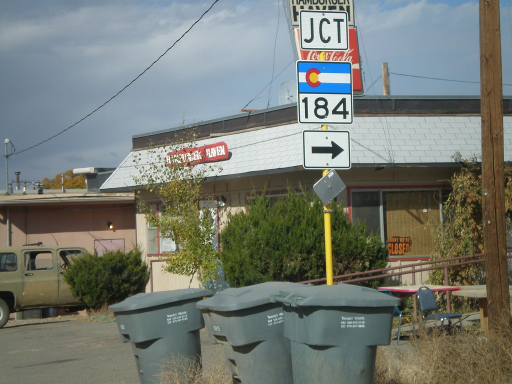
US-160 West at CO-184
US-160 west at CO-184.
Taken 10-20-2008
 Mancos
Montezuma County
Colorado
United States
Mancos
Montezuma County
Colorado
United States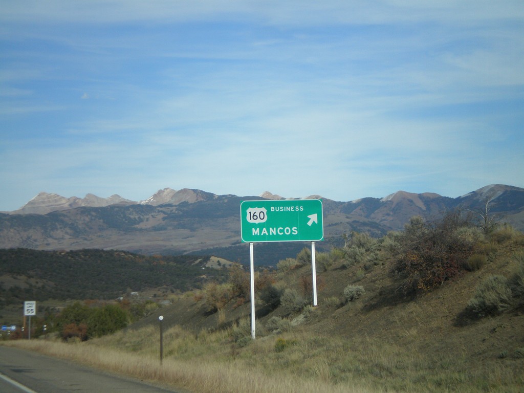
US-160 East - Manco Business Loop
US-160 east at the western end of the Mancos business loop.
Taken 10-19-2008
 Mancos
Montezuma County
Colorado
United States
Mancos
Montezuma County
Colorado
United States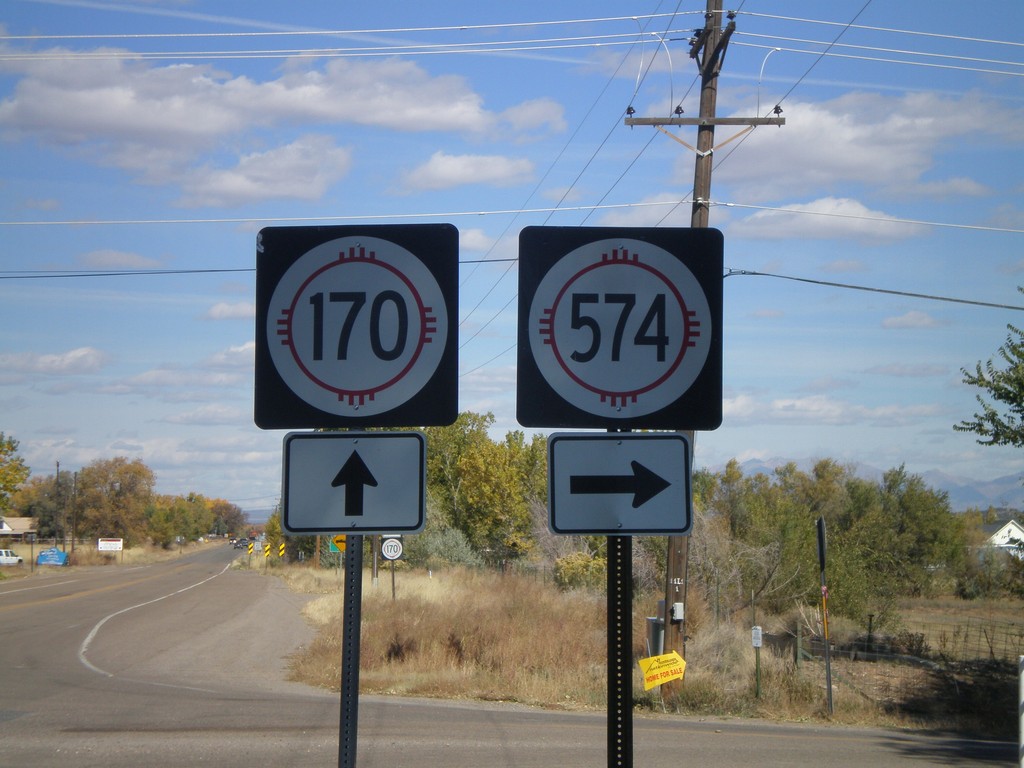
NM-170 North at NM-574 East
NM-170 north at NM-574 east.
Taken 10-19-2008

 Farmington
San Juan County
New Mexico
United States
Farmington
San Juan County
New Mexico
United States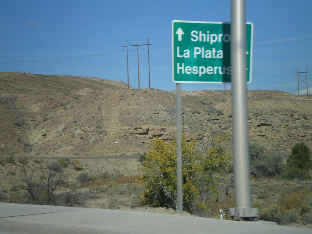
US-64 West at NM-170
US-64 West at NM-170 north to La Plata and Hesperus (CO).
Taken 10-19-2008
 Farmington
San Juan County
New Mexico
United States
Farmington
San Juan County
New Mexico
United States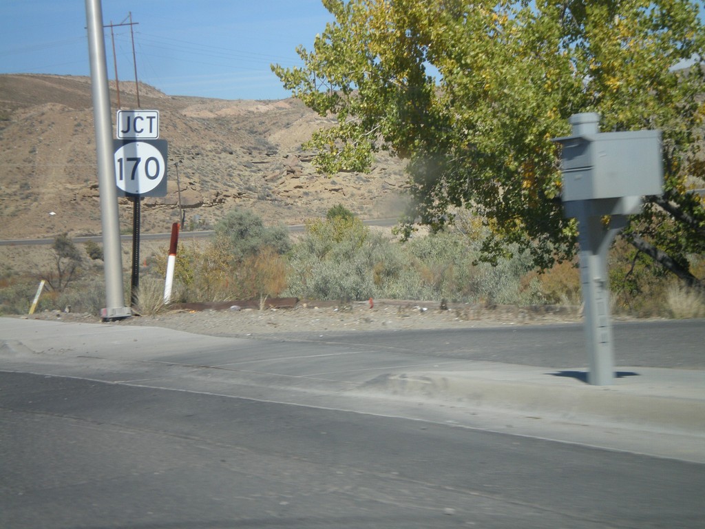
US-64 West Approaching NM-170
US-64 West approaching NM-170 North.
Taken 10-19-2008
Farmington
San Juan County
New Mexico
United States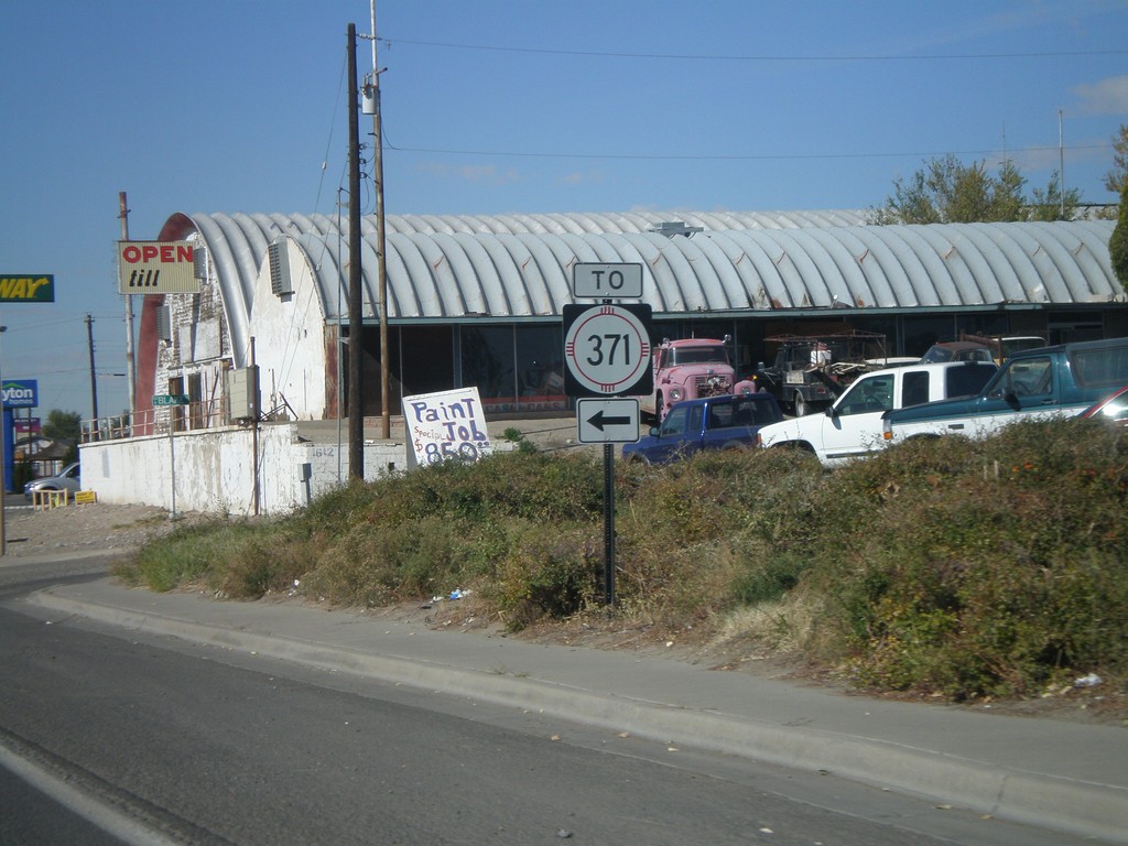
Bus. US-64 West at US-64/To NM-371
Bus. US-64 west at US-64. Turn east on US-64 for NM-371.
Taken 10-19-2008
 Farmington
San Juan County
New Mexico
United States
Farmington
San Juan County
New Mexico
United States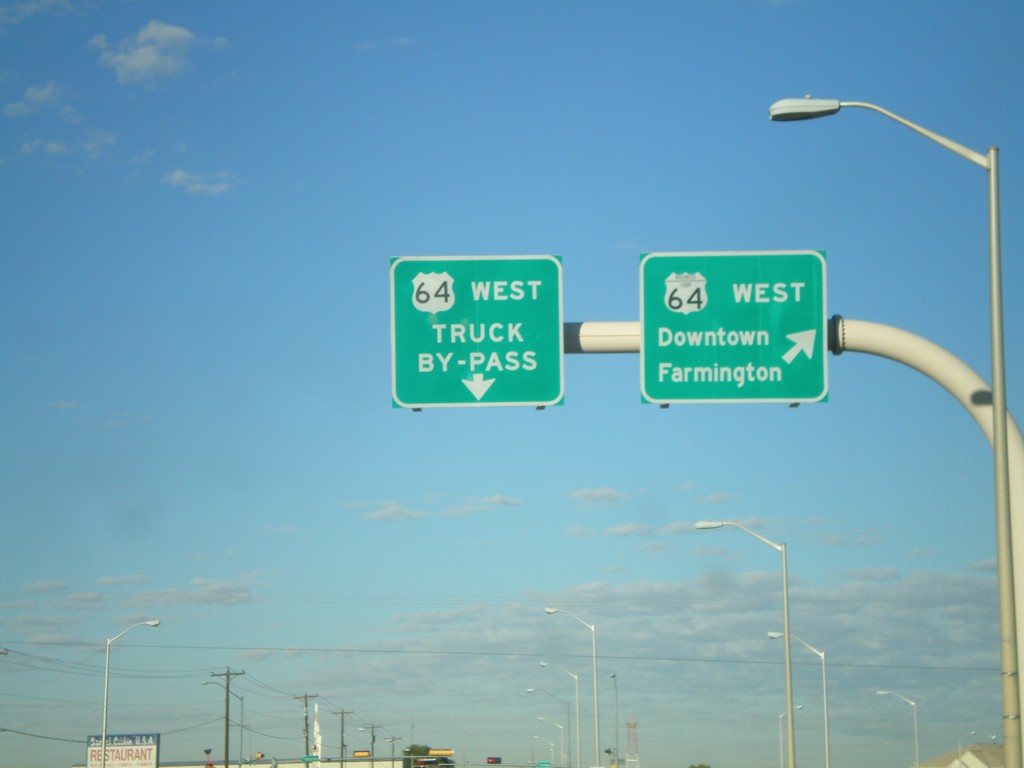
US-64 West - Farmingon Bypass
US-64 West at Bus. US-64 West. Use Bus. US-64 west for Downtown Farmington.
Taken 10-19-2008
Farmington
San Juan County
New Mexico
United States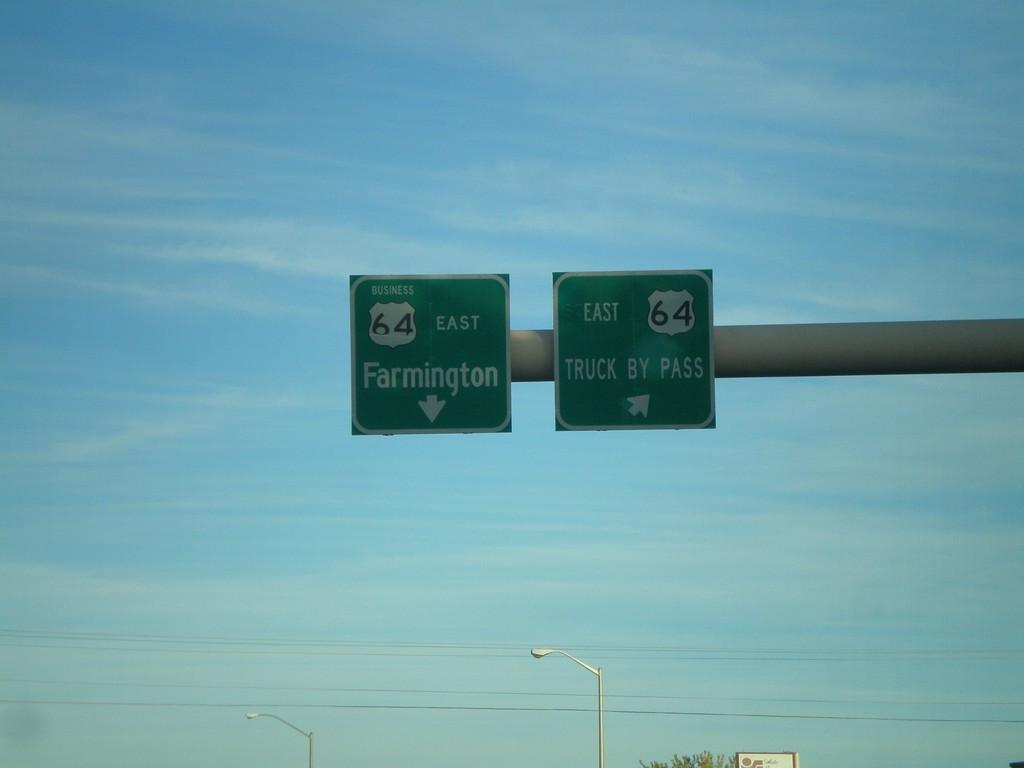
US-64 East - Farmington Bypass
US-64 East at Bus US-64. Use Bus. US-64 for Farmington. Use US-64 for the Truck Bypass.
Taken 10-18-2008
Farmington
San Juan County
New Mexico
United States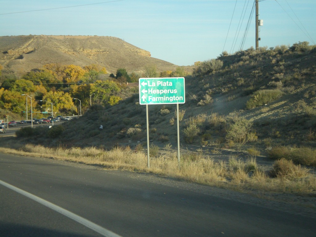
US-64 East at NM-170
US-64 east at NM-170 north to La Plata and Hesperus (CO).
Taken 10-18-2008
Farmington
San Juan County
New Mexico
United States