Signs Tagged With Intersection
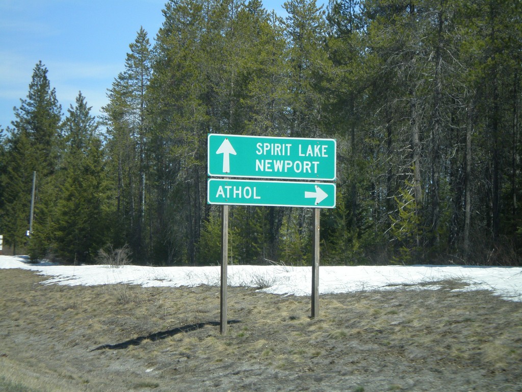
ID-41 North Approaching ID-54
ID-41 north approaching ID-54 east to Athol.
Taken 04-13-2008

 Spirit Lake
Kootenai County
Idaho
United States
Spirit Lake
Kootenai County
Idaho
United States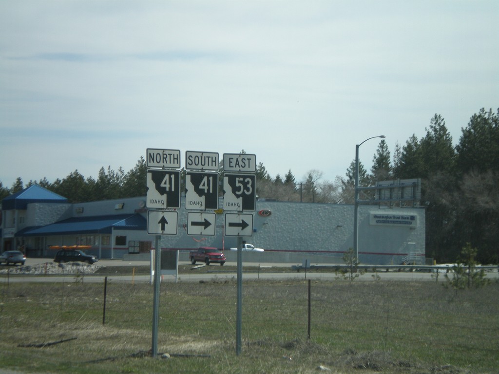
ID-53 East at ID-41
ID-53 east at ID-41 junction. ID-53 east traffic turns right here. ID-41 north traffic continue straight.
Taken 04-13-2008
 Rathdrum
Kootenai County
Idaho
United States
Rathdrum
Kootenai County
Idaho
United States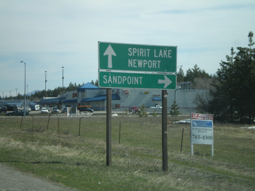
ID-53 East Approaching ID-41
ID-53 east approaching ID-41/ID-53 to Sandpoint and ID-41 north to Spirit Lake and Newport (WA).
Taken 04-13-2008
Rathdrum
Kootenai County
Idaho
United States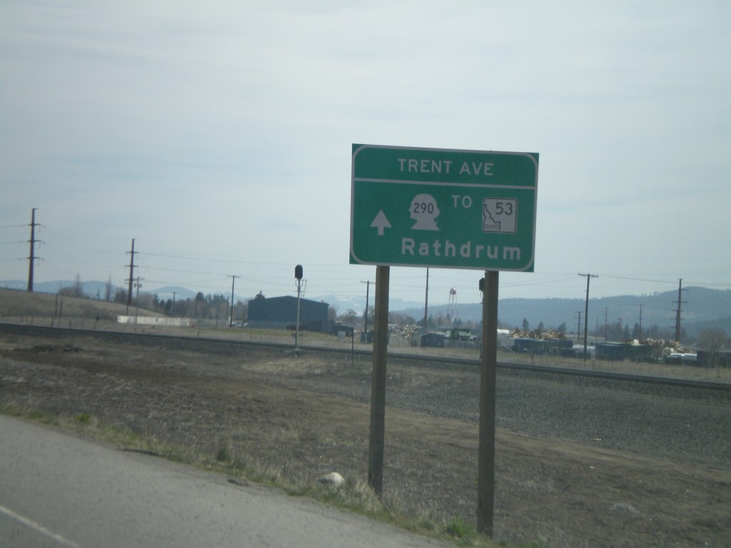
WA-290 East/To ID-53 East at Wellsley Ave
WA-290/To ID-53/Rathdrum at the intersection of Trent Ave. and Wellesley Ave.
Taken 04-13-2008
 Spokane Valley
Spokane County
Washington
United States
Spokane Valley
Spokane County
Washington
United States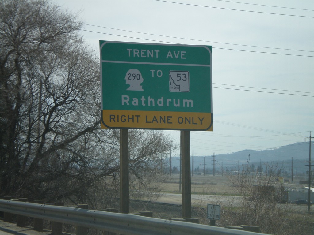
WA-290 East - Use right lane for WA-290/To-ID-53/Rathdrum
Use right lane for WA-290/To ID-53/Rathdrum on WA-290/Trent Ave. east at Wellesley Ave.
Taken 04-13-2008
Spokane
Spokane County
Washington
United States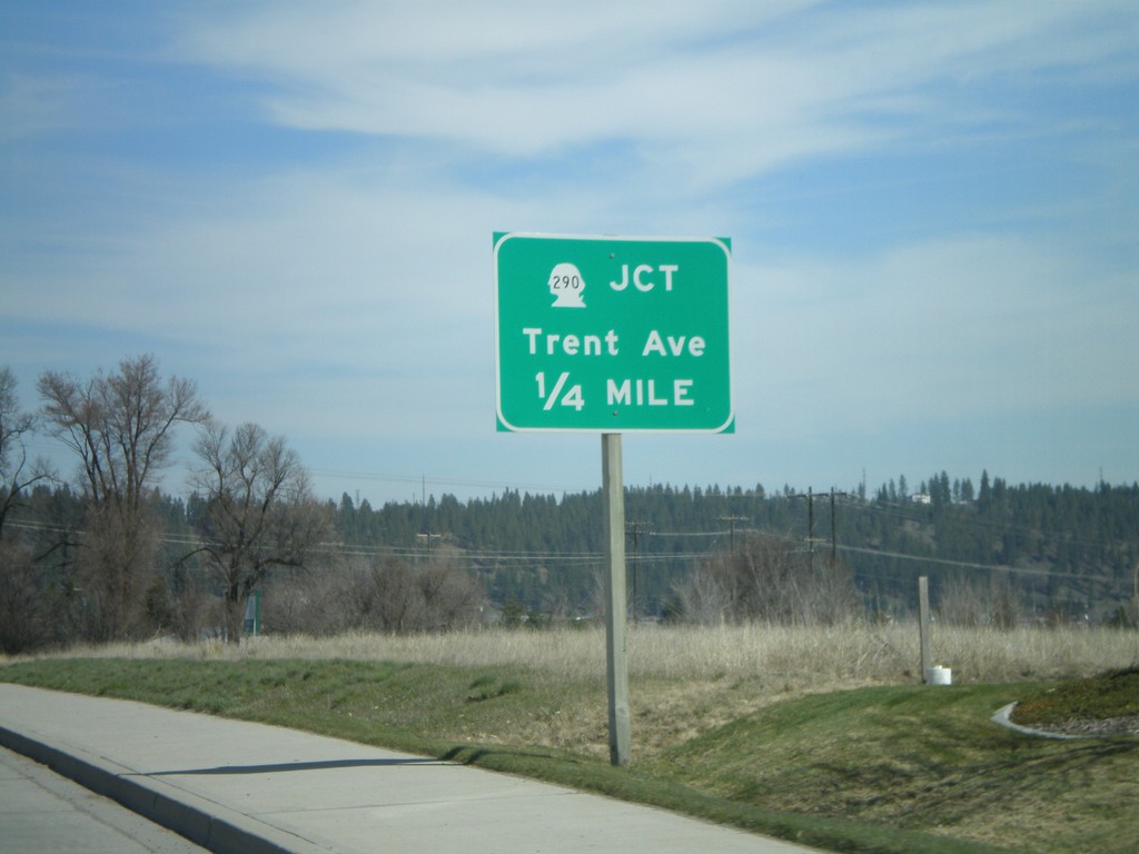
End WA-27 North At WA-290
WA-27 north approaching WA-290/Trent Ave. This is the northern end of WA-27. The southern end of WA-27 is in Pullman.
Taken 04-13-2008
 Spokane Valley
Spokane County
Washington
United States
Spokane Valley
Spokane County
Washington
United States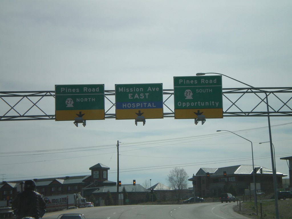
I-90 East - Exit 289 Offramp
I-90 east at Exit 289 offramp - WA-27/Pines Road. Turn right for WA-27 south to Opportunity.
Taken 04-13-2008
 Spokane Valley
Spokane County
Washington
United States
Spokane Valley
Spokane County
Washington
United States
I-90 East - Exit 276 Onramp
Marshall Road south at I-90 East onramp at Exit 276.
Taken 04-13-2008
 Spokane
 County
Washington
United States
Spokane
Spokane County
Washington
United States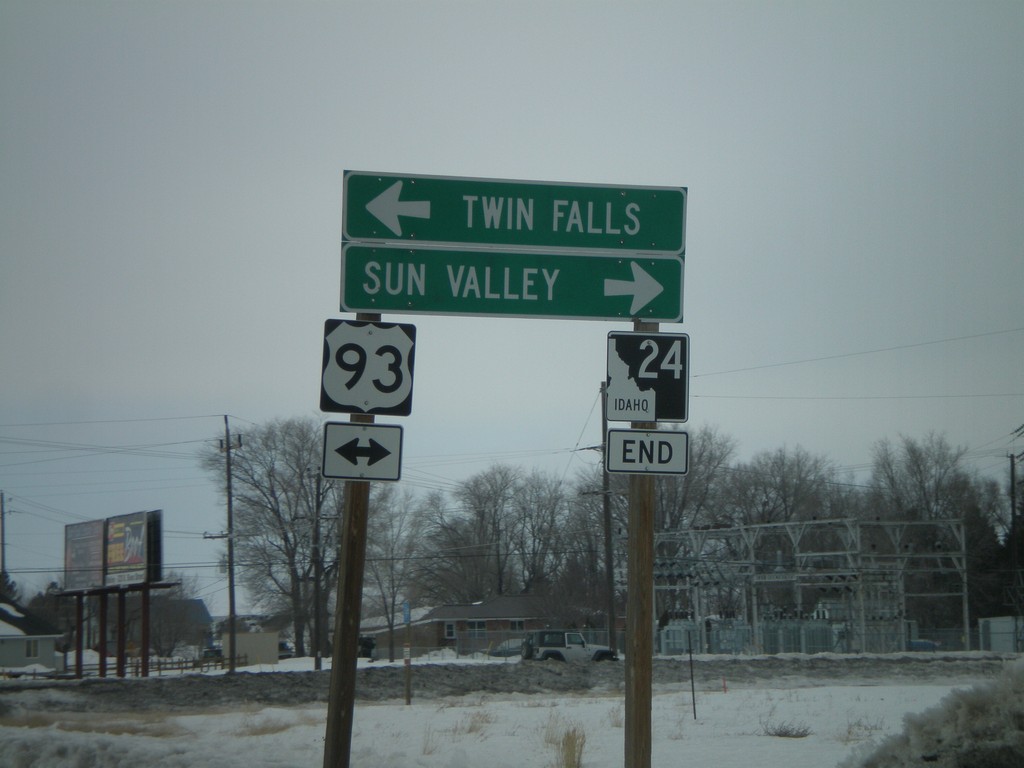
End ID-24 at US-93
End ID-24 West at US-93 Junction north to Sun Valley and south to Twin Falls.
Taken 02-17-2008

 Shoshone
Lincoln County
Idaho
United States
Shoshone
Lincoln County
Idaho
United States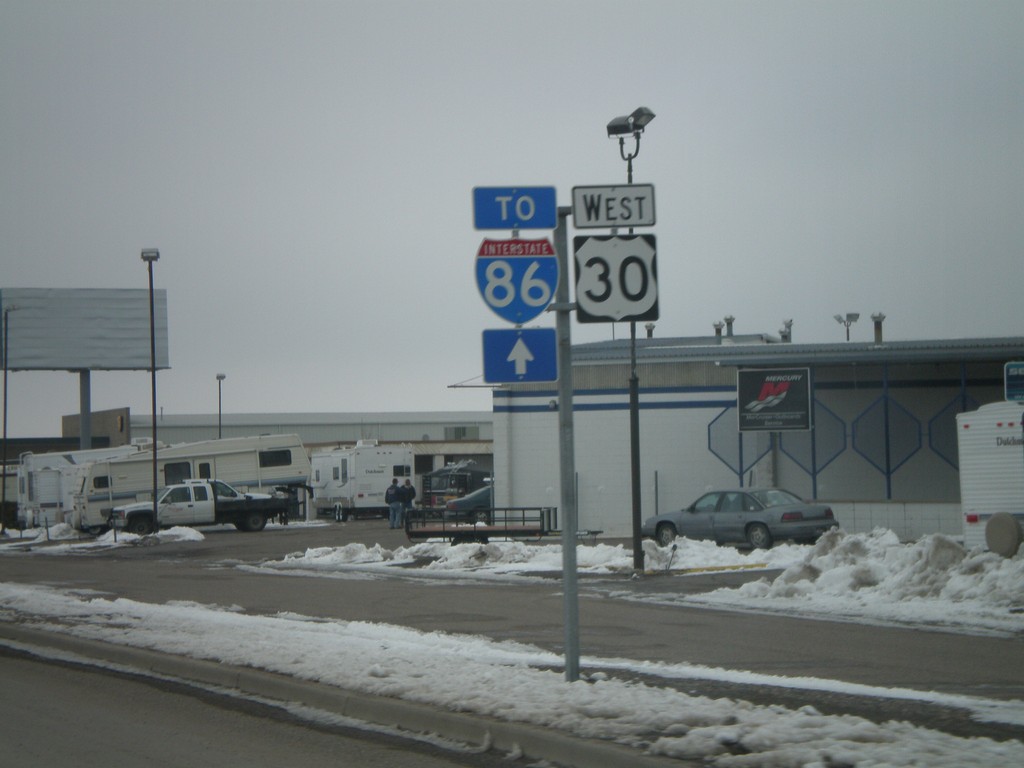
US-30 West/To I-86
US-30 West/To I-86 on Garrett Way.
Taken 02-17-2008

 Pocatello
Bannock County
Idaho
United States
Pocatello
Bannock County
Idaho
United States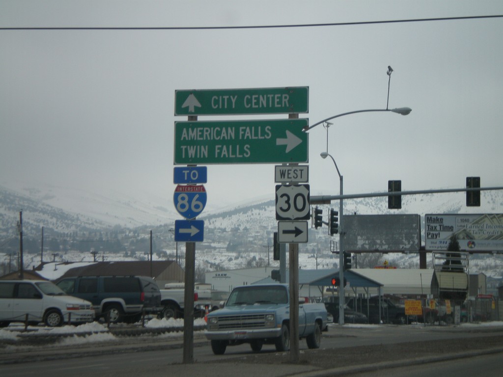
US-30 West - Oak St./Garrett Way Jct.
US-30 west (Oak St.) at Garrett Way to American Falls and Twin Falls.
Taken 02-17-2008
Pocatello
Bannock County
Idaho
United States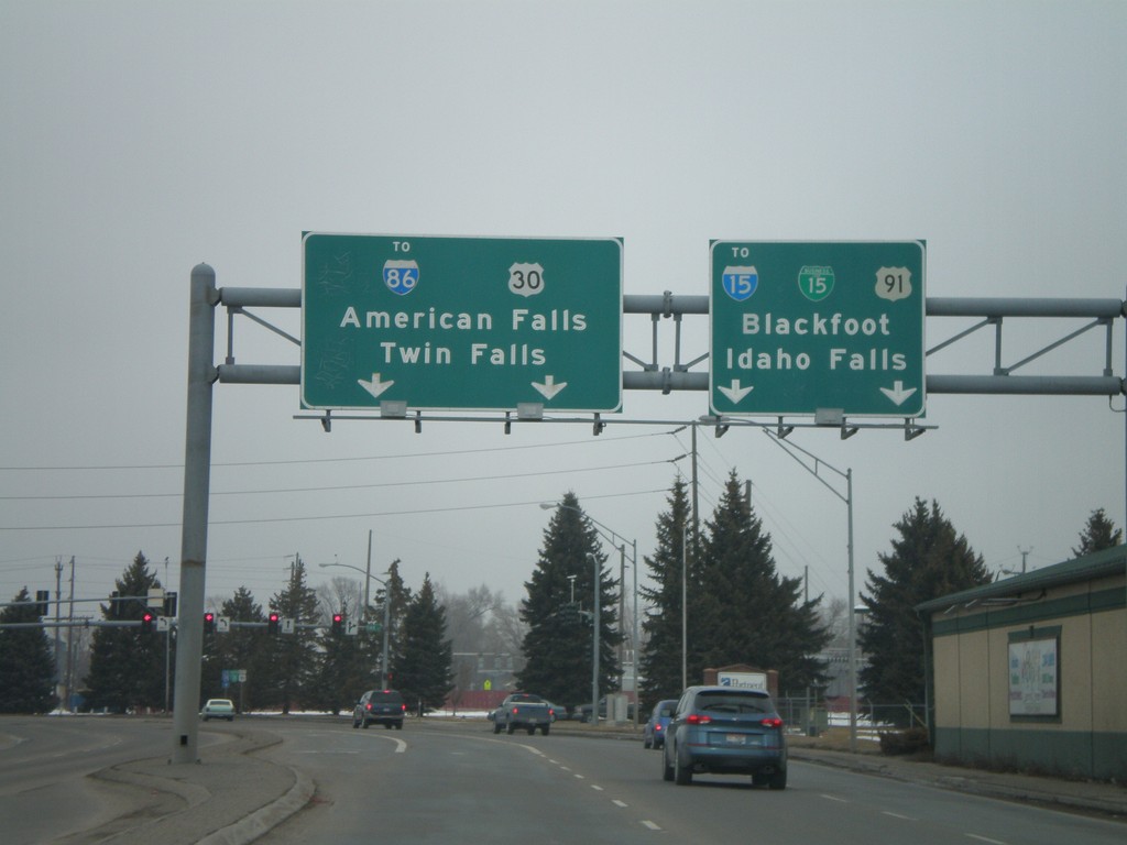
US-91/US-30/BL-15 North at US-30 West
US-91 N./US-30 W./BL-15 N. at US-91/US-30 split. Continue on 5th Ave. for BL-15/US-91/To I-15/Blackfoot/Idaho Falls. Turn left on Oak St. for US-30/To I-86/American Falls/Twin Falls.
Taken 02-17-2008


 Pocatello
Bannock County
Idaho
United States
Pocatello
Bannock County
Idaho
United States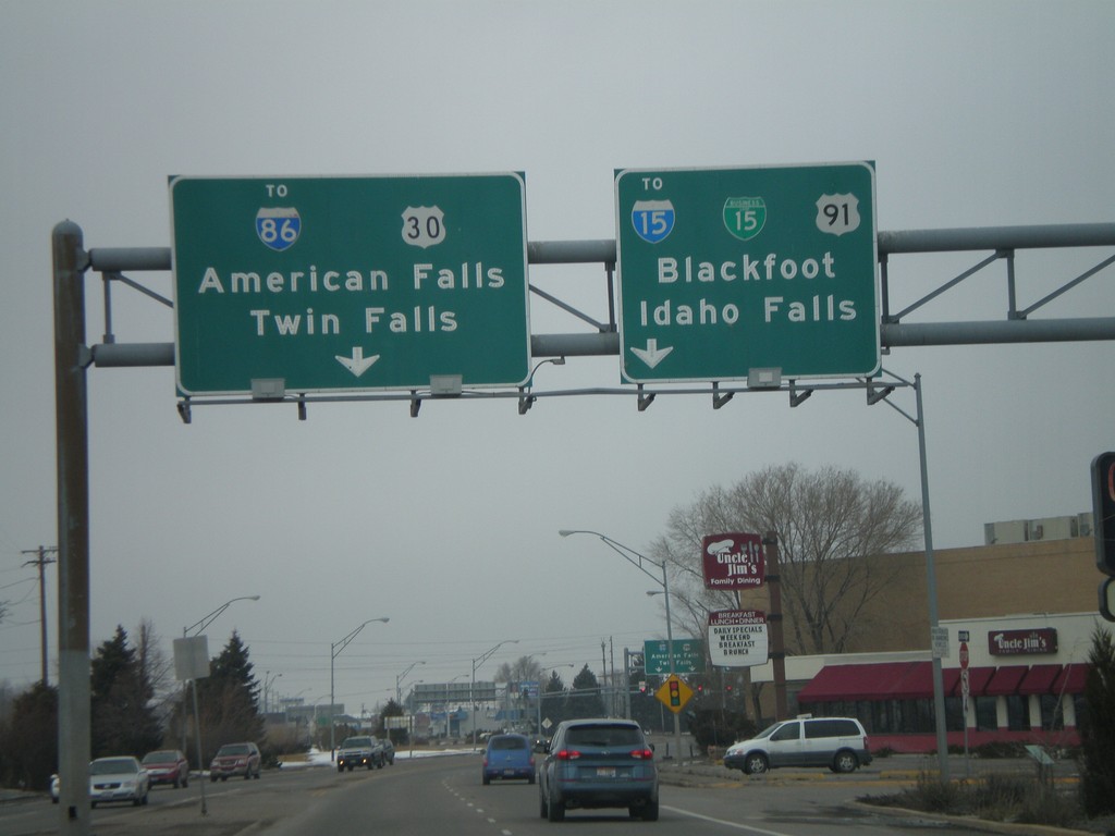
US-91/US-30/BL-15 North at US-30 West
US-91 North/US-30 West/BL-15 North approaching US-91/US-30 split. Continue on 5th Ave. for BL-15/US-91/To I-15/Blackfoot/Idaho Falls. Turn left on Oak St. for US-30/To I-86/American Falls/Twin Falls.
Taken 02-17-2008
Pocatello
Bannock County
Idaho
United States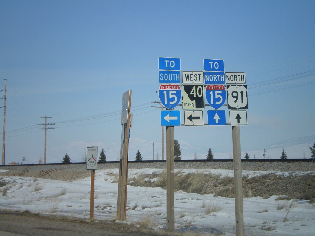
US-91 North at ID-40 West
US-91 north at ID-40 west. Use ID-40 west for I-15 south. Use US-91 north for I-15 north.
Taken 02-17-2008
 Downey
Bannock County
Idaho
United States
Downey
Bannock County
Idaho
United States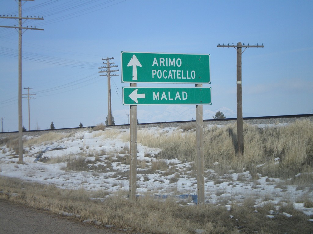
US-91 North at ID-40 West to Malad
US-91 north to Arimo and Pocatello at ID-40 west to Malad.
Taken 02-17-2008
Downey
Bannock County
Idaho
United States
End ID-40 East at US-91
End ID-40 east at US-91.
Taken 02-17-2008
Downey
Bannock County
Idaho
United States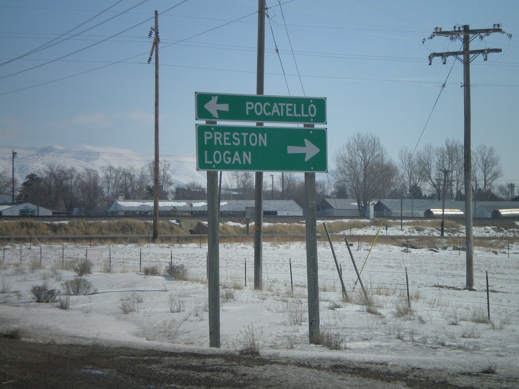
End ID-40 East at US-91
End ID-40 east at US-91 north to Pocatello - and US-91 south to Preston and Logan (Utah)
Taken 02-17-2008
Downey
Bannock County
Idaho
United States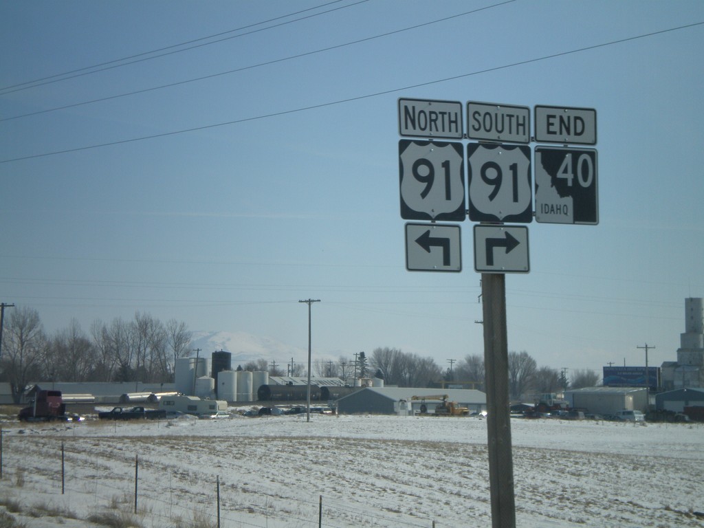
End ID-40 at US-91
End ID-40 east at US-91.
Taken 02-17-2008
Downey
Bannock County
Idaho
United States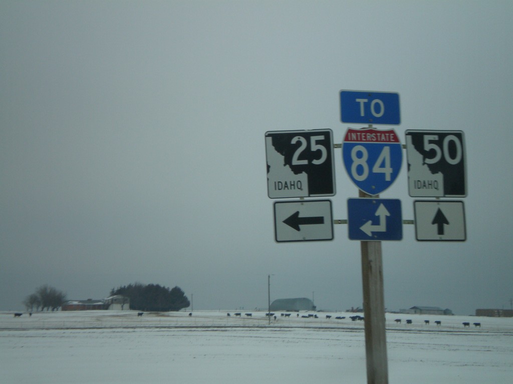
ID-25 East at ID-50
ID-25 east at ID-50 south. Use either ID-25 or ID-50 for I-84 access.
Taken 02-17-2008

 Eden
Jerome County
Idaho
United States
Eden
Jerome County
Idaho
United States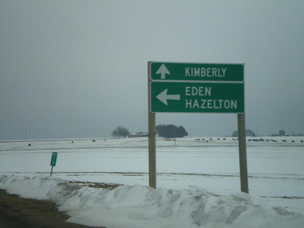
ID-25 East at ID-50 to Kimberly
ID-25 east to Eden and Hazelton, at ID-50 south to Kimberly.
Taken 02-17-2008
Eden
Jerome County
Idaho
United States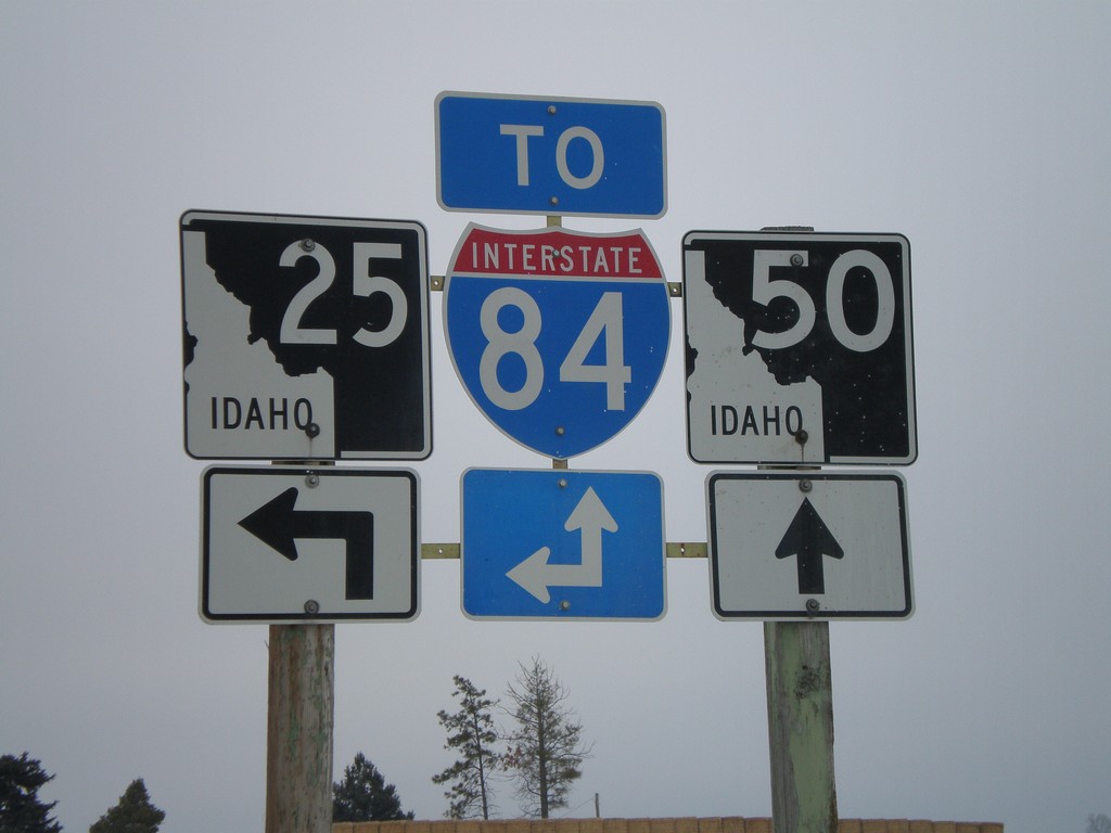
ID-25 East at ID-50
ID-25 east approaching ID-50. Use either ID-50 south or ID-25 east for I-84. ID-25 east parallels I-84 from here until the Hazelton area.
Taken 02-17-2008
Eden
Jerome County
Idaho
United States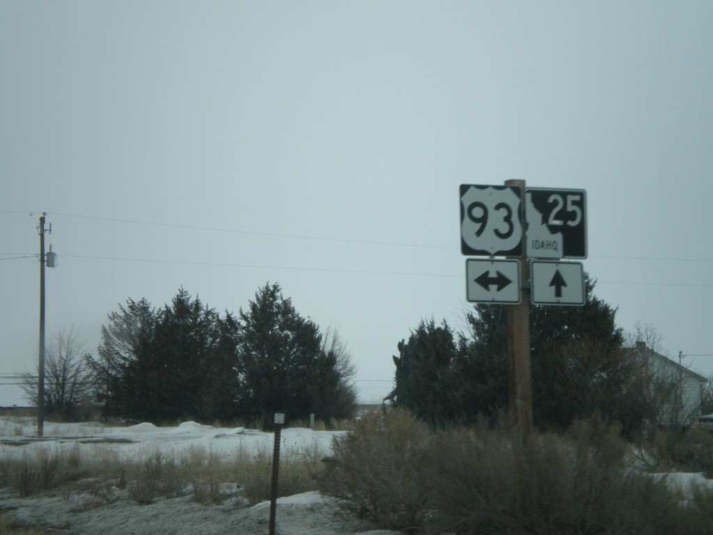
ID-25 East at US-93
ID-25 east approaching US-93 - south to Twin Falls, north to Shoshone.
Taken 02-17-2008
Jerome
Jerome County
Idaho
United States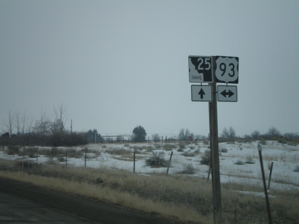
ID-25 East Approaching US-93
ID-25 east approaching US-93.
Taken 02-17-2008
Jerome
Jerome County
Idaho
United States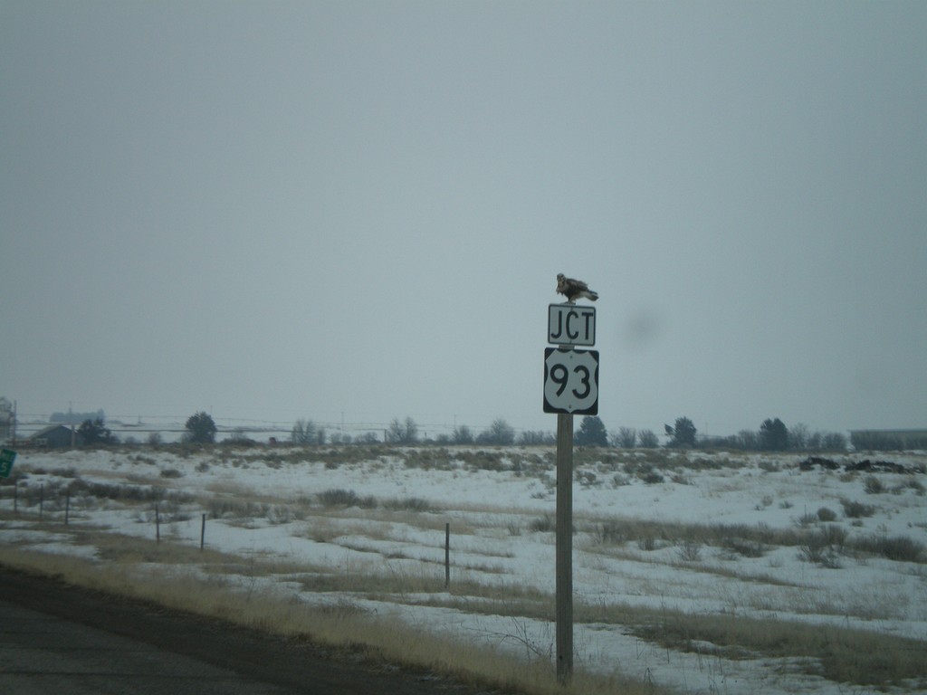
Jct. US-93 on ID-25 East
ID-25 east approaching US-93. A hawk is sitting on top of the Junction US-93 sign.
Taken 02-17-2008
Jerome
Jerome County
Idaho
United States