Signs Tagged With Intersection
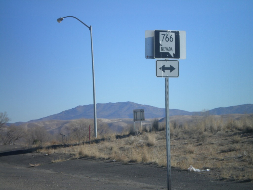
I-80 East Exit 280 Offramp at NV-766
I-80 east Exit 280 offramp at NV-766. NV-766 heads north to Newmont Gold Mine, south into Carlin.
Taken 11-24-2007

 Carlin
Elko County
Nevada
United States
Carlin
Elko County
Nevada
United States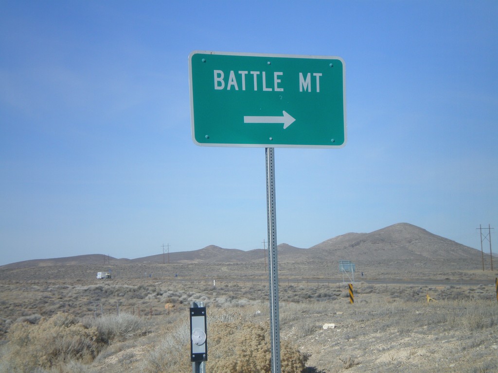
I-80 Exit 203 East Onramp
I-80 east onramp at Exit 203 to Battle Mountain
Taken 11-24-2007
Red House
Humboldt County
Nevada
United States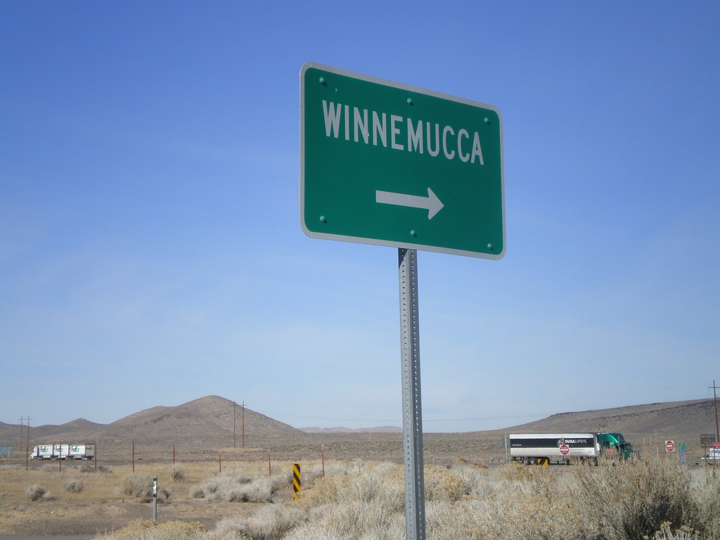
I-80 Exit 203 West Onramp
I-80 west onramp at Exit 203 to Winnemucca
Taken 11-24-2007
Red House
Humboldt County
Nevada
United States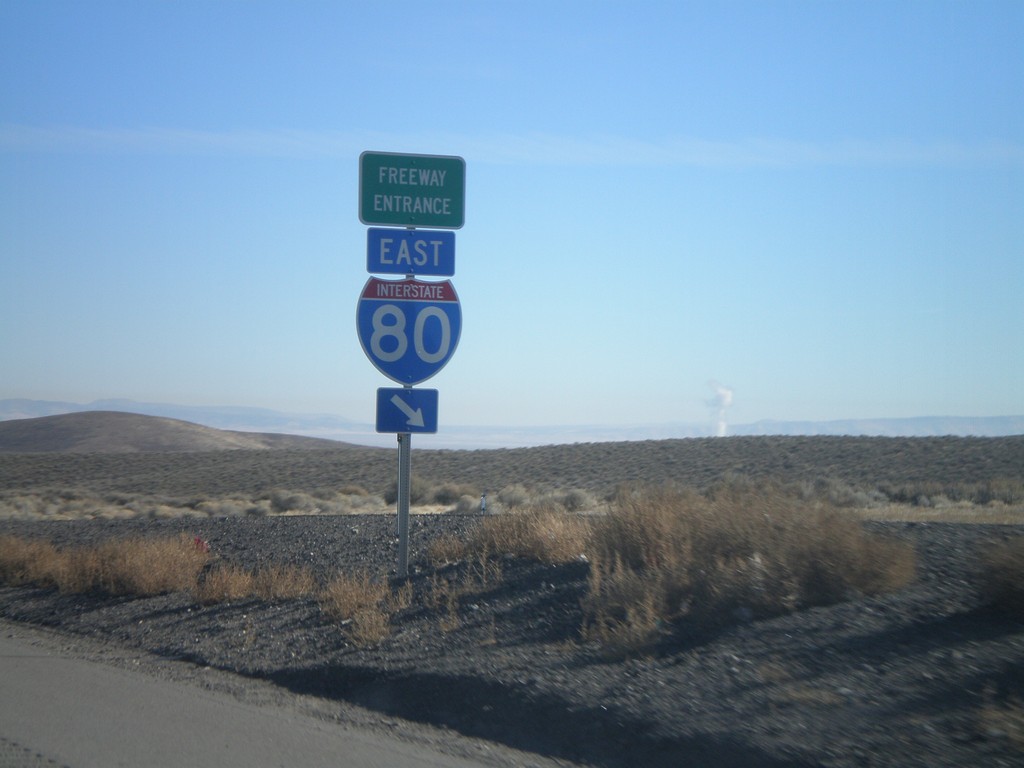
I-80 East Exit 200 Onramp
I-80 east onramp at Exit 200 on Golconda Summit
Taken 11-24-2007
Golconda
Humboldt County
Nevada
United States
End NV-794 West at NV-289/BL-80
End NV-794 at NV-289/BL-80. Turn right on NV-289/BL-80 to Reno and Elko. Turn left for Winnemucca city center.
Taken 11-24-2007

 Winnemucca
Humboldt County
Nevada
United States
Winnemucca
Humboldt County
Nevada
United States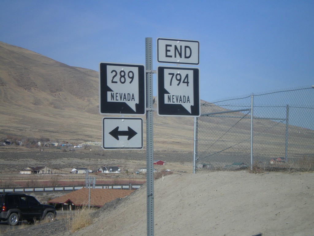
End NV-794 West at NV-289
End NV-794 west at BL-80/NV-289
Taken 11-24-2007
Winnemucca
Humboldt County
Nevada
United States
End NV-794 West at NV-289
NV-794 east approaching BL-80/NV-289.
Taken 11-24-2007
Winnemucca
Humboldt County
Nevada
United States
NV-794 West at I-80 East Exit 180 Onramp
End NV-794 east at I-80 Exit 180 onramp
Taken 11-24-2007
Winnemucca
Humboldt County
Nevada
United States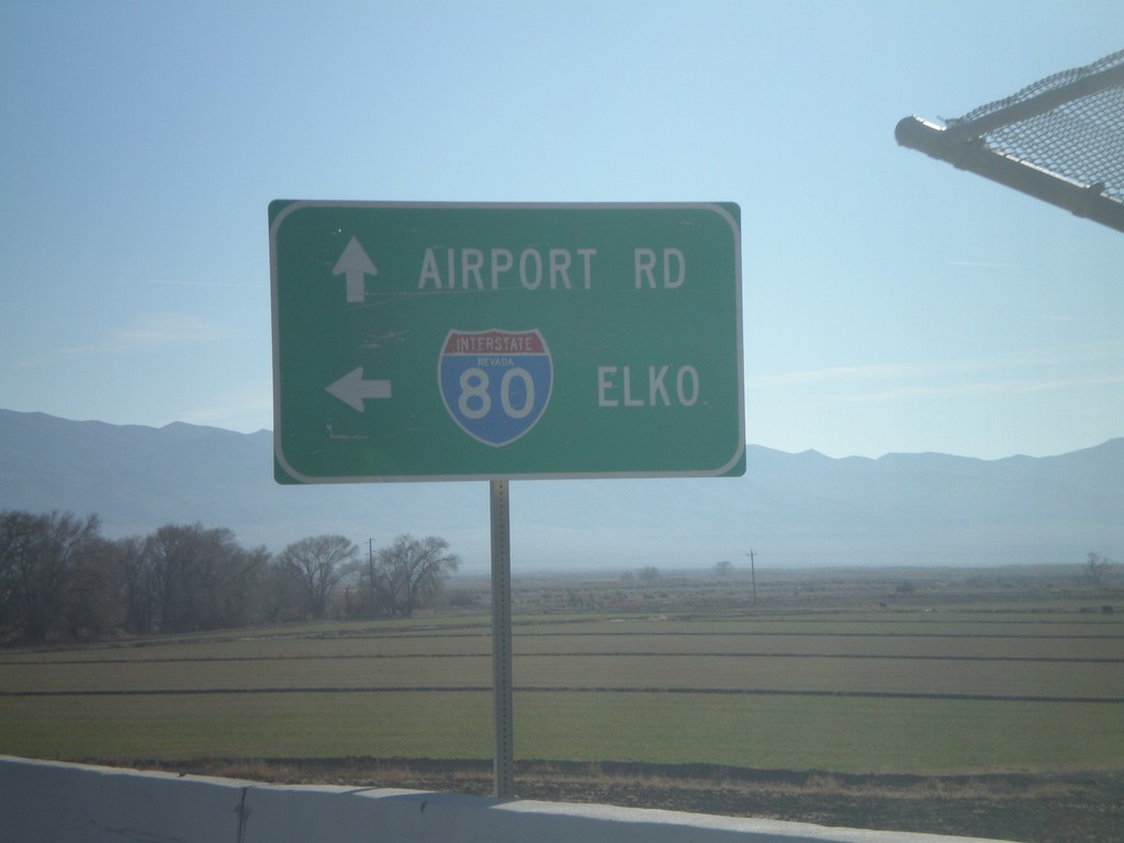
BL-80/NV-856 East at I-80 East
NV-856/BL-80 at I-80 east to Elko
Taken 11-24-2007

 Lovelock
Pershing County
Nevada
United States
Lovelock
Pershing County
Nevada
United States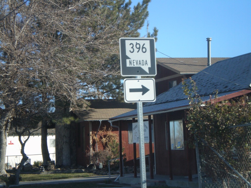
NV-396 East at NV-856 East
BL-80/NV-396 east at NV-856 east. BL-80 follows NV-856 east of here.
Taken 11-24-2007
 Lovelock
Pershing County
Nevada
United States
Lovelock
Pershing County
Nevada
United States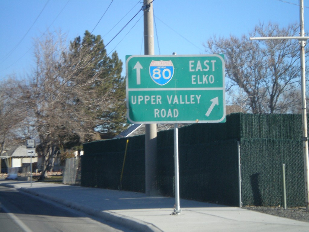
NV-396 East at NV-856
BL-80/NV-396 east at NV-856 jct. NV-396 continues to the right as Upper Valley Road. NV-856/BL-80 continue eastward.
Taken 11-24-2007
Lovelock
Pershing County
Nevada
United States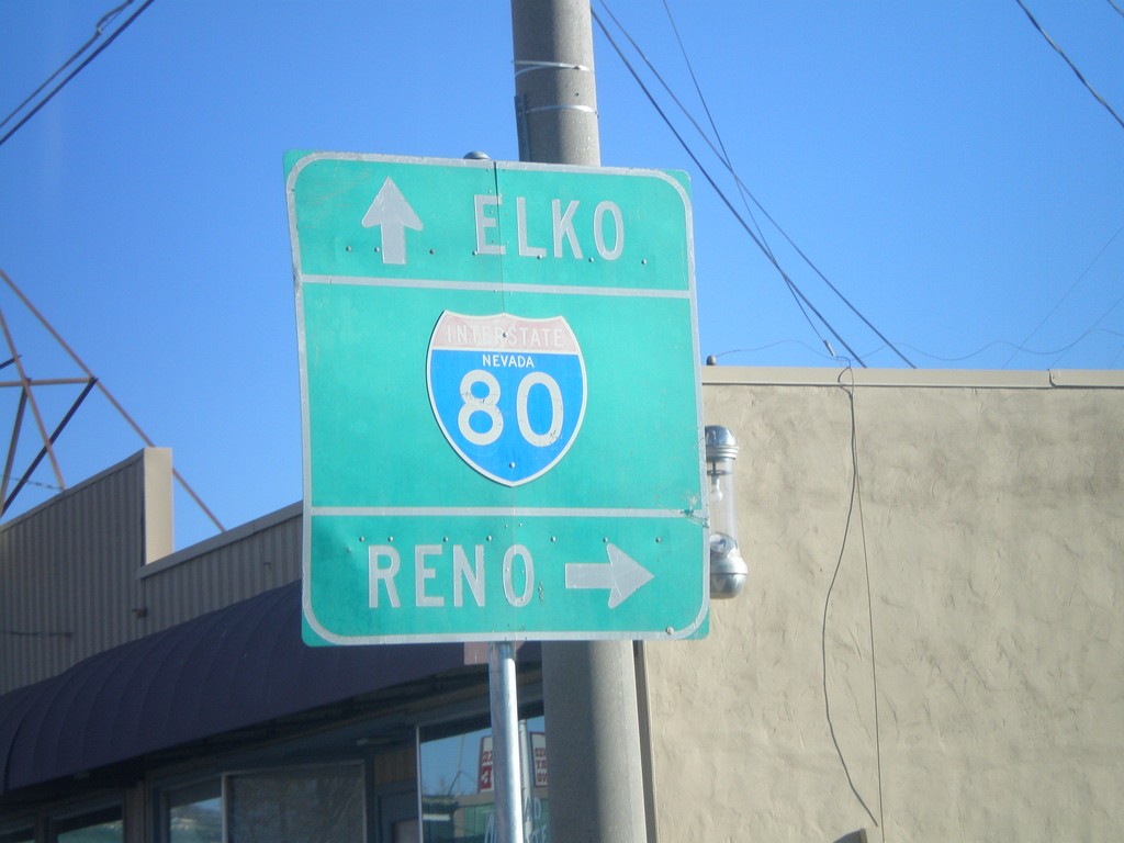
BL-80/NV-396 East at NV-398
BL-80/NV-396 east (Cornell Ave) at NV-398/Main St. Use NV-398 for I-80 westbound access.
Taken 11-24-2007
 Lovelock
Pershing County
Nevada
United States
Lovelock
Pershing County
Nevada
United States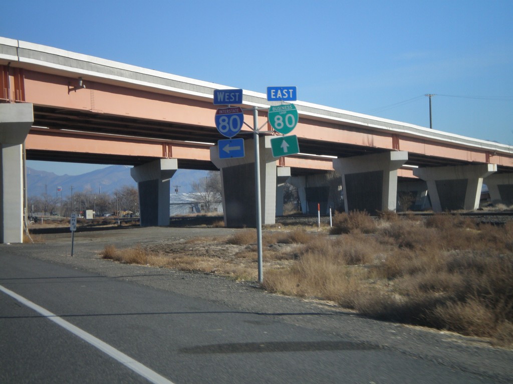
NV-396/BL-80 East at I-80 West
NV-396 east at begin BL-80 east. Approaching I-80 west ramps at Exit 105.
Taken 11-24-2007
 Lovelock
Pershing County
Nevada
United States
Lovelock
Pershing County
Nevada
United States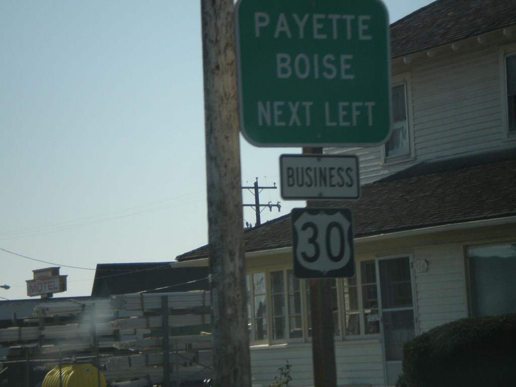
Bus. US-30 South in Ontario
Bus. US-30 East at Idaho St.
Taken 11-04-2007
 Ontario
Malheur County
Oregon
United States
Ontario
Malheur County
Oregon
United States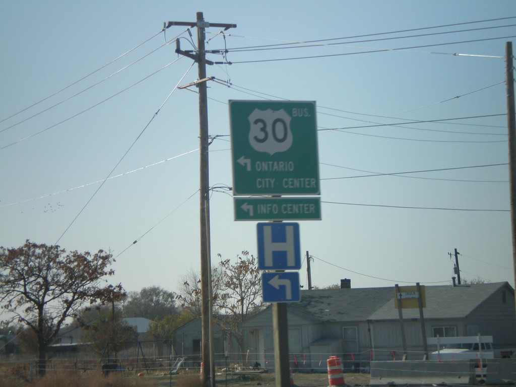
OR-201 South at Bus. US-30
OR-201 south at Bus. US-30 to Ontario City Center.
Taken 11-04-2007
 Ontario
Malheur County
Oregon
United States
Ontario
Malheur County
Oregon
United States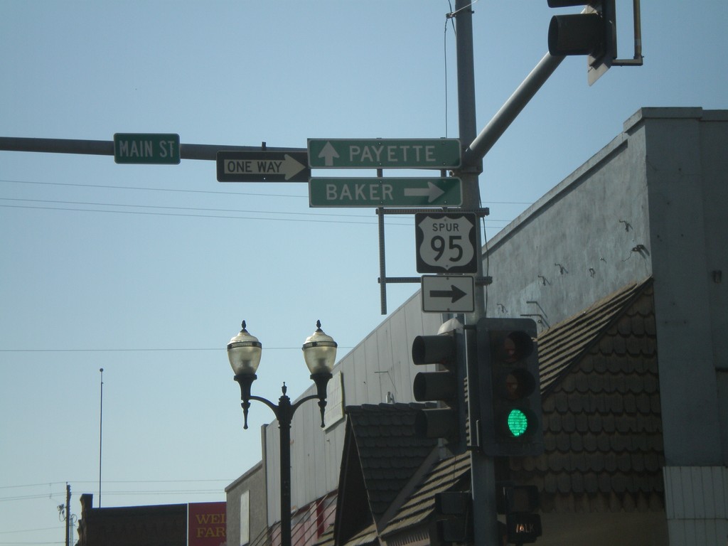
US-95 Spur - Weiser
US-95 Spur south (State St.) to Payette at Main St. to Baker (Oregon).
Taken 11-04-2007
 Weiser
Washington County
Idaho
United States
Weiser
Washington County
Idaho
United States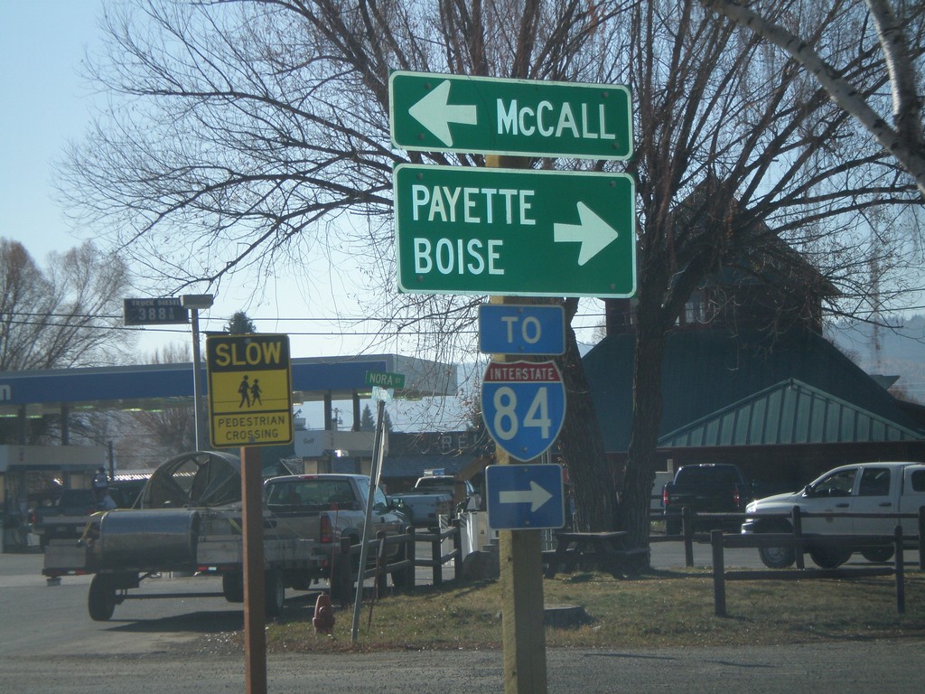
US-95 South at ID-55
US-95 South at ID-55. Although fastest way to Boise is via ID-55 - sign directs Boise traffic on US-95. US-95 south is the fastest way to I-84.
Taken 11-04-2007

 New Meadows
Adams County
Idaho
United States
New Meadows
Adams County
Idaho
United States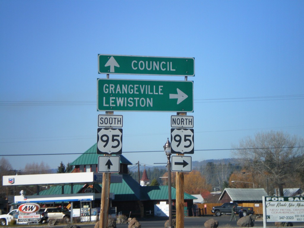
End ID-55 North at US-95
End ID-55 at US-95 south to Council, and north to Grangeville and Lewiston.
Taken 11-04-2007
New Meadows
Adams County
Idaho
United States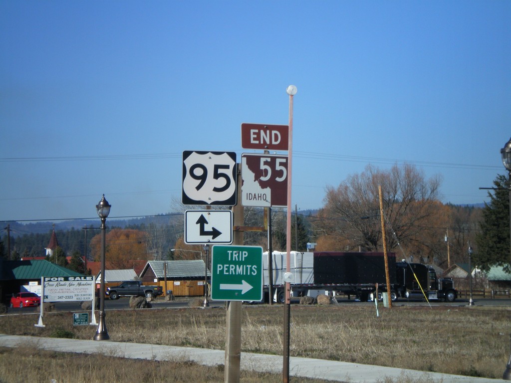
End ID-55 North at US-95
End ID-55 north at US-95. US-95 between New Meadows and Grangeville is the only highway connecting north and south Idaho.
Taken 11-04-2007
New Meadows
Adams County
Idaho
United States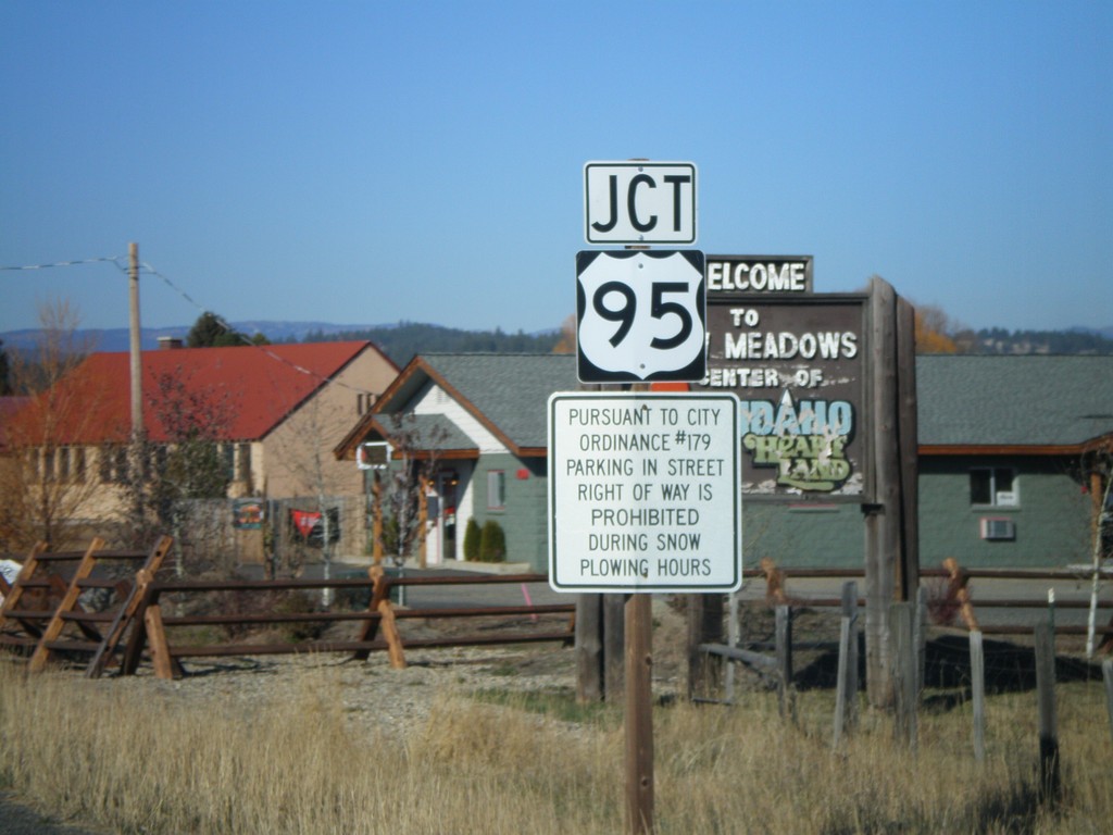
ID-55 North At US-95
ID-55 north approaching US-95.
Taken 11-04-2007
New Meadows
Adams County
Idaho
United States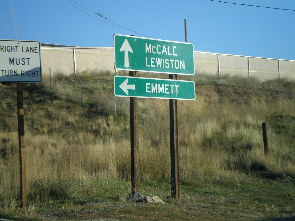
ID-55 North At ID-52
ID-55 north at ID-52 west to Emmett.
Taken 11-04-2007
 Horseshoe Bend
Boise County
Idaho
United States
Horseshoe Bend
Boise County
Idaho
United States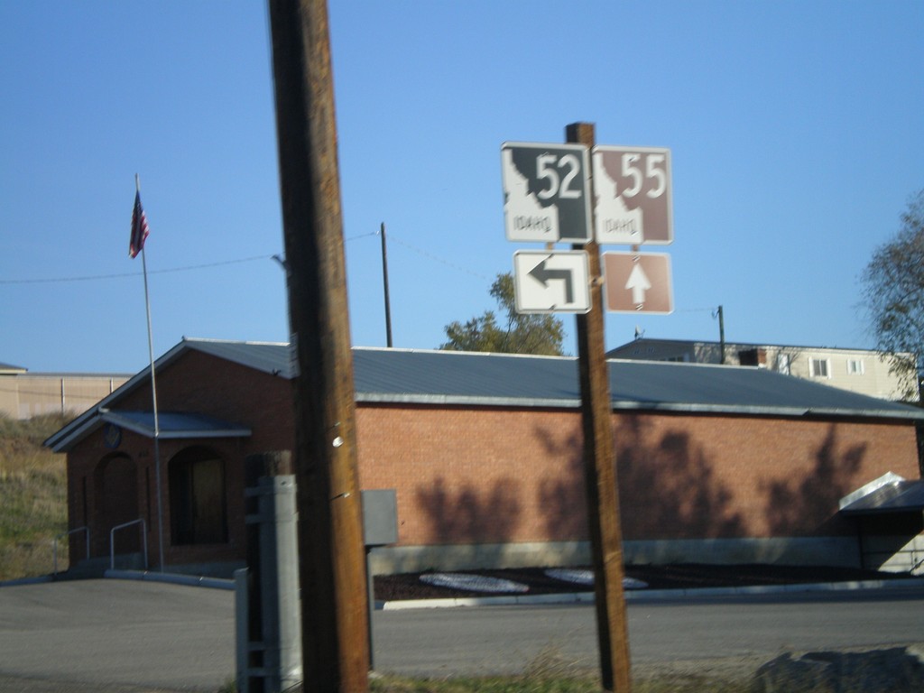
ID-55 North Approaching ID-52
ID-55 north approaching ID-52.
Taken 11-04-2007
Horseshoe Bend
Boise County
Idaho
United States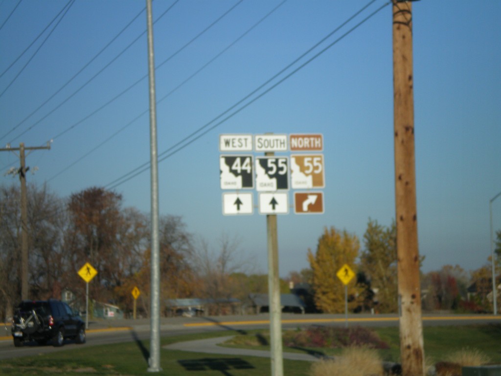
US-20/US-26 West at ID-44
US-20/US-26 west at ID-44 west - to ID-55.
Taken 11-04-2007


 Garden City
Ada County
Idaho
United States
Garden City
Ada County
Idaho
United States
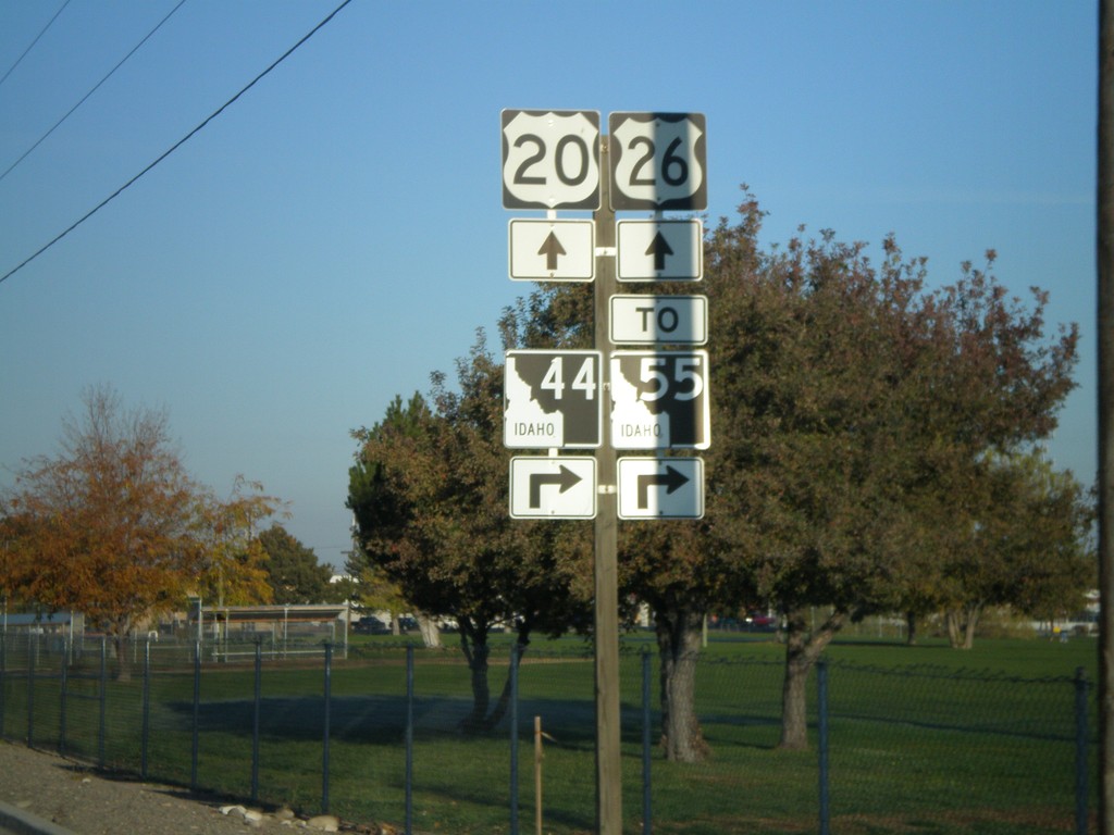
Jct. ID-44 on US-20/US-26 West
US-20/US-26 west approaching ID-44.
Taken 11-04-2007
Garden City
Ada County
Idaho
United States