Signs Tagged With Intersection
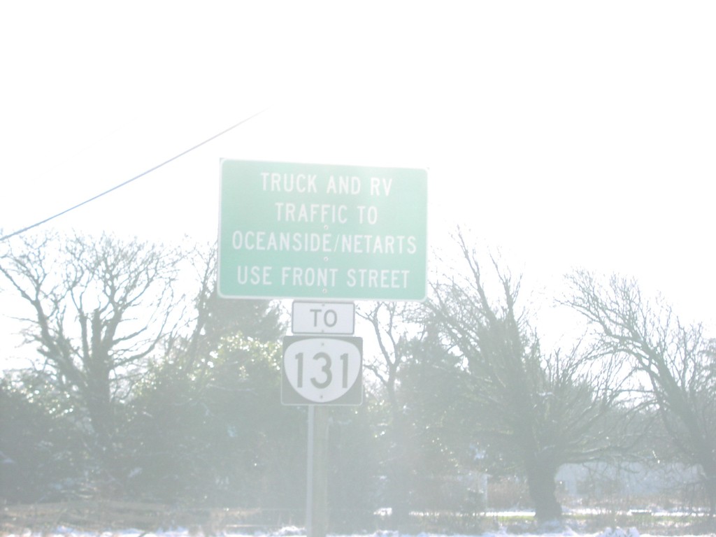
US-101 South at OR-131
US-101 south approaching OR-131. OR-131 bound truck and RV Traffic, use Front St.
Taken 01-01-2007

 Tillamook
 County
Oregon
United States
Tillamook
Tillamook County
Oregon
United States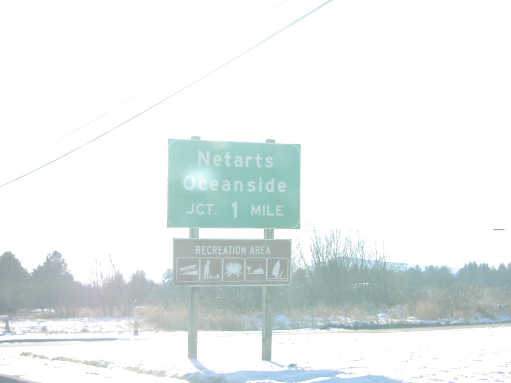
US-101 South Approaching OR-131
US-101 south approaching OR-131/Netarts/Oceanside, 1 mile.
Taken 01-01-2007
Tillamook
Tillamook County
Oregon
United States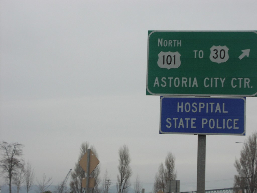
US-101 North To US-30 at OR-202
US-101 north to US-30/Astoria City Center, at OR-202 roundabout.
Taken 01-01-2007

 Astoria
Clatsop County
Oregon
United States
Astoria
Clatsop County
Oregon
United States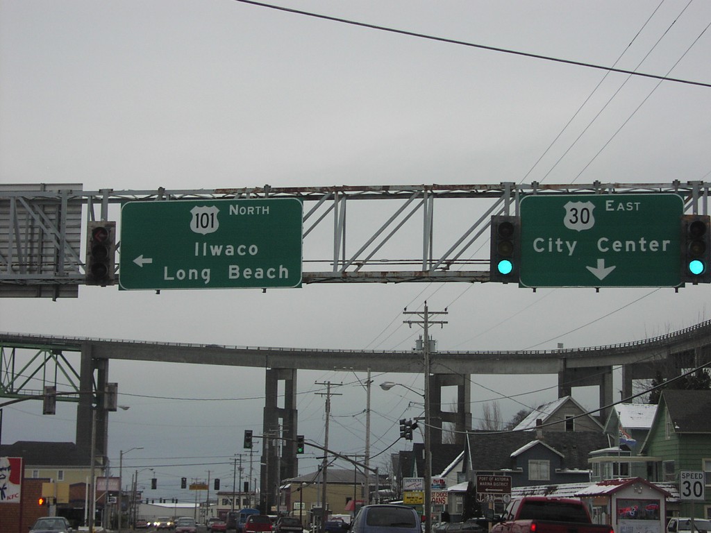
US-101 North at US-30
Begin US-30 to (Astoria) City Center at US-101 north to Ilwaco and Long Beach. The overpass in background is the US-101 North approach to the Columbia River Bridge.
Taken 01-01-2007
Astoria
Clatsop County
Oregon
United States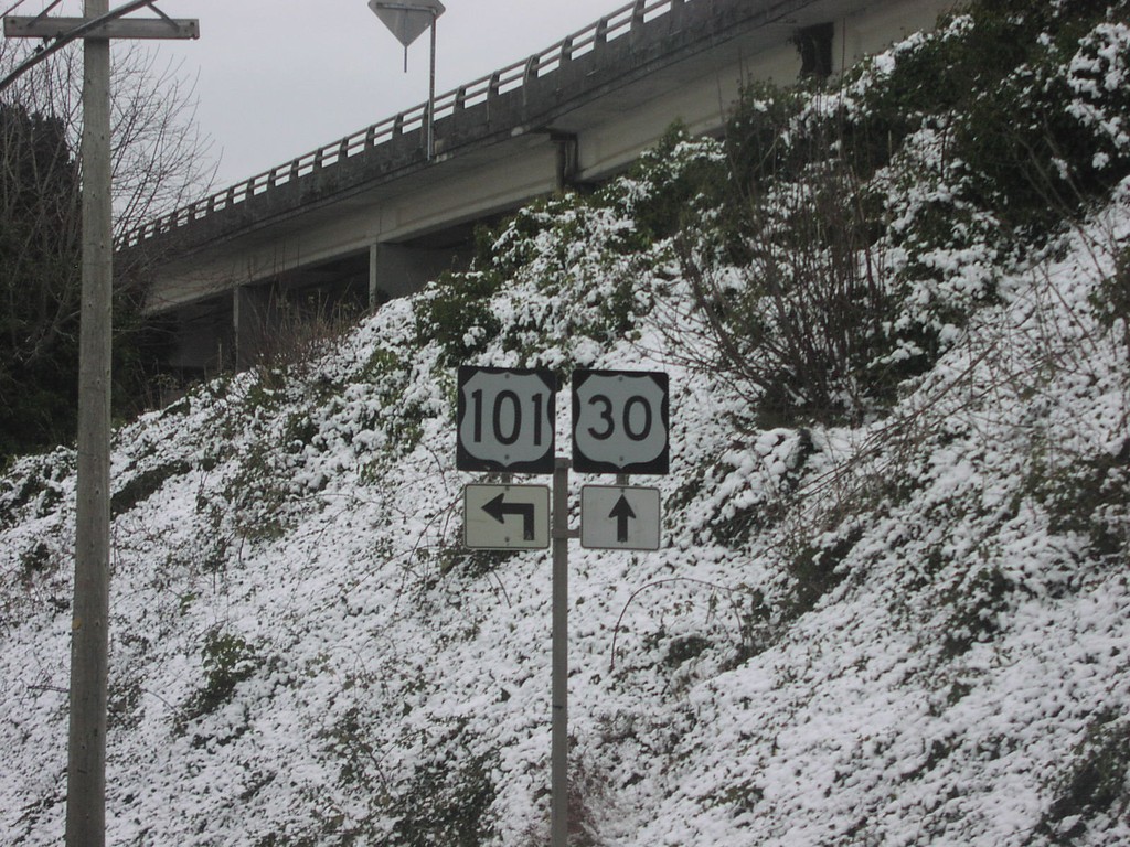
US-101 North at US-30
US-101 north approaching beginning of US-30.
Taken 01-01-2007
Astoria
Clatsop County
Oregon
United States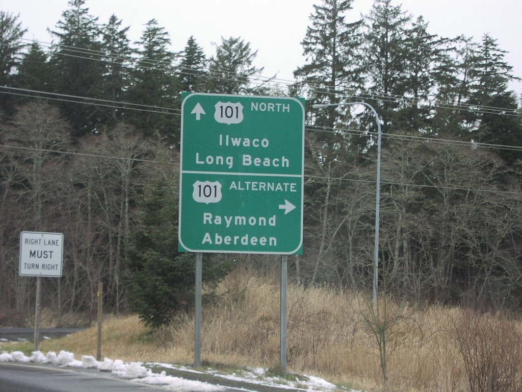
US-101 North at US-101 Alternate
US-101 north at US-101 Alternate to Aberdeen and Raymond.
Taken 01-01-2007
 Ilwaco
Pacific County
Washington
United States
Ilwaco
Pacific County
Washington
United States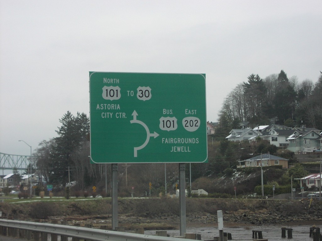
US-101 North at OR-202 South - Roundabout
US-101 north at OR-202 East/Bus. US-101 South to Jewell and Fairgrounds. US-101/OR-202 junction is a roundabout.
Taken 01-01-2007
Astoria
Clatsop County
Oregon
United States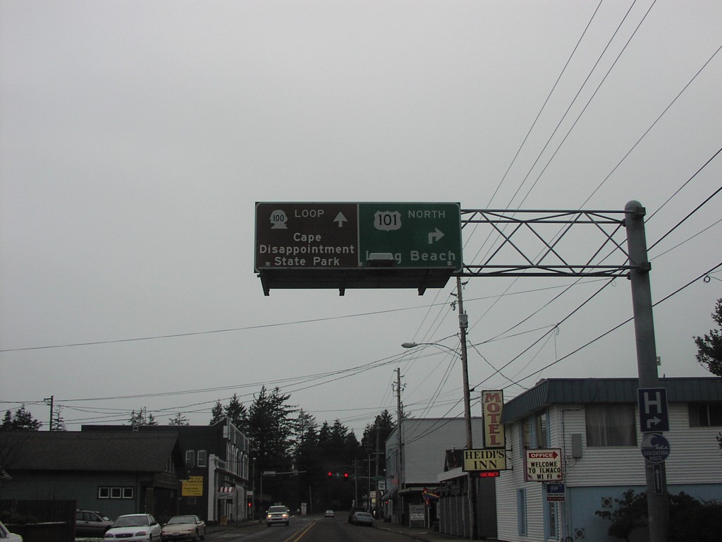
US-101 North at Loop WA-100
US-101 north approaching WA-100 Loop to Cape Disappointment State Park.
Taken 01-01-2007
 Ilwaco
Pacific County
Washington
United States
Ilwaco
Pacific County
Washington
United States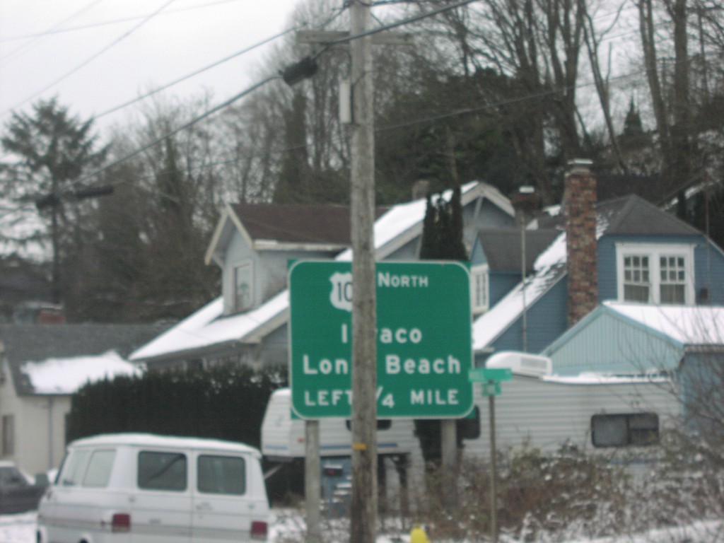
US-101 North Approaching US-30
US-101 north approaching Columbia River Bridge at US-30 east junction.
Taken 01-01-2007
Astoria
Clatsop County
Oregon
United States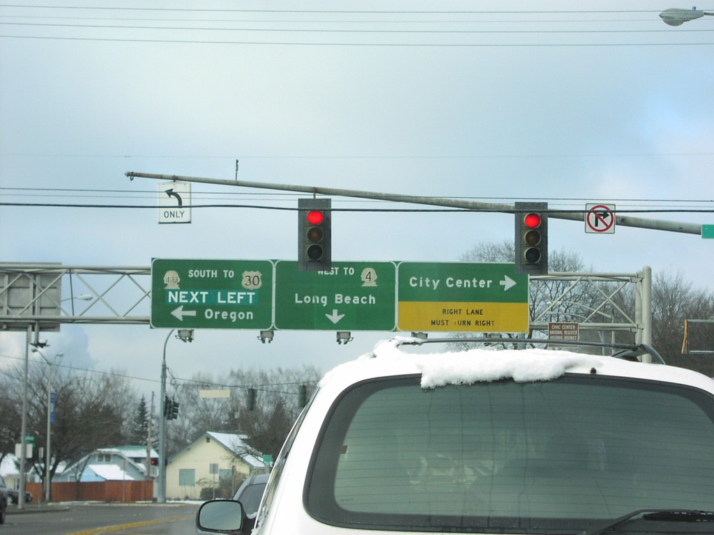
Tennant Way West - Longview
Tennant Way west at Oregon Ave South to WA-432 South/US-30/Oregon, north to City Center. Tennant Way becomes Nichols Blvd. west to WA-4/Long Beach.
Taken 01-01-2007

 Longview
Cowlitz County
Washington
United States
Longview
Cowlitz County
Washington
United States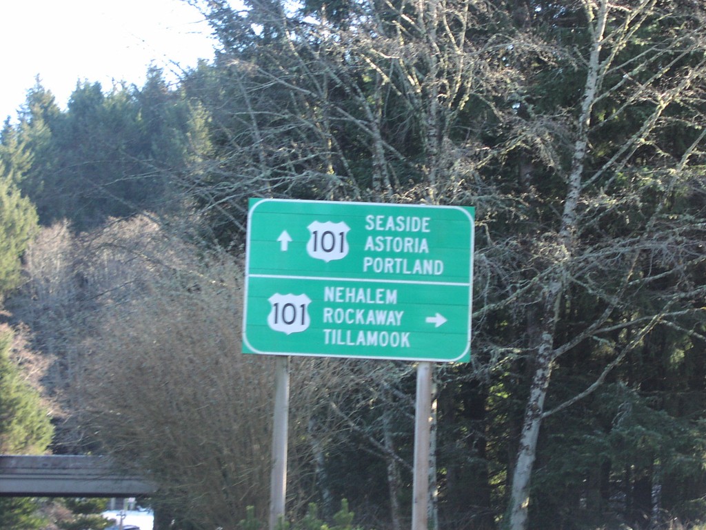
Sunset Blvd. at US-101 in Cannon Beach
Sunset Blvd. at US-101 on ramp.
Taken 01-01-2007
Cannon Beach
Clatsop County
Oregon
United States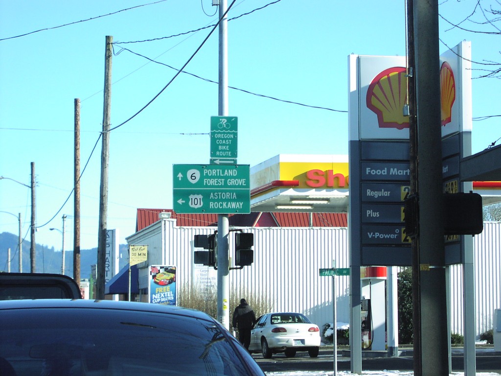
OR-6 East at US-101 North
OR-6 east at US-101 north to Rockaway and Astoria.
Taken 01-01-2007
 Tillamook
 County
Oregon
United States
Tillamook
Tillamook County
Oregon
United States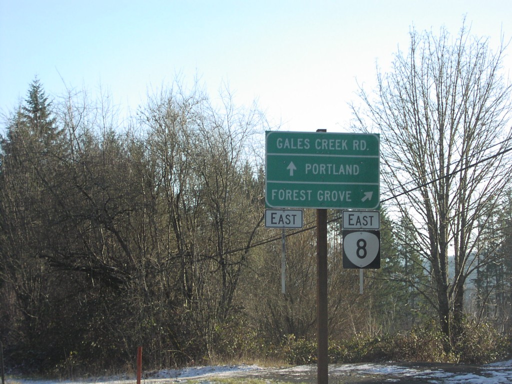
OR-6 East at OR-8
OR-6 east at OR-8 east to Forest Grove.
Taken 01-01-2007
 Gales Creek
Washington County
Oregon
United States
Gales Creek
Washington County
Oregon
United States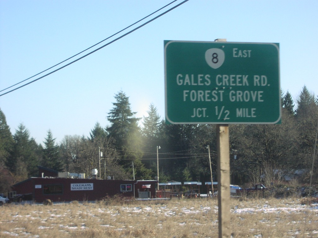
OR-6 East Approaching OR-8
OR-6 east approaching OR-8/Gales Creek Road/Forest Grove, 1/2 mile.
Taken 01-01-2007
Gales Creek
Washington County
Oregon
United States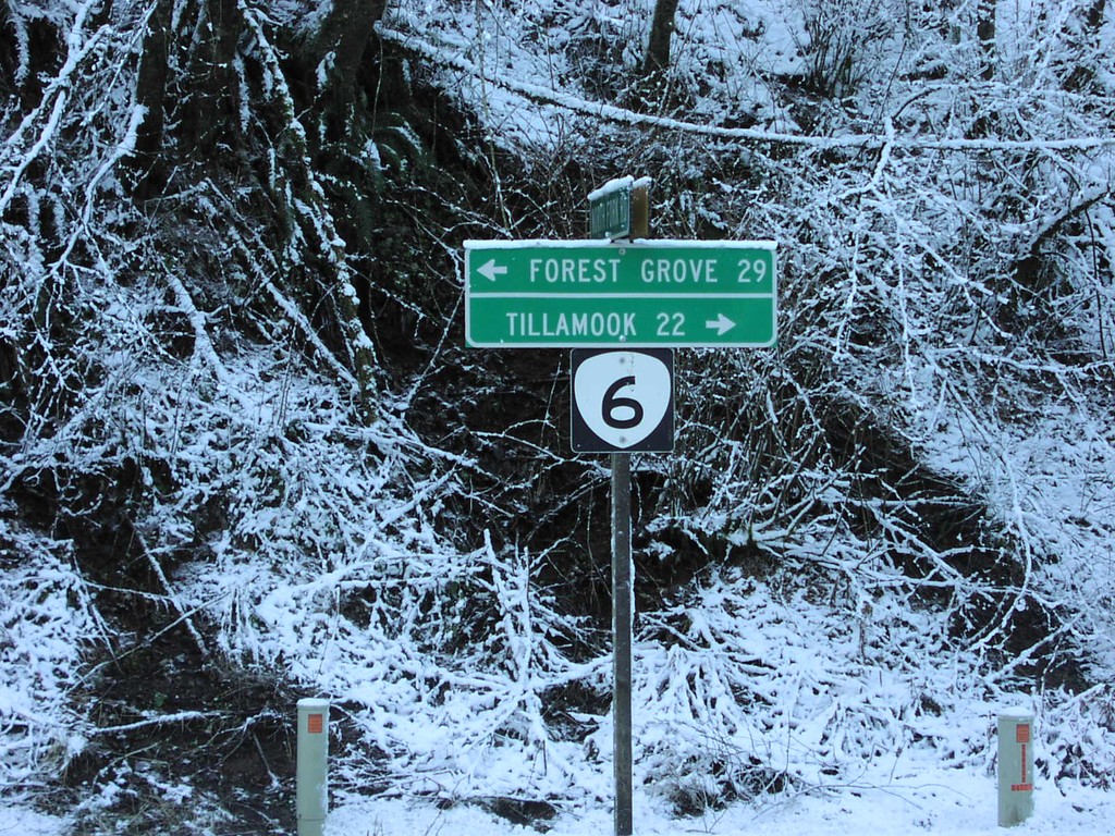
OR-6 - Tillamook State Forest
OR-6 to Tillamook and Forest Grove in the Tillamook State Forest.
Taken 01-01-2007
Tillamook
Tillamook County
Oregon
United States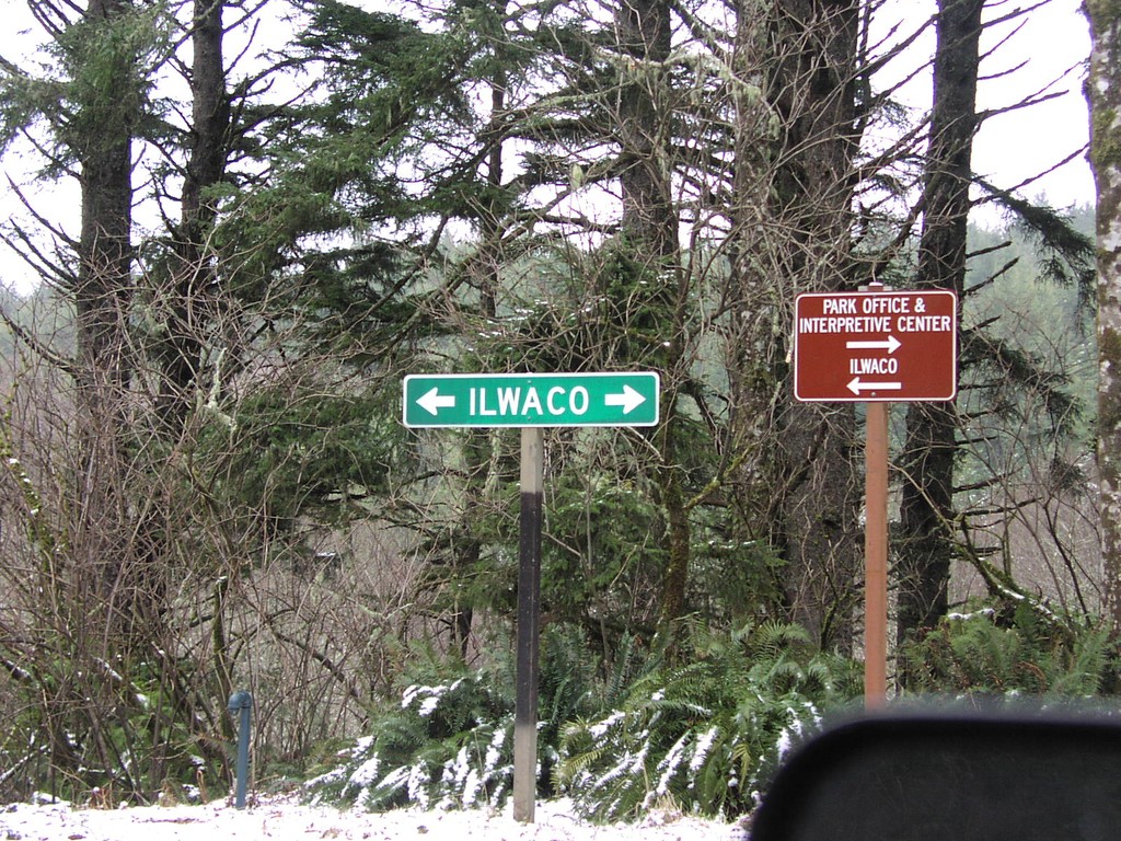
North Lighthouse Access Rd. at WA-100
North Head Lighthouse access road at WA-100 Loop to Ilwaco.
Taken 01-01-2007
Ilwaco
Pacific County
Washington
United States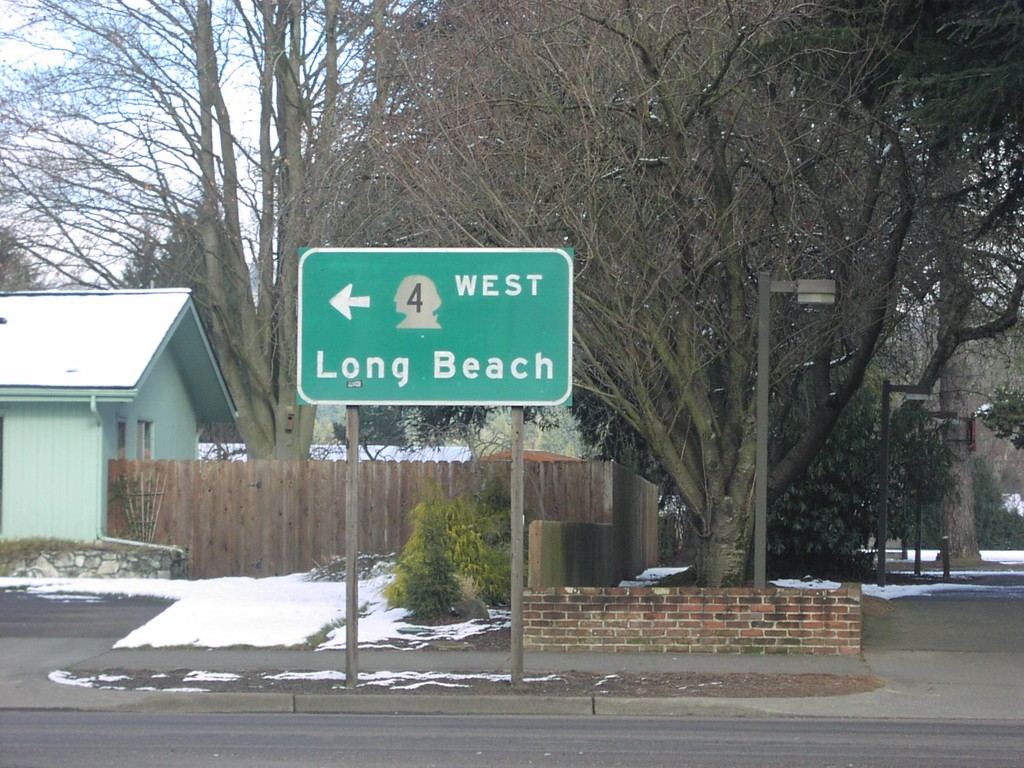
Nichols Blvd. West at WA-4
Nichols Blvd. west at WA-4 west to Long Beach.
Taken 01-01-2007
Longview
Cowlitz County
Washington
United States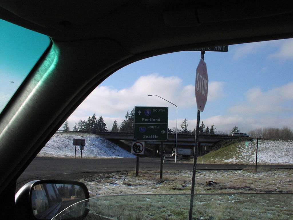
I-5 Freeway Entrance - Exit 27
Todd Road at I-5 to Portland and Seattle.
Taken 01-01-2007
 Kalama
Cowlitz County
Washington
United States
Kalama
Cowlitz County
Washington
United States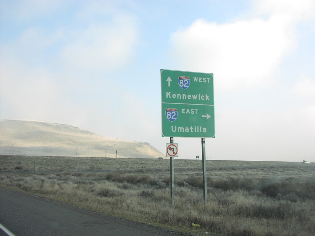
End WA-14 East at I-82
End WA-14 east at I-82 to Umatilla and Kennewick.
Taken 01-01-2007


 Plymouth
Benton County
Washington
United States
Plymouth
Benton County
Washington
United States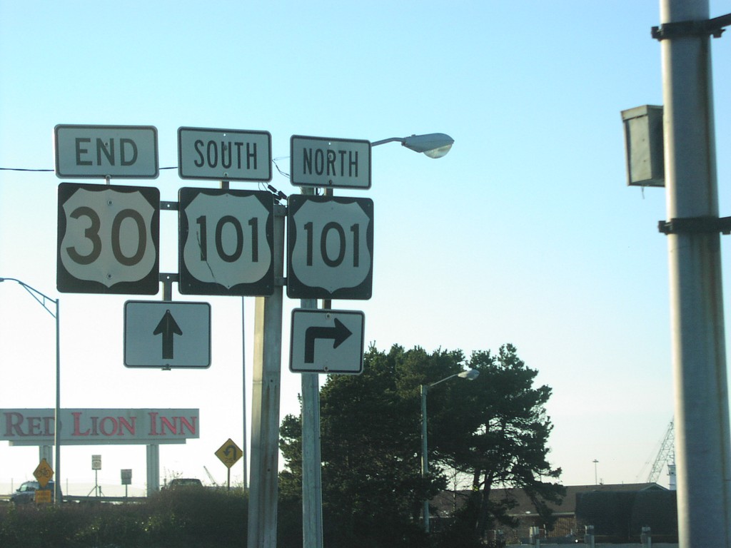
End US-30 West at US-101
End US-30 west at US-101.
Taken 01-01-2007
Astoria
Clatsop County
Oregon
United States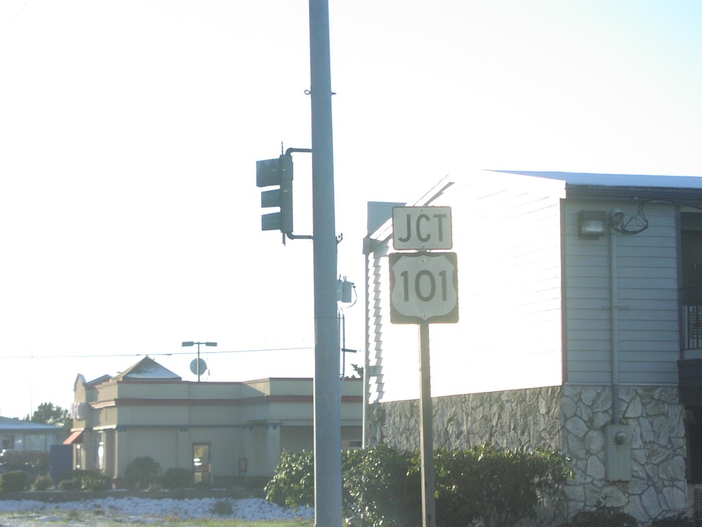
End US-30 West at US-101
Junction US-101 nearing western end of US-30.
Taken 01-01-2007
Astoria
Clatsop County
Oregon
United States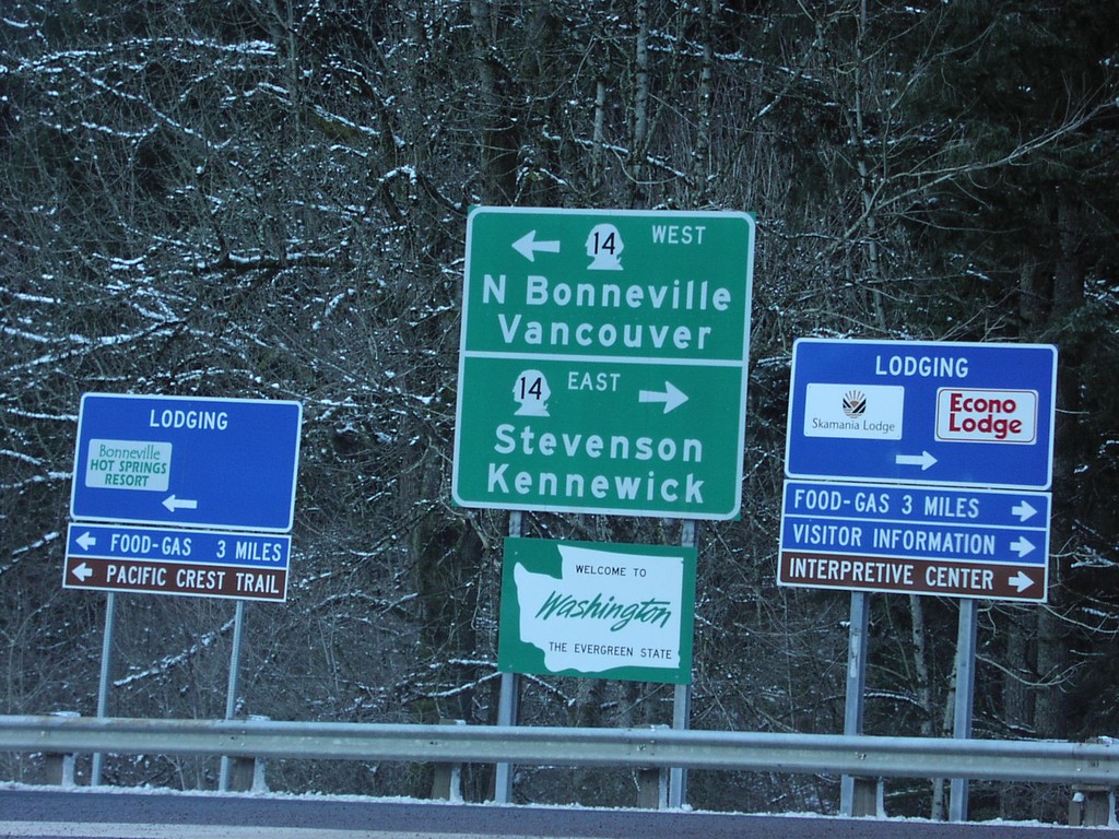
Bridge Of The Gods - WA-14
End of the Bridge of the Gods at WA-14, and Welcome To Washington sign.
Taken 01-01-2007
North Bonneville
Skamania County
Washington
United States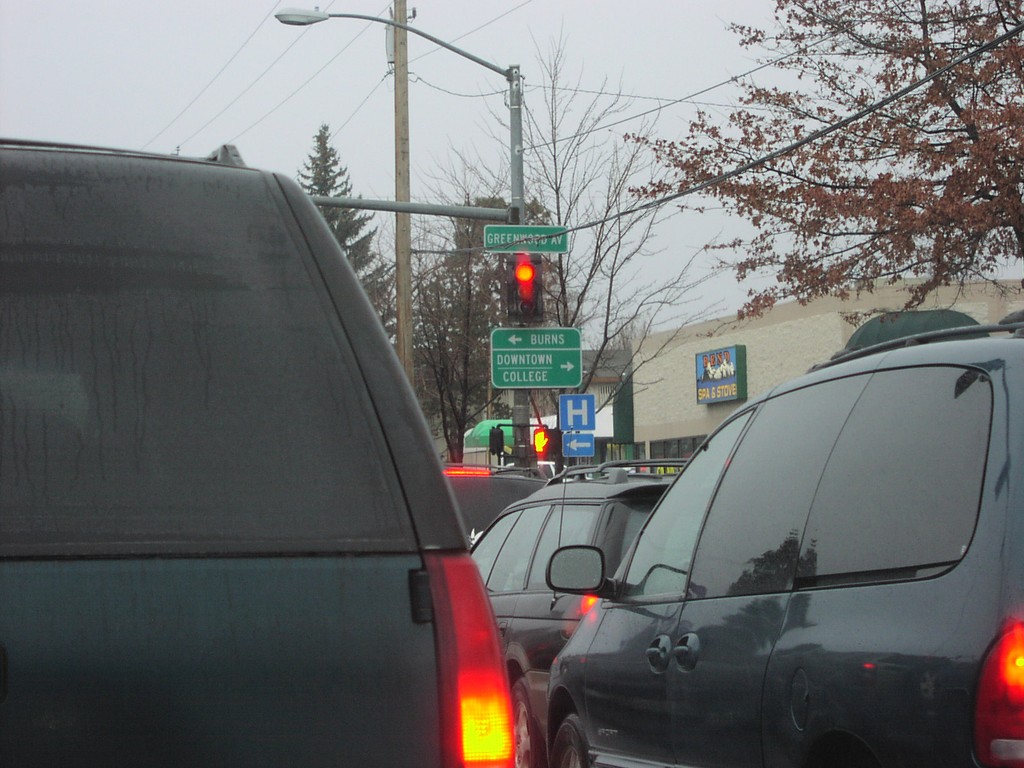
US-97 Bus. South/US-20 at US-20 East
US-20 East/Bus. US-97 South (3rd St) at US-20 East (Greenwood St.) to Burns.
Taken 12-01-2006

 Bend
Deschutes County
Oregon
United States
Bend
Deschutes County
Oregon
United States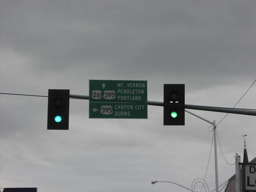
US-26 West at US-395 South
US-26 west at US-395 south to Canyon City and Burns. US-395 north joins US-26 west to Mt. Vernon.
Taken 12-01-2006
 John Day
Grant County
Oregon
United States
John Day
Grant County
Oregon
United States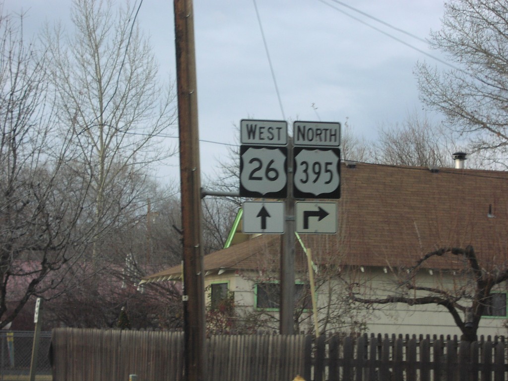
US-26 West at US-395 North
US-26 West/US-395 North approaching US-395 north.
Taken 12-01-2006
Mount Vernon
Grant County
Oregon
United States