Signs Tagged With Intersection
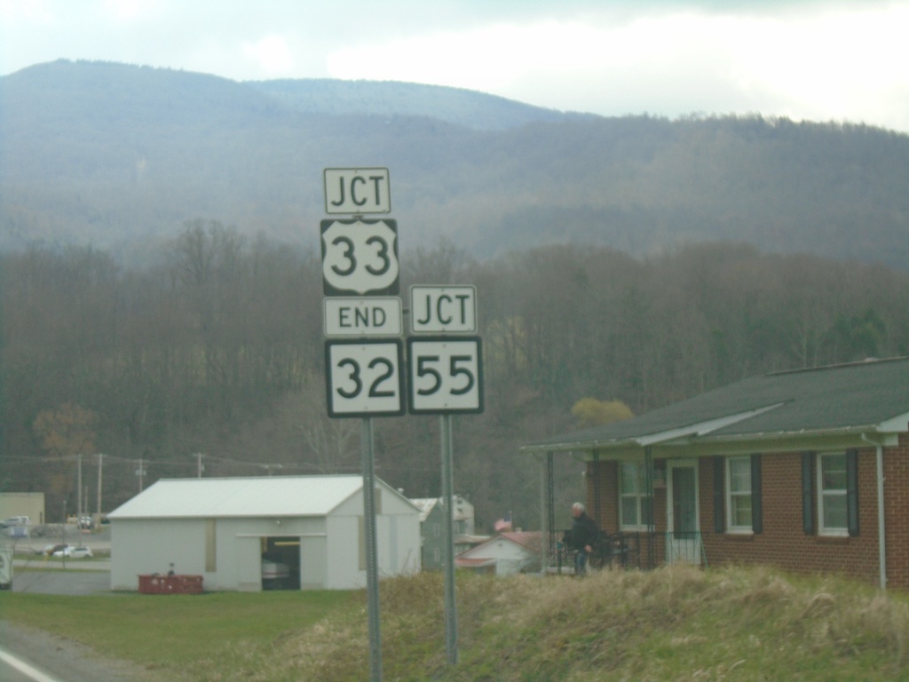
End WV-32 South at US-33/WV-55
End WV-32 South at US-33/WV-55 in Harman.
Taken 03-29-2024


 Harman
Randolph County
West Virginia
United States
Harman
Randolph County
West Virginia
United States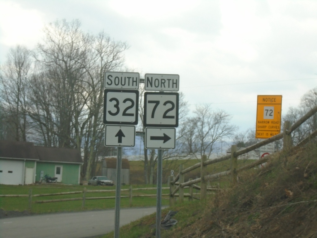
WV-32 South at WV-72
WV-32 South at WV-72 in Tucker County.
Taken 03-29-2024
 Davis
Tucker County
West Virginia
United States
Davis
Tucker County
West Virginia
United States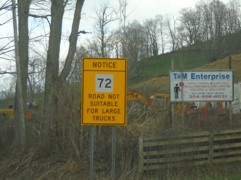
WV-72 Warning on WV-32 South
WV-32 South Approaching WV-72. Warning sign for WV-72 traffic: Road Not Suitable for Large Trucks.
Taken 03-29-2024
Dryfork
Tucker County
West Virginia
United States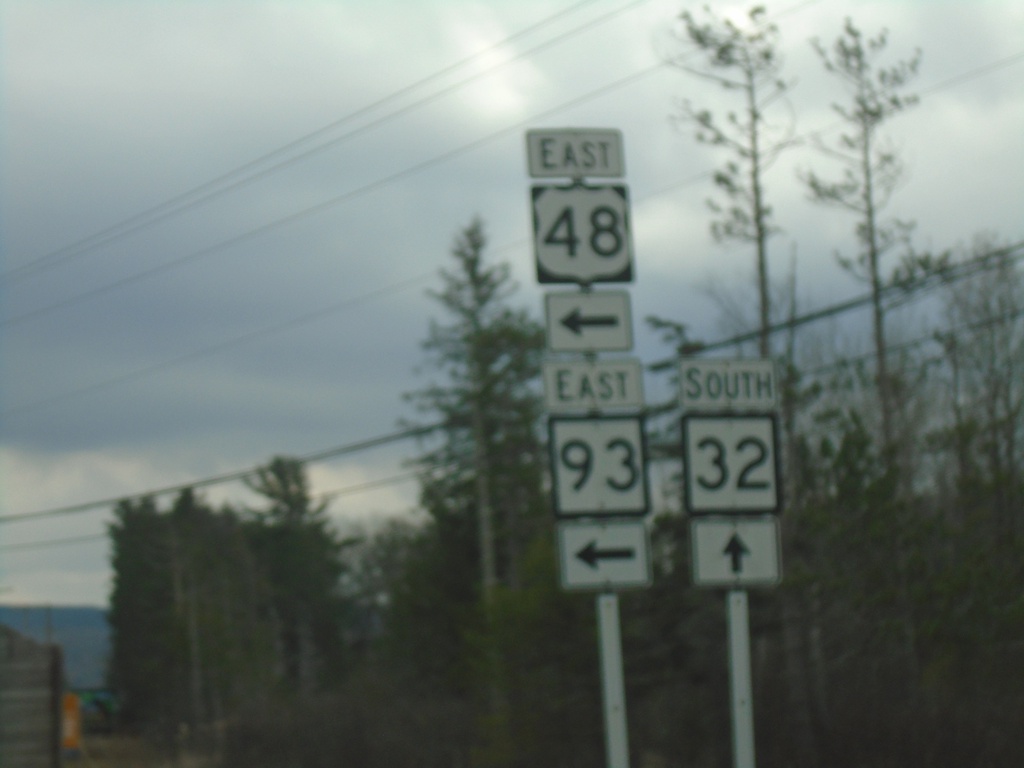
US-48 East/WV-32 South at US-48/WV-93
US-48 East/WV-32 South at US-48/WV-93.
Taken 03-29-2024

 Davis
Tucker County
West Virginia
United States
Davis
Tucker County
West Virginia
United States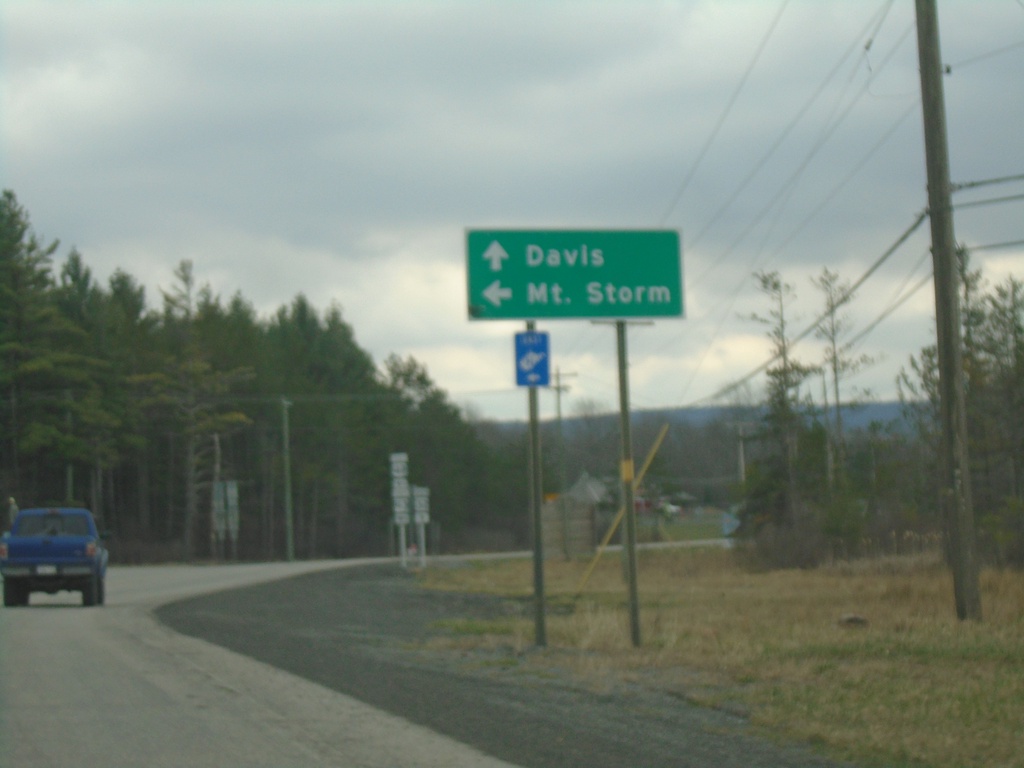
US-48 East/WV-32 South at US-48/WV-93
US-48 East/WV-32 South at US-48/WV-93 to Mount Storm. Continue south on WV-32 to Davis.
Taken 03-29-2024
Davis
Tucker County
West Virginia
United States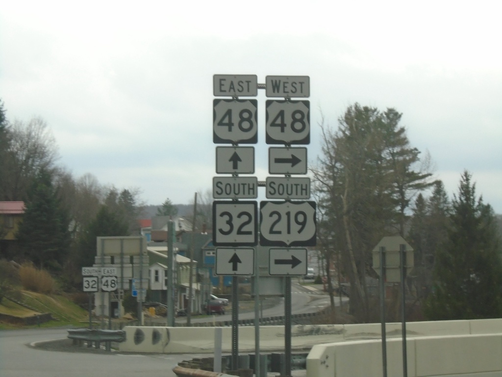
US-219 South at US-48/WV-32
US-219 South at US-48/WV-32 in Thomas. Turn right for US-48 West/US-219 South. Continue straight for US-48 East/WV-32 South.
Taken 03-29-2024
 Thomas
Tucker County
West Virginia
United States
Thomas
Tucker County
West Virginia
United States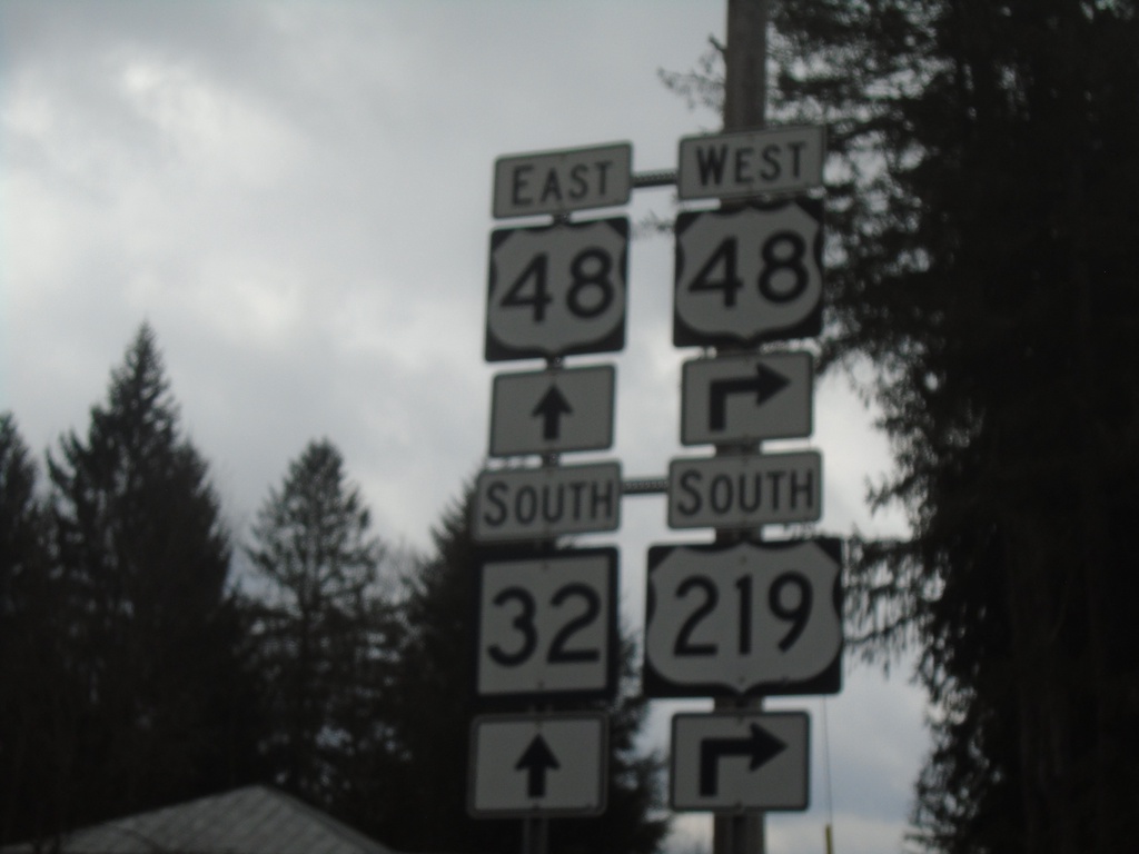
US-219 South at US-48/WV-32
US-219 South at US-48/WV-32 in Thomas. Turn right for US-48 West/US-219 South. Continue straight for US-48 East/WV-32 South.
Taken 03-29-2024
Thomas
Tucker County
West Virginia
United States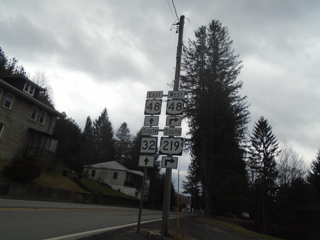
US-219 South at US-48/WV-32
US-219 South at US-48/WV-32 in Thomas. Turn right for US-48 West/US-219 South. Continue straight for US-48 East/WV-32 South.
Taken 03-29-2024
Thomas
Tucker County
West Virginia
United States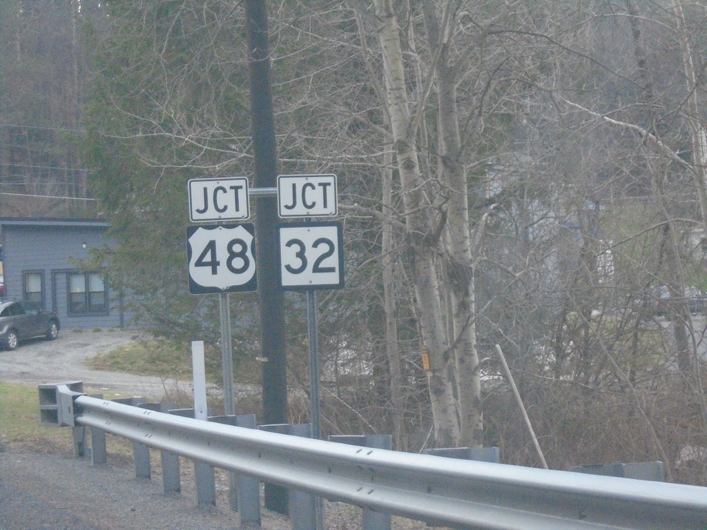
US-219 South at US-48/WV-32
US-219 South at US-48/WV-32 in Thomas.
Taken 03-29-2024
Thomas
Tucker County
West Virginia
United States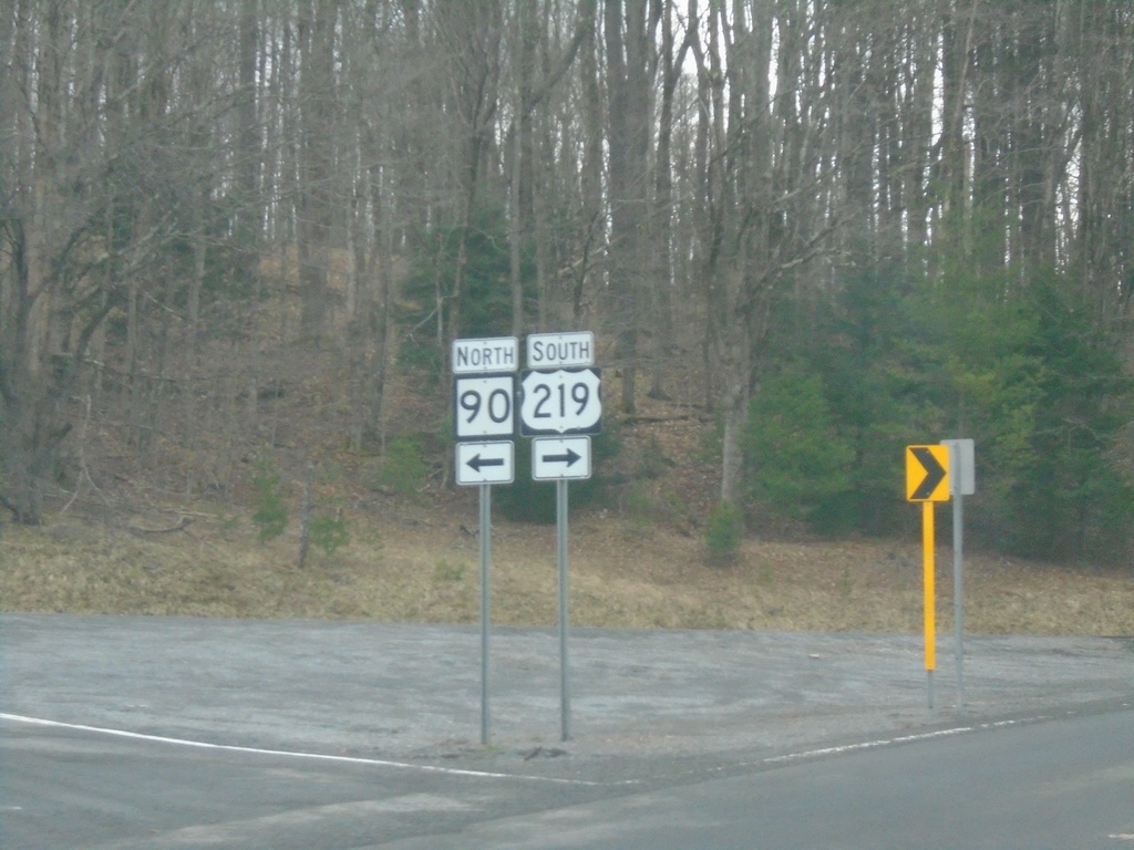
US-219 South at WV-90
US-219 South at WV-90 in Tucker County.
Taken 03-29-2024
 Thomas
Tucker County
West Virginia
United States
Thomas
Tucker County
West Virginia
United States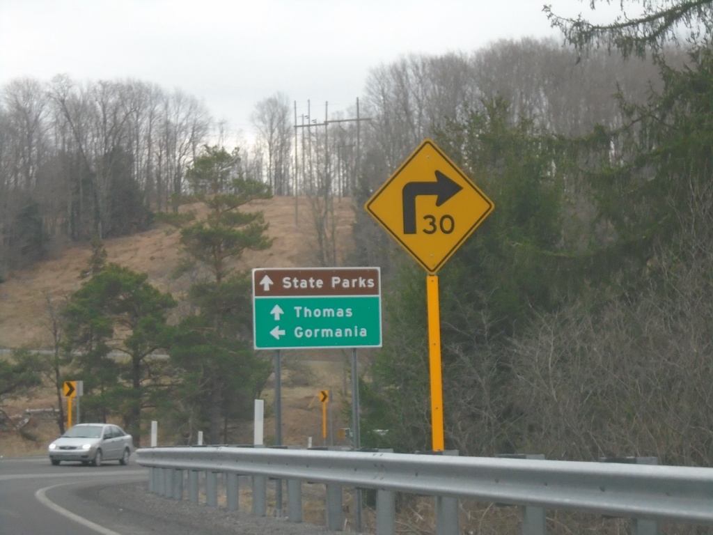
US-219 South at WV-90
US-219 South at WV-90 east to Gormania. Continue south on US-219 for Thomas and State Parks.
Taken 03-29-2024
William
Tucker County
West Virginia
United States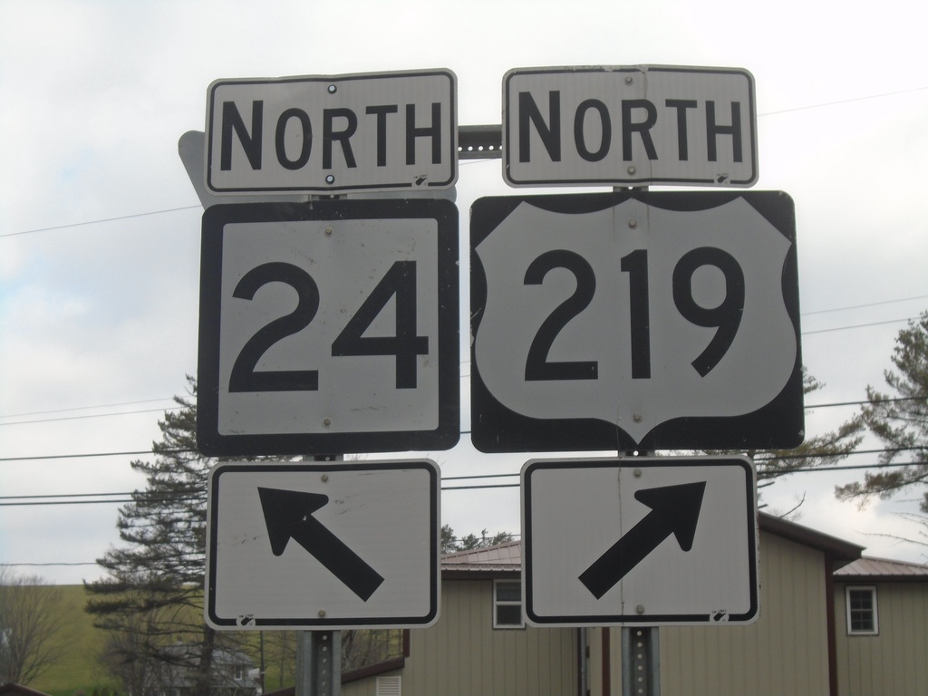
US-219 North at WV-24 North - Silver Lake
US-219 North at WV-24 North at Silver Lake
Taken 03-29-2024
 Eglon
Preston County
West Virginia
United States
Eglon
Preston County
West Virginia
United States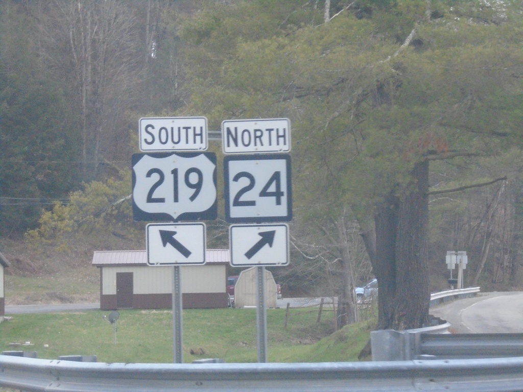
US-219 South at WV-24 North - Silver Lake
US-219 South at WV-24 North at Silver Lake
Taken 03-29-2024
Eglon
Preston County
West Virginia
United States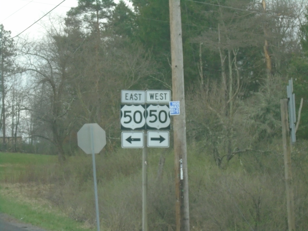
US-219 South at US-50
US-219 South at US-50 at Red House.
Taken 03-29-2024
 Oakland
Garrett County
Maryland
United States
Oakland
Garrett County
Maryland
United States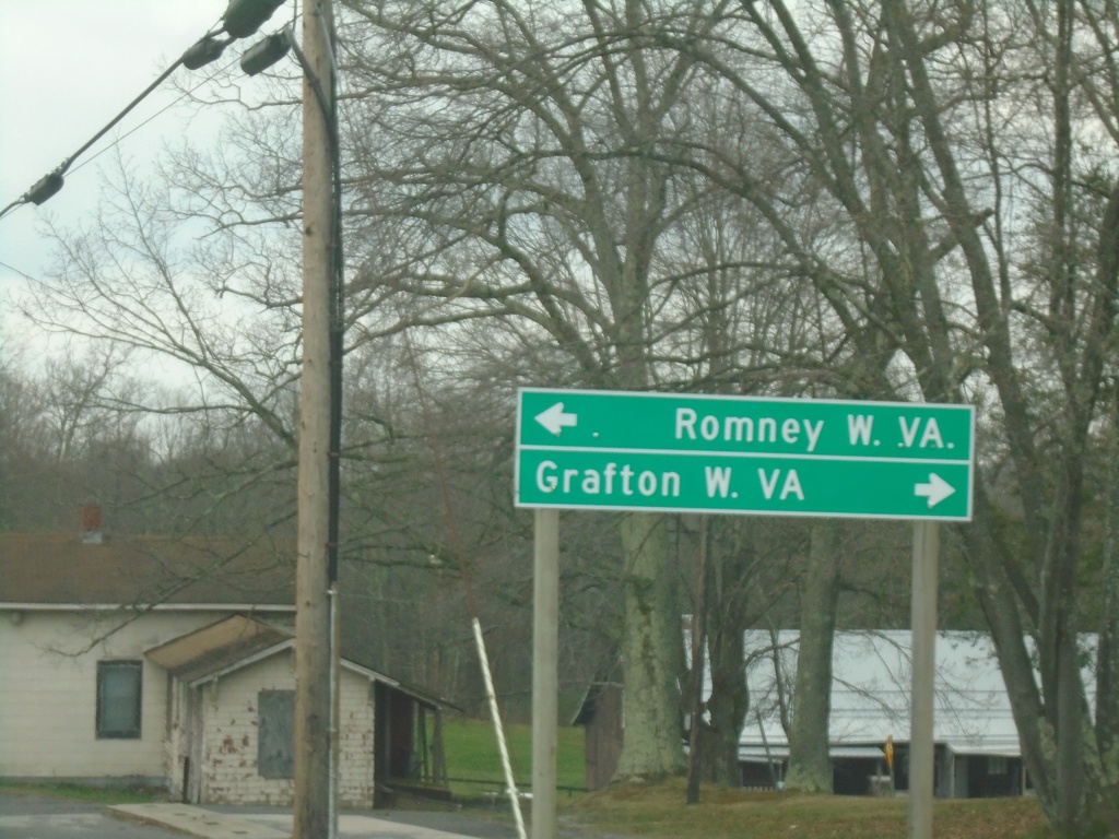
US-219 South at US-50
US-219 South at US-50 at Red House. Turn right on US-50 West to Grafton, WV; turn left on US-50 east to Romney, WV.
Taken 03-29-2024
Oakland
Garrett County
Maryland
United States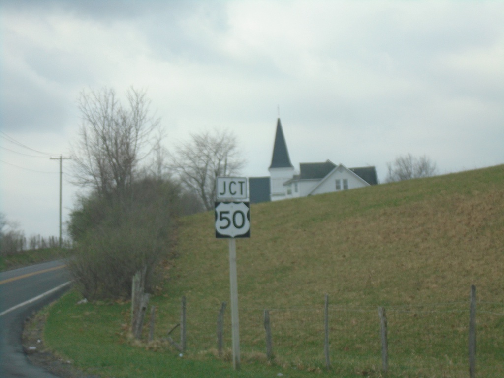
US-219 South Approaching US-50
US-219 South approaching US-50 in Red House.
Taken 03-29-2024
Oakland
Garrett County
Maryland
United States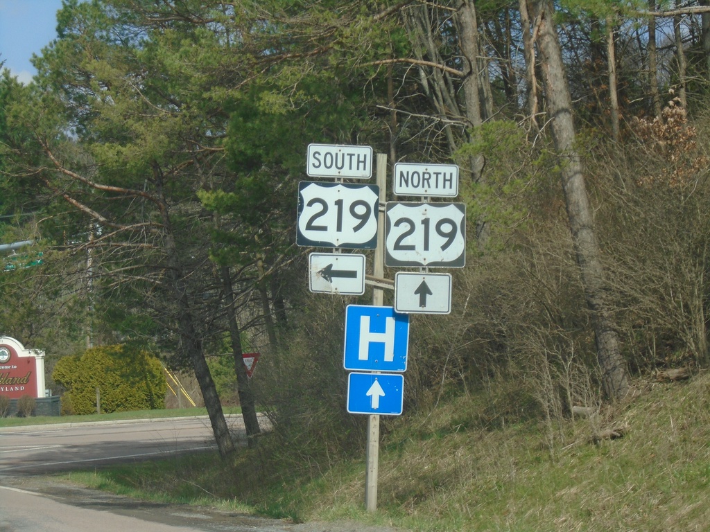
End MD-135 West at US-219
End MD-135 West at US-219 in Oakland. Turn left for US-219 south; continue straight for US-219 north.
Taken 03-29-2024
 Oakland
Garrett County
Maryland
United States
Oakland
Garrett County
Maryland
United States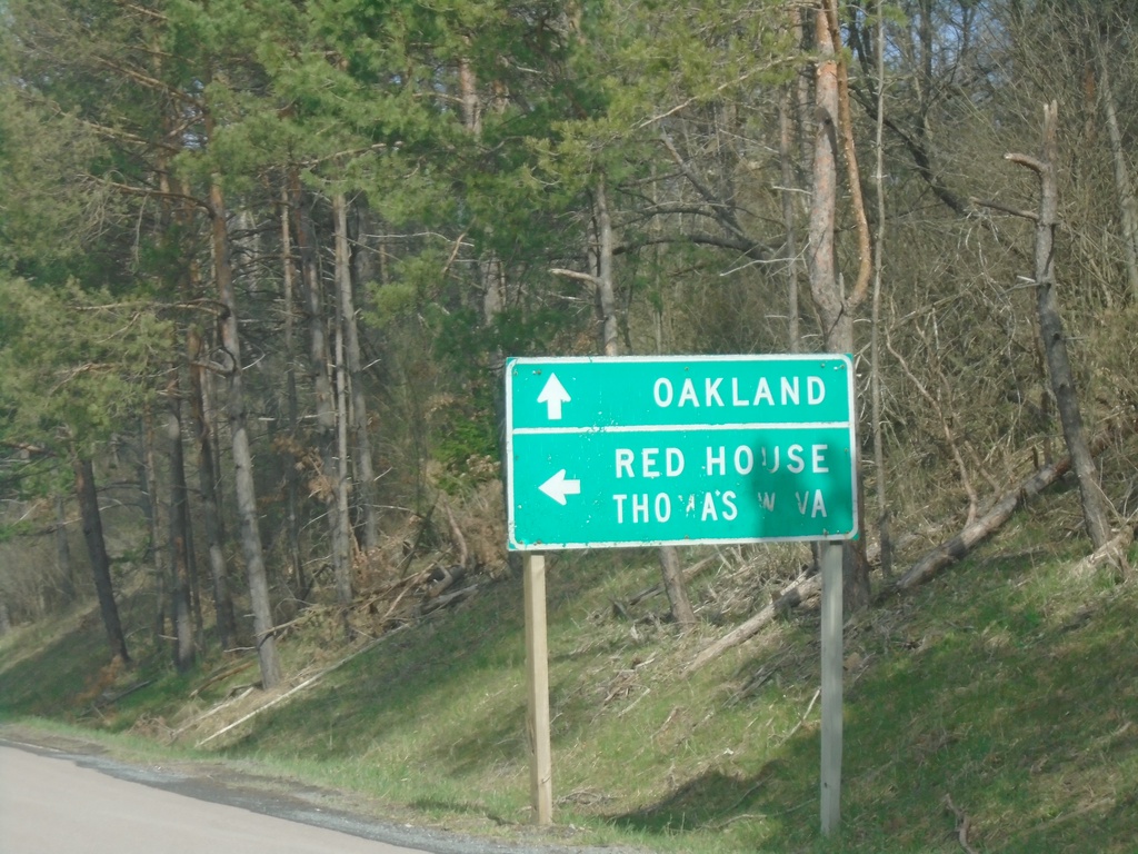
End MD-135 West at US-219
End MD-135 West at US-219 in Oakland. Use US-219 north to Oakland; US-219 south to Red House and Thomas, WV.
Taken 03-29-2024
Oakland
Garrett County
Maryland
United States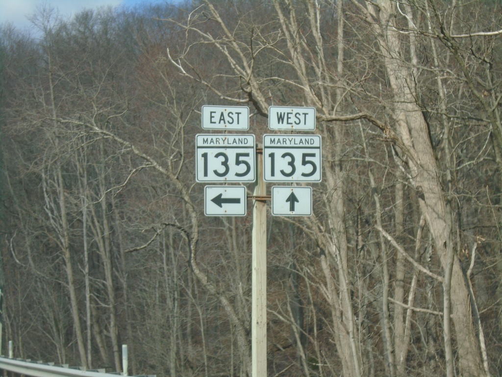
End MD-495 South at MD-135
End MD-495 South at MD-135 in Garrett County.
Taken 03-29-2024
 Swanton
Garrett County
Maryland
United States
Swanton
Garrett County
Maryland
United States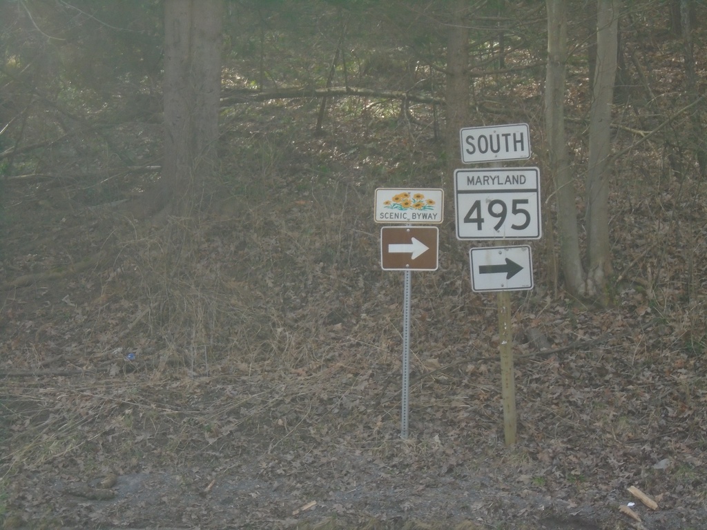
MD-495 South at Swanton Hill Road
MD-495 South at Swanton Hill Road. Turn right to continue south on MD-495 (Maryland Mountain Scenic Byway).
Taken 03-29-2024
Swanton
Garrett County
Maryland
United States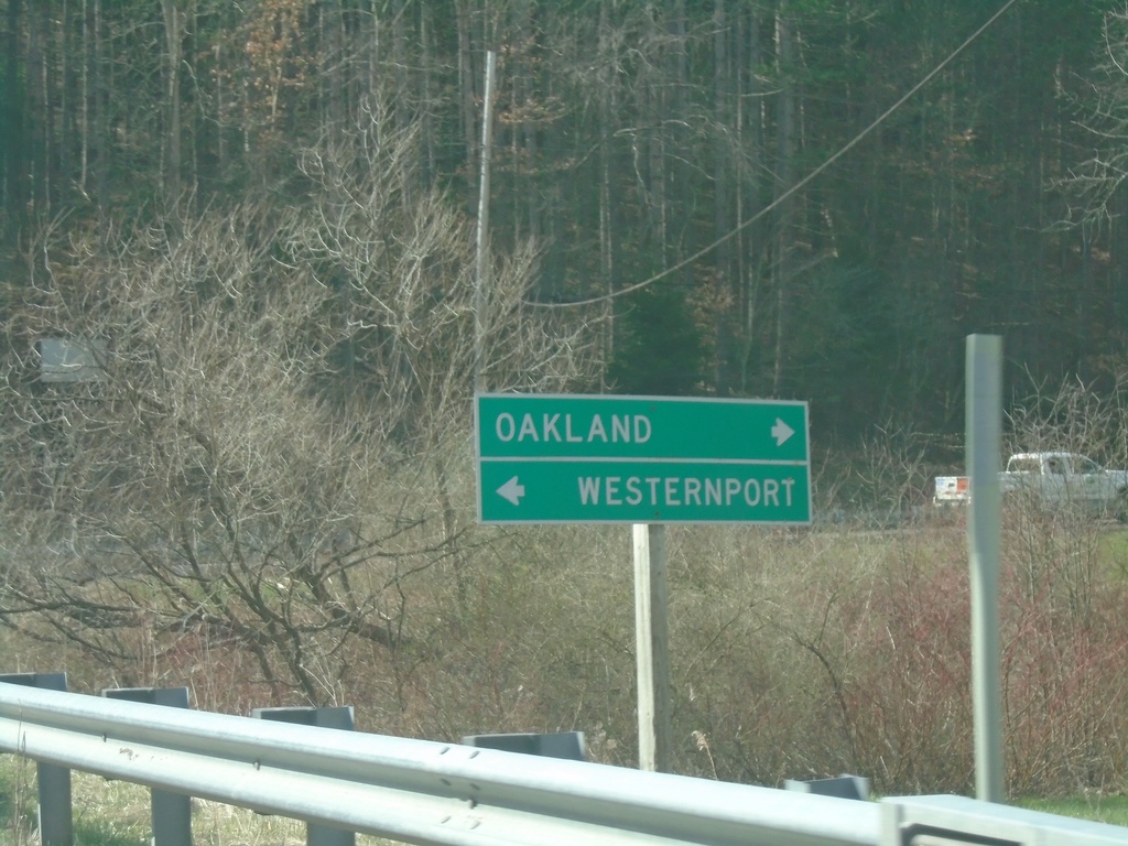
MD-495 South at Swanton Hill Road
MD-495 South at Swanton Hill Road. Turn left for Swanton Hill Road east to Westernport; right for MD-495 south to Oakland.
Taken 03-29-2024
Swanton
Garrett County
Maryland
United States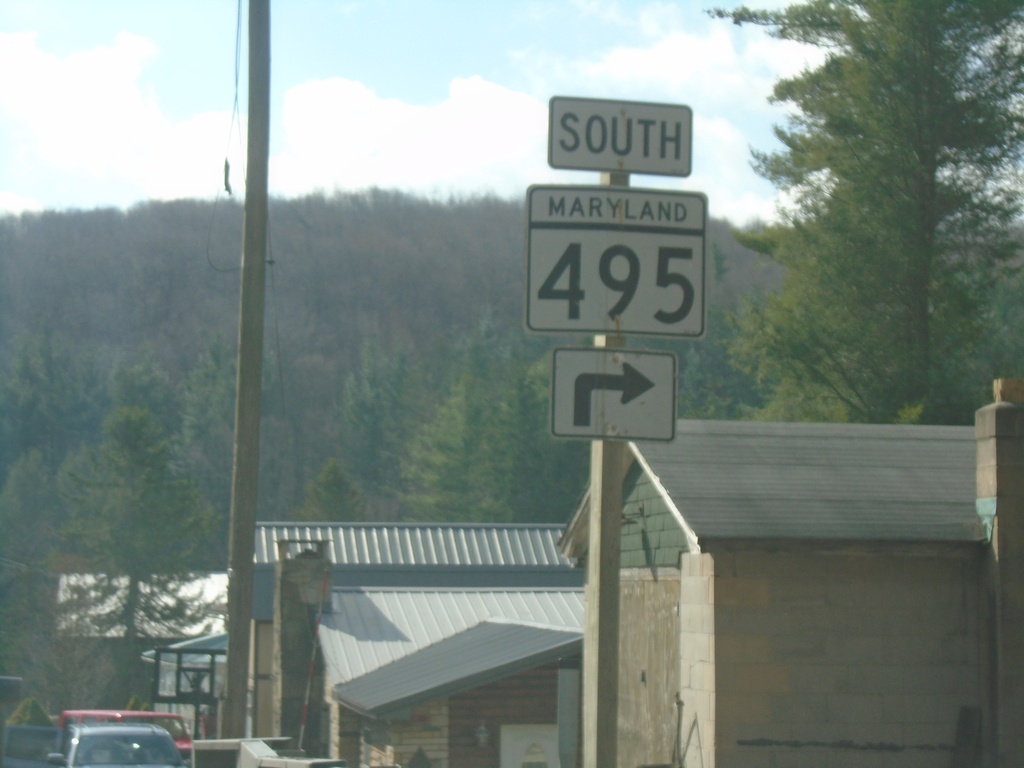
MD-495 South at Swanton Hill Road
MD-495 South at Swanton Hill Road. Turn right to continue south on MD-495.
Taken 03-29-2024
Swanton
Garrett County
Maryland
United States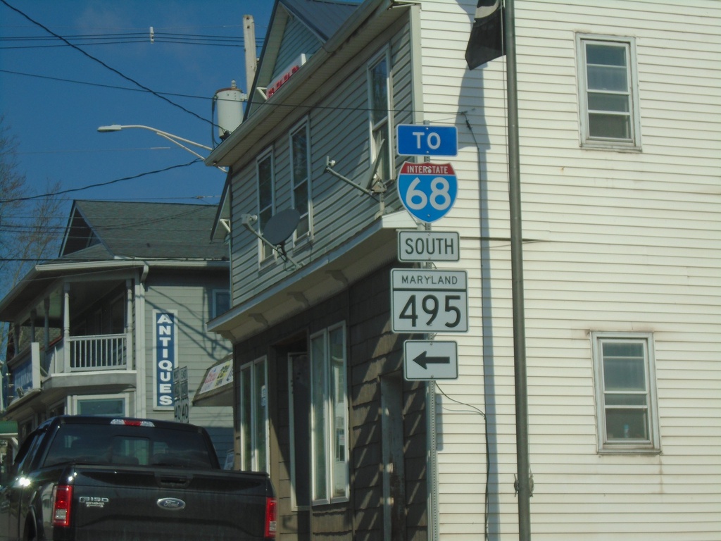
US-40 ALT West at MD-495/To I-68
US-40 ALT West at MD-495/To I-68 in Grantsville.
Taken 03-29-2024

 Grantsville
Garrett County
Maryland
United States
Grantsville
Garrett County
Maryland
United States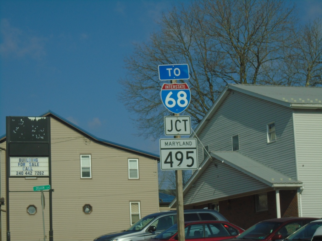
US-40 ALT West at MD-495/To I-68
US-40 ALT West at MD-495/To I-68 in Grantsville.
Taken 03-29-2024
Grantsville
Garrett County
Maryland
United States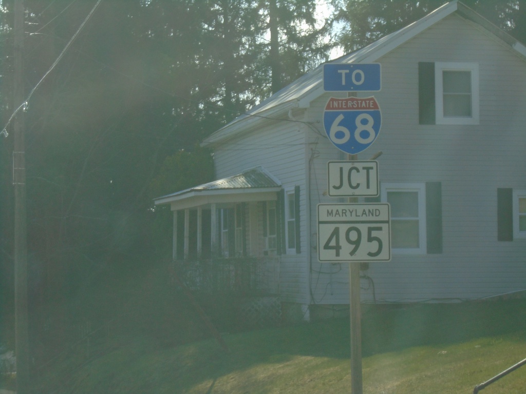
US-40 ALT East Approaching MD-495/To I-68
US-40 ALT East approaching MD-495/To I-68 in Grantsville.
Taken 03-29-2024
Grantsville
Garrett County
Maryland
United States