Signs Tagged With Intersection
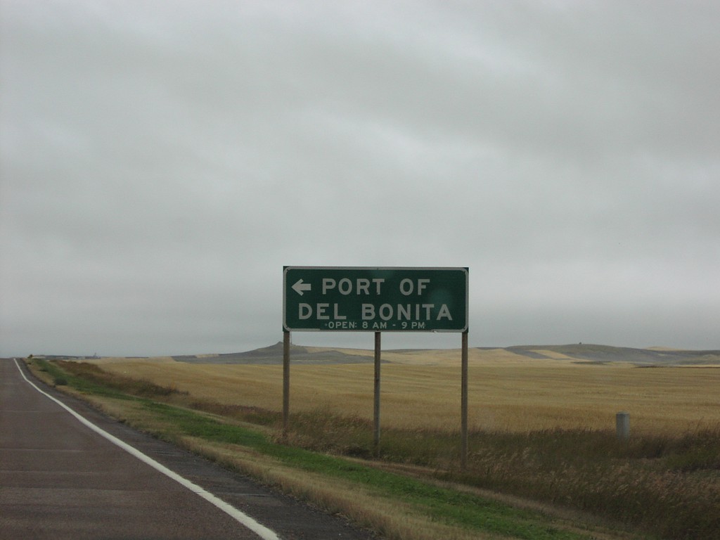
MTS-213/MTS-214 North at MTS-214 to Port Of Del Bonita
MTS-213/MTS-214 junction to Port of Del Bonita
Taken 09-10-2005

 Cut Bank
Glacier County
Montana
United States
Cut Bank
Glacier County
Montana
United States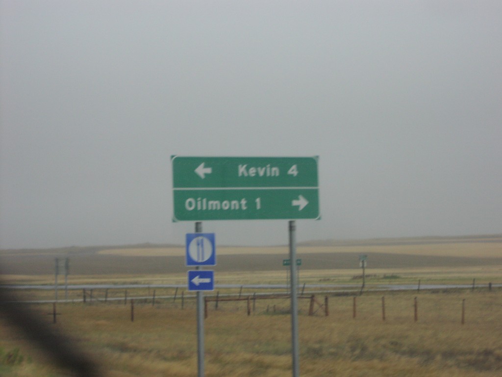
I-15 Exit 379 - MTS-215 and MTS-343
I-15 Exit 379 offramp. Turn right for MTS-215 to Kevin; turn right for MTS-343 to Oilmont.
Taken 09-10-2005


 Oilmont
Toole County
Montana
United States
Oilmont
Toole County
Montana
United States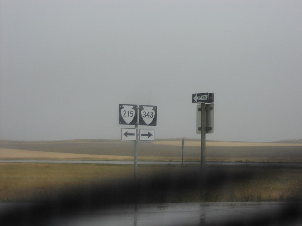
I-15 Exit 379 - MTS-215 and MTS-343
I-15 (Exit 379) offramp at MTS-215 and MTS-343.
Taken 09-10-2005
Oilmont
Toole County
Montana
United States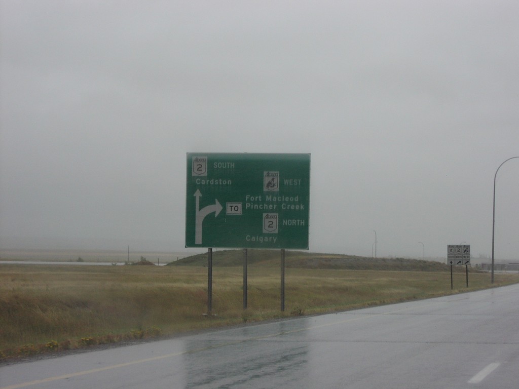
Fort Macleod Route Diagram on AB-3 West
Diagram on AB-3 west approaching AB-2 south to Cardston, and AB-3/AB-2 north to
Taken 09-10-2005

 Fort Macleod
Willow Creek No. 26
Alberta
Canada
Fort Macleod
Willow Creek No. 26
Alberta
Canada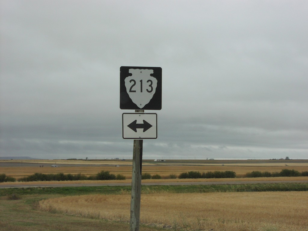
End MTS-215 at MTS-213
End of MTS-215 at MTS-213 in Glacier County.
Taken 09-10-2005
Cut Bank
Glacier County
Montana
United States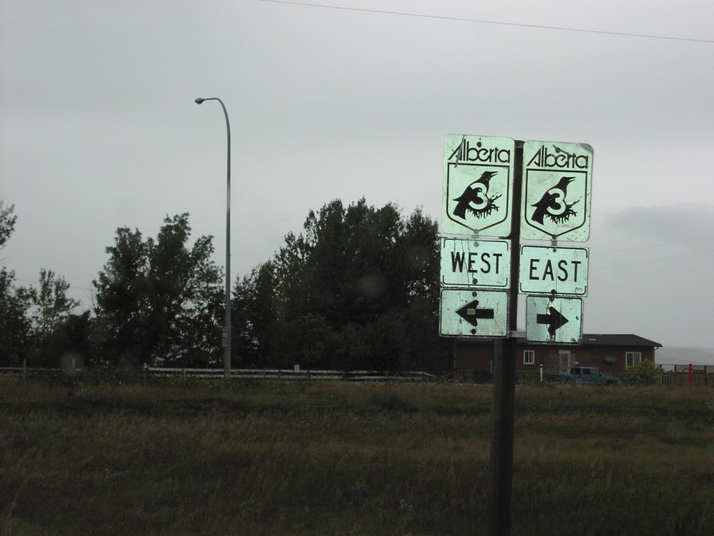
End ABS-786 at AB-3 Jct.
End of ABS-786 at AB-3
Taken 09-10-2005
 Brocket
Pincher Creek No. 9
Alberta
Canada
Brocket
Pincher Creek No. 9
Alberta
Canada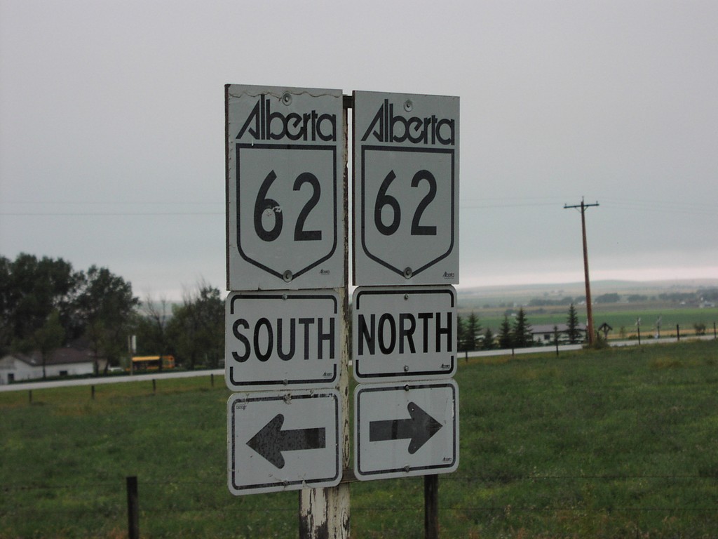

End AB-6 North at AB-3 Jct.
AB-3 East/West at End AB-6
Taken 09-10-2005
 Pincher Creek
 No. 9
Alberta
Canada
Pincher Creek
Pincher Creek No. 9
Alberta
Canada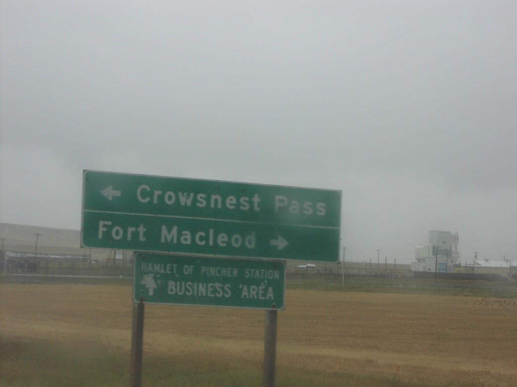
End AB-6 North At AB-3
AB-6 north at AB-3 to Crowsnest Pass and Fort Macleod
Taken 09-10-2005
Pincher Creek
Pincher Creek No. 9
Alberta
Canada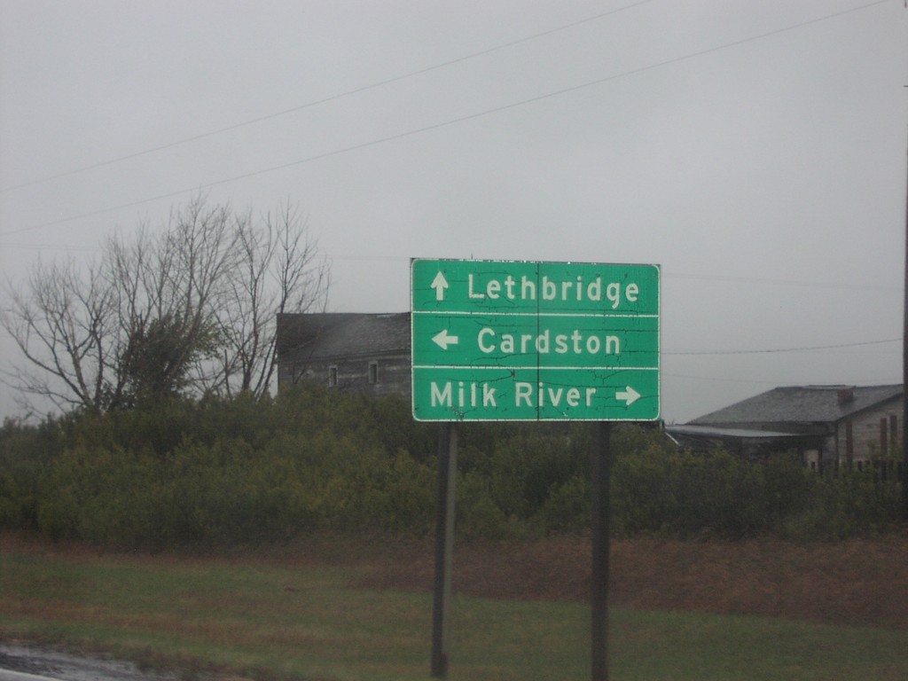
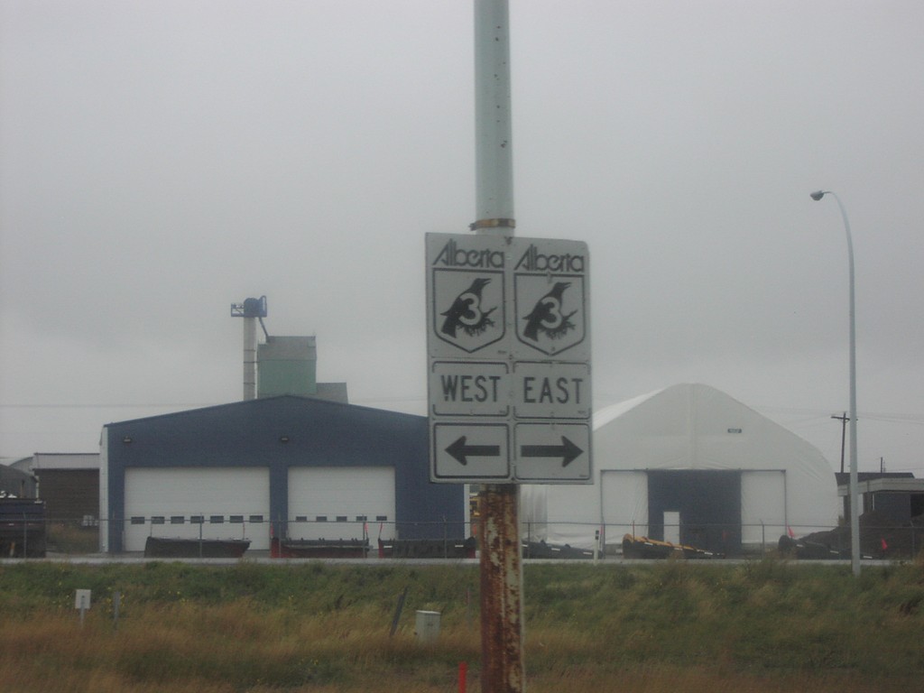
AB-62 North at ABS-501
AB-62 at ABS-501 to Milk River, and Cardston
Taken 09-10-2005

 Del Bonita
Cardston County
Alberta
Canada
Del Bonita
Cardston County
Alberta
Canada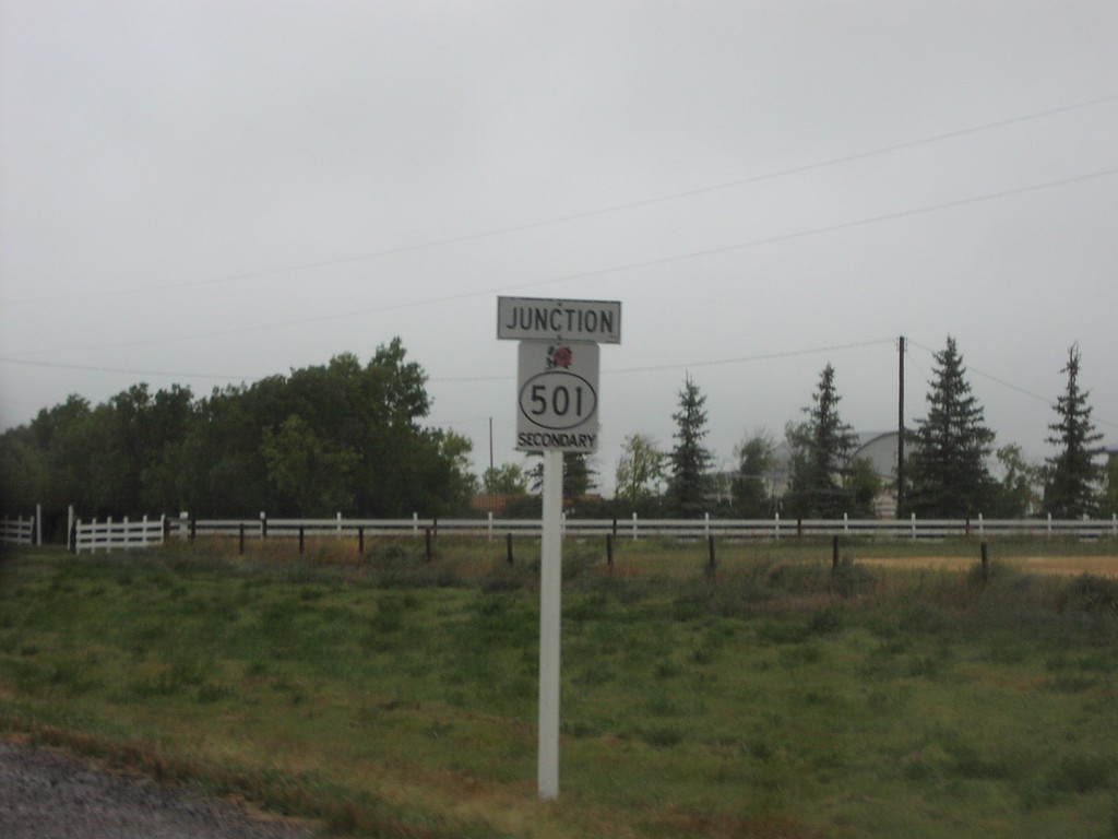
AB-62 North ABS-501 Jct.
Junction ABS-501 on AB-62 north
Taken 09-10-2005
Del Bonita
Cardston County
Alberta
Canada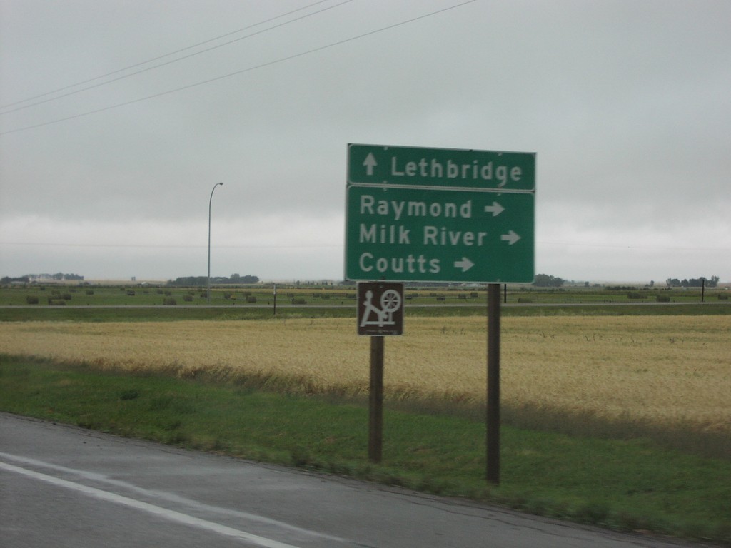
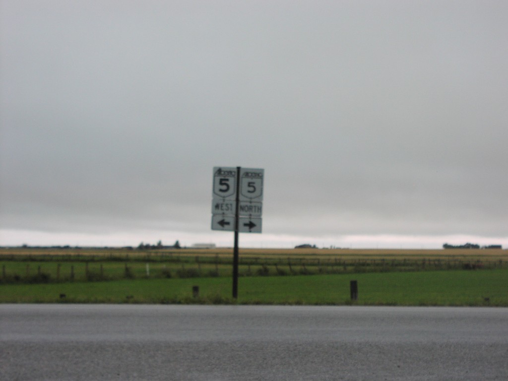
AB-5 North at AB-52 Jct.
AB-5 north at AB-52 to Raymond, Milk River, and Coutts
Taken 09-10-2005

 Welling
Cardston County
Alberta
Canada
Welling
Cardston County
Alberta
Canada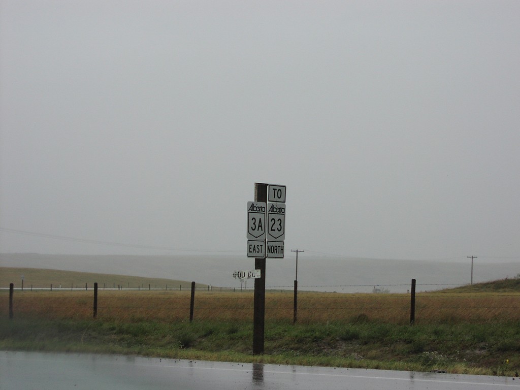
AB-3A East To AB-23 North
AB-3A East to AB-23 at AB-3 junction
Taken 09-10-2005

 Monarch
Willow Creek No. 26
Alberta
Canada
Monarch
Willow Creek No. 26
Alberta
Canada
AB-3/AB-2 Fort Macleod
Signs leading to AB-3/AB-2 on Fort Macleod surface streets
Taken 09-10-2005
Fort Macleod
Willow Creek No. 26
Alberta
Canada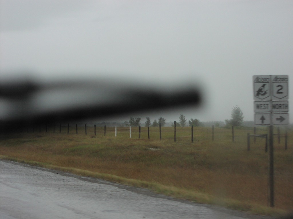
AB-3 West at AB-2 North
AB-3 west/AB-2 north shields approaching AB-3/AB-2 North split
Taken 09-10-2005
Fort Macleod
Willow Creek No. 26
Alberta
Canada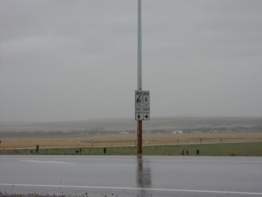
AB-3 East at AB-6 Jct.
AB-3 east (Crowsnest Highway) at AB-6 south.
Taken 09-10-2005
Pincher Station
Pincher Creek No. 9
Alberta
Canada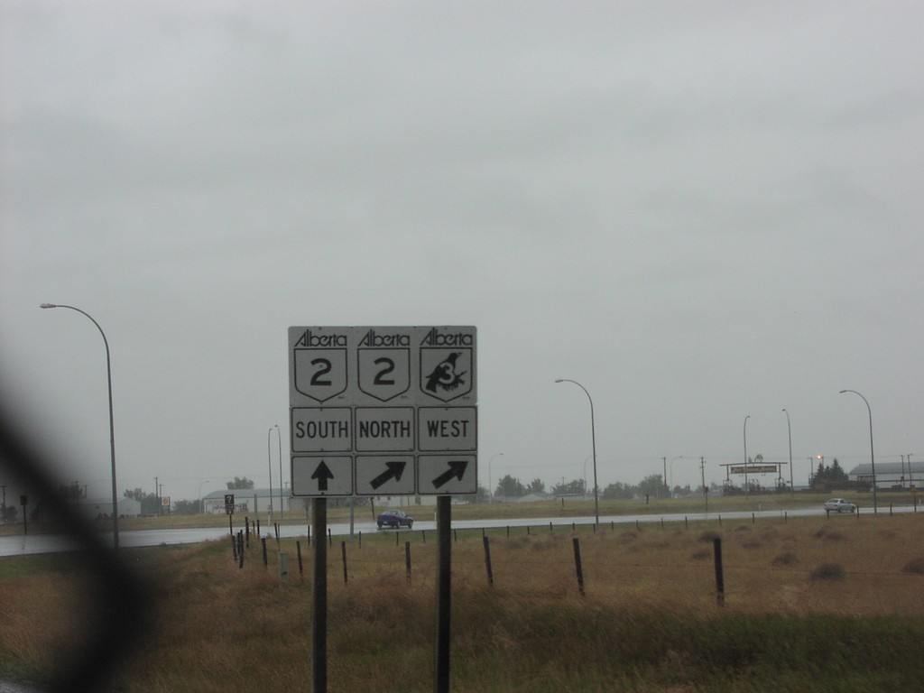
AB-2 South AB-3 Jct.
AB-3 at AB-2 North/South split
Taken 09-10-2005
Fort Macleod
Willow Creek No. 26
Alberta
Canada
AB-2 North/AB-3 West
AB-3 (Crowsnest) West/AB-2 North shields
Taken 09-10-2005
Fort Macleod
Willow Creek No. 26
Alberta
Canada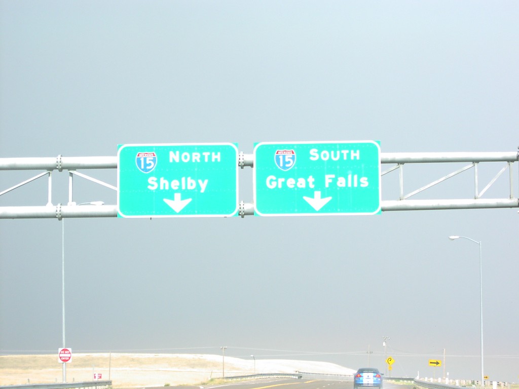
US-89 South/MT-200 East At I-15
US-89 South/MT-200 East. Both US-89 and MT-200 joins I-15 south into Great Falls.
Taken 09-09-2005

 Great Falls
Cascade County
Montana
United States
Great Falls
Cascade County
Montana
United States
US-89 South/MT-200 East Approaching I-15
US-89 South/MT-200 East approaching I-15 junction.
Taken 09-09-2005
Vaughn
Cascade County
Montana
United States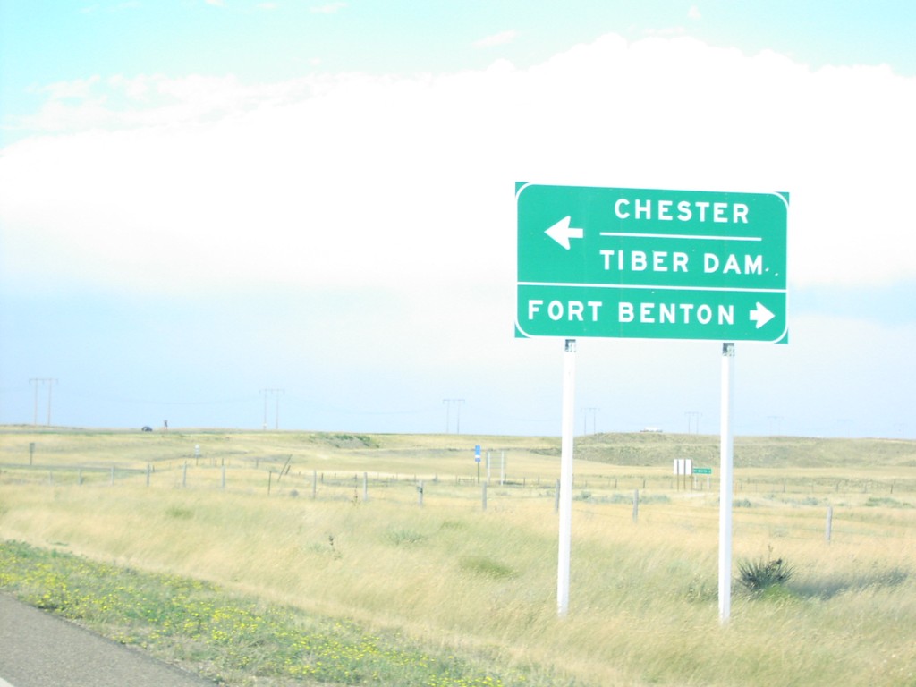
US-87 North at MT-80/MTS-223
US-87 north at MT-80 to Fort Benton and MTS-223 to Chester and Tiber Dam.
Taken 09-09-2005
 Fort Benton
Chouteau County
Montana
United States
Fort Benton
Chouteau County
Montana
United States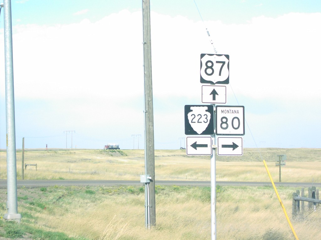
US-87 North at MT-80 and MTS-223
US-87 north at MT-80 East and MTS-223 West, on hill above Fort Benton.
Taken 09-09-2005

 Fort Benton
Chouteau County
Montana
United States
Fort Benton
Chouteau County
Montana
United States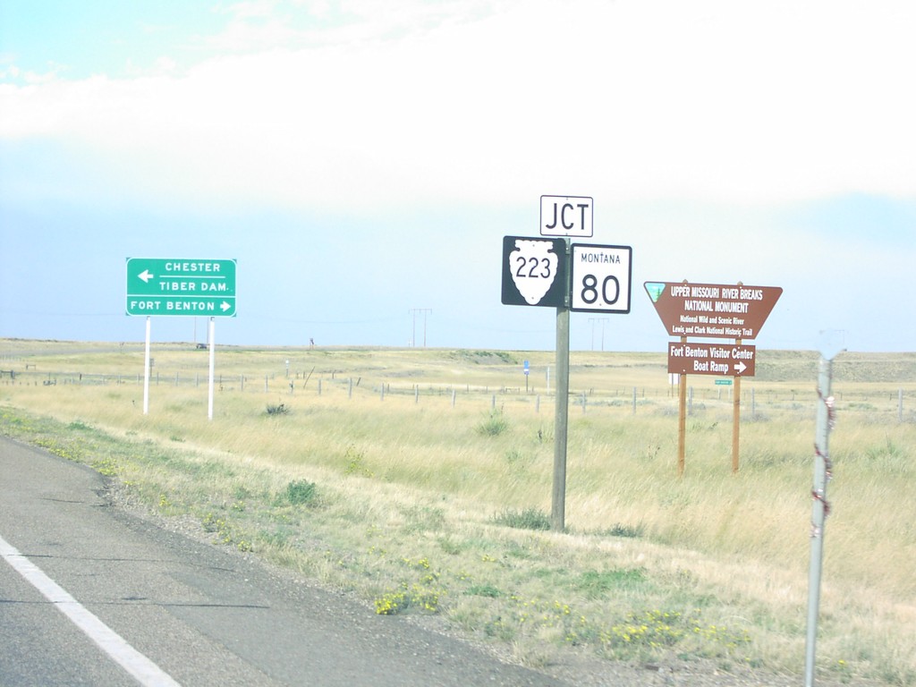
US-87 North Approaching MT-80/MTS-223
US-87 north at MT-80/MTS-223 junction.
Taken 09-09-2005
Fort Benton
Chouteau County
Montana
United States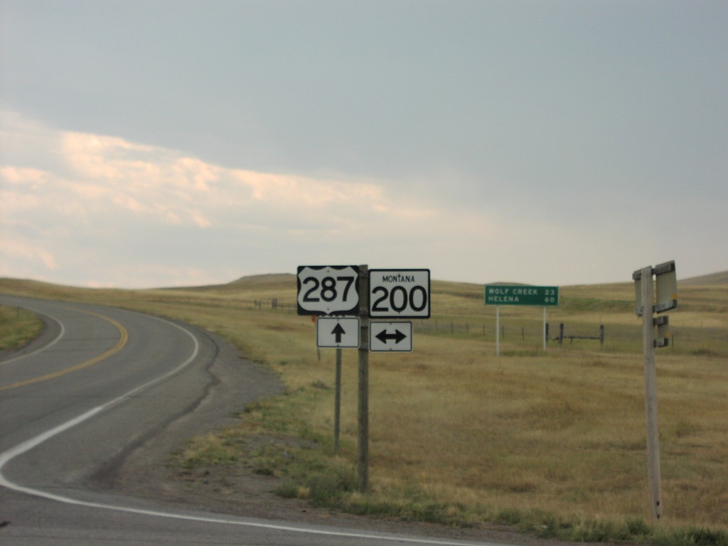
US-287 South at MT-200
US-287 south at MT-200. Distance marker in the background on US-287 to Wolf Creek and Helena.
Taken 09-09-2005
 Milford Colony
Lewis and Clark County
Montana
United States
Milford Colony
Lewis and Clark County
Montana
United States