Signs Tagged With Intersection
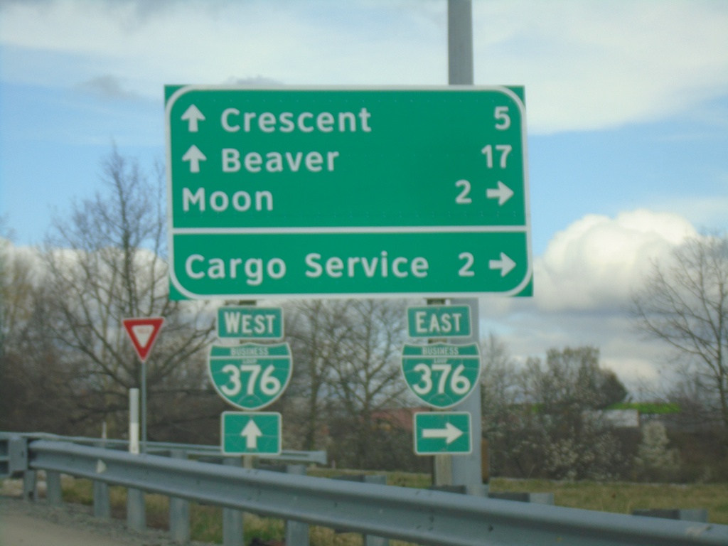
Flaugherty Run Road at BL-376
Flaugherty Run Road at BL-376. Use BL-376 East to Moon and Cargo Service. Continue over freeway for Beaver and Crescent.
Taken 04-01-2024
 Carnot-Moon
Allegheny County
Pennsylvania
United States
Carnot-Moon
Allegheny County
Pennsylvania
United States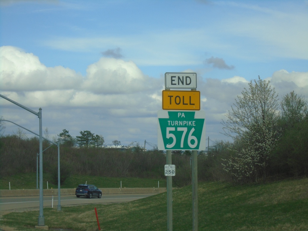
End PA-576 West at I-376 West
End PA-576 West at I-376 West in Allegheny County.
Taken 04-01-2024

 Clinton
Allegheny County
Pennsylvania
United States
Clinton
Allegheny County
Pennsylvania
United States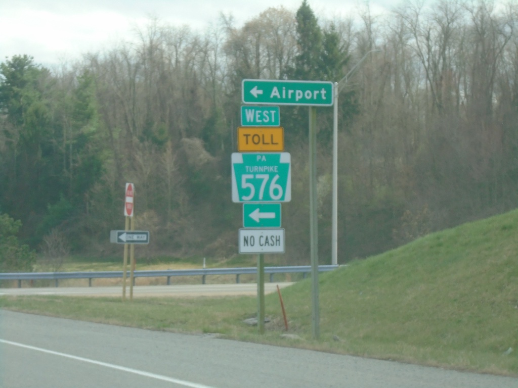
US-30 East at PA-576 West
US-30 East at PA-576 West onramp to (Pittsburgh International) Airport. PA-576 is the Southern Beltway and is part of the Pennsylvania Turnpike system.
Taken 04-01-2024
 Imperial
Allegheny County
Pennsylvania
United States
Imperial
Allegheny County
Pennsylvania
United States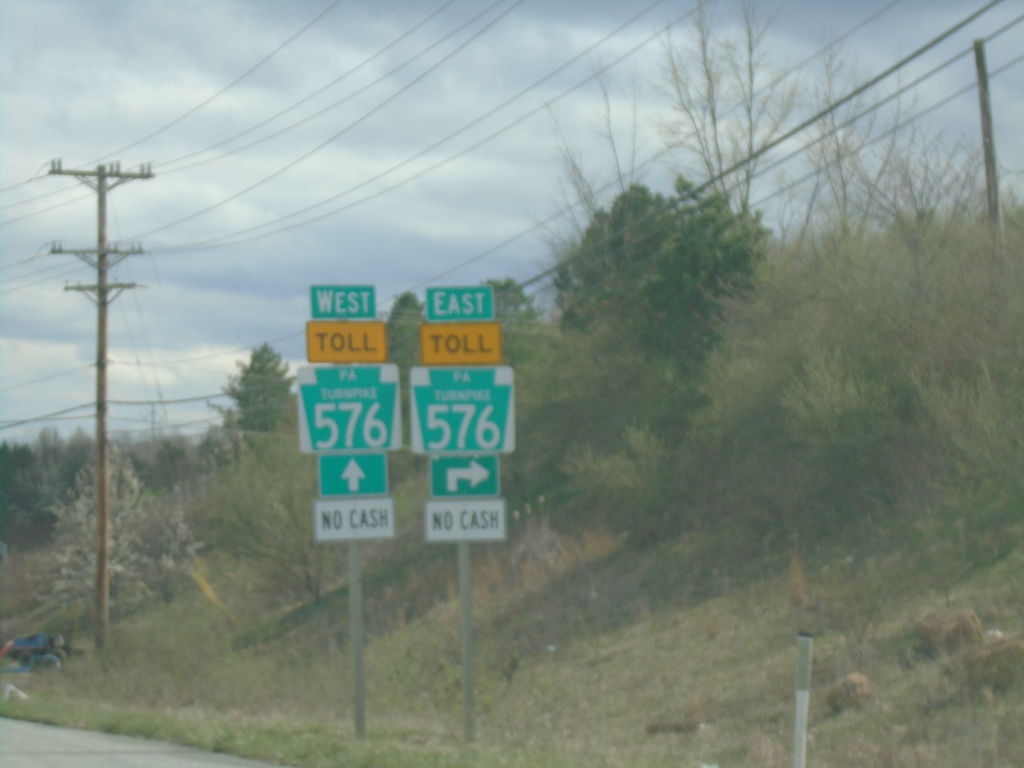
US-30 East Approaching PA-576
US-30 East approaching PA-576 (Southern Beltway) which is part of the Pennsylvania Turnpike system.
Taken 04-01-2024
Clinton
Allegheny County
Pennsylvania
United States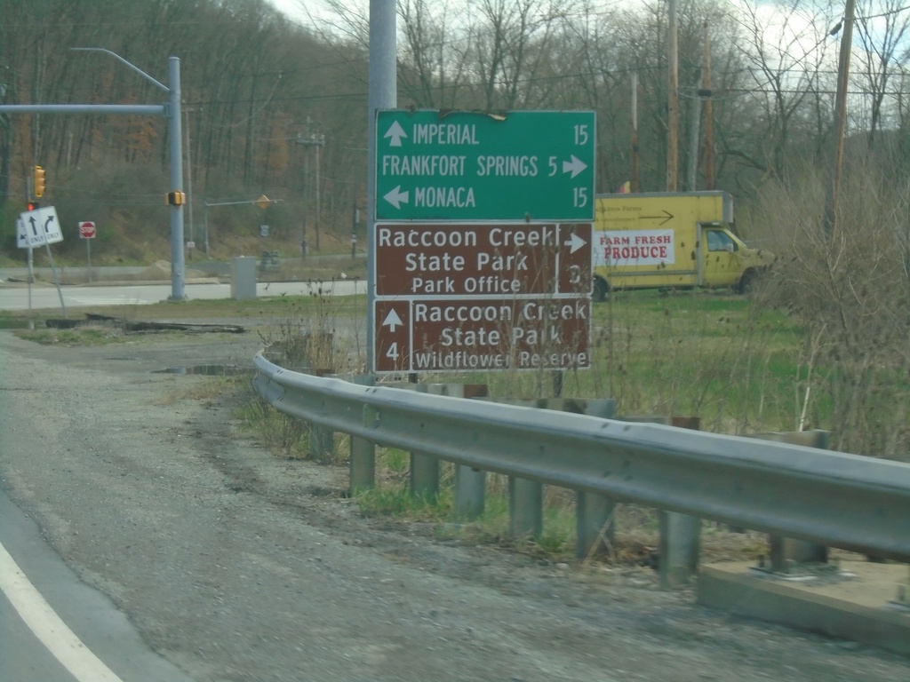
US-30 East at PA-18
US-30 East at PA-18. Use PA-18 north to Monaca; use PA-18 south to Frankfort Springs and Raccoon Creek State Park - Park Office. Continue east on US-30 for Imperial and Raccoon Creek State Park - Wildflower Reserve.
Taken 04-01-2024
 Clinton
Beaver County
Pennsylvania
United States
Clinton
Beaver County
Pennsylvania
United States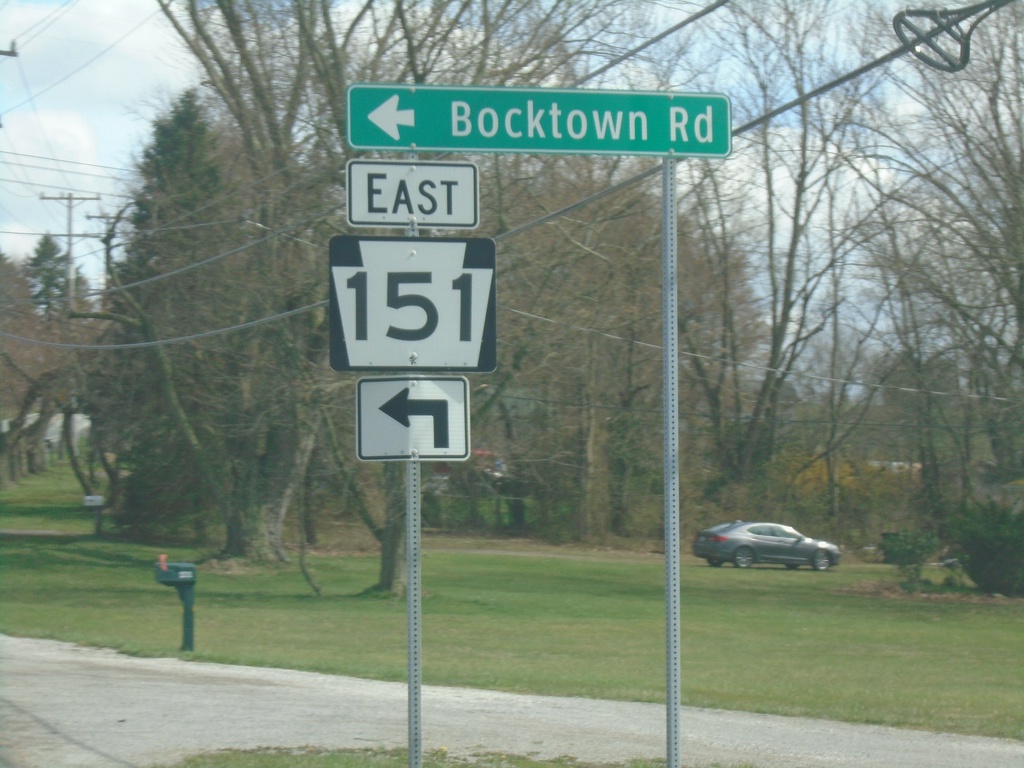
US-30 East at PA-151 East
US-30 East at PA-151 East/Bocktown Road.
Taken 04-01-2024
 Hookstown
Beaver County
Pennsylvania
United States
Hookstown
Beaver County
Pennsylvania
United States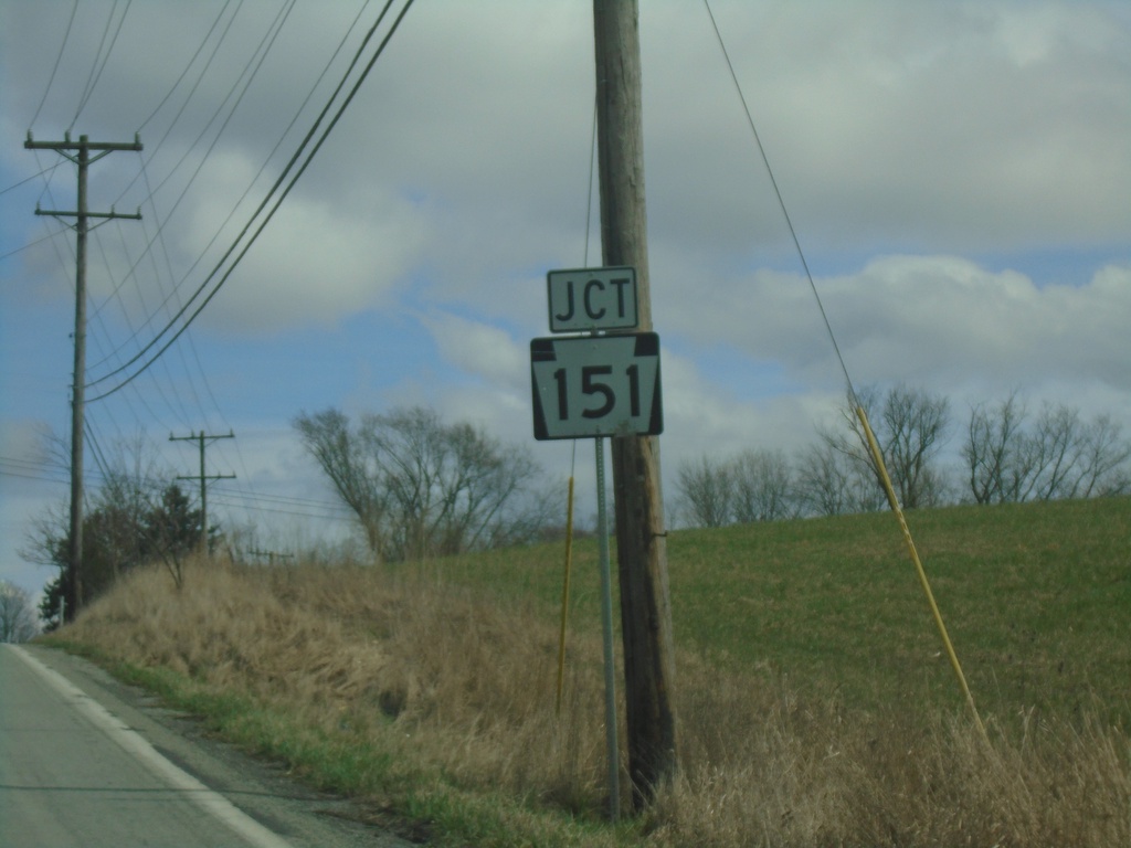
US-30 East Approaching PA-151
US-30 East approaching PA-151 in Beaver County.
Taken 04-01-2024
Hookstown
Beaver County
Pennsylvania
United States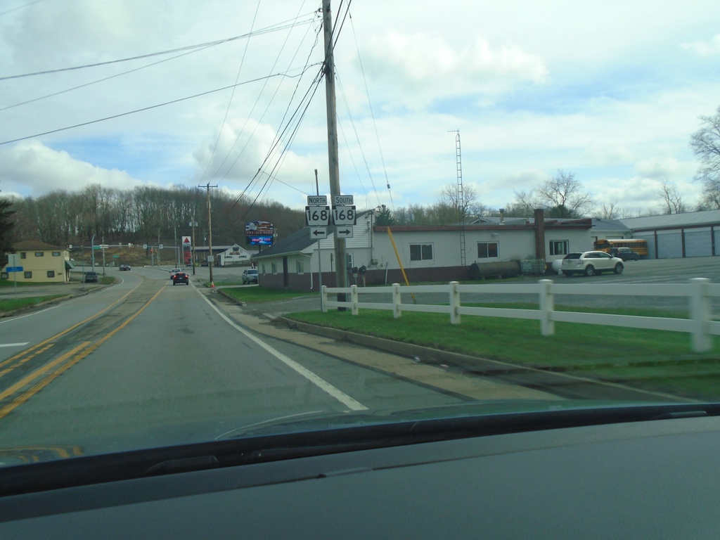
US-30 East Approaching PA-168
US-30 East approaching PA-168 in Greene Township.
Taken 04-01-2024
 Georgetown
Beaver County
Pennsylvania
United States
Georgetown
Beaver County
Pennsylvania
United States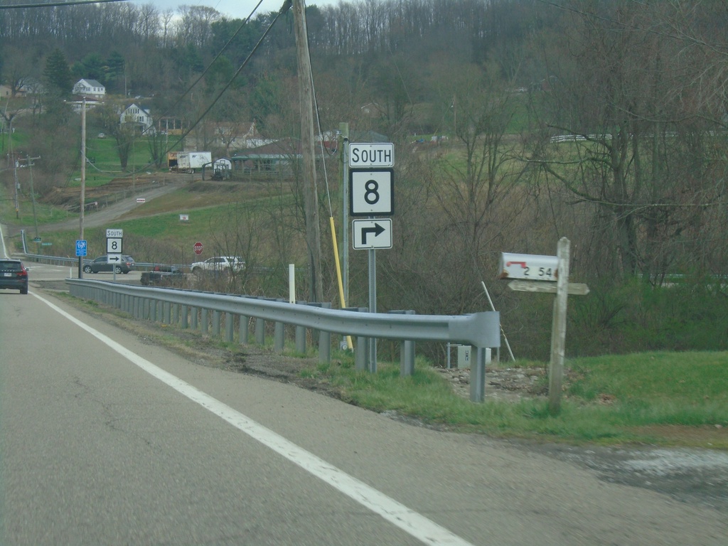
US-30 East at WV-8 South
US-30 East at WV-8 South in Hancock County.
Taken 04-01-2024
 Chester
Hancock County
West Virginia
United States
Chester
Hancock County
West Virginia
United States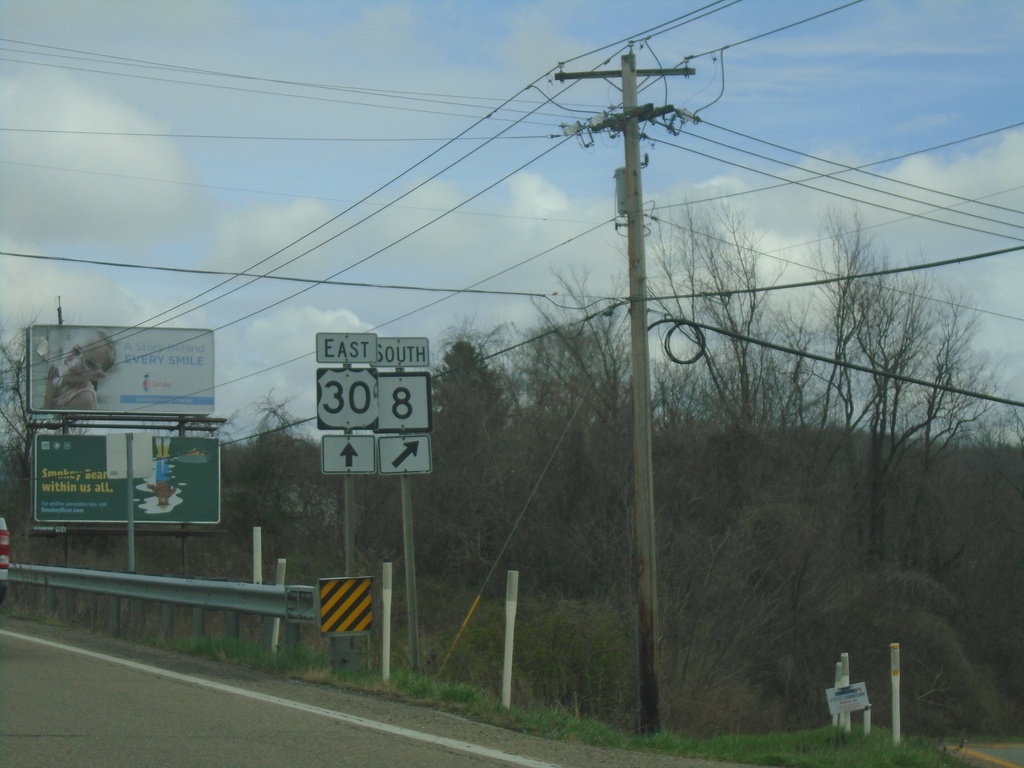
US-30 East Approaching WV-8
US-30 East approaching WV-8 in Hancock County.
Taken 04-01-2024
Chester
Hancock County
West Virginia
United States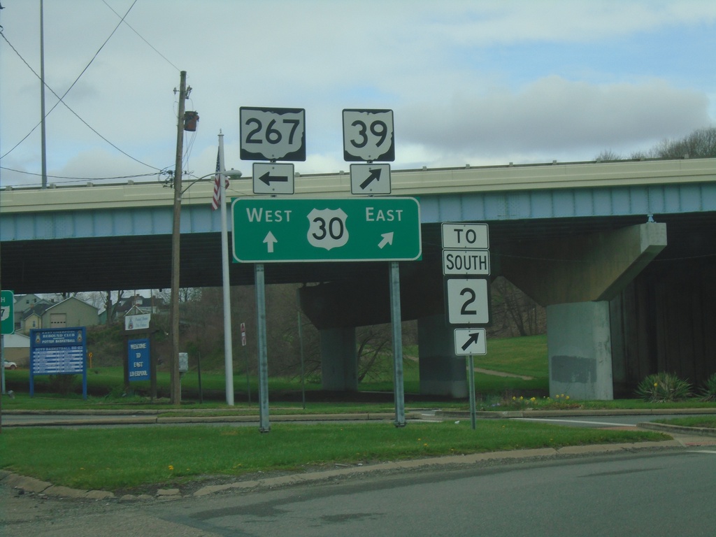
OH-7 North/OH-39 East at US-30/OH-267
OH-7 North/OH-39 East at US-30/OH-267 in East Liverpool. Turn left for OH-267. Continue straight for US-30 West/OH-7 North; merge right for US-30 East/OH-39 East/To WV-2.
Taken 04-01-2024


 East Liverpool
Columbiana County
Ohio
United States
East Liverpool
Columbiana County
Ohio
United States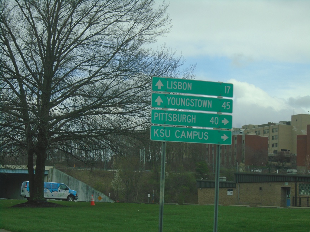
OH-7 North/OH-39 East at US-30/OH-267
OH-7 North/OH-39 East at US-30/OH-267 in East Liverpool. Use US-30/OH-39 East to Pittsburgh (PA) and KSU Campus. Use US-30 West/OH-267/OH-7 North to Youngstown and Lisbon.
Taken 04-01-2024
East Liverpool
Columbiana County
Ohio
United States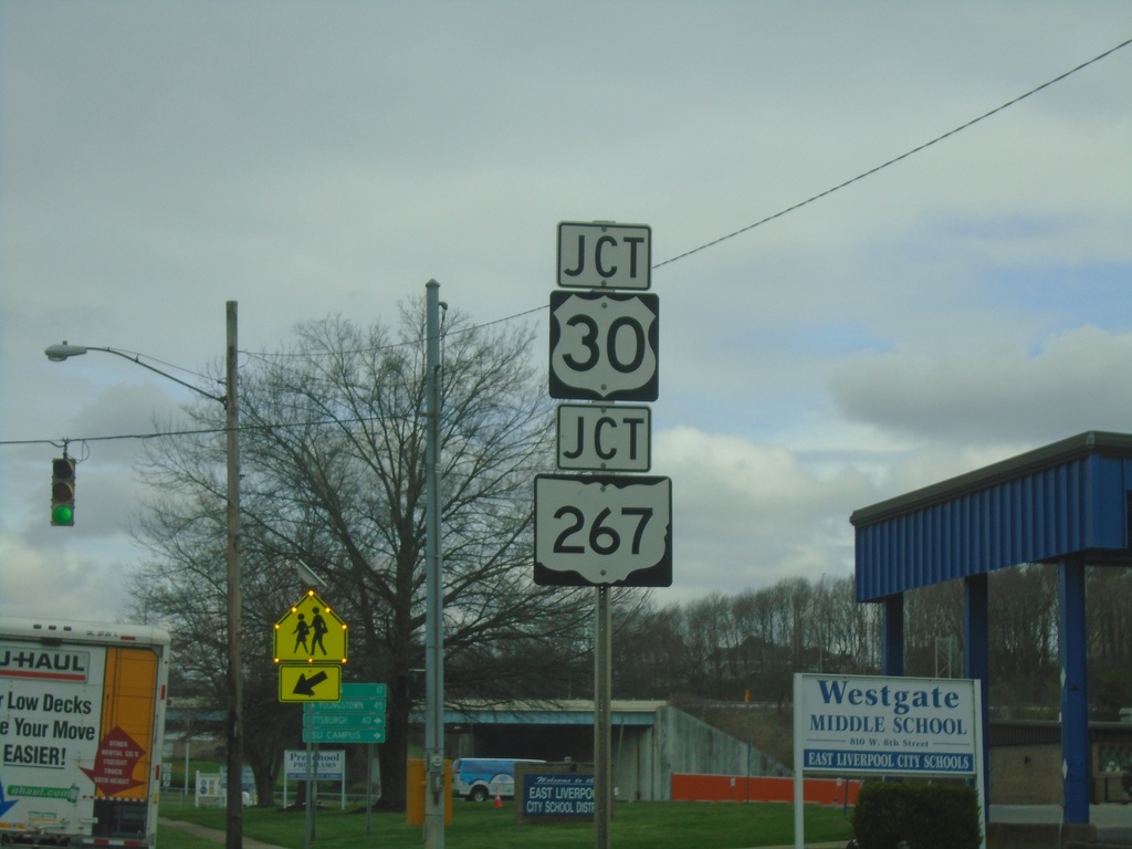
OH-7 North/OH-39 East Approaching US-30/OH-267
OH-7 North/OH-39 East approaching US-30/OH-267 in East Liverpool.
Taken 04-01-2024
East Liverpool
Columbiana County
Ohio
United States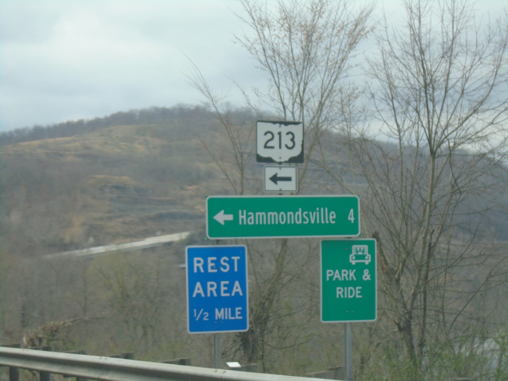
OH-7 North at OH-213 West
OH-7 North at OH-213 West to Hammondsville and Rest Area.
Taken 04-01-2024
 Toronto
Jefferson County
Ohio
United States
Toronto
Jefferson County
Ohio
United States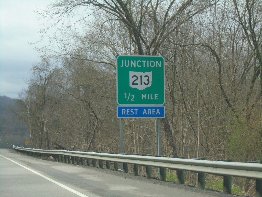
OH-7 North Approaching OH-213
OH-7 North approaching OH-213 in Jefferson County.
Taken 04-01-2024
Toronto
Jefferson County
Ohio
United States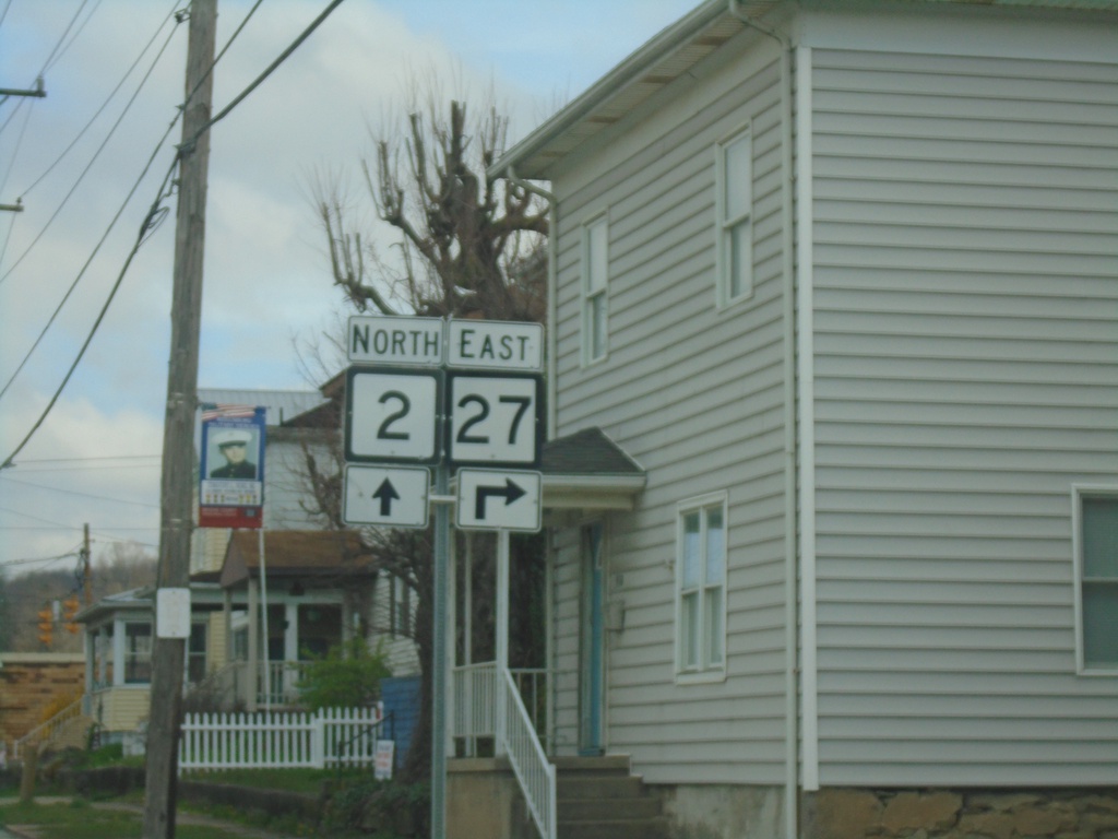
WV-2 North at WV-27
WV-2 North at WV-27 in Wellsburg.
Taken 04-01-2024
 Wellsburg
Brooke County
West Virginia
United States
Wellsburg
Brooke County
West Virginia
United States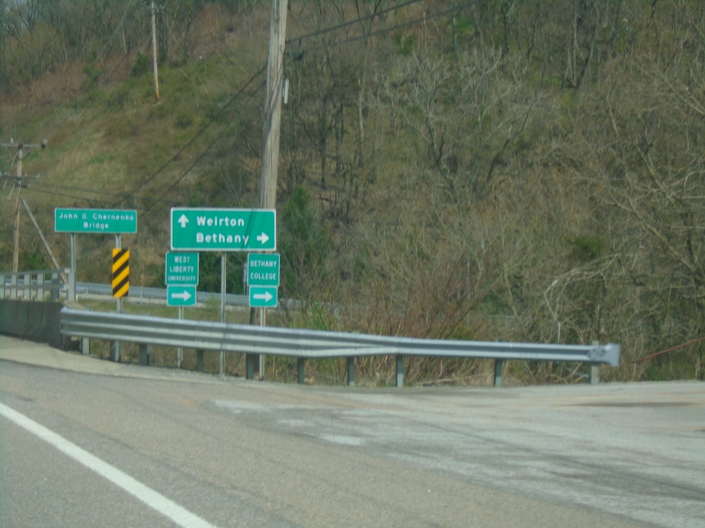
WV-2 North at WV-67
WV-2 North at WV-67 East to Bethany. Continue north on WV-2 to Weirton.
Taken 04-01-2024
 Wellsburg
Brooke County
West Virginia
United States
Wellsburg
Brooke County
West Virginia
United States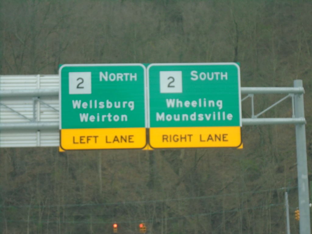
Wellsburg Bridge at WV-2
Wellsburg Bridge over Ohio River at WV-2. Use WV-2 South to Wheeling and Moundsville; WV-2 North to Wellsburg and Weirton.
Taken 04-01-2024
Wellsburg
Brooke County
West Virginia
United States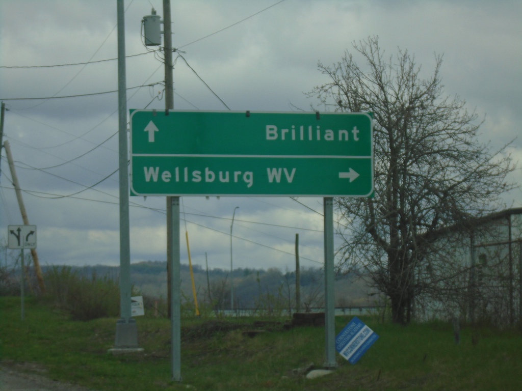
3rd St. at Wellsburg Bridge Junction
3rd St. at approach to Wellsburg Bridge to Wellsburg, WV in Brilliant.
Taken 04-01-2024
Brilliant Jefferson County Ohio United States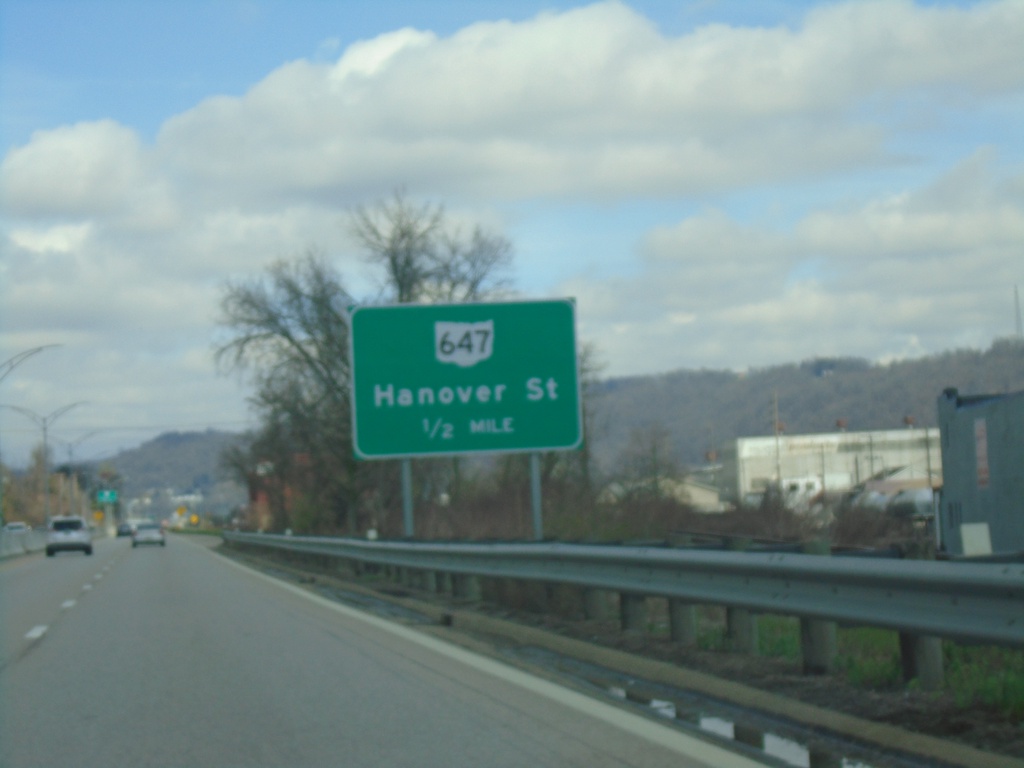
OH-7 North Approaching OH-647
OH-7 North Approaching OH-647/Hannover St.
Taken 04-01-2024
 Martins Ferry
Belmont County
Ohio
United States
Martins Ferry
Belmont County
Ohio
United States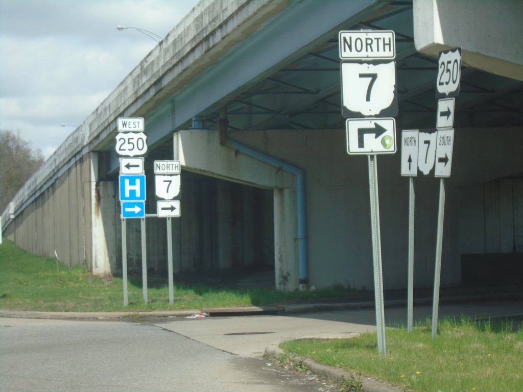
US-250 West at OH-7 North Ramp
US-250 West at OH-7 North onramp
Taken 04-01-2024
 Bridgeport
Belmont County
Ohio
United States
Bridgeport
Belmont County
Ohio
United States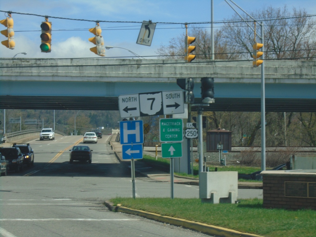
US-40 East at US-250/OH-7
US-40 East at US-250 and OH-7 ramps in Bridgeport.
Taken 04-01-2024
 Bridgeport
Belmont County
Ohio
United States
Bridgeport
Belmont County
Ohio
United States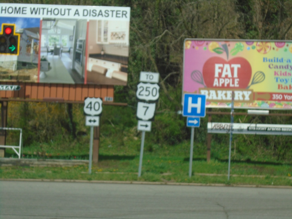
Marion St. at US-40 - To OH-7/US-250
Marion St. at US-40. Turn right to OH-7/US-250
Taken 04-01-2024
Bridgeport
Belmont County
Ohio
United States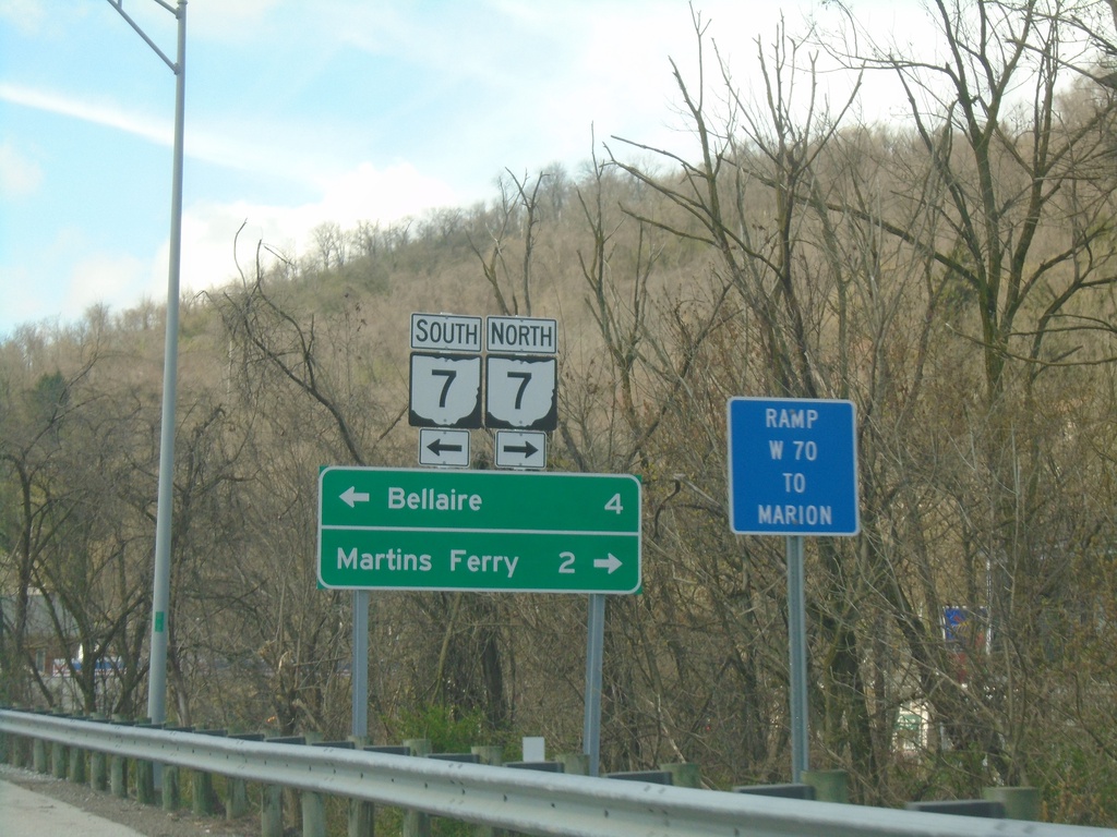
I-70 West - Exit 225 Offramp
I-70 West - Exit 225 offramp at access road to OH-7. Turn right for OH-7 North to Martins Ferry; left for OH-7 South to Bellaire.
Taken 04-01-2024
 Bridgeport
Belmont County
Ohio
United States
Bridgeport
Belmont County
Ohio
United States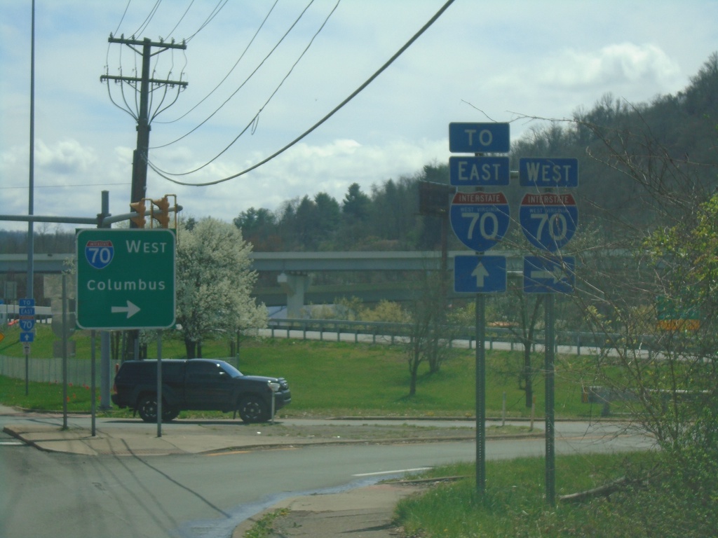
US-40 East at I-70 West
US-40 East at I-70 West to Columbus (OH).
Taken 04-01-2024
Wheeling
Ohio County
West Virginia
United States