Signs Tagged With Intersection
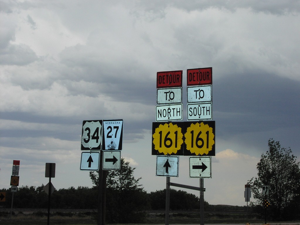
US-34 East at NE-27 South
US-34 East at NE-27 South. Use NE-27 south for detour to KS-161 South. Use US-34 east for detour to KS-161 North.
Taken 05-01-2004


 Haigler
Dundy County
Nebraska
United States
Haigler
Dundy County
Nebraska
United States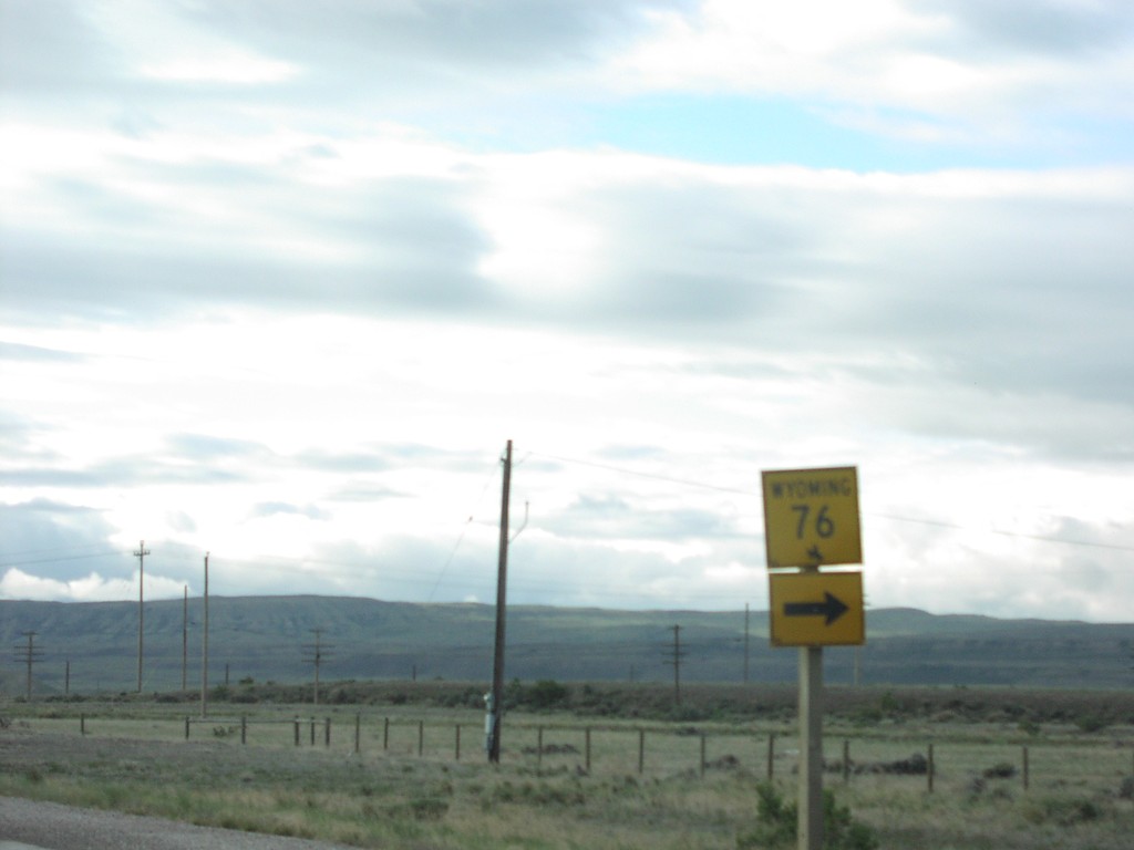
US-287 South at WY-76
US-287 South at WY-76 Junction
Taken 05-01-2004

 Rawlins
Carbon County
Wyoming
United States
Rawlins
Carbon County
Wyoming
United States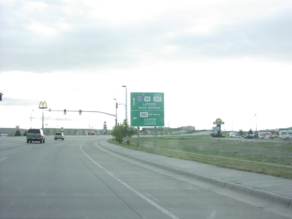
US-287 North at US-287 Bypass
BL-80 East/US-287 South at US-287/Rawlins Bypass
Taken 05-01-2004
Rawlins
Carbon County
Wyoming
United States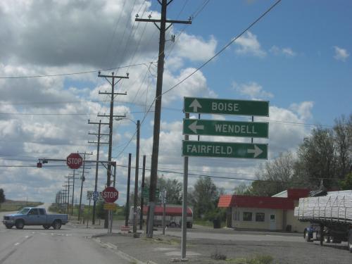
US-26 West at ID-46
US-26/ID-46 Junction to Boise, Wendell and Fairfield, in
Taken 05-01-2004

 Gooding
 County
Idaho
United States
Gooding
Gooding County
Idaho
United States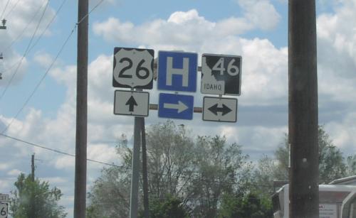
US-26 West at ID-46
US-26/ID-46 Junction on US-26 West
Taken 05-01-2004
Gooding
Gooding County
Idaho
United States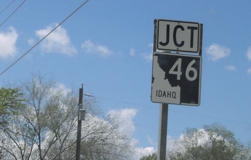
US-26 West Approaching ID-46
Junction ID-46 on US-26 West
Taken 05-01-2004
Gooding
Gooding County
Idaho
United States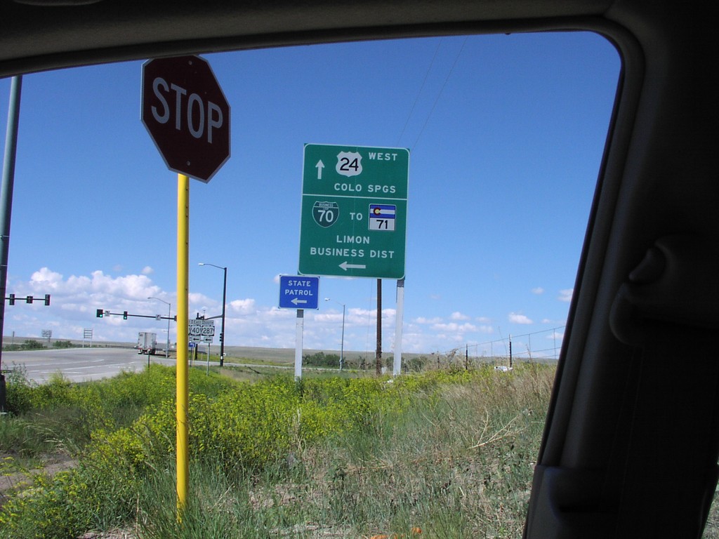
US-24 West at BL-70
BL-70/US-24 Junction in Limon
Taken 05-01-2004


 Limon
Lincoln County
Colorado
United States
Limon
Lincoln County
Colorado
United States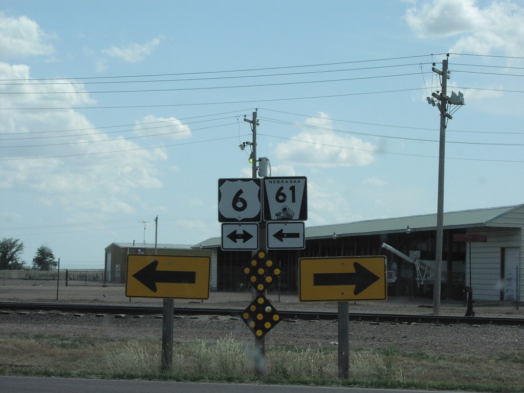
NE-61 South at US-6
NE-61/US-6 Shields in
Taken 05-01-2004

 Imperial
Chase County
Nebraska
United States
Imperial
Chase County
Nebraska
United States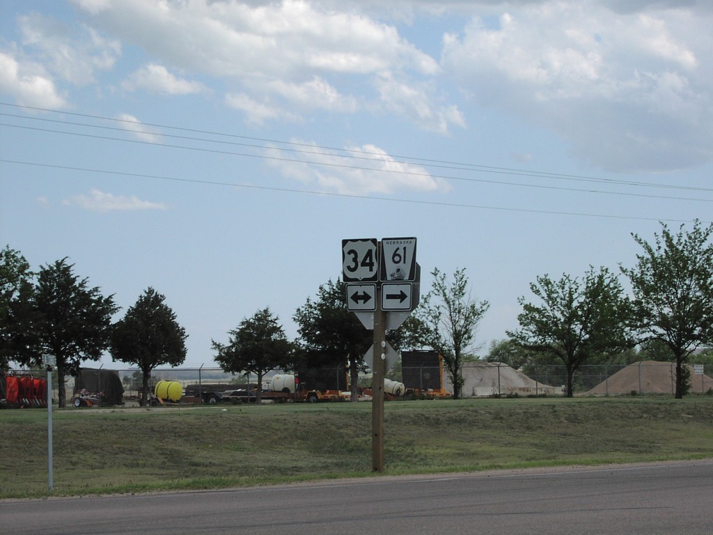
NE-61 South at US-34
US-34/NE-61 Junction in
Taken 05-01-2004
Benkelman
Dundy County
Nebraska
United States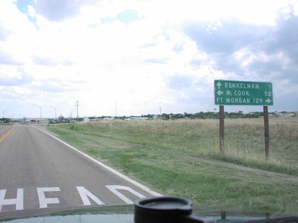
NE-61 South at US-34
NE-61 South at US-34 Junction
Taken 05-01-2004
Benkelman
Dundy County
Nebraska
United States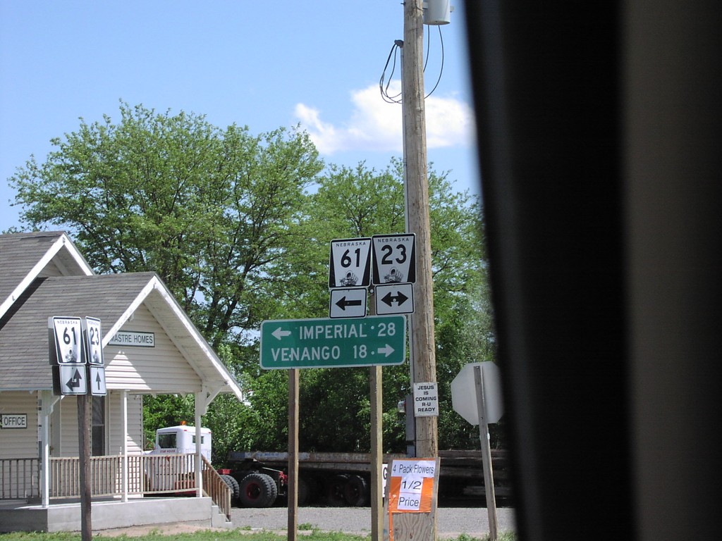
NE-61 South at NE-23
NE-61/NE-23 Junction to Imperial and Venango
Taken 05-01-2004
 Grant
Perkins County
Nebraska
United States
Grant
Perkins County
Nebraska
United States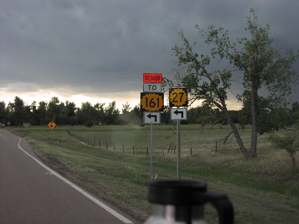
KS-27 South at US-36
KS-27/KS-161 Detour South at US-36 Jct.
Taken 05-01-2004

 Saint Francis
Cheyenne County
Kansas
United States
Saint Francis
Cheyenne County
Kansas
United States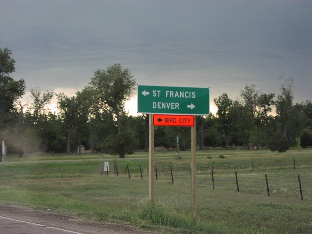
KS-27 South at US-36
KS-27 South at US-36 Junction to St. Francis and Denver
Taken 05-01-2004
Saint Francis
Cheyenne County
Kansas
United States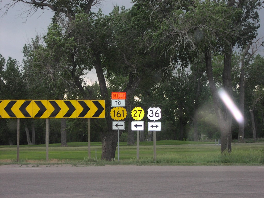
KS-27 South at US-36
KS-27/KS-161 Detour/US-36 Junction
Taken 05-01-2004
Saint Francis
Cheyenne County
Kansas
United States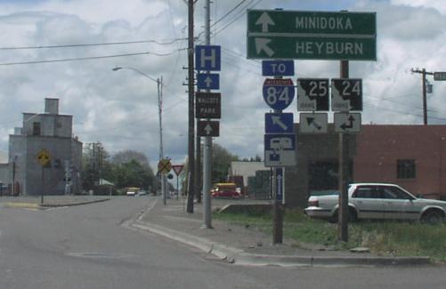
ID-25 West at ID-24
ID-25 west at ID-24. Use ID-24 west for Minidoka. Merge left for ID-24/ID-25 west to Heyburn and I-84. ID-24 and ID-25 join through Rupert.
Taken 05-01-2004

 Rupert
Minidoka County
Idaho
United States
Rupert
Minidoka County
Idaho
United States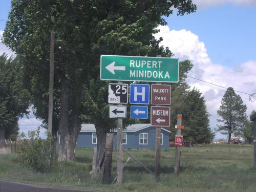
ID-25 West - Minidoka County
ID-25 west (South 200 East) at Baseline Road. Turn left to continue west on ID-25 towards Rupert and MInidoka.
Taken 05-01-2004
Rupert
Minidoka County
Idaho
United States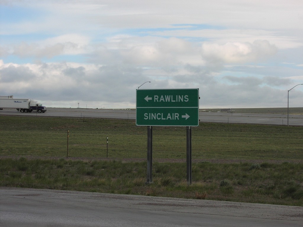
End WY-76 at US-287
End WY-76 at US-287 Junction Rawlins/Sinclair
Taken 05-01-2004
Rawlins
Carbon County
Wyoming
United States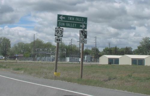
End ID-24 at US-93
End ID-24 at US-93 in Shoshone. Use US-93 north to Sun Valley; US-93 south to Twin Falls.
Taken 05-01-2004
 Shoshone
Lincoln County
Idaho
United States
Shoshone
Lincoln County
Idaho
United States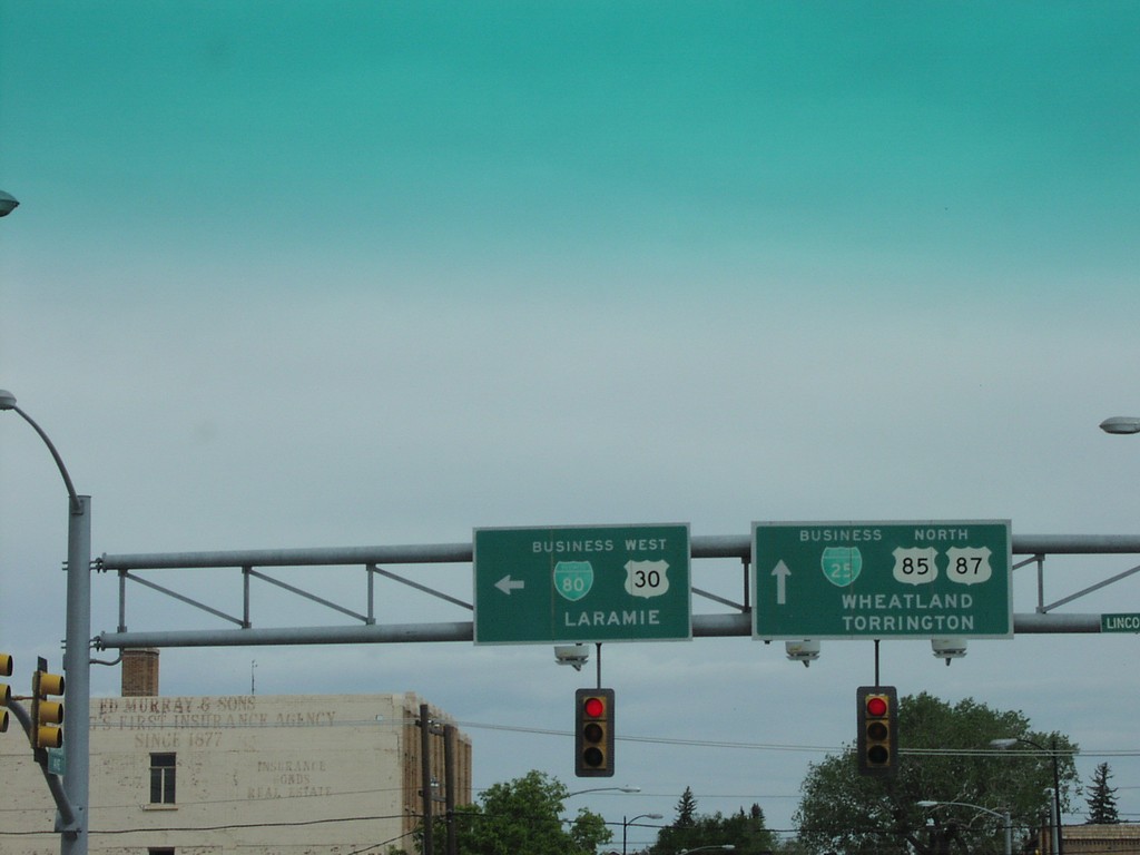
End I-180 North at US-30
End I-180 North at US-30/US-85/US-87
Taken 05-01-2004
 Cheyenne
Laramie County
Wyoming
United States
Cheyenne
Laramie County
Wyoming
United States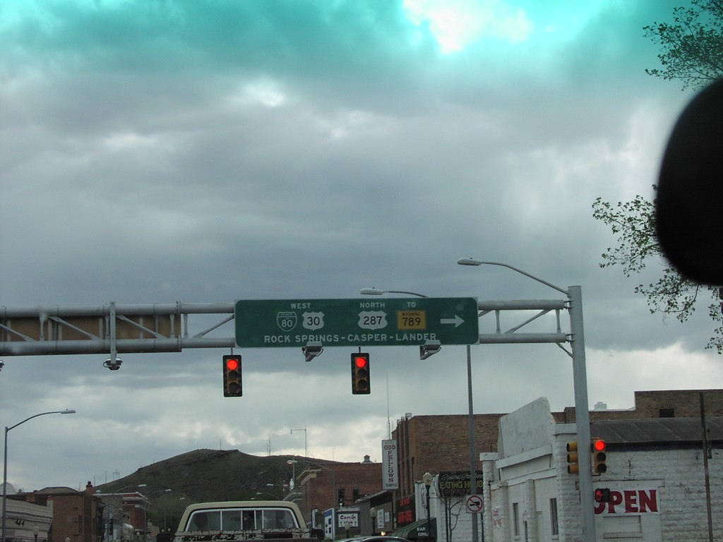
BL-80/US30/US-287/WY-789 West
BL-80/US-30/US-287/To WY-789/Rock Springs/Casper
Taken 05-01-2004
 Rawlins
Carbon County
Wyoming
United States
Rawlins
Carbon County
Wyoming
United States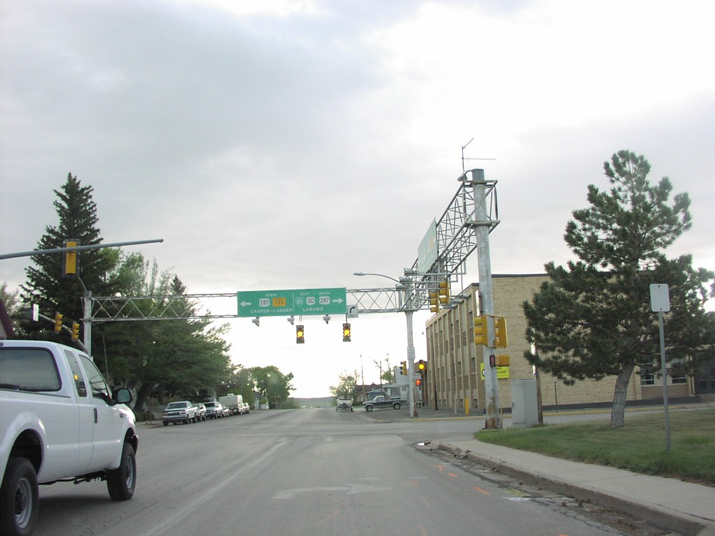
BL-80 East at US-287 Jct.
US-30/WY-789/US-287 Junction
Taken 05-01-2004
Rawlins
Carbon County
Wyoming
United States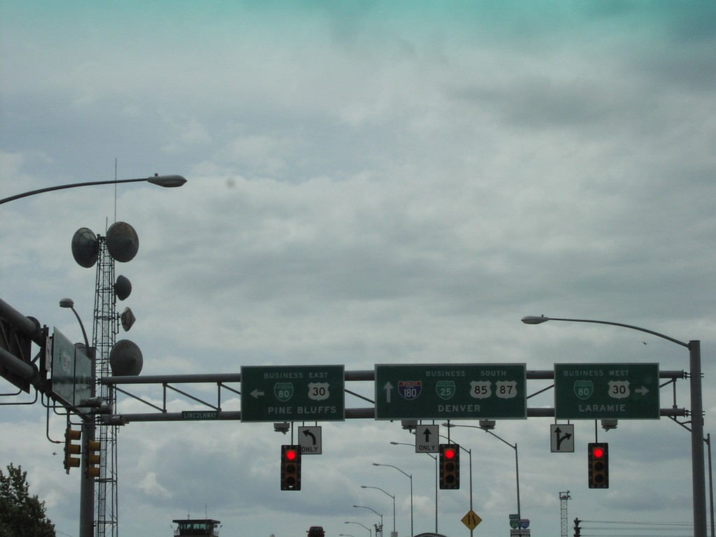
Begin I-180 South at US-30
Begin I-180 South at US-30/US-85/US-87 Junction, Downtown
Taken 05-01-2004
Cheyenne
Laramie County
Wyoming
United States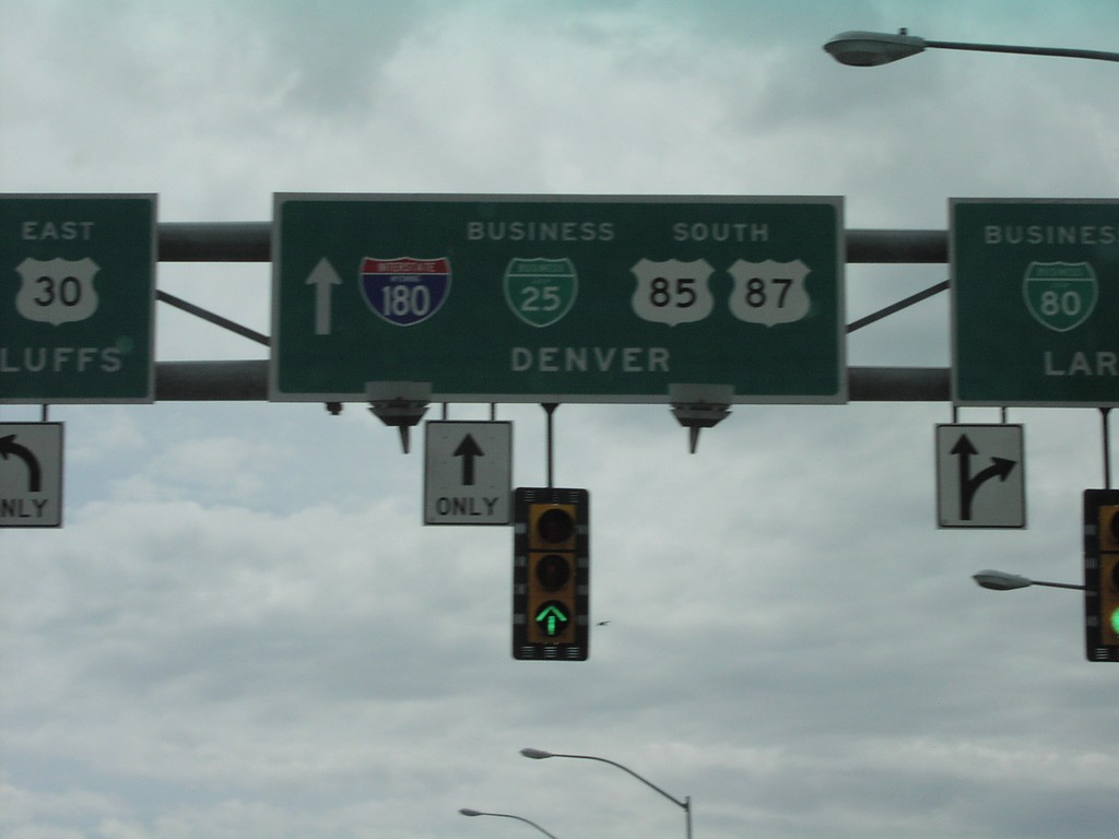
Begin I-180 South at US-30
Begin I-180 South Closeup, Downtown Cheyenne
Taken 05-01-2004
Cheyenne
Laramie County
Wyoming
United States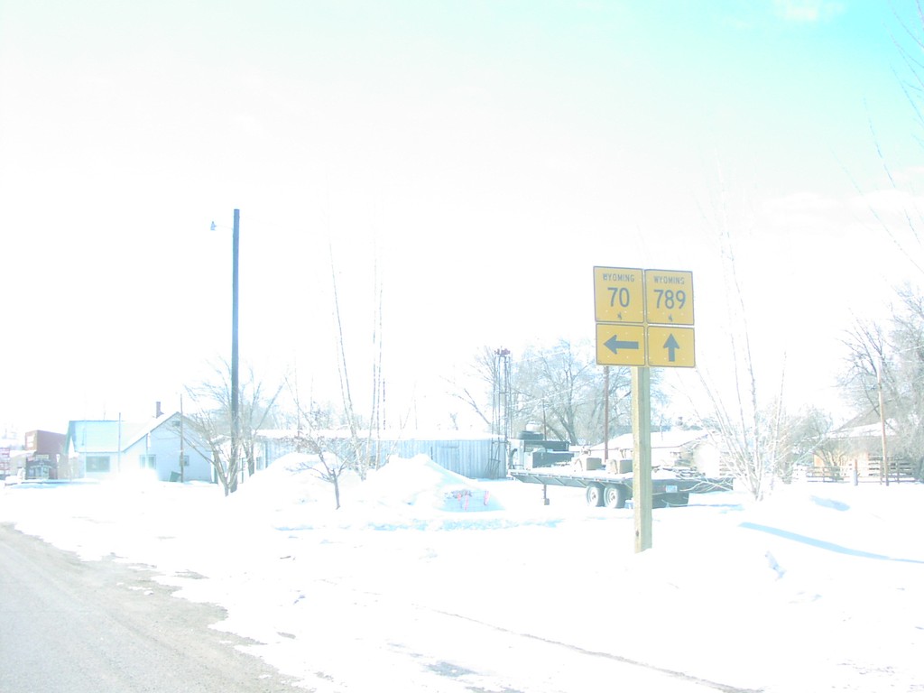
WY-789 South at WY-70
WY-70/WY-789 Junction
Taken 02-01-2004
 Baggs
Carbon County
Wyoming
United States
Baggs
Carbon County
Wyoming
United States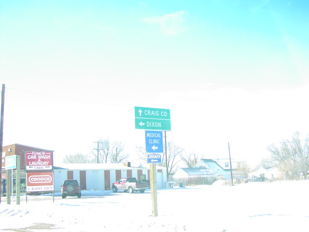
WY-789 South at WY-70
Destination Sign to Craig, CO and Dixon, WY at WY-70/WY-789 Junction
Taken 02-01-2004
Baggs
Carbon County
Wyoming
United States