Signs Tagged With Intersection
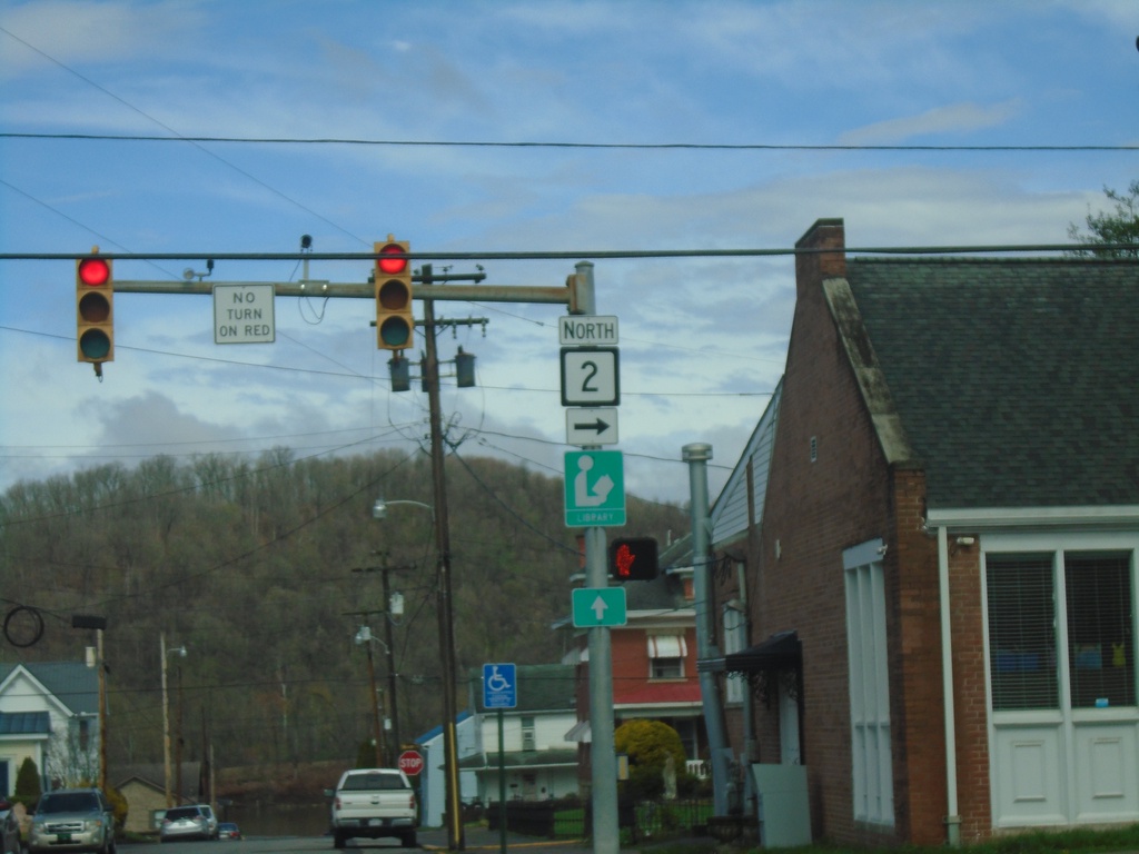
WV-2 - Sistersville
WV-2 at the corner of Elizabeth St. and Wells St. in Sistersville.
Taken 04-01-2024
 Sistersville
Tyler County
West Virginia
United States
Sistersville
Tyler County
West Virginia
United States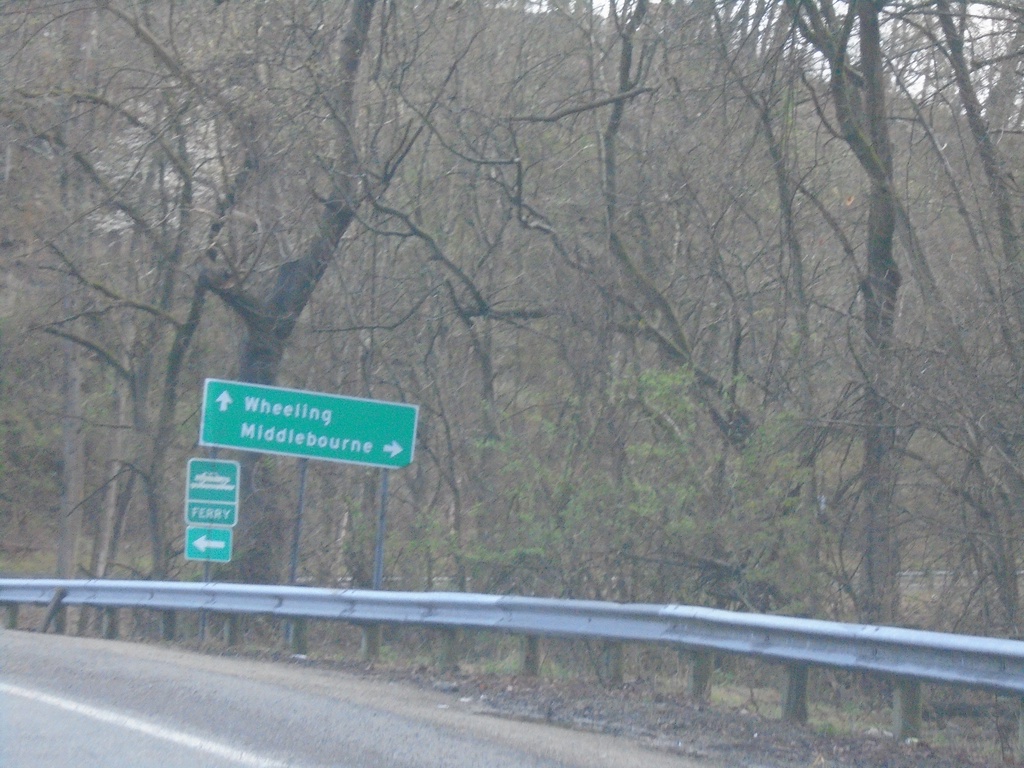
WV-2 North at WV-18
WV-2 North at WV-18 to Middlebourne. Continue north on WV-2 for Wheeling and for access to the Sistersville Ferry across the Ohio River.
Taken 04-01-2024
 Sistersville
Tyler County
West Virginia
United States
Sistersville
Tyler County
West Virginia
United States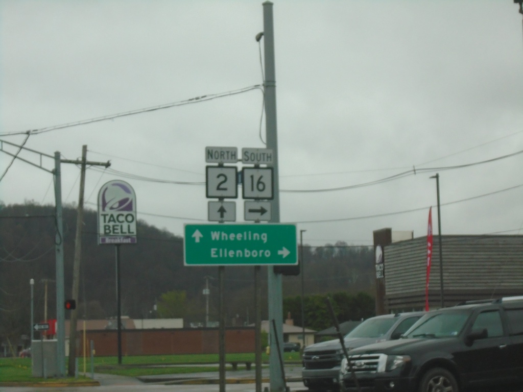
WV-2 North at WV-16
WV-2 North at WV-16 South to Ellenboro. Continue north on WV-2 for Wheeling.
Taken 04-01-2024
 Saint Marys
Pleasants County
West Virginia
United States
Saint Marys
Pleasants County
West Virginia
United States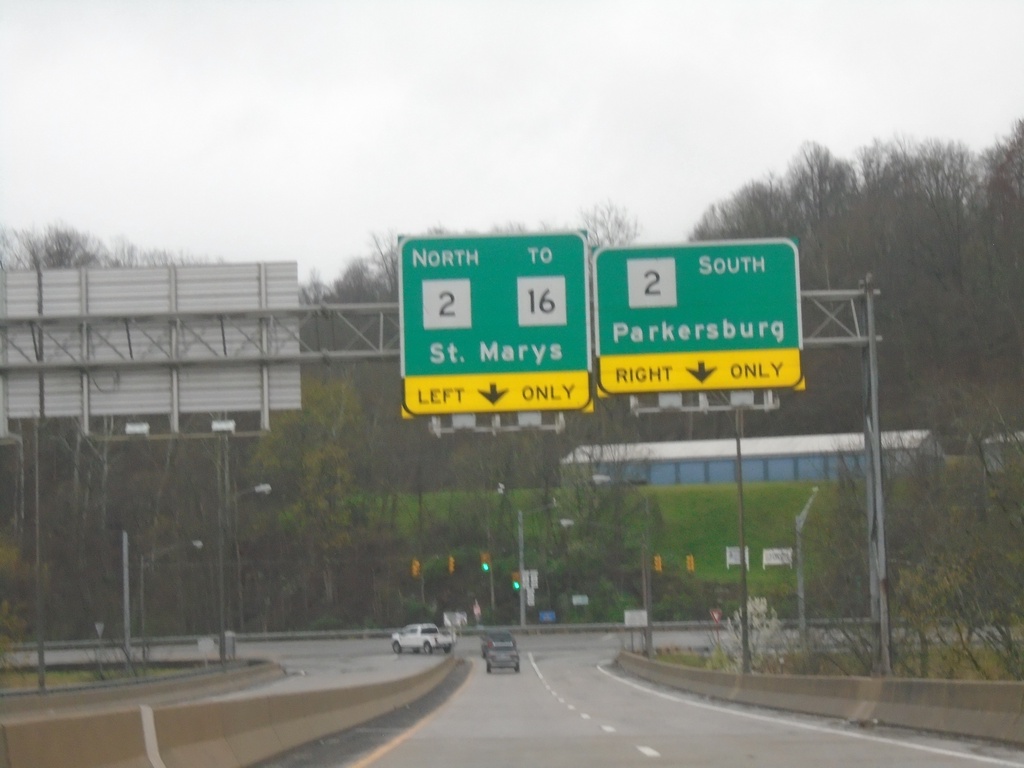
Carpenter Bridge Over Ohio River at WV-2
Carpenter Bridge over Ohio River at WV-2. Use WV-2 South to Parkersburg; WV-2 North/To WV-16 to St. Marys.
Taken 04-01-2024
Saint Marys
Pleasants County
West Virginia
United States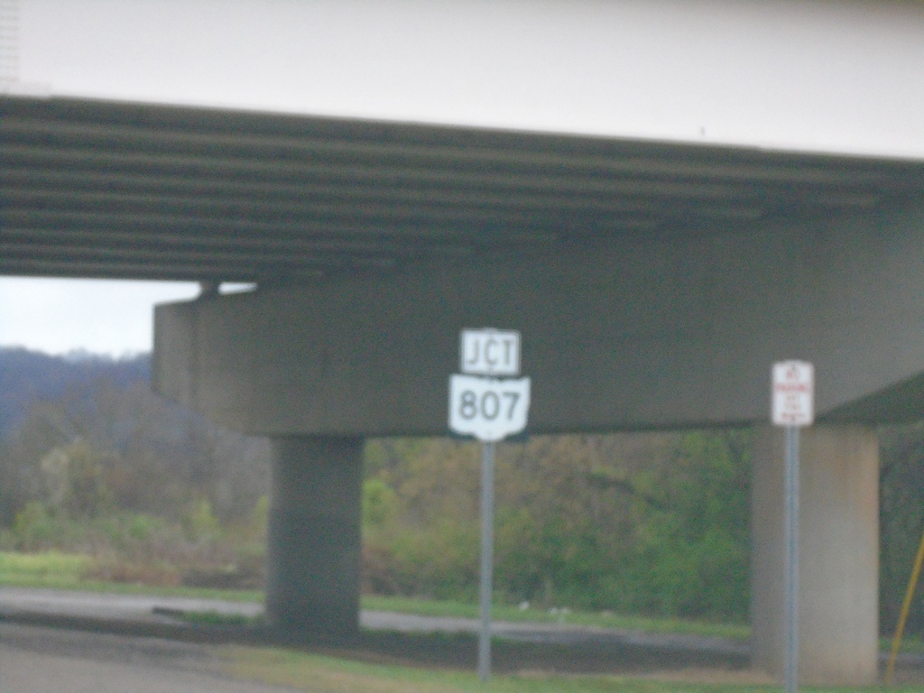
OH-7 North Approaching OH-807
OH-7 North approaching OH-807 in Newport.
Taken 04-01-2024

 Newport
Washington County
Ohio
United States
Newport
Washington County
Ohio
United States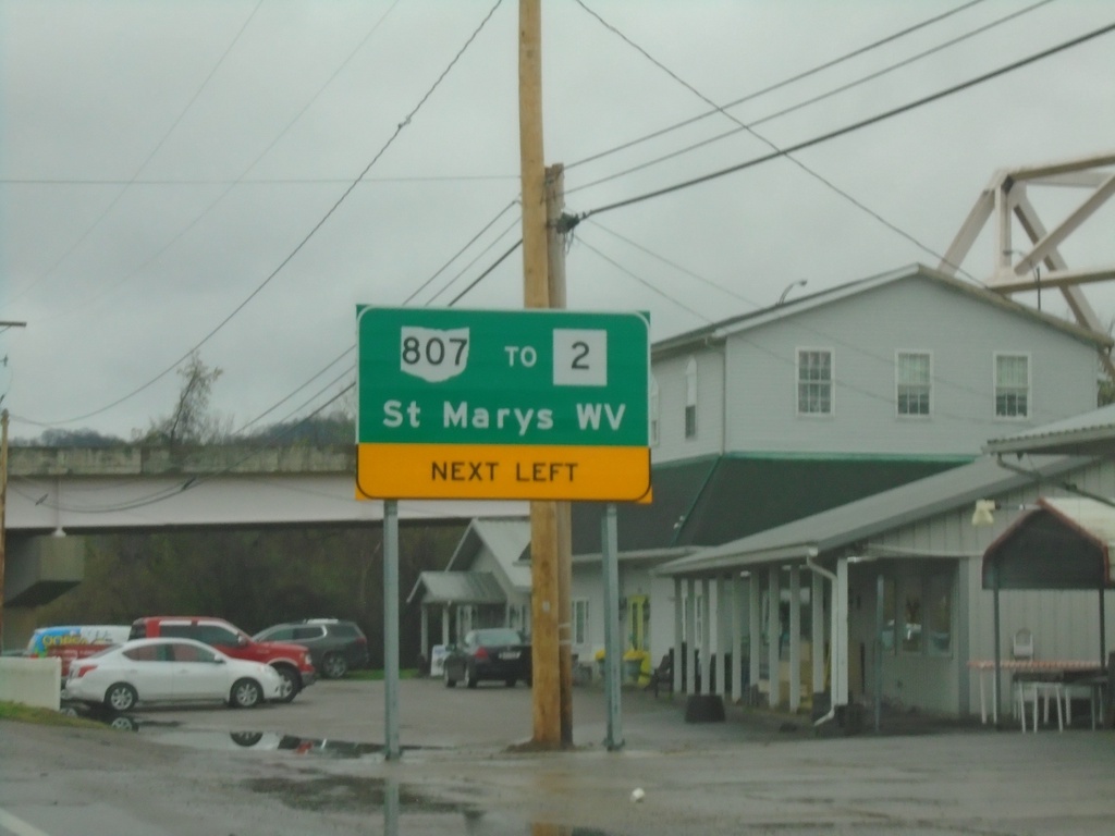
OH-7 North Approaching OH-807/To WV-2
OH-7 North Approaching OH-807/To WV-2/St. Marys, WV in Newport. OH-807 connects Ohio to West Virginia with a bridge over the Ohio River. The bridge can be seen on the upper right side of the picture.
Taken 04-01-2024
Newport
Washington County
Ohio
United States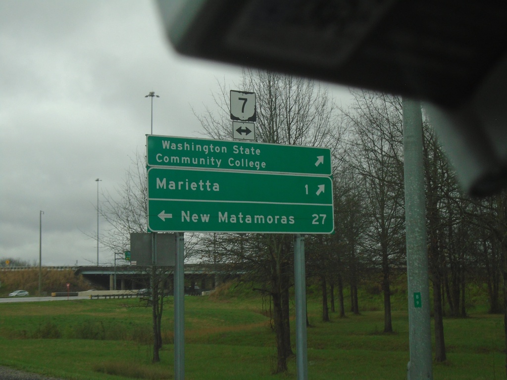
I-77 North - Exit 1 Offramp at OH-7
I-77 North - Exit 1 Offramp at OH-7. Use OH-7 South to Washington State Community College and Marietta. Use OH-7 North to New Matamoras.
Taken 04-01-2024
 Marietta
Washington County
Ohio
United States
Marietta
Washington County
Ohio
United States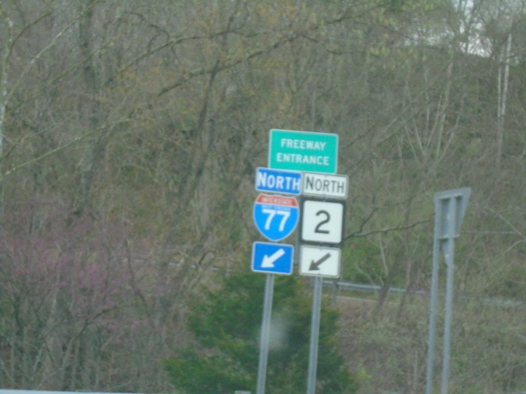
US-33 East/WV-2 North at I-77
I-77/WV-2 North Freeway Entrance.
Taken 04-01-2024
 Ravenswood
Jackson County
West Virginia
United States
Ravenswood
Jackson County
West Virginia
United States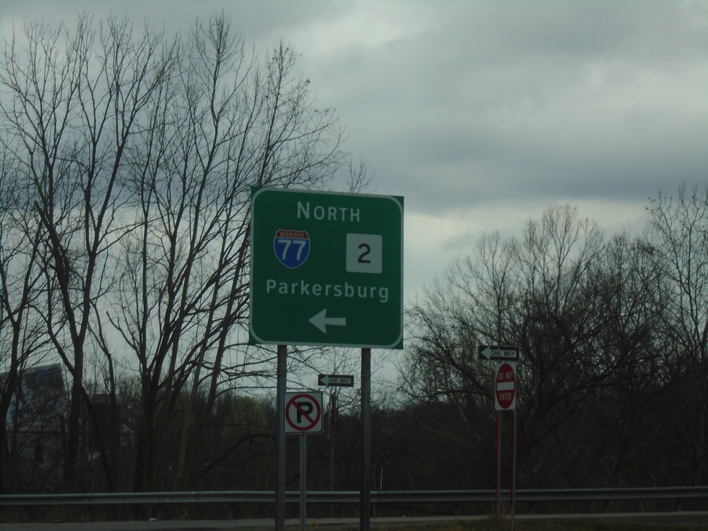
US-33 East/WV-2 North at I-77
US-33 East/WV-2 North at I-77/WV-2 North to Parkersburg.
Taken 04-01-2024
Silverton
Jackson County
West Virginia
United States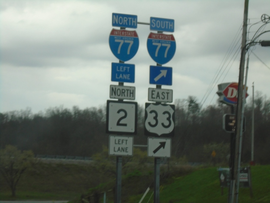
US-33 East/WV-2 North at I-77
US-33 East/WV-2 North at I-77. Merge right for I-77 South/US-33 East; continue under freeway for I-77/WV-2 North.
Taken 04-01-2024
Ravenswood
Jackson County
West Virginia
United States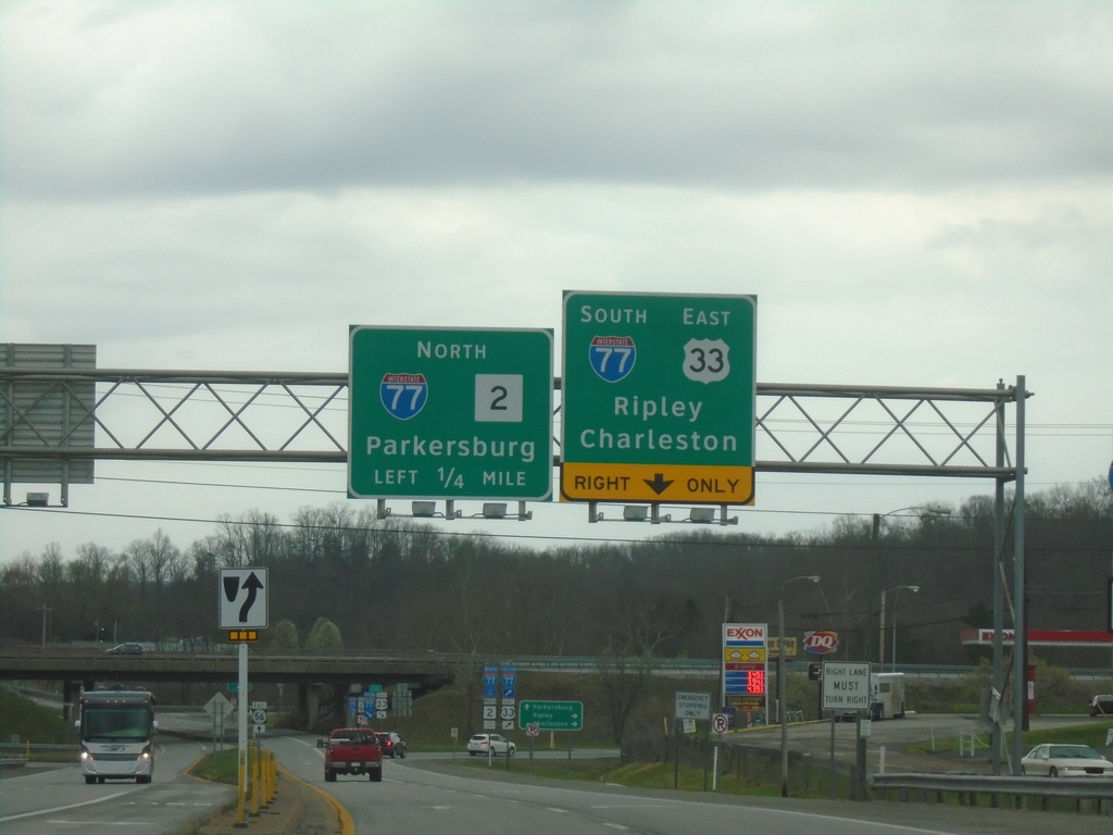
US-33 East/WV-2 North at I-77
US-33 East/WV-2 North at I-77. Use I-77 South/US-33 East to Ripley and Charleston. Use I-77/WV-2 North to Parkersburg.
Taken 04-01-2024
Ravenswood
Jackson County
West Virginia
United States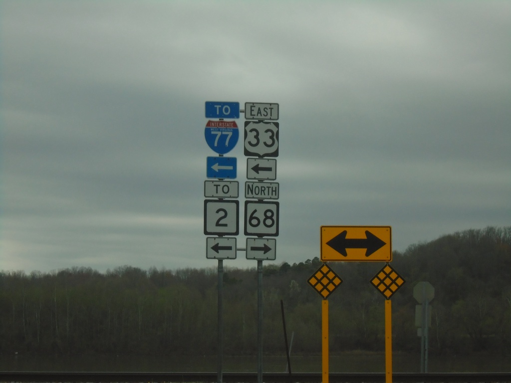
US-33 East at WV-68
US-33 East at WV-68. Turn left for US-33 East/WV-68 South/To WV-2/To I-77.
Taken 04-01-2024
 Ravenswood
Jackson County
West Virginia
United States
Ravenswood
Jackson County
West Virginia
United States
US-33 East Approaching WV-68
US-33 East approaching WV-68. Use WV-68 North to Ravenswood; WV-68 South/US-33 East To I-77 and Point Pleasant.
Taken 04-01-2024
Ravenswood
Jackson County
West Virginia
United States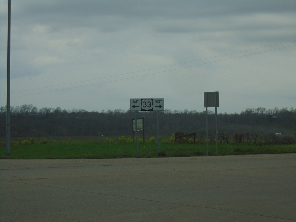
Great Bend Road at US-33
Great Bend Road at US-33 in Meigs County.
Taken 04-01-2024
Portland
Meigs County
Ohio
United States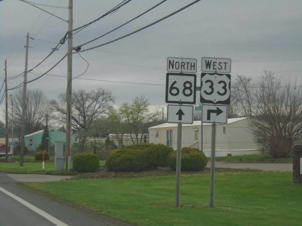
US-33 West/WV-68 North at US-33/WV-68 Split
US-33 West/WV-68 North at US-33/WV-68 split. Turn right for US-33 West and Ohio River bridge.
Taken 04-01-2024
Ravenswood
Jackson County
West Virginia
United States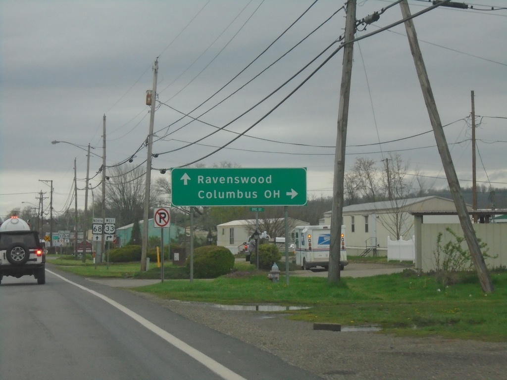
US-33 West/WV-68 North at US-33/WV-68 Split
US-33 West/WV-68 North at US-33/WV-68 split. Use US-33 West to Columbus, OH. Continue north on WV-68 to Ravenswood.
Taken 04-01-2024
Ravenswood
Jackson County
West Virginia
United States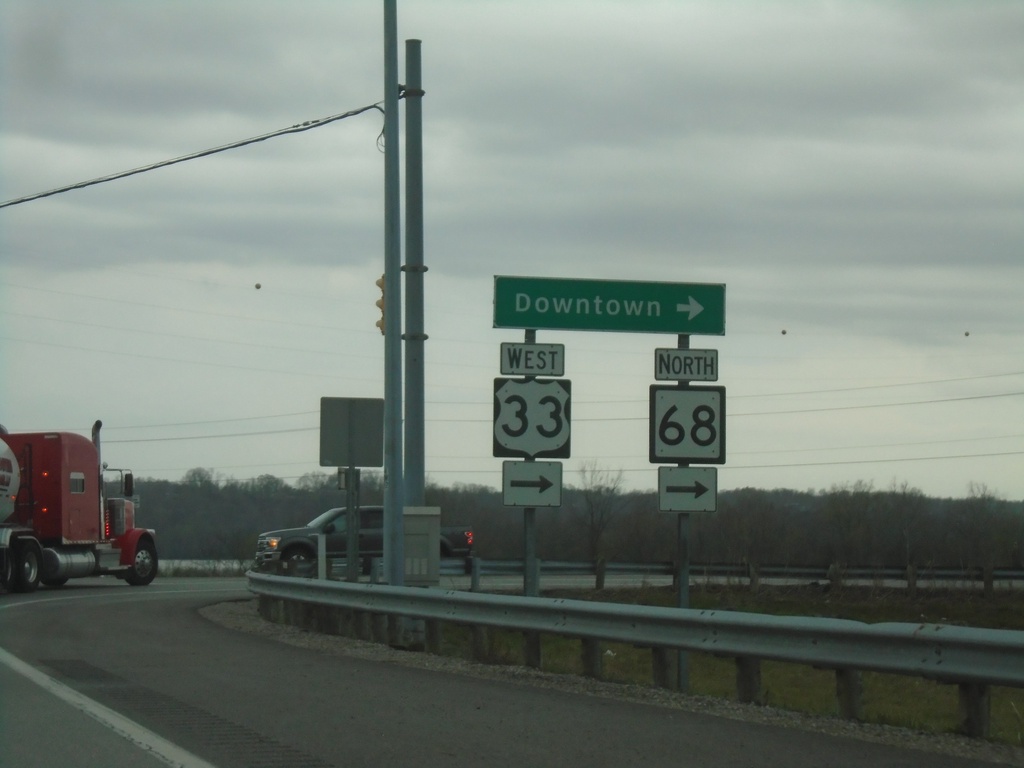
US-33 West/WV-2 South at US-33/WV-68
US-33 West/WV-2 South at US-33 West/WV-68 North to Downtown (Ravenswood).
Taken 04-01-2024
Ravenswood
Jackson County
West Virginia
United States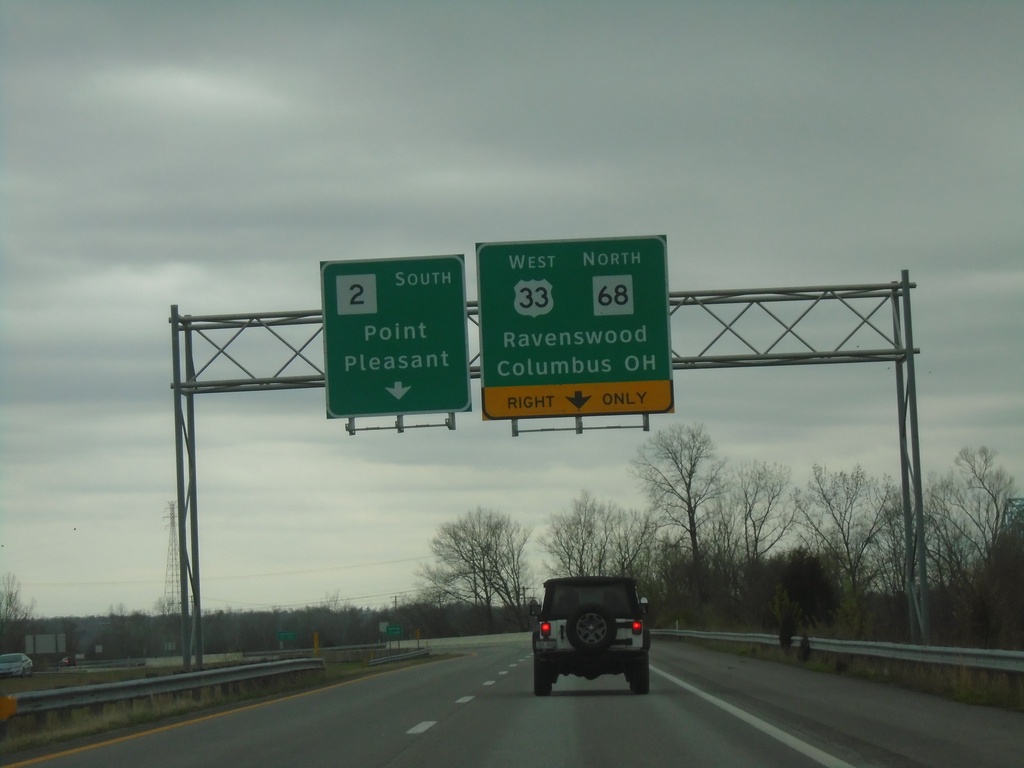
US-33 West/WV-2 South Approaching US-33/WV-68
US-33 West/WV-2 South approaching US-33 West/WV-68 North to Ravenswood and Columbus, OH. Continue south on WV-2 for Point Pleasant.
Taken 04-01-2024
Ravenswood
Jackson County
West Virginia
United States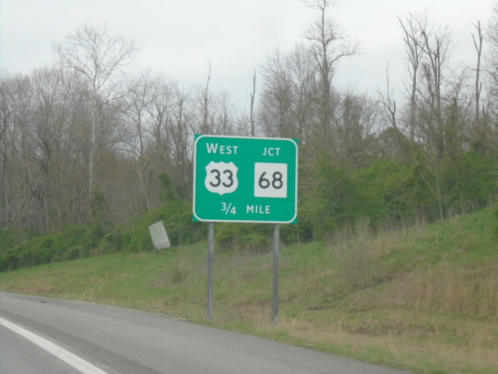
US-33 West/WV-2 South Approaching WV-68
US-33 West/WV-2 South approaching US-33 West/WV-68 North in Ravenswood.
Taken 04-01-2024
Ravenswood
Jackson County
West Virginia
United States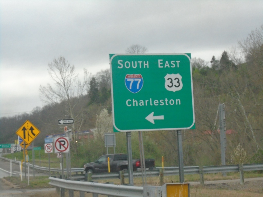
US-33 West/WV-2 South at I-77 South/US-33 East
US-33 West/WV-2 South at I-77 South/US-33 East to Charleston.
Taken 04-01-2024
Ravenswood
Jackson County
West Virginia
United States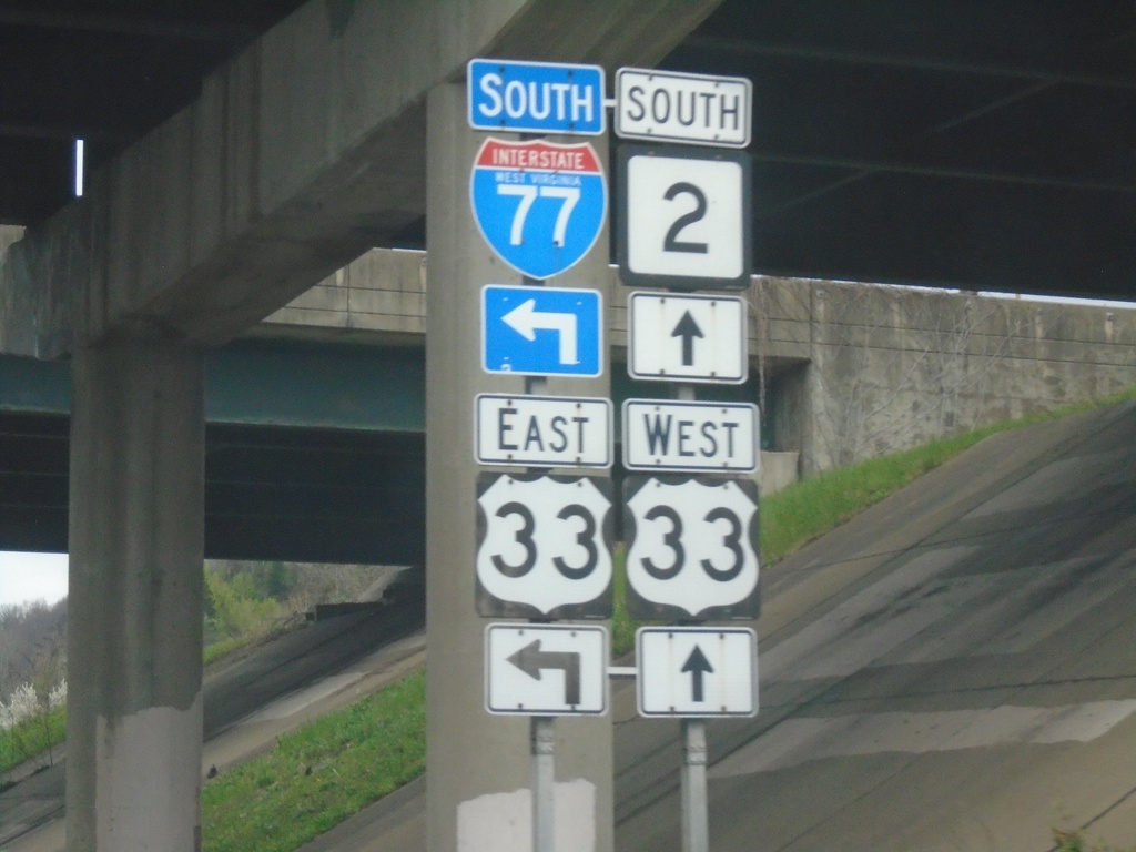
US-33 West/WV-2 South at I-77 South/US-33 East
US-33 West/WV-2 South at I-77 South/US-33 East in Ravenswood.
Taken 04-01-2024
Ravenswood
Jackson County
West Virginia
United States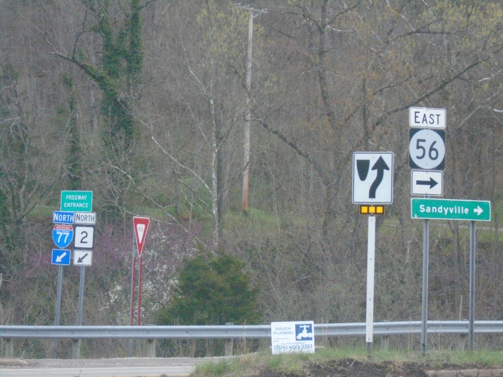
I-77 North at US-33/WV-2/WVCR-56
I-77 North at US-33/WV-2/WVCR-56. Turn right for WVCR-56 East to Sandyville. The I-77 North/WV-2 North freeway entrance is in the background.
Taken 04-01-2024
 Silverton
Jackson County
West Virginia
United States
Silverton
Jackson County
West Virginia
United States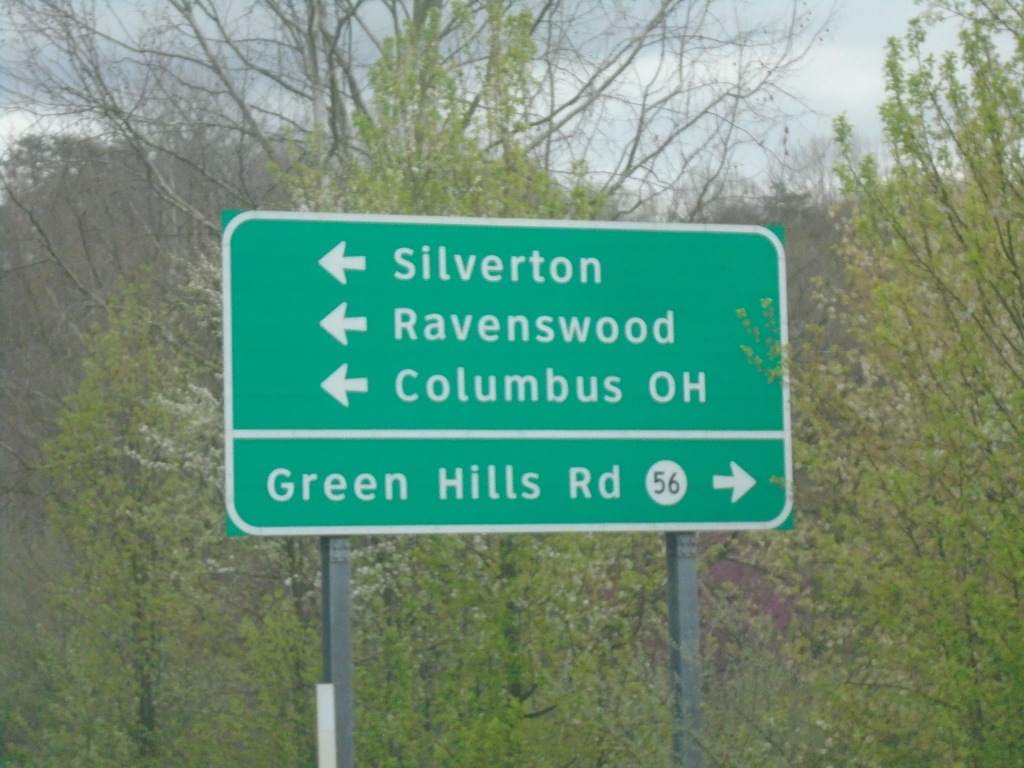
I-77 North Exit 146 Offramp at US-33/WV-2/WVCR-56
I-77 North Exit 146 Offramp at US-33/WV-2/WVCR-56. Turn left for US-33 West/WV-2 South to Silverton, Ravenswood, and Columbus, OH. Turn right for WVCR-56 to Green Hills Road.
Taken 04-01-2024
Silverton
Jackson County
West Virginia
United States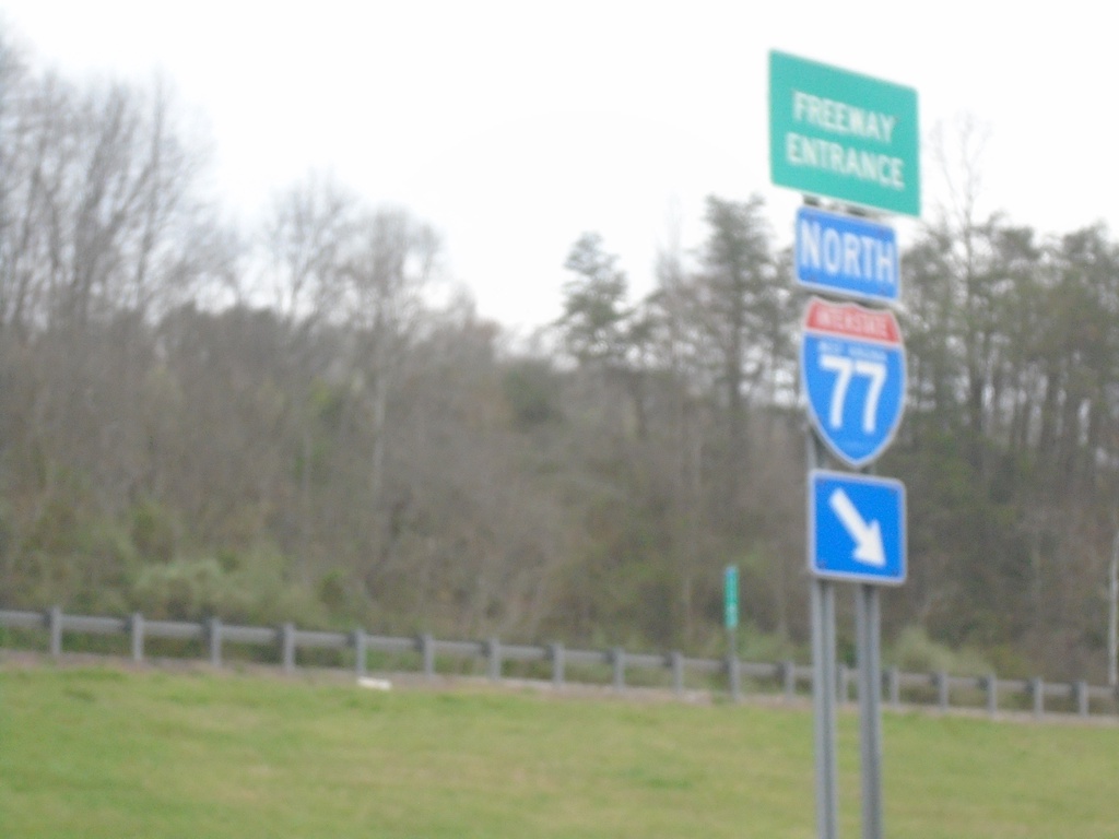
I-77 North - Freeway Entrance
Haines Branch Road at I-77 North Freeway Entrance.
Taken 04-01-2024
Charleston
Kanawha County
West Virginia
United States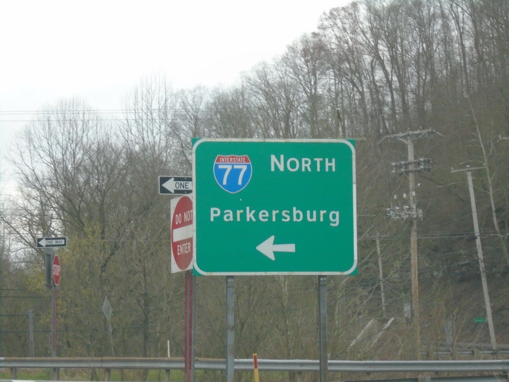
Haines Branch Road at I-77 North
Haines Branch Road at I-77 North to Parkersburg.
Taken 04-01-2024
Charleston
Kanawha County
West Virginia
United States