Signs Tagged With Intersection
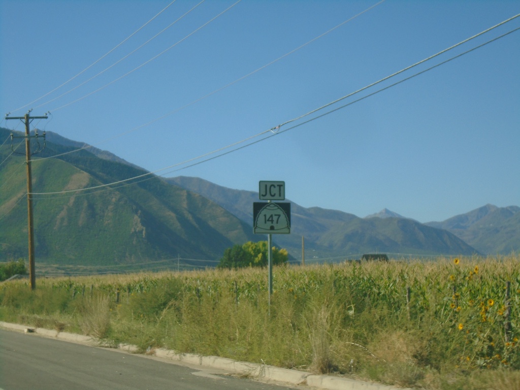
US-89 South Approaching UT-147
US-89 South approaching UT-147 in Mapleton.
Taken 09-07-2023

 Mapleton
Utah County
Utah
United States
Mapleton
Utah County
Utah
United States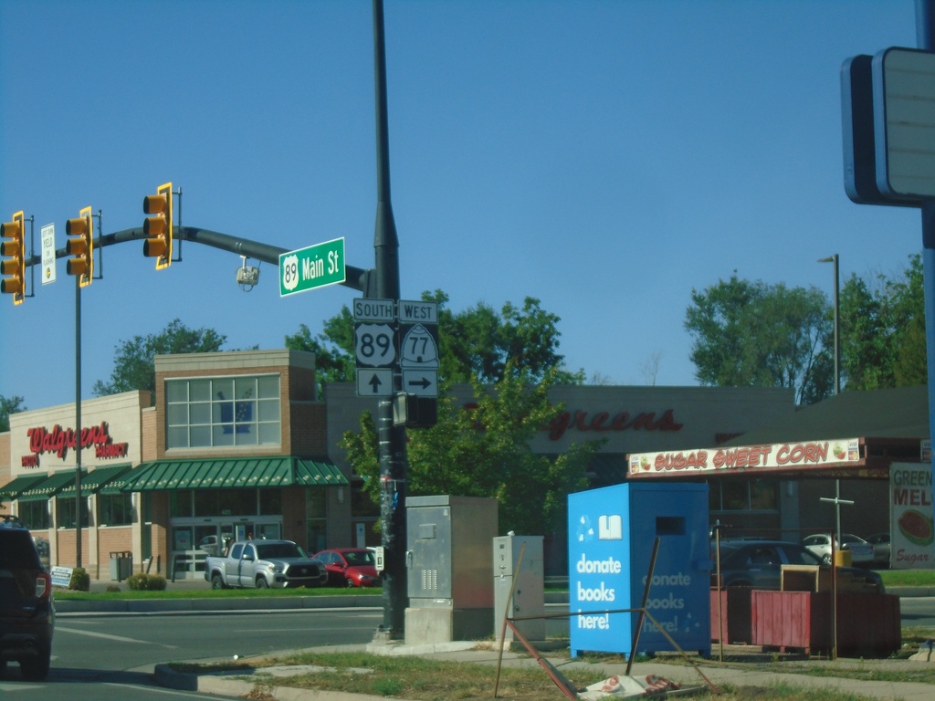
US-89 South at UT-77
US-89 South (Main St.) at UT-77 (400 S) in Springville.
Taken 09-07-2023
 Springville
Utah County
Utah
United States
Springville
Utah County
Utah
United States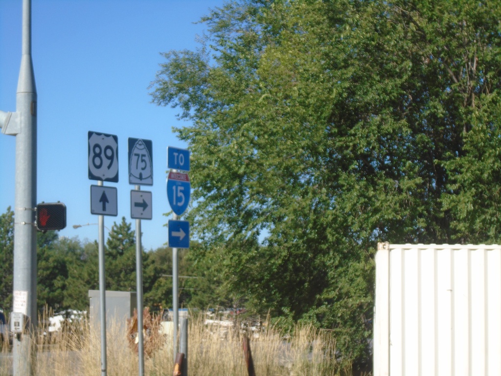
US-89 South at UT-75/To I-15
US-89 South at UT-75 (W 1400 N)/To I-15 in Springville.
Taken 09-07-2023

 Springville
Utah County
Utah
United States
Springville
Utah County
Utah
United States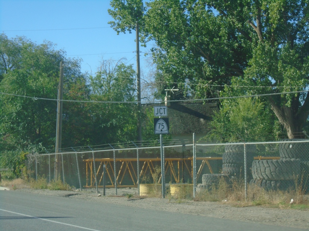
US-89 South Approaching UT-75
US-89 South approaching UT-75 (1400 N) in Springville.
Taken 09-07-2023
Springville
Utah County
Utah
United States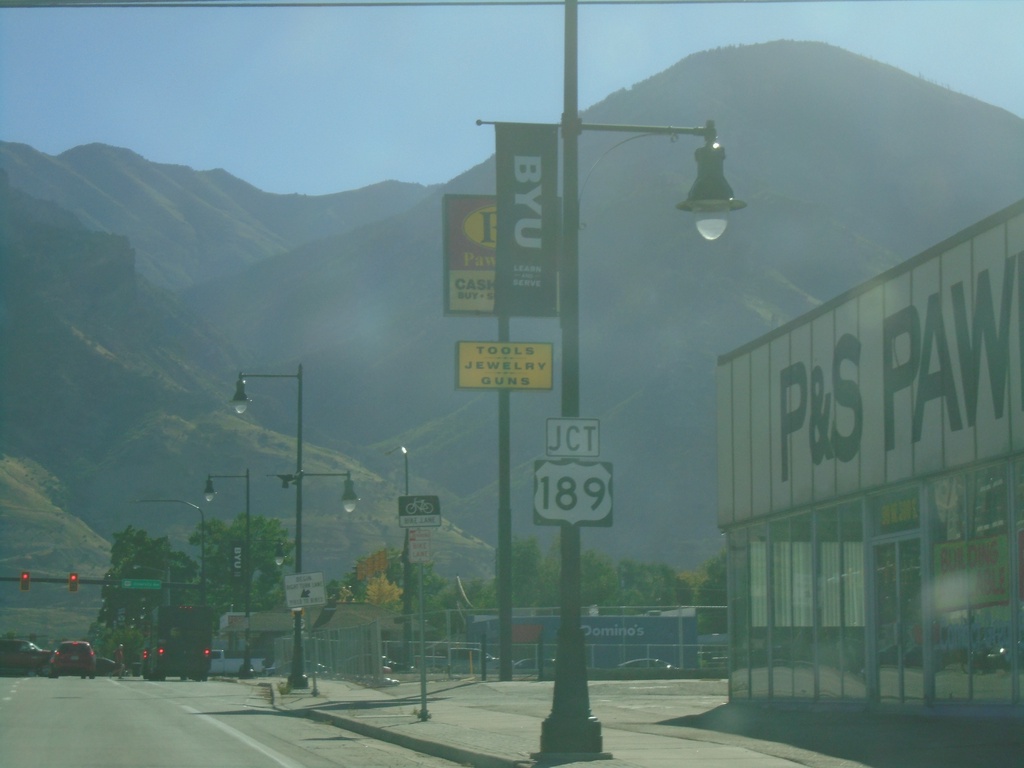
US-89 South Approaching US-189
US-89 South (300 S) approaching US-189 (University Ave.) in Provo.
Taken 09-07-2023
 Provo
Utah County
Utah
United States
Provo
Utah County
Utah
United States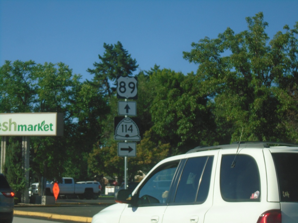
US-89 South at UT-114
US-89 South (N 500 W) at UT-114 (Center St.) in Provo.
Taken 09-07-2023
 Provo
Utah County
Utah
United States
Provo
Utah County
Utah
United States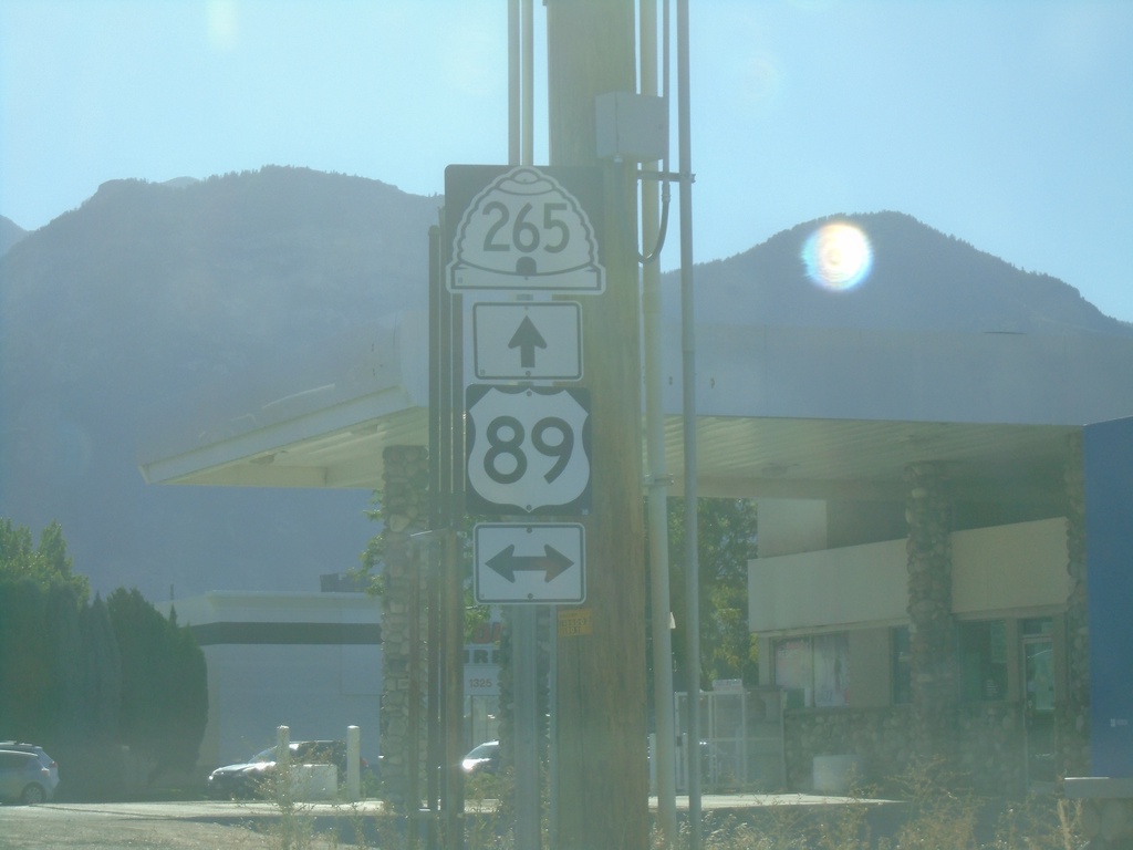
UT-265 East at US-89 - Orem
UT-265 East (University Parkway) at US-89 (State St.) in Orem
Taken 09-07-2023
 Orem
Utah County
Utah
United States
Orem
Utah County
Utah
United States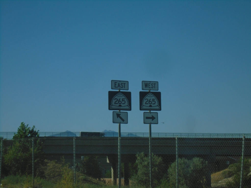
I-15 South (Exit 269) Offramp at UT-265
I-15 South (Exit 269) Offramp at UT-265 (University Parkway)
Taken 09-07-2023
Orem
Utah County
Utah
United States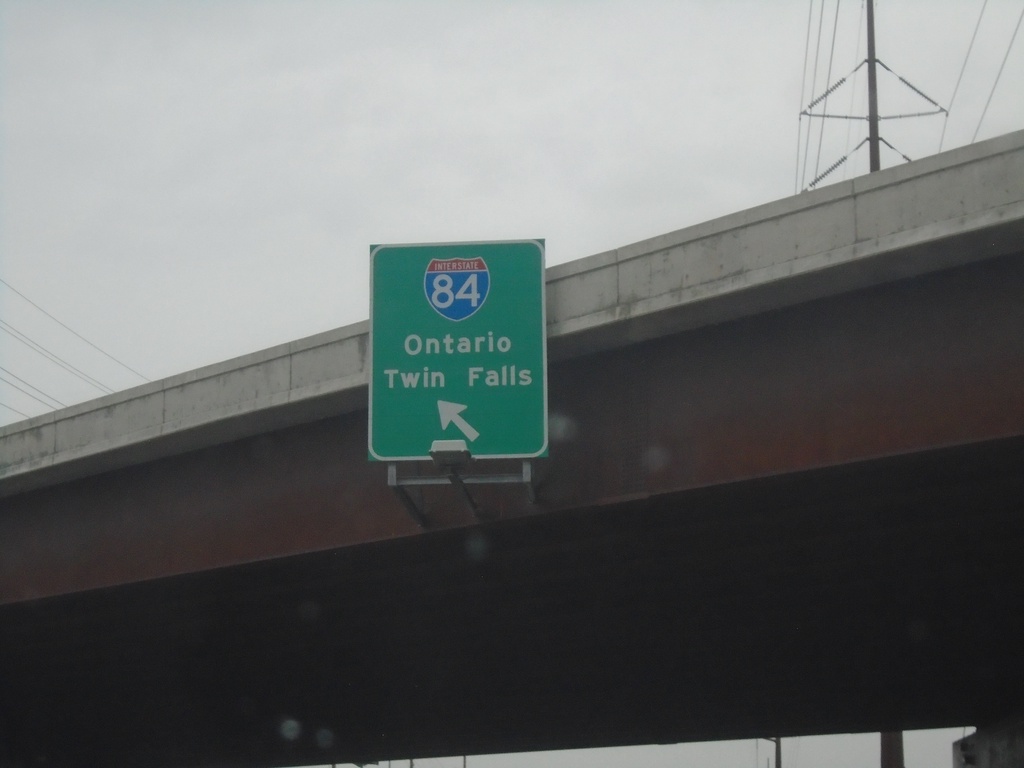
Franklin Road West at I-84
Franklin Road West at I-184 (Exit 1). Westbound I-184 traffic immediately merges into I-84. Use I-84 for Ontario (Oregon) and Twin Falls.
Taken 08-20-2023


 Boise
Ada County
Idaho
United States
Boise
Ada County
Idaho
United States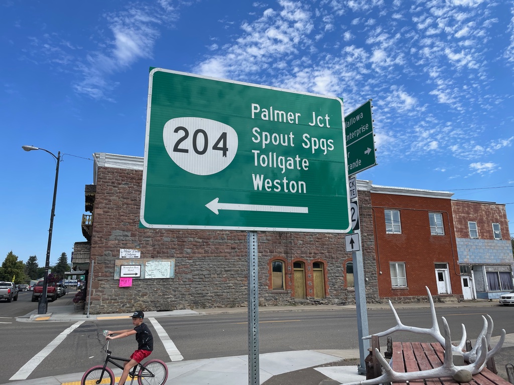
OR-82 East at OR-204 West
OR-82 East at OR-204 West in Elgin. Use OR-204 west to Palmer Junction, Spout Springs, Tollgate, and Weston.
Taken 07-29-2023

 Elgin
Union County
Oregon
United States
Elgin
Union County
Oregon
United States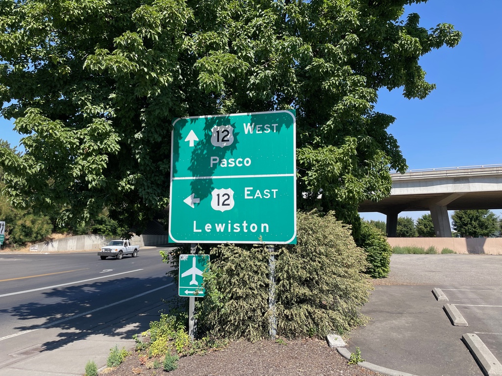
2nd Ave. North at US-12
2nd Ave. North at US-12 in Walla Walla. Use US-12 West to Pasco; US-12 East to Lewiston (Idaho).
Taken 07-28-2023
 Walla Walla
 County
Washington
United States
Walla Walla
Walla Walla County
Washington
United States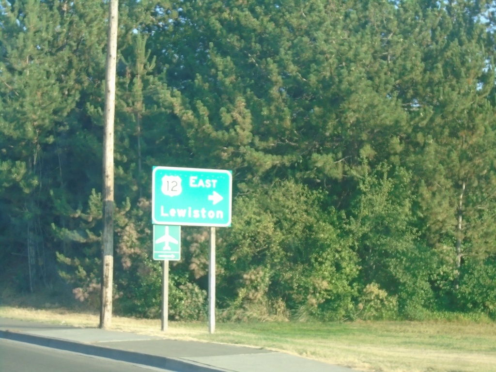
2nd Ave. Southbound At US-12 East
2nd Ave. Southbound At US-12 East to Lewiston (Idaho).
Taken 07-27-2023
Walla Walla
Walla Walla County
Washington
United States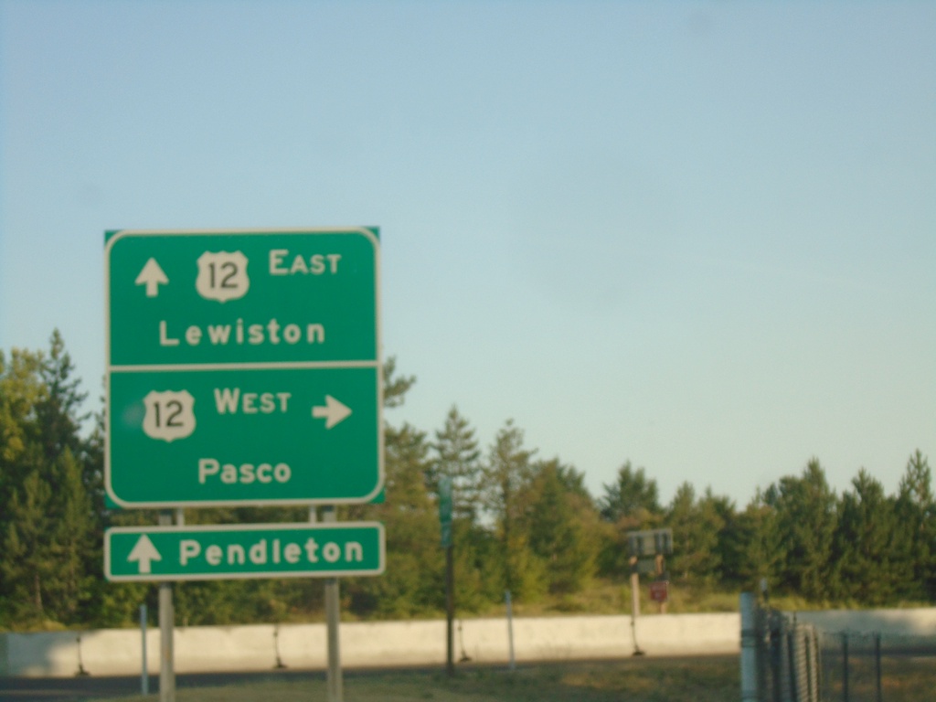
2nd Ave. Southbound at US-12
2nd Ave. southbound at US-12 in Walla Walla. Turn right for US-12 West to Pasco. Continue under freeway for US-12 East to Lewiston (Idaho). Continue on 2nd Ave. through downtown Walla Walla to access WA-125 to Pendleton (Oregon).
Taken 07-27-2023
Walla Walla
Walla Walla County
Washington
United States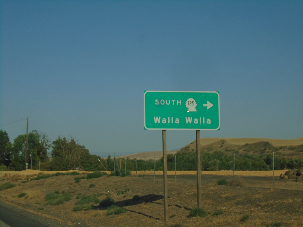
WA-124 East at WA-125 South
WA-124 East at WA-125 South to Walla Walla.
Taken 07-27-2023

 Prescott
Walla Walla County
Washington
United States
Prescott
Walla Walla County
Washington
United States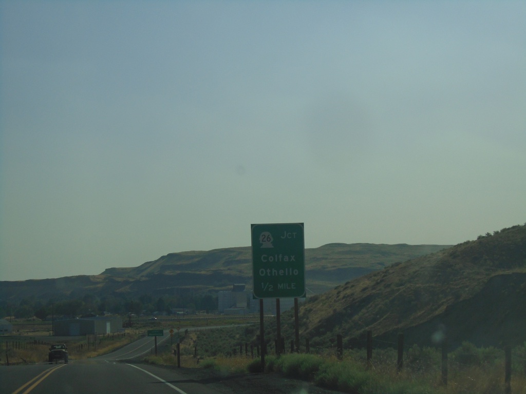
WA-261 South Approaching WA-26 and WA-260
WA-261 South approaching WA-26 and WA-260. Use WA-26 to Colfax and Othello.
Taken 07-27-2023


 Washtucna
Adams County
Washington
United States
Washtucna
Adams County
Washington
United States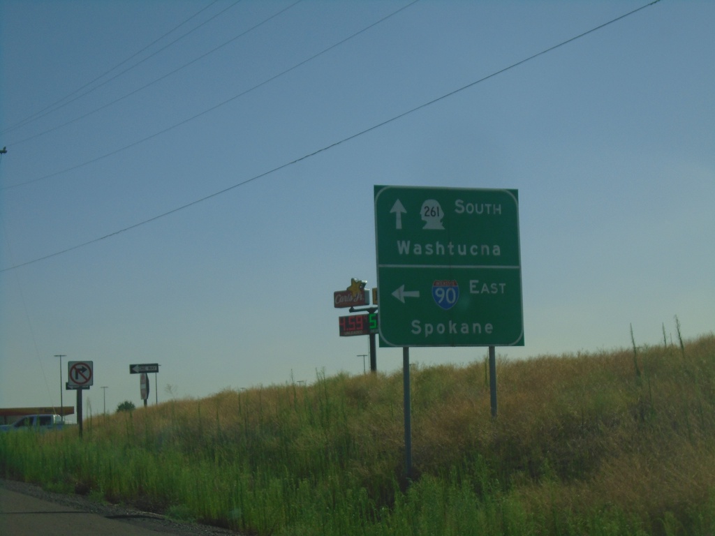
WA-261 South at I-90 East
WA-261 South at I-90 East (Exit 221) to Spokane. Continue south on WA-261 to Washtucna.
Taken 07-27-2023

 Ritzville
Adams County
Washington
United States
Ritzville
Adams County
Washington
United States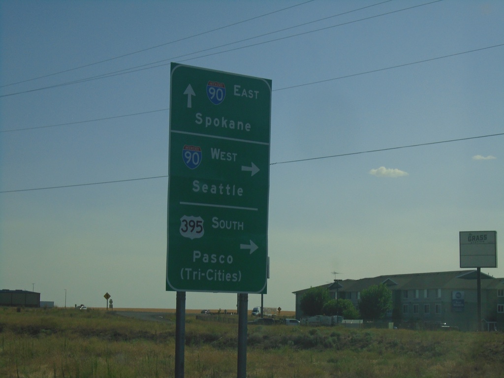
Division St. South at I-90/US-395/WA-261
Division St. South at I-90/US-395/WA-261 in Ritzville. Turn right for I-90 West/Seattle and US-395 South/Pasco (Tri-Cities). Continue under freeway for I-90 East to Spokane. WA-261 southbound begins here.
Taken 07-27-2023
Ritzville
Adams County
Washington
United States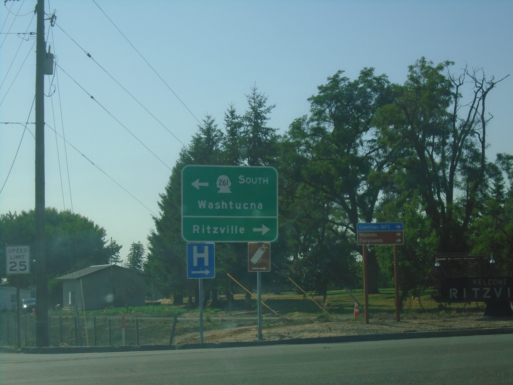
I-90 West - Exit 221 Offramp
I-90 West - Exit 221 Offramp at WA-261. Turn right for Ritzville; left for WA-261 south to Washtucna.
Taken 07-27-2023
Ritzville
Adams County
Washington
United States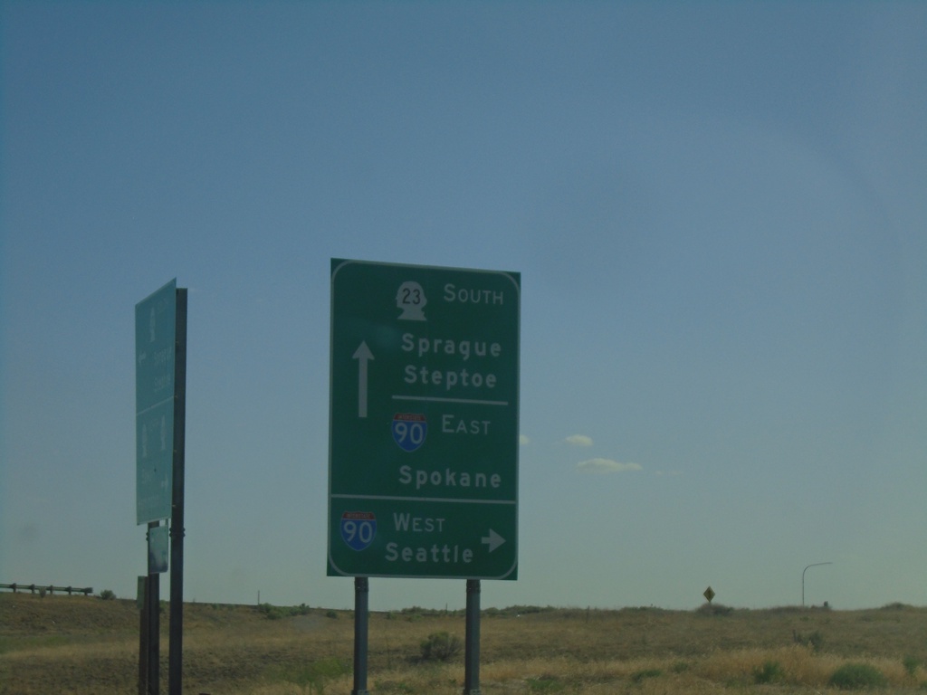
WA-23 East at I-90 Junction
WA-23 East at I-90 Junction (Exit 245). Turn right for I-90 West to Seattle. Continue under freeway for I-90 East to Spokane. Continue south on WA-23 for Sprague and Steptoe.
Taken 07-27-2023
 Sprague
Lincoln County
Washington
United States
Sprague
Lincoln County
Washington
United States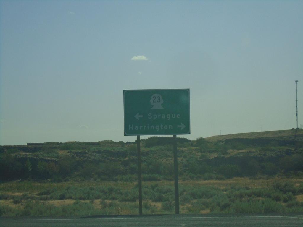
End WA-231 South at WA-23
End WA-231 south at WA-23. Use WA-23 west to Harrington; WA-23 east to Sprague.
Taken 07-27-2023
 Sprague
Lincoln County
Washington
United States
Sprague
Lincoln County
Washington
United States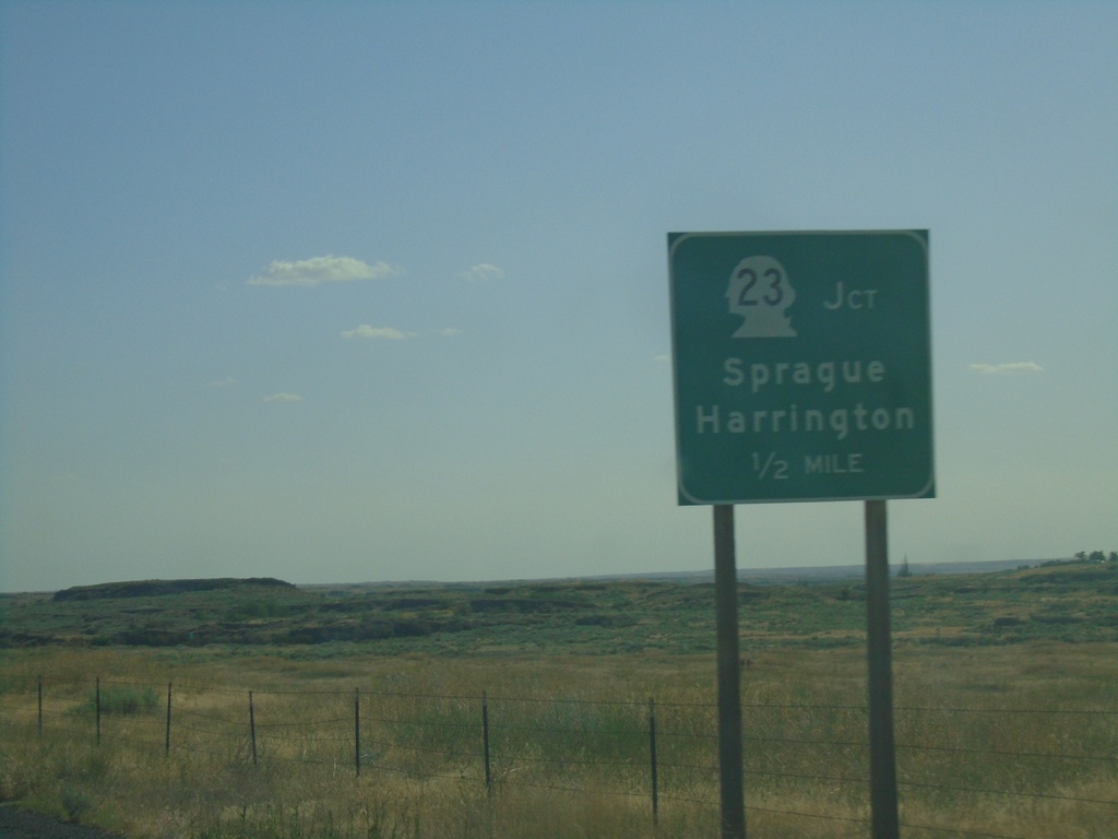
WA-231 South Approaching WA-23
WA-231 South approaching WA-23. Use WA-23 for Sprague and Harrington.
Taken 07-27-2023
Sprague
Lincoln County
Washington
United States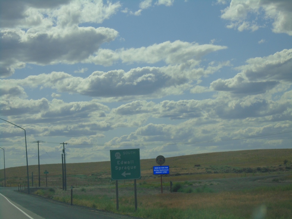
US-2 West/WA-231 South at US-2/WA-231 Split
US-2 West/WA-231 South at US-2/WA-231 split in Lincoln County. Use WA-231 south for Edwall and Sprague.
Taken 07-27-2023
 Reardan
Lincoln County
Washington
United States
Reardan
Lincoln County
Washington
United States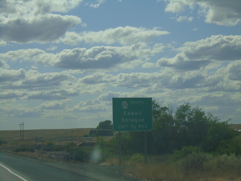
US-2 West/WA-231 South Approaching US-2/WA-231 Split
US-2 West/WA-231 South approaching US-2/WA-231 Split in Lincoln County. Use WA-231 south for Edwall and Sprague.
Taken 07-27-2023
Reardan
Lincoln County
Washington
United States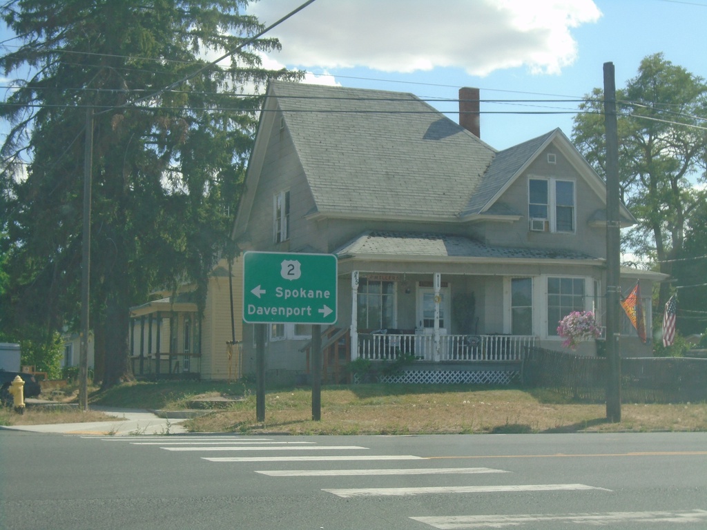
WA-231 South at US-2
WA-231 South at US-2 in Reardan. Use US-2 west for Davenport; US-2 east for Spokane. WA-231 south joins US-2 westbound.
Taken 07-27-2023
Reardan
Lincoln County
Washington
United States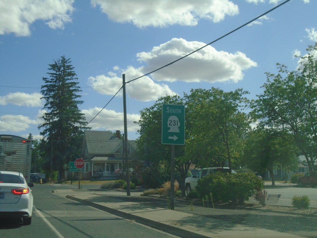
WA-231 South Approaching US-2
WA-231 South approaching US-2 in Reardan. Turn right on US-2 west to continue south on WA-231. WA-231 south joins US-2 west through Reardan.
Taken 07-27-2023
Reardan
Lincoln County
Washington
United States