Signs Tagged With Intersection
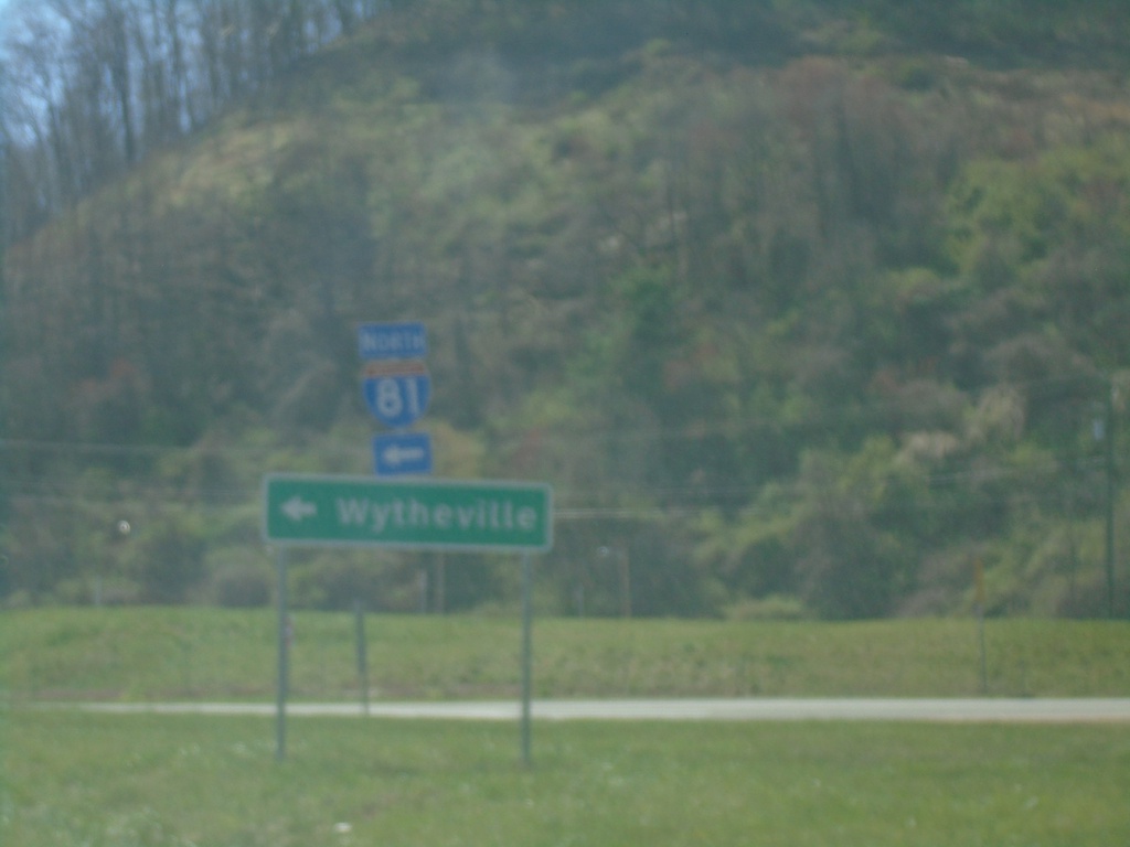
VAS-622 South at I-81 North
VAS-622 South at I-81 North to Wytheville.
Taken 03-30-2024

 Atkins
Smyth County
Virginia
United States
Atkins
Smyth County
Virginia
United States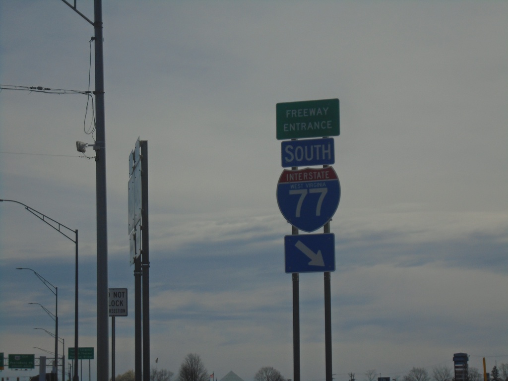
US-460 East at I-77 South Freeway Entrance
US-460 East at I-77 South Freeway Entrance in Princeton.
Taken 03-30-2024

 Princeton
Mercer County
West Virginia
United States
Princeton
Mercer County
West Virginia
United States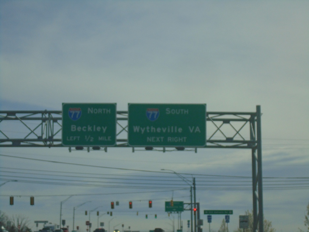
US-460 East Approaching I-77
US-460 East approaching I-77 in Princeton. Use I-77 South to Wytheville, VA. Use I-77 North to Beckley.
Taken 03-30-2024
Princeton
Mercer County
West Virginia
United States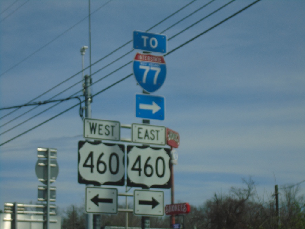
Ambrose Lane (WVCR-27/3) North at US-460
Ambrose Lane (WVCR-27/3) North at US-460. Use US-460 East to I-77.
Taken 03-30-2024
 Princeton
Mercer County
West Virginia
United States
Princeton
Mercer County
West Virginia
United States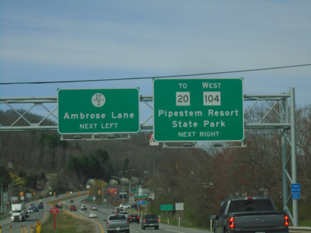
US-460 West Approaching WV-104 and WVCR-27/3
US-460 West approaching WV-104 and WVCR-27/3 in Princeton. Use WV-104 West to WV-20/Pipestem Resort State Park. Use WVCR-27/3 to Ambrose Lane.
Taken 03-30-2024

 Princeton
Mercer County
West Virginia
United States
Princeton
Mercer County
West Virginia
United States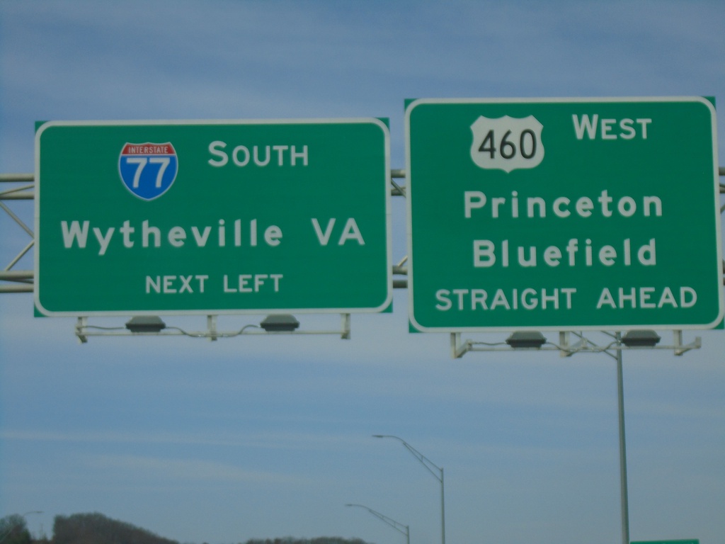
US-460 West Approaching I-77 South
US-460 West Approaching I-77 South to Wytheville, VA. Continue west on US-460 for Princeton and Bluefield.
Taken 03-30-2024
Princeton
Mercer County
West Virginia
United States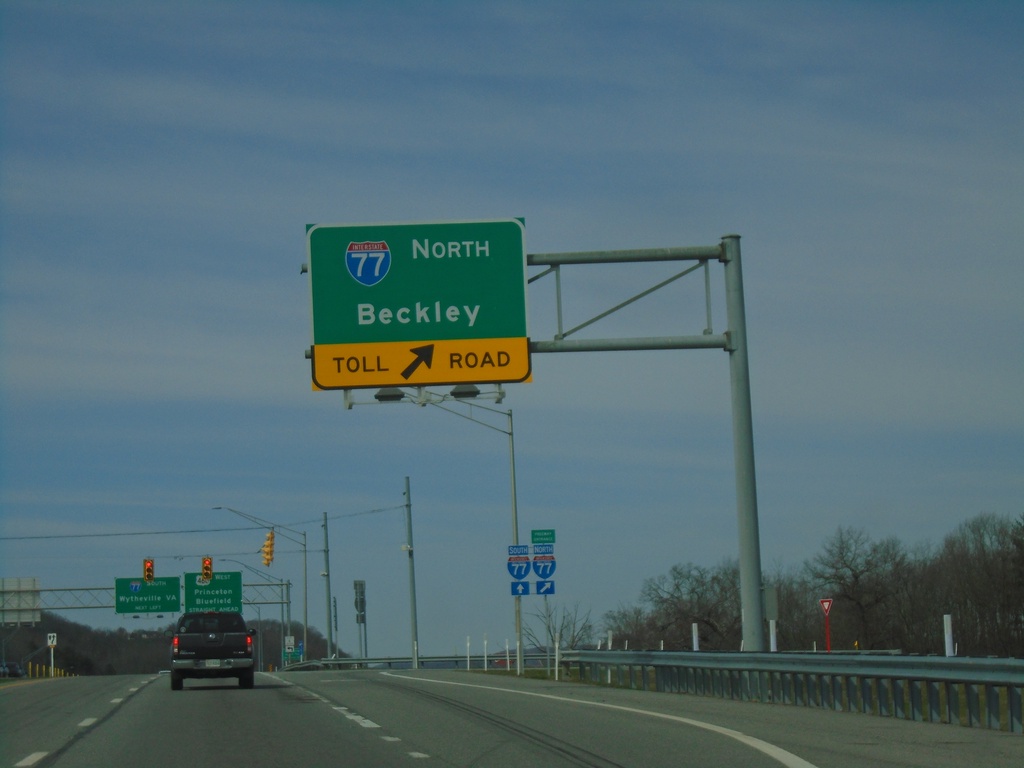
US-460 West at I-77 North
US-460 West at I-77 North Toll Road (West Virginia Turnpike) to Beckley.
Taken 03-30-2024
Princeton
Mercer County
West Virginia
United States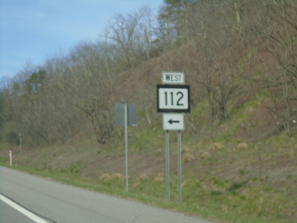
US-460 West at WV-112
US-460 West at WV-112 West
Taken 03-30-2024
 Princeton
Mercer County
West Virginia
United States
Princeton
Mercer County
West Virginia
United States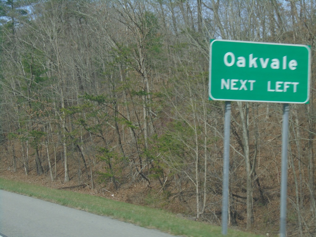
US-460 West Approaching WV-112
US-460 West approaching WV-112. Use WV-112 to Oakvale.
Taken 03-30-2024
Princeton
Mercer County
West Virginia
United States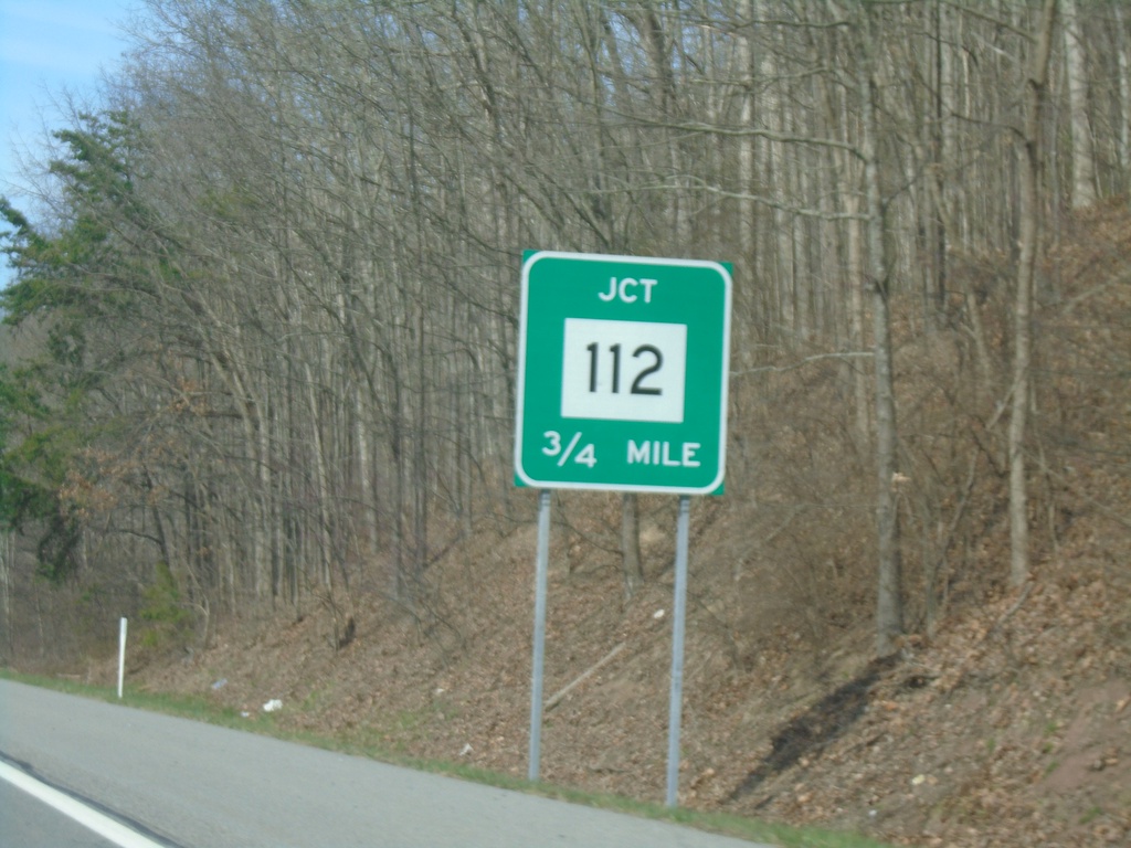
US-460 West Approaching WV-112
US-460 West approaching WV-112
Taken 03-30-2024
Kellysville
Mercer County
West Virginia
United States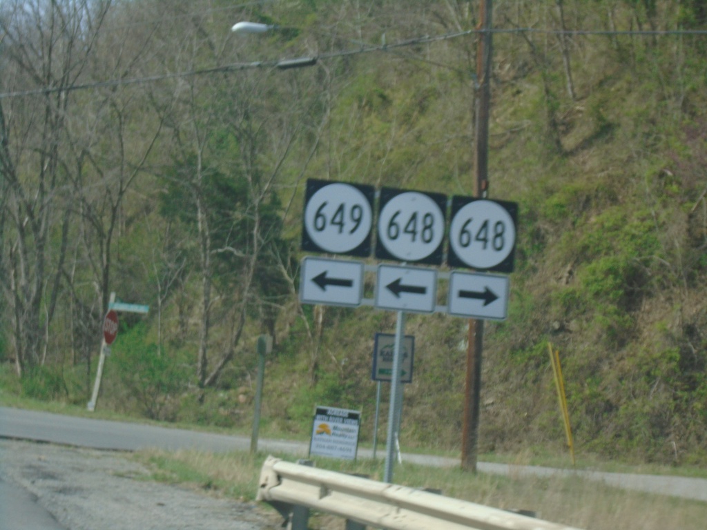
US-460 West at VAS-648/VAS-649
US-460 West at VAS-648/VAS-649 in Glen Lyn.
Taken 03-30-2024

 Glen Lyn
Giles County
Virginia
United States
Glen Lyn
Giles County
Virginia
United States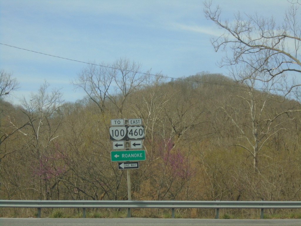
End US-219 South at US-460/To VA-100
End US-219 South at US-460/To VA-100. Use US-460 East to Roanoke. US-460 is part of Corridor Q.
Taken 03-30-2024

 Rich Creek
Giles County
Virginia
United States
Rich Creek
Giles County
Virginia
United States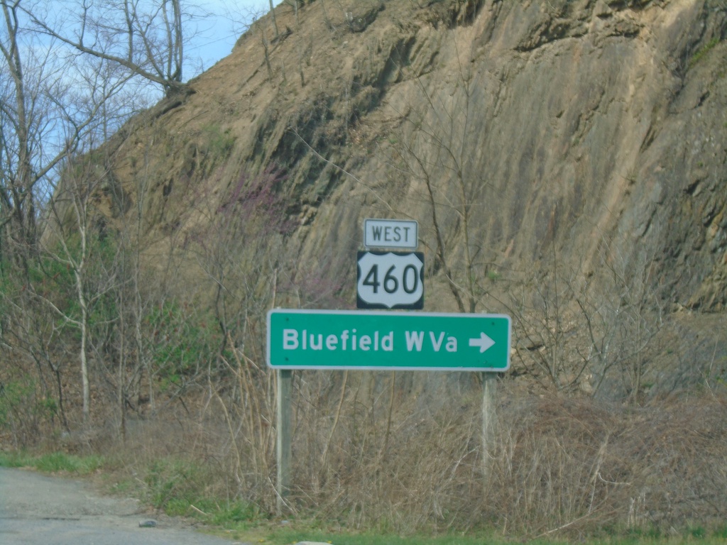
End US-219 South at US-460
End US-219 South at US-460. Use US-460 West to Bluefield, WV.
Taken 03-30-2024
Rich Creek
Giles County
Virginia
United States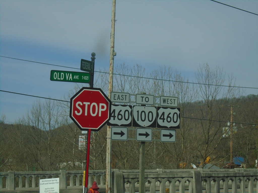
US-219 - Rich Creek
US-219 at Old Virginia St. in Rich Creek. Turn right to continue south on US-219, and for US-460/VA-100 junction.
Taken 03-30-2024
Rich Creek
Giles County
Virginia
United States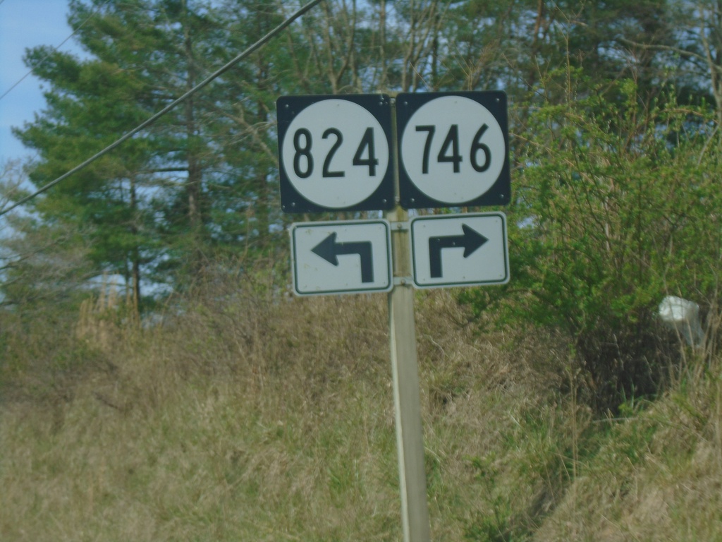
US-219 South at VAS-746/VAS-824
US-219 South at VAS-746/VAS-824 in Midway.
Taken 03-30-2024

 Narrows
Giles County
Virginia
United States
Narrows
Giles County
Virginia
United States
US-219 South at WV-12
US-219 South at WV-12 North in Peterstown. WV-12 is part of the Farm Heritage Road Scenic Byway.
Taken 03-30-2024
 Peterstown
Monroe County
West Virginia
United States
Peterstown
Monroe County
West Virginia
United States
US-219 South Approaching WV-12
US-219 South approaching WV-12 in Peterstown.
Taken 03-30-2024
Peterstown
Monroe County
West Virginia
United States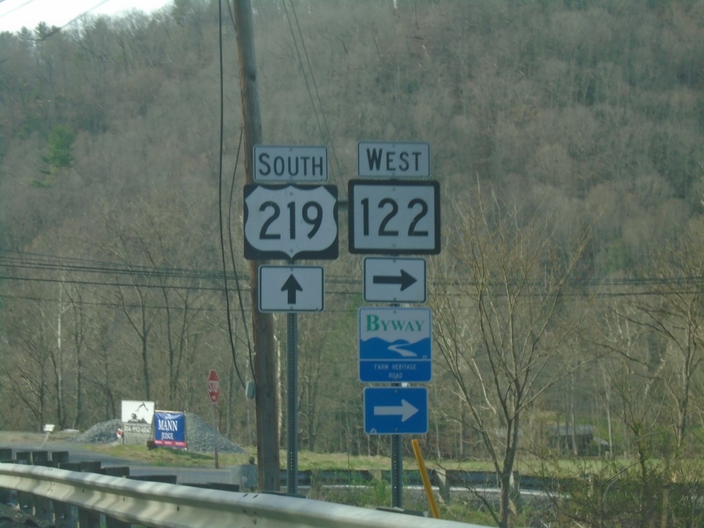
US-219 South at WV-122
US-219 South at WV-122 in Monroe County. WV-122 is part of the Farm Heritage Road Scenic Byway.
Taken 03-30-2024
 Union
Monroe County
West Virginia
United States
Union
Monroe County
West Virginia
United States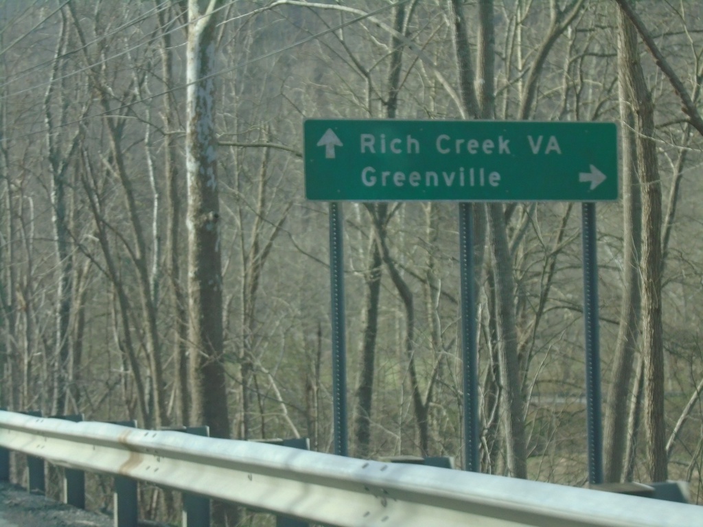
US-219 South at WV-122
US-219 South at WV-122 west to Greenville. Continue south on US-219 for Rich Creek, VA.
Taken 03-30-2024
Union
Monroe County
West Virginia
United States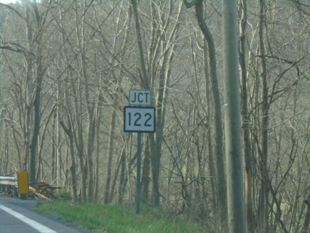
US-219 South Approaching WV-122
US-219 South approaching WV-122 in Monroe County.
Taken 03-30-2024
Union
Monroe County
West Virginia
United States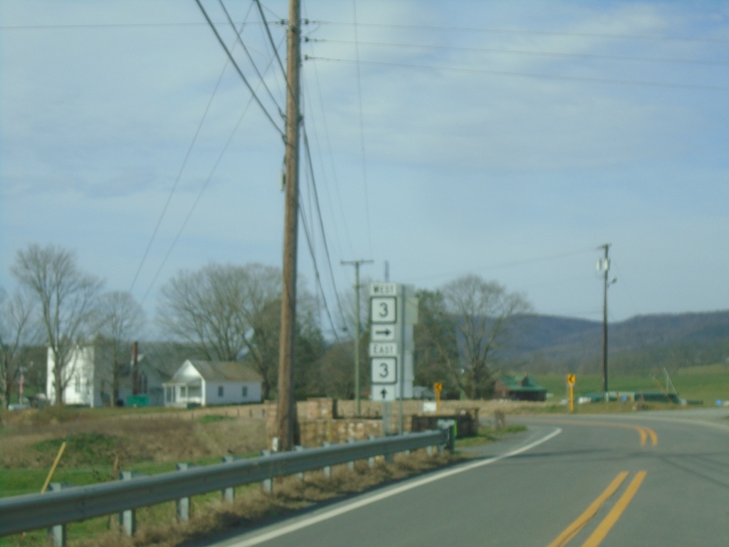
US-219 South at WV-3
US-219 South at WV-3. WV-3 east joins US-219 southbound.
Taken 03-30-2024
 Sinks Grove
Monroe County
West Virginia
United States
Sinks Grove
Monroe County
West Virginia
United States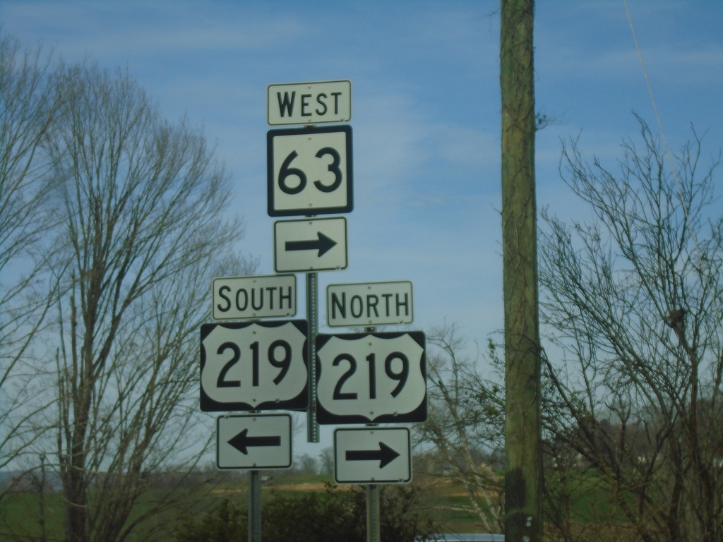
WV-63 West at US-219
WV-63 West at US-219 in Organ Cave. WV-63 West joins US-219 northbound.
Taken 03-30-2024
 Ronceverte
Greenbrier County
West Virginia
United States
Ronceverte
Greenbrier County
West Virginia
United States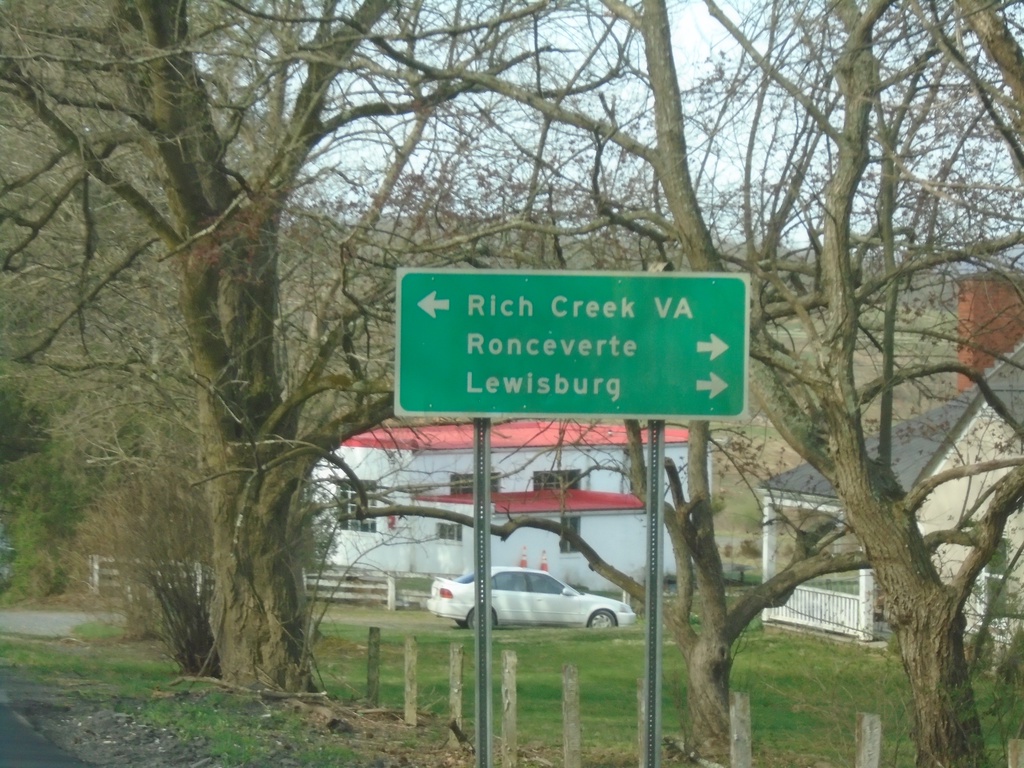
WV-63 West Approaching US-219
WV-63 West approaching US-219 in Organ Cave. Use US-219 North/WA-63 West to Ronceverte and Lewisburg; use US-219 South to Rich Creek, VA.
Taken 03-30-2024
Ronceverte
Greenbrier County
West Virginia
United States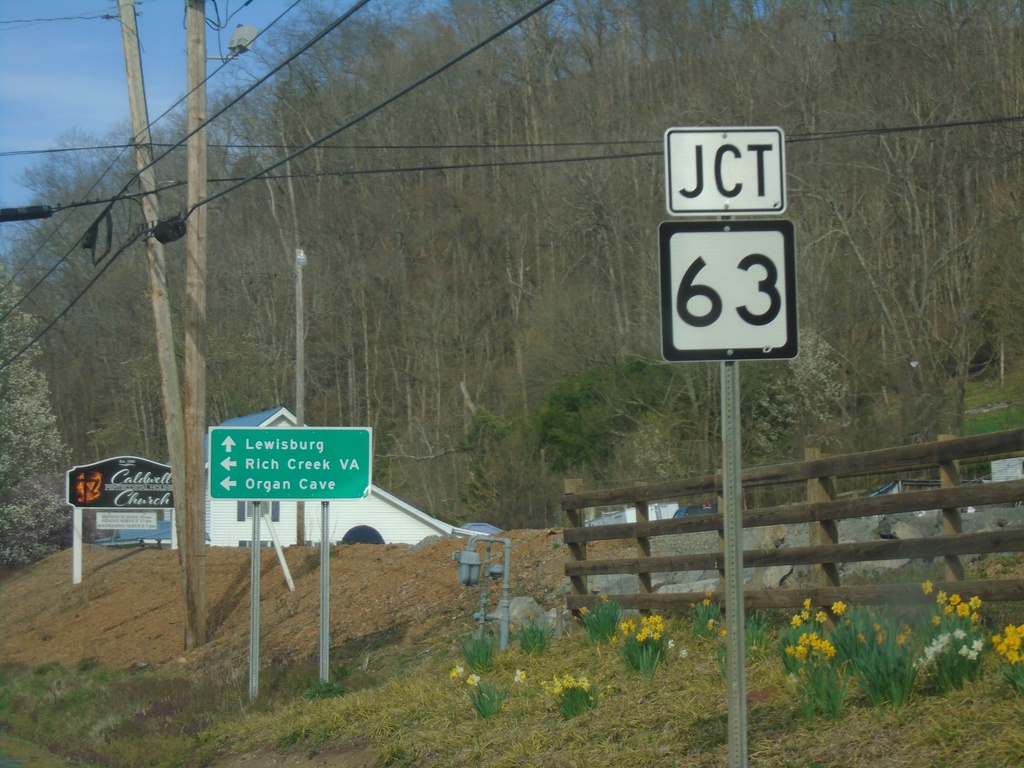
US-60 West Approaching WV-63
US-60 West approaching WV-63 in Caldwell.
Taken 03-30-2024
 Caldwell
Greenbrier County
West Virginia
United States
Caldwell
Greenbrier County
West Virginia
United States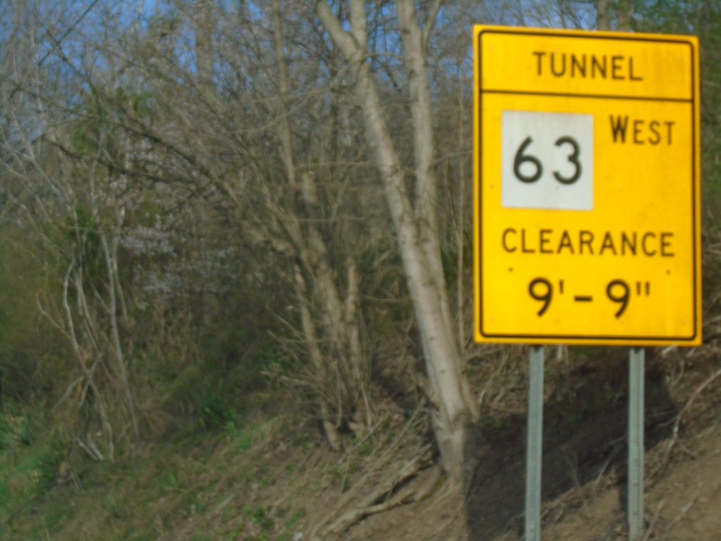
US-60 West Approaching WV-63 - Height Restrictions
US-60 West approaching WV-63 in Caldwell. WV-63 westbound has a one lane tunnel with height restrictions.
Taken 03-30-2024
Caldwell
Greenbrier County
West Virginia
United States