Signs Tagged With Intersection
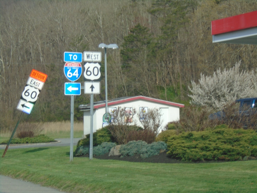
US-60 West at I-64 (Exit 175) Interchange
US-60 West at I-64 (Exit 175) Interchange
Taken 03-30-2024

 Caldwell
Greenbrier County
West Virginia
United States
Caldwell
Greenbrier County
West Virginia
United States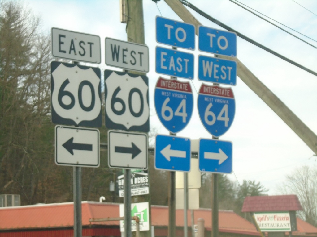
End WV-92 South at US-60/To I-64
End WV-92 South at US-60/To I-64 in White Sulphur Springs.
Taken 03-30-2024
 White Sulphur Springs
Greenbrier County
West Virginia
United States
White Sulphur Springs
Greenbrier County
West Virginia
United States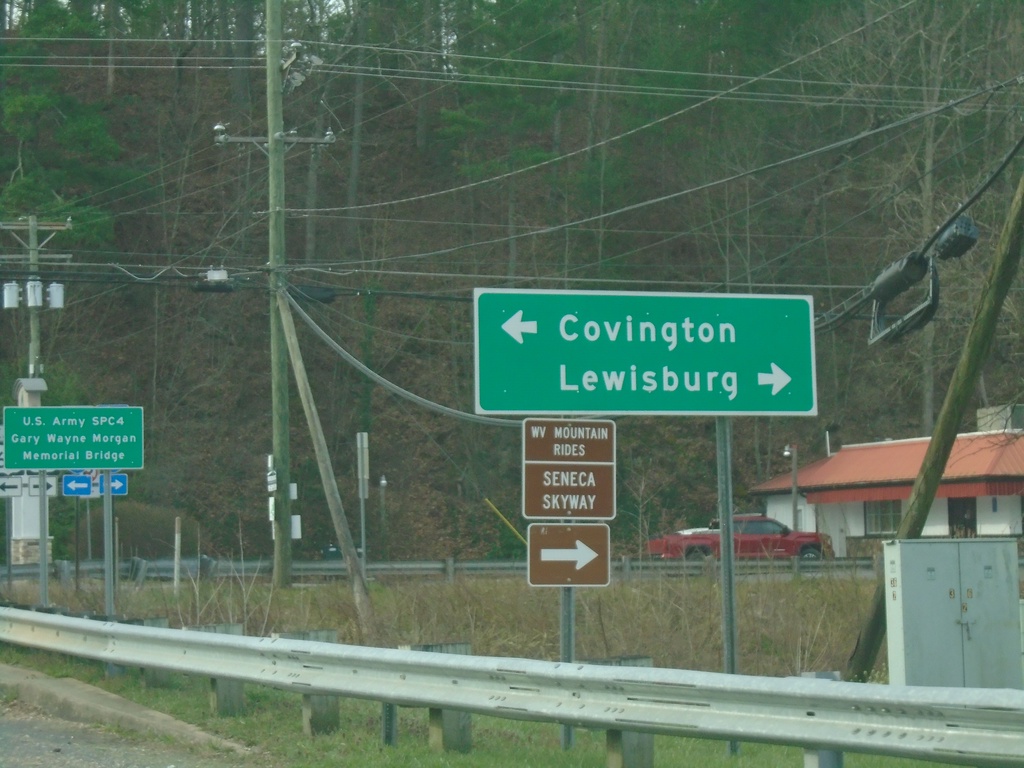
End WV-92 at US-60
End WV-92 at US-60 in White Sulphur Springs. Use US-60 west to Lewisburg; US-60 east to Covington (VA).
Taken 03-30-2024
White Sulphur Springs
Greenbrier County
West Virginia
United States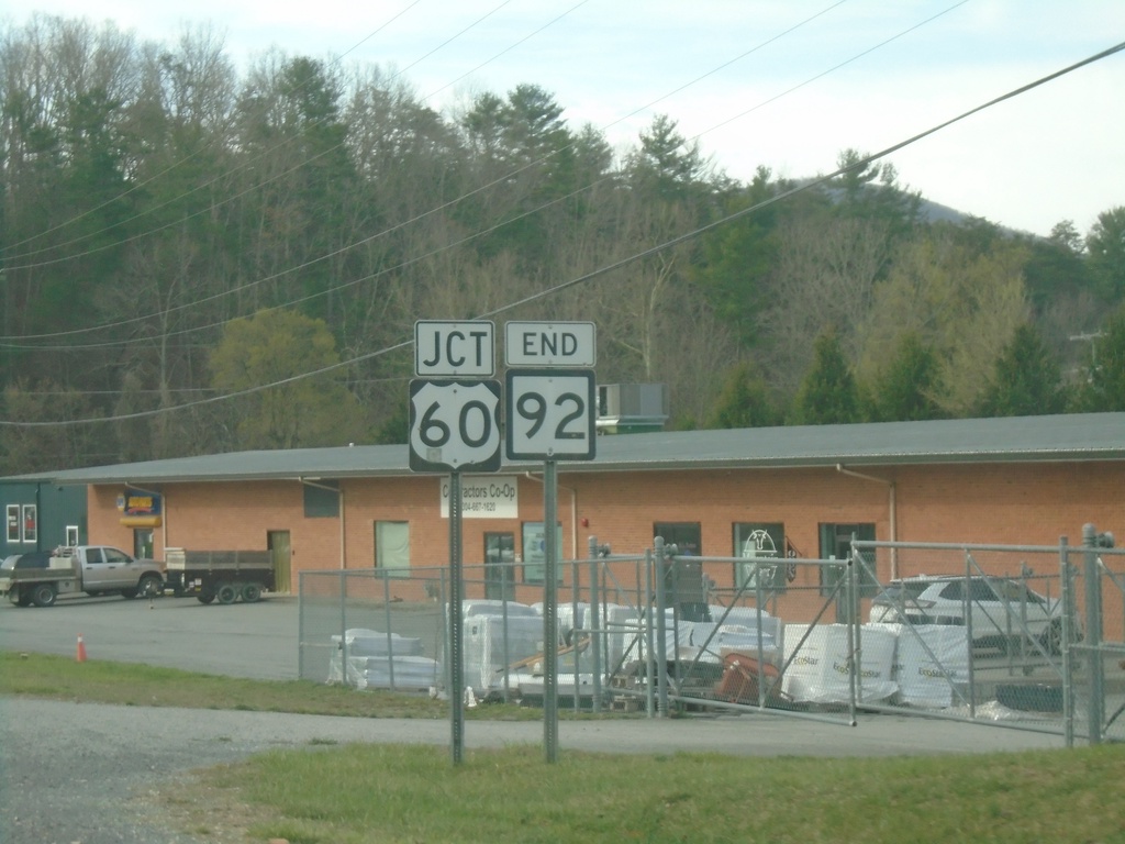
End WV-92 South at US-60
End WV-92 South at US-60 in White Sulphur Springs
Taken 03-30-2024
White Sulphur Springs
Greenbrier County
West Virginia
United States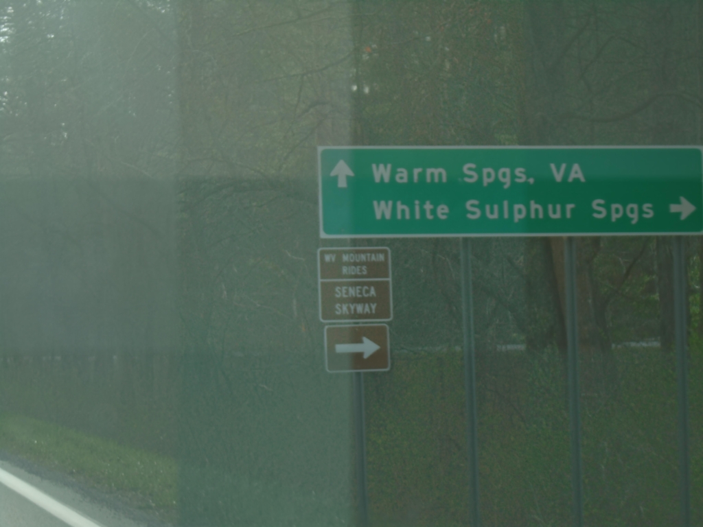
WV-39 East/WV-92 South Split
WV-39 East/WV-92 South split. Use WV-39 East to Warm Springs, VA. Use WV-92 South to White Sulphur Springs.
Taken 03-30-2024
 Marlinton
Pocahontas County
West Virginia
United States
Marlinton
Pocahontas County
West Virginia
United States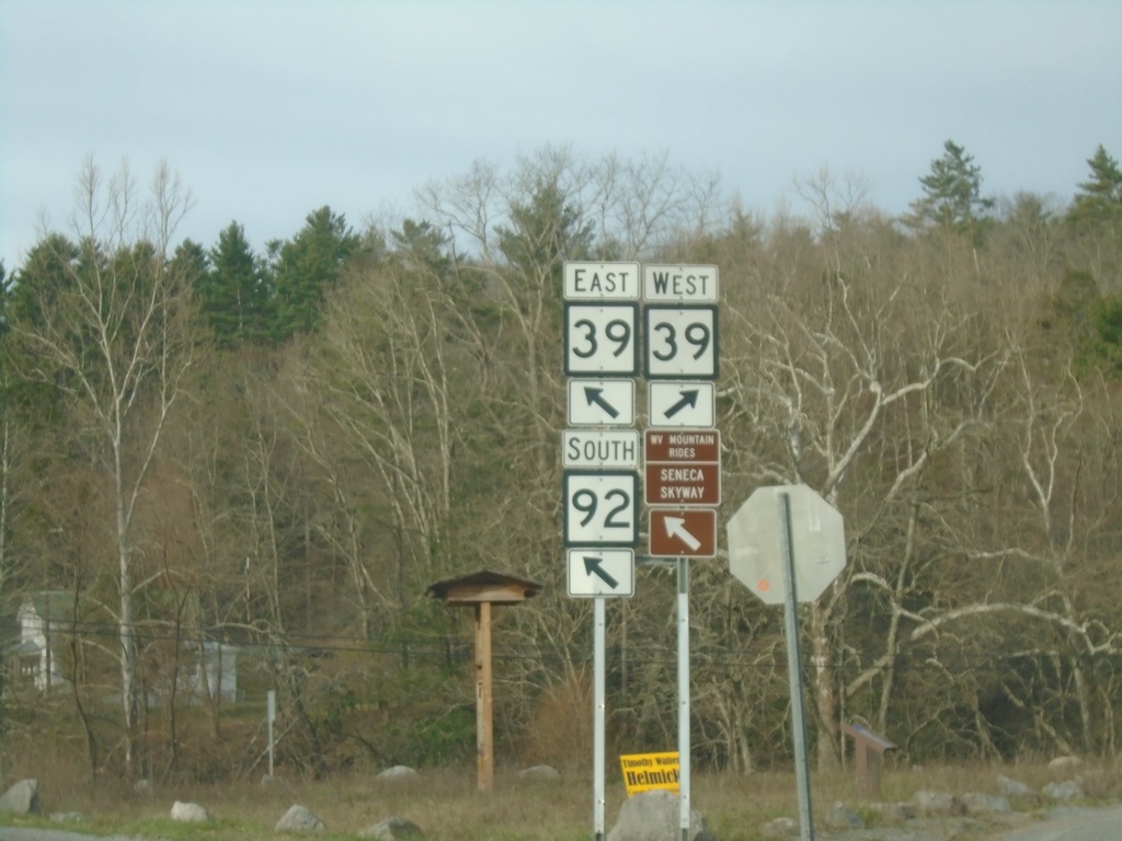
WV-92 South at WV-39 - Minnehaha Springs
WV-92 South at WV-39 in Minnehaha Springs. WV-39 East joins WV-92 southbound.
Taken 03-30-2024
Marlinton
Pocahontas County
West Virginia
United States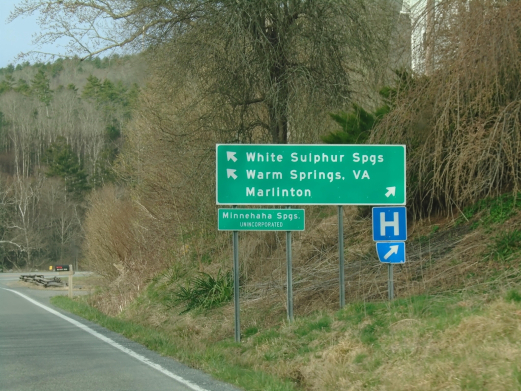
WV-92 South at WV-39 - Minnehaha Springs
WV-92 South at WV-39 in Minnehaha Springs. Use WV-39 West to Marlinton; WV-39 East/WV-92 South to White Sulphur Springs, and Warm Springs (VA).
Taken 03-30-2024
Marlinton
Pocahontas County
West Virginia
United States
End WV-84 West at WV-92
End WV-84 West at WV-92 in Frost.
Taken 03-30-2024
 Marlinton
Pocahontas County
West Virginia
United States
Marlinton
Pocahontas County
West Virginia
United States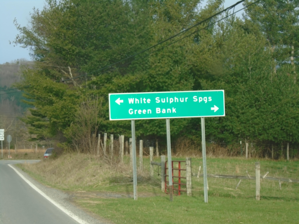
End WV-84 West at WV-92
End WV-84 West at WV-92 in Frost. Use WV-92 north to Green Bank; WV-92 south to White Sulphur Springs.
Taken 03-30-2024
Marlinton
Pocahontas County
West Virginia
United States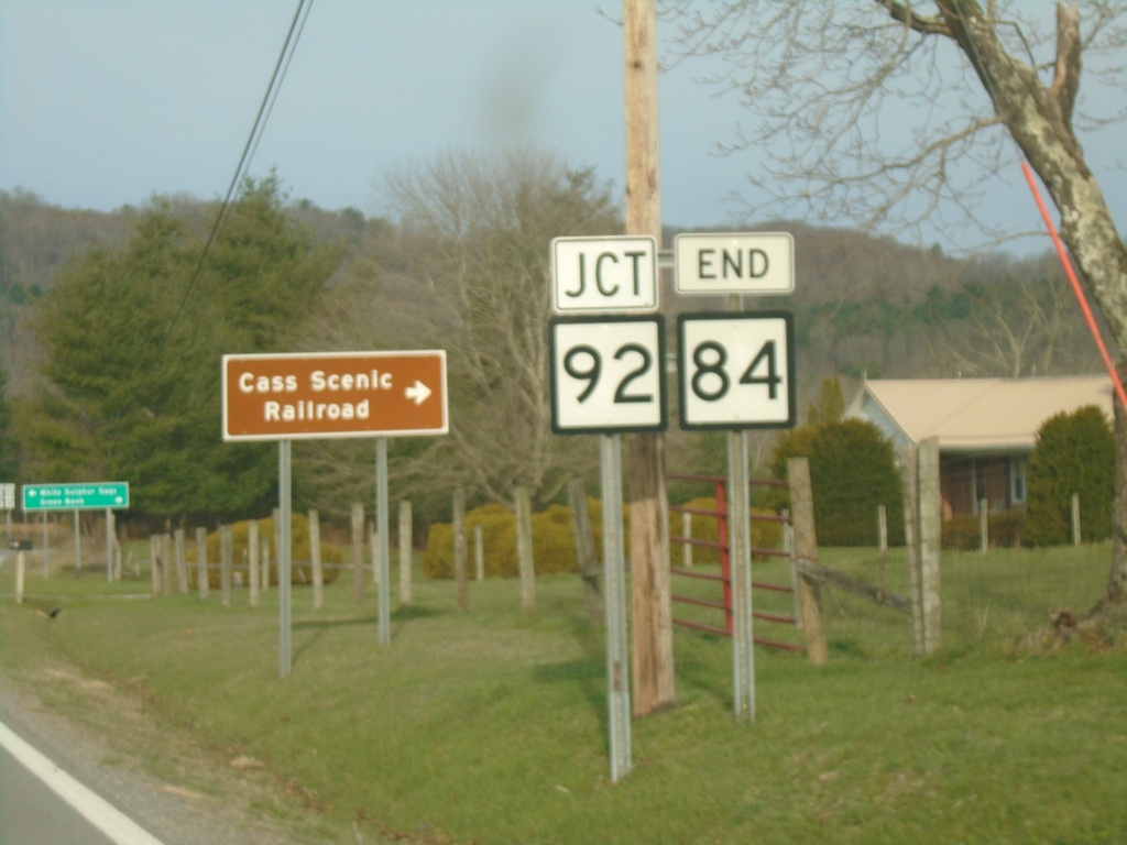
End WV-84 West at WV-92
End WV-84 West at WV-92 in Frost. Use WV-92 north to Cass Scenic Railroad.
Taken 03-30-2024
Marlinton
Pocahontas County
West Virginia
United States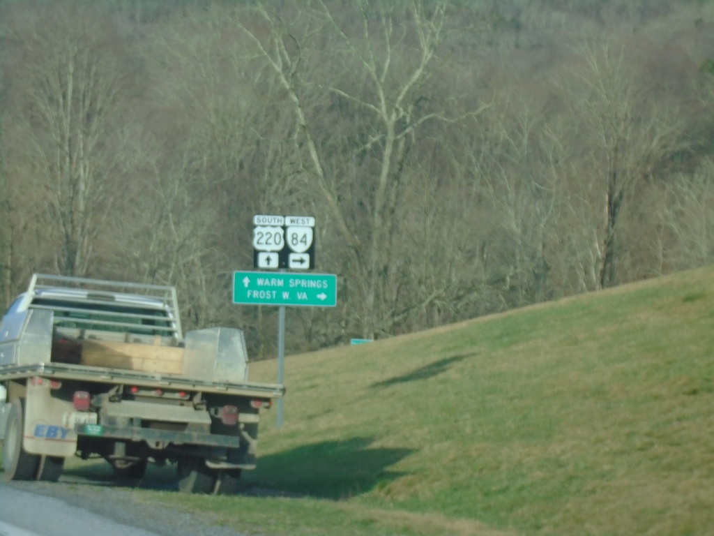
US-220 South at VA-84 West
US-220 South at VA-84 West to Frost, WV. Continue south on US-220 for Warm Springs.
Taken 03-30-2024

 Monterey
Highland County
Virginia
United States
Monterey
Highland County
Virginia
United States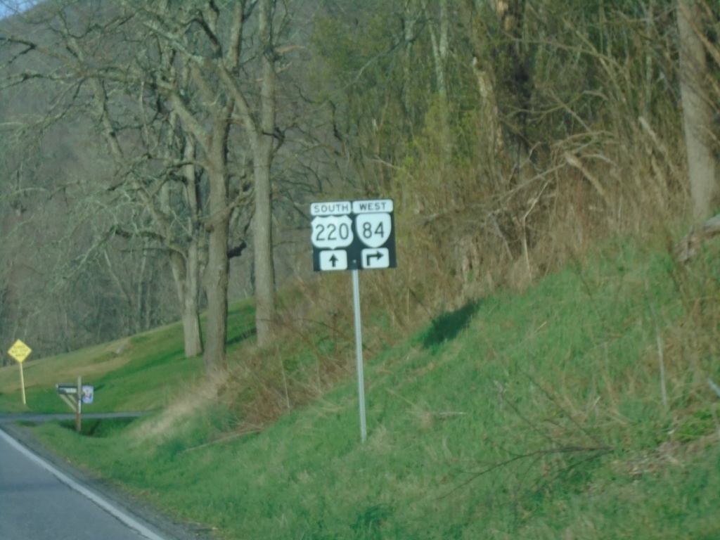
US-220 South at VA-84
US-220 South at VA-84 in Vanderpool.
Taken 03-30-2024
Monterey
Highland County
Virginia
United States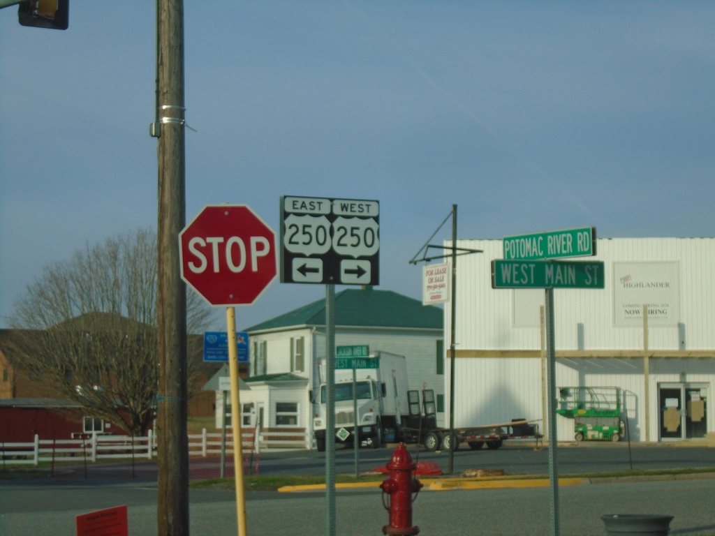
US-220 South at US-250
US-220 South at US-250 in Monterey.
Taken 03-30-2024
 Monterey
Highland County
Virginia
United States
Monterey
Highland County
Virginia
United States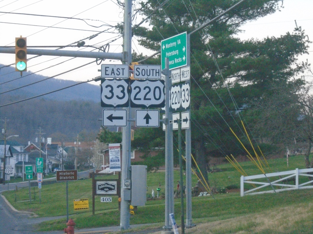
US-33 East/US-220 South at Split
US-33 East/US-220 South at US-33/US-220 split in Franklin.
Taken 03-30-2024
 Franklin
Pendleton County
West Virginia
United States
Franklin
Pendleton County
West Virginia
United States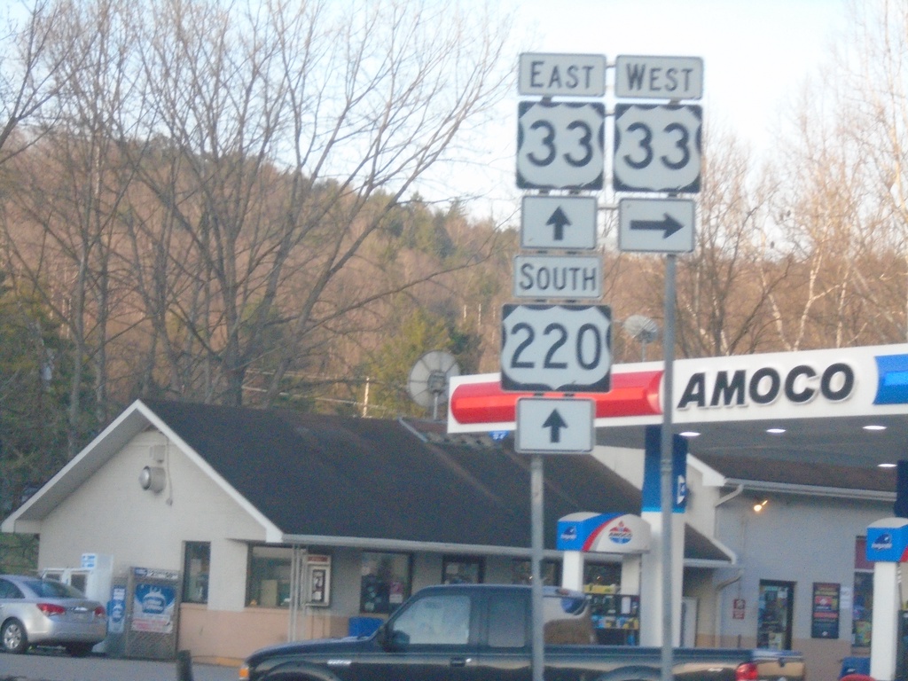
US-220 South at US-33
US-220 South at US-33 in Franklin. US-33 East joins US-220 South through Franklin.
Taken 03-30-2024
Franklin
Pendleton County
West Virginia
United States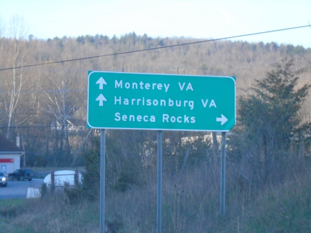
US-220 South Approaching US-33
US-220 South approaching US-33 in Franklin. Use US-33 west to Seneca Rocks. Use US-33 West/US-220 South to Monterey, VA (via US-220) and Harrisonburg, VA (via US-33).
Taken 03-30-2024
Franklin
Pendleton County
West Virginia
United States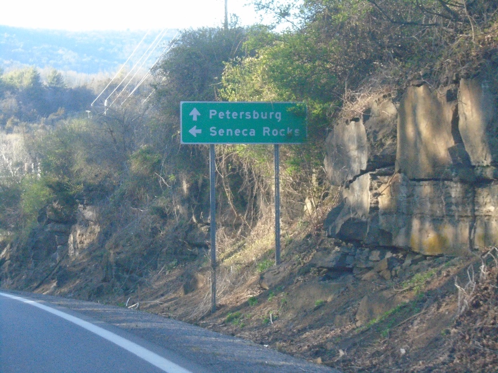
US-33 West/US-220 North Approaching US-33/US-220 Split
US-33 West/US-220 North approaching US-33/US-220 Split in Franklin. Use US-33 for Seneca Rocks; US-220 for Petersburg.
Taken 03-29-2024
Franklin
Pendleton County
West Virginia
United States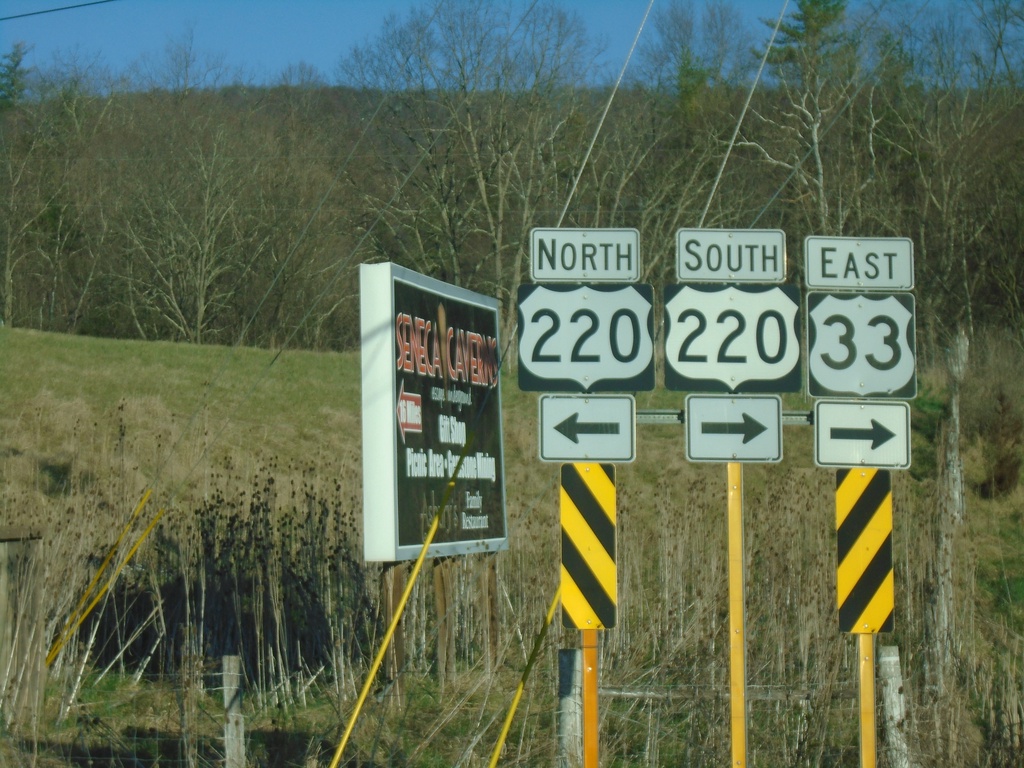
US-33 East at US-220
US-33 East at US-220 in Franklin. US-33 East joins US-220 South through Franklin.
Taken 03-29-2024
Franklin
Pendleton County
West Virginia
United States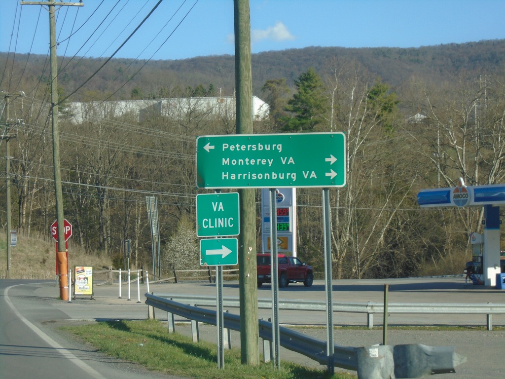
US-33 East Approaching US-220
US-33 East approaching US-220 in Franklin. Use US-220 north to Petersburg; US-220 South/US-33 East to Monterey, VA (via US-220) and Harrisonburg, VA (via US-33).
Taken 03-29-2024
Franklin
Pendleton County
West Virginia
United States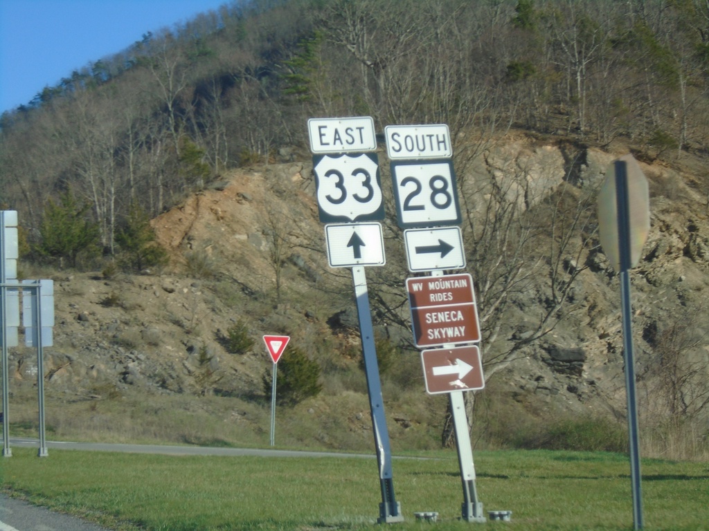
US-33 East/WV-28 South at US-33/WV-28 Split
US-33 East/WV-28 South at US-33/WV-28 split at Judy Gap. Use WV-28 south for the Scenic Skyway Mountain Rides route.
Taken 03-29-2024
 Riverton
Pendleton County
West Virginia
United States
Riverton
Pendleton County
West Virginia
United States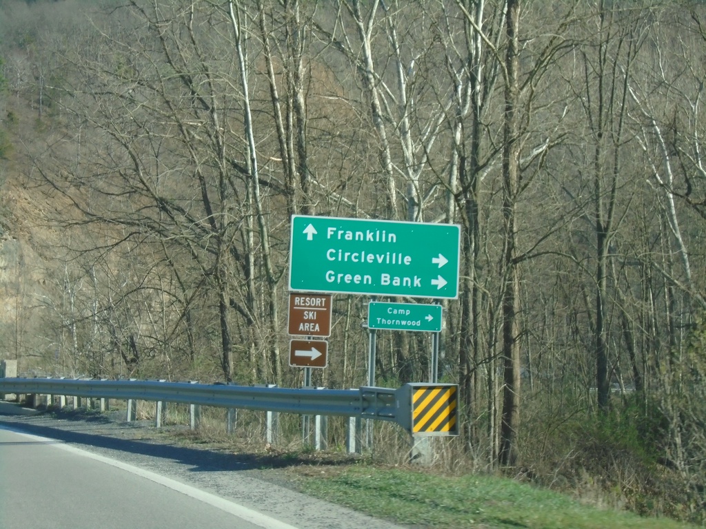
US-33 East/WV-28 South at US-33/WV-28 Split
US-33 East/WV-28 South at US-33/WV-28 Split at Judy Gap. Use WV-28 south to Circleville and Greenbank; use US-33 east to Franklin.
Taken 03-29-2024
Riverton
Pendleton County
West Virginia
United States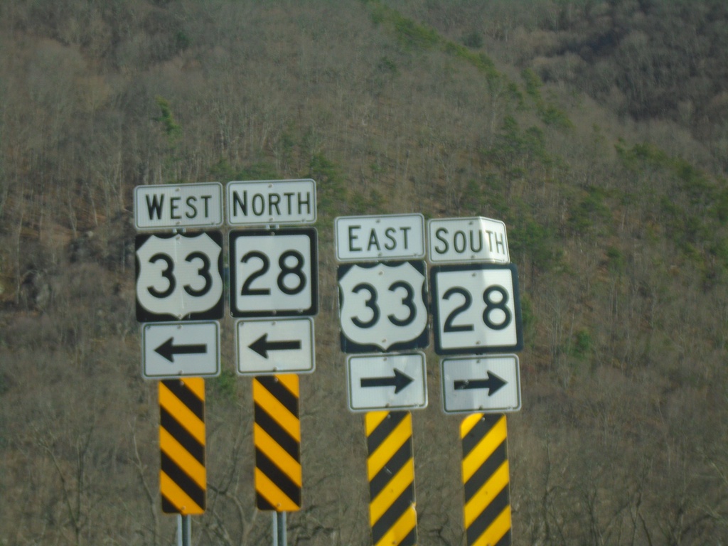
End Briery Gap Road (WVCR-33/4) at US-33/WV-28
End Briery Gap Road (WVCR-33/4) at US-33/WV-28 near Judy Gap.
Taken 03-29-2024
 Riverton
Pendleton County
West Virginia
United States
Riverton
Pendleton County
West Virginia
United States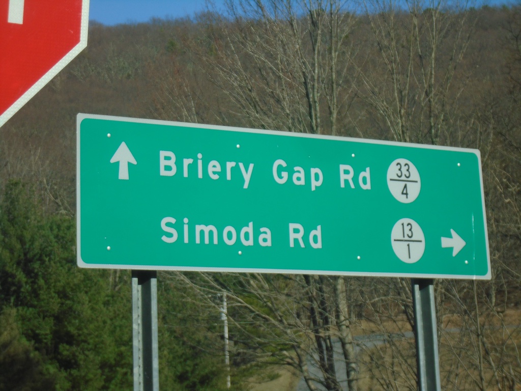
Briery Gap Road at Simoda Road
Briery Gap Road (WVCR-33/4) at Simoda Road (WVCR-13/1)
Taken 03-29-2024
 Riverton
Pendleton County
West Virginia
United States
Riverton
Pendleton County
West Virginia
United States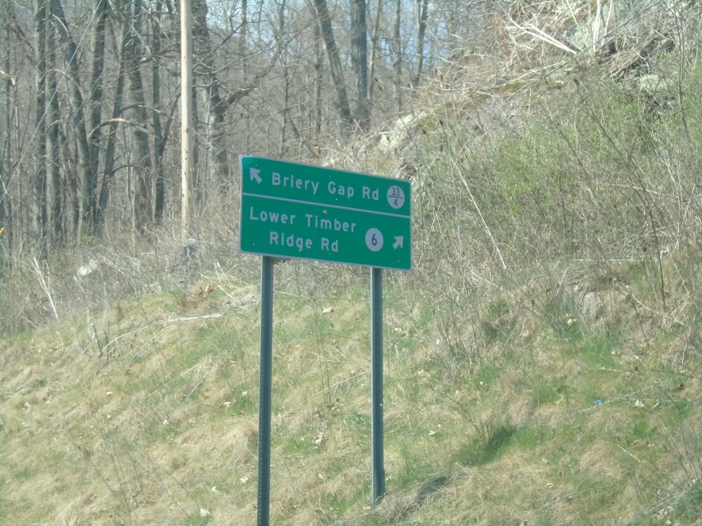
Briery Gap Road at Lower Timber Ridge Road
Briery Gap Road (WVCR-33/4) at Lower Timber Ridge Road (WVCR-6).
Taken 03-29-2024
 Riverton
Pendleton County
West Virginia
United States
Riverton
Pendleton County
West Virginia
United States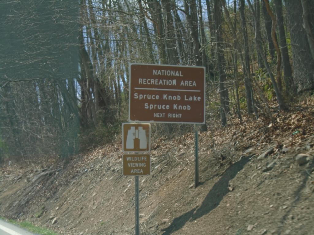
US-33 East/WV-28 South Approaching WVCR-33/4
US-33 East/WV-28 South approaching WVCR-33/4 to Spruce Knob and Spruce Knob Lake National Recreation Areas. Spruce Knob is the highest point in West Virginia.
Taken 03-29-2024
Riverton
Pendleton County
West Virginia
United States