Signs Tagged With Intersection
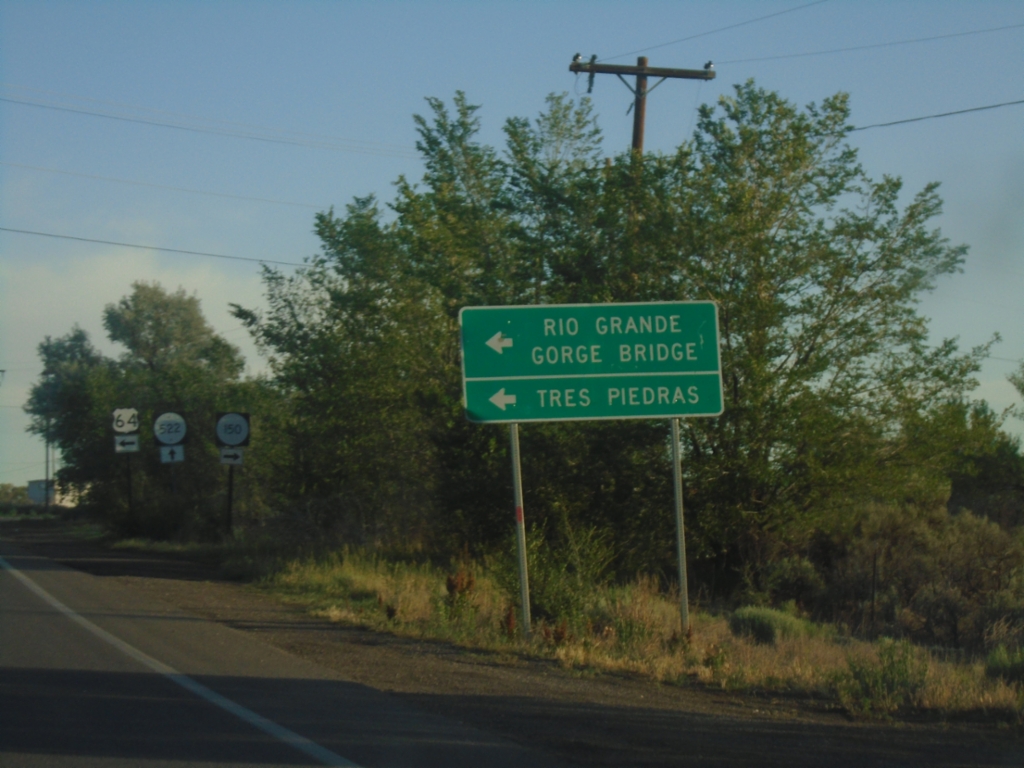
US-64 West at NM-150/NM-522
US-64 west at NM-150/NM-522 junction. Use US-64 for Tres Piedras and Rio Grande Gorge Bridge.
Taken 06-19-2026


 El Prado
Taos County
New Mexico
United States
El Prado
Taos County
New Mexico
United States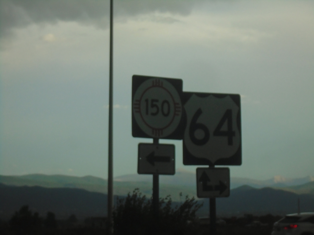
End NM-522 South at US-64 and NM-150
End NM-522 South at US-64 and NM-150 in El Prado.
Taken 06-18-2026
Taos County
New Mexico
United States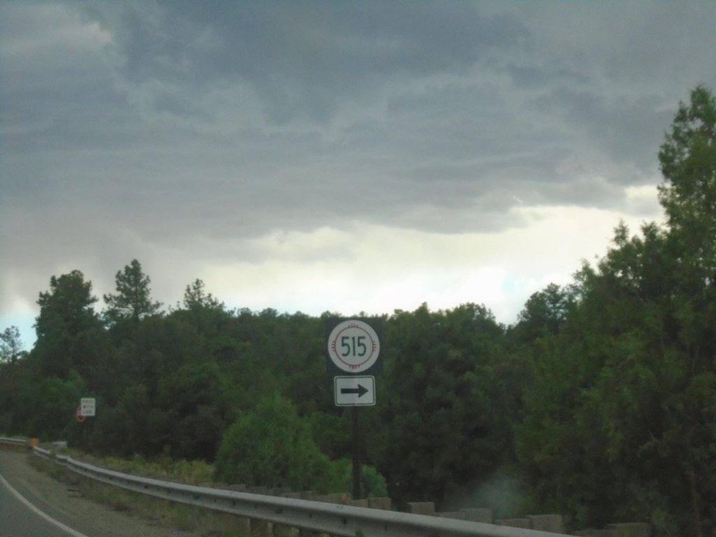
NM-522 South at NM-515
NM-522 South at NM-515 in Taos County.
Taken 06-18-2026
 Questa
Taos County
New Mexico
United States
Questa
Taos County
New Mexico
United States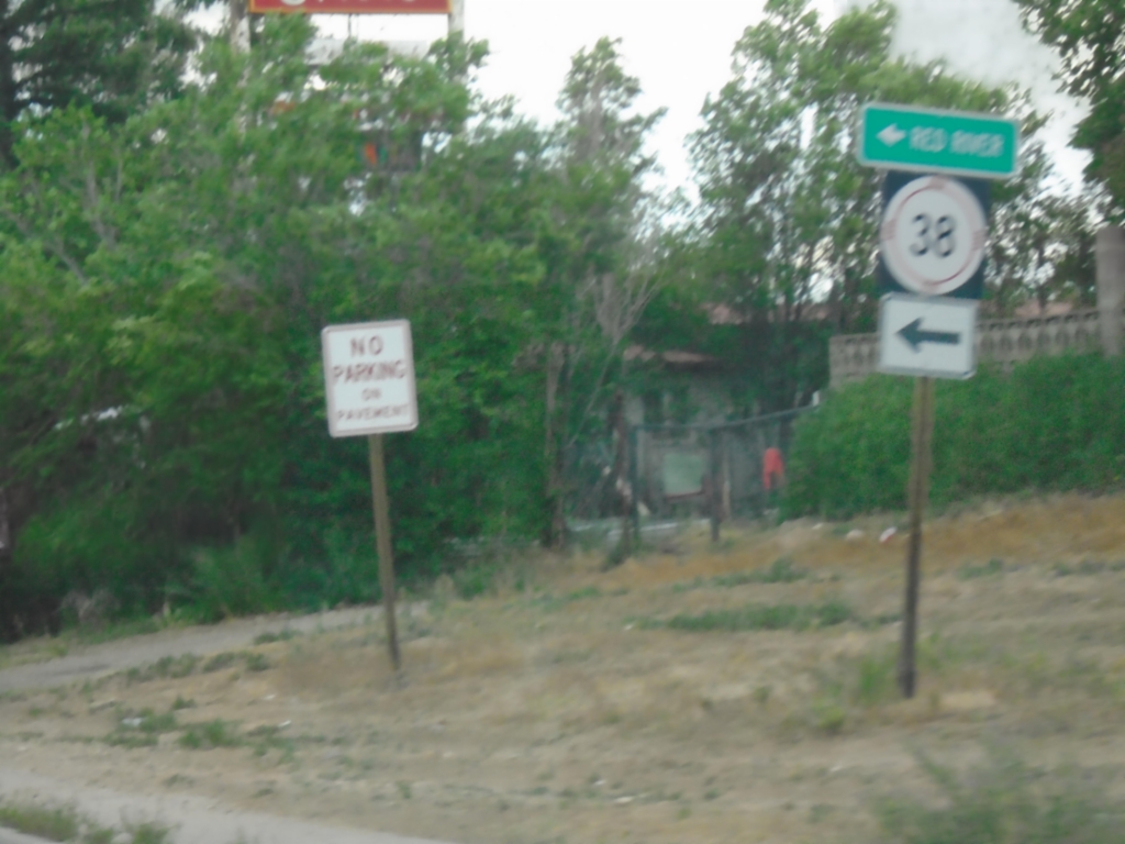
NM-522 South at NM-38
NM-522 South at NM-38 in Questa. Use NM-38 East to Red River.
Taken 06-18-2026
 Questa
Taos County
New Mexico
United States
Questa
Taos County
New Mexico
United States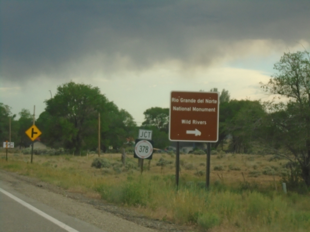
NM-522 South at NM-378
NM-522 South at NM-378 to Rio Grande National Monument and Wild Rivers.
Taken 06-18-2026
 Questa
Taos County
New Mexico
United States
Questa
Taos County
New Mexico
United States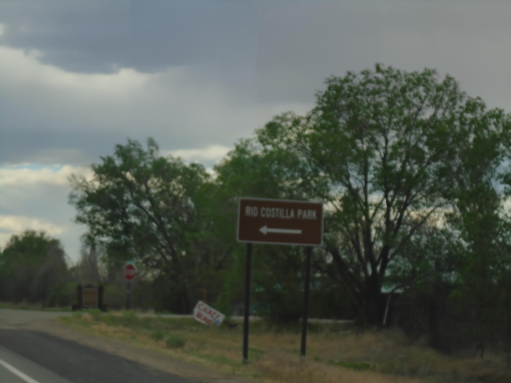
NM-522 South at NM-196
NM-522 South at NM-196 to Rio Costilla Park.
Taken 06-18-2026
 Costilla
Taos County
New Mexico
United States
Costilla
Taos County
New Mexico
United States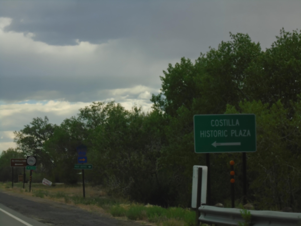
NM-522 South Approaching NM-196
NM-522 South approaching NM-196 to Costilla Historic Plaza.
Taken 06-18-2026
Costilla
Taos County
New Mexico
United States
CO-159 South at CO-142
CO-159 South at CO-142 in San Luis. Use CO-142 west to Romeo; continue south on CO-152 to Taos (New Mexico).
Taken 06-18-2026

 San Luis
Costilla County
Colorado
United States
San Luis
Costilla County
Colorado
United States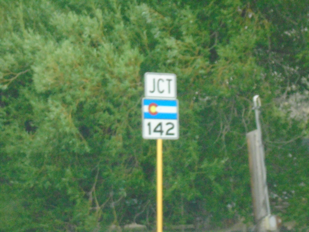
CO-159 South Approaching CO-142
CO-159 South approaching CO-142 in San Luis.
Taken 06-18-2026
San Luis
Costilla County
Colorado
United States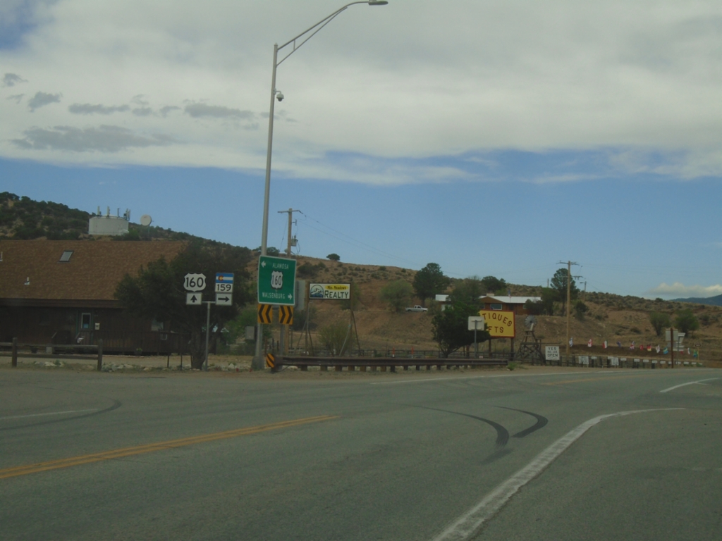
US-160 East at CO-159
US-160 East at CO-159 in Fort Garland.
Taken 06-18-2026
 Fort Garland
Costilla County
Colorado
United States
Fort Garland
Costilla County
Colorado
United States
US-160 East at CO-159 South
US-160 East at CO-159 South in Fort Garland. Use CO-159 south to San Luis and Taos (New Mexico).
Taken 06-18-2026
Fort Garland
Costilla County
Colorado
United States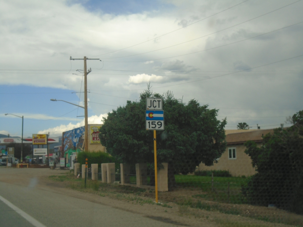
US-160 East Approaching CO-159
US-160 East approaching CO-159 in Fort Garland.
Taken 06-18-2026
Fort Garland
Costilla County
Colorado
United States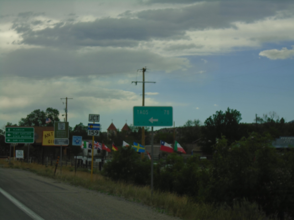
US-160 West Approaching CO-159
US-160 West approaching CO-159 in Fort Garland. Use CO-159 South to Taos (New Mexico), San Luis, and Fort Garland State Museum. Continue west on US-160 for Alamosa.
Taken 06-18-2026
Fort Garland
Costilla County
Colorado
United States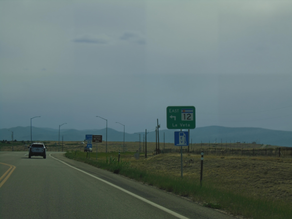
US-160 West at CO-160 East
US-160 West at CO-160 East to La Veta
Taken 06-18-2026
 Huerfano County
Colorado
United States
Huerfano County
Colorado
United States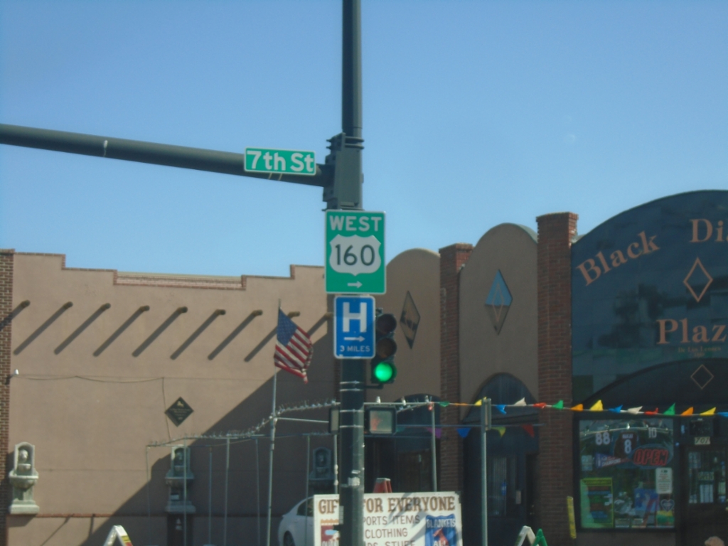
US-160 West/BL-25 South at US-160 West
US-160 West/BL-25 South (Main Street) at US-160 West (7th St.) in Walsenburg.
Taken 06-18-2026
 Walsenburg
Huerfano County
Colorado
United States
Walsenburg
Huerfano County
Colorado
United States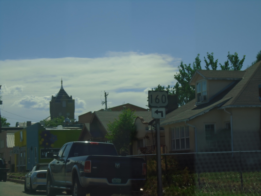
US-160 West Approaching BL-25
US-160 West (E 5th St) approaching BL-25 (Main Street) in Walsenburg. Turn left on Main St. to continue west on US-160.
Taken 06-18-2026
Walsenburg
Huerfano County
Colorado
United States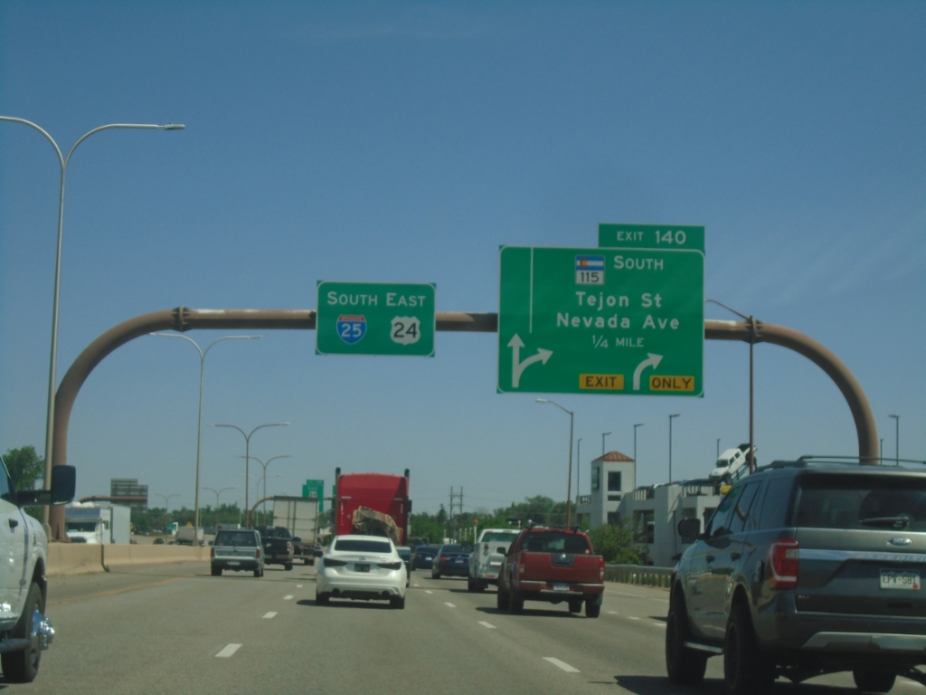
I-25 South - Exit 140
I-25 South/US-24 East approaching Exit 140 - CO-115 South/Tejon St./Nevada Ave.
Taken 06-18-2026


 Colorado Springs
El Paso County
Colorado
United States
Colorado Springs
El Paso County
Colorado
United States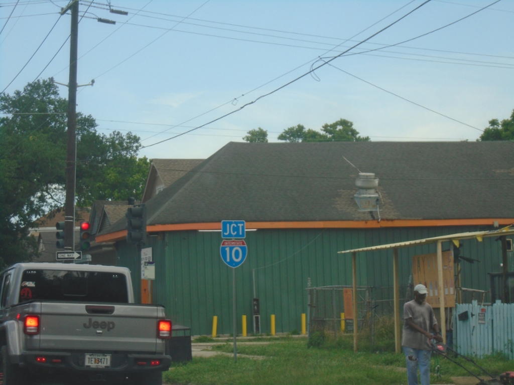
LA-3021 North Approaching I-10
LA-3021 North (Elysian Fields Ave.) approaching I-10.
Taken 05-31-2026

 New Orleans
Orleans Parish
Louisiana
United States
New Orleans
Orleans Parish
Louisiana
United States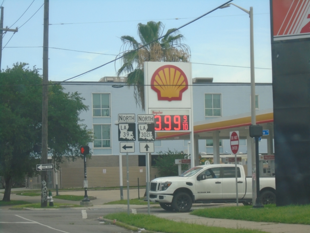
End LA-46 West at LA-39/LA-3021
End LA-46 West (Elysian Fields Ave.) at LA-39/LA-3021 in New Orleans. Turn left for LA-39 North (Claiborne Ave.); continue straight for LA-3021 North.
Taken 05-31-2026

 New Orleans
Orleans Parish
Louisiana
United States
New Orleans
Orleans Parish
Louisiana
United States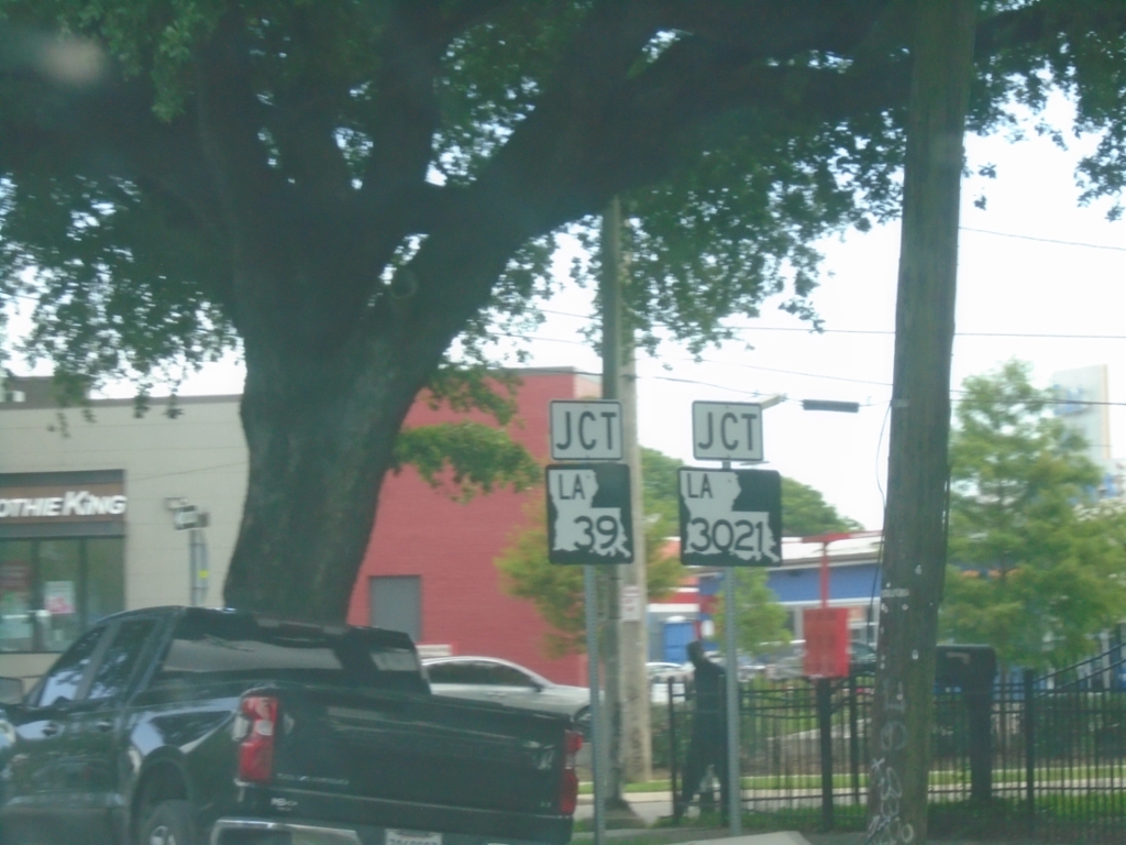
LA-46 West Approaching LA-39/LA-3021
LA-46 West (Elysian Fields Ave.) approaching LA-39 (Claiborne Ave.). Elysian Fields Ave. continues north as LA-3021. This is the west end of LA-46.
Taken 05-31-2026
New Orleans
Orleans Parish
Louisiana
United States
LA-46 West Approaching Elysian Fields Ave
LA-46 West (Saint Claude Ave) approaching Elysian Fields Ave. in New Orleans. Turn right on Elysian Fields Ave. to continue west on LA-46.
Taken 05-31-2026
New Orleans
Orleans Parish
Louisiana
United States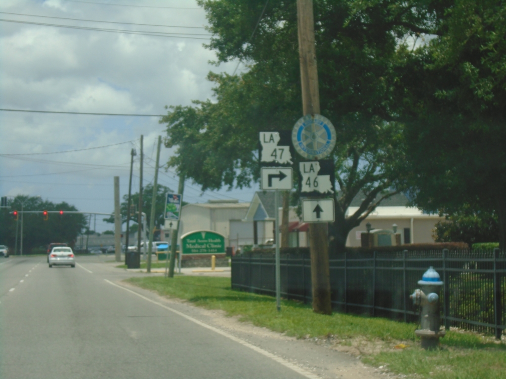
LA-46 West at LA-47 North - Chalmette
LA-46 West at LA-47 North (Paris Road) in Chalmette
Taken 05-31-2026
 Chalmette
Saint Bernard Parish
Louisiana
United States
Chalmette
Saint Bernard Parish
Louisiana
United States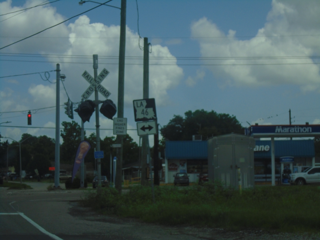
LA-39 North at LA-46 in Poydras
LA-39 North at LA-46 in Poydras. Turn left for LA-46 West; right for LA-46 East and to continue north on LA-39.
Taken 05-31-2026
Poydras
Saint Bernard Parish
Louisiana
United States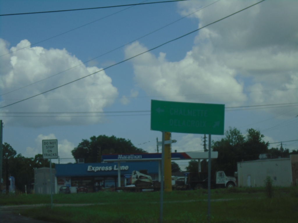
LA-39 North Approaching LA-46 - Poydras
LA-39 North Approaching LA-46 in Poydras. A very faded sign shows to turn left on LA-46 West for Chalmette; turn right on LA-46 East/LA-39 North to Delacroix.
Taken 05-31-2026
Poydras
Saint Bernard Parish
Louisiana
United States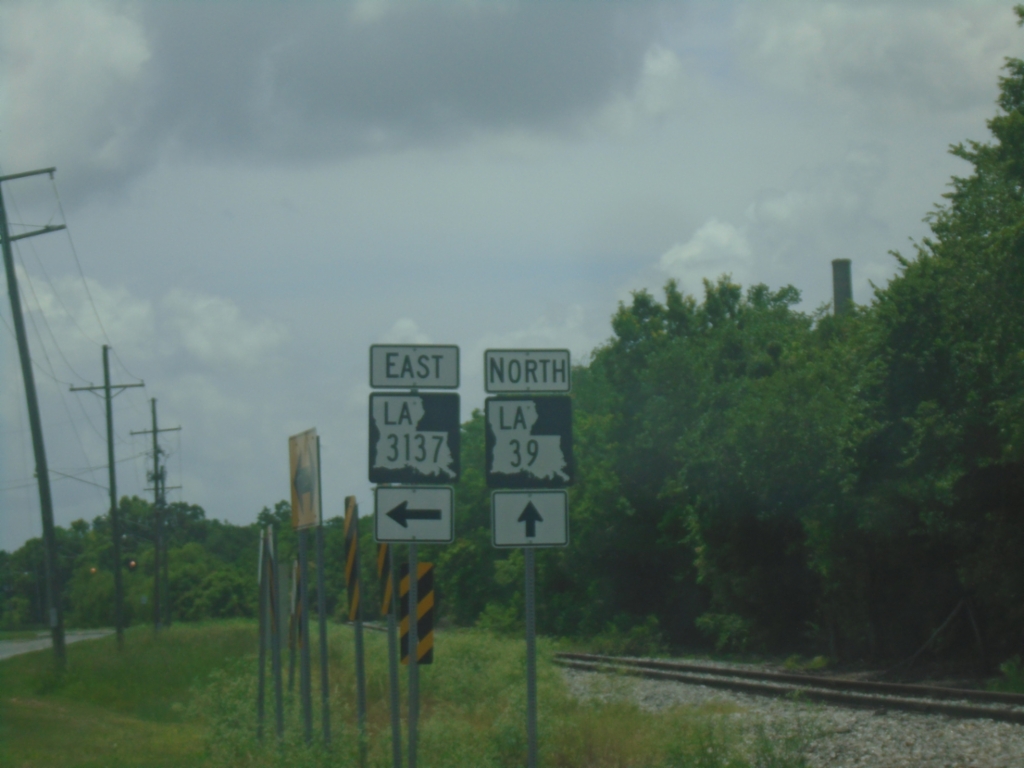
LA-39 North at LA-3137
LA-39 North at LA-3137 in Braithwaite.
Taken 05-31-2026
 Braithwaite
Plaquemines Parish
Louisiana
United States
Braithwaite
Plaquemines Parish
Louisiana
United States