Signs Tagged With Intersection
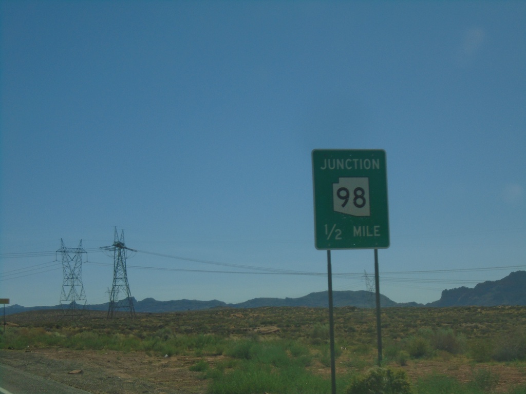
US-89 South Approaching AZ-98
US-89 south approaching AZ-98 east in Page.
Taken 09-07-2023

 Page
Coconino County
Arizona
United States
Page
Coconino County
Arizona
United States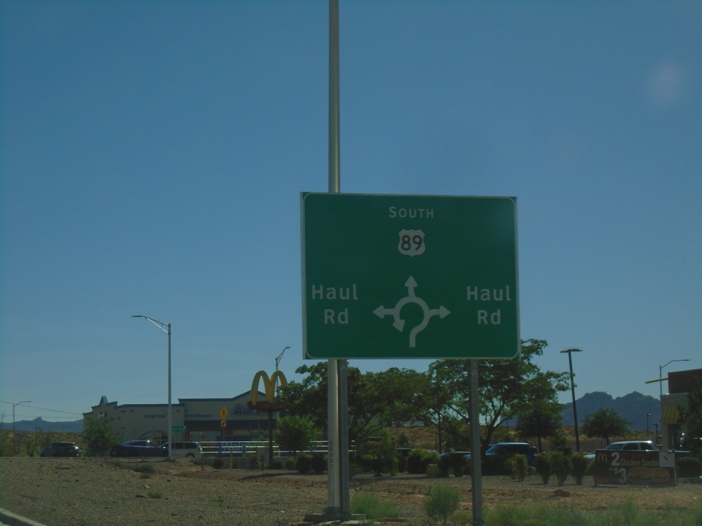
US-89 South at Haul Road Roundabout
US-89 South at Haul Road roundabout in Page.
Taken 09-07-2023
Page
Coconino County
Arizona
United States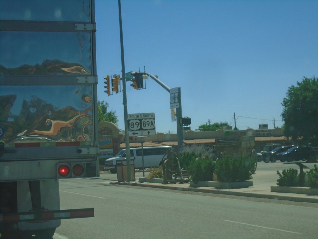
US-89 South at US-89A
US-89 South at US-89A in Kanab.
Taken 09-07-2023
 Kanab
Kane County
Utah
United States
Kanab
Kane County
Utah
United States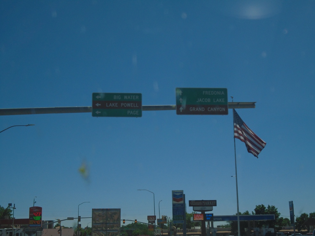
US-89 South at US-89A
US-89 South at US-89A in Kanab. Continue straight for US-89A south to Fredonia (Arizona), Jacob Lake (Arizona), and Grand Canyon (North Rim). Turn left to continue south on US-89 to Big Water, Page (Arizona) and Lake Powell.
Taken 09-07-2023
Kanab
Kane County
Utah
United States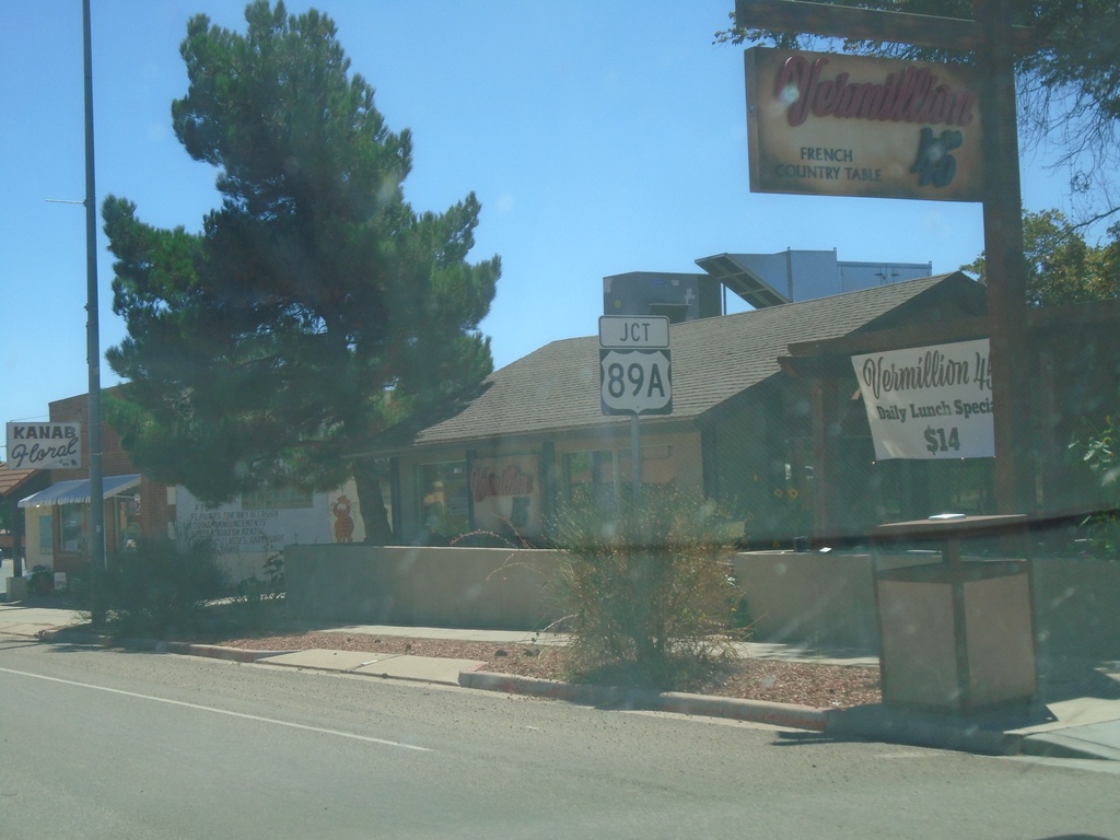
US-89 South Approaching US-89A
US-89 South approaching US-89A in Kanab.
Taken 09-07-2023
Kanab
Kane County
Utah
United States
US-89 South at UT-14
UT-89 south at UT-14 west to Duck Creek, Cedar Breaks (National Monument), and Cedar City. Continue south on US-89 for Mt. Carmel Junction.
Taken 09-07-2023
 Alton
Kane County
Utah
United States
Alton
Kane County
Utah
United States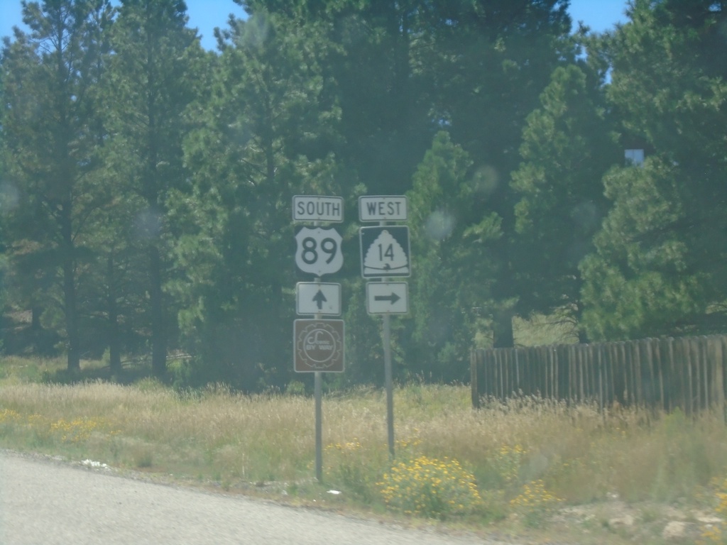
US-89 South Approaching UT-14
US-89 South approaching UT-14 at Long Valley Junction.
Taken 09-07-2023
Alton
Kane County
Utah
United States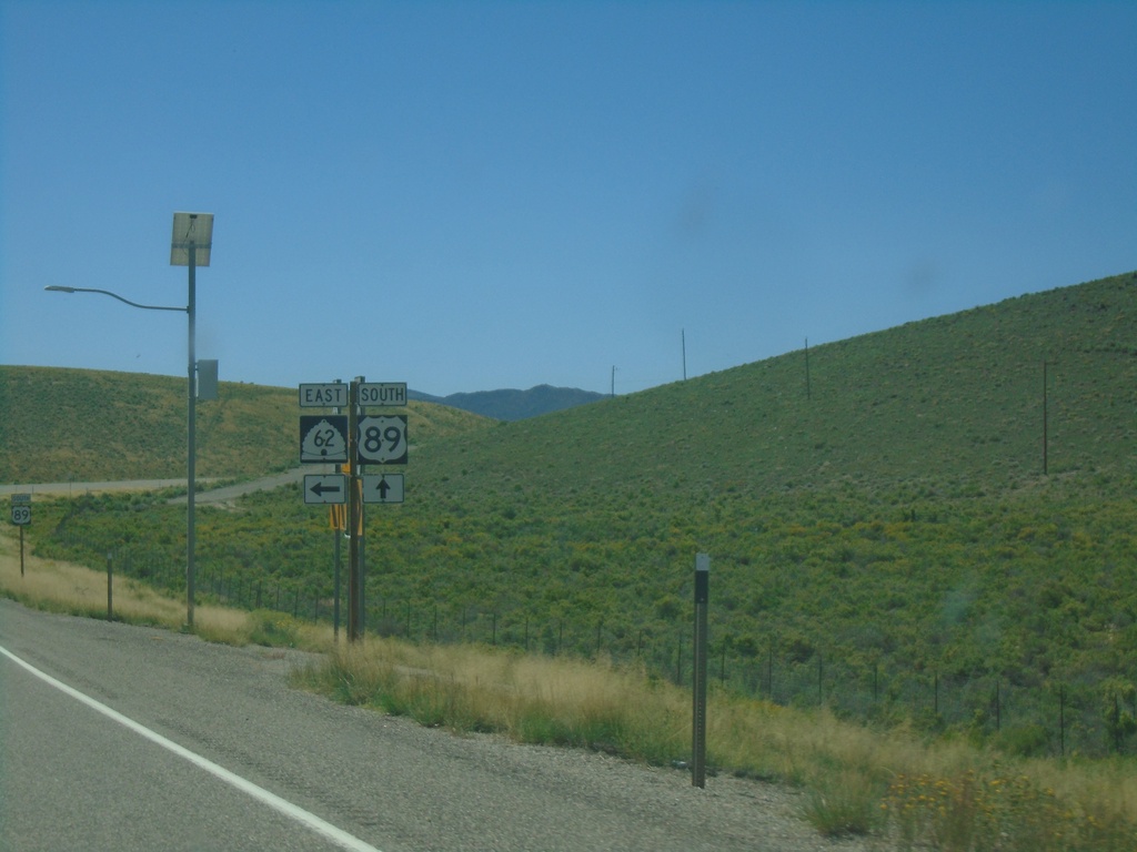
US-89 South at UT-62
US-89 South at UT-62 in Piute County.
Taken 09-07-2023
 Junction
Piute County
Utah
United States
Junction
Piute County
Utah
United States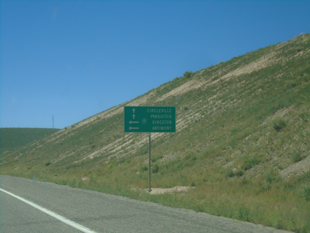
US-89 South at UT-62 East
US-89 South at UT-62 East to Antimony and Kingston. Continue south on US-89 for Circleville and Panguitch.
Taken 09-07-2023
Junction
Piute County
Utah
United States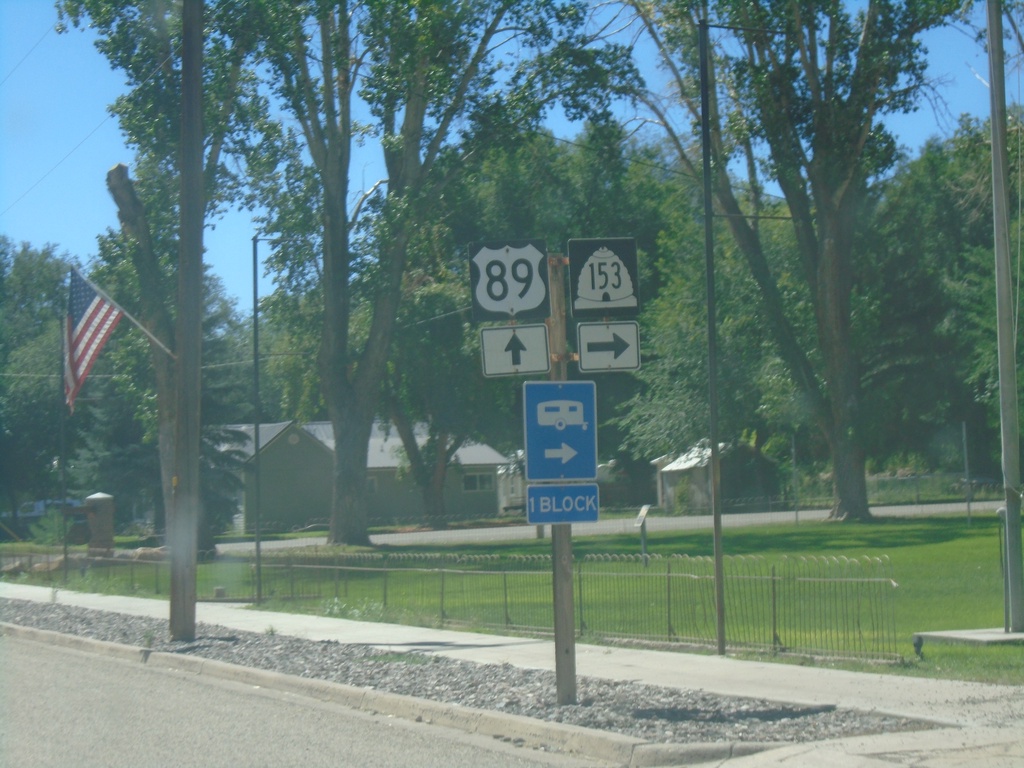
US-89 South at UT-153
US-89 South at UT-153 in Junction.
Taken 09-07-2023
 Junction
Piute County
Utah
United States
Junction
Piute County
Utah
United States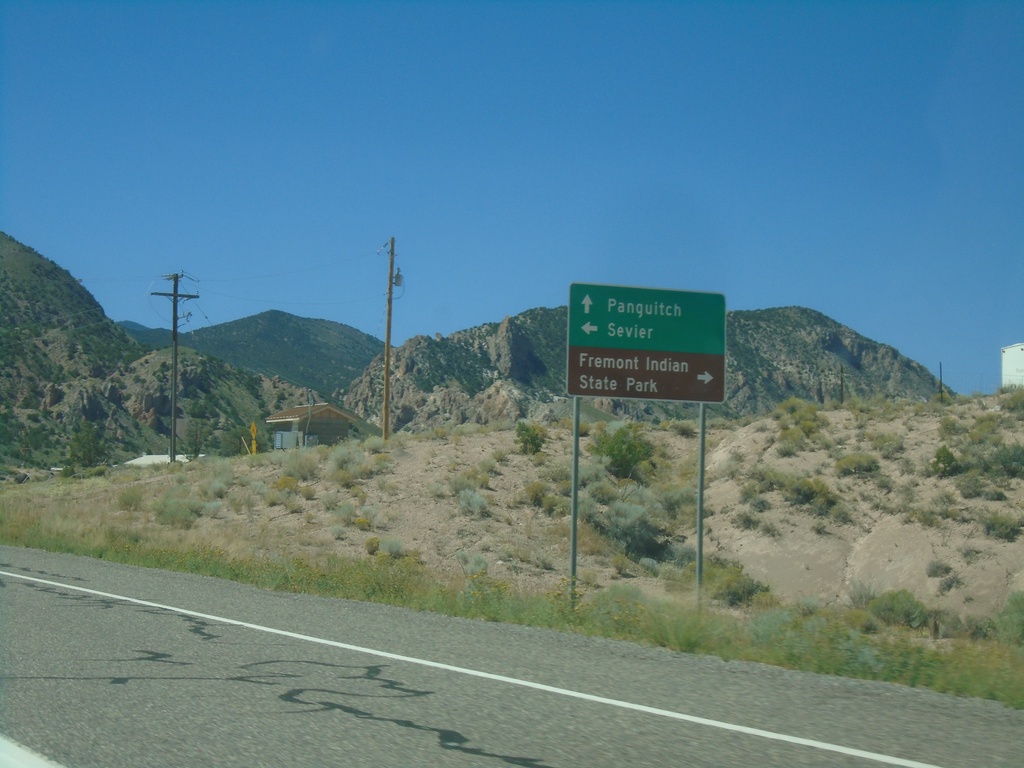
US-89 South - Sevier Highway
US-89 South at Sevier Highway junction. Use Sevier Highway west to Fremont Indian State Park; east to Sevier. Continue south on US-89 for Panguitch.
Taken 09-07-2023
Sevier
Sevier County
Utah
United States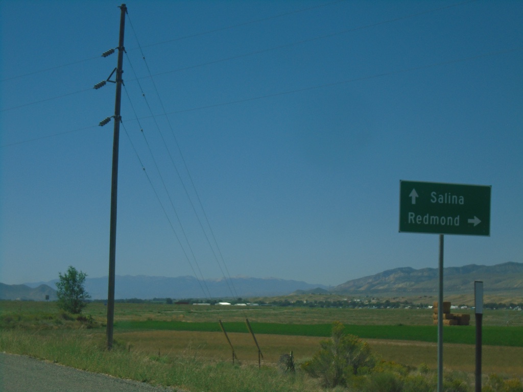
US-89 South at UT-256
US-89 South at UT-256 to Redmond. Continue south on US-89 to Salina.
Taken 09-07-2023
 Salina
Sanpete County
Utah
United States
Salina
Sanpete County
Utah
United States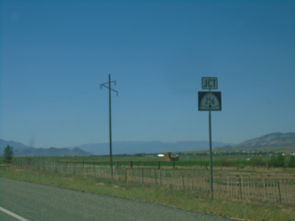
US-89 South Approaching UT-256
US-89 South approaching UT-256 in Sanpete County.
Taken 09-07-2023
Axtell
Sanpete County
Utah
United States
US-89 South Approaching UT-137
US-89 South approaching UT-137 (600 S) in Gunnison.
Taken 09-07-2023
 Gunnison
Sanpete County
Utah
United States
Gunnison
Sanpete County
Utah
United States
US-89 South at UT-28 North - Gunnison
US-89 South at UT-28 North in Gunnison.
Taken 09-07-2023
 Gunnison
Sanpete County
Utah
United States
Gunnison
Sanpete County
Utah
United States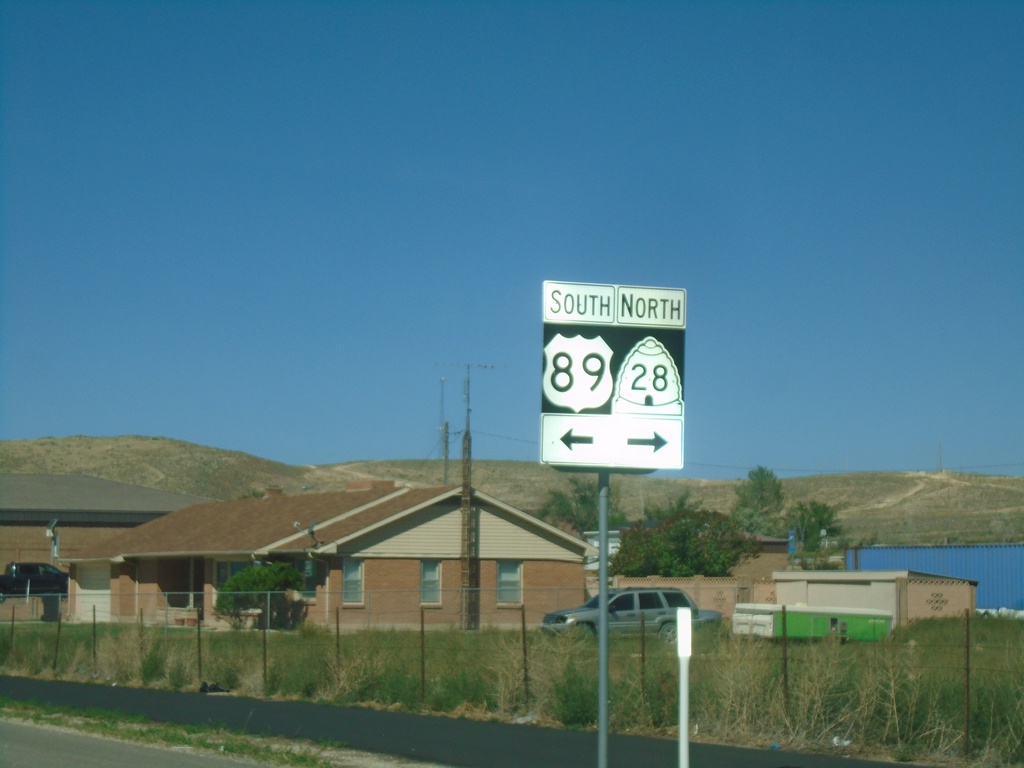
US-89 South at UT-28
US-89 South at UT-28 in Gunnison.
Taken 09-07-2023
Gunnison
Sanpete County
Utah
United States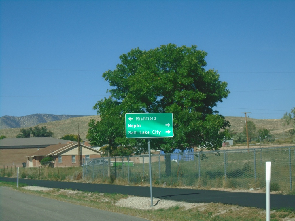
US-89 South Approaching UT-28
US-89 South approaching UT-28 in Gunnison. Use UT-28 north to Nephi and Salt Lake County. Turn left for US-89 south to Richfield.
Taken 09-07-2023
Gunnison
Sanpete County
Utah
United States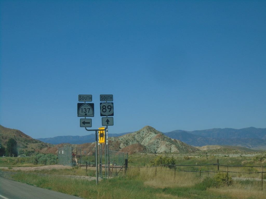
US-89 South at UT-137
US-89 South at UT-137 in Sanpete County.
Taken 09-07-2023
Mayfield
Sanpete County
Utah
United States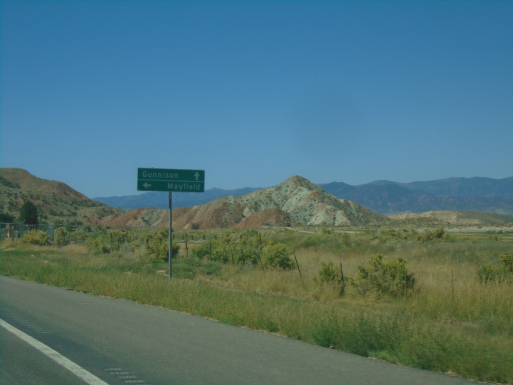
US-89 South Approaching UT-137
US-89 South approaching UT-137 south to Mayfield. Continue south on US-89 for Gunnison.
Taken 09-07-2023
Sterling
Sanpete County
Utah
United States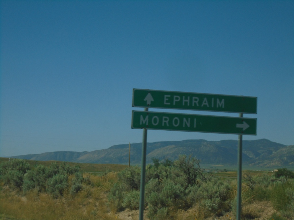
US-89 South at UT-132
US-89 South at UT-132 west to Moroni. Continue south on US-89 for Ephraim.
Taken 09-07-2023
 Ephraim
Sanpete County
Utah
United States
Ephraim
Sanpete County
Utah
United States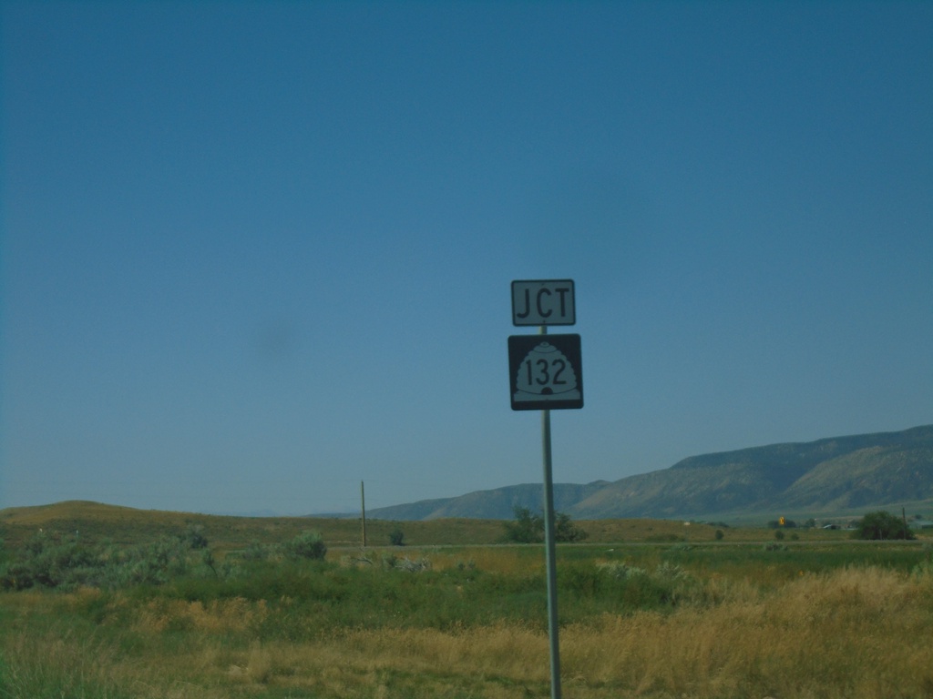
US-89 South Approaching UT-132
US-89 South approaching UT-132
Taken 09-07-2023
Ephraim
Sanpete County
Utah
United States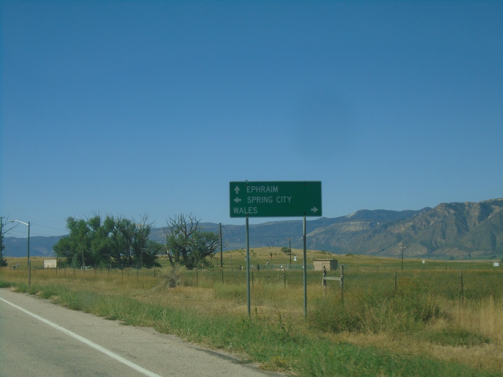
US-89 South at UT-117
US-89 South at UT-117. Use UT-117 west to Wales; UT-117 east to Spring City. Continue south on US-89 to Ephraim.
Taken 09-07-2023
 Spring City
Sanpete County
Utah
United States
Spring City
Sanpete County
Utah
United States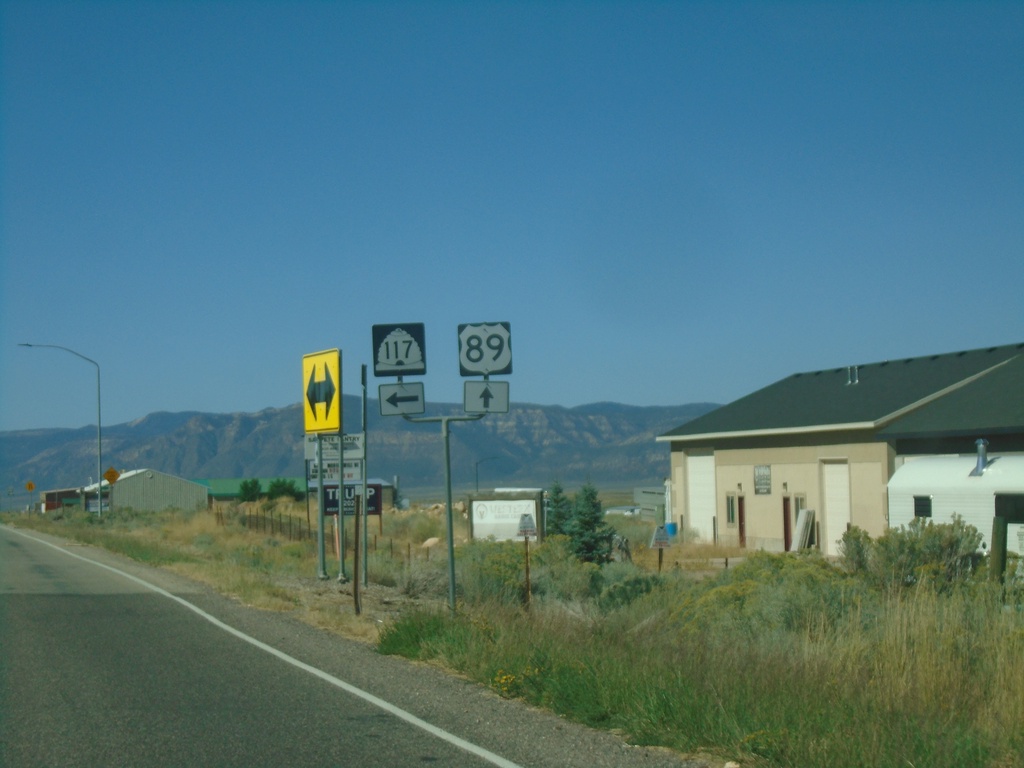
US-89 South at UT-117
US-89 South at UT-117, south of Mount Pleasant.
Taken 09-07-2023
Mount Pleasant
Sanpete County
Utah
United States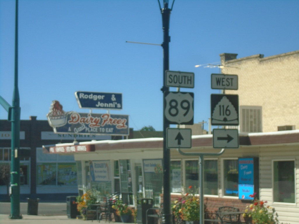
US-89 South at UT-116
US-89 South at UT-116 West to Moroni
Taken 09-07-2023
 Mount Pleasant
Sanpete County
Utah
United States
Mount Pleasant
Sanpete County
Utah
United States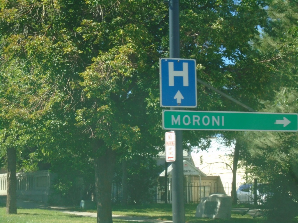
US-89 South Approaching UT-116
US-89 South approaching UT-116 West (Main St.) to Moroni.
Taken 09-07-2023
Mount Pleasant
Sanpete County
Utah
United States