Signs Tagged With Intersection
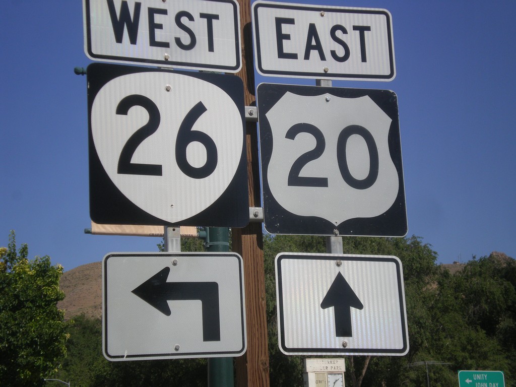
US-20 East Approaching US-26 West - Vale
US-20 east approaching US-26 in downtown Vale. The US-26 shield here has been incorrectly signed using the Oregon state highway shield. So it appears to be a US-20/OR-26 junction.
Taken 07-15-2017

 Vale
Malheur County
Oregon
United States
Vale
Malheur County
Oregon
United States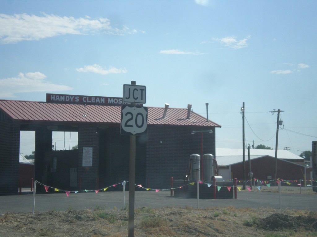
US-26 East Approaching US-20
US-26 east approaching US-20 junction in Vale.
Taken 07-15-2017
Vale
Malheur County
Oregon
United States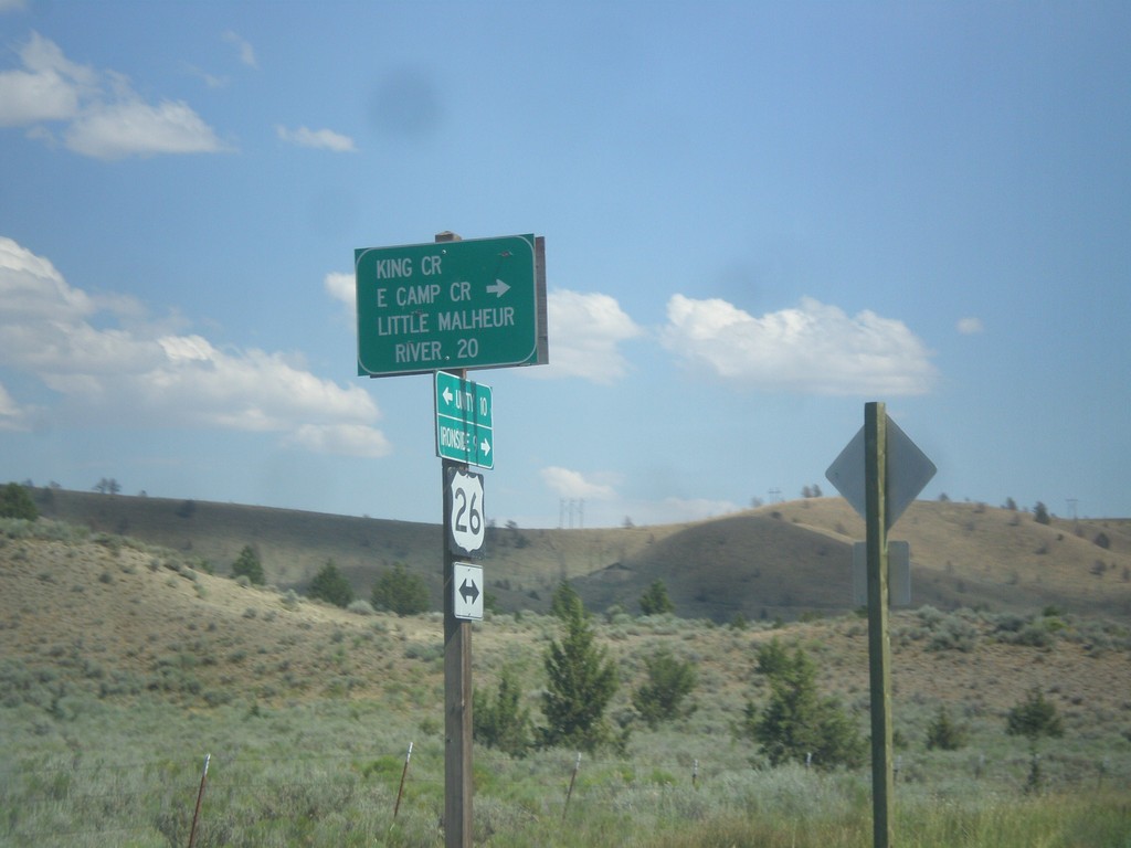
US-26 East - Camp Creek Road
US-26 East at King Creek/East Camp Creek/Little Malheur River junction.
Taken 07-15-2017
Unity
Baker County
Oregon
United States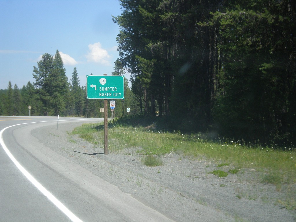
US-26 East at OR-7 - Austin Junction
US-26 East at OR-7 north to Sumpter and Baker City.
Taken 07-15-2017
 Grant County
Oregon
United States
Grant County
Oregon
United States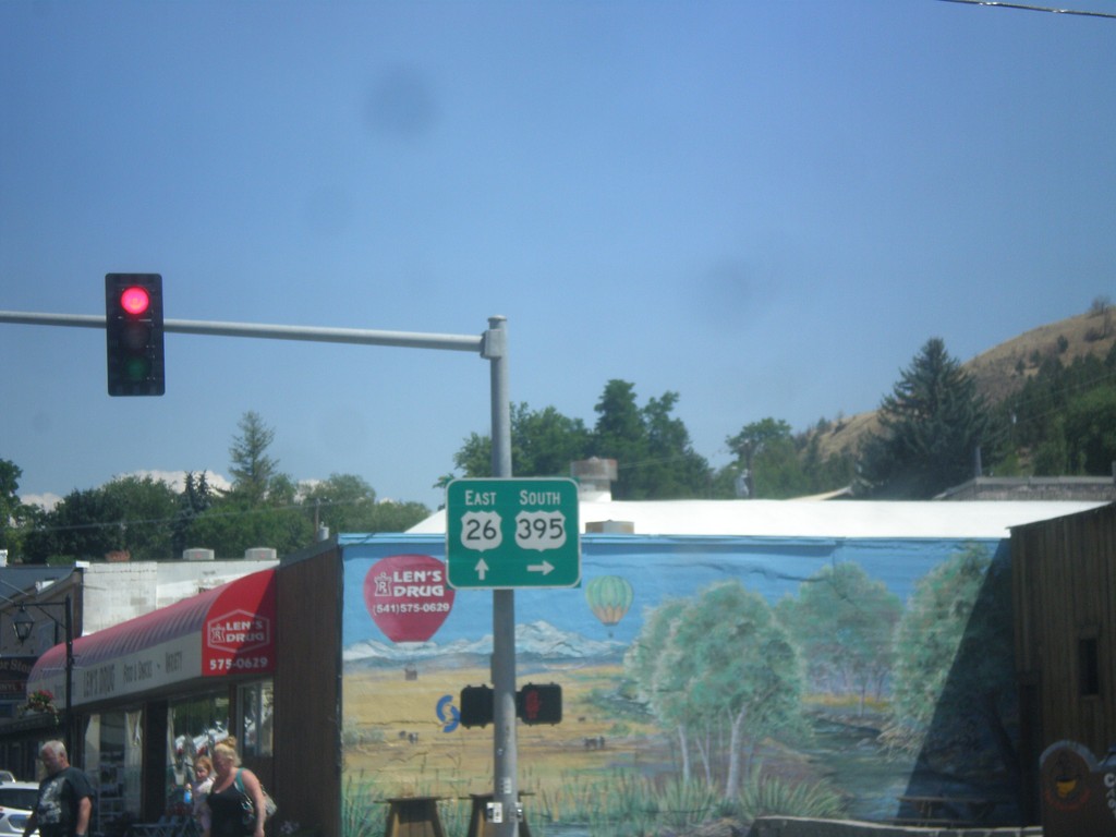
US-26 East/US-395 South Split - John Day
US-26 East/US-395 South Split in John Day. Turn right for US-395 south; continue straight for US-26 east. US-395 north joins US-26 westbound to Mount Vernon.
Taken 07-15-2017
 John Day
Grant County
Oregon
United States
John Day
Grant County
Oregon
United States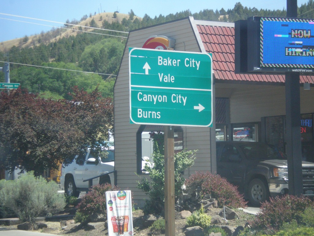
US-26 East/US-395 South Split - John Day
US-26 East/US-395 Split in John Day. Turn right for US-395 south to Canyon City and Burns. Continue east on US-26 for Baker City (via OR-7), and Vale.
Taken 07-15-2017
John Day
Grant County
Oregon
United States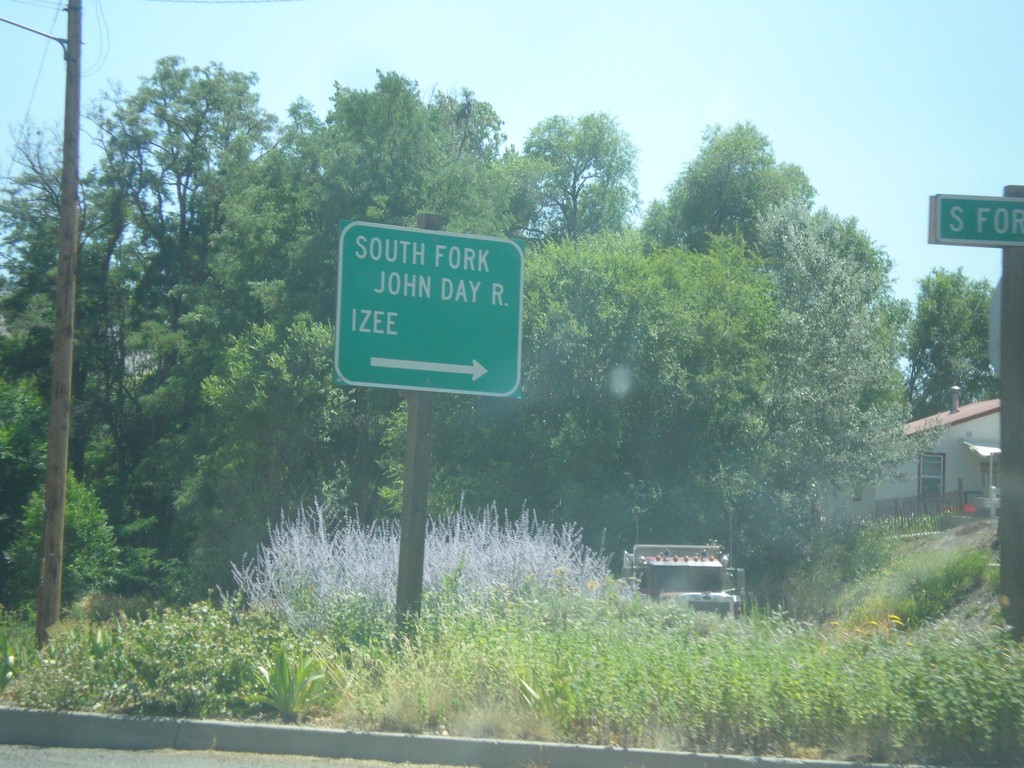
US-26 East - South Fork Road
US-26 East at South Fork (John Day River) Road in Dayville. Turn right for the South Fork John Day River and Izee.
Taken 07-15-2017
Dayville
Grant County
Oregon
United States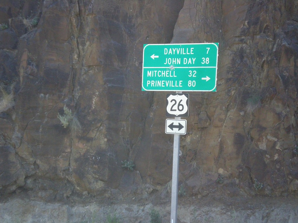
End OR-19 South at US-26
End OR-19 South at US-26 in Grant County. Turn right for US-26 West to Mitchell and Prineville (Ochoco Highway); turn left for US-26 East to Dayville and John Day (John Day Highway).
Taken 07-15-2017
 Dayville
Grant County
Oregon
United States
Dayville
Grant County
Oregon
United States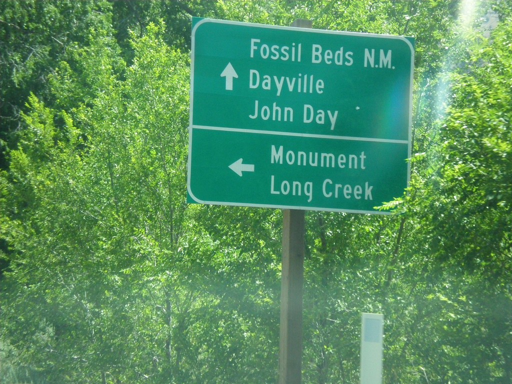
OR-19 South at OR-402 Junction
OR-19 South at OR-402 east to Monument and Long Creek. Continue south on OR-19 for (John Day) Fossil Beds National Monument, Dayville, and John Day.
Taken 07-15-2017
 Kimberly
Grant County
Oregon
United States
Kimberly
Grant County
Oregon
United States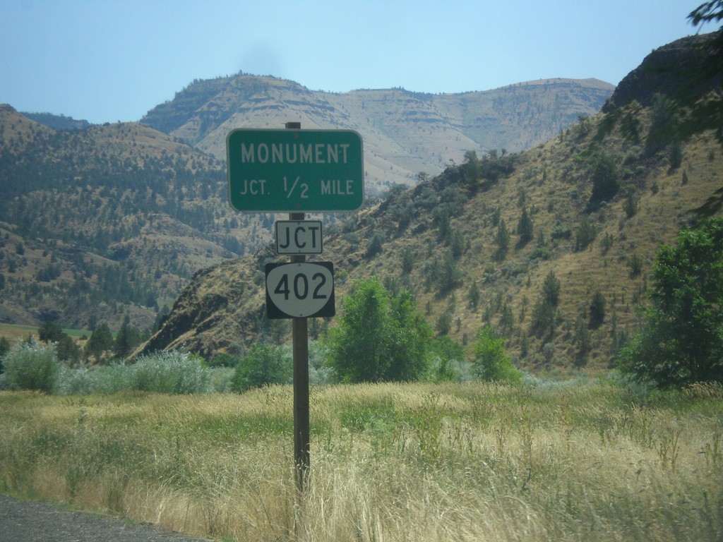
OR-19 South Approaching OR-402
OR-19 South approaching OR-402 to Monument.
Taken 07-15-2017
Kimberly
Grant County
Oregon
United States