Signs Tagged With Intersection
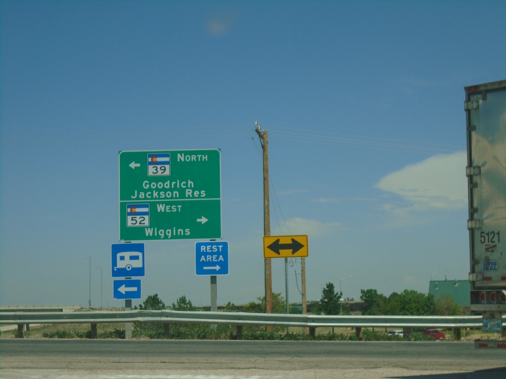
I-76 East - Exit 66A Offramp at CO-39/CO-52
I-76 East - Exit 66A Offramp at CO-39/CO-52. Turn left for CO-39 North to Goodrich and Jackson Reservoir. Turn right for CO-52 West to Wiggins.
Taken 07-10-2022


 Wiggins
Morgan County
Colorado
United States
Wiggins
Morgan County
Colorado
United States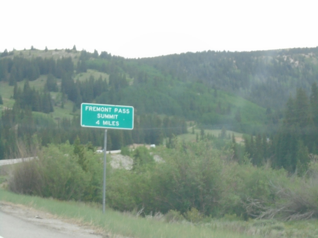
CO-91 North - Fremont Pass Summit - 4 Miles
CO-91 North - Fremont Pass Summit - 4 Miles in Lake County.
Taken 07-10-2022
 Leadville
Lake County
Colorado
United States
Leadville
Lake County
Colorado
United States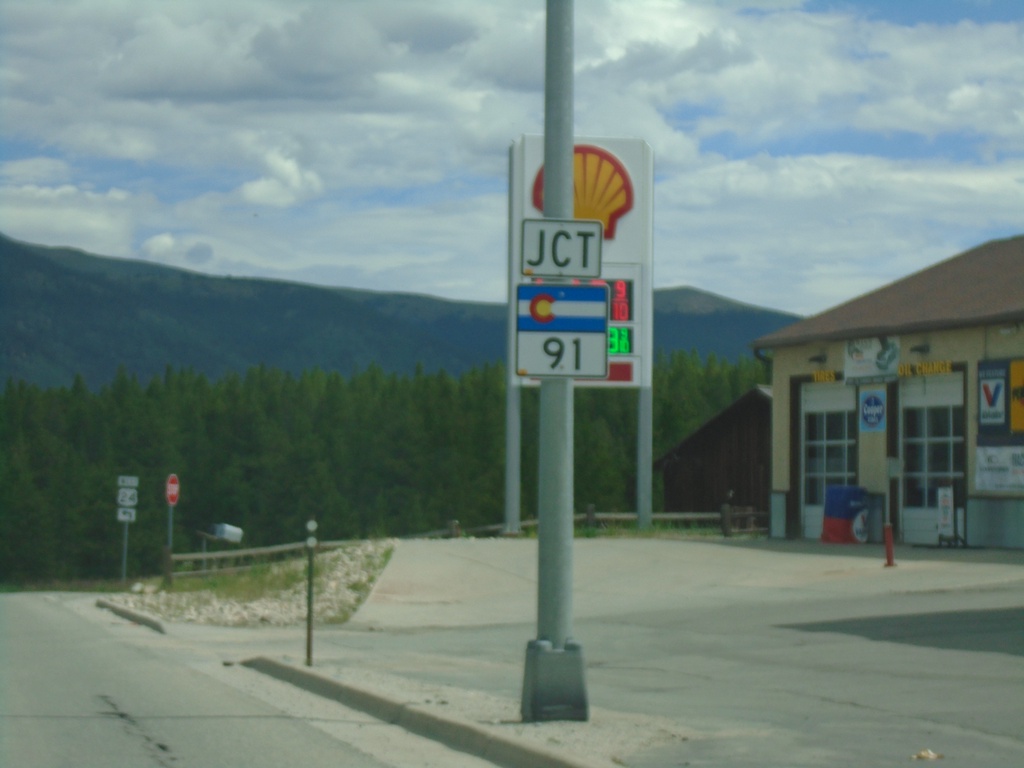
US-24 West Approaching CO-91
US-24 West approaching CO-91 in Leadville.
Taken 07-10-2022
 Leadville
Lake County
Colorado
United States
Leadville
Lake County
Colorado
United States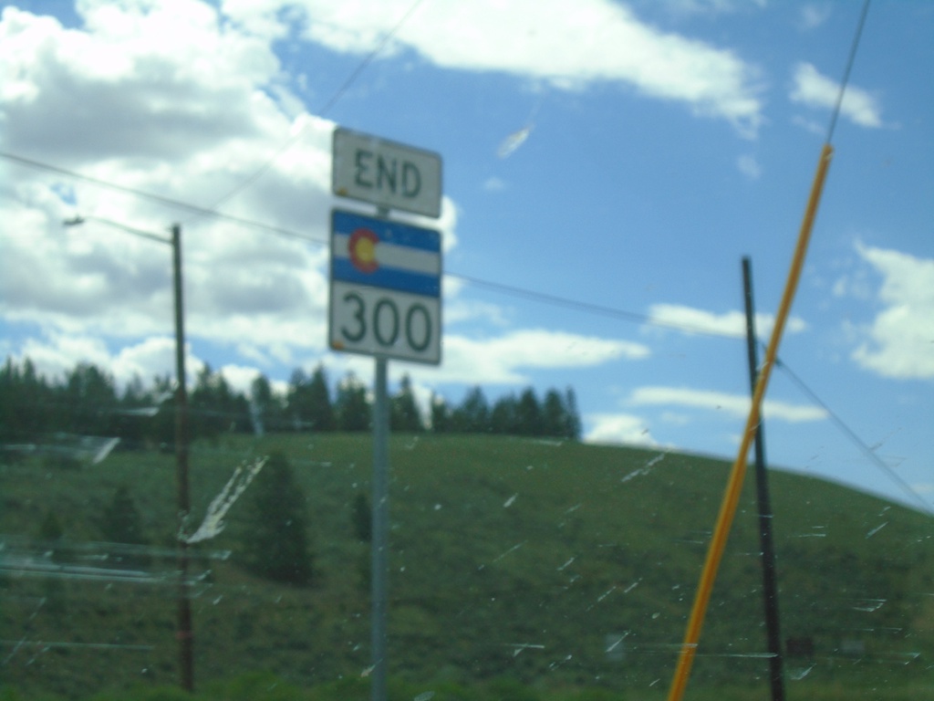
End CO-300 West at US-24
End CO-300 West at US-24 in Lake County.
Taken 07-10-2022
 Leadville
Lake County
Colorado
United States
Leadville
Lake County
Colorado
United States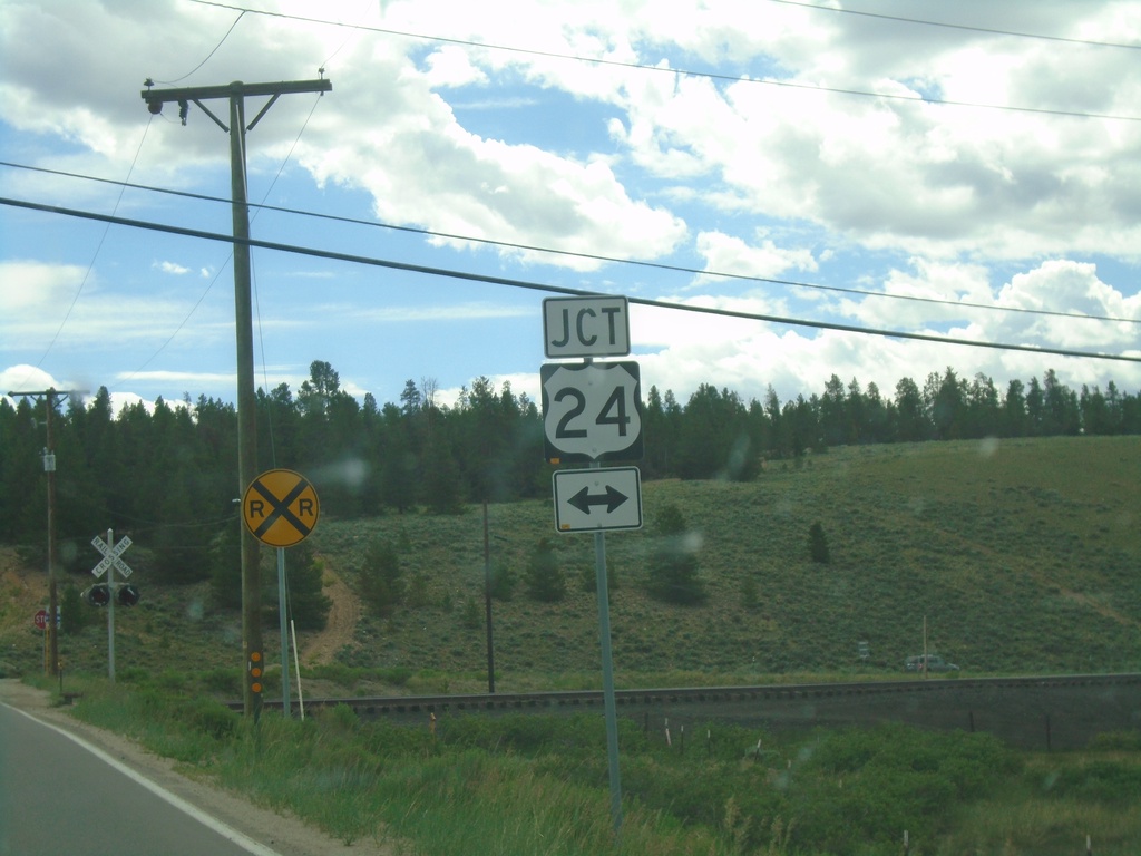
CO-300 West Approaching US-24
CO-300 West approaching US-24 in Lake County.
Taken 07-10-2022
Leadville
Lake County
Colorado
United States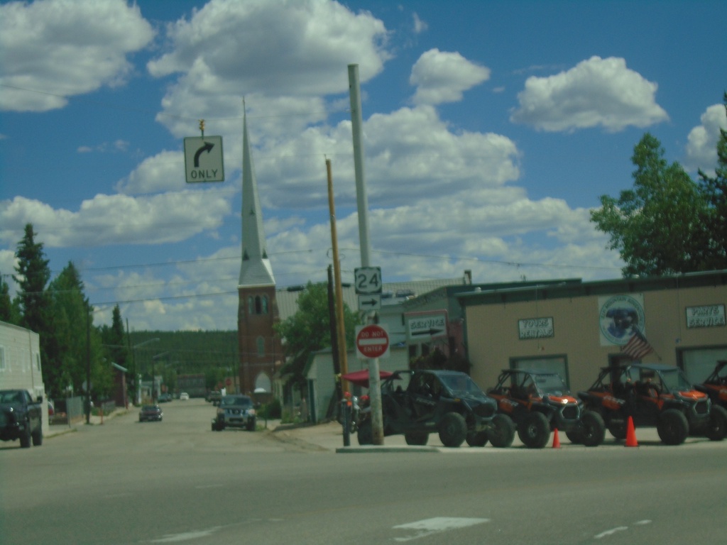
US-24 East - Leadville
US-24 east - Poplar St. at E 9th St. in Leadville. Turn right on E 9th St. to continue east on US-24.
Taken 07-09-2022
Leadville
Lake County
Colorado
United States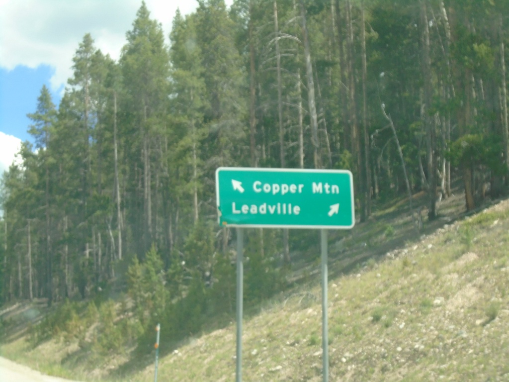
US-24 East at CO-91 North
US-24 East at CO-91 North in Leadville. Use CO-91 north to Copper Mountain; US-24 East to Leadville.
Taken 07-09-2022
Leadville
Lake County
Colorado
United States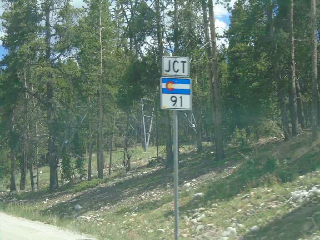
US-24 East Approaching CO-91
US-24 East approaching CO-91 in Leadville.
Taken 07-09-2022
Leadville
Lake County
Colorado
United States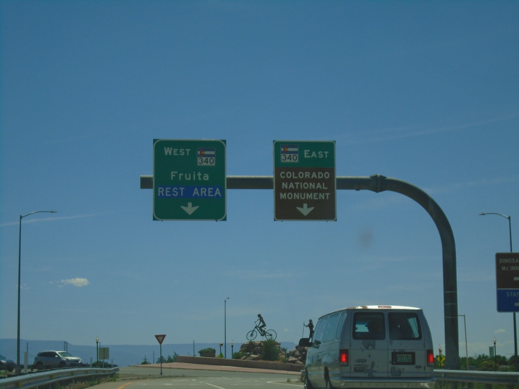
I-70 East Exit 19 Offramp at CO-340
I-70 East Exit 19 Offramp at CO-340 in Fruita. Use CO-340 West to Fruita and Rest Area. Use CO-340 East to Colorado National Monument.
Taken 07-09-2022


 Fruita
Mesa County
Colorado
United States
Fruita
Mesa County
Colorado
United States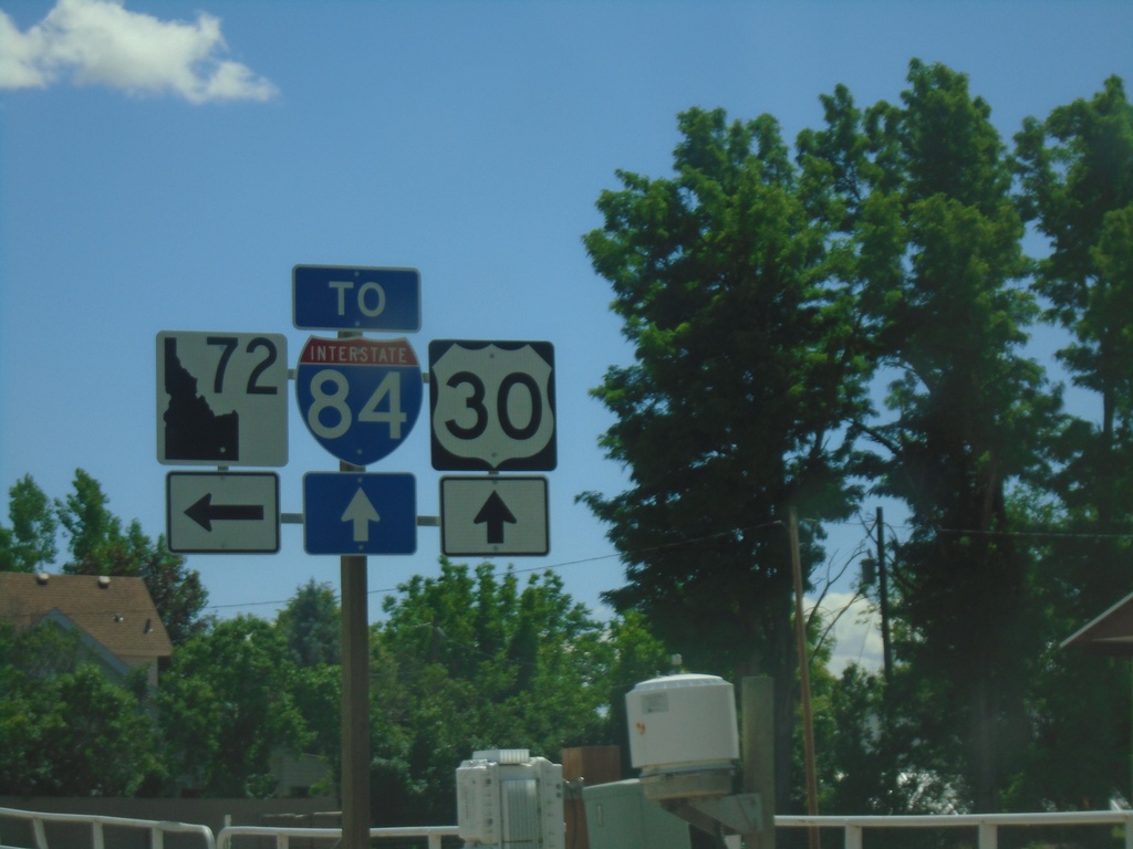
US-30 East approaching ID-72
US-30 East approaching ID-72. Turn left for ID-72; continue straight for access to I-84.
Taken 06-20-2022


 New Plymouth
Payette County
Idaho
United States
New Plymouth
Payette County
Idaho
United States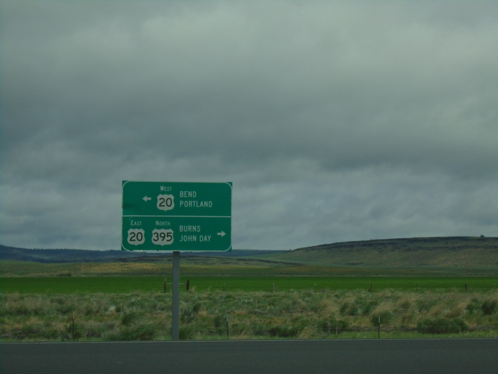
US-395 North at US-20 - Riley
US-395 North at US-20 in Riley. Use US-20 West to Bend and Portland; use US-395 North/US-20 East to Burns and John Day. US-395 North joins US-20 East to Burns.
Taken 05-29-2022

 Riley
Harney County
Oregon
United States
Riley
Harney County
Oregon
United States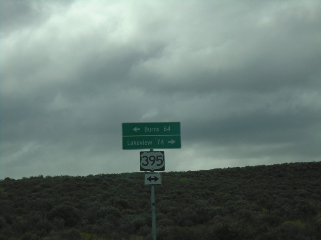
End Christmas Valley Highway at US-395
End Christmas Valley Highway at US-395 in Lake County. Use US-395 South to Lakeview; US-395 North to Burns.
Taken 05-29-2022
Wagontire
Harney County
Oregon
United States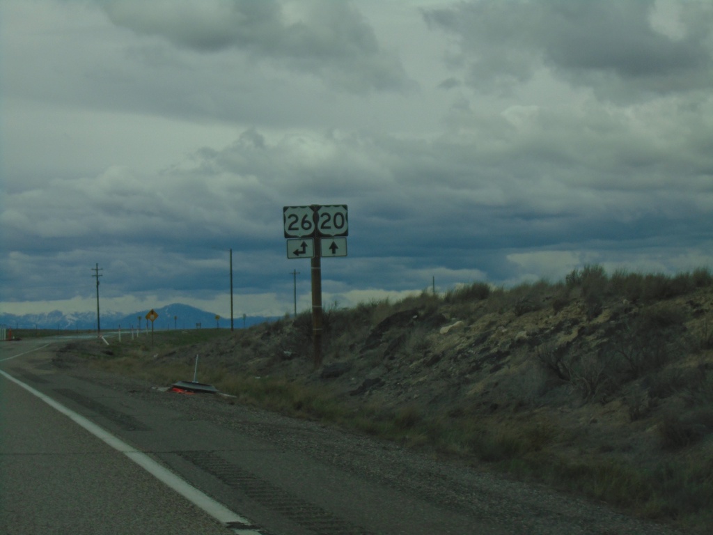
US-20 West at US-26
US-20 West at US-26 in Butte County. US-26 West joins US-20 West to Carey.
Taken 05-03-2022
 Blackfoot
Butte County
Idaho
United States
Blackfoot
Butte County
Idaho
United States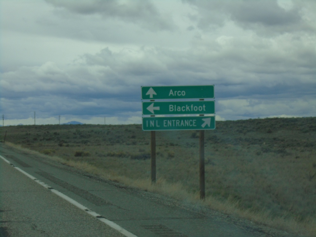
US-20 West Approaching US-26
US-20 West approaching US-26 in Butte County. Turn right for entrance to Idaho National Laboratory. Continue straight for Arco via US-20/US-26; left for US-26 East to Blackfoot.
Taken 05-03-2022
Atomic City
Bingham County
Idaho
United States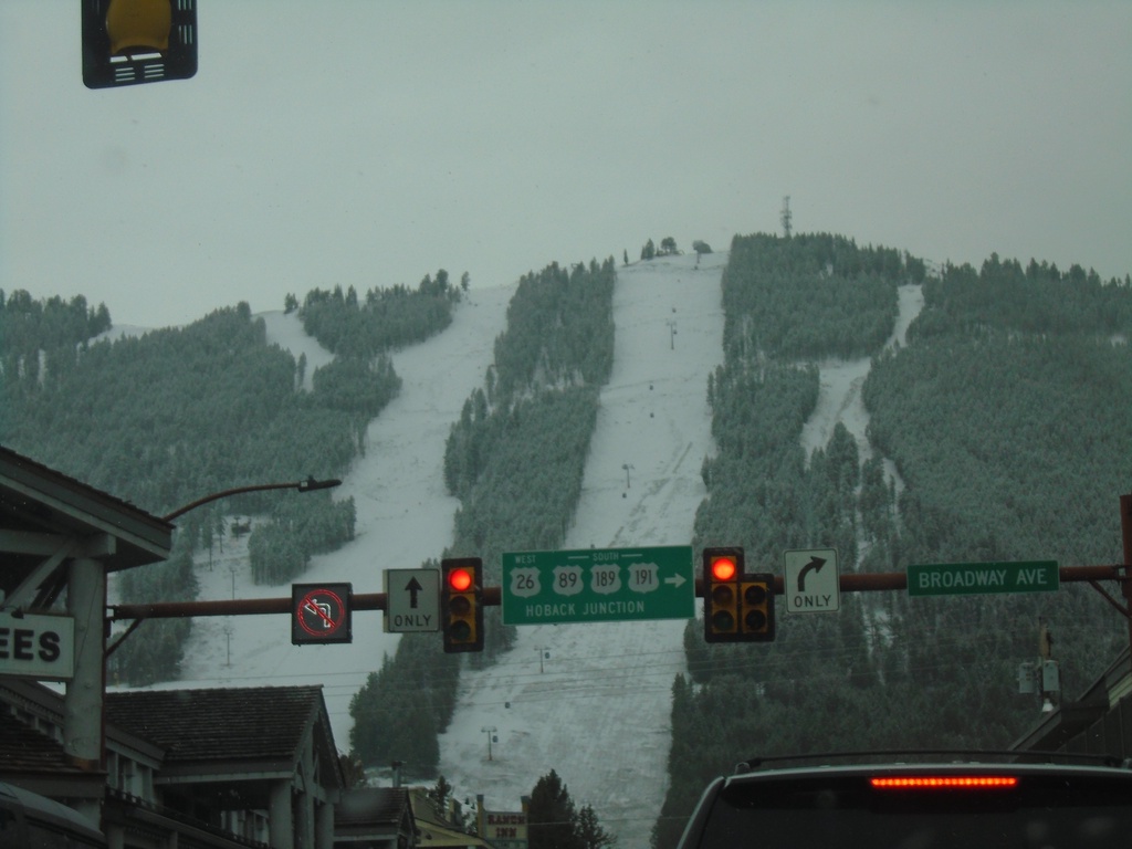
US-26 West/US-89 South/US-191 South - Jackson
Cache Drive at Broadway in Jackson. Turn right on Broadway to continue on US-26 West/US-89 South/US-191 South/US-189 South to Hoback Junction. This is the beginning of US-189 southbound.
Taken 05-03-2022


 Jackson
Teton County
Wyoming
United States
Jackson
Teton County
Wyoming
United States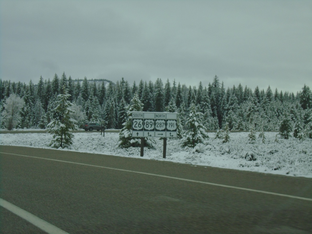
US-26 West/US-287 North at US-191/US-89 - Moran Junction
US-26 West/US-287 North at US-191/US-89 at Moran Junction. Turn right for US-89/US-191/US-287 North; straight for US-26 West/US-89 South/US-191 South.
Taken 05-03-2022
 Moran
Teton County
Wyoming
United States
Moran
Teton County
Wyoming
United States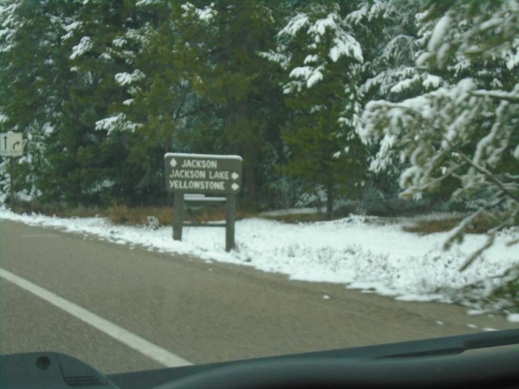
US-26 West/US-287 North Approaching US-89/US-191 at Moran Junction
US-26 West/US-287 North Approaching US-89/US-191 at Moran Junction. Turn right for US-89/US-191/US-287 North to Yellowstone and Jackson Lake. Continue straight for US-26 West/US-191 South/US-89 South to Jackson.
Taken 05-03-2022
Moran
Teton County
Wyoming
United States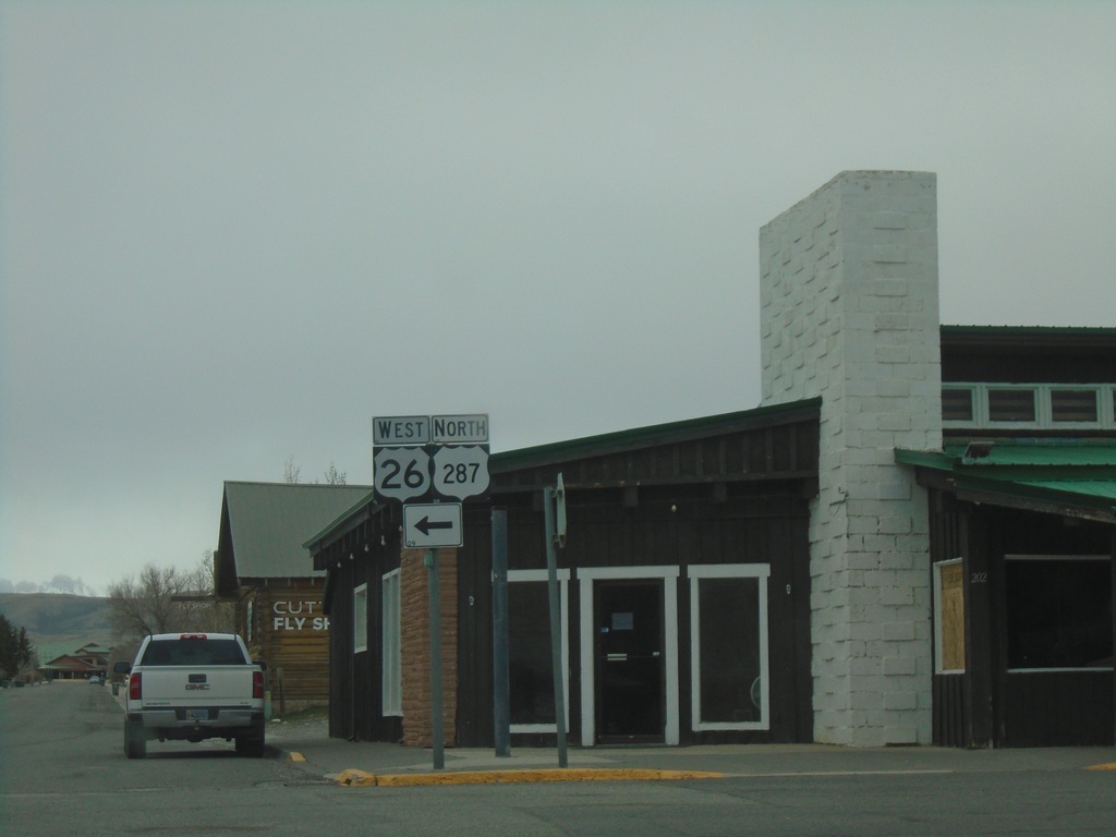
US-287 North/US-26 West - Dubois
US-287 North/US-26 West in Dubois. Turn left to continue on US-287 North/US-26 West.
Taken 05-03-2022
Dubois
Fremont County
Wyoming
United States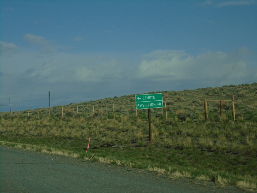
US-26 West at WY-132/WY-133
US-26 West at WY-132/WY-133 junction. Use WY-133 to Pavillion; use WY-132 to Ethete.
Taken 05-03-2022

 Johnstown
Fremont County
Wyoming
United States
Johnstown
Fremont County
Wyoming
United States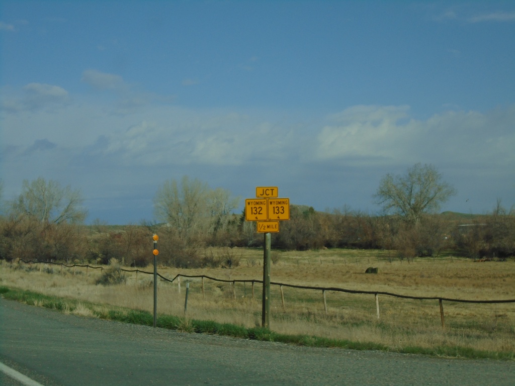
US-26 West Approaching WY-132/WY-133
US-26 West approaching WY-132/WY-133 in Fremont County.
Taken 05-03-2022
Kinnear
Fremont County
Wyoming
United States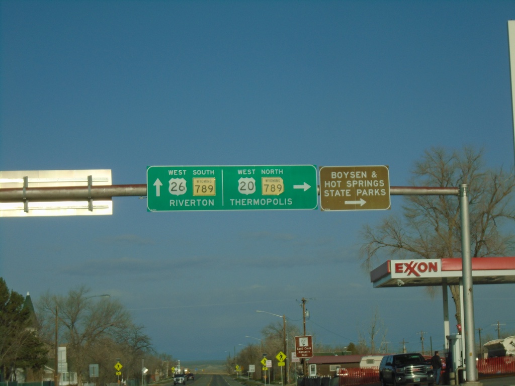
US-20/US-26 West at WY-789 - Shoshoni
US-20/US-26 West at WY-789 in Shoshoni. Turn right for US-20 West/WY-789 North to Thermopolis, Boysen State Park, and Hot Springs State Park. Continue straight for US-26 West/WY-789 South to Riverton.
Taken 05-03-2022
 Shoshoni
Fremont County
Wyoming
United States
Shoshoni
Fremont County
Wyoming
United States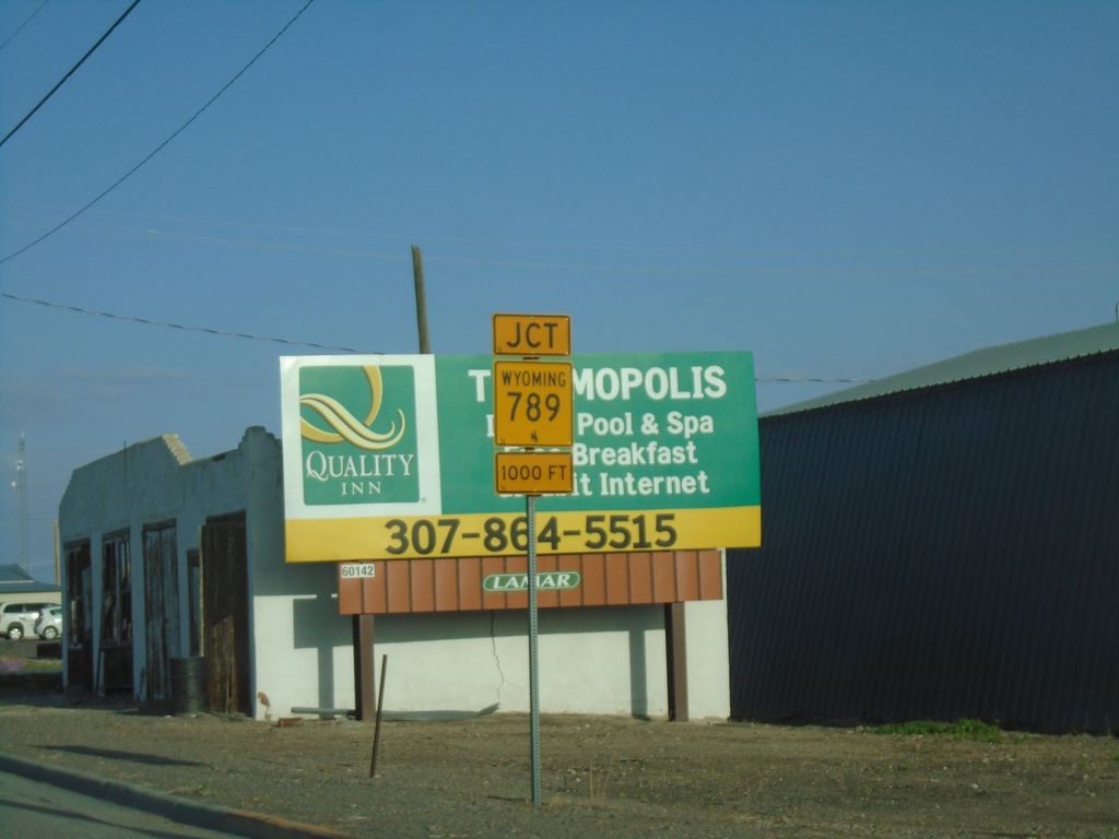
US-20/US-26 West Approaching WY-789
US-20/US-26 West approaching WY-789 in Shoshoni.
Taken 05-03-2022
Shoshoni
Fremont County
Wyoming
United States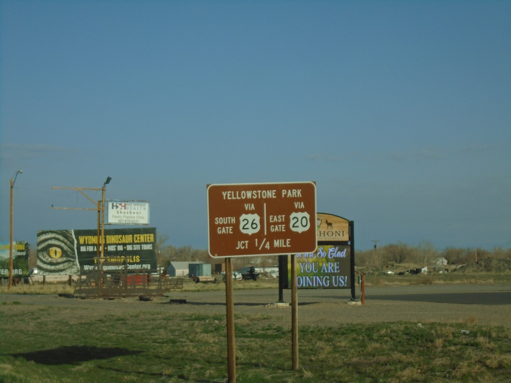
US-20/US-26 West - Yellowstone Park
US-20/US-26 West approaching US-20/US-26 split and WY-789. Use US-20 West for Yellowstone East Gate. Use US-26 West for Yellowstone South Gate.
Taken 05-03-2022
Shoshoni
Fremont County
Wyoming
United States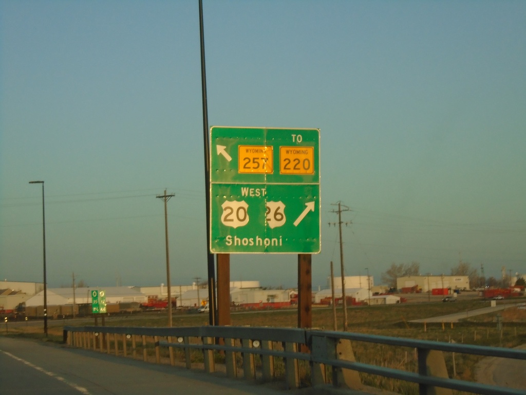
US-20/US-26 West at WY-257/To WY-220
US-20/US-26 West at WY-257/To WY-220 (Casper West Belt Loop) and Bus. US-20/Bus. US-26 (not signed). Turn right to continue west on US-20/US-26 to Shoshoni.
Taken 05-03-2022


 Casper
Natrona County
Wyoming
United States
Casper
Natrona County
Wyoming
United States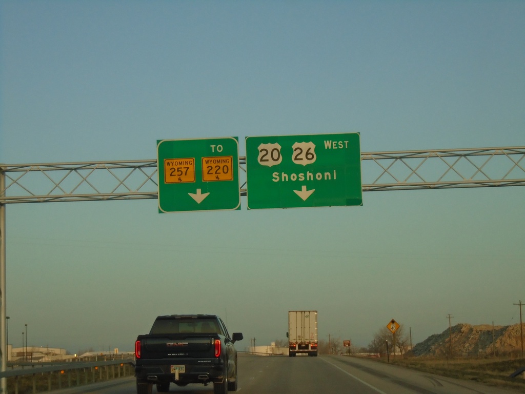
US-20/US-26 West at WY-257/To WY-220 and Bus. US-20/Bus. US-26
US-20/US-26 West at WY-257/To WY-220 and Bus. US-20/Bus. US-26 (not marked) in Casper. Use right lane to continue west on US-20/US-26 to Shoshoni. Continue straight for WY-257/To WY-220 which is the Casper West Belt Route.
Taken 05-03-2022
Mills
Natrona County
Wyoming
United States