Signs Tagged With Intersection
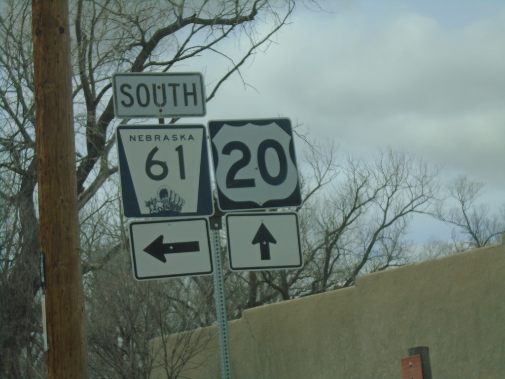
US-20 West/NE-61 South at NE-61 South
US-20 West/NE-61 South at NE-61 South in Merriman.
Taken 05-02-2022

 Merriman
Cherry County
Nebraska
United States
Merriman
Cherry County
Nebraska
United States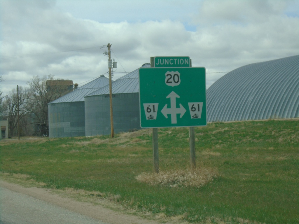
US-20 West Approaching NE-61
US-20 West Approaching NE-61 in Merriman.
Taken 05-02-2022
Merriman
Cherry County
Nebraska
United States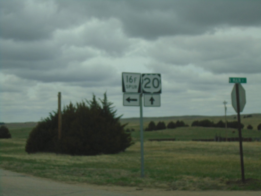
US-20 West at NE-16F Spur
US-20 West at NE-16F Spur in Cherry County.
Taken 05-02-2022
 Nenzel
Cherry County
Nebraska
United States
Nenzel
Cherry County
Nebraska
United States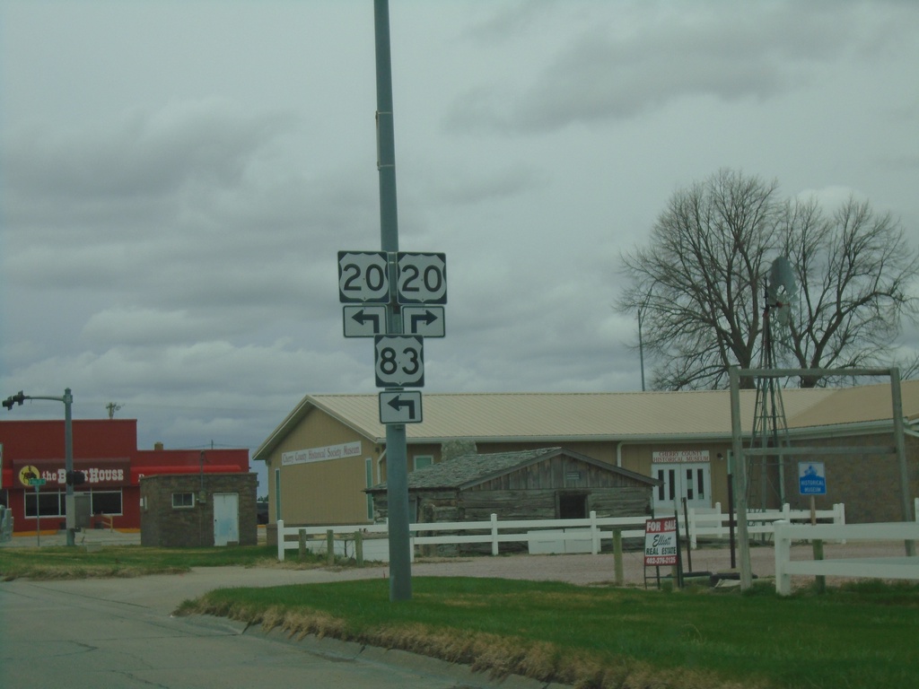
US-83 South at US-20
US-83 South at US-20 in Valentine. US-20 east joins US-83 southbound.
Taken 05-02-2022
 Valentine
Cherry County
Nebraska
United States
Valentine
Cherry County
Nebraska
United States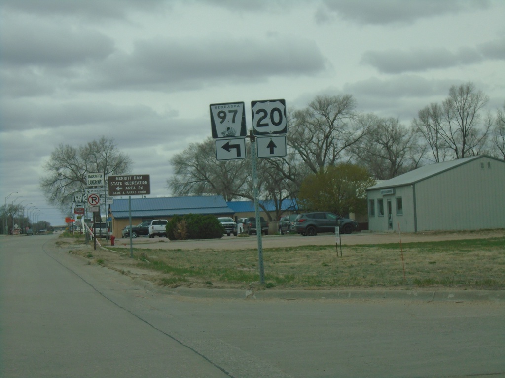
US-20 West At NE-97
US-20 West At NE-97 in Valentine.
Taken 05-02-2022
 Valentine
Cherry County
Nebraska
United States
Valentine
Cherry County
Nebraska
United States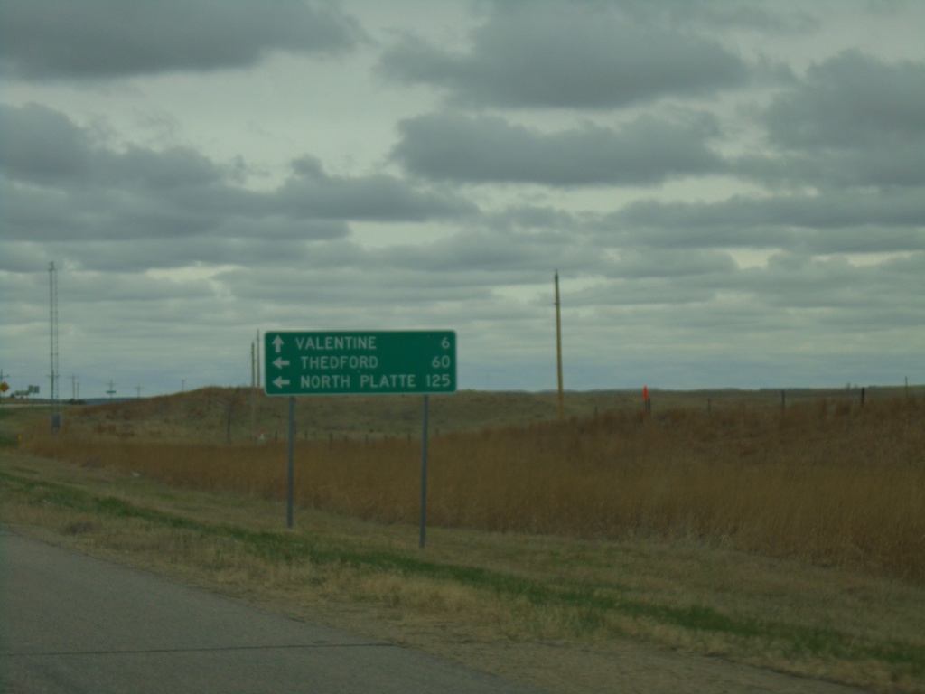
US-20 West at US-83
US-20 West at US-83 in Cherry County. Use US-83 south to North Platte and Thedford. Continue on US-20 West/US-83 North to Valentine.
Taken 05-02-2022
Valentine
Cherry County
Nebraska
United States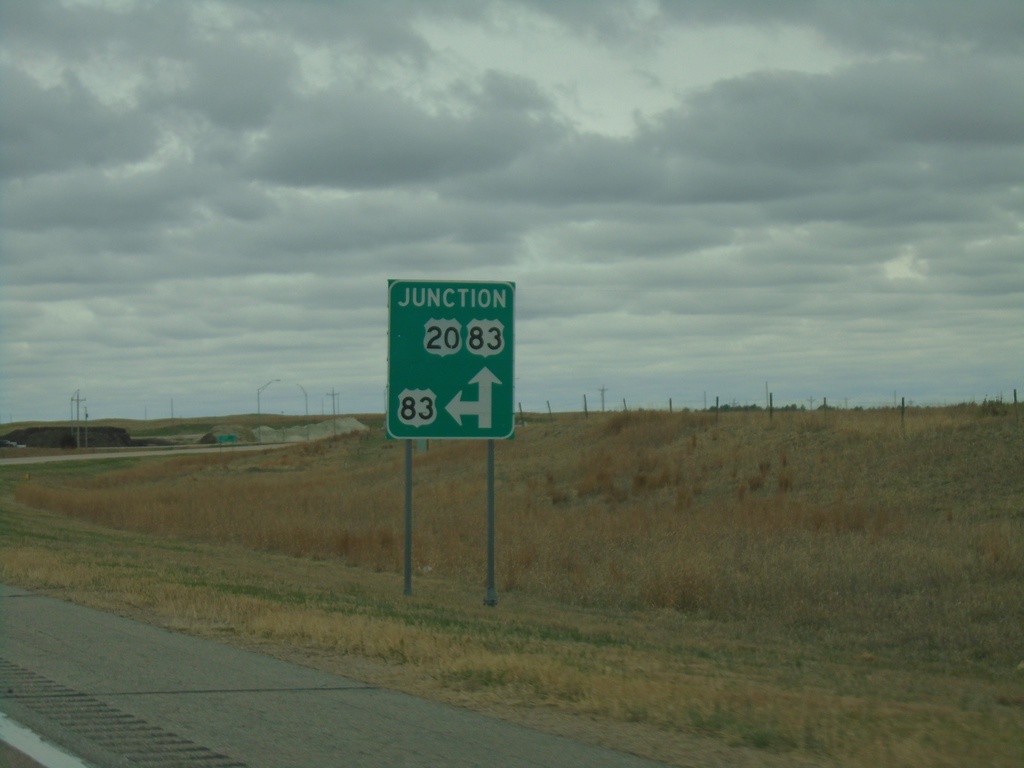
US-20 West Approaching US-83
US-20 West approaching US-83 in Cherry County. US-83 North joins US-20 West to Valentine.
Taken 05-02-2022
Valentine
Cherry County
Nebraska
United States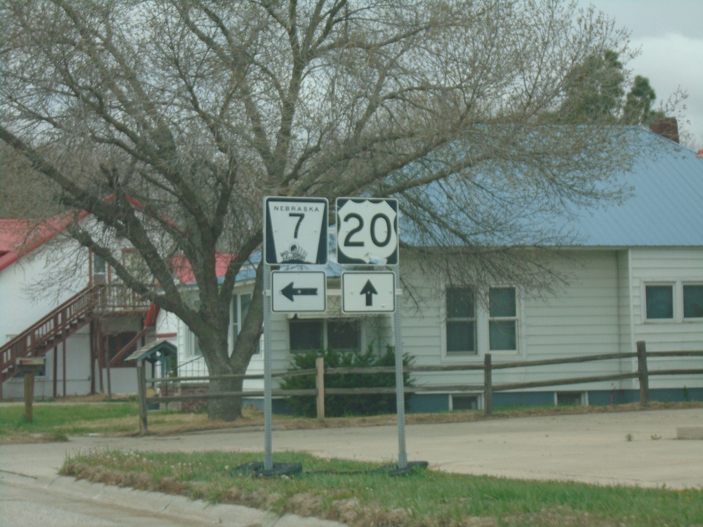
US-20 West/NE-7 South at US-20/NE-7 Split
US-20 West/NE-7 South at US-20/NE-7 split in Ainsworth.
Taken 05-02-2022
 Ainsworth
Brown County
Nebraska
United States
Ainsworth
Brown County
Nebraska
United States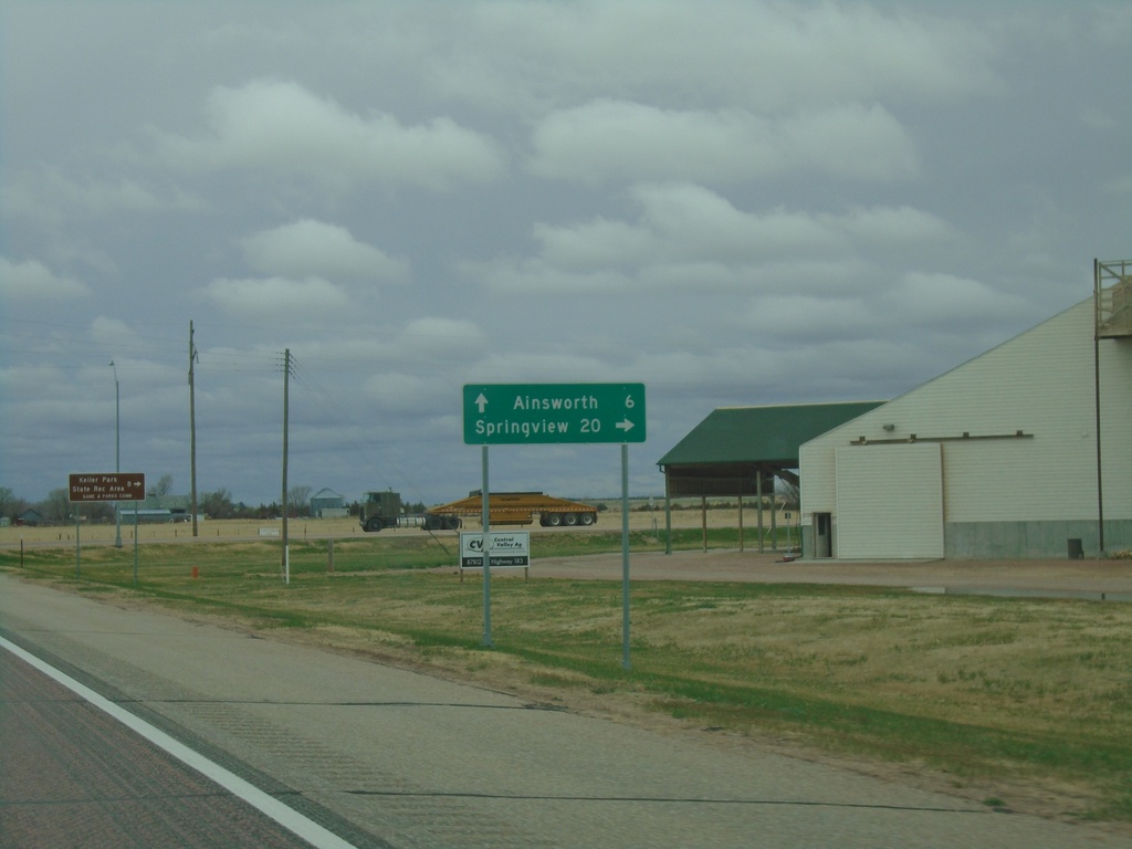
US-20 West/US-183 North/NE-7 South at US-183 North
US-20 West/US-183 North/NE-7 South at US-183 North in Brown County. Use US-183 North to Springview. Continue on US-20 West/NE-7 South to Ainsworth.
Taken 05-02-2022
 Ainsworth
Brown County
Nebraska
United States
Ainsworth
Brown County
Nebraska
United States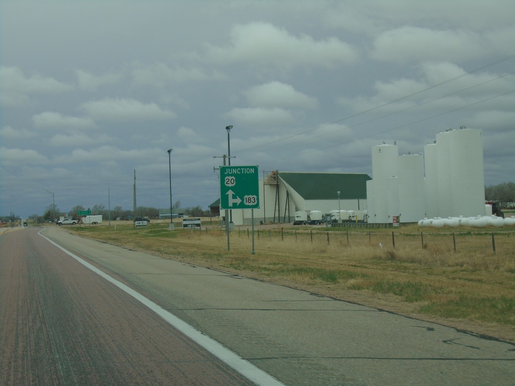
US-20 West/US-183 North/NE-7 South at at US-183 North
US-20 West/US-183 North/NE-7 South at at US-183 North in Brown County.
Taken 05-02-2022
Long Pine
Brown County
Nebraska
United States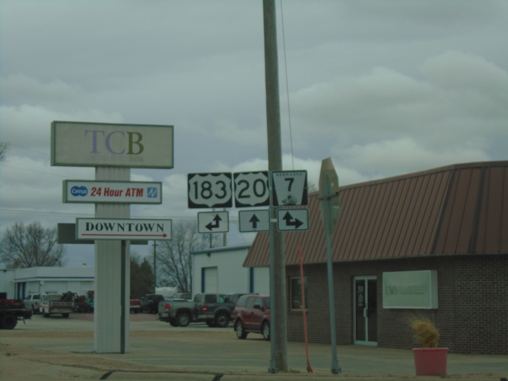
US-20 West at US-183/NE-7
US-20 West at US-183 and NE-7 in Bassett. Turn right for NE-7 North; left for US-183 South. US-183 North and NE-7 South joins US-20 westbound.
Taken 05-02-2022
Bassett
Rock County
Nebraska
United States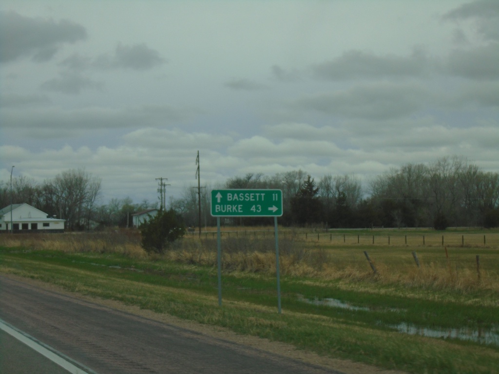
US-20 West at NE-137 North
US-20 West at NE-137 North to Burke (South Dakota). Continue west on US-20 to Bassett.
Taken 05-02-2022
 Newport
Rock County
Nebraska
United States
Newport
Rock County
Nebraska
United States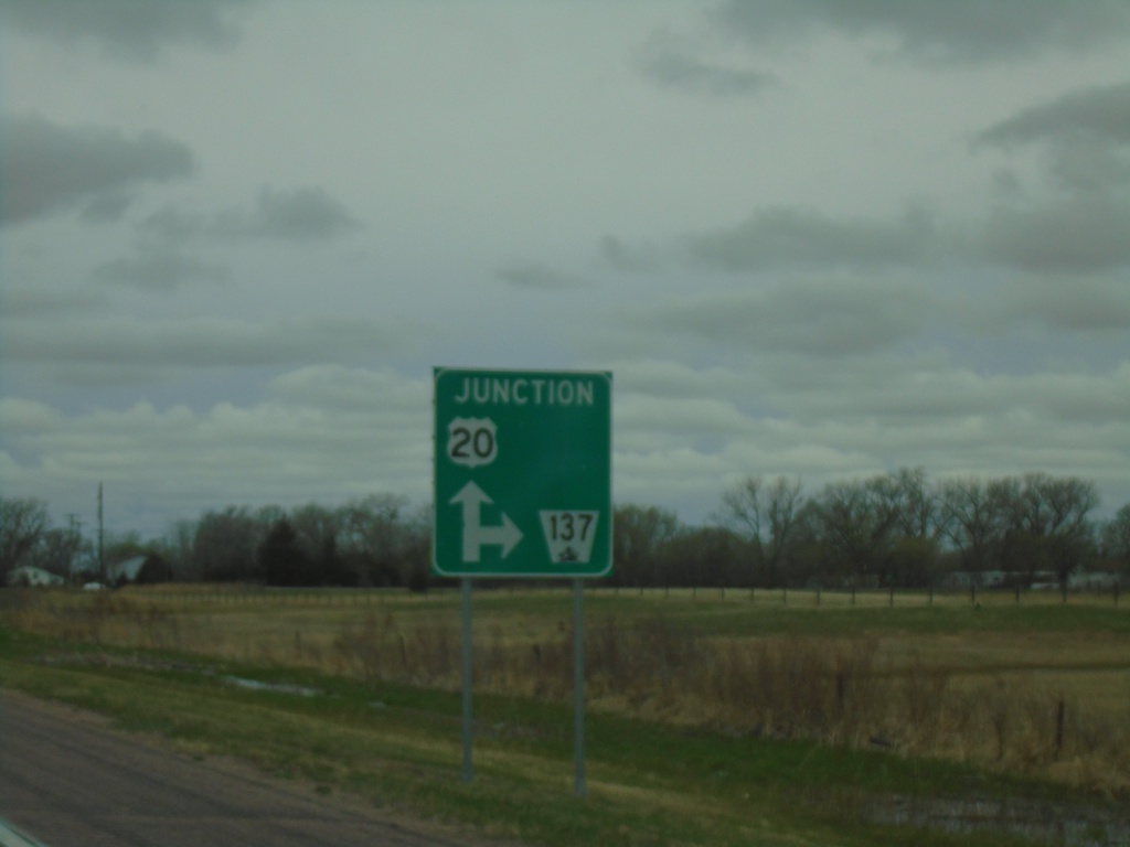
US-20 West Approaching NE-137
US-20 West approaching NE-137 in Newport.
Taken 05-02-2022
Stuart
Rock County
Nebraska
United States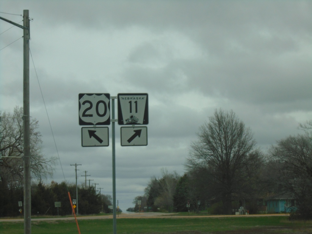
US-20 West/NE-11 North at US-20/NE-11 Split
US-20 West/NE-11 North at US-20/NE-11 split in Atkinson.
Taken 05-02-2022
 Atkinson
Holt County
Nebraska
United States
Atkinson
Holt County
Nebraska
United States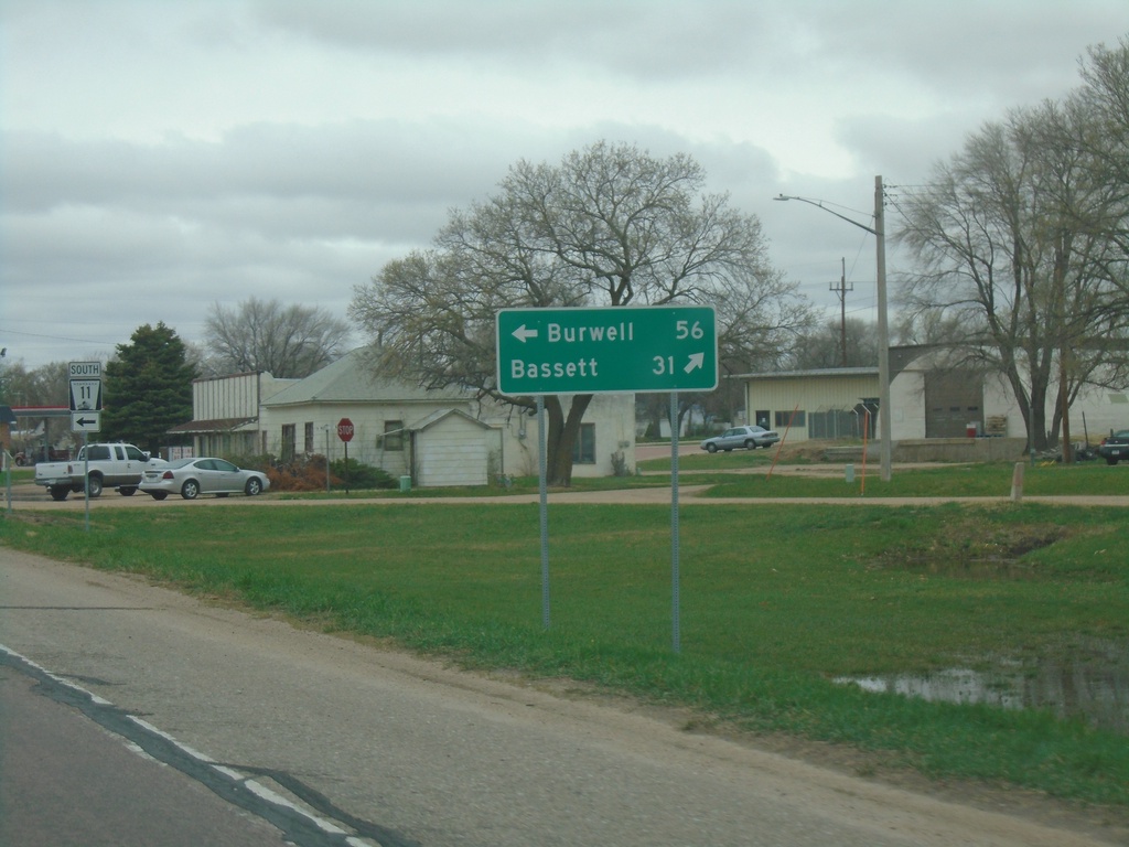
US-20 West at NE-11 - Atkinson
US-20 West at NE-11 in Atkinson. Use NE-11 South to Burwell. Continue west on US-20 to Bassett. NE-11 North joins US-20 west through Atkinson.
Taken 05-02-2022
Atkinson
Holt County
Nebraska
United States
US-20 West Approaching NE-11
US-20 West approaching NE-11 in Atkinson. NE-11 North joins US-20 West through Atkinson.
Taken 05-02-2022
Atkinson
Holt County
Nebraska
United States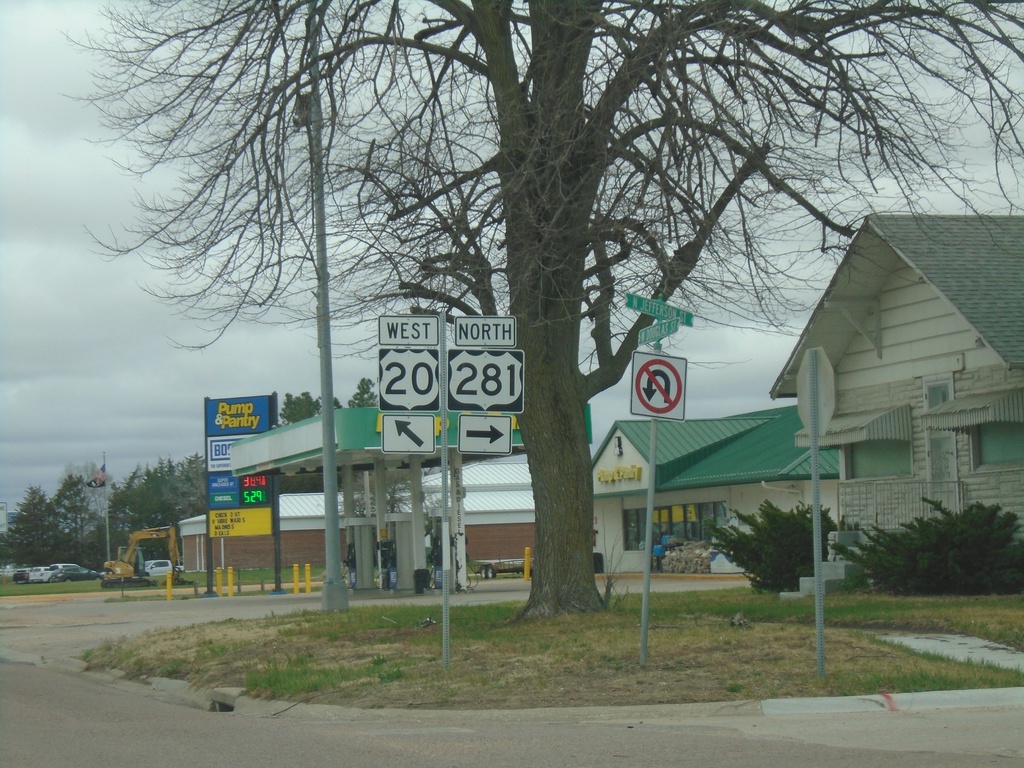
US-20 West/US-281 North at US-20/US-281 Split
US-20 West/US-281 North at US-20/US-281 split in O’Neill.
Taken 05-02-2022
 O'Neill
Holt County
Nebraska
United States
O'Neill
Holt County
Nebraska
United States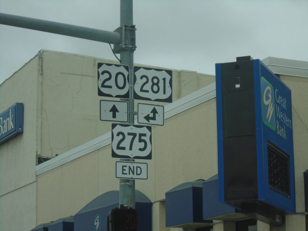
US-20 West/End US-275 West at US-281
US-20 West/End US-275 West at US-281 in O’Neill. US-281 North joins US-20 West through O’Neill.
Taken 05-02-2022
 O'Neill
Holt County
Nebraska
United States
O'Neill
Holt County
Nebraska
United States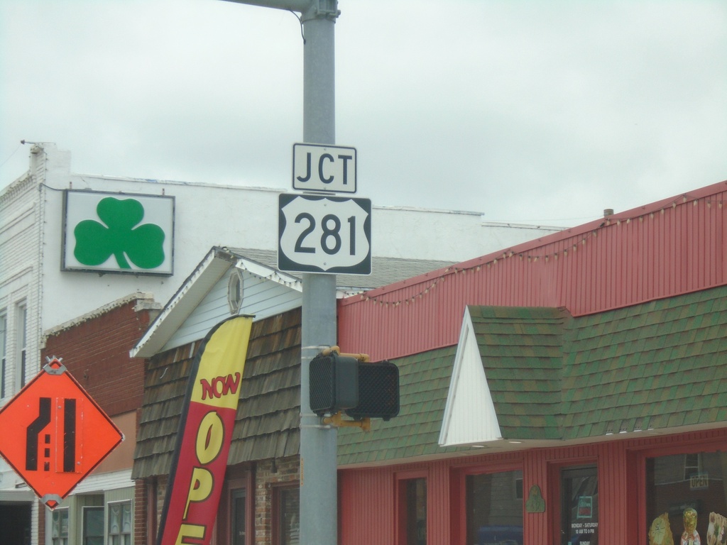
US-20/US-275 West Approaching US-281
US-20/US-275 West approaching US-281 in O’Neill. This is the western terminus of US-275.
Taken 05-02-2022
O'Neill
Holt County
Nebraska
United States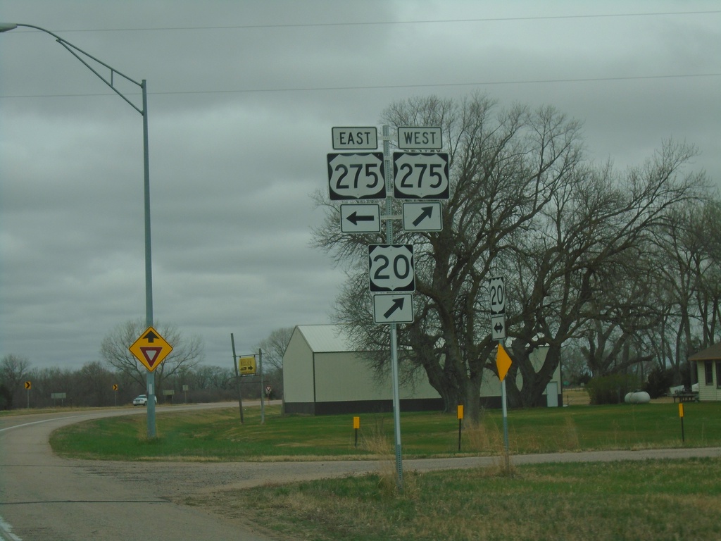
US-20 West at US-275
US-20 West at US-275 in Holt County. US-275 West joins US-20 westbound.
Taken 05-02-2022
Inman
Holt County
Nebraska
United States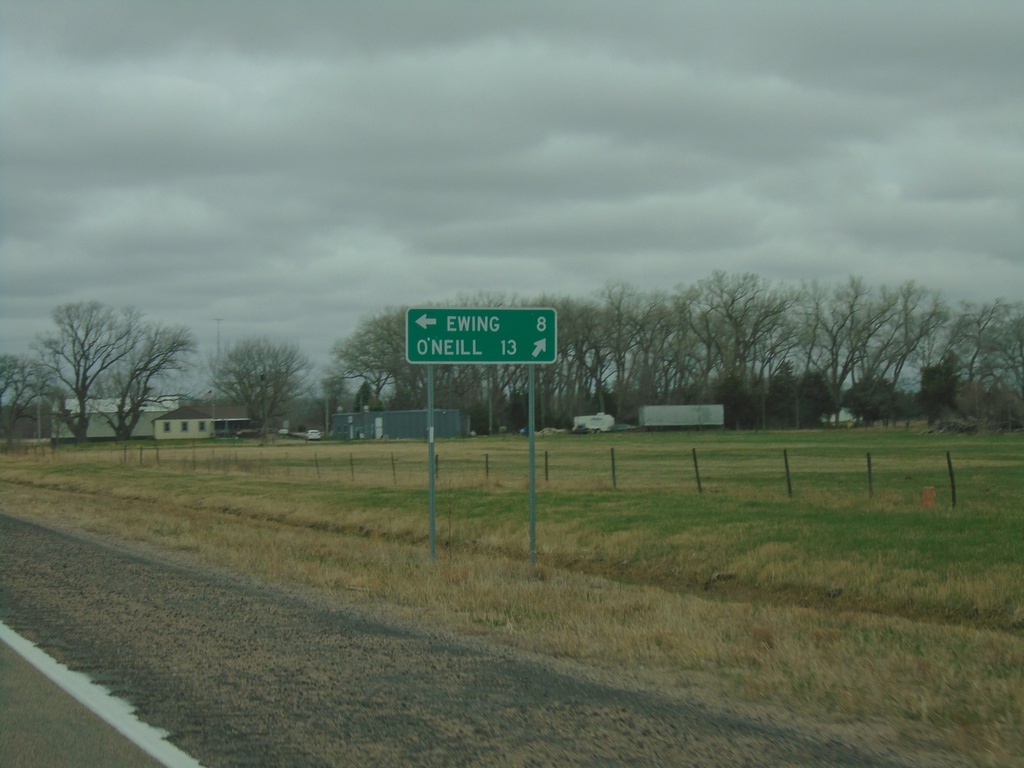
US-20 West Approaching US-275
US-20 West approaching US-275 in Holt County. Use US-275 East to Ewing; use US-20/US-275 West to O’Neill.
Taken 05-02-2022
Page
Holt County
Nebraska
United States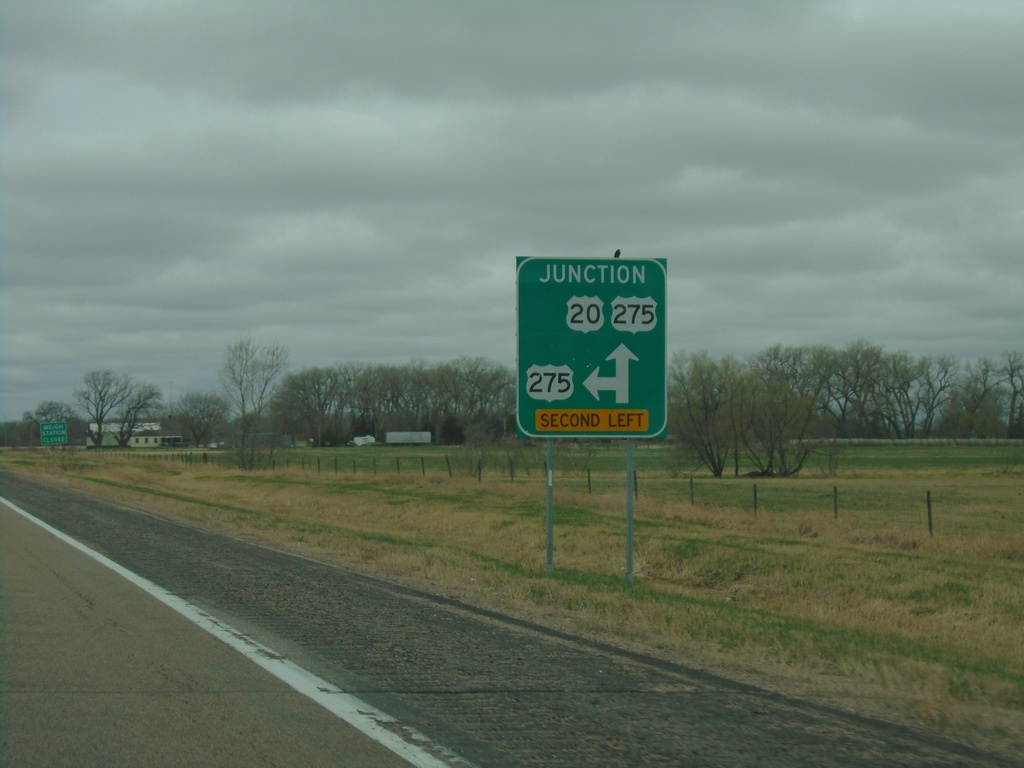
US-20 West Approaching US-275
US-20 West approaching US-275 in Holt County. US-275 West joins US-20 west to O’Neill.
Taken 05-02-2022
Page
Holt County
Nebraska
United States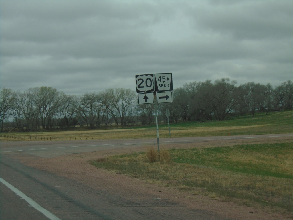
US-20 West Approaching NE-45A Spur
US-20 West approaching NE-45A Spur in Holt County.
Taken 05-02-2022
 Page
Holt County
Nebraska
United States
Page
Holt County
Nebraska
United States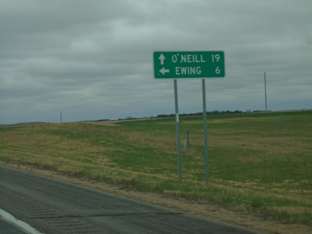
US-20 West at NE-45B Link South
US-20 West at NE-45B Link South to Ewing. Continue west on US-20 for O’Neill.
Taken 05-02-2022
 Orchard
Antelope County
Nebraska
United States
Orchard
Antelope County
Nebraska
United States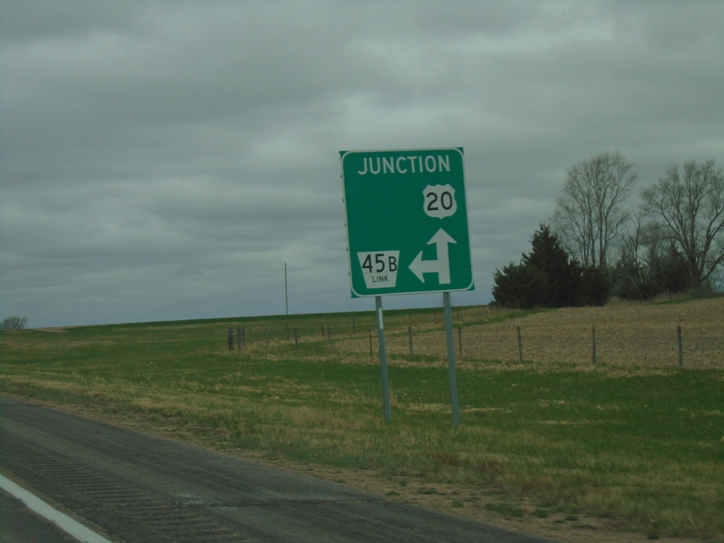
US-20 West Approaching NE-45B Link
US-20 West approaching NE-45B Link in Holt County.
Taken 05-02-2022
Orchard
Holt County
Nebraska
United States