Signs Tagged With Intersection
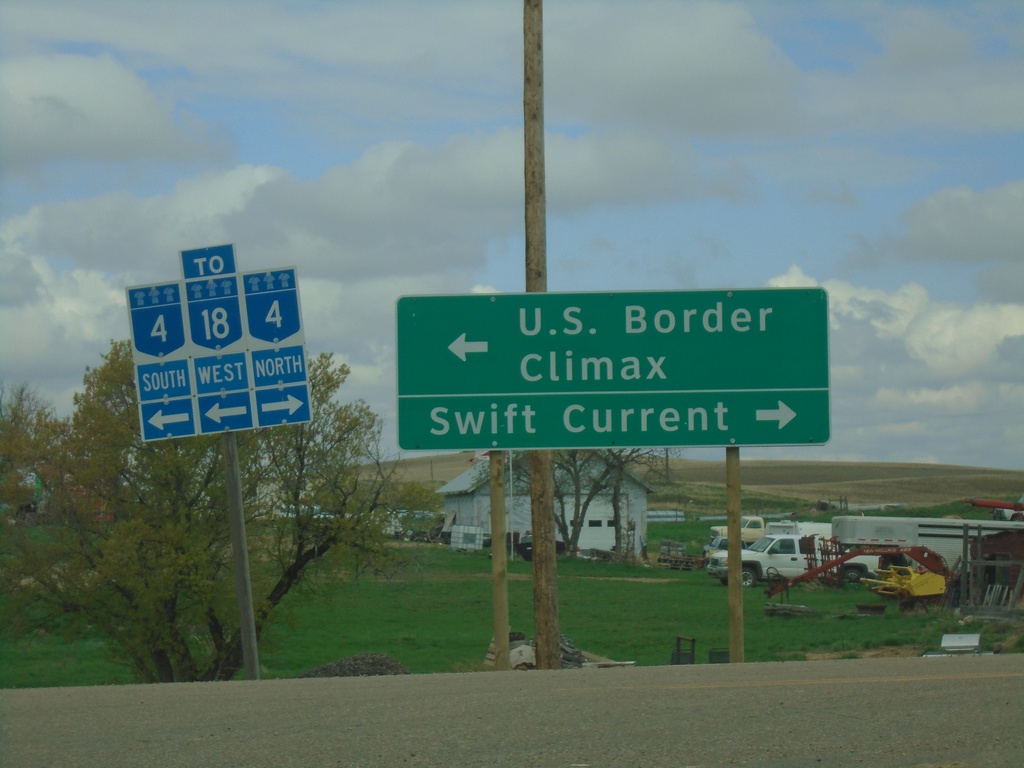
SK-18 West at SK-4 - Val Marie
SK-18 West at SK-4 in Val Marie. Turn right for SK-4 North to Swift Current; turn left for SK-4 South/SK-18 West to U.S. Border and Climax.
Taken 05-13-2023

 Val Marie
 No. 17
Saskatchewan
Canada
Val Marie
Val Marie No. 17
Saskatchewan
Canada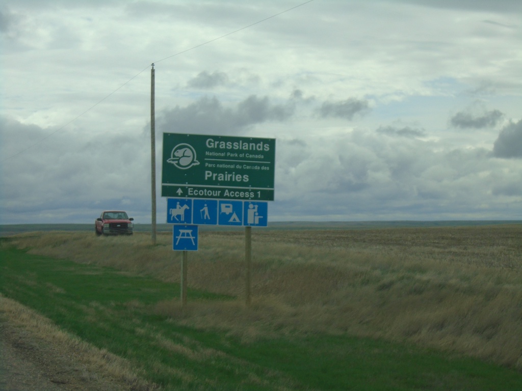
SK-18 East Approaching Grasslands National Park
SK-18 East approaching Grasslands National Park - West Block junction.
Taken 05-12-2023
Val Marie
Glen McPherson No. 46
Saskatchewan
Canada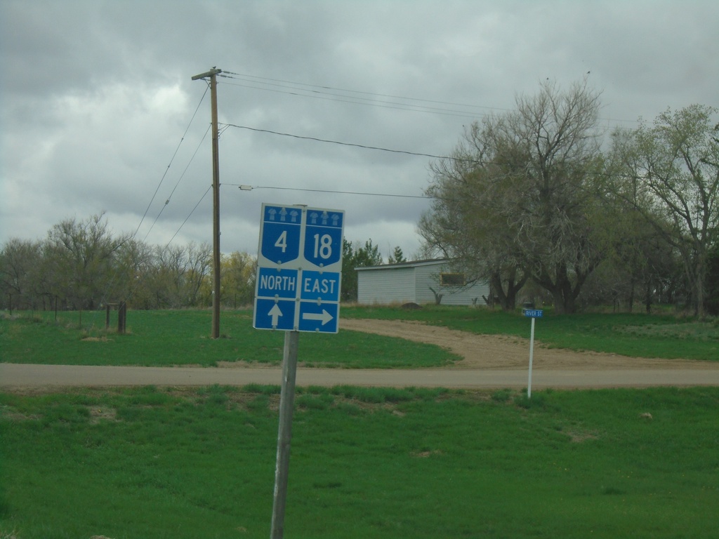
SK-4 North/SK-18 East at SK-4/SK-18 Split
SK-4 North/SK-18 East at SK-4/SK-18 split in Val Marie. Turn right for SK-18 East; continue straight for SK-4 north.
Taken 05-12-2023
Val Marie
Val Marie No. 17
Saskatchewan
Canada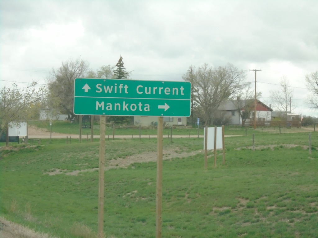
SK-4 North/SK-18 East Approaching SK-4/SK-18 Split
SK-4 North/SK-18 East approaching SK-4/SK-18 split in Val Marie. Use SK-4 north for Swift Current; SK-18 east for Mankota.
Taken 05-12-2023
Val Marie
Val Marie No. 17
Saskatchewan
Canada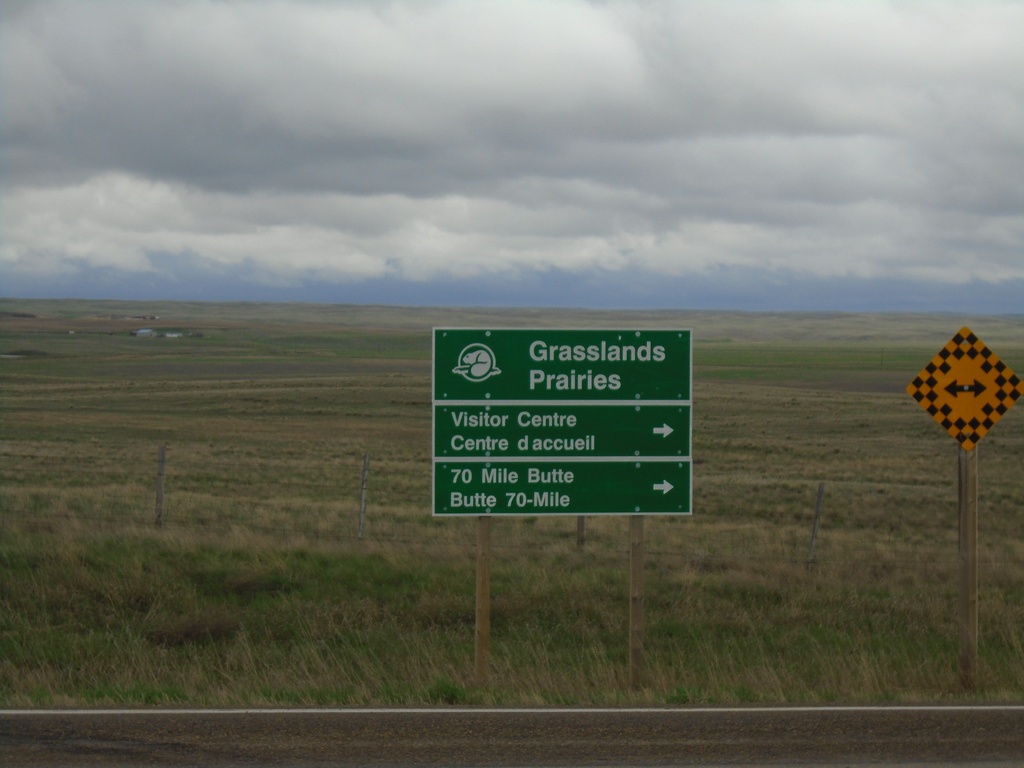
End SK-607 North at SK-4/SK-18
End SK-607 North at SK-4/SK-18 in RM of Val Marie No. 17. Use SK-4 North/SK-18 East for access to Grassland National Park Visitor Center and 70 Mile Butte.
Taken 05-12-2023
 Val Marie
 No. 17
Saskatchewan
Canada
Val Marie
Val Marie No. 17
Saskatchewan
Canada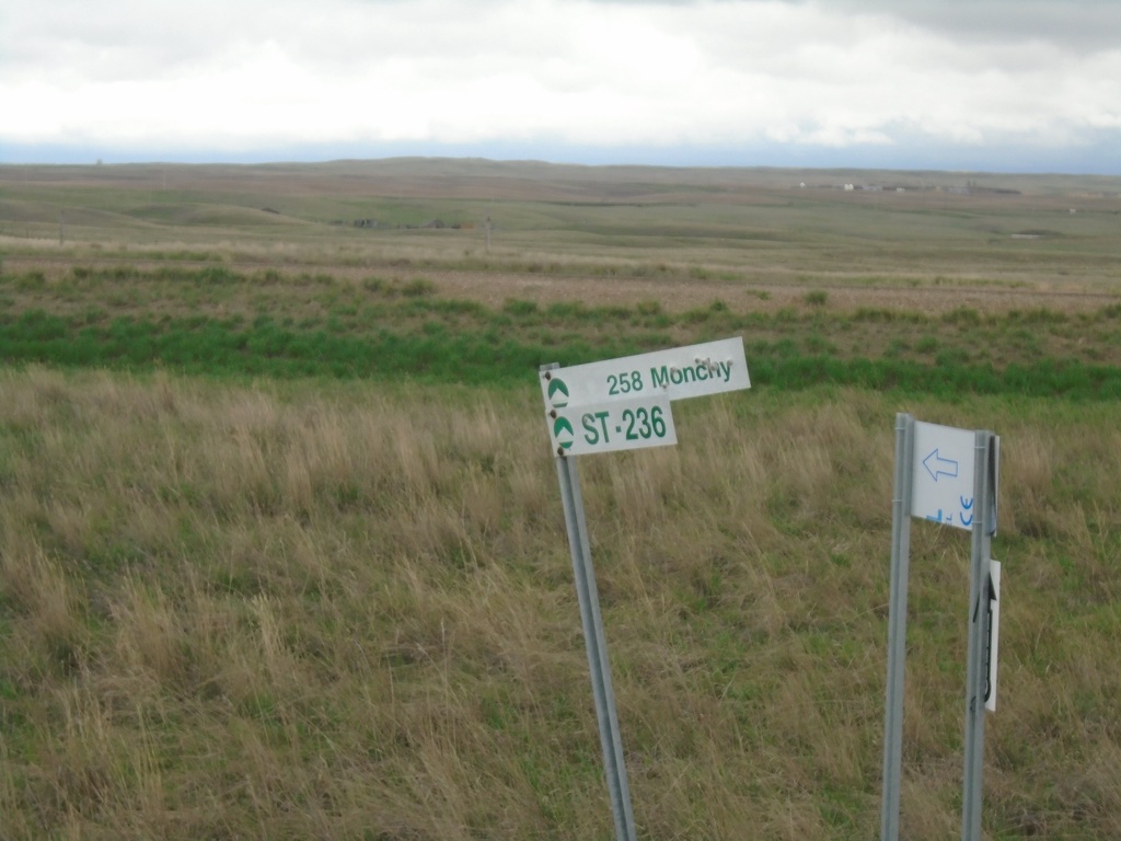
Fingerboard at SK-4/SK-18 at SK-607 Junction
Fingerboard at SK-4/SK-18 at SK-607 junction. Unclear on the meaning of this sign, but they are located at several junctions along the highways in southern Saskatchewan.
Taken 05-12-2023
Val Marie
Val Marie No. 17
Saskatchewan
Canada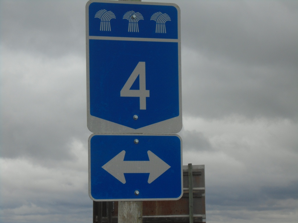
End SK-607 at SK-4/SK-18
End SK-607 at SK-4/SK-18 near Val Marie.
Taken 05-12-2023
Val Marie
Val Marie No. 17
Saskatchewan
Canada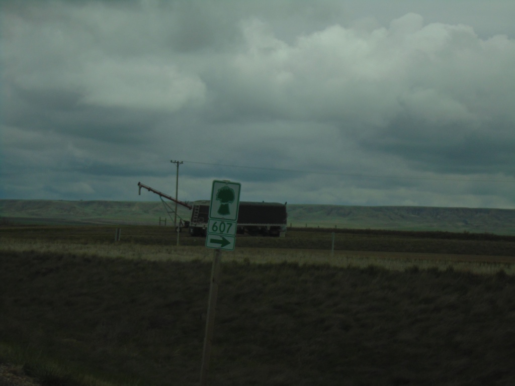
SK-4 North/SK-18 East at SK-607
SK-4 North/SK-18 East at SK-607 junction.
Taken 05-12-2023
Val Marie
Val Marie No. 17
Saskatchewan
Canada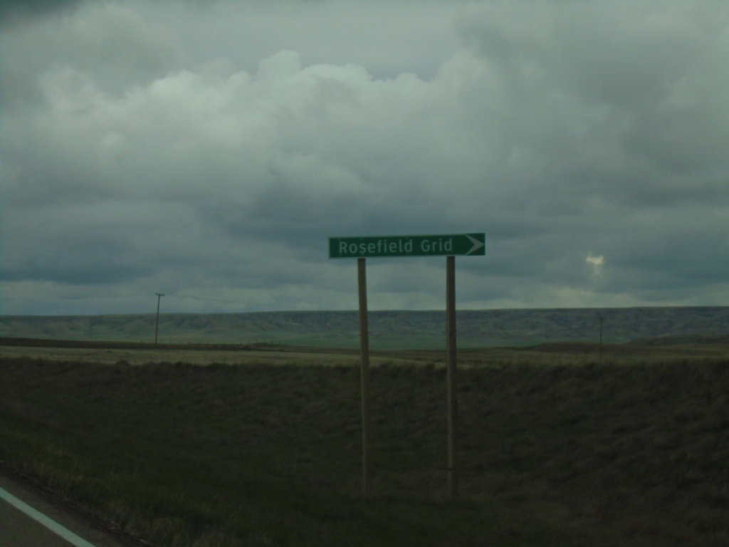
SK-4 North/SK-18 East Approaching SK-607
SK-4 North/SK-18 East Approaching SK-607/Rosefield Grid.
Taken 05-12-2023
Val Marie
Val Marie No. 17
Saskatchewan
Canada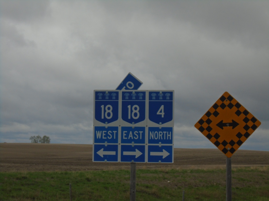
SK-4 North at SK-18
SK-4 North at SK-18 in RM of Val Marie #17. SK-4 North joins SK-18 East to Val Marie.
Taken 05-12-2023
Orkney
Val Marie No. 17
Saskatchewan
Canada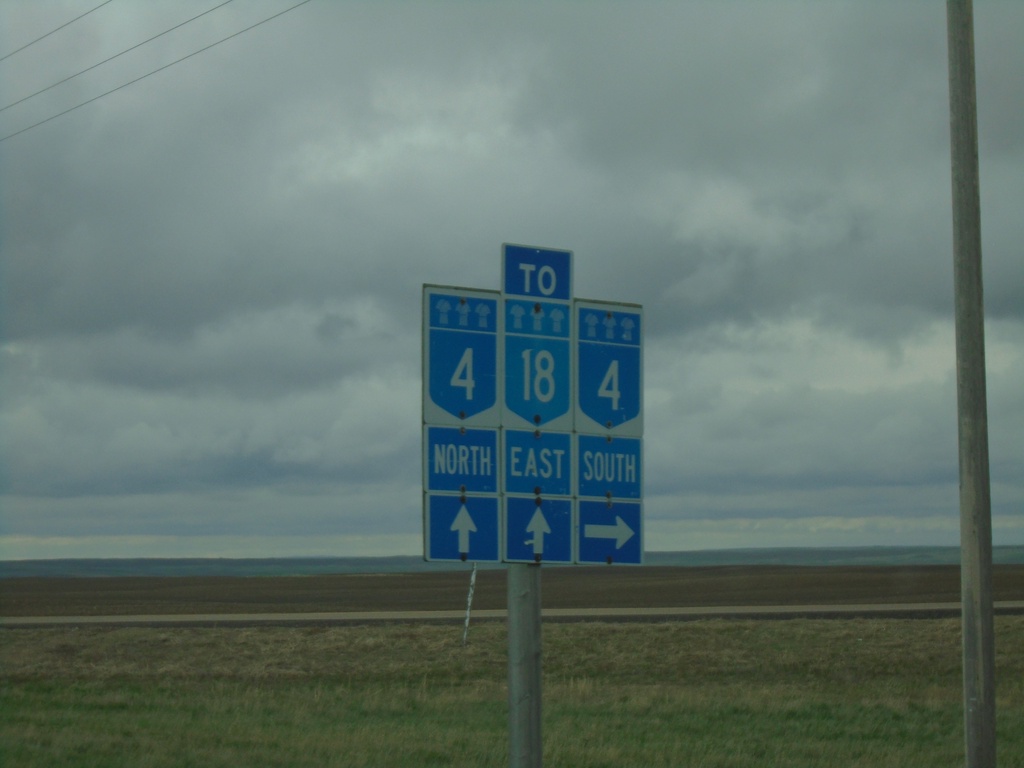
SK-18 East at SK-4
SK-18 East at SK-4 junction. Turn right for SK-4 south; continue straight for SK-4 North/SK-18 East.
Taken 05-12-2023
Orkney
Val Marie No. 17
Saskatchewan
Canada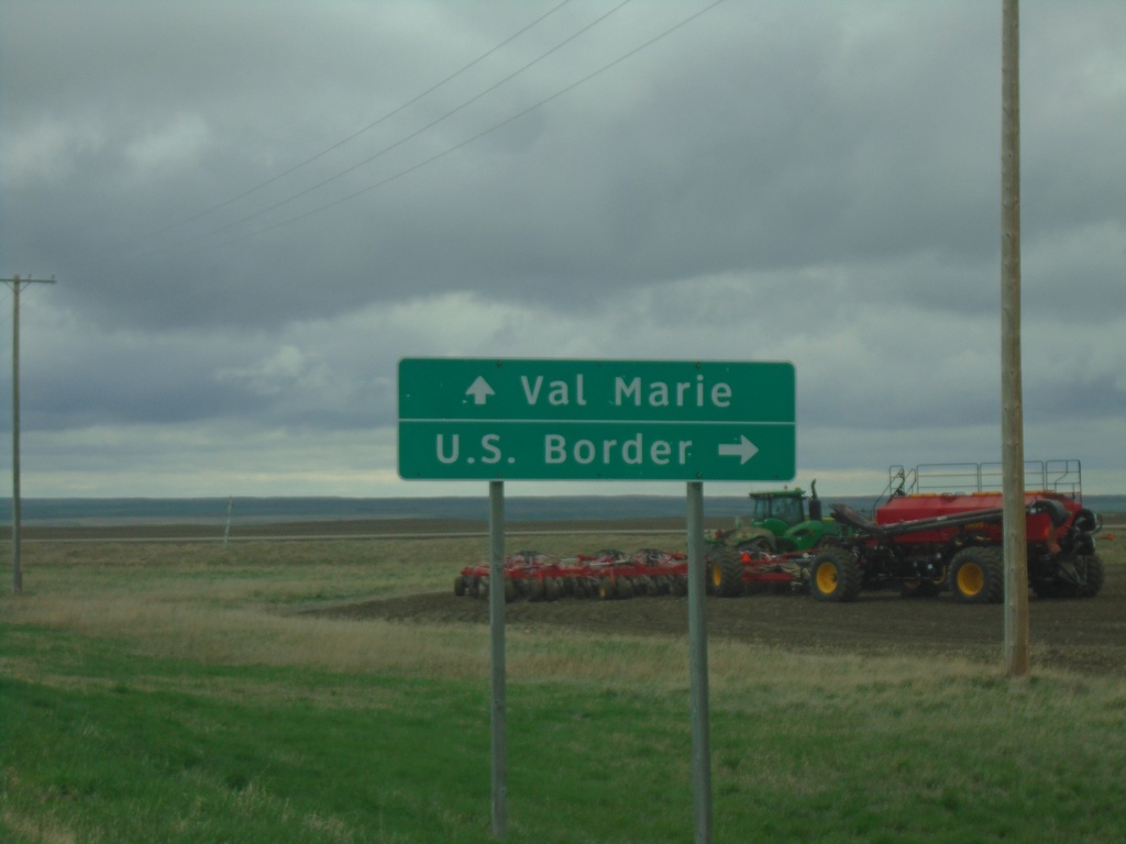
SK-18 East Approaching SK-4
SK-18 East approaching SK-4 south to US Border. Continue on SK-4 North/SK-18 East to Val Marie.
Taken 05-12-2023
Masefield
Val Marie No. 17
Saskatchewan
Canada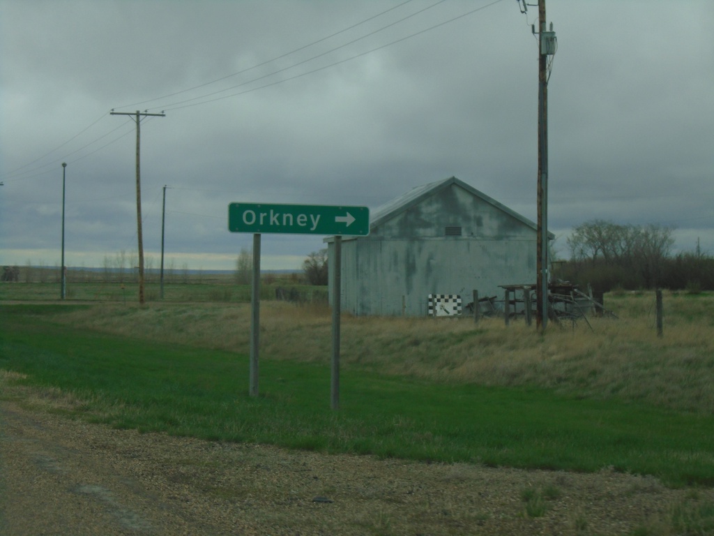
SK-18 East - Orkney
SK-18 East at Orkney junction.
Taken 05-12-2023
Orkney
Val Marie No. 17
Saskatchewan
Canada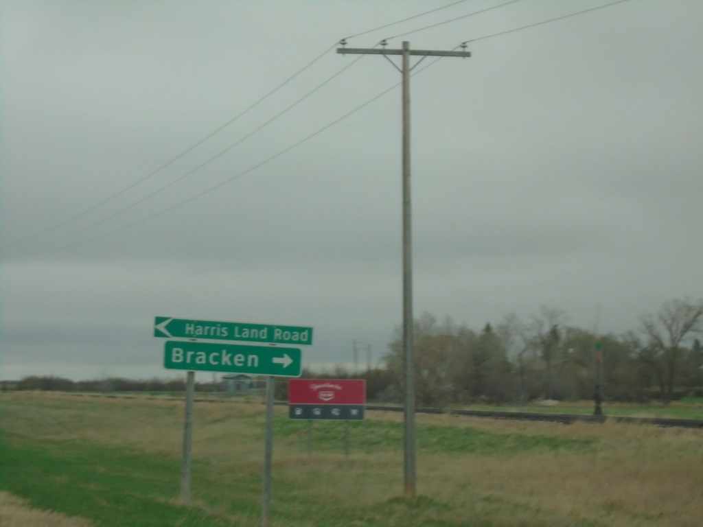
SK-18 East - Bracken
Bracken junction on SK-18 east. Turn left for Harris Land Road.
Taken 05-12-2023
Bracken
Lone Tree No. 18
Saskatchewan
Canada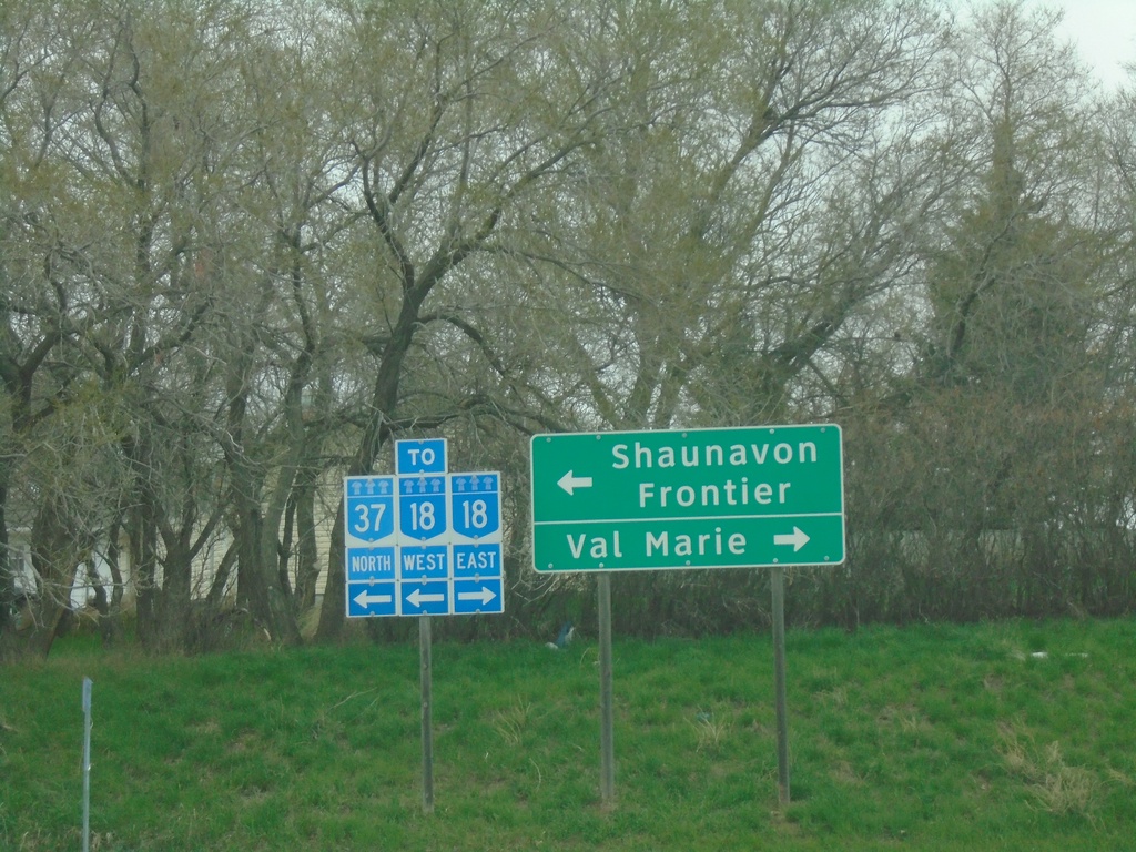
SK-37 North at SK-18
SK-37 North at SK-18 in Climax. Use SK-18 East to Val Marie; use SK-18 West/SK-37 North to Frontier and Shaunavon. Overlapping routes in Saskatchewan are sign as “TO”, as if there is not a continuity in the route.
Taken 05-12-2023
 Climax
Saskatchewan
Canada
Climax
Saskatchewan
Canada
SK-37 North Approaching SK-18
SK-37 North approaching SK-18 in Climax.
Taken 05-12-2023
Climax
Saskatchewan
Canada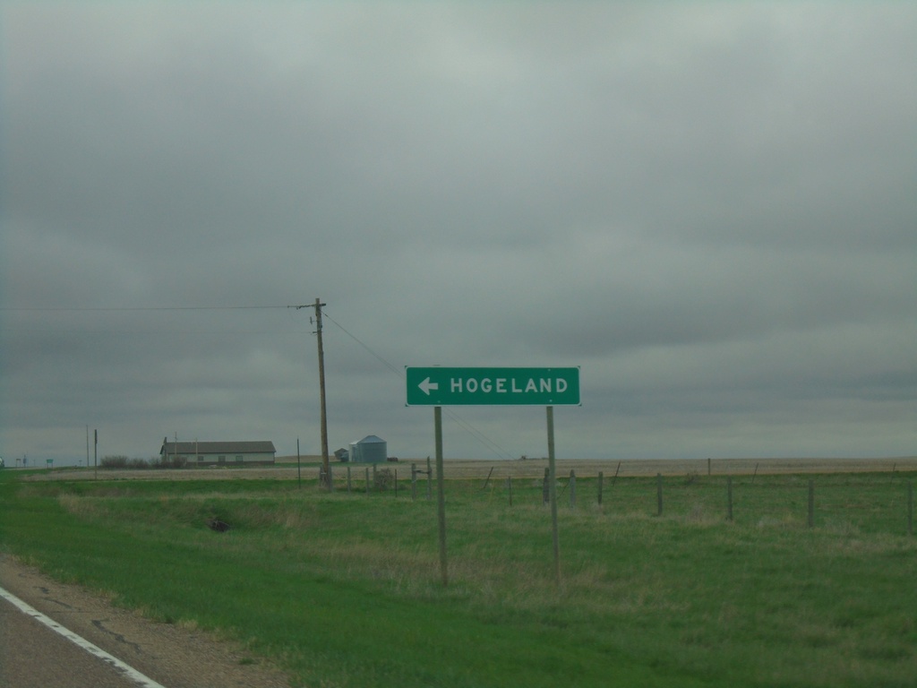
MTS-241 North - Hogeland Junction
MTS-241 North at Hogeland junction
Taken 05-12-2023
 Turner
Blaine County
Montana
United States
Turner
Blaine County
Montana
United States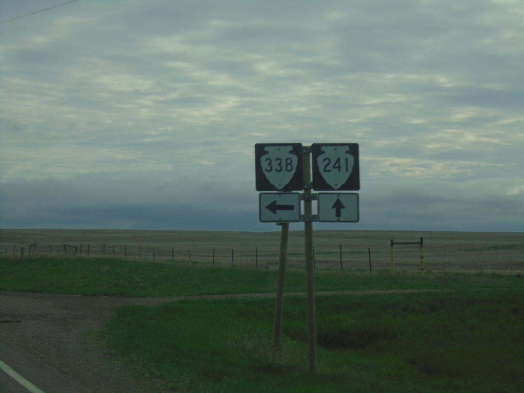
MTS-241 North at MTS-338
MTS-241 North at MTS-338 in Blaine County
Taken 05-12-2023
 Harlem
Blaine County
Montana
United States
Harlem
Blaine County
Montana
United States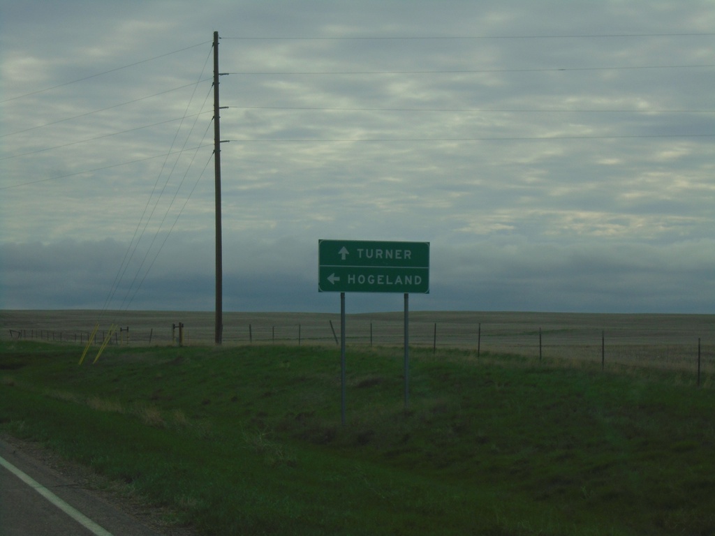
MTS-241 North Approaching MTS-338
MTS-241 North approaching MTS-338 in Blaine County. Use MTS-338 north to Hogeland. Continue north on MTS-241 to Turner.
Taken 05-12-2023
Harlem
Blaine County
Montana
United States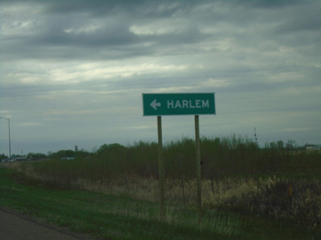
US-2 East - Harlem
US-2 east at Harlem Junction.
Taken 05-12-2023
 Harlem
Blaine County
Montana
United States
Harlem
Blaine County
Montana
United States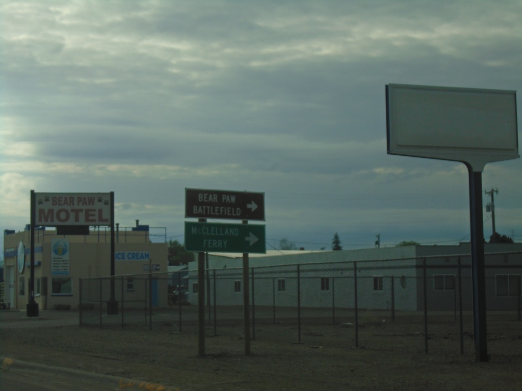
US-2 East at MTS-240 South
US-2 East at MTS-240 South to McClelland Ferry and Bear Paw Battlefield. The McClelland Ferry crosses the Missouri River south of Chinook.
Taken 05-12-2023
 Chinook
Blaine County
Montana
United States
Chinook
Blaine County
Montana
United States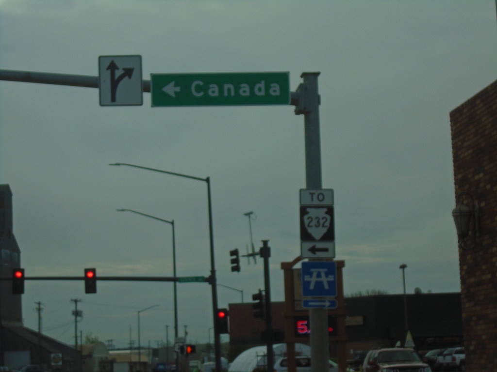
US-2 East at MTS-232
US-2 East at MTS-232 in Havre. Use MTS-232 north to Canada. MTS-232 is shown here with a TO banner on the shield, although the signage along the route through Havre seems to indicate it is part of the state highway system.
Taken 05-12-2023
 Havre
Hill County
Montana
United States
Havre
Hill County
Montana
United States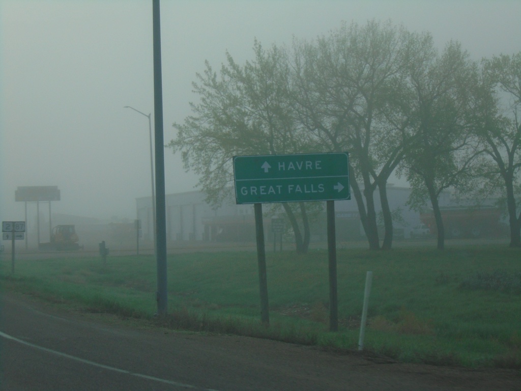
US-2 East at US-87 Junction
US-2 East at US-87 south to Great Falls. Continue east on US-2 for Havre.
Taken 05-12-2023
 Havre
Hill County
Montana
United States
Havre
Hill County
Montana
United States
End US-87 North at US-2
End US-87 North at US-2 in Hill County.
Taken 05-11-2023
Havre
Hill County
Montana
United States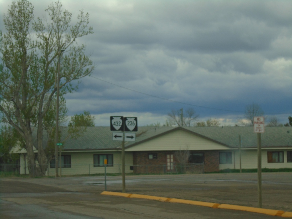
US-87 North at MTS-432/MTS-236 Junction
US-87 North at MTS-432 and MTS-236 in Big Sandy
Taken 05-11-2023

 Big Sandy
Chouteau County
Montana
United States
Big Sandy
Chouteau County
Montana
United States